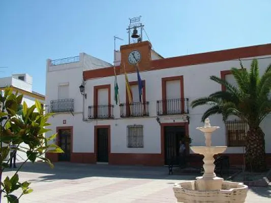
Tourist Office



Fuerte del Rey is a small town in Jaén, located to the north-west of the provincial capital, in the Campiña region, characterised by a landscape of olive trees, cereal crops and vegetable gardens.
Its municipal area is crossed by the road linking the city of Jaén (only 15 km away) with Andújar (27 km away).
Fuerte del Rey sits at an altitude of 432 m, bordering the municipality of Jaén to the south and part of the east, Torredelcampo to the west, and Lahiguera, Villanueva de la Reina and Cazadilla to the north and the rest of the eastern side.
The landscape is characterised by rolling hills, through which flow various streams such as El Saladillo, Las Cuarenta and La Silla del Conde, which drain into the Guadalquivir river; other, lower hills include the Cerro de la Atalayuelas, at 598 m altitude.
The main occupation of the population is agriculture, predominantly olive growing, having until recently been dominated by cereal farming. Construction and the metal processing, farm implements and machinery industries are of some importance for the employment they generate. The construction of new housing has been increasing in recent years, with prospects of continuing to do so.
It is worth noting that Jaén is only 15 km away, and housing in the provincial capital is much more expensive. The construction sector therefore appears to offer a promising future for the town, which is one of five municipalities in the province expected to double its housing stock over the next five years, taking advantage of the revision of its urban development plans.
Among its architectural heritage, the Church of the Natividad de Nuestra Señora stands out, completed in 1796. Its most interesting features are its century-old façade and slender bell gable.
Also of interest is a mill from the first third of the 20th century, recently restored. Small game is abundant, especially partridge, rabbit and hare, although these species face heavy pressure from hunting, from disease, and from the conversion of cereal fields into olive plantations.

The vegetation in the area has been shaped by agricultural use, causing the original holm oak woodland and scrubland to be gradually replaced by olive groves or other crops such as wheat or barley.
Most farming is rainfed, with irrigated land covering very little area — barely 100 hectares — since no permanent watercourse or aquifer runs through the municipal area.
As a result, naturally occurring vegetation has been reduced to roadside verges and paths. Along the streams, remnants of riparian vegetation can be found, such as reeds, tamarisks and poplars.
This human-shaped landscape has allowed steppe birds to settle here, most notably in winter the great bustard, a large and heavy bird that survives in farmland areas.
The little bustard is more common and easier to spot. Birds of prey include the Montagu's harrier in spring and summer, and the hen harrier in winter. Other birds found in these areas include the kestrel and the peregrine falcon, scarce elsewhere on the continent but common in this countryside.
Of particular interest, more historical than natural, is the group of plateaus that make up Las Atayuelas, with archaeological sites dating back to the 2nd millennium BC, which have made it possible to reconstruct the earliest history not only of this municipality, but of the whole Campiña region.
Fuerte del Rey is located on the road linking Jaén and Andújar, just 15 kilometres from the provincial capital. This, together with the fact that only cereals were grown locally, meant that garden produce had to be sourced from Jaén, giving the local cuisine close ties to that of the capital. Notable dishes include:
From prehistoric times, Fuerte del Rey is home to one of the best-studied archaeological sites, Las Atayuelas, dating from the 2nd millennium BC.
During the Iberian period, a fortress was built on this same site. During the Roman period, Las Atayuelas was restructured, transformed following the model of the Roman "castro" (fortified settlement), with the appearance of numerous farmhouses.
After being definitively abandoned in the 4th century, a new settlement arose nearby, on the site of the present-day town, which became established thanks to a natural spring and its strategic location on the road linking Andújar with Jaén and Arjona.
Between the 11th and 12th centuries, a fortification was built for the defence of both the settlement and the city of Jaén. The defensive complex was later expanded, as it lay on the frontier between crown lands and those of the Order of Calatrava, witnessing the conflicts between the supporters of Henry IV, led by Lucas de Iranzo, and the rebels led by the Master of the Order, Don Pedro Girón.
From the Early Modern period, in the 16th century, this settlement was known as Fuente del Rey, a small hamlet dependent on the vast municipal district of the city of Jaén. It kept this name until 1765, when it was renamed Fuerte del Rey.
The municipality achieved independence from Jaén between 1803 and 1805.
Its present-day urban layout stems from the fact that, once independence from Jaén was achieved, many residents of the scattered farmhouses built homes within the town itself. Some of these were destroyed by the flood that struck Calle del Pilar in 1856.
3