Description
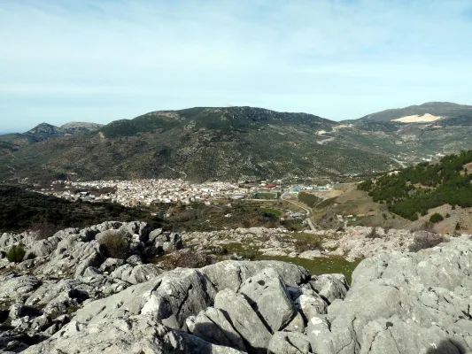
The path GR-7 is just over 300 km. of the province of Jaéngoing throughthree of the most important Sierras in the province:Sierra Sur, Sierra Magina and Sierras de Cazorla, Segura and Las Villas. This is a stretch of this great road that runs through the European continent. It begins in Tarifa (Cadiz, Spain) and through Brussels (Belgium), it ends in Athens (Greece). As you pass through the province of Jaén, you will find a network of local, no less interesting, small tour trails.
Is part of

Datos de la ruta
ROUTE NAME
GR-7
TRAIL TYPE
--
DIFFICULTY
--
TOTAL DISTANCE (IN KILOMETERS) 150 km
-
Stretch of asphalt or concrete:
-
Section of track, forest road, or dry watercourse:
-
Trail section:
-
Sections of livestock trails:
HUSO 30S
ESTIMATED TRAVEL TIME
Unas 100 h de andadura a una media de 3 km/h
ROAD SURFACE TYPE
Road
ELEVATION CHANGE
11000mm
11000mm
DIFFICULTY. RATING ACCORDING TO THE MIDE METHOD
--
MEANS
Severity of the natural environment
--
ITINERARY
Route guidance
--
DISPLACEMENT
Difficulty moving about
--
EFFORT
Amount of effort required
ACCESSIBILITY TYPE
TIME OF YEAR
SIGNALING
No
MORE INFORMATION
TUNNELS
STEEL VIADUCTS
METAL WALKWAYS
WATER POINTS
PONTOONS
GUARD BOOTHS AND BARRIERS
SWITCHMAN'S CABINS
CYCLABILITY
RECREATIONAL OR SPORTS AREAS NEAR THE TRAIL
AID STATIONS
LINKS TO OTHER TRAILS
SHELTERS
RECOMMENDATIONS
OTHER INFORMATION OF INTEREST (ARCHITECTURAL OR HISTORICAL-CULTURAL, GEOLOGICAL-ECOLOGICAL)
Technical Description
The explanations offered here are very brief, and do not go from being a presentation of this great itinerary, with the aim of locating its different stages as it passes through our province. The most important localities and reference steps are mentioned, but the explanation does not stop to inform about each and every detail of the road, actually formed by different types of roads, landscapes and conditions.
The entire route in the province of Jaén will take a week to ten days of long walks, with the most recommended support of one or two vehicles for the transport of material. Its passage through villages makes its division possible and allows it to make stages of less journey, depending on the interest of the group of hiking people. The GR-7 was marked and beheaded by the Andalusian Mountain Federation and the Tourism, Trade and Sport Council. Years later, some of the milestones have been lost, but by using traditional roads, their realization remains possible.
The path crosses the provincial border Cordoba-Jaén in Pilas de Fuente Soto, reaches Alcalá la Real and continues, in the direction of the village of Santa Ana, coinciding with a Royal Canyon adorned with stone crosses that crosses a moor with the Castle of La Mota on the horizon. It passes through Santa Ana, takes us to Fries and then to Los Rosales, from where it follows a paved road and then to rural roads.
It traverses several ports among which is that of Los Alamillos, goes down to the river Valdearazo and comes up again by seeping the Stone of the Palo, between Camillo de Arenas and Carchelejo, giving view to the Embalse of Quiebrajano. The road continues to ascend to a few plains before the town of Carchelejo, which is accessed by a steep road, by the upper part of the town, by the deposits.
The road leaves the Sierra Sur and leaves Carchelejo following a path that descends in search of the old road N-323, passing through a rock needle to which they refer by "The Old Tooth." In the N-323 it continues to the highway, the cross below and goes back the river line between orchards and choperas to access Cambil next to the debugger of the population. From here we go in the direction of the Corrijada of Matabejid, in the direction of Huelma, to enter the Natural Park of Sierra Magina, with the highest summits of the province of Jaén. We pass through Matabejid and follow a track towards the Port of La Mata, passing through the area of the Castillejo, a magnificent landscape characterized by the ruins of a castle of the ancient medieval border. This mountain of oaks and complaints is kept by one of the most emblematic mountains of the province, La Peña de Jaén. This landscape has the particularity of being the dehesa of complaints on a limestone mountain, higher in Spain. Crossing the Port the road runs between pine trees in the direction of Torres, where we can refresh with the water of the Fuenmayor, and already in the village in the Pila Pellenda, at the entrance to the village, before continuing to Albánchez de Magina by means of pecuaria roads, used as pedestrian roads between populations, accompanied by almonds and cherry trees characteristic of this area, which offers an image of whitened valley during its flowering.
Once again, we pass through Fuente de la Fresneda and through the recreational area of Cuadros until we reach Bedmar, from where we will suddenly go up to El Portillo by one of the most pronounced ramps of the GR to go down to Jódar through the Serrezuela. We left Jódar for the Jódara-Quesada railway station, we crossed the Minor Guadiana looking for Peal Furnaces, then Toya, and continued on the Vega to Quesada.
We are already in the Natural Park of the Serras de Cazorla, Segura and the Villas. As we leave Quesada we will pass under the site known as El Chorro, in search of the Monastery of Monte Zion, and from here to the hermitage of San Isicio, near Cazorla. We will leave Cazorla on one of the most beautiful roads of the whole route, we will see the hermitage of the Virgin of the Cabeza, on a road between pine trees we will pass by the Fountain of the Bear in search of the village of Vadillo Castril, then the village of Loma de Mª Ángeles, later on, through the Natural Park of the Sierra de Cazorla, Segura and Las Villas, Catorrios, and through the avenue of the Guadalquivir, passing near the Aguamulas River, we will go to the Fountain to Segura to reach Pontones. From Pontones we continue to Poyotello, we go down next to the channel of the young Rio Zumeta to the village of the Ruices, Santiago de la Espada, and finally we cross the provincial limit towards the Puebla de D. Fadrique, in Granada.