Recreational Area Fuenmaandor – Albanchez de Mágina


Description
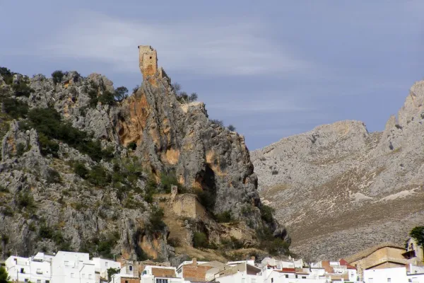
This route from Fuenmayor offers a short but complete route, where water, forest and height mark the way. Part in the shadow of Fuenmajor, with the water marking the compass of the march. Soon the rock is dressed in lime in the Zurreon and the air is fresh; it is the prelude of a sidewalk that goes back among pine trees until the Víbora hill, where the limestone opens and the cornicabra ignites the red umbria when autumn comes. From there, we let the loin release us to Las Hoyas, more kind, and let the cattle feral take us between olive groves, without haste, to Albanchez de Magina. It is a short and complete tour (water, forest and height) that invites you to repeat it at another station, when the mountain changes skin and each step counts something different.
Is part of

Datos de la ruta
ROUTE NAME
Área Recreativa Fuenmayor – Albanchez de Mágina
TRAIL TYPE
--
DIFFICULTY
Medium
TOTAL DISTANCE (IN KILOMETERS) 10,7 km
-
Stretch of asphalt or concrete: --
-
Section of track, forest road, or dry watercourse: --
-
Trail section: --
-
Sections of livestock trails: --
HUSO 30S
ESTIMATED TRAVEL TIME
ROAD SURFACE TYPE
Trail
MAXIMUM ELEVATION CHANGE 953mm
--
--
DIFFICULTY. RATING ACCORDING TO THE MIDE METHOD
--
MEANS
Severity of the natural environment
--
ITINERARY
Route guidance
--
DISPLACEMENT
Difficulty moving about
--
EFFORT
Amount of effort required
ACCESSIBILITY TYPE
TIME OF YEAR
SIGNALING
No
MORE INFORMATION
TUNNELS
STEEL VIADUCTS
METAL WALKWAYS
WATER POINTS
PONTOONS
GUARD BOOTHS AND BARRIERS
SWITCHMAN'S CABINS
CYCLABILITY
RECREATIONAL OR SPORTS AREAS NEAR THE TRAIL
AID STATIONS
LINKS TO OTHER TRAILS
SHELTERS
RECOMMENDATIONS
OTHER INFORMATION OF INTEREST (ARCHITECTURAL OR HISTORICAL-CULTURAL, GEOLOGICAL-ECOLOGICAL)
Technical Description
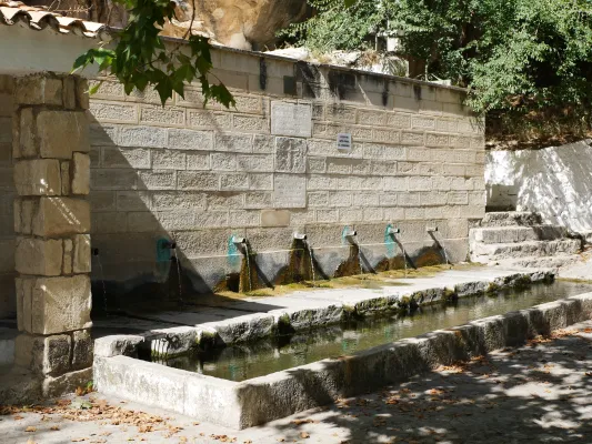
A linear and varied route linking water, forest and height from the recreational area of Fuenmayor to Albanchez de Magina. A very grateful tour, with pinars, rails and open views, which changes considerably according to the season and encourages it to be repeated at different times of the year. The itinerary begins in the recreational area of Fuenmayor, a fresh and dark environment marked by the constant presence of water. From the parking lot and the fountain is taken a compact ground track that gently ascends between pine trees, with progressive views over Torres and a rosary of Sierra Magina summits, including the Aznaitín and the Almadén. Soon after, the tour approaches the Zurreon Cascade, an intermittent jump where the water covers the rock with delicate travertine. Although the spring is permanent, the waterfall appears after abundant rains and, in cold winters, can become cold, offering a unique picture. The road continues along the path of the GR-7, sharing a corridor with old fallow tracks that have historically articulated the transit along these slopes. The ascent continues to reach the Nita Fountain, a spring attached to the foot of the hillside, a good point for a pause and to read the landscape: the Torres Valley, the Lomas of La Loma, the traces of loose stone of the Almadén and the summits that close the horizon. From here, the route leaves the main track to enter the Barrio de la Víbora, where a narrow and stony path goes back between pine and clear limestone. The rise culminates in the Collado de la Vibora, turning point of the journey. From here on, the itinerary begins a descent by a cattle foyer - the tranche of the pecuary track of the Cordel de la Sierra to the Abradero del Espino - which leads to the area of Las Hoyas. The limestone is in open steps and loins, with a prominent presence of cornicabra, which in the autumn is dyed with red shades. There are also remains of ancient huts, a testimony of the traditional use of this high. The final section runs between olive groves, alternating paths and barbed tracks that are right across the local road before gently descending to the vicinity of Albanchez de Magina, where the route ends. General recommendations Check the meteorology before starting the route, especially in the collate and stony down sections. Wear mountain shoes with good grip; the sticks are appreciated on the down from the Collado de la Viper. It takes enough water and extreme caution when crossing local roads.
We recommend