Route Cabra del Santo Cristo
Description
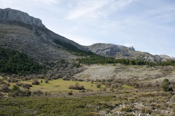
Unpublished route, near the Natural Park of Sierra Magina. The tour is divided into three sections: The first kilometers - just over 10 - represent a rise from the valley of the Jandulilla River to the high plane of Cabra of Holy Christ. This stretch stands out for the subdesert landscapes, a little known beauty of unique shapes and colors. From here there are still 7 Km. without slope to the town of Cabra of Holy Christ. In this town, one of the historic places of the espartera industry in southern Spain, you must visit its interesting church or eat at Casa Herminia restaurant.
Is part of

Datos de la ruta
ROUTE NAME
Ruta Cabra del Santo Cristo
TRAIL TYPE
--
DIFFICULTY
--
TOTAL DISTANCE (IN KILOMETERS) --
-
Stretch of asphalt or concrete: --
-
Section of track, forest road, or dry watercourse: --
-
Trail section: --
-
Sections of livestock trails: --
HUSO 30S
30S x = 466705 and = 4175691
ESTIMATED TRAVEL TIME
ROAD SURFACE TYPE
Road
--
--
DIFFICULTY. RATING ACCORDING TO THE MIDE METHOD
--
MEANS
Severity of the natural environment
--
ITINERARY
Route guidance
--
DISPLACEMENT
Difficulty moving about
--
EFFORT
Amount of effort required
ACCESSIBILITY TYPE
TIME OF YEAR
All year round
SIGNALING
No
MORE INFORMATION
TUNNELS
STEEL VIADUCTS
METAL WALKWAYS
WATER POINTS
PONTOONS
GUARD BOOTHS AND BARRIERS
SWITCHMAN'S CABINS
CYCLABILITY
RECREATIONAL OR SPORTS AREAS NEAR THE TRAIL
AID STATIONS
LINKS TO OTHER TRAILS
SHELTERS
RECOMMENDATIONS
OTHER INFORMATION OF INTEREST (ARCHITECTURAL OR HISTORICAL-CULTURAL, GEOLOGICAL-ECOLOGICAL)
53 km of asphalt roads with occasional traffic.
Technical Description
If you prefer to save your promotion to Cabra, you can start your pedal in this town, but the beginning and end of the route will be very disconnected.
From here there are almost 20 km of solitary plains (including the detour and the visit to the Cabra Station), along the secondary road of the altiplano. The tour is very quiet because of the few slopes - except some ramps - and because of the near absence of road traffic. The road has a sufficiently cyclable floor, passing through repopulation pines, olive groves and high cerealist fields. The area consists of a succession of rural areas, with large panoramic to the south, with the permanent image of the summits of the Sierra Nevada Natural Park (province of Granada). To the north the summits of the Natural Park of Sierra Magina rise.
The last stretch is a continuous descent from the pedanean town of Solera to the valley of the Jandulilla River. Solera is a small town with a tiny old town set up around the ruins of a rocky castle that was watching the medieval border. This 15 km stretch ends in Huelma, where you can eat in one of its restaurants, and visit the Vandelvirian Church and its castle, both monuments of the Andalusian Renaissance.