Saltar al contenido principal

Route del río Cerezuelo

Submitted by brandcode_deweloper on
Id
9271092
Descripción larga

Shortly after the fifth bridge, it is recommended to continue to the left, where it is already incorporated into a wider road, right next to a rural house called "Nace el Río." If you go ahead, there are two ways to return, or on a road to the left that goes down to the same point of departure, or you can follow the right by a road called "Paseo del Solar," which when you reach the village allows you to go down to the Plaza de Santa María again.

The first option would be about an hour, the second option would be half an hour more, but it is worth the beautiful views we have from the viewpoints. Both routes are very simple so they are perfect for those trails who want to go for a walk or families with children. But they are also ideal to discover the most beautiful corners of the area without making an intense effort, being able to enjoy the road to the maximum.

Breve descripción

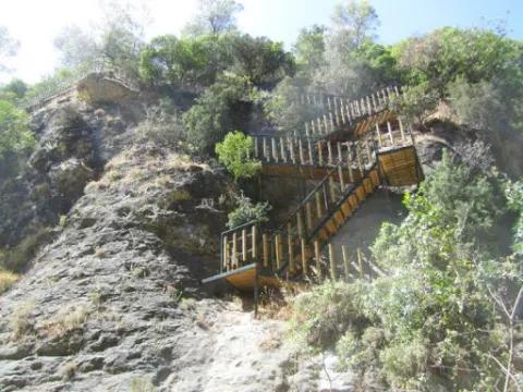
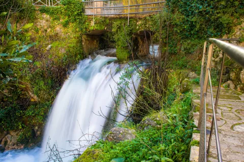
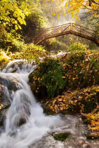
In the direction of the Castle of the Yedra we run into a small square where to the right it is moving towards the Castle, and to the left it is already marked the beginning of this circular route, which will enter into a space closed by large chopos that, in combination with the crystal waters of the river forming pozas, will make our journey an unparalleled environment to enjoy nature. Using the various wooden bridges, you can cross the river to continue this magnificent expedition.
Latitud
37.9143
Longitud
-3.0072
Municipio
Ubicación en el mapa
POINT (-3.0072 37.9143)
imagen
Image
Cascada%20r%C3%ADo%20Cerezuelo.jpg
Imagen principal
Activado
imagen
Image
Ruta%20r%C3%ADo%20Cerezuelo.jpg
Imagen principal
Desactivado
1 h

Nature

icon-intereses-naturaleza

Friends

icon-intereses-amigos

Adventure

icon-intereses-aventura

Sport

icon-intereses-deporte

Eco-friendly

icon-intereses-eco-friendly

For couples

icon-intereses-en-pareja

Family

icon-intereses-familia

Municipality

icon-intereses-municipio

Low-cost tourism

icon-intereses-turismo-low-cost

Solo travel

icon-intereses-viajar-solo
Baja
Ruta del río Cerezuelo
2,4 km
All year round
Desactivado

Wear adequate clothing and footwear.

About 200 m behind the ruins of Santa Maria.
Tramo de asfalto o cemento
 
Tramo de pista o camino forestal
 
Tramo de vía pecuaria
 
Tramo de senda
 

Trail río Cañamares

Submitted by brandcode_deweloper on
Id
4445720
Descripción larga

From the entrance of Chilluévar we head to the reservoir of Aguascebas, about two kilometres away we take an asphalt track to the right and we will travel about 2.7 kilometres to the left. After this detour we crossed the Cañamares River within a few meters in the area known as the Grey Molino; the point of beginning of the path.

Breve descripción

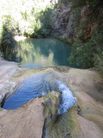
The Sierra de Cazorla in the Natural Park of the Sierras de Cazorla, Segura and the Villas, keeps on its strange well-known routes, being one of the doors to the Natural Park, but we can also find routes as beautiful as the Cañamares River, a little known place that surprises in positive to everyone who walks into it.

Latitud
37.8402
Longitud
-3.3404
Municipio
Ubicación en el mapa
POINT (-3.3404 37.8402)
imagen
Image
1397576Master.jpg
Imagen principal
Activado
imagen
Image
Sendero%20r%C3%ADo%20Ca%C3%B1amares.jpg
Imagen principal
Desactivado
4 h

Nature

icon-intereses-naturaleza

Friends

icon-intereses-amigos

Adventure

icon-intereses-aventura

Culture

icon-intereses-cultura

Sport

icon-intereses-deporte

Eco-friendly

icon-intereses-eco-friendly

For couples

icon-intereses-en-pareja

Family

icon-intereses-familia

Gastronomy

icon-intereses-gastronomia

Municipality

icon-intereses-municipio

Low-cost tourism

icon-intereses-turismo-low-cost

Solo travel

icon-intereses-viajar-solo
Medium
Sendero río Cañamares
3,81 km
On foot
All year round
Desactivado

Wear drinking water and clothing and footwear.

No public parking.

At the beginning of the Cañamares River trail, we find a poetry by the local poet Ramón Martínez Contreras, called "The Way."