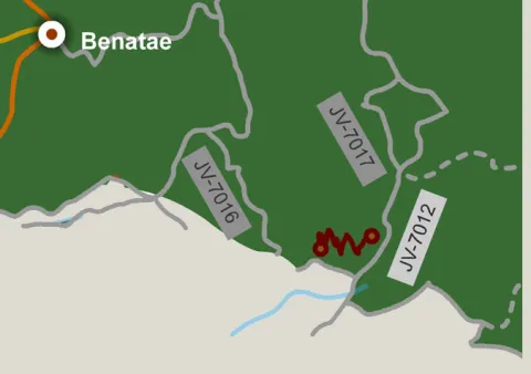
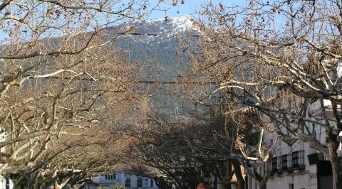
Home marked "El Puntal Free Flight Zone" in the upper part of Siles, next to the Old Age Residence.
Breve descripción
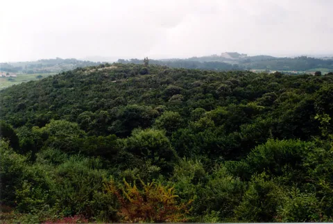
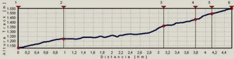
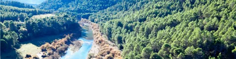
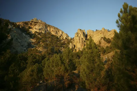
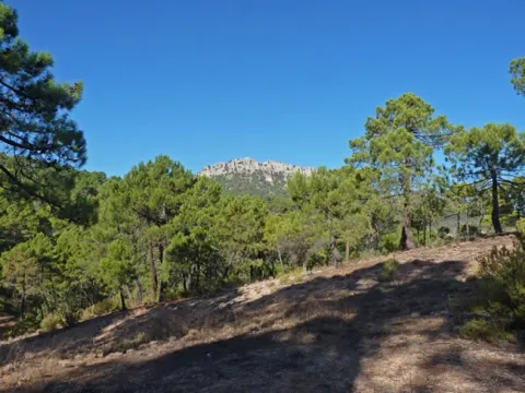
This track, usually in good condition, allows access to the Puntal, a promontory at just over 1,500 m above Siles. There is a fire surveillance shed and a free flight take-off, from which large panoramic views are dominated. On the way we can look at two viewpoints and take some walks to some of the most beautiful places in the northern part of the Natural Park. The route runs between carrasco, black and laricio pine pines.
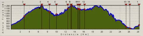
Just less than 2 km from the beginning you can reach the Portichuelo, where is the first lookout and arrows of two signposted paths. In the km 5.8 we find the indication to the view of La Rayuela, with extraordinary views. It's 5 minutes walk from the track.
Back to the main route, in km 10.8 we will find a new indication to the right towards El Puntal. This is a track that usually
Take a walk along the track that goes right a few meters before the path of the lookout of La Rayuela. It is a wide and very panoramic road that has no loss. After 6.5 km, it ends in the Free Time Residence of Siles.
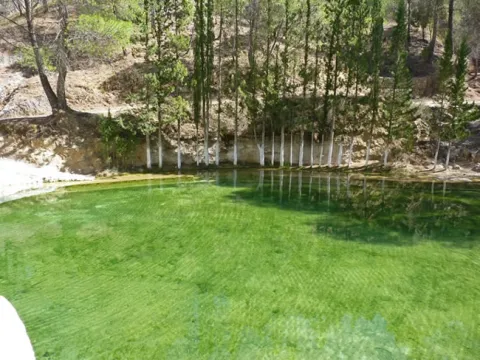
Walk 3 km to La Laguna de Siles, one of the few in the Natural Park. Although it may be dry, the place is very beautiful, as it is a wide meadow surrounded by thick oak trees near the Calar del Mundo. The road, which is not signposted, leaves to the left in a closed curve to the right in the km 8.2. Just follow him without taking any detour.
Instead of going up to the Puntal, leaving the car at the crossing of the km 10.8 we find the indication to the view of La Rayuela, with extraordinary views. And continue walking along the main track, which from that point has worse firm. You will be surprised, in the first few miles, by an impressive forest of oak, splashed with abundant maples and moans. Beyond that, the landscape opens in panoramic vases to the site of Pozo Romero, in the confines of the Calar del Mundo.
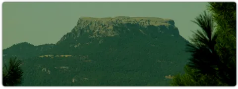
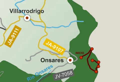
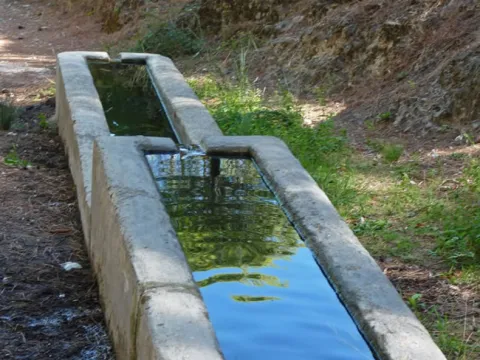
This route links the Recreative Area of the Dehesa del Bear with the Cambrón summit, a pétrea mole whose walls rise almost vertical on a pine sea. In the Dehesa del Bear we have a fountain with abundant flow, stone tables, small meadows and beautiful walnuts.
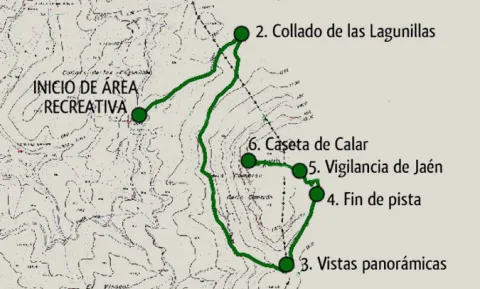
The road gently ascends along a narrow forest track, in the middle of a closed black pine forest with abundant oak and some complaints, from which you enjoy views that go from the valley of the Onsares to Calar del Mundo, valley of the head of the Guadalimar and saw of Alcaraz, in Albacete. In the end it climbs through a path of pastors that opens way between the rocks, to reach the impressive stone platform of the calar, typical carstic landscape of lapiaz with some hills, in which only few isolated black pine trees dare grow.
From the fire surveillance shed there is a superb panoramic from the manchegan plains of Ciudad Real and Albacete to Sierra Nevada. Crossing to the other end of the calar is another house belonging to Castilla-La Mancha. In the area there is plenty of the rocky plane and the piquirred chova, and we can see the flight of the lion vulture and the pilgrim hawk. You can also see flocks of muflons.
In the Collado de Las Lagunillas, we would continue to the village of El Bellotar, in the province of Albacete. Instead, we turn the track to the right. From here, the track remains without possible loss until it ends at the foot of the calar, which will have to go up a sidewalk.
At the end of the track, we take a path of shepherds to the left that goes up in zig@-@ zag. As we enter the plateau platform, the path loses some definition. We must follow the marks that we will find in stone milestones, pine trees and plates that mark the limits of the Natural Park.
We finally arrived at the Jaén fire site. It is highly recommended to cross the calar to the place in its eastern part, belonging to Castilla-La Mancha, where it will take about 15 'to arrive.
Breve descripción
This route links the Recreative Area of the Dehesa del Bear with the Cambrón summit, a pétrea mole whose walls rise almost vertical on a pine sea. In the Dehesa del Bear we have a fountain with abundant flow, stone tables, small meadows and beautiful walnuts. The road gently ascends along a narrow forest track, in the middle of a closed black pine forest with abundant oak and some complaints, from which you enjoy views that go from the valley of the Onsares to Calar del Mundo, valley of the head of the Guadalimar and saw of Alcaraz, in Albacete.
The forest track of access to the Dehesa del Bear coincides with part of the PR-A 151 Siles- Villarrodrigo route.
Recreative area of the Bear Dehesa. Your access via the road A-310, from La Puerta de Segura to Siles, direction Siles, past km 12 we take to the left a well-established lane that passes through the village of La Pendolera. After 14.8 km, without being separated by any detour, we reached the Dehesa del Oso.
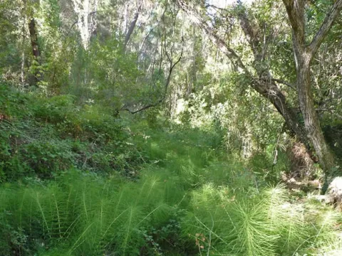
This route allows you to admire one of the most unique botanical enclaves of the Iberian Peninsula and enjoy wonderful panoramic views. A particularly humid and fresh microclimate is given in the area of Las Abeas. Thanks to him, under the canopy of pine larice grows an amazing hazelnut - the southernmost of Spain - with plenty of large stalks. There are many climbing plants such as ivy and clematide, and there are very few species in Andalusia, such as wild strawberry and noble liver. The set transmits a sense of freshness and plant abundance that is typical of the northern forests.
As we ascend, there are oaks, maples and oaks mixed with the pines, and finally the clare vegetation giving way to the piornal and to the lastoning. The route ends in the surveillance shed, promontory air from which very wide views are dominated. Before you go down, you recommend a walk through the Calar de Navalperal to enjoy its praises and its typical karmic landscape.
The exceptional nature of the hazelnut and acebos forest in southern Spain, together with the presence of many endemic or endangered plant species, has made this area a reserve area of Las Acebeas- Nava del Espino. It therefore enjoys the highest level of protection within the Natural Park.
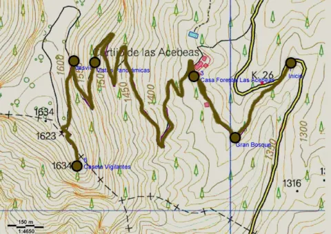
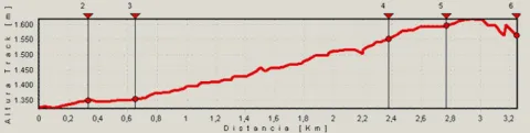
At 600 m from the beginning we find the Forest House of the Azebeas This is two beautiful houses, the first for use by environmental agents and the second, recently restored, was formerly at the service of forest engineers. There are several strands planted. At this point the forest track is narrow and turn left.
At 2700 m we left the forest track and turned left on a well-marked path. (If we prefer, we can also follow the track, which makes a wide and soft loop by rodeo the central area of the calar, to join again with the path). The path passes through a navel and is headed towards a few stone mojones.
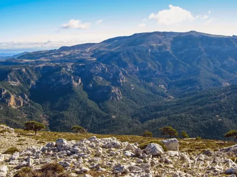
And finally in the km 3.2 we arrived at the fire surveillance shed. Impressive panoramic areas of the provinces of Jaén, Ciudad Real, Albacete and Granada. To the north you can see the manchegan plains, the mountains of the Alcaraz saw and the Calar del Mundo. To the west, the cliffs of Segura La Vieja, the high valley of Trujala, Orcera and the memorial tower of the castle of Segura de la Sierra. To the South we see the Yelmo and to the bottom the Banderillas, the great mole of La Sagra and the saw of Cazorla. And to the east we contemplate the Cerrico de Las Mentiras and the nearby calares of Navalespino and Morillas.
Breve descripción
This route allows you to admire one of the most unique botanical enclaves of the Iberian Peninsula and enjoy wonderful panoramic views. A particularly humid and fresh microclimate is given in the area of Las Abeas. Thanks to him, under the canopy of pine larice grows an amazing hazelnut - the southernmost of Spain - with plenty of large stalks. There are many climbing plants such as ivy and clematide, and there are very few species in Andalusia, such as wild strawberry and noble liver. The set transmits a sense of freshness and plant abundance that is typical of the northern forests.
The ideal time to visit from October to the end of April. Set up for 4 hours minimum.
The entire route runs along the edge of one of the Park Reserve areas, an area with maximum protection level (Grade A) due to the ecological values it houses. Path marked PR.
From Siles: In the km 12 of the said road we find a forest track to the right, to the counter, with a barrier that prevents the passage of vehicles (on the road JF-7012, marked "Camino de Las Acebeas"). From Segura de la Sierra: at 8.4 km from the aforementioned road, turn left towards Siles. The forest track is about 1.5 km to the left (on the JF-7032 road to the saw).
We will continue the main track in continuous rise. As you pass the indication to the Mirador de La Rayuela, which is essential to visit, there is a very pronounced curve to the left and there appears a track in slight descent to the front, which is the one we take. We continue in a well-deserved decline that will allow us to regain strength, and we contemplate unbeatable views of Siles and its surroundings, the olive grove in the lower area and the pine forests at medium and high altitudes. This area is very suitable for the observation of marine fossils, of ammonites above all, who lived at sea millions of years ago.
Just as we pass through a small water channelling shed that is at the foot of the track, we have a great view of the Anchorian and Calarejo ravine. Finally, we will cross a stream with permanent water and find a small building on our left that corresponds to a water survey that took place several years ago. From here on there is a profound change in the forest, as we went into a pinar of slender and high lard pine trees very rich in grass and much cooler than we had gone across the hill. We started going up again.
After 2 km. from the rise, we get to some cords that are left to our right. In the Cortijo Palerillas, we recommend a deviation before we return to our route: take the track that starts to the left, in a more sharp and counterman rise, to follow it to its end in 2 km. approximately. If we go to our right, at the base of the rocky cuts that rise upon us we will find several millennia of tejo. It is the most important weave of the Natural Park Sierras de Cazorla, Segura and Las Villas. Then we will return to the Cortijo Pancalillas, to continue the journey along the track. At 700 m we left to the left the great building of the Free Time Residence of Siles, known as The Seminary, and finally we reached asphalt road.
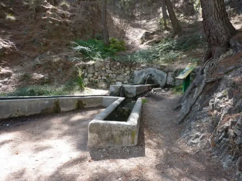
When we get to the road we turn right to go back down slightly until 1 km. down to a crossing where we have to turn left to get back on track and back up. Right at this point we find a magnificent source. We go to the Canalica Fountain Camping, to which we will have to deviate following the entry signs, but before passing through the access door, we will have to continue on a track that opens to the front. This will take us with a soft rise by places of great beauty, such as the Stone of the Hole and the Cerro Bucentaina, which we will surround, to view the valley of the Morles River, and already on a much more sharp and pleasant descent, we will reach the Peña del Olivar. It is a unique place suitable for the bathroom with a recreational area and a botanical collection. From there and by road we are headed for Siles. A few meters after exceeding the campsite Rio Los Molinos we will turn to our right, in the absence of 1 km. to reach Siles, thus avoiding more asphalted stretch and entering the town by land track.
Breve descripción
The circular tour begins in the town of Siles. We are headed for a forest track towards the hill of the Portichuelo, from which we have an unbeatable view of the village and the Vega de Castrobayona, before the nearby Albaceteña mountains and which shows the difficult agricultural life of the former inhabitants of the area. The Portichuelo is also the starting point of several signposted trails of small route.
This stage of the Southern Forest trail allows you to enjoy the wide variety of landscapes of the low mountain of the natural park, in which the pine trees are alternated with Mediterranean sotoforest, olive groves and small villages and villages.
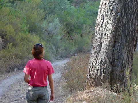
In the surroundings of Siles we will see a beautiful mosaic of pineapples and olive groves and we will enter one of the best pineapples of carrasco pine in the natural park, in which you can see and touch two gigantic examples of carrasco pine included in the Inventory of Singular Trees of Andalusia.
We can approach the remains of the small castle of Puentehonda, half hidden in the thickness of the forest and walk a delicious horseshoe road that part of the recreational area of Los Straits, from which you can see the Hispanic Muslim torreons of Santa Catalina and the wavy olive groves of the Trujala valley.
The day will not end better, because the stage ends in Segura de la Sierra, a small town declared a Historical-Artistic Set, in which it is enjoyed its spectacular location, its castle - of indispensable visit - and its popular architecture.
Orcera, a town very close to the journey of this stage and that is seen when it rises to Segura de la Sierra, was the stage in the 16th century of an event that is still considered emblematic in the history of the Sierra de Segura. This is the preparation of the ordinances of the Segura Common and its Earth, signed in 1580 by the representatives of the following councils in the Franciscan convent of Santa María de la Peña.
Once Granada was conquered by Christians in 1492, the Sierra de Segura, which for centuries had been a land of border and struggle between Christians and Muslims, is living a stage of stability, prosperity and population growth. Most of the territory was occupied by the mountains and pastures, the pine wood being the main wealth, because already at that time the woods were circulating through the rivers supplying the entire kingdom.
The inhabitants themselves were aware that the external greed over their wealth posed a danger to the survival of their economy, so the Ordinances were made in 1580, whose aim was to ensure that the wealth generated in the region reverted to its own inhabitants. The Ordinances, based on the Fuero de Cuenca, were the regulatory norm of the coexistence of the serrans and of the economic activities that were the sustenance of the region, especially the wood and the pastures. It also regulated the collection of fruits and seeds, hunting, fishing and the conservation of roads, sources and caves as common goods.
They had an enormous significance for two centuries as a regulatory instrument for trade and the use of natural resources, creating a framework of ecological rationality that was appropriate to the criteria, needs and knowledge of the time. When the walker satisfied his thirst in some source, remember what more than four centuries ago prescribed article 50 of the Ordinances:
"Item we order and command that because the sources are clean and their births for the drinking of the people and their service and use that no person abreve or wash in them other filth with the penalty of six hundred maravedis (...) and they restrain clean (...) two rods of measuring around the so-called penalty because it is in the public good."
La ruta comienza en el Área Recreativa de la Peña del Olivar, situada a escasos 2 kilómetros de la población de Siles en la carretera de Las Acebeas. Se trata de uno de los equipamientos de uso público mejor dotados del parque que cuenta con mesas, fuente, juegos infantiles, bar, terraza, etc., y en verano incluso con una excepcional zona natural de baño. Es recomendable visitar también su Colección Botánica, en la que se pueden ver muchas de las especies más representativas de la flora del parque natural. El sendero arranca bajo un gran panel con un croquis de carreteras pintado sobre un muro de piedra. Por la pista forestal que sale hacia la derecha, en sus primeros kilómetros contemplaremos un mosaico de terrenos de olivar mezclados con pinares.
Km 1
Fuente del Noguerón
Apenas a 1 kilómetro del inicio encontramos a nuestra izquierda la Fuente del Noguerón. El terreno calizo filtra de manera lenta y continua el agua que cae durante los meses húmedos como si se tratara de una gran esponja rocosa, dándole salida a través de fuentes como esta cuando el agua se encuentra con una capa de terreno impermeable.
A pocos metros de la fuente dejamos a nuestra izquierda el sendero PR-A 175 Circular de la Peña del Olivar y la etapa 21 del propio sendero Bosques del Sur, que nos llevaría hasta el refugio de la Era del Fustal. Nosotros continuaremos por la pista al frente, inmersos en uno de los mejores pinares de carrasco del parque natural, bajo el cual crece un cerrado sotobosque con encinas, madroños y durillos (Viburnum tinus).
Km 2,4
Bifurcación
Llegamos a una bifurcación de pistas y debemos de ir por la de la derecha que va en suave descenso hacia el valle del río Morles. El bosque cada vez es más auténtico y prueba de ello es que a 2 kilómetros de la citada bifurcación vamos a encontrar a nuestra derecha, a pie de pista, dos gigantescos y venerables ejemplares de pino carrasco. Ambos están incluidos en el Inventario de Árboles Singulares de Andalucía con los nombres de Pino de los Barrancos de Puentehonda y Pino del Cerro Bucentaina respectivamente. Este último tiene 32 metros de altura y 4,5 metros de diámetro en su base.
Un poco más adelante dejamos a nuestra izquierda una pequeña senda, no muy bien conservada, que se corresponde con el PR-A 79, en dirección a las ruinas del Castillo de Puente Honda. No obstante, si no queremos desviarnos, lo podremos contemplar un poco más adelante, a nuestra izquierda y en la parte alta entre los pinares. Se trata de un pequeño puesto de atalaya medieval en la ladera del Cerro Bucentaina, compuesto por dos torres construidas sobre dos rocas gemelas y unidas por un muro.
Km 5,1
Cruce de Puentehonda
Llegamos a un cruce con una pista forestal bastante más ancha que la que hemos transitado. Hacia la izquierda conduce a la encantadora aldea de La Hueta, pero nuestra ruta gira hacia la derecha para transitar por esta pista apenas 200 metros y girar de nuevo hacia la izquierda por otra pista, llegando enseguida a la aldea de Puentehonda, que ya habremos observado cuando bajábamos hacia el valle y que está al otro lado del pequeño río Morles. Junto a la aldea hay una agradable área recreativa dotada de fuente. En esta zona el paisaje ya ha sido más transformado por el ser humano y existen pequeñas parcelas de olivar que se mezclan en algunos casos con nogales, frutales y pequeños huertos.
Nuestra ruta continúa por una pista forestal que está un poco antes de llegar al área recreativa. Es más estrecha y empinada que la anterior, y nos vuelve a adentrar en el bosque de pinar. El bosque de pino carrasco da paso al de pino negral, más adaptado a estas altitudes, salpicado con algunas encinas y robles (quejigos). A nuestra izquierda, en lo alto, se contempla el Calar de Navalperal y a nuestra derecha, encaramada sobre la roca, la caseta de vigilancia de Peñalta.
Km 9,5
Puerto de Siles
La subida culmina en el Puerto de Siles, muy próximo a los 1100 metros de altitud. En este punto podremos desviarno de nuestra ruta para recorrer el PR-A 180, que también forma parte del sendero Bosques del Sur y que nos llevará a Peñalta, cumbre de 1400 metros que es un espléndido mirador natural sobre los Valles del Guadalimar y del Trujala. La subida a Peñalta es la derivación 1 de este GR. Más información en la página 281.
Continuando hacia Segura de la Sierra desde el Puerto de Siles, comenzamos un descenso por senda hacia la casa forestal El Pilarillo que encontramos apenas 600 metros más abajo. Hay una fuente, justo donde se sitúan las casas, al pie de la carretera. A nuestra izquierda y en paralelo discurre una pista forestal asfaltada que más tarde cruzaremos. Después, nuestra senda cruza una ancha pista de tierra, atajando para finalmente volver a ella.
Km 12
Área Recreativa de los Estrechos
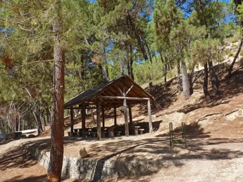
Llegamos al Área Recreativa de Los Estrechos que nos encontraremos a nuestra izquierda. Cuenta con un techado de madera con mesas para comer, además de una magnífica fuente y sombras. Si continuáramos por la pista que traemos llegaríamos muy pronto a la gran piscina municipal de Amurjo, a 1,2 kilómetros, de excepcionales dimensiones y rodeada de pinares y roquedos. Después de otros 0,8 kilómetros alcanzaríamos Orcera entrando por su encantador casco viejo.
Para continuar nuestra etapa desde Los Estrechos tomamos un delicioso camino de herradura. Caminando bajo los pinos carrascos, con muy poco desnivel, iremos viendo el monte Peñalta, hasta que la perspectiva se abre hacia Orcera, los torreones hispano-musulmanes de Santa Catalina y los ondulados olivares del valle del Trujala.
Más adelante, tras pasar por un olivar, ganamos altura por el camino tradicional que durante siglos fue transitado por las gentes que circulaban entre los pueblos de Orcera y Segura de la Sierra, y que es muy panorámico en algunos tramos. Aparece ante nuestra vista la inconfundible mole de El Yelmo, la montaña más emblemática de esta zona del parque natural, y más al sur, la línea de cumbres de la Sierra de Las Villas.
Km 19,6
Segura de la Sierra
La etapa finaliza en Segura de la Sierra, un pequeño pueblo declarado Conjunto Histórico-Artístico, cuya vista ya enamora desde que empezamos a divisarlo desde el sendero Bosques del Sur, con sus casitas blancas ciñéndose al perfil del monte coronado por un castillo de origen musulmán, que alberga el Espacio Temático del Territorio de Frontera. Pasear sin prisa por sus calles estrechas, descubrir los detalles y rincones de su arquitectura popular y extasiarse con las panorámicas que se abren en todas las direcciones es una de las experiencias más gratificantes que depara el sendero Bosques del Sur. Visitar el pueblo llegando en vehículo es agradable para todo el mundo, pero llegar a él caminando nos permitirá sentir con más autenticidad su esencia, ya que el origen histórico de su emplazamiento fue defensivo, y por tanto la altitud y la dificultad de acceso constituyen el sentido original de Segura de la Sierra.
En esta misma población, cerca del acceso al castillo y a la carretera de salida hacia Siles-Pontones (Ctra. de La Cumbre), el GR te ofrece una alternativa al trazado principal: la variante GR 247.1 (más información en la página 231), que en dos jornadas conecta directamente con las etapas 19 y 20, pudiendo cerrar un circuito completo con las etapas del norte del GR 247.