Saltar al contenido principal

Trail de Siles a Villarrodrigo

Submitted by brandcode_deweloper on
Id
8100491
Descripción larga

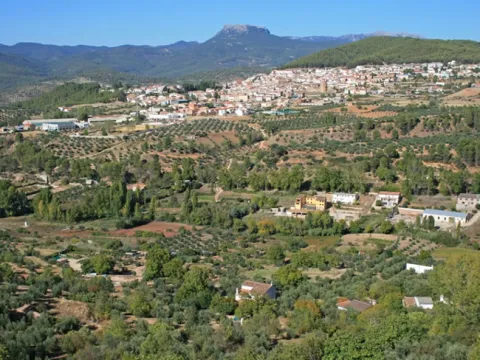
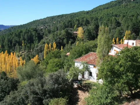
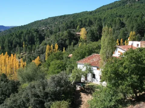
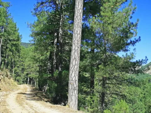
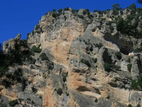
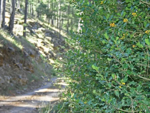
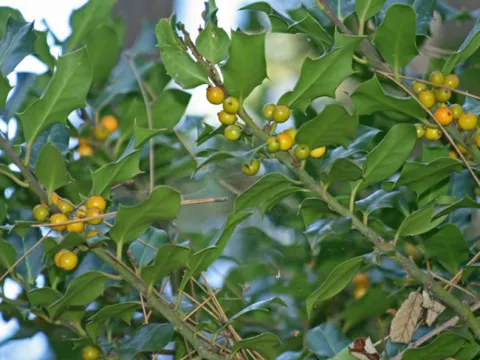
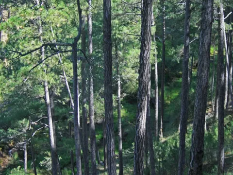
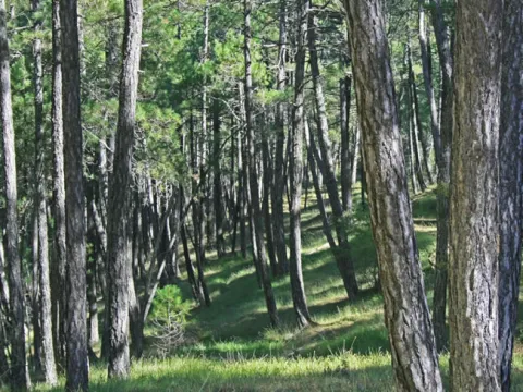
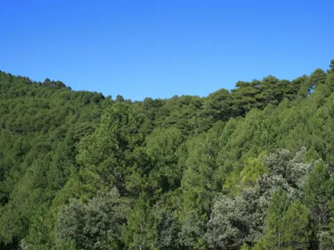
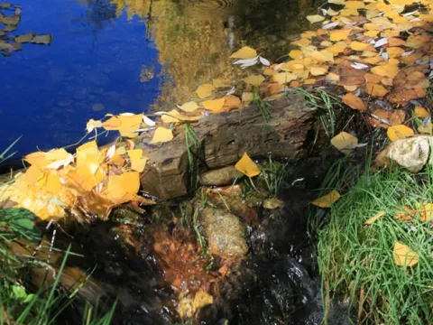
We will walk through a varied landscape of low and half mountain, between olive groves and masses of carrasco and black pine with abundant Mediterranean forest, spilled by beautiful walnuts, complaints and pineapples. We can also see well-preserved river vegetation.

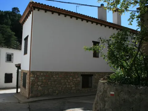
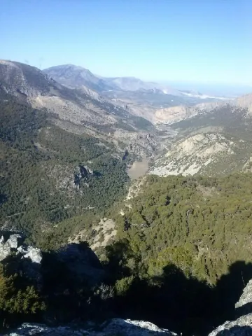
Between the Dehesa del Oso and Villarrodrigo there are long sections from which we will enjoy a wide range of views of all theNatural Park. In the vicinity of Villarrodrigo you can see the last eastern foothills of Sierra Morena and the transition landscape formed by dehesas.

The corvids, such as the lard and the corneas, as well as the boar, are abundant. In the area of the Cambrón there is an interesting colony of leonate vulture.

Breve descripción

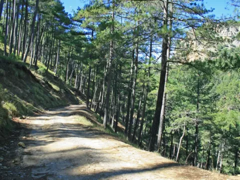
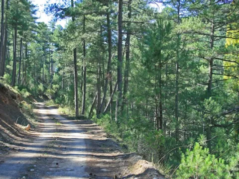
The Path of Siles to Villarrodrigo runs almost entirely through a forest track that unites these two localities, crossing the valleys of the Guadalimar and its tributary the Onsares.

Latitud
38.487184
Longitud
-2.636444
Distrito
Municipio
Ubicación en el mapa
POINT (-2.636444 38.487184)
imagen
Image
sendero%20de%20Siles%20a%20Villarrodrigo2.jpg
Imagen principal
Activado
imagen
Image
sendero%20de%20Siles%20a%20Villarrodrigo.jpeg
Imagen principal
Desactivado

Nature

icon-intereses-naturaleza

Friends

icon-intereses-amigos

Adventure

icon-intereses-aventura

Culture

icon-intereses-cultura

Sport

icon-intereses-deporte

Eco-friendly

icon-intereses-eco-friendly

For couples

icon-intereses-en-pareja

Family

icon-intereses-familia

Gastronomy

icon-intereses-gastronomia

Seniors

icon-intereses-senior

Low-cost tourism

icon-intereses-turismo-low-cost

Solo travel

icon-intereses-viajar-solo
Sendero de Siles a Villarrodrigo
On foot
All year round
Activado
Coordenadas / Huso 30S
30S x = 531707 and = 4259934
Tramo de asfalto o cemento
 
Tramo de pista o camino forestal
 
Tramo de vía pecuaria
 
Tramo de senda
 

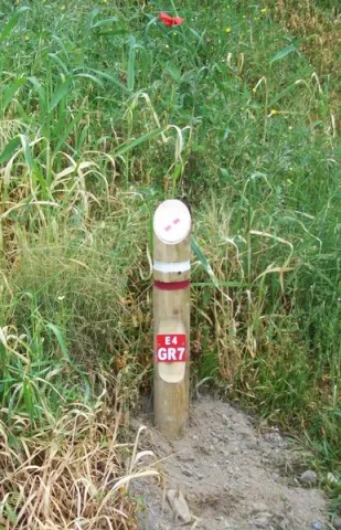
El Trail de Gran Recorrido GR 7, Trail Europeo E-4

Submitted by brandcode_deweloper on
Id
3919177
Breve descripción

It is the longest path in Europe. Alcalá la Real is part of this path and perhaps we stand before the stretch of the path, where we can see the historical presence more; the stretch that we are going to begin, it circulates between some of the villages of Alcalá la Real; we will pass by old stone crosses, watchmen, who were watching enemy incursions. We will run between ancient stone walls that protected the fields of cultivation, from the passage of the cattle, that passed through the crossroads of cascades and cords that are in the area of moor before reaching the population.

Latitud
37.4614
Longitud
-3.9222
Distrito
Municipio
Ubicación en el mapa
POINT (-3.9222 37.4614)
imagen
Image
2%20%281%29.jpeg
Imagen principal
Activado

Nature

icon-intereses-naturaleza

Friends

icon-intereses-amigos

Adventure

icon-intereses-aventura

Culture

icon-intereses-cultura

Sport

icon-intereses-deporte

Eco-friendly

icon-intereses-eco-friendly

For couples

icon-intereses-en-pareja

Family

icon-intereses-familia

Gastronomy

icon-intereses-gastronomia

Municipality

icon-intereses-municipio

Low-cost tourism

icon-intereses-turismo-low-cost

Solo travel

icon-intereses-viajar-solo
El Sendero de Gran Recorrido GR 7, Sendero Europeo E-4
On foot
All year round
Activado
Tramo de asfalto o cemento
 
Tramo de pista o camino forestal
 
Tramo de vía pecuaria
 
Tramo de senda
 

Trail Fundición de la Tortilla

Submitted by brandcode_deweloper on
Id
2150089
Descripción larga

After passing through an alpechenera and under an old bridge of the mining railway the path ascends along the stony coast of San Pedro to the Cañada de Incosa; from which we continue, to the right, a stretch that presents, to the west, magnificent views of the population of Baños de la Encina.

Walking this path is moving in memory to a period in the history of Linares.

After 1.4 Km we connect with the road and by a wooden step we take the Green Way until we reach a crossing (connection to the path of the Gitana Mine PR-A 264), then we pass through the solid waste treatment plant and continue on the old steep path of Siles that will lead us back to Linares.

Breve descripción

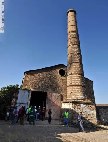
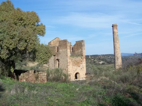
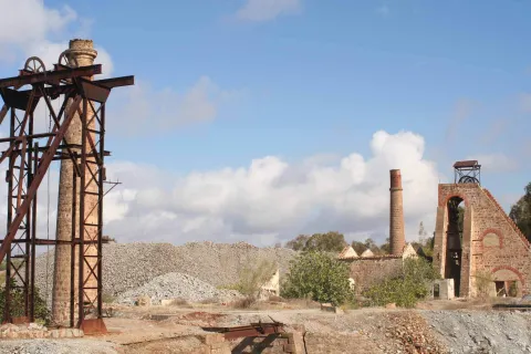
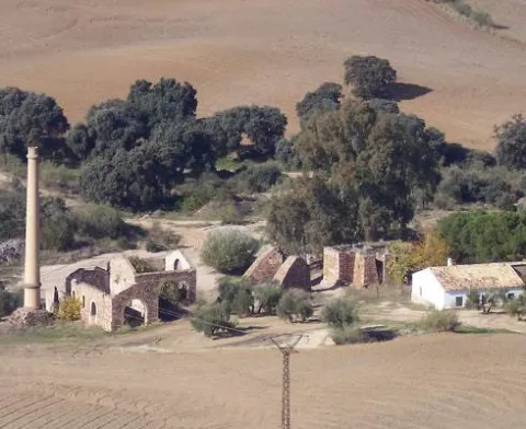
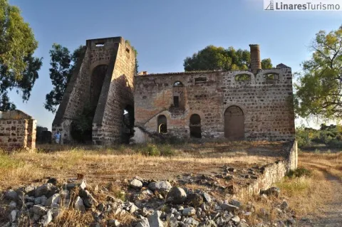
To walk this path is to move in memory to a period in the history of Linares: its mining industry which, during the 19th and mid-20th centuries, meant the way of life for many Linarians and whose heritage is scattered throughout its term. Mines, wells and smelters, today abandoned, where you can still see the melted granite constructions, the high chimneys of the smelters and the old "Cabrias" for the extraction of the material. A path that runs along the road of the Tortilla, very passed by the Linarians and that has no loss. 2 km. is found the Foundry of the Tortilla, a crossroads of roads and numerous buildings in ruins denote its importance in the mining past of Linares.

Latitud
38.0956
Longitud
-3.6369
Distrito
Municipio
Ubicación en el mapa
POINT (-3.6369 38.0956)
imagen
Image
20111022-118.jpg
Imagen principal
Activado
imagen
Image
Sendero%20Fundici%C3%B3n%20de%20la%20Tortilla.jpeg
Imagen principal
Desactivado

Friends

icon-intereses-amigos

Adventure

icon-intereses-aventura

Culture

icon-intereses-cultura

Sport

icon-intereses-deporte

Eco-friendly

icon-intereses-eco-friendly

For couples

icon-intereses-en-pareja

Family

icon-intereses-familia

Gastronomy

icon-intereses-gastronomia

Municipality

icon-intereses-municipio

Nature

icon-intereses-naturaleza

Low-cost tourism

icon-intereses-turismo-low-cost

Solo travel

icon-intereses-viajar-solo
Sendero Fundición de la Tortilla
On foot
All year round
Activado
Tramo de asfalto o cemento
 
Tramo de pista o camino forestal
 
Tramo de vía pecuaria
 
Tramo de senda
 

Trail del cerro de las Mancebas

Submitted by brandcode_deweloper on
Id
2149963
Descripción larga

The itinerary turns left and gently descends between chaps, next to air-navigation antennas, enjoying beautiful panoramic views. It concludes the fall at a crossroads between the Cerro de las Manciebas and Pico, near the Dark Porvenir well. We continue on the right to reach the hill, connecting with the path of the Garza, PR-A 262. Let us go on a path that will make us drunk by its beauty and by the history of its mining remains: the Pozo Zulueta, the Pozo de San Ignacio and the Lavadero de Mineral de Arrayanes, as well as views of the valley of the lagoons.

In the Lavadero de Arrayanes (construction on the hillside to take advantage of a gravity circuit that separated the mineral, through several phases) we moved away from the path of La Garza to continue a ramp to reach the well of San José and the Central Electric, where the route coincides again with the path of Pico to the well restoration, in which they are separated following the Green Way.

About 100 meters from this point the Via Verde is bifurca (1); on the left you reach the La Cruz Fundition road, which we follow 20 meters to take a lane to the left, next to a ruins, which leads to an aerodrome. We find two branches outside the path, both on the left, interesting if time is available, the first leads to the well Chaves and the second to the High Alamillo Mine with the possibility of enjoying an unbeatable view. Later there is the urbanization of La Cruz, where we will reach the beginning of this mining route.

(1) This bifurcation on the Green Way on the right is a shortcut to the La Cruz Fundition when little time is available to make the route marked

Breve descripción

The path begins at La Fundado La Cruz (see the path of Pico, PR-A 260). We are heading for the well-known Cadenas, which is reached after passing by an old Civil Guard headquarters and through the Vimora mineral wash. After the La Cruz fireplace, which was 100 meters high (today it is 57 m), the trails are separated.

Latitud
37.7903
Longitud
-3.5104
Distrito
Municipio
Ubicación en el mapa
POINT (-3.5104 37.7903)
imagen
Image
100_5789.jpg
Imagen principal
Activado

Nature

icon-intereses-naturaleza

Friends

icon-intereses-amigos

Adventure

icon-intereses-aventura

Culture

icon-intereses-cultura

Sport

icon-intereses-deporte

Eco-friendly

icon-intereses-eco-friendly

For couples

icon-intereses-en-pareja

Family

icon-intereses-familia

Gastronomy

icon-intereses-gastronomia

Municipality

icon-intereses-municipio

Low-cost tourism

icon-intereses-turismo-low-cost

Solo travel

icon-intereses-viajar-solo
Sendero del cerro de las Mancebas
On foot
All year round
Activado

Trail del Paño Pico

Submitted by brandcode_deweloper on
Id
2149913
Descripción larga

In the well restoration, open between 1844 and 1850, the building that housed the garage and locomotives workshop of the mining railway stands out. In the well of San José, next to the road, you can still see the place called "Bajada de la Reina," made for a visit by Elizabeth II to the first gallery.

We pass by the well Cadenas and later through the Vimora Lavadero, example of natural regeneration of the vegetation of the area...

The path continues to Paño Pico (geodetic vertex) and the Mina de La Mexicana, don enclaves from where it is possible to enjoy an unbeatable panorama of the area: far away La Carolina and Baños de la Encina, closer to the Hoyo de San Bartolomé, Cerro de las Manciebas, etc. From Mexico an ancient road between oak trees, interrupted by an olive grove, leads to the Fireplace de la Cruz, one of the highest in the area that reached a height of 100 m (today it is 57 m), and where the path reshares route with the PR-A 261. We passed by the Pozo Cadenas and later on through the Vimora Lavadero, an example of natural regeneration of the vegetation of the area, to go around the urbanization until the end of the La Cruz Foundry, where all types of lead products were made, and that will be the seat of the future Interpretation Centre.

Breve descripción

This practically flat-profile Path, born in the Barrio de Arrayanes and follows one of the most important roads that the Minas de Arrayanes communicated with Linares. The itinerary after passing the Pozo Acosta, where the house of extraction machines, fireplace and auxiliary buildings are still preserved, crosses on two occasions the tracks of the old mining tram, today dismantled: one, at its pass through the Pozo Restoration, and another, before reaching the Pozo San José and the Central Electric. The stretch between the two wells is consistent with the path PR-A 261 "Cerro de las Manciebas" which allows us to combine the route.

Latitud
37.8001
Longitud
-3.4902
Distrito
Municipio
Ubicación en el mapa
POINT (-3.4902 37.8001)
imagen
Image
MINA_DE_SAN_VICENTE_linares.jpg
Imagen principal
Activado

Nature

icon-intereses-naturaleza

Friends

icon-intereses-amigos

Adventure

icon-intereses-aventura

Culture

icon-intereses-cultura

Sport

icon-intereses-deporte

Eco-friendly

icon-intereses-eco-friendly

For couples

icon-intereses-en-pareja

Family

icon-intereses-familia

Gastronomy

icon-intereses-gastronomia

Municipality

icon-intereses-municipio

Low-cost tourism

icon-intereses-turismo-low-cost

Solo travel

icon-intereses-viajar-solo
Sendero del Paño Pico
On foot
All year round
Activado
Tramo de asfalto o cemento
 
Tramo de pista o camino forestal
 
Tramo de vía pecuaria
 
Tramo de senda
 

Trail de La Gitana

Submitted by brandcode_deweloper on
Id
2149545
Descripción larga

The well of the Gitana, ideal place of rest where we can be surprised by a spectacular rainbow effect produced in the mouth of the well.

A lane connects right to the path. We follow on the right and about 100 meters away there are ruins, later leading a short and slight descent to the urbanization of San Roque in front of a slender fireplace on the Carretera de Guarroman. On the road and on the left you have to walk about 250 meters to a track between chalets that we take to turn left again. The path gently descends through an area of dehesa to reach the well of the Gypsy, not before opening and closing a wire that as a door prevents the free passage.

The well of the Gitana, ideal place of rest where we can be surprised by a spectacular rainbow effect produced in the mouth of the well. We arrive at the well of Las Animas, there at a table of interpretation the most interesting places in the area are recognized. The crossing is located with the mines of Adaro. Without deviating, during the descent to the left is the Pozo de San Isidro, below a vaguada the road ascends leaving at its pass and to the right the Pozo San Francisco 2nd, and culminates in the Solid Waste Plant, where it continues along the road, which is only to be left after passing the crossing with the Mina de Los Quinientos and taking a path that leaves to the left through the Via Verde next to a ruined shed linking with the Fundado de la Tortilla, PRA 265, which together use the Camino de Siles to reach Linares.

Breve descripción

This Path, in its journey, not only recovers the pecuary path of the Way of Mayecosas at its beginning, but also does so by returning to Linares on the old way of Siles, also called the Way of the Stones. This road has no loss and is marked by some other stone wall. We leave the pecuaria road turning left at the first crossing, a few meters from another crossing with the road of the well of San Adriano, which we can visit if we leave the route. Our tour continues to cross the Green Way and reach a crossing where we turn right on a road next to an electric tower that continues between olive trees.

Latitud
37.8202
Longitud
-3.4601
Distrito
Municipio
Ubicación en el mapa
POINT (-3.4601 37.8202)
imagen
Image
MINA_POZO_DE_LA_GITANA.jpg
Imagen principal
Activado
imagen
Image
20110702-0391.jpg
Imagen principal
Desactivado

Nature

icon-intereses-naturaleza

Friends

icon-intereses-amigos

Adventure

icon-intereses-aventura

Culture

icon-intereses-cultura

Sport

icon-intereses-deporte

Eco-friendly

icon-intereses-eco-friendly

For couples

icon-intereses-en-pareja

Family

icon-intereses-familia

Gastronomy

icon-intereses-gastronomia

Municipality

icon-intereses-municipio

Low-cost tourism

icon-intereses-turismo-low-cost

Solo travel

icon-intereses-viajar-solo
Sendero de La Gitana
On foot
All year round
Activado
Tramo de asfalto o cemento
 
Tramo de pista o camino forestal
 
Tramo de vía pecuaria
 
Tramo de senda
 

ALTERNATIVE GR 247.1 STAGE 1: Prado Maguillo and Forestrand House Refuge El Bodegón - Río Madera

Submitted by brandcode_deweloper on
Id
8165149
Breve descripción

This first stage of the GR 247.1 Variant unites two of the most emblematic small inhabited nuclei of the deep interior of the Natural Park, in the Sierra de Segura. The first is the village of Los Anchos and Prado Maguillo, and the second is the village of Arroyo Canales and Rio Madera.

They are isolated, lonely and surrounded by a very beautiful environment. The first, at the highest altitude, draw attention to the good conservation of popular architecture, of great simplicity and with an aesthetics fully integrated into the landscape. The Recreative Area of La Morringa, which is a very pleasant and shaded space with fountain and tables next to the River Madera, whose waters run manly between the riverside vegetation, stands out.

Most of the route runs through the forest track that runs through the Valley of Arroyo de las Tres Aguas, linking the valleys of Los Anchos and Río Madera through thick forests of pine laricio or salgareño. The Stage is short, and it is possible to chain it in the same day with one of the other steps of the Southern Forest Path with which it links, or with a stretch of them, but we recommend to do so without haste and to remain at any of the two ends of it, because they have left-over attractions for it.

Latitud
37.8351
Longitud
-3.1403
Distrito
Municipio
Ubicación en el mapa
POINT (-3.1403 37.8351)
imagen
Image
1.jpg
Imagen principal
Activado
imagen
Image
1.jpg
Imagen principal
Desactivado
imagen
Image
2.jpg
Imagen principal
Desactivado
imagen
Image
4.jpg
Imagen principal
Desactivado
imagen
Image
5.jpg
Imagen principal
Desactivado
imagen
Image
6.jpg
Imagen principal
Desactivado
imagen
Image
7.jpg
Imagen principal
Desactivado
imagen
Image
8.jpg
Imagen principal
Desactivado
imagen
Image
9.jpg
Imagen principal
Desactivado
imagen
Image
10.jpg
Imagen principal
Desactivado
imagen
Image
11.jpg
Imagen principal
Desactivado
imagen
Image
12.jpg
Imagen principal
Desactivado
imagen
Image
13.jpg
Imagen principal
Desactivado
imagen
Image
14.jpg
Imagen principal
Desactivado
imagen
Image
15.jpg
Imagen principal
Desactivado
imagen
Image
16.jpg
Imagen principal
Desactivado
imagen
Image
17.jpg
Imagen principal
Desactivado
imagen
Image
18.jpg
Imagen principal
Desactivado
imagen
Image
19.jpg
Imagen principal
Desactivado
2 h 12 min

Nature

icon-intereses-naturaleza

Friends

icon-intereses-amigos

Adventure

icon-intereses-aventura

Culture

icon-intereses-cultura

Sport

icon-intereses-deporte

Eco-friendly

icon-intereses-eco-friendly

For couples

icon-intereses-en-pareja

Family

icon-intereses-familia

Gastronomy

icon-intereses-gastronomia

Municipality

icon-intereses-municipio

Low-cost tourism

icon-intereses-turismo-low-cost

Solo travel

icon-intereses-viajar-solo
Medium
Prado Maguillo y Refugio Casa Forestal El Bodegón - Río Madera
7,78 km
248m
241m
416m
1
1
1
2
On foot
All year round
Activado
Some strong reels shortly before the end of the Stage in Rio Madera
Prado Maguillo, La Morringa Recreative Area, Arroyo Canales, Río Madera

On the path: No
Near the path: Segura de la Sierra

In the beginning: Refugio Casa Forestal El Bodegón (1.4 km from the beginning of Etapa).
In the end: there is no.

The serrano cortijo, a combination between the practical and the simple

The Valley of Los Anchos, from which this route is part, is perhaps the area where what is left of the popular architecture of these mountains is best preserved. Joaquín Gómez Mena, an excellent connoisseur of the Natural Park, sums up its main features.
The serrana house, as a general rule, is rectangular and has thick walls ranging from 50 to 70 centimeters, made of stones and toves attached with argamase, which serves as protection against summer heat and the cold of winter. The surface of this rectangle ranges from 25-35 meters wide by 30-40 meters long.

On the lower floor there are usually three rooms that are aligned. The first is a kitchen-dining room, where there is the access door to the house and it has one or two windows not very large. In this kitchen-dining room is the home or fireplace, which has the double function of heating the room in winter and serving to cook the food and heat the water.

In most of the houses, on both sides of the fireplace are two fitted cupboards on the wall, where the cooking tools are kept. Sometimes in one of these holes the quarries were placed with the water that was brought from the source.

The other two rooms are single bedrooms, one for marriage and one for children. They have small ventilation windows and are very austere, for in them there is only one bed and a harpoon to keep the clothes. From one of the bedrooms leaves the staircase that gives access to the upper floor, where the camera is located.

The roof of this plant is of descending height, or as we say today, overstretched, because the roof becomes inclined, usually to a water, to run the rainwater. This camera has one or two small windows to air the stay, where the products of the killing are cured and stored. The roof of the camera is unglued, with the wooden rolls that make of beams and the wooden boards placed above them. Finally, a clay layer and tiles are available on the boards.

Next to the human stays, but separated by a wall and with independent entrances, the blocks for the cattle are located, which have freckles for mules and donkeys. In some corijos these blocks are separated from the house, in front of it or on one side of it. Other buildings of the cortijo separated from the family house are the corrals and aprines for the goats and sheep, the cochineas and the hens.

There are also other common-use infrastructure for different families in a corijada. Among them are the ages to pull the grain, which are usually on high and well ventilated grounds to take advantage of the effect of the air, are almost always circular and its soil is made with rolling edges, perfectly placed as if of a mosaic. Many of these ages are currently abandoned and it is regrettable that they end up being lost in the near future, because they are part of the cultural heritage of the natural park.

Another element of common use is the bread oven, built of stone and mud and in a vaulted form. It can be found standing out of the walls of the house to which it is located or, more often, as an independent construction among other buildings of the cortijo. The plant of these furnaces is usually circular or square, and is covered with Arab tile.

Also the fountains and lavatories, which were essential elements in the daily life of the village, are another heritage that in many places is being lost and that, even if the installation of running water in the houses makes them barely used, should be kept perfectly preserved.

Prado Maguillo and Refugio Casa Forestal El Bodegón

Wood River

Coordenadas / Huso 30S
According to Projection UTM Datum ETRS89
Tramo de asfalto o cemento
2.19%
Tramo de pista o camino forestal
87.79%
Tramo de vía pecuaria
0
Tramo de senda
10.02%

Route card

Km 0

Prado Maguillo

Nuestra ruta comienza en Prado Maguillo, una pequeña aldea de montaña muy cerca de Los Anchos. Ambas están en un entorno de extraordinaria belleza y conservan bastante bien la arquitectura popular. Salimos entre huertas, la mayoría ya abandonadas, y a los 500 metros, a la izquierda hay un pequeño cerro al que es imprescindible subir (son muy pocos metros) para recrearse en las maravillosas vistas que se contemplan desde él: el valle de Los Anchos en primer plano y, al fondo, las crestas de El Calarico, Poyo Gavilán y Poyo Alto.

Km 0,75

A la izquierda sale un camino que, al cabo 650 metros, nos lleva a la Casa Forestal El Bodegón, una de cuyas construcciones auxiliares ha sido rehabilitada como refugio. La Casa y el almacén –al que se llamaba barraca- ya están en ruinas, pero el paraje, que es un amplio claro en pleno bosque, es encantador.

Volviendo a nuestra ruta, continuamos bajando por la solitaria pista forestal en medio de un gran bosque de pino laricio o salgareño con sotobosque de encina, un paisaje cautivador que nos acompañará hasta el final de la Etapa. Vamos entre la Loma del Mirandante y el Calar de Peña Rubia, por el encajado valle del Arroyo del Prado de los Fresnos.

Pronto oiremos el rumor de sus aguas, mezclado con el canto de la abundante avifauna forestal. A la derecha, al otro lado del valle, aparece la inconfundible silueta de Peña Rubia, con sus paredones verticales que, haciendo honor a su nombre, tienen un llamativo color dorado y sepia que se acentúa con las últimas luces de la tarde.

A la altura del kilómetro 3, aproximadamente, en el fondo del valle confluyen las aguas del Arroyo del Prado de los Fresnos con las de los Arroyos de La Cerecera y La Cuesta del Majano. Por eso, a partir de ese punto, el cauce que resulta tiene el bello nombre de Arroyo de las Tres Aguas.

El ambiente fresco y umbrío del valle propicia la existencia de acebos aislados, pudiendo admirar un pequeño grupo de ellos en el kilómterom 3,8. Un poco más adelante vemos abajo las ruinas del Molino de Peña Rubia y su antigua conducción de agua, que nos hablan de un pasado en el que se trabajaba para sobrevivir, pero donde el agua era mucho más abundante, porque la que circula en la actualidad apenas podría mover la rueda de un molino con la necesaria continuidad.

En el kilómetro 4,4 hay un manantial de agua que sale a través de una conducción por el lado derecho de la pista forestal.

Km 5,9

Puente sobre el Arroyo de Las Tres Aguas

La ruta llega al fondo del valle y cruzamos sobre este río, que poco después afluye al Río Madera. Es un lugar refrescante con abundancia de mimbreras y juncos, al igual que el cruce sobre el Río Madera por un vado unos 400 metros más adelante. La lámina de agua que tenemos que atravesar suele ser muy delgada, pero si ha llovido mucho puede tener alguna dificultad. También hay que tener prudencia en invierno, época en la que puede tener una capa de hielo. A partir del vado, y ya por el Valle del Río Madera, caminamos otros 400 metros con el río a nuestra derecha. En este tramo apreciamos que la vegetación es abundante, pero además hay que saber que las condiciones de frescor y humedad convierten a la zona en un enclave con una relevante importancia botánica. Hay, por ejemplo, una población de un equiseto (similar a la cola de caballo) denominado Equisetum palustre, planta propia del norte cuyas escasas poblaciones andaluzas sólo están en este Parque Natural. También se puede ver la centaurea (Centaurea nevadensis), exclusiva de las sierras calizas del este y sureste de España, y la ajonjera de Cazorla (Carlina baetica), una planta de distribución restringida al Parque Natural y sierras cercanas.

Km 6,7

Área Recreativa de La Morringa

Este Área es un buen lugar para descansar e incluso para echarse una siesta, tal vez por eso los serranos le pusieron este nombre, que en el habla local es sinónimo de soñarrera. Es un espacio muy agradable y sombreado que dispone de fuente y mesas junto al Río Madera, cuyas aguas discurren mansamente entre la vegetación de ribera. Después salimos a la carretera del valle de Río Madera y caminamos por ella apenas 200 metros para tomar un camino que sale a nuestra izquierda. Se trata de un jorro (vía de saca de madera) con algunos repechos que al poco se convierte en senda. En el kilómetro 7, 4 llegamos a un collado donde se abren vistas hacia el pequeño Valle de Arroyo Canales, donde vemos la aldea del mismo nombre en la que finalizará nuestra Etapa. En este mismo collado cruzamos una pista forestal que, hacia la izquierda, nos llevaría a los cortijos de Los Jarales y Los Asperones.

Km 7,7

Arroyo Canales y Río Madera

La Etapa termina en la pequeña aldea de Arroyo Canales, unos metros después de atravesar el arroyo del mismo nombre y las huertas que riega. Por la carreterita que pasa por la aldea, a la derecha, llegaríamos en unos minutos a la aldea de Río Madera, que tiene menos casas, pero que con su ermita, su venta, su plazuela y su antigua casa forestal ha sido siempre y sigue siendo el lugar de referencia del frondoso y seductor valle de Río Madera. Si en vez de bajar a la aldea de Río Madera queremos continuar por la Etapa 2 de la Variante GR 247.1, solo hay que cruzar Arroyo Canales, y al llegar a la carretera seguir por el camino que arranca enfrente.

Trail Cruz de la Chimba

Submitted by brandcode_deweloper on
Id
6488877
Descripción larga

The path begins at the same source of the Cañada de las Azadillas, before a small round where the asphalt road ends. To the right of the fountain and to the empty, we go up perpendicularly from the road about 80 m. We make a turn of something more than 90 ° to the left where a horseshoe path is born that passes on the hillside of the fountain. Once on the road there is no loss as it is very marked, only some fallen trees cross the road, but these do not have difficulty avoiding them.

This first stretch is a constant rise and the good route of the path facilitates progression. As you gain height, the cups of the bushes adjacent to the path partially occupy some areas of the path, but in no case makes the footprint difficult or hidden. Already at the top the slope is softer and soon in a clear area we find the remains of a low-marked lane that lead to an explanade where forest cars turn, and start of the track. This point is the place of access and to which we must return, if we want to visit the forest shed Cruz de la Chimba at about 200 meters, hidden by the thickness of the pines. There is no path marked as such, so it is easy to get confused even though the distance is short. The best option is to walk on the track about 20 m from where the vehicle pass begins and is marked, perpendicularly to the lane and to the right of the track (west direction, direction 247th) we enter the pine in an area of path little defined, but with traces of the passage of the people, and that goes slightly up to reach a meadow where the shed is.

The Chimba Cross. It's the star point of the excursion. It has one of the best panoramic views of the Sierra de Jaén. Behind the shed is La Pandera, below the valley of the Quiebrajano River, and towards the north, the Castle of Otiñar and to the bottom of Jaén. It is in a semi-exclusive state thanks to the respectful care of its visitors. Caution should be exercised if we are accompanied by children or have vertigo, as the shed is in the vicinity of a steep area without any protection.

For return to the track the same route is used in the one way. Again on the forest track you have to continue to the right, the land is flat. This area is known as the Llanos de Navalopos. The track has no confusion. At its step and on the left it passes close to a plain and later borders a second plain up to a hill. At this point, the track goes down continuously until it returns to the Azadillas Canyon. But first we will find a chain that cuts the way to the cars and just beyond there is a crossing with the track that links the Azadillas Canyon with the Llanos de Palomares and the Pueblo de Carchelejo. We continue on the left descending, direction to the Cañada de las Azadillas. At the entrance to the Hall of Nature we will have finished the tour.

Breve descripción

It is located in the area of the Cañada de las Azadillas, inside the Jaén Periurban Park, at 18.5 Km. Its forest and abrupt orography are of a great beauty and landscape wealth that deserves to visit it. Their isolation because it is not a place of passage, has helped to remain practically intact. There is a recreational area, known and visited by the Jiennenses and people of neighbouring villages on weekends to make picnic hiking, etc. There is also a Nature Hall dedicated to environmental education. The previous approach is made from Jaén, from the Alcantarilla district, by regional road JA-3210 to the Sierra Bridge. From there, follow to the right, the road towards the Quebrajano Pantano, Otinar and Cañada de las Azadillas. In the Km 14 of the road, under the Castle of Otiñar, we take the left road across the bridge and about 3 km away we will reach the Cañada.

Latitud
37.654095
Longitud
-3.728805
Ubicación en el mapa
POINT (-3.728805 37.654095)
imagen
Image
1226012Master.jpg
Imagen principal
Activado
imagen
Image
Sendero%20Cruz%20de%20la%20Chimba%20%282%29.jpg
Imagen principal
Desactivado
2 h

Nature

icon-intereses-naturaleza

Friends

icon-intereses-amigos

Adventure

icon-intereses-aventura

Culture

icon-intereses-cultura

Sport

icon-intereses-deporte

Eco-friendly

icon-intereses-eco-friendly

For couples

icon-intereses-en-pareja

Family

icon-intereses-familia

Gastronomy

icon-intereses-gastronomia

Municipality

icon-intereses-municipio

Low-cost tourism

icon-intereses-turismo-low-cost

Solo travel

icon-intereses-viajar-solo
Medium
1114 m
Sendero Cruz de la Chimba
6,9 km
283m
283m
On foot
All year round
Desactivado

Recreational area of the Cañada de las Azadillas
Source of the Cañada de las Azadillas (non-drinking water) at the beginning of the path

It is located at 18.5 km. of the city of Jaén, in the area of the Cañada de las Azadillas well known for the recreational area of the same name. A vehicle is currently needed to access the start of the path quickly. Take the JA-3210 communal road leading to the Sierra Bridge. From there, we take to the right the road towards the Quebrajano Pantano, Otinar and Cañada de las Azadillas.

In the Km. 14 of the road, under the castle of Otiñar, we take the left road crossing the bridge over the river until we reach the canyon. The path begins at the source of the Cañada de las Azadillas, before a small round don ends the asphalt road.

Coordenadas / Huso 30S
UTM coordinates: x = 435713 and = 4167687

Signposted Trail - El Encinarejo

Submitted by brandcode_deweloper on
Id
6474525
Breve descripción

It is a path designed around the Jandula River. Through a pleasant walk, you can enjoy the contrast between the riverside ecosystems and those of a typical dehesa of the Sierra de Andújar Natural Park.

It starts at the Iron Bridge that crosses the Jandula River and is also the main entrance to the natural park. A recreational area with barbecues and tables continues in parallel to the right bank of the river. In this section of the path we can observe the characteristic vegetation of the park's riverside forests: strawberries, alyses, sardines, tarayes, etc., which serve as a refuge to the representative fauna of this humid area: royal herons, zampullin, water cocks and if we are lucky you can see some otter. It is interesting, too, the presence of small sides of rabies or mohyes that often approach visitors waiting for food.

On this same stretch and on our left, in what constitutes the Solana del Coscojar, we can see, on the hillside, that the vegetation changes markedly, with the appearance of oak, pine pines, lentils and grasses.

Following the river bank we arrive at the foot of the dam of the Encinarejo swamp. It is a small swamp, more like a lake, and the purpose of which is the use of electrical energy. Under the dam and through a bridge you cross the other shore, after a small climb you reach the village of Encinarejo, built to house the employees who built the dam.

The rabbit is of great importance inside the park. In addition to traditional cynegetic use in the area, it provides support for species of great interest such as the lince, the imperial eagle or the meloncillo. The deer is the species of major hunting par excellence in the natural park, the traditional form of hunting is the montaria, its tradition in this

Latitud
38.0704
Longitud
-4.0303
Distrito
Municipio
Ubicación en el mapa
POINT (-4.0303 38.0704)
imagen
Image
1190_SS_02%20%281%29.jpg
Imagen principal
Activado
imagen
Image
Sendero%20se%C3%B1alizado%20-%20El%20Encinarejo.jpg
Imagen principal
Desactivado
1 h

Nature

icon-intereses-naturaleza

Friends

icon-intereses-amigos

Adventure

icon-intereses-aventura

Culture

icon-intereses-cultura

Sport

icon-intereses-deporte

Eco-friendly

icon-intereses-eco-friendly

For couples

icon-intereses-en-pareja

Family

icon-intereses-familia

Gastronomy

icon-intereses-gastronomia

Municipality

icon-intereses-municipio

Low-cost tourism

icon-intereses-turismo-low-cost

Solo travel

icon-intereses-viajar-solo
Baja
Sendero señaliado - El Encinarejo
2,7 km
On foot
All year round
Desactivado
  • In front of COVID19, keep the safety distance and carry a mask, avoid agglomerations and contact with surfaces, wash your hands frequently, use hydroalcoholic gel and consult the available digital materials. Take care of your health and others.
  • It works to prevent fires. Do not throw cigarettes or any other object that produces combustion.
  • By consuming local products and having companies in the area you will contribute to rural development.
  • He lives with the local people and other users. It respects private property and property.
  • Unwind in a sustainable way: public transport, bike, walk, shared vehicle...
  • Noise is another form of pollution. In silence you will enjoy your experience more.
  • It facilitates the use of people with special needs.
  • The trash doesn't come back alone. Take her with you to the nearest container. Reduce, reuse, recycle.
  • Don't leave a mark on your way through nature.
  • It practices a responsible and committed tourism with the environment. Be a real ecotourist!
  • Respect the facilities at your disposal. We all pay for your maintenance.
  • Check the weather forecast before starting your activity.
  • Avoid going out alone. If you do, it communicates tour and time of return to other people.
  • Extreme caution under adverse conditions and with the occasional presence of animals or motor vehicles.
  • Please provide prior information on the possible existence of cynegetic activity.
  • It has water, sun protection, proper clothes and shoes.
  • It carries a mobile with enough battery in case of emergency (112), but remember that there is not always coverage.
  • Don't even bother animals. You would negatively alter his behavior.
  • For your safety and the safety of the environment, don't get out of the signposted road or take shortcuts.
  • Remember that the capture of animals, light fire, fish and collect plants or minerals is prohibited.
  • If you bring a dog, take him with his strap and make sure he doesn't bother other animals or people.
  • Your safety is our concern, but it's your responsibility.
  • Thank you for your cooperation!
Tramo de asfalto o cemento
 
Tramo de pista o camino forestal
 
Tramo de vía pecuaria
 
Tramo de senda
 

Signposted Trail Camino Viejo: Sections Los Cerrillos-San Ginés

Submitted by brandcode_deweloper on
Id
6474117
Descripción larga

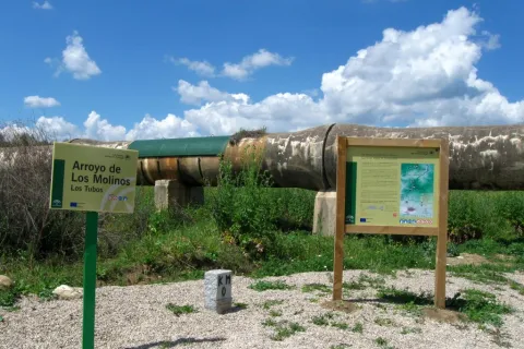
To take this path we will have to go to the northern part of the urban town of Andújar and from the cemetery take the Old Way or the San Amasio Way. The road is a track of land with good firm, up to the kilometer 1.9 where is the area known as Los Tubos, where the track is crossed by a huge tube of the Rumblar Canal.

In the area known as the "Tubos" is located the zero km of the route Camino Viejo - Cordel de los Molinos. From this point on the track through which we travel, it has worse firm, but it is passable by all-terrain vehicles for 900 meters more, until it reaches a rest area for the pilgrims and the sign of the beginning of the path. The starting signal is located next to a metal door that we will have to close to us to start the path on foot, on horse or by bicycle.

Breve descripción

IMPORTANT AVISO

As a preventive measure to prevent the contagion of COVID19, this path must be carried in the sense indicated in the starting sign.

The trail Los Cerrillos is part of the Old Way, used by the pilgrims to climb from Andújar to the Sanctuary of the Virgin of the Head. Part of the site known as Los Cerrillo and reaches the Hermitage of San Ginés, a traditional meeting point for pilgrims.

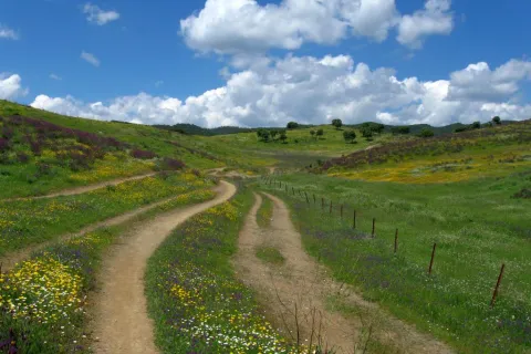
The path gently ascends from the countryside, crosses through areas of livestock pastures and goes into the Sierra, crossing mountains covered with oak trees, cantuesos and jaras. During the flowering season, in April and May, the landscape becomes especially attractive.

It is worth walking this path in order to see an interesting panorama of Andújar and the countryside of the Guadalquivir valley and to go through the intertwined paths excavated on the slate rocks by the continued passage of thousands of pilgrims: walkers, cyclists and riders

Latitud
38.0902
Longitud
-4.0101
Distrito
Municipio
Ubicación en el mapa
POINT (-4.0101 38.0902)
imagen
Image
1636_SS_03.jpg
Imagen principal
Activado
imagen
Image
1636_SS_04.jpg
Imagen principal
Desactivado
imagen
Image
1636_SS_01.jpg
Imagen principal
Desactivado
2 h

Nature

icon-intereses-naturaleza

Friends

icon-intereses-amigos

Adventure

icon-intereses-aventura

Culture

icon-intereses-cultura

Sport

icon-intereses-deporte

Eco-friendly

icon-intereses-eco-friendly

For couples

icon-intereses-en-pareja

Family

icon-intereses-familia

Gastronomy

icon-intereses-gastronomia

Municipality

icon-intereses-municipio

Low-cost tourism

icon-intereses-turismo-low-cost

Solo travel

icon-intereses-viajar-solo
Sendero Señalizado Camino Viejo: Tramos Los Cerrillos-San Ginés
5,5 km
On foot
All year round
Desactivado
  • In front of COVID19, keep the safety distance and carry a mask, avoid agglomerations and contact with surfaces, wash your hands frequently, use hydroalcoholic gel and consult the available digital materials. Take care of your health and others.
  • It works to prevent fires. Do not throw cigarettes or any other object that produces combustion.
  • By consuming local products and having companies in the area you will contribute to rural development.
  • He lives with the local people and other users. It respects private property and property.
  • Unwind in a sustainable way: public transport, bike, walk, shared vehicle...
  • Noise is another form of pollution. In silence you will enjoy your experience more.
  • It facilitates the use of people with special needs.
  • The trash doesn't come back alone. Take her with you to the nearest container. Reduce, reuse, recycle.
  • Don't leave a mark on your way through nature.
  • It practices a responsible and committed tourism with the environment. Be a real ecotourist!
  • Respect the facilities at your disposal. We all pay for your maintenance.
  • Check the weather forecast before starting your activity.
  • Avoid going out alone. If you do, it communicates tour and time of return to other people.
  • Extreme caution under adverse conditions and with the occasional presence of animals or motor vehicles.
  • Please provide prior information on the possible existence of cynegetic activity.
  • It has water, sun protection, proper clothes and shoes.
  • It carries a mobile with enough battery in case of emergency (112), but remember that there is not always coverage.
  • Don't even bother animals. You would negatively alter his behavior.
  • For your safety and the safety of the environment, don't get out of the signposted road or take shortcuts.
  • Remember that the capture of animals, light fire, fish and collect plants or minerals is prohibited.
  • If you bring a dog, take him with his strap and make sure he doesn't bother other animals or people.
  • Your safety is our concern, but it's your responsibility.
  • Thank you for your cooperation!