Saltar al contenido principal

Observación Astronomómica Privada

Submitted by brandcode_deweloper on
Id
329162
Descripción larga

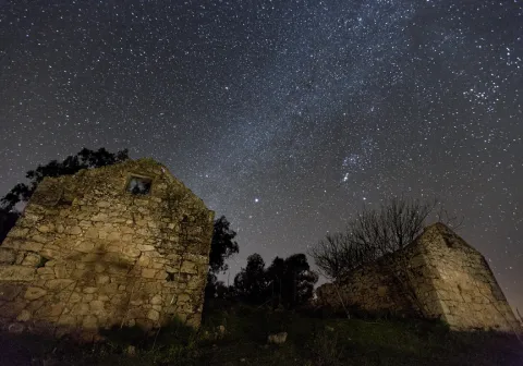
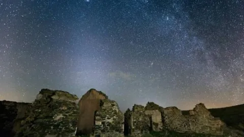
You can enjoy a rich dinner in a great accommodation, and end the night by admiring the wonderful night sky of the largest Starlight Reserve on the planet by the hand of astronomy experts and through large telescopes... These are some of the attractions of this very special getaway.

INCLUDE

  • Dinner at the selected accommodation.
  • Hotel night with breakfast.
  • Transfer from the hotel to the observation point.
  • Private and exclusive astronomical observation.
  • Assistance of a specialist monitor during observation.
  • Use of a high-end astronomical telescope.
  • Session of astronomical photographs of memory.
  • Cup of wine or cava and I tentpedo.

NOT INCLUDED

  • Transfer to the selected accommodation.
  • Lunch.
  • Any expenditure or concept not referred to in the "Includes" section.
  • Transfer to the Viñas de Peñallana Visitors Center and tasting of local and artisanal products of Sierra Morena (see follow-up to the trip at the last step of the reservation).

Itinerary

DAY 1

12: 00 h. - Arrival to the selected accommodation.

- Free lunch.

17: 00 h. - Free visit to the Virgin of the Head Sanctuary and the natural environment.

- Dinner at the accommodation.

21: 30 h. - 4 × 4 to the observation point.

22: 00 h. - Private and exclusive astronomical observation:

  • Introduce talk to astronomy.
  • Workshop of star recognition and constellations.
  • Astronomical observation with high-end telescopes.
  • Session astronomical photography of memory.
  • toast under the stars (light snack and copy of wine or cava)

02: 00 h. - End of observation. Transfer to the hotel. (Approximate time)

DAY 2

10: 30.

12: 00. - End of our services.

* Optional complement:Degustation of local and artisanal products from Sierra Morena at the Viñas de Peñallana Visitors Center.

    INFORMATION FROM THE DRAWAL

    The town of Andújar is located at the foot of Sierra Morena, constituting the entrance door by anthonomasia to the Natural Park of its same name. Because Andújar is a saw, Andújar is the Guadalquivir river that bathes it and divides it between the oaks and pedestals to the north and the sodomy countryside to the south.

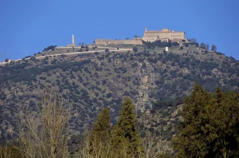
    Andújar is a monumental city, rich in heritage and emblem of a typical architecture that demonstrates a high past. A 13 Km from Andújar is the Viñas de Peñallana Visitors Center, an ideal place to inform you about the visit to the Natural Space and to know the main values of it. Following the road, we enter the Sierra de Andújar Natural Park until we reach the Sanctuary of the Virgin of the Head next to which is the accommodation. It is a great rock sanctuary located in the heart of Sierra Morena, where much of the Sierra is seen from its privileged location. It is a place of pilgrimage famous for its rosemary and its great cultural and ethnographic value.

    The Natural Park of the Sierra de Andújar is a special place, a wild and infinite place, where the loins and valleys covered with oak trees extend to where the view reaches. Eagles, vultures, deer and a multitude of other species live in these areas, being the undisputed lord of these vast lands the Iberian Lince, for here it cherishes its most extensive population.

    Breve descripción

    Visit the emblematic Sanctuary of the Virgin of the Head, walk beautiful trails and recreate among the dehesas of the Sierra de Andújar Nature Park.
    Latitud
    38.183252
    Longitud
    -4.349458
    Ubicación en el mapa
    POINT (-4.349458 38.183252)
    imagen
    Image
    observacion-privada.jpg
    Imagen principal
    Activado
    imagen
    Image
    observacion%20astronomica.jpg
    Imagen principal
    Desactivado

    Nature

    icon-intereses-naturaleza

    Observación Astronómica Privada

    Desactivado

    - The prices expressed are final, including I.V.A.

    - The programmes indicated are permanent throughout the year, although depending on the station, they may include activities complementary to those detailed as optional or recommended, with the aim of making the stay on the Route of the Castles and the Battle of Jaén as attractive and varied as possible within authenticity.

    - The hours may be adjusted according to the host of the service.

    - Except those expressly indicated, proposals do not require a minimum number of persons.

    - It is recommended to consult availability and prices according to dates, days of stay and number of passengers.

    - The accommodation is mostly three-star hotels.

    - Depending on availability, the accommodation may vary to a similar or higher category.

    - Foreign visitors will be able to have an English-speaking guide, from their arrival at the destination. Service with supplement.

    - If necessary, transfer service is available with collection from the airport of Granada-Jaén Federico García Lorca. Service with supplement.

    - Consult prices, conditions and availability for special dates, individual supplement, children's discounts and cot service, Internet connection,...
    Coordenadas / Huso 30S
    30S x = 381814 and = 4227008
    Tramo de asfalto o cemento
     
    Tramo de pista o camino forestal
     
    Tramo de vía pecuaria
     
    Tramo de senda
     

    Route cicloturista de Andújar a Baños de la Encina

    Submitted by brandcode_deweloper on
    Id
    2641192
    Descripción larga

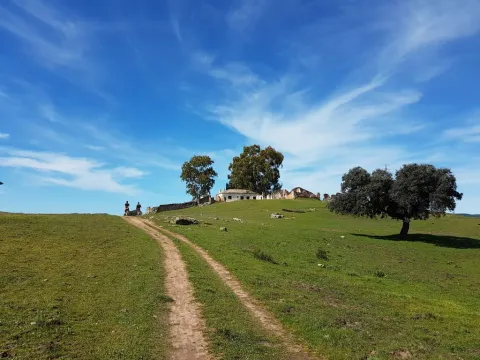
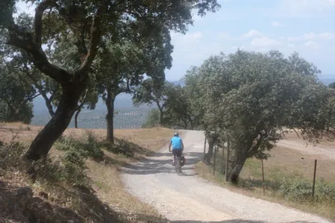
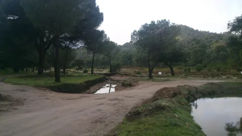
    We left Andujar in the direction of the Peñallana vineyards through the Ctra. J-501. In the km. About 14,400, after passing the Los Pinos Restaurant, we take a road that comes out to the right; we go into it we will get to Los Escoriales, leave to our left a dish of bulls or tentadero and, at about 100 m., we will get a track to the right that we will take; here we can observe an interesting darkness occupied preferably by alcornocals, at some points as a mature or climate community on a sediment-type substrate. When we begin to descend, we will leave to our right the Cerro del Moro, an elevation that maintains a well-developed shroud, we will pass through the house of the Gorgojil and the Nava de Andújar, dehesa ganadera and place of transit that allows to observe the typical topographic relief of Sierra Morena and the crops of the geological domain of Guadalquivir, coming to the reservoir of the Rumblar, a sheet of water perfectly attached to the steep relief and, from here, to Baños de la Encina, one of the four municipalities that make up the Natural Park of Sierra de Andújar, the whole of the city of the town of the city of the city of the city of the city of the city of the city of the town of the city of the city of the city of the town of the city of the city of the town of the city of the city of the town of the city of the city of the city of the city of the town of the town of the town of the town of the town of the town of the town of the town of the town of the town of the town of the town of the town of the town of the town of

    Breve descripción

    Unbeatable views of the local castle. First Km by road and soft profile.

    Stage without any complication.

    Latitud
    38.17381
    Longitud
    -3.844715
    Distrito
    Municipio
    Ubicación en el mapa
    POINT (-3.844715 38.17381)
    imagen
    Image
    16811388.jpg
    Imagen principal
    Activado
    imagen
    Image
    Ruta%20cicloturista%20de%20And%C3%BAjar%20a%20Ba%C3%B1os%20de%20la%20Encina.jpg
    Imagen principal
    Desactivado

    Nature

    icon-intereses-naturaleza

    Friends

    icon-intereses-amigos

    Adventure

    icon-intereses-aventura

    Culture

    icon-intereses-cultura

    Sport

    icon-intereses-deporte

    Eco-friendly

    icon-intereses-eco-friendly

    For couples

    icon-intereses-en-pareja

    Family

    icon-intereses-familia

    Gastronomy

    icon-intereses-gastronomia

    Municipality

    icon-intereses-municipio

    Low-cost tourism

    icon-intereses-turismo-low-cost

    Solo travel

    icon-intereses-viajar-solo
    Ruta cicloturista de Andújar a Baños de la Encina
    In Bicycle, Horse, on foot
    All year round
    Desactivado
    Coordenadas / Huso 30S
    30S x = 426011 and = 4225437
    Tramo de asfalto o cemento
     
    Tramo de pista o camino forestal
     
    Tramo de vía pecuaria
     
    Tramo de senda
     

    GR-48

    Submitted by brandcode_deweloper on
    Id
    2575177
    Descripción larga

    The entire route has been divided into 28 linear stages and one circular alternative route in the province of Seville. All of them can be comfortably completed during a single day of hiking. Each stage begins and ends either in one of the municipalities through which the trail passes or in places where food and overnight accommodation are available, such as the Sanctuary of the Virgen de la Cabeza in the Sierra de Andújar.

    In the province of Jaén, the GR 48 is divided into five stages. Some of these are among the longest in the whole of Sierra Morena and, without detracting from the routes through the other three provinces, they are among the most highly appreciated by hikers because of their exceptional beauty.

    The Jaén section of the GR 48 is characterised by its varied landscapes. Along the route, the typical wooded pastureland of Sierra Morena, where livestock graze, alternates with the steep slopes of the Sierra de Andújar and the foothills of Despeñaperros. Here, gorges, ravines and medium-altitude mountains create an evocative landscape reminiscent of high-mountain regions.

    The Sierra Morena trail in Jaén is divided into five stages, taking us from Marmolejo to the centre of Santa Elena. Along the way, the route passes close to important landmarks such as the Sanctuary of the Virgen de la Cabeza, the outstanding historical heritage of Baños de la Encina and the former mining pasturelands around La Carolina. The journey crosses constantly changing landscapes in which Mediterranean woodland blends with more rugged natural surroundings, creating spectacular scenery whose colours vary throughout the year and are at their finest in autumn and spring.

    However, this route offers much more than scenery. The absence of major towns in the heart of the mountains has allowed the area to remain exceptionally well preserved, making it relatively easy to observe birds and mammals at almost any point along the GR 48.

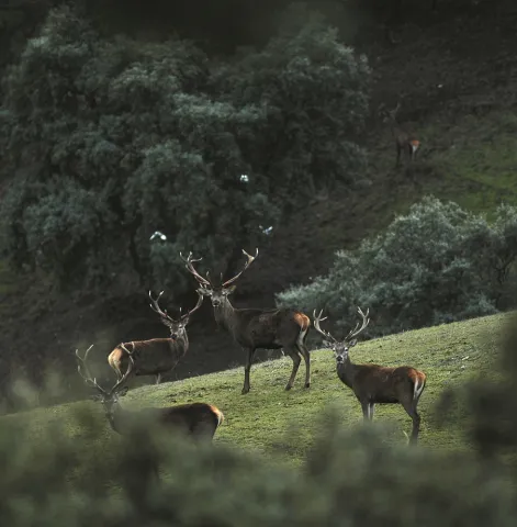
    The great biodiversity of this territory provides an opportunity to observe unique species of both fauna and flora. The Sierra de Andújar is one of the last remaining strongholds of the Iberian lynx, as well as being home to other protected species such as the cinereous vulture and the golden eagle. As this area is one of the most important hunting regions in Spain, sightings of large mammals such as red deer, fallow deer and wild boar are very frequent and almost commonplace. Extensive cattle-grazing estates with herds of fighting bulls are another attraction, becoming more common as the trail continues towards the north-east of the province, particularly along the central section between the Sierra de Andújar Natural Park and the Despeñaperros Natural Park.

    In addition to the species already mentioned, those interested in herpetology will find a significant amphibian population along the Jaén section of the GR 48. This includes species found exclusively on the Iberian Peninsula, such as the Iberian painted frog, the Iberian newt and the Iberian midwife toad.

    The vegetation encountered along the route consists mainly of typical Mediterranean woodland and scrub, dominated by holm oak forests with rockroses, mastic trees and wild olive trees. These are complemented by examples of the conifer plantations established in the mid-20th century, particularly the pine forests around the Sierra de Andújar and near Santa Elena in Despeñaperros. Along the streams and rivers crossed by the GR 48, hikers can also appreciate riverside woodland, such as that found along Los Santos Stream during the first stage, the Jándula River during the second and the Campana River during the final stage.

    When walking the GR 48, it should be remembered that the stages cover long distances and are best completed over full days. Food and supplies are available at the beginning and end of each stage. Nevertheless, particularly on the longer stages, it is advisable to carry plenty of water, as Sierra Morena is typically dry and there are few springs where hikers can quench their thirst. The time of year should also be considered carefully, as summers in Sierra Morena are extremely hot, with very high temperatures during the summer months. Anyone wishing to complete the trail during July or August should therefore plan their schedule carefully and alternate periods of walking with adequate rest.

    In addition to the sensory pleasure of walking along this trail, each stage leads to fascinating places that reveal the rich heritage left in the province by different civilisations. Throughout the route, there are numerous reasons to make short detours and explore the past: archaeological sites and prehistoric cave paintings provide a connection with ancient history; the magnificent medieval heritage of Baños de la Encina and the nearby battlefield of the Battle of Las Navas de Tolosa in Santa Elena recall the Middle Ages; while the elegant urban layouts of the New Settlements of Sierra Morena and the surrounding mining remains provide evidence of the province’s more recent history.

    Breve descripción

    The GR 48 Path of Sierra Morena is the long-distance route that allows you to cross this mountain range from west to east. They are 590 Km of signposted itinerary and conditioning that begin their journey in the Portuguese town of Barrancos, on the border of Andalusia with Portugal, and from there it leads us to a tour of the provinces of Huelva, Sevilla, Córdoba and Jaén, ending in the municipality of Santa Elena, opening the door to the Natural Park of Despeñaparos.

    Latitud
    38.052907
    Longitud
    -4.238353
    Distrito
    Municipio
    Ubicación en el mapa
    POINT (-4.238353 38.052907)
    imagen
    Image
    image_161430%20%281%29.jpeg
    Imagen principal
    Activado
    imagen
    Image
    santuario-2-jpg
    Imagen principal
    Desactivado
    imagen
    Image
    pag33-despenaperros-032-png
    Imagen principal
    Desactivado
    imagen
    Image
    _mg_5140-jpg
    Imagen principal
    Desactivado
    imagen
    Image
    _mg_2137-jpg
    Imagen principal
    Desactivado
    imagen
    Image
    pag21-despenaperros-ciervos-png
    Imagen principal
    Desactivado

    Friends

    icon-intereses-amigos

    Nature

    icon-intereses-naturaleza

    Solo travel

    icon-intereses-viajar-solo

    Gastronomy

    icon-intereses-gastronomia

    For couples

    icon-intereses-en-pareja

    Family

    icon-intereses-familia

    Adventure

    icon-intereses-aventura

    Culture

    icon-intereses-cultura

    Sport

    icon-intereses-deporte

    Municipality

    icon-intereses-municipio

    Low-cost tourism

    icon-intereses-turismo-low-cost

    Eco-friendly

    icon-intereses-eco-friendly
    GR-48
    Spring and autumn
    Activado
    Coordenadas / Huso 30S
    30S x = 391352 and = 4212409

    Signposted Trail - El Encinarejo

    Submitted by brandcode_deweloper on
    Id
    6474525
    Breve descripción

    It is a path designed around the Jandula River. Through a pleasant walk, you can enjoy the contrast between the riverside ecosystems and those of a typical dehesa of the Sierra de Andújar Natural Park.

    It starts at the Iron Bridge that crosses the Jandula River and is also the main entrance to the natural park. A recreational area with barbecues and tables continues in parallel to the right bank of the river. In this section of the path we can observe the characteristic vegetation of the park's riverside forests: strawberries, alyses, sardines, tarayes, etc., which serve as a refuge to the representative fauna of this humid area: royal herons, zampullin, water cocks and if we are lucky you can see some otter. It is interesting, too, the presence of small sides of rabies or mohyes that often approach visitors waiting for food.

    On this same stretch and on our left, in what constitutes the Solana del Coscojar, we can see, on the hillside, that the vegetation changes markedly, with the appearance of oak, pine pines, lentils and grasses.

    Following the river bank we arrive at the foot of the dam of the Encinarejo swamp. It is a small swamp, more like a lake, and the purpose of which is the use of electrical energy. Under the dam and through a bridge you cross the other shore, after a small climb you reach the village of Encinarejo, built to house the employees who built the dam.

    The rabbit is of great importance inside the park. In addition to traditional cynegetic use in the area, it provides support for species of great interest such as the lince, the imperial eagle or the meloncillo. The deer is the species of major hunting par excellence in the natural park, the traditional form of hunting is the montaria, its tradition in this

    Latitud
    38.0704
    Longitud
    -4.0303
    Distrito
    Municipio
    Ubicación en el mapa
    POINT (-4.0303 38.0704)
    imagen
    Image
    1190_SS_02%20%281%29.jpg
    Imagen principal
    Activado
    imagen
    Image
    Sendero%20se%C3%B1alizado%20-%20El%20Encinarejo.jpg
    Imagen principal
    Desactivado
    1 h

    Nature

    icon-intereses-naturaleza

    Friends

    icon-intereses-amigos

    Adventure

    icon-intereses-aventura

    Culture

    icon-intereses-cultura

    Sport

    icon-intereses-deporte

    Eco-friendly

    icon-intereses-eco-friendly

    For couples

    icon-intereses-en-pareja

    Family

    icon-intereses-familia

    Gastronomy

    icon-intereses-gastronomia

    Municipality

    icon-intereses-municipio

    Low-cost tourism

    icon-intereses-turismo-low-cost

    Solo travel

    icon-intereses-viajar-solo
    Baja
    Sendero señaliado - El Encinarejo
    2,7 km
    On foot
    All year round
    Desactivado
    • In front of COVID19, keep the safety distance and carry a mask, avoid agglomerations and contact with surfaces, wash your hands frequently, use hydroalcoholic gel and consult the available digital materials. Take care of your health and others.
    • It works to prevent fires. Do not throw cigarettes or any other object that produces combustion.
    • By consuming local products and having companies in the area you will contribute to rural development.
    • He lives with the local people and other users. It respects private property and property.
    • Unwind in a sustainable way: public transport, bike, walk, shared vehicle...
    • Noise is another form of pollution. In silence you will enjoy your experience more.
    • It facilitates the use of people with special needs.
    • The trash doesn't come back alone. Take her with you to the nearest container. Reduce, reuse, recycle.
    • Don't leave a mark on your way through nature.
    • It practices a responsible and committed tourism with the environment. Be a real ecotourist!
    • Respect the facilities at your disposal. We all pay for your maintenance.
    • Check the weather forecast before starting your activity.
    • Avoid going out alone. If you do, it communicates tour and time of return to other people.
    • Extreme caution under adverse conditions and with the occasional presence of animals or motor vehicles.
    • Please provide prior information on the possible existence of cynegetic activity.
    • It has water, sun protection, proper clothes and shoes.
    • It carries a mobile with enough battery in case of emergency (112), but remember that there is not always coverage.
    • Don't even bother animals. You would negatively alter his behavior.
    • For your safety and the safety of the environment, don't get out of the signposted road or take shortcuts.
    • Remember that the capture of animals, light fire, fish and collect plants or minerals is prohibited.
    • If you bring a dog, take him with his strap and make sure he doesn't bother other animals or people.
    • Your safety is our concern, but it's your responsibility.
    • Thank you for your cooperation!
    Tramo de asfalto o cemento
     
    Tramo de pista o camino forestal
     
    Tramo de vía pecuaria
     
    Tramo de senda
     

    Trail de los Cuatro Términos

    Submitted by brandcode_deweloper on
    Id
    4961684
    Descripción larga

    We started the march up for about 350 meters, by a sidewalk between jars, until we reached a firewall by which we will ascend for 150 meters more. We will then arrive at the base of a canchal, where we will find a hollow forest, made up of oak trees, alcornoques, complaints and madroños growing between loose rocks. We'll soon be going out to an enembral installed on the quartates. A few meters from here we already arrived at the Sellator's Hill.

    We will then move on a forest track for about two and a half kilometres. In the first part of this section we will go through a dense darkness of oaks and complaints. We can even see a melojo oak bosquet growing on the Sealing hill at a higher height than the complaints. Then we will pass through a gardener, a cork plantation and a pasture, before reaching the base of the point.

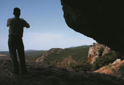
    Finally the path ascends through a path, between jars and alcornoques, at the foot of the top of the Puntal of the Four terms. From this point the panorama is impressive: towards the South, beyond the pinars of Mount Selladores- Contadero are extended the mountains and dehesas of the Natural Park Sierra de Andújar. In the distance we can see the reservoir of the Jandula and even the Sanctuary of the Virgin of the Head. To the east is the town of Centenillo (Baños de la Encina) and La Carolina, and to the north, beyond the division of provinces, is Sierra Madrona.

    Breve descripción

    The path leads to a hill or point where four municipal terms coincide: Andújar, Villanueva de la Reina, Baños de la Encina, from the province of Jaén and Mestanza, from Ciudad Real. This route runs along the pecuaria road called Cañada Real de la Plata, within the Selladores Contadero, owned by the Ministry of Agriculture and the Environment. This is a mountain-like tour that goes through very little-crossed areas, covered in an interesting natural vegetation.

    Latitud
    38.0394
    Longitud
    -4.0511
    Distrito
    Municipio
    Ubicación en el mapa
    POINT (-4.0511 38.0394)
    imagen
    Image
    2%20%282%29.jpg
    Imagen principal
    Activado
    imagen
    Image
    Sendero%20de%20los%20Cuatro%20T%C3%A9rminos.jpg
    Imagen principal
    Desactivado
    1 h 20 min

    Nature

    icon-intereses-naturaleza

    Friends

    icon-intereses-amigos

    Adventure

    icon-intereses-aventura

    Culture

    icon-intereses-cultura

    Sport

    icon-intereses-deporte

    Eco-friendly

    icon-intereses-eco-friendly

    For couples

    icon-intereses-en-pareja

    Family

    icon-intereses-familia

    Gastronomy

    icon-intereses-gastronomia

    Municipality

    icon-intereses-municipio

    Low-cost tourism

    icon-intereses-turismo-low-cost

    Solo travel

    icon-intereses-viajar-solo
    Media - Alta
    Sendero de los Cuatro Términos
    4 km
    On foot
    All year round
    Desactivado
    • In front of COVID19, keep the safety distance and carry a mask, avoid agglomerations and contact with surfaces, wash your hands frequently, use hydroalcoholic gel and consult the available digital materials. Take care of your health and others.
    • It works to prevent fires. Do not throw cigarettes or any other object that produces combustion.
    • By consuming local products and having companies in the area you will contribute to rural development.
    • He lives with the local people and other users. It respects private property and property.
    • Unwind in a sustainable way: public transport, bike, walk, shared vehicle...
    • Noise is another form of pollution. In silence you will enjoy your experience more.
    • It facilitates the use of people with special needs.
    • The trash doesn't come back alone. Take her with you to the nearest container. Reduce, reuse, recycle.
    • Don't leave a mark on your way through nature.
    • It practices a responsible and committed tourism with the environment. Be a real ecotourist!
    • Respect the facilities at your disposal. We all pay for your maintenance.
    • Check the weather forecast before starting your activity.
    • Avoid going out alone. If you do, it communicates tour and time of return to other people.
    • Extreme caution under adverse conditions and with the occasional presence of animals or motor vehicles.
    • Please provide prior information on the possible existence of cynegetic activity.
    • It has water, sun protection, proper clothes and shoes.
    • It carries a mobile with enough battery in case of emergency (112), but remember that there is not always coverage.
    • Don't even bother animals. You would negatively alter his behavior.
    • For your safety and the safety of the environment, don't get out of the signposted road or take shortcuts.
    • Remember that the capture of animals, light fire, fish and collect plants or minerals is prohibited.
    • If you bring a dog, take him with his strap and make sure he doesn't bother other animals or people.
    • Your safety is our concern, but it's your responsibility.

    Thank you for your cooperation!

    From Carolina (35 Km): Take the JA-6100 road and continue for 18 Km to the Centenillo. From there take the local road JM 5005 towards the Collado del Jardín, follow for 17 Km until the beginning of the path. 100 m before the path there is a location signal indicating the distance at the beginning of the path. The starting point of the path is a pedestrian door on the mesh, behind which is the starting signal. This door needs to be closed once we reach the path.

    From Andújar (51.4 Km, complicated access for cars other than all-road cars): Take the A-6177 Road and travel it for 14.6 Km to the Los Pinos tourist complex. From here take the JH-5002 road and follow 9.4 km to the junction of Los Escoriales. Once here follow the ground road JM 5003 for 27.4 Km until the beginning of the path, which is located 230 m beyond the Garden Hill. A hundred meters before the path there is a location signal indicating the distance at the beginning of the path. The starting point of the path is a pedestrian door in the mesh.

    Tramo de asfalto o cemento
     
    Tramo de pista o camino forestal
     
    Tramo de vía pecuaria
     
    Tramo de senda
     

    Trail Camino Viejo: tramo Santuario de Nuestra Señora de la Cabeza- Lugar Nuevo

    Submitted by brandcode_deweloper on
    Id
    4935428
    Breve descripción

    This path begins in Cerro del Cabezo, being all its descending path.

    The first stretch of this path runs along the margin of the stream of the Virgin between jars, acebuchs and some aromatic plants such as the cantbone and the rosemary. On the left of this descent, called Cuesta de los Caracolillos, there is a magnificent view of Cerro del Cabezo, on which stands the sanctuary of the Virgin of the Head and of all the southern hillside of this, known as the Solanas of the Virgin.

    Around 1.7 km, you can reach the Old Way, from where you can see the Jandula River Valley as you pass through New Place. In addition, with a little luck, it can be seen, through the skies of the Sierra de Andújar Natural Park, the imperial eagle, the black vulture or the royal eagle, as on this area are often found.

    From the viewpoint, the path goes on to have a more pronounced slope, and caution must be extreme. After the descent, the vegetation changes and there appears to the left a repopulation of pine piñonero, and on the right margin, to the front, a dehesa of burning. Through that dehesa we arrive to a Roman bridge that crosses the Jandula River, on whose shores there is a rich vegetation of strawberry, alyses and adelfas.

    Latitud
    38.0394
    Longitud
    -4.0511
    Distrito
    Municipio
    Ubicación en el mapa
    POINT (-4.0511 38.0394)
    imagen
    Image
    1%20%281%29%20%281%29.jpg
    Imagen principal
    Activado
    imagen
    Image
    Sendero%20Camino%20Viejo%20tramo%20Santuario%20de%20Nuestra%20Se%C3%B1ora%20de%20la%20Cabeza.jpg
    Imagen principal
    Desactivado
    2 h 30 min

    Nature

    icon-intereses-naturaleza

    Friends

    icon-intereses-amigos

    Adventure

    icon-intereses-aventura

    Culture

    icon-intereses-cultura

    Sport

    icon-intereses-deporte

    Eco-friendly

    icon-intereses-eco-friendly

    For couples

    icon-intereses-en-pareja

    Family

    icon-intereses-familia

    Gastronomy

    icon-intereses-gastronomia

    Municipality

    icon-intereses-municipio

    Low-cost tourism

    icon-intereses-turismo-low-cost

    Solo travel

    icon-intereses-viajar-solo
    Baja
    Sendero Camino Viejo: tramo Santuario de Nuestra Señora de la Cabeza- Lugar Nuevo
    5,5 km
    On foot
    All year round
    Desactivado
    • In front of COVID19, keep the safety distance and carry a mask, avoid agglomerations and contact with surfaces, wash your hands frequently, use hydroalcoholic gel and consult the available digital materials. Take care of your health and others.
    • It works to prevent fires. Do not throw cigarettes or any other object that produces combustion.
    • By consuming local products and having companies in the area you will contribute to rural development.
    • He lives with the local people and other users. It respects private property and property.
    • Unwind in a sustainable way: public transport, bike, walk, shared vehicle...
    • Noise is another form of pollution. In silence you will enjoy your experience more.
    • It facilitates the use of people with special needs.
    • The trash doesn't come back alone. Take her with you to the nearest container. Reduce, reuse, recycle.
    • Don't leave a mark on your way through nature.
    • It practices a responsible and committed tourism with the environment. Be a real ecotourist!
    • Respect the facilities at your disposal. We all pay for your maintenance.
    • Check the weather forecast before starting your activity.
    • Avoid going out alone. If you do, it communicates tour and time of return to other people.
    • Extreme caution under adverse conditions and with the occasional presence of animals or motor vehicles.
    • Please provide prior information on the possible existence of cynegetic activity.
    • It has water, sun protection, proper clothes and shoes.
    • It carries a mobile with enough battery in case of emergency (112), but remember that there is not always coverage.
    • Don't even bother animals. You would negatively alter his behavior.
    • For your safety and the safety of the environment, don't get out of the signposted road or take shortcuts.
    • Remember that the capture of animals, light fire, fish and collect plants or minerals is prohibited.
    • If you bring a dog, take him with his strap and make sure he doesn't bother other animals or people.
    • Your safety is our concern, but it's your responsibility.

    Thank you for your cooperation!

    Important warning.As a preventive measure to prevent the contagion of the COVID19, this path must be crossed in the sense of ascending from the San Ginés Pubo Nuevo section, not allowing itself to be done in the direction of Pubo Nuevo to avoid crossing of trails at a short distance.

    From Andújar we go up to the Sierra by the A-6177, to the visitor center Viñas de Peñallana, where we take the exit the Alcaparrosa JV-5011. In km 8 of that road we will find the indications that will lead us to San Ginés. Also, from Andújar by the road of the Chain.

    Tramo de asfalto o cemento
     
    Tramo de pista o camino forestal
     
    Tramo de vía pecuaria
     
    Tramo de senda
     

    Trail Camino Viejo: tramo San Ginés-Lugar Nuevo

    Submitted by brandcode_deweloper on
    Id
    4929187
    Descripción larga

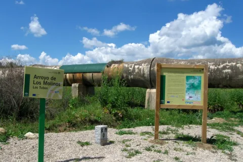
    To take this path we will have to go to the northern part of the urban town of Andújar and from the cemetery take the Old Way or the San Amasio Way. The road is a track of land with good firm, up to the kilometer 1.9 where is the area known as Los Tubos, where the track is crossed by a huge tube of the Rumblar Canal.

    In the area known as the "Tubos" is located the zero km of the route Camino Viejo - Cordel de los Molinos. From this point on the track through which we travel, it has worse firm, but it is passable by all-terrain vehicles for 900 meters more, until it reaches a rest area for the pilgrims and the sign of the beginning of the path. The starting signal is located next to a metal door that we will have to close to us to start the path on foot, on horse or by bicycle.

    Breve descripción

    The path runs along the Old Way to the Sanctuary, the route used by the rosemary to go from Andújar to The Sanctuary of Our Lady of the Head, for centuries. This rosemary is declared a party of national tourist interest.

    We will enjoy beautiful panoramic views of the Sierra de Andújar Natural Park from the view of the Monument to the Pilgrim. A beautiful walk through a path full of history, culture and tradition in an incomparable framework.

    The trail Los Cerrillos is part of the Old Way, used by the pilgrims to climb from Andújar to the Sanctuary of the Virgin of the Head. Part of the site known as Los Cerrillo and reaches the Hermitage of San Ginés, a traditional meeting point for pilgrims.

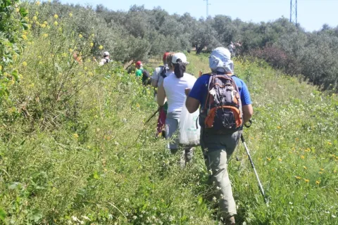
    The path gently ascends from the countryside, crosses through areas of livestock pastures and goes into the Sierra, crossing mountains covered with oak trees, cantuesos and jaras. During the flowering season, in April and May, the landscape becomes especially attractive.

    It is worth walking this path in order to see an interesting panorama of Andújar and the countryside of the Guadalquivir valley and to go through the intertwined paths excavated on the slate rocks by the continued passage of thousands of pilgrims: walkers, cyclists and riders

    Latitud
    38.0394
    Longitud
    -4.0511
    Distrito
    Municipio
    Ubicación en el mapa
    POINT (-4.0511 38.0394)
    imagen
    Image
    1%20%281%29.jpg
    Imagen principal
    Activado
    imagen
    Image
    Sendero%20Camino%20Viejo.%20tramo%20San%20Gin%C3%A9s.jpg
    Imagen principal
    Desactivado
    imagen
    Image
    1315_SS_06.jpg
    Imagen principal
    Desactivado
    imagen
    Image
    1315_SS_02.jpg
    Imagen principal
    Desactivado
    imagen
    Image
    1636_SS_03.jpg
    Imagen principal
    Desactivado
    imagen
    Image
    1636_SS_04.jpg
    Imagen principal
    Desactivado
    imagen
    Image
    1636_SS_01.jpg
    Imagen principal
    Desactivado
    2 h

    Nature

    icon-intereses-naturaleza

    Friends

    icon-intereses-amigos

    Adventure

    icon-intereses-aventura

    Culture

    icon-intereses-cultura

    Sport

    icon-intereses-deporte

    Eco-friendly

    icon-intereses-eco-friendly

    For couples

    icon-intereses-en-pareja

    Family

    icon-intereses-familia

    Gastronomy

    icon-intereses-gastronomia

    Municipality

    icon-intereses-municipio

    Low-cost tourism

    icon-intereses-turismo-low-cost

    Solo travel

    icon-intereses-viajar-solo
    Medium
    Sendero Camino Viejo: tramo San Ginés-Lugar Nuevo
    5,6 km
    On foot
    All year round
    Desactivado
    • In front of COVID19, keep the safety distance and carry a mask, avoid agglomerations and contact with surfaces, wash your hands frequently, use hydroalcoholic gel and consult the available digital materials. Take care of your health and others.
    • It works to prevent fires. Do not throw cigarettes or any other object that produces combustion.
    • By consuming local products and having companies in the area you will contribute to rural development.
    • He lives with the local people and other users. It respects private property and property.
    • Unwind in a sustainable way: public transport, bike, walk, shared vehicle...
    • Noise is another form of pollution. In silence you will enjoy your experience more.
    • It facilitates the use of people with special needs.
    • The trash doesn't come back alone. Take her with you to the nearest container. Reduce, reuse, recycle.
    • Don't leave a mark on your way through nature.
    • It practices a responsible and committed tourism with the environment. Be a real ecotourist!
    • Respect the facilities at your disposal. We all pay for your maintenance.
    • Check the weather forecast before starting your activity.
    • Avoid going out alone. If you do, it communicates tour and time of return to other people.
    • Extreme caution under adverse conditions and with the occasional presence of animals or motor vehicles.
    • Please provide prior information on the possible existence of cynegetic activity.
    • It has water, sun protection, proper clothes and shoes.
    • It carries a mobile with enough battery in case of emergency (112), but remember that there is not always coverage.
    • Don't even bother animals. You would negatively alter his behavior.
    • For your safety and the safety of the environment, don't get out of the signposted road or take shortcuts.
    • Remember that the capture of animals, light fire, fish and collect plants or minerals is prohibited.
    • If you bring a dog, take him with his strap and make sure he doesn't bother other animals or people.
    • Your safety is our concern, but it's your responsibility.

    Thank you for your cooperation!

    Important warning.As a preventive measure to prevent the contagion of COVID19, this path must be carried in the sense indicated in the starting sign.

    From Andújar we go up to the Sierra by the A-6177, to the visitor center Viñas de Peñallana, where we take the exit the Alcaparrosa JV-5011. In km 8 of that road we will find the indications that will lead us to San Ginés. Also, from Andújar by the road of the Chain.

    Route del Toro Bravo

    Submitted by brandcode_deweloper on
    Id
    2854106
    Descripción larga

    The tour begins at point 0 of the road J-5010 to the Sanctuary of the Virgin of the Head and Puertollano. In the first three kilometers we move between the family gardens and the irrigations of the terraces of Guadalquivir to pass, at the point of kilometer 4,500, by olive land. From this point, coinciding with the state's stallion stop, the terrain becomes more serrano, first by shrubs and pasture dehesa, gradually passing to high density repopulation pines. At the kilometer point 12,300 we can visit the Visitor Center of the Natural Park Viñas de Peñallana, a place where magnificent recreational farms, known as "Viñas," are located. At the kilometer point 14,200 we take the right deviation on the JH-5002 road, which runs between more or less mixed pineas with lentils, coscojas and jars of great faunistic wealth and cynetic and livestock dedication. At this crossing there are two restaurants, last point for breakfast or a snack in two or three hours. The road has a regular state of conservation.

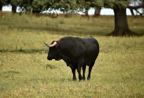
    Around the 18th kilometer of the tour, the pineapple disappears, the landscape is dehesa of pastures with oak and cork trees, mainly, and panoramic views of the saw open on both sides. Towards kilometer 21 begins a magnificent adhesado encore in which the bulls of the Finca de los Escoriales, of the iron of D. Germán Gervás, founded in 1959, are pasted. In the km 24,100 we found the mines of Los Escoriales, which was already exploited by the Romans. At the kilometer 24,400 we are at a crossroads and a tentadero. The detour to the left will lead us to the Jandula Embalse. Following to the right we will pass through the Tapicas farms, the Farms of Flores- Albarrán, Navas of Benjamin Sordo or The Alarms of Samuel Flores, the latter since 1928, places where we can discover the bravo bull in its middle, the fences of protection and management, the places of food and abrevadero, along with some protected species or cynetics. From the kilometer point 32,800 you can see magnificent views that must not be lost: to the right, of the Sierra de Ambroz (761 m.), and to the left of the Embalse del Rumblar and the Castle of Burgalimar, in Baños de la Encina. From here on the road continues north, passing through the big house-cortijo of Los Alarcones. The landscape opens to the mountains of Ambroz and Los Calderones, at the northeastern end of the Natural Park of the Sierra de Andújar. At point kilometer 42, and coinciding with the beginning of the National Cote of Selladores- Contadero, we will see areas of small pinars that intermingle with the dehesa and the matorral; later the pinar spots are larger and dense although retaining some copies of alcornoque. The road improves and becomes descending, turning from the house of Selladores to the southeast. The landscape, leaving Selladores- Contadero, changes to a mountain of shrubs dominated by the lentisco jara and natural pastures; thus we arrive at Nava del Sach, in the kilometer 64, where there are catalogued rock paintings, to ascend from here to El Centenillo, a former mining village, in which environment we can see numerous scaffolding of the mines that operated until the 1950s, now converted into a residential core. In this small town we can make a recess to take an appetizer and taste the typical dishes of the place, including hunting meat stew and serrano products. We continue the last part of the route, already on a road of saw in perfect condition of conservation to La Carolina, distant about 16 km, descending from El Centenillo to the Rio Grande, where the pine definitely disappears to follow already on the ground of bushes and pastures and cross the river of the Campana.

    Breve descripción

    This route connects us to the north-west of the park, where you will find the National Contradero-Sealing Party.

    Latitud
    38.0394
    Longitud
    -4.0511
    Distrito
    Municipio
    Ubicación en el mapa
    POINT (-4.0511 38.0394)
    imagen
    Image
    ruta-caballo.jpg
    Imagen principal
    Activado
    imagen
    Image
    shutterstock_1717083154.jpg
    Imagen principal
    Desactivado
    imagen
    Image
    shutterstock_3420981.jpg
    Imagen principal
    Desactivado
    imagen
    Image
    shutterstock_1713194008.jpg
    Imagen principal
    Desactivado
    5 h

    Nature

    icon-intereses-naturaleza

    Friends

    icon-intereses-amigos

    Adventure

    icon-intereses-aventura

    Culture

    icon-intereses-cultura

    Sport

    icon-intereses-deporte

    Eco-friendly

    icon-intereses-eco-friendly

    For couples

    icon-intereses-en-pareja

    Family

    icon-intereses-familia

    Gastronomy

    icon-intereses-gastronomia

    Municipality

    icon-intereses-municipio

    Low-cost tourism

    icon-intereses-turismo-low-cost

    Solo travel

    icon-intereses-viajar-solo
    Image
    6996ab12-e8a9-f353-626d-e1b608c315f1?t=1589486967838
    Ruta del Toro Bravo
    88 km
    All year round
    Desactivado

    The ideal time to visit from October to the end of April. Set up for 4 hours minimum.

    • Peñallana vineyards
    • The Scoriales, area with cattle of ligia
    • National Contradero-Sealing Cow
    • Mirador Los Alarcornes
    • Mirador Los Pastores
    • El Centenillo, former mining village of Baños de la Encina
    • La Carolina, La Aliseda recreational area

    In Andújar (opposite the monument of La Morenita and Carrefour shopping center)

    Entrance to La Carolina from the Centenillo road.

    Tramo de asfalto o cemento
     
    Tramo de pista o camino forestal
     
    Tramo de vía pecuaria
     
    Tramo de senda
     

    Trail El Santuario

    Submitted by brandcode_deweloper on
    Id
    2545140
    Descripción larga

    If you come from Andújar on the road A-6177 towards the shrine of the Virgin of the Head, we will have to get to its vicinity, thus walking about 30 kilometers, to be located at the point of start of the path, located next to the road two hundred meters before the last crossing to the sanctuary.

    We are at the foot of the hill of the Cabezo, the promontory where the sanctuary that we have in front of us is located, less than a kilometre away in a straight line and about 50 meters away. Surrounded by a forest of black pines, we take the way to the south-west, just up to a crossing - at about three hundred meters - where we have to turn 90 degrees to our right. We soon arrived at a cortijo called La Huerta de los Fráiles, a name that makes clear reference to its use by religious guardians of the sanctuary. We will round the building by recovering the south-west direction to keep it alone for two hundred meters, until we reach a crossing at which we will deviate by a track to the right.

    We will pass under a high-voltage electric line and we will immediately cross the Membrellar stream, from where we can see panoramic views towards the valley of the Jandula River as it passes through the New Place, an emblematic public mountain for its great ecological and cynetic wealth. We gradually approach the slopes of the hill of the Cabezo and the urbanized space that occupy there various cofradies and facilities linked to the sanctuary and to the famous and multitudinary Romany that is celebrated on the last Sunday of April.

    Moving in the same direction on foot of the hill, we will reach the asphalt road on which we start our way, to which we will join on our left to walk it just over 50 meters, always with due caution.

    Thus we will reach the steep street of the Sanctuary, which goes up to it with a considerable slope of about three hundred meters. Above the hill ends the path, although here we are offered different offers, such as visiting the sanctuary and its surroundings, or approaching the lookout from where a wide view of Sierra Morena is covered.

    Breve descripción

    The proverbial depopulation of Sierra Morena, and the consequent preservation of its natural wealth, has here, in the Andújar saw, one of its clearest manifestations. In an agribusiness territory, 30 kilometres from Andújar, the sanctuary of the Virgin of the Head is raised, which finds its meaning in such a strange location. For centuries he has attracted a large number of pilgrims from remote places and year by year, he has concentrated crowds in one of the country's most popular romaneries. The path brings together in its brief journey nature and history, landscapes and tradition.

    Latitud
    38.0394
    Longitud
    -4.0511
    Distrito
    Municipio
    Ubicación en el mapa
    POINT (-4.0511 38.0394)
    imagen
    Image
    715_SS_01%20%281%29.jpg
    Imagen principal
    Activado
    imagen
    Image
    Sendero%20el%20santuario.jpg
    Imagen principal
    Desactivado
    46 min

    Nature

    icon-intereses-naturaleza

    Friends

    icon-intereses-amigos

    Adventure

    icon-intereses-aventura

    Culture

    icon-intereses-cultura

    Sport

    icon-intereses-deporte

    Eco-friendly

    icon-intereses-eco-friendly

    For couples

    icon-intereses-en-pareja

    Family

    icon-intereses-familia

    Gastronomy

    icon-intereses-gastronomia

    Municipality

    icon-intereses-municipio

    Low-cost tourism

    icon-intereses-turismo-low-cost

    Solo travel

    icon-intereses-viajar-solo
    Baja
    Image
    0555e93c-2269-03fc-3ed8-8a63f94e61a6?t=1588956745285
    Image
    ff19adf8-c065-2525-6249-b708ddf99062?t=1588956878234
    Sendero El Santuario
    3 km
    82m
    82m
    2
    1
    1
    1
    On foot
    All year round
    Desactivado

    - Mediterranean mountain and oak and cork dehesas.
    - Cortijo La Huerta de los Fráiles.
    - Membrellar Arroyo.
    - Popular sanctuary on the hill of the Cabezo with various associated infrastructure and equipment.

    From Andújar, you must take the road A-6177, north-east sense, to the sanctuary of the Virgin of the Head. After 30 Km we will find the beginning of the path, located next to the road two hundred meters before the last crossing to the sanctuary.

    Tramo de asfalto o cemento
     
    Tramo de pista o camino forestal
     
    Tramo de vía pecuaria
     
    Tramo de senda