Saltar al contenido principal

Route of the Castles and Battles

Submitted by brandcode_deweloper on
Id
1477084
Descripción larga

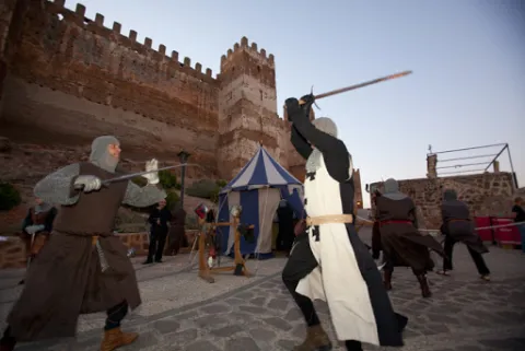
Arjona is included in the Route of the Castles and Battles, an itinerary running through the province of Jaén and part of the provinces of Ciudad Real and Granada. Arjona once had one of the most complex fortification systems in Al-Ándalus, with a triple line of defensive walls which, combined with Arjona's own strategic position, made it an impregnable stronghold. The origin of its wall system is set within the protohistory of the Iberian Peninsula, having been used by the successive cultures that passed through it, all of which left their mark on its structure. Today, part of this vast defensive system survives, along with an Almohad-period cistern located at the heart of the Alcazaba. The Archaeology Room of the Arjona Museum holds remains of weapons used in the Islamic medieval period, notably including arrowheads of a type matching those used at the Battle of Las Navas de Tolosa; also of note, inside the Sanctuary of the Sacred Relics, is a collection of drawings and plans based on the manuscripts of the 17th-century historian Martín Ximena Jurado, showing what Arjona's defensive system looked like at that time.

The visit ticket includes a guide and admission to all monuments, museums and churches, except the Sanctuary of the Sacred Relics; admission to the Sanctuary costs €1, payable at its entrance.

Latitud
37.936503
Longitud
-4.055315
Distrito
Municipio
Ubicación en el mapa
POINT (-4.055315 37.936503)
imagen
Image
vistas.JPG
Imagen principal
Activado

Nature

icon-intereses-naturaleza

Friends

icon-intereses-amigos

Adventure

icon-intereses-aventura

Culture

icon-intereses-cultura

Sport

icon-intereses-deporte

Eco-friendly

icon-intereses-eco-friendly

For couples

icon-intereses-en-pareja

Family

icon-intereses-familia

Gastronomy

icon-intereses-gastronomia

Municipality

icon-intereses-municipio

Low-cost tourism

icon-intereses-turismo-low-cost

Solo travel

icon-intereses-viajar-solo

Ruta de los castillos y batallas

All year round

Desactivado
Coordenadas / Huso 30S

30S x=407265 y=4199295

Tramo de asfalto o cemento
 
Tramo de pista o camino forestal
 
Tramo de vía pecuaria
 
Tramo de senda
 

Despegue del Almadén

Submitted by brandcode_deweloper on
Id
RUT-0017
Descripción larga
At 2,036 meters above sea level, the Almadén peak rises as one of the great natural balconies of Sierra Mágina. From its crest, the look dominates a sea of olive groves, the loins that descend to the Guadalquivir valley and, on clear days, the nearby summits of Granada. It is certainly one of those places that leave a mark on both the visitor and the pilot who decides to take on their heights. The enclave has two take-off guidelines. South facing, towards the surroundings of the Cortijo de Bornos, with wide open views. North facing, which allows to plan for Real Mancha with relative comfort in favourable conditions. It is a clearly thermal area, with powerful ascendencies that allow you to gain height quickly when the convective cycle is active. These upward currents can offer long and spectacular flights, but require more experience and accurate reading of the aerology than other more accessible areas in the environment. It is not a recommended take-off for unsupervised initiation pilots. The Almadén has been the stage of official testing when other areas did not meet adequate conditions, as was the case in a manga of the 2004 Spanish Paragliding Championship, which shows its technical and sports potential. Its current use is less frequent, partly due to prolonged access, approximately one hour from Pegalajar or Real Mancha, and to the improvement of infrastructure in areas such as Seven Pillas or the Eagle Peña, more comfortable and common. However, those who seek a more wild and high mountain experience find here a demanding and memorable scenario. Security recommendations Always consult up-to-date weather and wind forecast in height. Fly with approved and revised equipment. Valuing the technical level of its own and, if necessary, having accredited local guides or pilots. Plan access and collection well, given the location and altitude of the enclave. El Despega del Almadén is a mountain in a pure state: a place to walk to the top, run the hill and, when the wind accompanies, fly over one of the most iconic landscapes of the province.
Breve descripción
At 2,036 meters above sea level, the Almadén peak rises as one of the great natural balconies of Sierra Mágina. From its crest, the look dominates a sea of olive groves, the loins that descend to the Guadalquivir valley and, on clear days, the nearby summits of Granada. It is certainly one of those places that leave a mark on both the visitor and the pilot who decides to take on their heights.
Latitud
37.7904
Longitud
-3.4802
Distrito
Municipio
Ubicación en el mapa
POINT (-3.4802 37.7904)
imagen
Image
_mg_5895-jpg
Imagen principal
Activado

Nature

icon-intereses-naturaleza
Despegue del Almadén
Desactivado
Tramo de asfalto o cemento
 
Tramo de pista o camino forestal
 
Tramo de vía pecuaria
 
Tramo de senda
 

Despegue de la Peña del Águila

Submitted by brandcode_deweloper on
Id
RUT-0016
Descripción larga
The Peña del Águila is located a few meters from the lookout of the same name, in the municipal term of Mancha Real. Its access is simple from the road up to the Almadén summit, making it one of the most comfortable and common flight points in Sierra Mágina. Located almost 1,200 metres above sea level, this enclave has a Northwest orientation, also allowing the flight with wind components from West and North. The take-off area has an approximate size of 200 m ², offering sufficient space to prepare the candle with comfort. Because of its aerological characteristics and its kind relief, it is an ideal place for both start-up flights and for those who seek to propose longer distance tours under favourable conditions. History and consolidation as a flight area The history of the Peña del Eagle dates back to the 1990s, when the newly created Paragliding Club Pegalajar Flight Centre began to systematically explore new flight areas in the province. Those years marked the beginning of the development of the paragliding in Sierra Magina, laying the foundation for what is today a consolidated network of takeoff. Some of the first flight concentrations of the region were held in Mancha Real in the 1990s. More recently, the Spanish Precision Paragliding Championship was held in 2022, a modality that tests the skill of the pilot in the approach and grounding. The area is currently frequented by the Peña el Eagle Flight Club and by numerous pilots who visit Sierra Magina attracted by the beauty of the environment and the regularity of its conditions. The proximity to Pegalajar allows to alternate flight days between both enclaves easily, enriching the experience. Security recommendations Always consult the weather forecast and assess the intensity and direction of the wind before taking off. Use equipment approved and in good condition. On start flights, have supervision of experienced technicians or pilots. Respect the take-off and landing areas as well as the natural environment. La Peña del Eagle is a natural balcony where the flight is integrated with the landscape: take off on the olive sea, gain height on the loins and feel that, between glances and crests, Sierra Magina invites to walk, run and fly.
Breve descripción
The Peña del Águila is located a few meters from the lookout of the same name, in the municipal term of Mancha Real. Its access is simple from the road up to the Almadén summit, making it one of the most comfortable and common flight points in Sierra Mágina.
Latitud
37.7801
Longitud
-3.4603
Distrito
Municipio
Ubicación en el mapa
POINT (-3.4603 37.7801)
imagen
Image
_mg_4644-jpg
Imagen principal
Activado

Nature

icon-intereses-naturaleza
Despegue de la Peña del Águila
Desactivado

Olivar del Llano de Motril

Submitted by brandcode_deweloper on
Id
7463682
Descripción larga

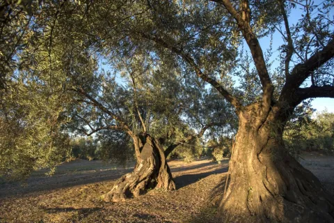
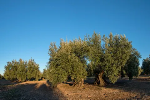
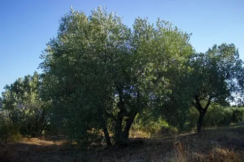
This enclave is located just over 1 km away. of the city centre of Martos, at the foot of the road of Martos to Santiago de Calatrava. It occupies an extension of 84 hectares., with 5,394 centenary trees, some of them, true living sculptures. It is a fully productive olive tree with an average of 150 kg. By tree.

Breve descripción

In the municipality of Martos more than 60% of the plants are over 200 years old. In this olive forest, the so-called Centennial Olives stand out. It is known from an oral tradition that some of the olive trees on the Motril Plane are over 500 years old.

Latitud
37.731186
Longitud
-3.990593
Distrito
Municipio
Ubicación en el mapa
POINT (-3.990593 37.731186)
imagen
Image
olivar-llano-motril.jpg
Imagen principal
Activado
imagen
Image
olivar-llano.jpg
Imagen principal
Desactivado
imagen
Image
olive-tree-2026741__340.jpg
Imagen principal
Desactivado

Friends

icon-intereses-amigos

Nature

icon-intereses-naturaleza

Solo travel

icon-intereses-viajar-solo

For couples

icon-intereses-en-pareja

Family

icon-intereses-familia

Adventure

icon-intereses-aventura

Culture

icon-intereses-cultura

Sport

icon-intereses-deporte

Municipality

icon-intereses-municipio

Eco-friendly

icon-intereses-eco-friendly

Leisure

icon-intereses-cultura
Olivar del Llano de Motril
Desactivado

Promotion: Internet, Guides.

Coordenadas / Huso 30S
30S x = 412711 and = 4176452
Tramo de asfalto o cemento
 
Tramo de pista o camino forestal
 
Tramo de vía pecuaria
 
Tramo de senda
 

Route de los Maquis (Quesada)

Submitted by brandcode_deweloper on
Id
650419
Descripción larga

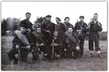
The Civil War unevenly affected the province of Jaén, which remained in the Republican area until 28 March 1939, almost the end of the War. In many municipalities, agricultural communities had been implemented and some initiatives had been abruptly interrupted after the end of the war. As was the case during the Napoleonic invasion, these saws facilitated the emergence of groups of armed resistance, known as maquis. Some of his family and friends always tried to help them, at the risk of reprisals for collaborating with the guerrilla.

In the Sierra de Segura, he highlighted Sixto García Espinosa, "that of Marchena," who led a group that resisted until 1950 in caves near the village of Marchena, near Santiago de la Espada, of which José Antonio Fernández, from the village of Miller, Juan Sáez, who was mayor of the neighbouring municipality of Nerpio, and Manuel Romero, secretary of the same municipality. They were all killed or arrested by the Civil Guard.

Another of the resistors was Pablo, that of Motril, although it was actually called Manuel Pérez Rubiño, who focused his activity until 1952 on the terms of Cazorla, Quesada and Pozo Alcón. Other names that have remained in the collective memory are those of "Fernandillo" or the "Red Terrinches," which now become known thanks to the latest historical investigations and the attempt to recover the historical memory of the period immediately after the Civil War.

Breve descripción

In 2007 Quesada designed 11 itineraries in which the time of the Maquis was interpreted and made known and their presence in the mountains of Cazorla and Segura recovering ancient paths, caves, natural shelters and cortijos by which the Maquis walked in an attempt to recover a chapter of our most recent history.

Latitud
37.843903
Longitud
-3.065956
Municipio
Ubicación en el mapa
POINT (-3.065956 37.843903)
imagen
Image
Ruta%20de%20los%20Maquis%20%28Quesada%29.jpg
Imagen principal
Activado
imagen
Image
640_img.png
Imagen principal
Desactivado

Nature

icon-intereses-naturaleza

Friends

icon-intereses-amigos

Adventure

icon-intereses-aventura

Culture

icon-intereses-cultura

Sport

icon-intereses-deporte

Eco-friendly

icon-intereses-eco-friendly

For couples

icon-intereses-en-pareja

Family

icon-intereses-familia

Gastronomy

icon-intereses-gastronomia

Municipality

icon-intereses-municipio

Low-cost tourism

icon-intereses-turismo-low-cost

Solo travel

icon-intereses-viajar-solo
Ruta de los Maquis (Quesada)
All year round
Desactivado
Coordenadas / Huso 30S
30S x = 494197 and = 4188498
Tramo de asfalto o cemento
 
Tramo de pista o camino forestal
 
Tramo de vía pecuaria
 
Tramo de senda
 

Route Ornitológica Sierra de Cazorla

Submitted by brandcode_deweloper on
Id
6216167
Descripción larga

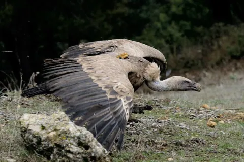
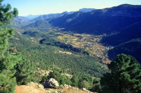
From here, with a little patience and luck, we can take advantage of the nearby feeding station for scavenging birds to enjoy the majestic flight of the griffon vulture, the most numerous of our large birds of prey. It may delight us by gliding just a few metres above the treetops of the surrounding pine forest. Other birds of prey can also be observed from here, including common buzzards and booted eagles.

From here, we continue along the same road until reaching Empalme del Valle, the point where this route connects with the main route when starting from the village of Arroyo Frío. We then turn right towards Vadillo-Castril. At this former timber settlement on the banks of the Guadalquivir River, we can make a second stop. Either by walking along the riverbanks through the village or by spending a little more time completing the circular Cerrada del Utrero trail on foot, which is also of ornithological interest, we can observe a wide variety of riverside bird species. These include the white-throated dipper, a reliable indicator of good water quality; the grey wagtail, moving among the rocks emerging from the water; Cetti’s warblers; and, in spring, the colourful golden oriole, among others.

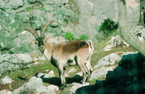
Continuing onwards, after crossing the Iron Bridge beside the Cerrada del Utrero trail, we reach a fork where we turn left and climb towards Las Navas. We leave behind the Lanchales de Linarejos, a beautiful karst landscape where, with a little patience, it is possible to observe the agile Iberian ibex. By remaining quiet and carefully examining the trunks of the surrounding trees, we may also see several small but beautiful woodland bird species, such as Eurasian nuthatches, short-toed treecreepers, coal tits and long-tailed tits. We continue to the Los Collados forest house, where the unpaved forest track begins. This track takes us along the Cuesta del Bazar to Nava del Espino.

A little further uphill, on our right, we find the first viewpoint overlooking Los Poyos de la Mesa. Griffon vultures are frequently seen flying here, and with luck we may also observe golden eagles, booted eagles and short-toed snake eagles. The latter are present during spring and summer, after returning to these mountains from their wintering grounds in Africa.

We continue climbing through beautiful forests of maritime pine, holm oak and a number of old Portuguese oaks. The undergrowth consists of rosemary, marjoram, turpentine trees and rockroses. As we ascend the Cuesta del Bazar, the maritime pines gradually give way to majestic European black pines. We are now in the Oro-Mediterranean vegetation zone, where these slender pine trees grow alongside centuries-old Portuguese oaks, hawthorns, barberries and prickly cushion plants.

We have reached the beginning of Nava del Espino, a beautiful high plateau covered with dense European black pine forests and high-mountain grasslands. It is surrounded by striking peaks such as Cabeza del Tejo and Cerro de Pedro Cerrillo, where fallow deer can often be seen running swiftly across the landscape, grazing or resting beneath the shade of a pine tree.

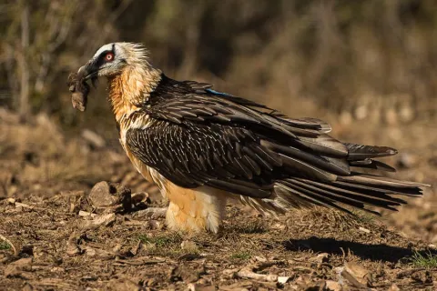
We continue along the forest track, passing the Fuente de la Garganta recreational area, until reaching La Esperilla, where the second viewpoint dedicated to Félix Rodríguez de la Fuente is located. This viewpoint overlooks Nava de San Pedro and Torcales del Lobo. It is well worth spending some time here and using binoculars to scan this magnificent landscape in search of a great spotted woodpecker, green woodpecker or carrion crow hidden among the scrub or the interwoven branches of the replanted poplar groves. Looking towards the sky, it is not unusual to see the silhouette of a golden eagle, peregrine falcon, griffon vulture, raven or one of the bearded vultures released as part of the species reintroduction programme. The Bearded Vulture Captive Breeding Centre is now located beside the former Nava de San Pedro Game Park. This ambitious project is producing successful results, as this threatened species has once again returned to the skies above these mountains.

We continue along the route and, after passing through the cutting, reach a viewpoint overlooking Vado de las Carretas. On days with good visibility, it is possible to see as far as Sierra Nevada National Park. A little further uphill, beside the former farmsteads of Poyo Manquillo, a short path on our left leads to the third viewpoint. It overlooks a beautiful holm oak woodland growing over limestone slabs, as well as the impressive cliffs of Torcales del Lobo and, further away, Cerro de las Cabañas, Puerto Pinillo and Torcal de Linares.

We return to our vehicle and, after travelling approximately two kilometres, reach the fourth viewpoint in the area known as Estrecho de los Perales. Here, beautiful and unusual geological formations surround the crystal-clear waters of the Valdetrillos Stream. Agile mouflons and male Iberian ibex can often be seen climbing the vertical rock walls, while golden eagles, griffon vultures and booted eagles may be observed flying majestically overhead. Flocks of unusual birds with crossed bills may also be seen. These are crossbills, remarkably adapted to feeding in pine forests and using their distinctive bills to extract seeds from pine cones. Another small bird that may be observed here is the citril finch.

We continue along the forest track, passing the former Fuente Acero forest house. One kilometre further on, we reach beautiful and impressive limestone cliffs, dominated by the peaks of Loma del Caballo de Acero, Alto de la Cabrilla and Navalasno. These were the last places where the bearded vulture nested before disappearing from the area in 1986–1987.

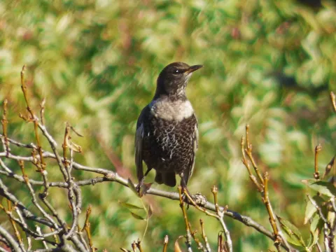
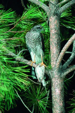
Continuing along the forest track and passing Collado de Fuente Bermejo, we arrive at Collado de la Zarca. On our left stands an impressive European black pine more than 300 years old. From here, there are beautiful panoramic views over the Guadalentín Ravine and the Natural Park’s great limestone formations, including Navalasno, Poyos de la Carilarga and La Cabrilla. At the end of the route, we reach the area known as Ramblaseca, the gateway to the renowned Campos de Hernán Perea. This high plateau has sparse vegetation because of the harsh environmental conditions and, above all, the pressure of livestock grazing. An endless variety of small birds can be seen in these open uplands, taking advantage of livestock drinking troughs as sources of water. These include chaffinches, crossbills, mistle thrushes, common rock thrushes and ring ouzels, with the latter two being more frequent in winter. Northern goshawks and Eurasian sparrowhawks may also be seen waiting for an opportunity to catch one of the birds that lowers its guard while drinking.

All that remains is to return along the same route to the Puente de las Herrerías junction. Here, we can either return along the same route used on the outward journey or take the road leading to the source of the Guadalquivir River and then continue to El Chorro. There, we can enjoy views of a griffon vulture colony situated on vertical cliffs of imposing beauty. Griffon vultures, red-billed choughs and crag martins can be observed, as well as Egyptian vultures and Alpine swifts during the breeding season. Please note that this alternative route considerably increases both the duration and distance of the journey, so it is advisable to complete it on a separate day.

Breve descripción

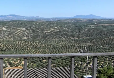
It begins in Cazorla, a village of a unique beauty catalogued as an artistic historical ensemble that is also the head of the Sierra de Cazorla region. We take direction to the Natural Park on the A-319 road, through the village of La Iruela and Burunchel, just before entering its limits, we continue on the winding mountain road, ascending to reach the Port of the Palomas and the Paso del Aire, at this point we can take advantage to make the first stop contemplating the difference of landscape between the slope facing the Guadalquivir Valley and the direction to the agricultural countryside covered by the olive mantle that covers these lands.

Latitud
37.91334
Longitud
-3.002196
Municipio
Ubicación en el mapa
POINT (-3.002196 37.91334)
imagen
Image
sierra-cazorla%20%282%29.png
Imagen principal
Activado
imagen
Image
quebrantahuesos-espana-3.jpg
Imagen principal
Desactivado
imagen
Image
buitres.jpg
Imagen principal
Desactivado
imagen
Image
33621933485_2b6a232942_b.jpg
Imagen principal
Desactivado
imagen
Image
Sierra-Cazorla.jpg
Imagen principal
Desactivado
imagen
Image
P1450025.JPG
Imagen principal
Desactivado
imagen
Image
Natu035.jpg
Imagen principal
Desactivado
imagen
Image
Natu206.jpg
Imagen principal
Desactivado

Nature

icon-intereses-naturaleza

Friends

icon-intereses-amigos

Adventure

icon-intereses-aventura

Culture

icon-intereses-cultura

Sport

icon-intereses-deporte

Eco-friendly

icon-intereses-eco-friendly

For couples

icon-intereses-en-pareja

Family

icon-intereses-familia

Gastronomy

icon-intereses-gastronomia

Municipality

icon-intereses-municipio

Low-cost tourism

icon-intereses-turismo-low-cost

Solo travel

icon-intereses-viajar-solo
Baja
Ruta Ornitológica Sierra de Cazorla
All year round
Desactivado
Coordenadas / Huso 30S
30S x = 499807 and = 4196200

Camino Mozárabe de Santiago

Submitted by brandcode_deweloper on
Id
3919434
Descripción larga

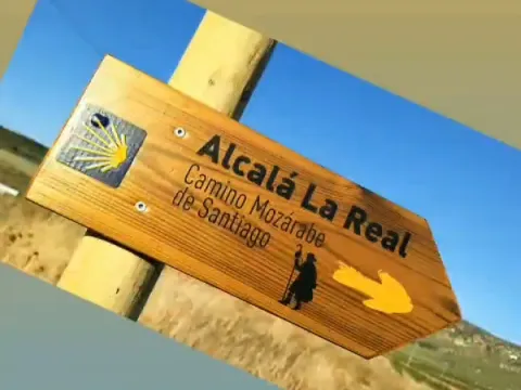
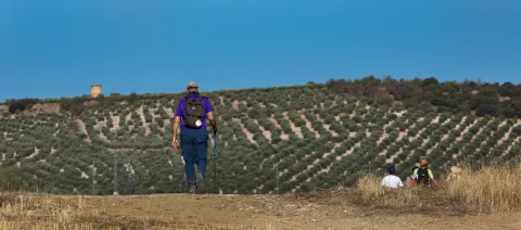
From Alcalá la Real you can enjoy two of the stages of this famous tour. First of all, the Moclin - Alcalá la Real (21.8 km) and Alcalá la Real - Alcaudete (23.7 km) stage.

Breve descripción

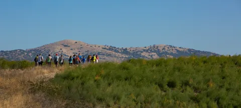
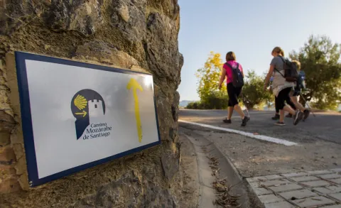
The well-known MozArab Way was used by Christians living in the Arab Kingdoms to link with the Via de la Plata to Santiago de Compostela, one of the oldest routes on the Santiago Way. Alcalá serves as a meeting point for pilgrims coming from Granada, acting as the end of the stage and beginning of the one that passes through the province of Jaén.
Latitud
37.461216
Longitud
-3.922399
Distrito
Municipio
Ubicación en el mapa
POINT (-3.922399 37.461216)
imagen
Image
6%20%281%29.jpeg
Imagen principal
Activado
imagen
Image
7%20%281%29.jpeg
Imagen principal
Desactivado
imagen
Image
5.jpeg
Imagen principal
Desactivado
imagen
Image
4.jpeg
Imagen principal
Desactivado
imagen
Image
1%20%281%29.jpeg
Imagen principal
Desactivado
imagen
Image
3%20%281%29.jpeg
Imagen principal
Desactivado
imagen
Image
8%20%281%29.jpeg
Imagen principal
Desactivado

Nature

icon-intereses-naturaleza

Friends

icon-intereses-amigos

Adventure

icon-intereses-aventura

Culture

icon-intereses-cultura

Sport

icon-intereses-deporte

Eco-friendly

icon-intereses-eco-friendly

For couples

icon-intereses-en-pareja

Family

icon-intereses-familia

Gastronomy

icon-intereses-gastronomia

Municipality

icon-intereses-municipio

Low-cost tourism

icon-intereses-turismo-low-cost

Solo travel

icon-intereses-viajar-solo
Camino Mozárabe de Santiago
Desactivado
Coordenadas / Huso 30S
30S x = 418426 and = 4146438

Route del Río Velillos

Submitted by brandcode_deweloper on
Id
3918981
Descripción larga

Path PR-A 414 River Velillos (10.4 km).

The uniqueness of this linear route is that through the river Alcalá la Real and Vega granadina communicated, making it a strategic area of the Sierra Sur de Jaén, throughout its history.
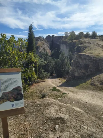
The path that begins in the village of Ribera Alta, for the most part on roads and paths, near or on the margins of the Salobral stream, the Palanantia stream and above all on the banks of the river Velillos, which we will be forced to cross on several occasions. The fountain of the Bath Cortijo will help us to refresh, before it takes some height to enjoy a great view of the river and up the Ribera Alta. Friars and the hill of the Martina at the bottom and looking down at the village of Ribera bajo.
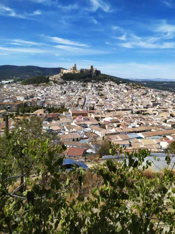
On the bridge next to Tahona, we arrive to the Baja Bank, small pedanía of Alcalá la Real, where the landscape is made up of 800 and 900 meters covered with olive trees, and in the low parts cereal crops. It is here that the river crosses the town side by side, with a magnificent Vega and some choperas or small wires, which give it a picturesque image and a refreshing climate.

Breve descripción

With this path approved by the National Mountain Federation, you will discover the natural heritage of the municipality. He walks by the river Velillos and discovers the importance of water in a land characterized by dry crops. It walks between olive trees, cereal, wire and choperas and is in a unique environment, discovering the pedanias of Ribera Alta and of Ribera Baja, in which the river has shaped the distribution of its population since Roman times.

Latitud
37.463702
Longitud
-3.925019
Distrito
Municipio
Ubicación en el mapa
POINT (-3.925019 37.463702)
imagen
Image
1.jpg
Imagen principal
Activado
imagen
Image
Ruta%20del%20rio%20velillos.jpg
Imagen principal
Desactivado

Nature

icon-intereses-naturaleza

Friends

icon-intereses-amigos

Adventure

icon-intereses-aventura

Culture

icon-intereses-cultura

Sport

icon-intereses-deporte

Eco-friendly

icon-intereses-eco-friendly

For couples

icon-intereses-en-pareja

Family

icon-intereses-familia

Gastronomy

icon-intereses-gastronomia

Municipality

icon-intereses-municipio

Low-cost tourism

icon-intereses-turismo-low-cost

Solo travel

icon-intereses-viajar-solo
Ruta del Río Velillos
All year round
Desactivado
Coordenadas / Huso 30S
30S x = 418197 and = 4146716

Route de Los Zumaques

Submitted by brandcode_deweloper on
Id
3917355
Descripción larga

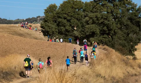
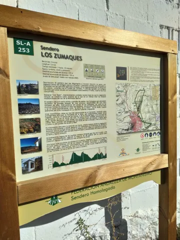
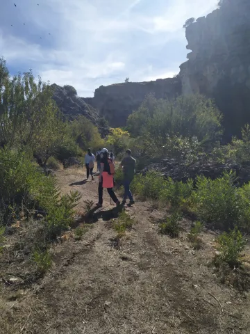
SLA-253 The Zumaques Path (9.4 km).

Breve descripción

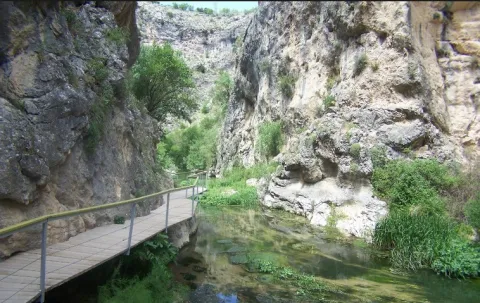
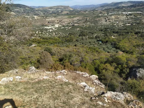
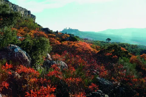
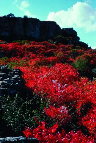
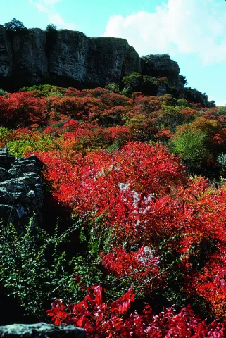
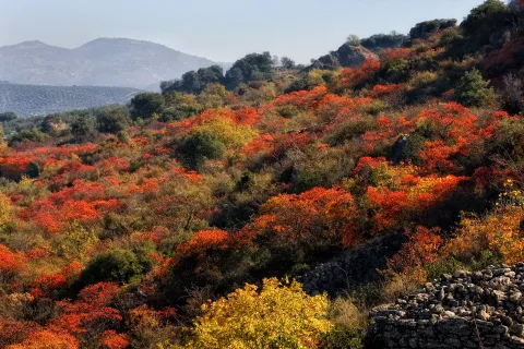
This path, approved by the National Mountain Federation, runs along the emblematic Zumaques route. Through canyons and trails you will enjoy "Los Tajos," impressive rocky cuts under which natural vegetation is preserved as a sample of what at one time were the Mediterranean forests of the southern Iberian Peninsula. This vegetation is an example of the zumala, this autumn plant, which takes a reddish tone that will fall in love with you. All this with wonderful views of the Fortress of the Mota. An impressive place to enjoy the sunset.

Latitud
37.463702
Longitud
-3.925019
Distrito
Municipio
Ubicación en el mapa
POINT (-3.925019 37.463702)
imagen
Image
9.jpeg
Imagen principal
Activado
imagen
Image
1.jpeg
Imagen principal
Desactivado
imagen
Image
2.jpeg
Imagen principal
Desactivado
imagen
Image
3.jpeg
Imagen principal
Desactivado
imagen
Image
5%20%281%29.jpeg
Imagen principal
Desactivado
imagen
Image
6.jpeg
Imagen principal
Desactivado
imagen
Image
7.jpeg
Imagen principal
Desactivado
imagen
Image
8.jpeg
Imagen principal
Desactivado
imagen
Image
10.jpg
Imagen principal
Desactivado
imagen
Image
11.jpeg
Imagen principal
Desactivado
imagen
Image
12.jpeg
Imagen principal
Desactivado
imagen
Image
Natu019.jpg
Imagen principal
Desactivado
imagen
Image
Natu024.jpg
Imagen principal
Desactivado
imagen
Image
Natu025.jpg
Imagen principal
Desactivado
imagen
Image
Natu397.jpg
Imagen principal
Desactivado

Nature

icon-intereses-naturaleza

Friends

icon-intereses-amigos

Adventure

icon-intereses-aventura

Culture

icon-intereses-cultura

Sport

icon-intereses-deporte

Eco-friendly

icon-intereses-eco-friendly

For couples

icon-intereses-en-pareja

Family

icon-intereses-familia

Gastronomy

icon-intereses-gastronomia

Municipality

icon-intereses-municipio

Low-cost tourism

icon-intereses-turismo-low-cost

Solo travel

icon-intereses-viajar-solo
Ruta de Los Zumaques
All year round
Desactivado
Coordenadas / Huso 30S
30S x = 418197 and = 4146716
Tramo de asfalto o cemento
 
Tramo de pista o camino forestal
 
Tramo de vía pecuaria
 
Tramo de senda
 

Talleres Didácticos en Baños de la Encina

Submitted by brandcode_deweloper on
Id
330034
Descripción larga

It rises on the Cerro del Cueto, where human presence before the building of the castle (Copper Age) is manifested, as it is attested in the archaeological site located inside the walled enclosure. The Castle was built in the Almohade period linked to the defenses raised in the Alto Guadalquivir prior to the Battle of the Navas de Tolosa (year 1212).

Breve descripción

Cultural visit to the Castle of Bury Al-Hamman, is one of the best preserved castles of its architectural typology in tapial, whose impossibility of reusing materials justifies that it has preserved its original walled enclosure almost intact.

Latitud
38.174891
Longitud
-3.782312
Distrito
Ubicación en el mapa
POINT (-3.782312 38.174891)
imagen
Image
ba%C3%B1os%20de%20la%20encina.jpg
Imagen principal
Desactivado
imagen
Image
ba%C3%B1os%20de%20la%20encina2.jpg
Imagen principal
Desactivado

Culture

icon-intereses-cultura
Talleres Didácticos en Baños de la Encina
Desactivado

Several workshops can be combined for a full day stay in our location.

All prices include the necessary monitors according to the number of schoolchildren and the activity chosen, teaching materials and workshop support materials. The hours are indicative and can be adapted to the needs of each school.

Coordenadas / Huso 30S
30S x = 431478 and = 4225509