Saltar al contenido principal

La Iruela

Submitted by brandcode_deweloper on
Id
918750
Descripción
Descripción larga

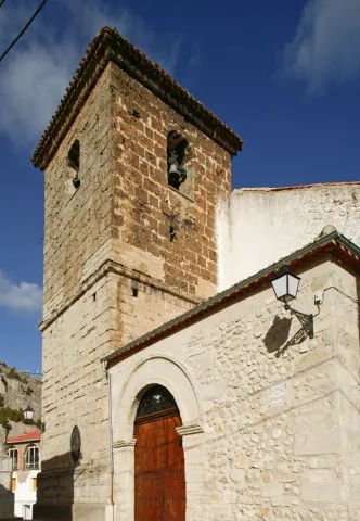
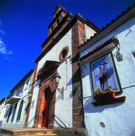
Next to the castle you will find the ruins of the Church of Sto. Silos Sunday. The legend tells that it was built on the place where the Arabs held captive Christians in prison and there was Santo Domingo doing his job. In the building there are traces of the disciples of Vandelvira. It's a must-see for any lover of history.

The Iruela was part of Cazorla until 1370, when Archbishop D. Gome Manrique gave it independence, power and shield. His political and territorial position has allowed him to preserve an important heritage: the Conistory House - a proud building in the Mudejar style of Toledan - and the Church of the Immaculate Conception are part of this legacy.

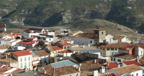
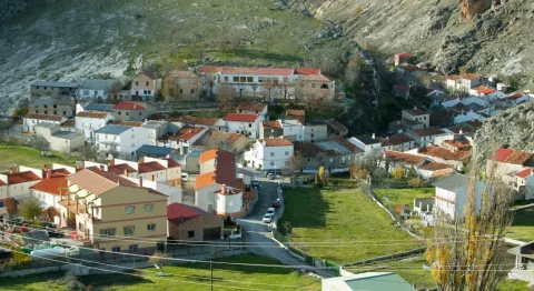
The population has a core worth visiting. The streets are steep and narrow, with crouched houses and flowers on the balconies. In the center there is a beautiful fountain from which several roads arise to surround the village. From here you can go up to Temple Street on a beautiful stone road accompanied by fig trees and cypresses.

We suggest:

  • About five minutes from La Iruela you will find Burunchel. Come to know the Hermitage of San Julián and the temple of the Holy Spirit among other attractions of this pedany.
  • On August 27, during the summer parties of the village you will see a curious pyrotechnic show, in which the castle is also the protagonist.
Breve descripción

The road that goes up to the saw from Cazorla borders this small, but amazing population. Its best known profile is due to the castle, a legendary fortress that became owned by the Templars and dominates the Guadalquivir Valley. The need to defend itself has given rise to this fortification which, because of its most abrupt aspect, is inexortable. But the Iruela is more attractive.

Ubicación
Latitud
37.920351
Longitud
-2.994140
Municipio
Ubicación en el mapa
POINT (-2.99414 37.920351)
Tipos de punto de interés
Imágenes carrusel
imagen
Image
iruela.jpeg
Imagen principal
Desactivado
Imágenes cabecera
imagen
Image
La-Iruela-Jaen-nuevo-municipio-turistico-de-Andalucia-foto-de-Junta.jpg
Imagen principal
Activado
Loading map
Preparing points of interest and routes...
Marcas de calidad

La Espinareda

Submitted by brandcode_deweloper on
Id
660041
Descripción larga

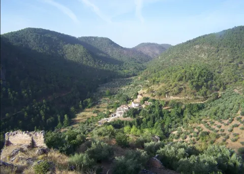
The ruins of the castle are impressive because of its elevated situation and the remains of houses and rooms made in tapial that are around it. From above you can observe much of the valley and see, right in front, the castle of Segura and a little below the Arab towers of Santa Catalina and Orcera. We suggest that you walk through the forest track that links this village with that of El Tobazo, by forest track with very little level marked for hiking like GR-146.

Breve descripción

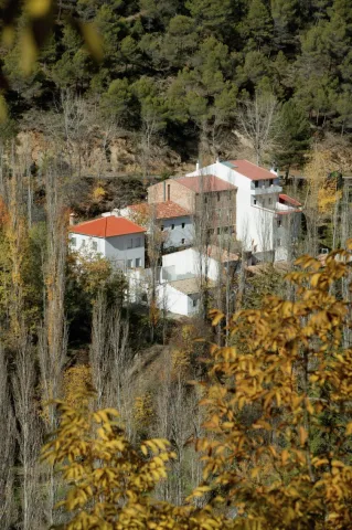
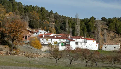
It is one of the most charming villages for its location, very close to the remains of the small castle of Espinareda, of which it is named. narrow streets, white walls and small roofs extended on the hillside. A shaded ravine makes it a lookout over the rest of the valley.
Latitud
38.301671
Longitud
-2.735648
Distrito
Ubicación en el mapa
POINT (-2.735648 38.301671)
imagen
Image
aldeaespiraneda.png
Imagen principal
Activado
imagen
Image
Segura_de_la_Sierra_PM_091670_E.jpg
Imagen principal
Desactivado

Nature

icon-intereses-naturaleza

Friends

icon-intereses-amigos

Adventure

icon-intereses-aventura

Culture

icon-intereses-cultura

Culture of the Bull

icon-intereses-cultura-del-toro

Sport

icon-intereses-deporte

Eco-friendly

icon-intereses-eco-friendly

For couples

icon-intereses-en-pareja

Family

icon-intereses-familia

Gastronomy

icon-intereses-gastronomia

Municipality

icon-intereses-municipio

Low-cost tourism

icon-intereses-turismo-low-cost

Solo travel

icon-intereses-viajar-solo
La Espinareda
Activado
Coordenadas / Huso 30S
30S x = 523114 and = 4239320
Tramo de asfalto o cemento
 
Tramo de pista o camino forestal
 
Tramo de vía pecuaria
 
Tramo de senda
 

Huelga Utrera

Submitted by brandcode_deweloper on
Id
659543
Descripción larga

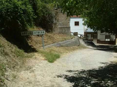
Ancient gardens turned into meadows when they are left without use, fruit, ferns, pine, oak, are present throughout the village. The houses are located around a square where we find silence only broken by the sound of the water of the fountain. Unpossible alleyways and windows of another time live together with rehabilitated houses and old laundry houses no longer used.

In the Utrera Strike there is a small path that goes towards the Water Cave that is worth the spectacular cave and the landscape surrounding the village.

Breve descripción

Utrera strike is surprised by its vegetation and the feeling of meeting us in forests of other latitudes. The water of the Segura River passes just below the village, leaving an impressive riverside with lush vegetation.

Latitud
38.167394
Longitud
-2.609647
Ubicación en el mapa
POINT (-2.609647 38.167394)
imagen
Image
huelgaUtrera%20%281%29.jpeg
Imagen principal
Activado
imagen
Image
huelga.jpg
Imagen principal
Desactivado

Nature

icon-intereses-naturaleza

Friends

icon-intereses-amigos

Adventure

icon-intereses-aventura

Culture

icon-intereses-cultura

Culture of the Bull

icon-intereses-cultura-del-toro

Sport

icon-intereses-deporte

Eco-friendly

icon-intereses-eco-friendly

For couples

icon-intereses-en-pareja

Family

icon-intereses-familia

Gastronomy

icon-intereses-gastronomia

Municipality

icon-intereses-municipio

Low-cost tourism

icon-intereses-turismo-low-cost

Solo travel

icon-intereses-viajar-solo
Huelga Utrera
Desactivado
Coordenadas / Huso 30S
30S x = 534194 and = 4224460

Route de los Maquis (Quesada)

Submitted by brandcode_deweloper on
Id
650419
Descripción larga

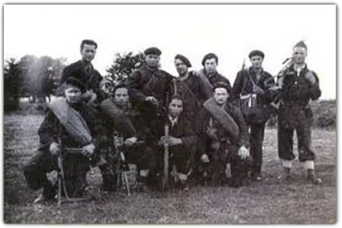
The Civil War unevenly affected the province of Jaén, which remained in the Republican area until 28 March 1939, almost the end of the War. In many municipalities, agricultural communities had been implemented and some initiatives had been abruptly interrupted after the end of the war. As was the case during the Napoleonic invasion, these saws facilitated the emergence of groups of armed resistance, known as maquis. Some of his family and friends always tried to help them, at the risk of reprisals for collaborating with the guerrilla.

In the Sierra de Segura, he highlighted Sixto García Espinosa, "that of Marchena," who led a group that resisted until 1950 in caves near the village of Marchena, near Santiago de la Espada, of which José Antonio Fernández, from the village of Miller, Juan Sáez, who was mayor of the neighbouring municipality of Nerpio, and Manuel Romero, secretary of the same municipality. They were all killed or arrested by the Civil Guard.

Another of the resistors was Pablo, that of Motril, although it was actually called Manuel Pérez Rubiño, who focused his activity until 1952 on the terms of Cazorla, Quesada and Pozo Alcón. Other names that have remained in the collective memory are those of "Fernandillo" or the "Red Terrinches," which now become known thanks to the latest historical investigations and the attempt to recover the historical memory of the period immediately after the Civil War.

Breve descripción

In 2007 Quesada designed 11 itineraries in which the time of the Maquis was interpreted and made known and their presence in the mountains of Cazorla and Segura recovering ancient paths, caves, natural shelters and cortijos by which the Maquis walked in an attempt to recover a chapter of our most recent history.

Latitud
37.843903
Longitud
-3.065956
Municipio
Ubicación en el mapa
POINT (-3.065956 37.843903)
imagen
Image
Ruta%20de%20los%20Maquis%20%28Quesada%29.jpg
Imagen principal
Activado
imagen
Image
640_img.png
Imagen principal
Desactivado

Nature

icon-intereses-naturaleza

Friends

icon-intereses-amigos

Adventure

icon-intereses-aventura

Culture

icon-intereses-cultura

Sport

icon-intereses-deporte

Eco-friendly

icon-intereses-eco-friendly

For couples

icon-intereses-en-pareja

Family

icon-intereses-familia

Gastronomy

icon-intereses-gastronomia

Municipality

icon-intereses-municipio

Low-cost tourism

icon-intereses-turismo-low-cost

Solo travel

icon-intereses-viajar-solo
Ruta de los Maquis (Quesada)
All year round
Desactivado
Coordenadas / Huso 30S
30S x = 494197 and = 4188498
Tramo de asfalto o cemento
 
Tramo de pista o camino forestal
 
Tramo de vía pecuaria
 
Tramo de senda
 

Hotel RL Ciudad de Úbeda

Submitted by brandcode_deweloper on
Id
12836283
Redes sociales
Facebook
https://www.facebook.com/hotelciudadeubeda/?fref=ts
Instagram
https://www.instagram.com/hotelciudaddeubeda/
Descripción
Breve descripción

The Hotel RL Ciudad de Úbeda, characterized by its classic architecture, in line with the style of this Renaissance city, offers all possible amenities, especially its magnificent restaurant "Las Cuatro Estaciones."

Información de contacto
Teléfono
953 791 011
Sitio web
www.hotelciudaddeubeda.com
Correo electrónico
info@hotelciudaddeubeda.com
Ubicación
Código Postal
23400
Latitud
38.017222
Longitud
-3.385244
Dirección
C/ Cronista Juan de la Torre, s/n
Municipio
Ubicación en el mapa
POINT (-3.385244 38.017222)
Tipo de alojamiento
Imágenes
imagen
Image
430016762_18424280530011998_285684029283441198_n-jpg
Imagen principal
Activado
imagen
Image
83248463_1860086990802241_4283301323010473984_n-jpg
Imagen principal
Desactivado
imagen
Image
434582395_18429957064011998_1962863726617331721_n-jpg
Imagen principal
Desactivado
imagen
Image
419370356_18411512383011998_1064294674883325721_n-jpg
Imagen principal
Desactivado
imagen
Image
image_173199-1-jpeg
Imagen principal
Desactivado
imagen
Image
image_133923-1-jpeg
Imagen principal
Desactivado
Aforo
210
Idiomas
Las habitaciones

Equipped with air conditioning, free WiFi, private bathroom with free toiletries, safe, and modern amenities such as satellite TV, fridge, and hairdryer, this room ensures a pleasant stay. Accessible by elevator, each detail has been designed to provide comfort and convenience, ideal for travelers looking for quality and good service.

Número de estrellas
4
Loading map
Preparing points of interest and routes...
El Hotel

Located in the Renaissance route par excellence, declared Ubeda and Baeza World Heritage Cities in 2003, is the Hotel RL City of Ubeda. With 96 fully equipped rooms and a great experience forged for many years, it is ideal for all kinds of celebrations, business meetings, congresses, etc.

It is equipped with the most modern technological advances in the service of the security and comfort of the customer, it also has an excellent international cuisine without forgetting the delicious local cuisine.

Hotel Puerta de la Luna

Submitted by brandcode_deweloper on
Id
12831880
Redes sociales
Facebook
https://es-es.facebook.com/Hotel-Puerta-de-la-Luna-181918675253169/
Instagram
https://www.instagram.com/hotelpuertadelaluna/
Descripción
Breve descripción

Next to Baeza Cathedral, the hotel is located in an old building that since the 16th century served as a residence for the bishopric. The tranquility of the enclave in the historic centre is its main attraction, as well as the peace of its patios and gardens.

Información de contacto
Teléfono
953 747 019
Sitio web
www.hotelpuertadelaluna.com
Correo electrónico
direccion@hotelpuertadelaluna.com
Ubicación
Código Postal
23440
Latitud
37.606040
Longitud
-3.836339
Dirección
C/ Canónigo Melgares Raya, 7
Municipio
Ubicación en el mapa
POINT (-3.836339 37.60604)
Tipo de alojamiento
Imágenes
imagen
Image
107a-jpg
Imagen principal
Activado
imagen
Image
553278_207709122674124_1881884280_n-jpg
Imagen principal
Desactivado
imagen
Image
107b-jpg
Imagen principal
Desactivado
imagen
Image
restaurante-exterior-1-jpg
Imagen principal
Desactivado
imagen
Image
107c-jpg
Imagen principal
Desactivado
imagen
Image
248-2-jpg
Imagen principal
Desactivado
Aforo
103
Idiomas
Las habitaciones

We have rooms and suites distributed in 3 buildings around a beautiful central courtyard: 3 suites / 2 junior suites / 5 upper double / 29 double / 5 single. Each room has its own exclusive personal touch. The charming Hotel Puerta de la Luna occupies a beautiful 17th-century mansion located in the old town of Baeza. It has an outdoor pool, gardens and a popular restaurant. It is only 50 metres from the Cathedral of Baeza.

Número de estrellas
4
Loading map
Preparing points of interest and routes...
El Hotel

The new facilities are designed to suit your needs. Peace and tranquility is our most pronounced feature. Free wifi available throughout the hotel.

In summer our outdoor courtyard has a swimming pool and hammocks area. Coffee shop all day since 12: 00. and the possibility of eating quietly on an informal basis. At night, the courtyard looks like a gala to offer the most relaxing space you can imagine for an outdoor dinner.

The Paco bar offers you the most welcoming place to replenish strength after a long day with the best tapestry in the area. (Not reserved).

Úbeda RV Parking Area

Submitted by brandcode_deweloper on
Id
11767010
Redes sociales
Facebook
https://www.facebook.com/ubeda.turismo
Descripción
Breve descripción

The city (World Heritage) has 48 notable monuments and over a hundred buildings of interest (Renaissance, Arab, Baroque and Gothic). Very important your Holy Week. A must visit to the Museum of the pottery and the Centre for the interpretation of the olive and oil.

Información de contacto
Teléfono
953 779 204
Sitio web
www.turismodeubeda.com
Correo electrónico
promocion@ubeda.es
Ubicación
Código Postal
23400
Latitud
38.006390
Longitud
-3.379440
Dirección
Travesía del Comendador Messía, s/n
Municipio
Ubicación en el mapa
POINT (-3.37944 38.00639)
Tipo de alojamiento
Imágenes
imagen
Image
visita-ubeda-baeza-individuales.jpg
Imagen principal
Activado
Horario
24 h
Qué ofrece

Ubeda has a beautiful monumental and cultural heritage that makes it a fundamental destination for those interested in the Renaissance architecture.

From its heritage we will highlight the excellent degree of conservation of many of its buildings, which still keep details of the time as can be the doors of claveted wood, the iron aldabas, the lanterns and the bars.

Loading map
Preparing points of interest and routes...
El Hotel

Free parking. Maximum stay, 48 hours. It is not allowed to remove chairs, tables, or other camping elements. All services and the historic centre are about 800 m away.

Number of places: 10 places.

Maximum permanence:Two nights.

Services included:

  • Empty of grey water

  • emptying of black water

  • Water filling

Úbeda

Submitted by brandcode_deweloper on
Id
785118
Perfil de redes sociales
Facebook
https://www.facebook.com/pages/Turismo-de-%C3%9Abeda/173591095987915
Twitter
https://twitter.com/Turismodeubeda
Descripción
Breve descripción

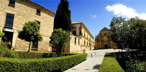
This important city, settled on the hills of its own name, is located in the centre of the province of Jaénand is the capital of the region called La Loma.

Surrounded by a landscape of an extraordinary natural beautyin which the flat grounds for the cultivation of the cereal are alternated, with the smooth slopes of olive trees, seems to summarize the essence of the province of Jaén.

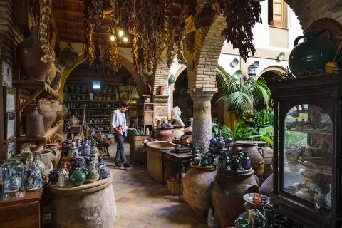
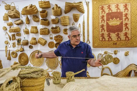
It is very important, within its varied economy, the crafts, with numerous workshops of pottery and ceramics, of forge, size, glass, tapestries, spartum, singing, etc.

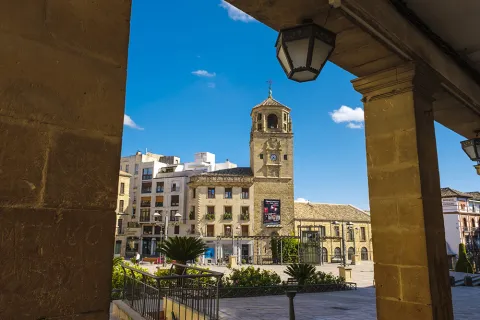
As we walk through its lordship streets to admire the monuments, churches, palaces and lordship houses, we move virtually to the times of the historical splendor of this city.

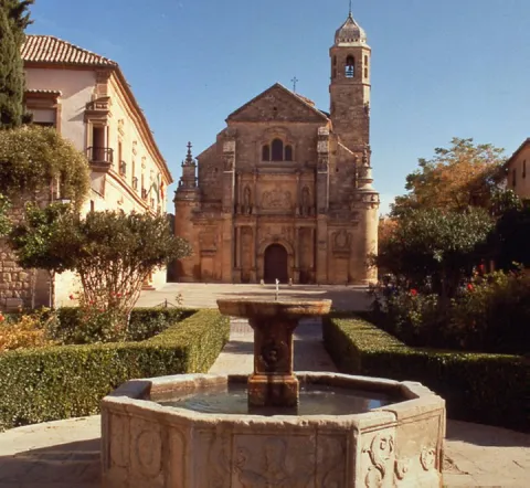
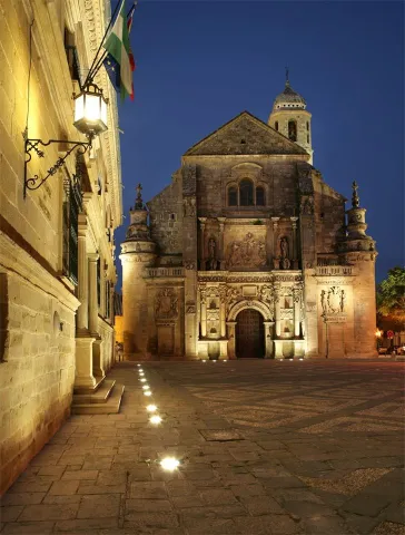
Ubeda is known as "the city of the Andalusian Renaissance"for the quantity and quality of the monuments of this artistic age.

Together with Baeza, it has been declared World Cultural Heritage by Unesco on 3 July 2003.

Telecomunicaciones
Teléfono
953 779 204
Sitio web
www.turismodeubeda.com
Correo electrónico
promocion@ubeda.es
Ubicación
Nombre
Úbeda
Latitud
38.012640
Longitud
-3.371590
Municipio
Ubicación en el mapa
POINT (-3.37159 38.01264)
Imágenes
imagen
Image
4799c128-4243-ddbe-4c6c-d5f7ee6541a5?t=1603983703047
Imagen principal
Desactivado
imagen
Image
b990224c-93ea-e0df-74c2-b7e6183a3016?t=1603984517266
Imagen principal
Desactivado
imagen
Image
751f0349-5ec0-e737-56cf-235536e32ce7?t=1603983703075
Imagen principal
Desactivado
imagen
Image
6ddd0085-05f6-e8ef-366a-1963e112a78f?t=1603983703173
Imagen principal
Desactivado
imagen
Image
079eab40-54b9-462f-9652-50503cdb19b9?t=1585914434000
Imagen principal
Desactivado
imagen
Image
658dab1d-a8b7-6142-60d7-be18c41b4400?t=1620124630064
Imagen principal
Desactivado
imagen
Image
783f65fe-f295-0ac3-a5f1-c8a445f97f9d?t=1603987184323
Imagen principal
Desactivado
imagen
Image
a1c2cc59-155f-b35e-3797-8753b948883f?t=1603987072290
Imagen principal
Desactivado
imagen
Image
d514a2f2-df93-6914-23d0-4a2d3d8def54?t=1585914433864
Imagen principal
Desactivado
imagen
Image
96a361d6-abc7-8d8a-ac2d-39d7b956fb9a?t=1585914432211
Imagen principal
Desactivado
imagen
Image
34223fac-9819-3cc8-ab77-1ea66239de9c?t=1585914433058
Imagen principal
Desactivado
imagen
Image
897fc220-a1c5-8dc7-21a7-f794bb4b5ab1?t=1585914432869
Imagen principal
Desactivado
imagen
Image
fd162935-02a3-19d4-6d0a-e70d45e30088?t=1585914432724
Imagen principal
Desactivado
imagen
Image
c31acbfe-c818-2117-4875-2a38f23fdadd?t=1585777415890
Imagen principal
Desactivado
imagen
Image
a3df8019-f7c4-818f-49a7-812719c7627e?t=1585914432622
Imagen principal
Desactivado
imagen
Image
d66bcf17-80e3-b88c-1e2b-9e0c440410ed?t=1602853416998
Imagen principal
Desactivado
imagen
Image
ac732a47-55b6-b0eb-e42d-53cde4d8d4b5?t=1602853581698
Imagen principal
Desactivado
imagen
Image
5f1448d6-c40c-9c82-d042-dffbb558575d?t=1602853977830
Imagen principal
Desactivado
imagen
Image
8e10cba1-a64b-07b1-57ea-fa3bbbc174a1?t=1602854679588
Imagen principal
Desactivado
imagen
Image
a370e5d1-865a-9977-a663-e2feb66503c8?t=1602854760846
Imagen principal
Desactivado
imagen
Image
8f29648a-eadd-6fcc-1d1c-72ed12871101?t=1602858438953
Imagen principal
Desactivado
imagen
Image
d91d519d-ed0d-52aa-15a1-d61aeea22169?t=1602858557129
Imagen principal
Desactivado
imagen
Image
ec2bae3a-6a55-0359-e557-f51383218c1d?t=1602858895450
Imagen principal
Desactivado
Información adicional
Curiosidades

Oficina De Turismo De Úbeda
Plaza Andalucía, 5, 23400 Úbeda, Jaén
http://turismodeubeda.com/index.php/es/

Imágenes cabecera
imagen
Image
f6f7b606-a62a-fa14-8ad1-f8933a23bfde?t=1611066284336
Imagen principal
Desactivado
Datos de interés

Tourist area: Ubeda / Baeza
Distance to the capital (km): 56
Altitude over sea level (m): 757
Extension (km ²): 404
Number of inhabitants: 34345
Gentilicon: Ubetens
Postal code: 23400

Videos
Video file
Cultura

Ubeda has a beautiful monumental and cultural heritage that makes it a fundamental destination for those interested in the Renaissance architecture.

From its heritage we will highlight the excellent degree of conservation of many of its buildings, which still keep details of the time as can be the doors of claveted wood, the iron aldabas, the lanterns and the bars.

It covers such a number of monuments, churches, palaces and master houses, that it would be difficult for us to list them here to the full. Among its most notable monuments of Ubeda are the following:

Historical center:

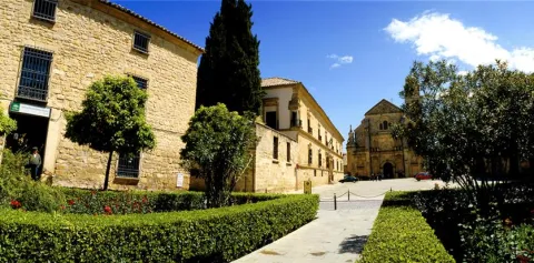
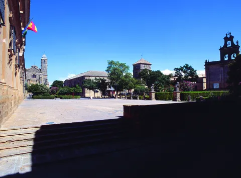
  • Plaza Vázquez de Molina
  • Sacra Capilla Funeraria de El Salvador del Mundo
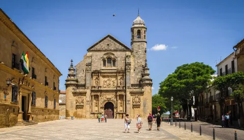
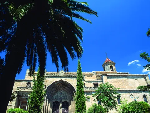
  • Basilica of Santa Maria de los Reales Alcázares
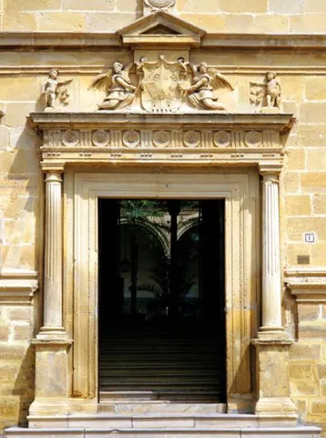
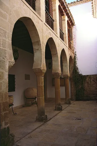
  • Palace of Vázquez de Molina or Palace of the Chains. Current City Hall and houses the Andrés de Vandelvira Interpretation Center
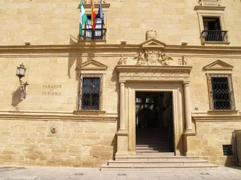
  • Deán Ortega Palace. Current National Tourism Parator
  • Hospital de los Honrados Viejos de El Salvador
  • Palace of the Marquis de Mancera
  • Vela de los Cobos Palace
  • Church of San Pedro
  • Church of St. Paul. Located at 1 May.

Barrio del Alcázar, San Lorenzo and Santo Domingo:

  • Casa de Las Torres
  • Palace of the Medinilla
  • Church of San Lorenzo
  • Church of Santo Domingo

San Isidoro district:

  • Santiago Hospital
  • Palacio del Marqués de la Rambla
  • Church of San Isidoro
  • Church and Convent of the Most Holy Trinity

Barrios de San Pablo y San Nicolás:

  • Church of San Nicolás de Bari
  • Convent of the Immaculate Conception. It houses a museum.
  • Casa de la Tercia - Olivar and Oil Interpretation Center

Barrios de San Millán y Santo Tomás:

  • Valencia Street. Numerous craft workshops to visit.
  • Church of San Millán
  • Palacio Francisco de los Cobos

Route of San Juan de la Cruz:

  • Convent of San Miguel and Oratorio of San Juan de la Cruz

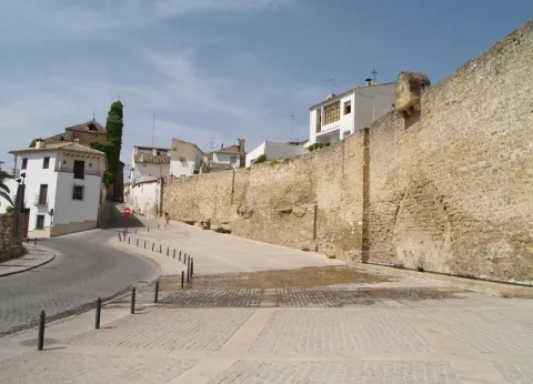
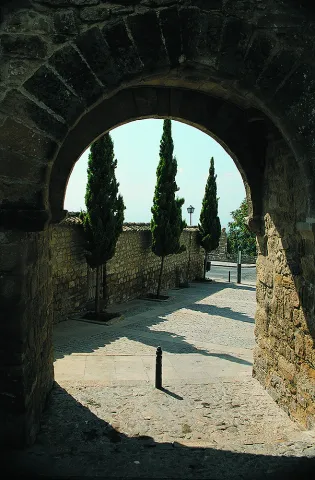
In addition to these interesting attractions, we suggest a visit to the walls to contemplate the extraordinary panorama obtained from them.

Naturaleza

It is the main center of the region called La Loma. Ubeda is located on a hill at 750 m of altitude, and is surrounded by the valleys of the Guadalquivir and the Guadalimar.

Very close, around it, are the Natural Parks of Despeñacolos, Sierra Magina and Sierras de Cazorla, Segura and Las Villas.

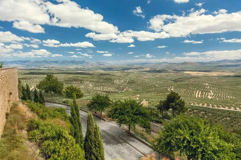
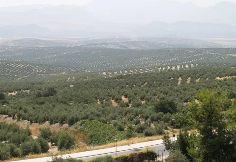
The landscape is very characteristic because it is composed of a "sea of olive trees," as the poet Antonio Machado wrote.

Fiestas y Eventos

The city of Ubeda presents a mosaic of cultural activities, festivals, fairs, romanias... Events all very deeply rooted in the population and with a very consolidated organization, which makes visitors from all parts of Spain participate.

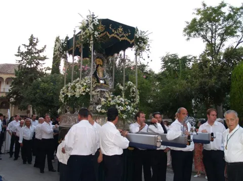
It is worth the celebration of the Holy Week, one of the most popular parties in Andalusia, being declared a National Tourist Interest Party.

On May 1, the Romeria de la Virgen de Guadalupe, patron of Ubeda and known as the "Great Romery." That day the Virgin moved from her sanctuary to the village of Santa Eulalia.

Typical are also the San Antón fires"the lumbres." On January 16, fires are made in the different neighborhoods, where sardines are roasted or the cobbled.

Special emphasis party of San Isidro Labradoron 15 May, farmers' employers and who enjoy much devotion among the olive workers.

Together with the neighbouring city of Baeza, the Festival of Ancient Music. And in the last months of the year, the puppet and tale festivals take place.

And we cannot stop quoting the San Miguel Fairon September 29, the city's patron party. And during the days of this fair the Autumn Theatre Show takes place, as well as high-quality musical activities and children's activities for all ages.

Other relevant events highlight theFlamenco and Mestizo Festival "City of Ubeda" or Exhibition of Autumn Theatre of Ubeda.

+ INFO

Gastronomía

The ubetense cuisine is basically Mediterranean, with influences both manchegas, alumina and Andalusian root.

The table includes legumes, game meat and products derived from the "slaughter of the pig," and, of course, virgin olive oil and table olives. Among the most outstanding dishes would be:

  • The crumbs (reminiscent of the shepherds in transhumanism).
  • The ointment, an olive oil cake.
  • The slick.
  • Potage of beans with eggplants.

The bars and canteens are the traditional meeting point of the ubetens. If you visit the city in September you can attend the Fiesta de la Tapa.

We cannot forget the "Gourmet days of the Renaissance". They take place from January to March in the most emblematic restaurants, where both lunch time and dinner are accompanied by shows.

Historia

The latest archaeological research shows that the first settlements of Ubeda date back to the Copper and Bronze Age (III and II millennium A.C), being the "oldest city in Europe" scientifically documented.

In search of product exchanges the Greeks will arrive and later the Carthaginians, who would be defeated by the Romans. It is under the Roman Empire, from the battle of Llipa in 206 BC, when the old city is romanized and will be known as the Betula.

The city takes on importance with the arrival of the Arabs, in particular with Abdeleran II, in the S. IX, who overlooks it with the name of Ubbada or Ubbadat Al-Arab (Ubeda "of the Arabs"). As a Muslim city it was surrounded by walls and became one of the most important cities of Al- Andalus, due mainly to its crafts and trade.

In the S. XI it will be conquered by the alparavids. And the definitive Christian conquest was carried out in 1234 by King Fernando III.

A number of factors, such as the geographical location, its extensive and rich jurisdiction, as well as the presence of an increasingly powerful nobility, would lay the foundation for the splendor that Ubeda reached in the 16th century.

The economic development of the city based on agriculture and on the feral livestock, the rotations of the forests that represented an increase in the land of cultivation, and having a mesta of its own, will base the greatest splendor of the city, which was a demographic increase to reach 18,000 inhabitants.

In addition to the ubetense nobility and the Orders of Cavalry, we found a group of neighbors who have prospered (doctors, tailor, scribes, bots...) that will lead to an incipient bourgeoisie.

To highlight the role of Francisco de los Cobos, secretary of Charles I, who, with his interest in art and under the advice of the architect Andrés de Vandelvira, fills the city with palaces. In Ubeda, take root the humanist currents of the Renaissance. It will be Juan Vázquez de Molina, Secretary of Charles I and Philip II, who will continue with the planning initiated by his predecessor.

Declive:
The 17th and 18th centuries are of decline for the city, as Spain is in a general crisis. The bad crops, the unfair pressure of taxation to cover the cost of wars, corruption, the power of the clergy, the expulsion of the Moorish, will be factors that contribute to the loss of that splendor that characterized this city.

Later, in 1820 and 1836, ecclesiastical disamortizations, Carlist wars, Civil War and post-war will come.

Recovery:
It will be in the 1960s and 70s of the last century, thanks to the development pull, when slowly it was the "Florence of Alta Andalucía" go to the present place and become a provincial reference point, head of the region of La Loma and a centre of industry and services of increasing importance.

Otra información

Known people born in Ubeda:

  • Antonio Muñoz Molina, writer and member of the Royal Academy of Language.
  • Joaquín Sabina, singer.

In Ubeda dies San Juan de la Cruzon 14 December 1591.

The popular saying of leaving or "walking on the hills of Ubeda," has its origin in the conquest of the Almohades of the Jienese city of Ubeda in 1234. It seems that one of the most important captains of King Fernando III "the Holy," disappeared moments before entering into combat, and that he appeared after the city was conquered. Asked where he had been, he replied that he had been lost by the hills of Ubeda.

Loading map
Preparing points of interest and routes...
Imagen principal
imagen
Image
9bbdff4c-5e18-d227-f40c-7c89c56fd0d7?t=1603979510184
Imagen principal
Activado
Literatura

These reasons are further enriched by the fact that San Juan de la Cruz died here, having been brought to the city to recover from a slight fever, and by the fact that it is the birthplace of Antonio Muñoz Molina, winner of the Premio Planeta and the Princess of Asturias Award for Literature.

You must come to Úbeda and venture into its streets and monuments, discovering them through the eyes of these authors. Without doubt, a different way to enjoy this monumental city.

Santiago Pontones

Submitted by brandcode_deweloper on
Id
750575
Perfil de redes sociales
Facebook
https://es-es.facebook.com/aytosantiagopontones/
Descripción
Breve descripción

Municipality formed by the localities of Santiago de la Espada and Pontones, based in Santiago de la Espada which is where the institutions are located. Until 1975 they were independent municipalities. In addition to these localities, there are 27 other population centres. Located north-east of the province of Jaén, it belongs to the region of Sierra de Segura. By extension is the largest municipality of the Natural Park of the Sierras de Cazorla, Segura and Las Villas and the second of the province. It symbolizes the deep saw, with spectacular ravines, beautiful valleys and arrogant summits, which offer idyllic landscapes. The Segura River is born in the area of Fuente Segura.

For the climate and the orography only 3% is cultivated land, dedicated to the cultivation of herbaceans. Its climatology is the coldest in the province. The economic activities are the livestock, mainly the cattle (it has several cattle cattle), the forestry, the inland tourism, hunting and fishing.

From the Architectural Heritage we highlight the Church of Santiago Apostol, the urban helmets of Santiago, Pontón Alto and Pontón Bajo and other monuments located in some of the population centres that are part of the City Council.

Telecomunicaciones
Teléfono
953 438 002 / 953 438 003
Sitio web
www.santiagopontones.es
Fax
953 438 009
Correo electrónico
ayuntamiento@santiagopontones.es
Ubicación
Nombre
Santiago Pontones
Latitud
38.118330
Longitud
-2.670260
Distrito
Municipio
Ubicación en el mapa
POINT (-2.67026 38.11833)
Imágenes
imagen
Image
dce75f72-d400-a9e8-f11a-b25ce9edbe11?t=1621443948721
Imagen principal
Desactivado
imagen
Image
ddbd58bb-7d83-95a4-8853-e41b290e6efd?t=1621443948783
Imagen principal
Desactivado
imagen
Image
4c5ef463-4e6e-a954-74aa-d355b98b6a93?t=1621443948834
Imagen principal
Desactivado
imagen
Image
faca425a-e62b-46a2-ed26-d017c6fd5c84?t=1621443948890
Imagen principal
Desactivado
imagen
Image
c9e175cd-4b5f-c8e3-050f-51a57a8ce18a?t=1621443948945
Imagen principal
Desactivado
imagen
Image
de18043b-f741-c890-7b35-dc081accb77d?t=1621443948992
Imagen principal
Desactivado
imagen
Image
78ddc946-a1c4-cf99-b9ae-1c680b4772c8?t=1621443949154
Imagen principal
Desactivado
imagen
Image
7f97a099-c6bb-bc6e-8d93-1c5c5d48b088?t=1621443949283
Imagen principal
Desactivado
imagen
Image
5aae6190-0f83-fd6a-5298-77b81bb658cf?t=1621443949420
Imagen principal
Desactivado
imagen
Image
33ab0f60-a38d-154a-2fba-409e20fe1188?t=1621443949679
Imagen principal
Desactivado
imagen
Image
cazorla-cabras-jpg
Imagen principal
Desactivado
Información adicional
Curiosidades

https://mosaicoinfinito.es/
Oficina de Información Turística: Avda. de Andalucía s/n –Santiago de la Espada
Oficina de Información Turística: Las Juntas, s/n  -Las Juntas de Miller
CENTROS DE INTERPRETACIÓN Centro de Visitantes Torre del Vinagre 
Ctra. del Tranco A-319 km 48

Imágenes cabecera
imagen
Image
Santiago Pontones
Imagen principal
Desactivado
Datos de interés

Tourist area: Serras de Cazorla, Segura and the Villas
Distance to the capital (km): 218
Altitude over sea level (m): 1340
Extension (km ²): 683
Number of inhabitants: 2,956
Gentillo: Santiagueños or Pontoneros
Postal code: 23290

Videos
Video file
Cultura
  • Church of James the Apostle: Built on an ancient hermitage in the 16th century with influences of the last Levine Gothic. It is a single ship divided by four arches, covered by a pair of armor in a row of Mudejar tradition, sustained by a half-point diaphragm arches. It reproduces the scheme of the early churches of the final Gothic, with Baroque altards and a wide wooden choir with curious craftsmen and a banner. The major Retail is from the 18th century and is the most valuable artistic element of the temple. On the outside stands the square-floor tower, which in 1763 was necessary to rebuild.
  • Urban helmets of Santiago, Pontón Alto and Pontón Bajo. The urban helmets of these nuclei are made up of streets that remember the morphology of medieval urbanism, in which regular and geometric planning is not followed, but is built according to needs. This gives rise to narrow and irregular streets with typical serrana houses: stone facades, farmed and encased, with small gaps, outstanding tiles to fire water and snow and thin chimneys.
  • Church of Our Lady of the Rosary. Located in Pontones, it has been built in the late 19th century. It is small, with a single rectangular ship and a simple facade with a stone cover, in harmony with the type of architecture surrounding it.
  • The Brush: Old inn of the 16th century. You can see a wooden balconade, a sample of the vernacular architecture, whose zapatas and balastres are well protected by the wide aldero of the roof.
  • Miller's Fort House, topped with thin aspilleras from the 13th to the 16th centuries, which could be a defensive bastion in front of the Alphavars and which was rehabilitated in the 19th century, during the Carlist wars.

It also has five declared property of Cultural Interest: The Castles of Matea and Gorgollitas, the coats ofCold River, No. Cañada de la Cruz y del Engarbothe latter, in addition World Heritage.

Naturaleza

Innailed in the Sierra de Segura, the municipality of Santiagos- Pontones, has an average altitude of 1,340 m., with a surface of 684 km ² that makes it the second municipality in extension of the province after Andújar.

Su orography which prevents its usefulness as a land of cultivation, differs with the rest of the municipalities of the province, occupying the olive tree an almost nil extension.

By the altitude it has a mountain climate, being much colder than the rest of the municipalities at all times of the year and one of the few where snow is not an extraordinary event.

Santiagos- Pontoons, fully included in the Natural Park of Cazorla, Segura and Las Villas, one of the most valuable forest areas in Spain, both for its density and variety of species.

The area of high mountain is populated by salgarean or larice pine, sabinas, maples, acebos and thorns; in the valley of Guadalquivir welcomes the engraving in addition to the black pine and in the intermediate area The dense pine trees and pastures abound. Next to the rivers and banks of the swamps develop the gallery forests: chopos, birches, willows... that put a color note in the landscape with the passage of the seasons, especially during the fall.

The fauna It is also very varied, in forests are often observed large mammals like the boar, and the muflon, and the deer, and the shrimp, and the goat, small mammals like the liron, the otter, the jineta and the common squirrel. Among the reptiles is the Valverde lizard, endemic to the area, and among the fish is the common trout.

However, the birds are the majority, for which the municipality was declared a Special Protection of Birds Zone (ZEPA). Here we can see large-scale raptures: leonate vulture, rattlers, pilgrim hawk, eagles of different species, and even broken bones.

It is also easy to see another type of smaller birds like the blue climber, common gateer, carbonero tick, piquituerto, verderon, pinzón, zorzal, picapinos..., and close to the rivers and reservoirs, the aquatic myrtle, the watershed or the bastard nightingale.

The numerous natural enclaves that are scattered by the municipal term are the best spaces that offer us the best information to appreciate the landscape, the morphology of the land, as well as the fauna and flora of this municipality. These include:

  • Pico Banderillas. A summit of almost 2,000 m (1,993 m.) altitude from which we can see beautiful panoramic views of the Natural Park of Cazorla, Segura and Las Villas.
  • The birth of the Segura. Inside the peculiar calcareous crest of Sierra de Segura, at 1,410 m of altitude, a crystalline water spring known as the Birth of the Segura River. Along its northwestern route it goes to the Mediterranean and collects the waters of the Wood, Zumeta and Tu rivers.In its surroundings there is a recreational area surrounded by a gallery forest. It's 22 km away. to the west of Santiago de la Sword.
  • Pino Galapan. It is an impressive natural monument, a 40 m tall larix pine and over four centuries old and four adults are needed to be able to surround its trunk with extended arms.
  • I jump from the organs. Next to the birth of the Borosa River, the Los Organos power plant presents a beautiful landscape that contains all the typical elements of the Natural Park. It highlights the geological environment, made up of calcareous formations of unusual forms that cause grotto and caves of great beauty.

Fiestas y Eventos

The traditional parties are very numerous in this municipality, because most of the population centers celebrate their own popular parties.

During these many and varied activities are carried out, such as the Romeria in honor of the pattern of each of the localities, the champions of the serrano bowling, popular verbenas, horse racing, children's games.... In Santiago de la Espada, Pontones and La Matea, there are also the popular bulls of braves, which are brought from the field to the square and which are tasted in the afternoon.

22 May Santiago de la Espada the Romeria of Santa Quiteria. The tradition of eating "hornazo" on that day has continued since the 16th century.

In mid-June, parties are held in the village of The Cerezo in honour of the Sacred Heart and during the last days of the month, festivals of the Virgin Miracle in La Matea

In July many villages celebrate their holidays: in Miller Santa Isabel, in the Atascaderos the Virgin of Carmen, on the 25th Santiago in Coto Ríos.

It is the month of August when more parties are held: Carrasco houses in honor of San Antonio, in Pontones the Virgin of the Rosary, in Pontón Alto meeting in which the neighbors prepare crumbs. In honor of the Immaculate Conception, parties are held in La Toba, Los Teatinos and Santiago de la Sword.

During the month of September the feast in honor of the Immaculate Conception takes place in Marchena. Maybe it's the party where the most traditions are preserved. Between 15 and 17, the Santiago de la Sword Livestock Fair And we finished with the Ponton Livestock Fair on October 12.

Gastronomía

It is to the transhumanous pastors to whom the municipal term of Santiago - Pontones owes the particularity of the serrana food, made with great patience as the saying indicates: "the crumbs of the gañan at both turns are, and the crumbs of the pastor the more the better."

  • The following lamb, star product of the local gastronomy.
  • Segureño lamb dish: lamb, red pepper, onion, garlic, pepper, laurel, water, white wine olive oil, flour, black pepper, vinegar and salt.
  • The sausages: from the massacres of the past.
  • Guisote: made of pork, potatoes, onion, pepper, peppers, tomatoes, spices and very fine minced almonds.
  • Gachamita: Made of flour, potatoes, oil or a "garlic."
  • The Pontoon's "spoon": Meat with garlic, olive oil, parsley, spices, aromatic herbs and pepper. It is left to rest and made in the oven in a casserole.
  • The "dyed rabbit 'means: dish that the shepherds prepare. The skin is removed and joined with butter, wine, aromatic herbs and spices and the skin is replaced.
  • Let us quote also, The Migas, El ajoatao, El ajo pringue, Las andrajos...

Warehouse: The fried donuts, the flowers, the chandelier of egg-plated mass...

The Carrascana catfish It is made in the villages of Vites, Tobos, La Marchenica, La Muela and Miller.

Historia

The municipality of Santiago Pontones was born from the merger carried out by decree in 1975 between the municipalities of Santiago de la Espada and Pontones.

In the Cave of Birth in Fuente Segura (Pontones), the oldest human occupation of the province has been documented with absolute dates. A community of kinship who lived from the hunt. To this first phase of occupation is added another in the Neolithic and to a later one belongs the coat of Rio Frio, where a collective tomb has been found.

The cave paintings of the Caves of Engarbo I and II, the Abrigo de Río Frio and the coat of the Cañada de la Cruz must be highlighted. All of them are included together with all of those who make up the Rupestre Art of the Spanish Mediterranean Arc on the list of World Heritage made by UNESCO in 1998.

+ INFO

In the forty years of the last century, a great treasure of goldsmiths was found, which is supposed to be of the first century BC. It is composed of more than a hundred objects, highlights a set of gold earrings in the form of a grape cluster, of Iberian manufacture, which inserts a figure of winged woman. It should be noted that these pieces are included among the key works of Iberian art. It is preserved at the Instituto Valencia de Don Juan in Madrid.

During Muslim period the municipal term of Santiago - Pontones was populated by numerous fortifications and alqueras or small populations. In the municipal term there are traces of fortified enclosures among them the Castle of Miller, or the castle of the Gorgolillas. This area was conquered to Muslims around 1247, by the Order of Santiago becoming part of its domains.

James of the Sword was founded in 1525, with its origin being a group of pastors who came with their cattle to this place, whom they called "The Bake.". For the Endowment of Santiago was "Puebla de Santiago" which in 1570 was declared a village by King Philip II, although under the jurisdiction of Segura de la Sierra. It was later declared "Villa de Santiago" and around 1770 would be given the current name: "Santiago de la Sword".

Pontones, in the time of Philip II was a village of Segura de la Sierra called "El Pontón," reached its independence in 1837 with a municipal term of about 200 km ²., being called "Pontones de Segura." Its work, legal and economic activities were regulated by the ordinances of the Segura Common from 1580 and was later part of the Maritime province.

The entire municipal territory is included in declarations of protection and conservation of the Sierra de Segura:

  • National Court on 21 July 1960
  • Declaration by UNESCO as a Biosphere Reserve on 30 June 1983
  • Natural Park on 5 February 1986
  • Special protection of birds by the EEC in 1988
Otra información

It has more than ten peaks with an altitude of more than 1.800m. With an extension of more than 700 km2 the distance between some points of the municipality exceeds 100 km.

Loading map
Preparing points of interest and routes...
Imagen principal
imagen
Image
Santiago Pontones
Imagen principal
Activado

Santa Elena

Submitted by brandcode_deweloper on
Id
750455
Perfil de redes sociales
Facebook
https://www.facebook.com/AyuntSantaElena/
Twitter
https://twitter.com/santaelenajaen
Youtube
https://www.youtube.com/user/santaelenajaen
Descripción
Breve descripción

Nice town, located in the northernmost area of the Sierra Morena regionnext to the provincial border with Ciudad Real.

The northern part of its term is found within the Natural Park of Despeñapores and its geographical position makes it the greatest point of passage between Andalusia and the plateau so it receives the nickname "Puerta de Andalucía. "

It is one of the few municipalities with little agricultural interest, only 1% of its term is cultivated land.

Its economy is based mainly on the exploitation of the mountain, among which the forest, cynegetic, mushroom collection and livestock, usually cattle. The passage of the motorway of Andalusia has developed a relevant hotel offer.

It has two nests: Miranda del Rey and Venta Nueva.

From its historical heritage we highlight the St. Helena Parish Church, Iberian Shrine of the Collado de los Jardines, Urban Helmets and Rupestrian Paints in St. Helena.

Telecomunicaciones
Teléfono
953 664 010
Sitio web
www.santaelena.es
Fax
953 664 253
Correo electrónico
santaelenajaen@gmail.com
Ubicación
Nombre
Santa Elena
Latitud
38.340230
Longitud
-3.539800
Distrito
Municipio
Ubicación en el mapa
POINT (-3.5398 38.34023)
Imágenes
imagen
Image
56f3a98d-b73d-3f55-8527-4d32fc56ae8f?t=1621425534983
Imagen principal
Desactivado
imagen
Image
e0fb7c79-3e7f-346a-cc16-3c8006bb9462?t=1610986998582
Imagen principal
Desactivado
imagen
Image
3429e098-1c49-2cdf-4ef5-179be64fce14?t=1621425535119
Imagen principal
Desactivado
imagen
Image
4e91cd6e-bea0-d427-df82-939c7ce7f23c?t=1621425535162
Imagen principal
Desactivado
imagen
Image
10c50cba-ee4b-ebcf-0e3e-0d11e8e97728?t=1621425535219
Imagen principal
Desactivado
imagen
Image
0c44f832-9d15-336d-b8e7-72044fea6e76?t=1610986998629
Imagen principal
Desactivado
imagen
Image
b5682c3b-4bf3-f730-fe45-52d0391f170c?t=1621425535421
Imagen principal
Desactivado
imagen
Image
78ede978-44df-d8c2-c363-f10c79bea024?t=1621425535584
Imagen principal
Desactivado
Información adicional
Curiosidades

OFICINAS DE INFORMACIÓN Centro de Visitantes LLANO DE LAS AMÉRICAS

  • Autovía A4, salida 257. Ctra. Miranda del Rey, Km. 2   
  • (Abierto de jueves a domingo)
  • Tfno.: 610 282 531
  • Email: puertanatura@hotmail.com
Imágenes cabecera
imagen
Image
Santa Elena
Imagen principal
Desactivado
Datos de interés

Tourist area: Sierra Morena / Despeñacolos

Distance to the capital (km): 78

Altitude over sea level (m): 742

Extension (Km2): 144

Number of inhabitants: 1,003

Gentilicon: Santaeleneros

Postal code: 23213

Videos
Video file
Cultura
  • St. Helena Parish Church: It was erected in 1793 on an ancient medieval hermitage, which had been raised to commemorate the Christian victory in the battle of the Navas de Tolosa, which had these sites on stage and to guard the Cross to which the miracle was attributed. Built of redesigned and painted masonry, with a simple facade, of small dimensions. A staircase stands out the access door, composed of a half-point arch on imposts, flanked by Tuscan pillars that give way to an inlet finished with triangular fronton and two bones, one on each side. On the top of the first body, the pyramidal structure is raised to three levels, with pinacles at the ends and half-point holes for bells. Inside it is a single drawer ship, covered with a half-canyon vault and double lunetes on the sides. The presbyterium is opened with a spinal arch, covered with an arista vault and illuminated with two large bone-shaped windows. The header is presided over by the image of its patron saint, St. Helena, between dogrous columns that support an injunction and a curved fronton. It was remodeled in 2001.
  • Iberian Shrine of the Collado de los Jardines: It is located in the heart of Sierra Morena Oriental, on the most important traditional road of communication between Alta Andalucía and the Plateau. For the Iberian shrines they chose places, usually caves, located next to springs and forests, where it was thought that the divinity lived and where the faithful went to worship, pray and deliver offerings to their divinities. These offerings were what we know as "exvotes," small statues, between eight and twenty cm, made of bronze, stone or mud. In Iberian Shrine of the Collado de los Jardines There have been many exvotes, most of them bronze, representing men and women offering, priests, warriors and objects. It is part of the whole town that was excavated on the hill adjacent to the castle, where a wall, a sacred enclosure and a cast of metal exvotes have appeared. We meet before one of the three great Iberian shrines of the peninsula.
  • St. Helena's Urban Helmets:Given its geographical location, a forced passage between the plateau and Andalusia, has experienced many historical events. The Battle of the Navas de Tolosa in 1212 in which King Alfonso VIII of Castile defeated the Almohades. To commemorate this battle, a hermitage was erected in honor of the Empress St. Helena, who would later name this place and the new population, which King Charles III founded in 1767. In the colonizing urbanism of Sierra Morena, the most important element is the large rectangular square, from which they leave streets on each side and where are the important buildings, such as the Church, the City Hall and the posite of Diezmos and Labradores. The rest of the town is organized from the Plaza. The streets are dominated by axial perspectives, houses of the same height and proportions, reticular fabric and geometric structure. It only deviates from the neoclassical model on its perimeter, to adapt to the road. It has been declared Good for Cultural Interest.

  • Rupestrian Paints: The province of Jaén has more than forty points with rock paintings, declared World Heritage Sitewithin the whole Mediterranean arc. Some of them are found in St. Helena with exceptional testimonies of schematic and seminaturalist paintings, located in coats of the area, including those of the Cave of the Cows of the Retamoso in the area of the bodies, Cave of the Holy, the Cave of the Schools and some more.
  • Mining Heritage. The landscape of ancient mines and Mediterranean mountains of the former Minero District extends to eight municipalities: Linares, La Carolina, Bailén, Baños de la Encina, Vilches, Guarroman, Santa Elena and Carboneros. This mining activity has left in these municipalities an exceptional concentration of remains, unique vestiges in the world and representative of the industrial revolution in the 19th century.
Naturaleza

St. Helena is located in the northernmost sector of the northern region, next to the border with the province of Ciudad Real.

It is of the few municipalities of the province without agricultural vocation, only 1% of the total area. So its economy is based on development of the mountainincluding forest, cicnetic, mushroom collection and livestock (cattle).

The passage of the highway of Andalusia through the municipality has developed in the town a certain hotel offer of importance.

By its term the rivers run Caraway and Bell.The northern part of the municipality of St. Helena belongs to the Natural Park of Despeñacolos, of great landscape, faunistic and botanical interest.

The Park includes, among others:

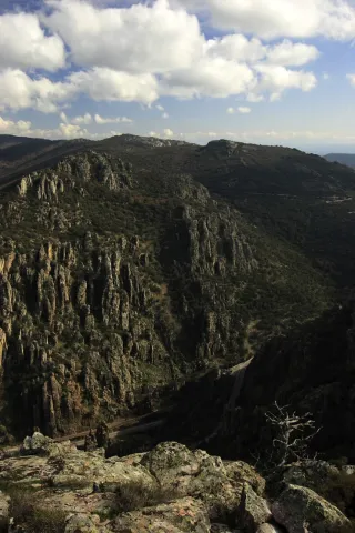
  • Place of the bodies, declared a Natural Monument of Andalusia. A place where a set of huge rock columns that resemble the tubes of the organ of a cathedral. Increases the beauty of this place the chromatic contrast of the grey of the coas with the intense yellow and orange of the different species of lichens that survive in them. On these rocks, oaks, alcornoques and shrubs form a Mediterranean forest in which they inhabit ginets, chickpeas and numerous rapacious birds.
  • Embryo de los Organos: It is an affront place that was inhabited from very old, as shown by the rock paintings found. From here we can discover the pineapples of repopulation (carrascos, black, pineapples), sodas of alcornoques, complaints, oaks and madroños.
  • The Empedraillo: These are the interesting remains of a small section of the Roman road that unites Catulo (Linares) and the Galena mines of El Centenillo with Toledo.
  • Quejigal del Collado de los Jardines: Also located in the Natural Park of Despeñacolos, its biodiversity stands out. In the plant species we find complaints, alcornoques, maples and other species typical of the Mediterranean forest. With regard to the faunistic species that inhabit this place quote the wolf, lince, the otter, imperial eagle, royal eagle and azor.

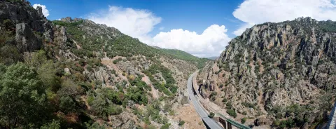
If anything characterizes Despeñacolos are their unique geological formations. The Despeñapoerno de Despeñaperes, with 4 km of extension is the product of the erosion of the stream of the same name on a natural failure of the Iberian Macizo and the main means of communication between Castilla La Mancha and the lower lands of the Guadalquivir valley.

Fiestas y Eventos
  • Sunday of Resurrection: From the Central European settlers who came in the 18th century, only the tradition of painting cooked eggs, which are eaten in the area of La Aliseda, is left. Before you have to meet the rite of making them roll by a earring of grass so they don't break. This has meant that, in St. Helena, the feast of this very well-known day is known as Rolaeggs.
  • Romeria de San Isidro: On May 15, the neighbors of St. Helena accompanied San Isidro, in gilded carrots for that party until the site of The Aliseda. In this place, of incomparable beauty, a mass is held in honor of the Holy and a whole day of field is spent.
  • Patron parties: In honor of their patron saint St. Helena, parties are held between 17 and 21 August. During all these days there are many and varied leisure and sports activities. On the 17th, with the traditional repeat of bells, the beginning of the parties is announced and the three rocket warnings indicate the beginning of the cobblestones in the streets of the town. In the afternoon, taurino show. We arrived at 18 August, big day. In the morning Mass in honor of the Holy and invitation to all attendees in one of the houses. At night, the most important event of the whole fair that is the procession of the Patronthat accompanied by a music band runs through the streets of the village. On the 20th and 21st days, the morning and evening cobwebs and taurino festival return. The fair ends with a powerful haze on the 21st of the morning.
Gastronomía

St. Helena for its location in Sierra Morena is a very suitable place to take mountain meat, either from major game (deer, boar or gamo) or from small game (perdiz, rabbit or hare).

  • Andrajos: Made with a mass of flour (andrajo) that is cooked in a broth of hare meat with a saffrito of peppers and tomatoes flavoured with mint.
  • Pipirrana: Salad made from roasted peppers, olives, cooked eggs, tuna and olive oil.
  • Sage in salsa: It is made with deer meat, onion, tomato, flour, water, thyme, rosemary, peppers, olive oil and almonds.
  • Niselos al ajillo: Niscalos, olive oil, ham, garlic, parsley white wine and salt.
  • Tortilla Alfonso XIII: Made of eggs, ham, lamb kidneys, mushrooms, salt, fried tomato and olive oil.

Warehouse:

  • Sweet Gachas: With toast, hot milk or boiler honey, flour, sugar, cinnamon powder olive oil. They are preparing for the feast of All Saints.
  • Pestiños: They are made with olive oil, wine, dry spirits, sugar, cinnamon and flour.
  • Lis flower: Eggs, flour, milk, sugar and olive oil, salt and cinnamon or melted honey for irrigation.
  • Risol: A drink made with sweet anis, coffee, mejana and water.
Historia

The area has been occupied from prehistoric periodAs shown by the rock paintings located in the area's coats, with more than five thousand years old and declared a World Heritage Site in 1998.

In time of the Iberiansin the term of St. Helena was one of the most important centres of worship: Shrine of the Collado de los Jardineswhere many Iberian exvotes and the remains of what could have been a village have been located, not only in Iberian times but also in Roman and medieval times. The sanctuary also known as Cave of the Dolls has been used by the Romans for religious worship.

In the Age of Mediathe most important event is the Battle of the Navas de Tolosain 1212. The town is very close to it, in the vicinity is the Museum of the Battle de las Navas de Tolosa. The Almohade army was defeated and King Alfonso VIII of Castilla, ordered to build in the place a hermitage to guard the Cross to which they attributed the miracle of victory and a window-castle, to commemorate the triumph over the Almohades and that currently It is part of the Route of the Castles and the Battle.

In this same place in the 18th century, one of the New populations of Sierra Morena, project driven by the King Charles III. One of these populations is St. Helena. With the settlers, farmers from Centroeuropa (French, German and Flemish), efforts were made to establish a population and generate wealth in the depopulated areas of Sierra Morena while ensuring the passage of Despeñacolos.

In 1793, the population was in a ruinous state and it was King Charles IV who ordered it to demolish and build a new colonial type..

Otra información

It has recently been built in the municipal term, the Museum of the Battle of the Navas de Tolosa. The museum is one of the most interesting points on the route of the Castles and the Battle and is the starting point for the seventeen municipalities that make up this tourist product. Very close is the Iberian Sanctuary of La Cueva de los Muñecos and The "Llano de las Américas" Interpretation Center.

Loading map
Preparing points of interest and routes...
Imagen principal
imagen
Image
Santa Elena
Imagen principal
Activado