Saltar al contenido principal

Casa de Máquinas

Submitted by brandcode_deweloper on
Id
4531449
Descripción
Descripción larga
Location: North-west of the town centre, right on the Guadalimar river. Distance: 8 km. Means of access: By car and on foot. Access route: Leaving via the JA-4108 road, towards Torreblascopedro.
Breve descripción
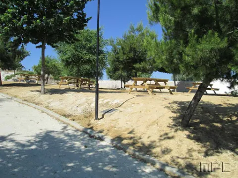
This is a dense grove located next to the Guadalimar, to the north of the municipal district of Lupión, where visitors can observe the typical riparian vegetation growing along both banks of the river.
Ubicación
Latitud
37.99741
Longitud
-3.54633
Municipio
Ubicación en el mapa
POINT (-3.54633 37.99741)
Tipos de punto de interés
Imágenes carrusel
imagen
Image
30.jpg
Imagen principal
Desactivado
imagen
Image
32.jpg
Imagen principal
Desactivado
Imágenes cabecera
imagen
Image
31.jpg
Imagen principal
Activado
Loading map
Preparing points of interest and routes...

Los Llanos (Higuera de Calatrava)

Submitted by brandcode_deweloper on
Id
4677120
Descripción
Descripción larga
Characterised by a hollow or plain enclosed on all four sides, with a narrow outlet serving as an overflow for the stream known as Arroyo de Los Llanos, which crosses it from east to west on its way to the Arroyo Salado, into which it flows near La Alameda. Los Llanos is a fertile plain of around 50 hectares, surrounded by hills that shape a landscape with a hard-earned reputation for harshness. This spot tends to record the municipality's most extreme temperatures in both winter and summer, with frequent frosts in winter and extremely scorching heat on summer afternoons. These factors, combined with the moisture the soil retains, make it ideal for cereal farming but not very suitable for extensive olive cultivation. Inhospitable as it is, all that remains here are the ruins of the Cortijo de las Canteras, so named for having been built next to old quarries, and the heavily altered farmhouses of Cruz del Carrero and the nearby Corneta. Of two other farmhouses that once stood on the same plain, barely a shadowy trace of their threshing floors remains in what is now cultivated land. This depopulation has allowed birds of prey and steppe birds to take over the site, and it is not unusual to see Montagu's harriers, as well as owls, barn owls and others. From the surrounding hills, there are wonderful panoramic views over the whole area around Los Llanos, Los Llanos del Salado, Cerro Girón, La Hondonera, Matamujeres, as well as the entire surroundings of Higuera and even Porcuna and other spots in the Martos countryside.
Breve descripción
Located next to the Torredonjimeno regional road (JV-2121), on the boundary between the municipal districts of Higuera de Calatrava and Torredonjimeno, lies this distinctive natural spot.
Ubicación
Distrito
Tipos de punto de interés
Imágenes carrusel
imagen
Image
llano.png
Imagen principal
Desactivado
Imágenes cabecera
imagen
Image
13.jpg
Imagen principal
Activado

Las Atalayuelas

Submitted by brandcode_deweloper on
Id
4518307
Descripción
Descripción larga
With extensively studied archaeological sites dating back to the 2nd millennium BC, which have made it possible to reconstruct the earliest history not only of this municipality, but of the whole Campiña Norte region of Jaén, since it later provided shelter and defence to successive cultures up to the Roman period. The Romans marked out its territory with towers — including those of Calvete and El Espino — and restructured its urban layout during the early Roman Empire, eventually being recognised as a city under Vespasian.
Ubicación
Latitud
37.86237
Longitud
-3.87414
Distrito
Municipio
Ubicación en el mapa
POINT (-3.87414 37.86237)
Tipos de punto de interés
Imágenes carrusel
imagen
Image
Atalayuelas.jpg
Imagen principal
Desactivado
Imágenes cabecera
imagen
Image
Yacimiento_de_las_Atalayuelas.jpg
Imagen principal
Activado
Loading map
Preparing points of interest and routes...

Las Aceñas

Submitted by brandcode_deweloper on
Id
4524292
Descripción
Descripción larga
This spot is home to the spring that once supplied the whole town with drinking water. Location: In Toledillo. Distance: 2 km. Means of access: Car. Access route: Via a track leading directly from the town centre.
Ubicación
Distrito
Municipio
Tipos de punto de interés
Imágenes carrusel
imagen
Image
008-Central-San-Rafael.jpg
Imagen principal
Desactivado
Imágenes cabecera
imagen
Image
012-Central-San-Rafael.jpg
Imagen principal
Activado

Paraje Santa Ana

Submitted by brandcode_deweloper on
Id
4524590
Descripción
Descripción larga
Home to one of the largest holm oak reserves in Andalusia, with close to 1,000 trees.
Ubicación
Latitud
38.03272
Longitud
-3.86207
Distrito
Municipio
Ubicación en el mapa
POINT (-3.86207 38.03272)
Tipos de punto de interés
Imágenes carrusel
imagen
Image
Paraje%20Santa%20Ana.jpg
Imagen principal
Desactivado
imagen
Image
Paraje%20Santa%20Ana2.JPG
Imagen principal
Desactivado
Imágenes cabecera
imagen
Image
parajesantaana%20%281%29.jpg
Imagen principal
Activado
Loading map
Preparing points of interest and routes...

Fuente Palacios

Submitted by brandcode_deweloper on
Id
4650607
Descripción
Descripción larga
Since the mid-20th century, the Romería de San Isidro has been held at Fuente Palacios on 15 May, in which the patron saint of farmers is carried in procession from Higuera de Calatrava to his hermitage, where locals gather for lunch and spend a festive day featuring float and horse competitions.
Breve descripción
The Fuente Palacios Natural Site is located very close to Higuera de Calatrava, barely a kilometre south of the town centre, and is reached via the J-2110 road towards Santiago de Calatrava. This natural spot, also known as San Isidro after the hermitage of the same name found here, offers beautiful views, thanks in particular to a large grove of trees. It has a good range of facilities for recreation and leisure, a picnic area without tables, a stage, a play area and a hostel currently under construction.
Telecomunicaciones
Sitio web
www.higueradecalatrava.es
Teléfono de contacto
953 529107
Ubicación
Código Postal
23611
Latitud
37.785080521129764
Longitud
-4.152102550592038
Dirección
Cortijo de Fuente Palacios
Distrito
Ubicación en el mapa
POINT (-4.152102550592 37.78508052113)
Tipos de punto de interés
Imágenes carrusel
imagen
Image
Fuente%20Palacios%20%281%29.jpg
Imagen principal
Desactivado
Imágenes cabecera
imagen
Image
natural8.jpg
Imagen principal
Activado
Loading map
Preparing points of interest and routes...

Parque de las Eras

Submitted by brandcode_deweloper on
Id
8113062
Descripción
Breve descripción
Located in the upper part of the town. It has wooden benches, a fountain and large shaded areas for relaxing and enjoying a wonderful day outdoors.
Telecomunicaciones
Teléfono de contacto
953 37 60 11 / 953 37 61 17
Correo electrónico
ayuntamiento@fuertedelrey.es
Ubicación
Código Postal
23180
Latitud
37.87327
Longitud
-3.88616
Dirección
C/ las Eras.  Fuerte del Rey
Distrito
Municipio
Ubicación en el mapa
POINT (-3.88616 37.87327)
Imágenes carrusel
imagen
Image
Parque%20de%20las%20Eras%2C2.jpg
Imagen principal
Desactivado
Imágenes cabecera
imagen
Image
Parque%20de%20las%20Eras%2C.jpg
Imagen principal
Activado
Loading map
Preparing points of interest and routes...

La Iruela

Submitted by brandcode_deweloper on
Id
918750
Descripción
Descripción larga

Next to the castle you will find the ruins of the Church of Sto. Silos Sunday. The legend tells that it was built on the place where the Arabs held captive Christians in prison and there was Santo Domingo doing his job. In the building there are traces of the disciples of Vandelvira. It's a must-see for any lover of history.

The Iruela was part of Cazorla until 1370, when Archbishop D. Gome Manrique gave it independence, power and shield. His political and territorial position has allowed him to preserve an important heritage: the Conistory House - a proud building in the Mudejar style of Toledan - and the Church of the Immaculate Conception are part of this legacy.

The population has a core worth visiting. The streets are steep and narrow, with crouched houses and flowers on the balconies. In the center there is a beautiful fountain from which several roads arise to surround the village. From here you can go up to Temple Street on a beautiful stone road accompanied by fig trees and cypresses.

We suggest:

  • About five minutes from La Iruela you will find Burunchel. Come to know the Hermitage of San Julián and the temple of the Holy Spirit among other attractions of this pedany.
  • On August 27, during the summer parties of the village you will see a curious pyrotechnic show, in which the castle is also the protagonist.
Breve descripción

The road that goes up to the saw from Cazorla borders this small, but amazing population. Its best known profile is due to the castle, a legendary fortress that became owned by the Templars and dominates the Guadalquivir Valley. The need to defend itself has given rise to this fortification which, because of its most abrupt aspect, is inexortable. But the Iruela is more attractive.

Ubicación
Latitud
37.920351
Longitud
-2.994140
Municipio
Ubicación en el mapa
POINT (-2.99414 37.920351)
Tipos de punto de interés
Imágenes carrusel
imagen
Image
iruela.jpeg
Imagen principal
Desactivado
Imágenes cabecera
imagen
Image
La-Iruela-Jaen-nuevo-municipio-turistico-de-Andalucia-foto-de-Junta.jpg
Imagen principal
Activado
Loading map
Preparing points of interest and routes...
Marcas de calidad

Mágina Peaks and Miramundos Zone

Submitted by brandcode_deweloper on
Id
5846349
Descripción
Breve descripción

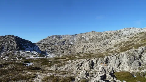
In this summit crest is the roof of the province: the Pico Magina, with 2,167 meters of height, which is the third highest altitude of Andalusia, after the massizos of Sierra Nevada and the Sierra de Baza. The vegetation and conditions are typical of the high Mediterranean mountain.

Ubicación
Latitud
37.730270
Longitud
-3.445830
Distrito
Ubicación en el mapa
POINT (-3.44583 37.73027)
Tipos de punto de interés
Imágenes carrusel
imagen
Image
17%20Magina.JPG
Imagen principal
Desactivado
imagen
Image
naturaleza_14268337_20191208114422%20%281%29.jpg
Imagen principal
Desactivado
imagen
Image
9788440Master%20%282%29.jpg
Imagen principal
Desactivado
Imágenes cabecera
imagen
Image
P1240066%20%282%29.jpg
Imagen principal
Activado
Microsite al que pertenece
Loading map
Preparing points of interest and routes...

Roman Villa of Bruñel

Submitted by brandcode_deweloper on
Id
919543
Descripción
Descripción larga

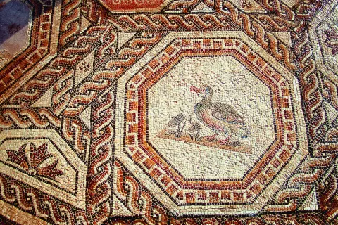
Most of these buildings are based as a second residence during the High Empire, although with the crisis of the third century and the insecurity of the cities many great aristocrats withdraw to their villages. As the residence becomes, the luxury and refinement of which the rich mosaics and the beginning of the walls of the different rooms are preserved as a testimony. Next to the Palaciega area there were other units with stables, with forges, alfares and, ultimately, everything necessary to be self-sufficient away from the city. Over time, the cities lost their importance, had to wafer to avoid dangers and the cultural spotlights that had gone out.

If we know nothing about the inhabitants of these luxurious rooms, we know less about those people who left the city to take refuge in these villas. They helped defend property in exchange for being able to cultivate a piece of land with which to get what is necessary to feed. Here is the origin of what would be the vasalage in the Middle Ages. Nor do we know how the craftsmen made these great mosaics, nor their living conditions, would they know that they represented the images they reproduced with the tesels? and the last inhabitants at the end of the fourth century?

Breve descripción

The villa of Bruñel represents the typical model of Roman villa that begins to extend during the Lower Empire.

Ubicación
Latitud
37.842982
Longitud
-3.066921
Municipio
Ubicación en el mapa
POINT (-3.066921 37.842982)
Tipos de punto de interés
Imágenes carrusel
imagen
Image
Mon167.jpg
Imagen principal
Desactivado
imagen
Image
quesada.jpg
Imagen principal
Desactivado
Imágenes cabecera
imagen
Image
DQxszNiU8AAV39W.jpg
Imagen principal
Activado
Loading map
Preparing points of interest and routes...
Marcas de calidad