Saltar al contenido principal

Recreational Zone río San Juan

Submitted by brandcode_deweloper on
Id
1909649
Descripción
Descripción larga

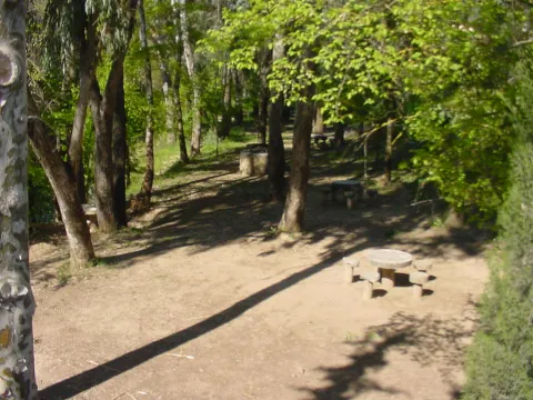
It is a very quiet area, surrounded by endless olive fields, where there are fountains with drinking water, barbecues, tables and seats. In the river you can practice, in season, fishing of the common trout and the barb, or practice swimming.

Breve descripción

This recreational area is located in the area known as the Palomillas Bridge

Ubicación
Latitud
37.540246
Longitud
-4.039030
Dirección
Carretera comarcal JV-2236 de Sabariego a La Rábita, en su cruce con la carretera N-432 Granada - Badajoz.
Distrito
Municipio
Ubicación en el mapa
POINT (-4.03903 37.540246)
Imágenes carrusel
imagen
Image
4%20%281%29.jpg
Imagen principal
Desactivado
imagen
Image
1%20%281%29.jpg
Imagen principal
Desactivado
imagen
Image
10.jpg
Imagen principal
Desactivado
Imágenes cabecera
imagen
Image
3%20%281%29.jpg
Imagen principal
Activado
Microsite al que pertenece
Loading map
Preparing points of interest and routes...

Mágina Peaks and Miramundos Zone

Submitted by brandcode_deweloper on
Id
5846349
Descripción
Breve descripción

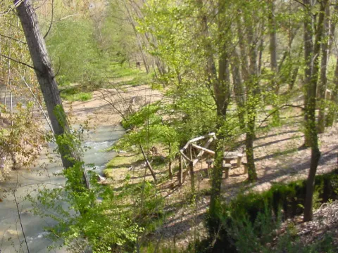
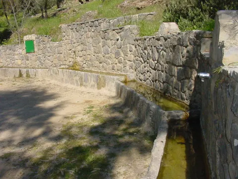
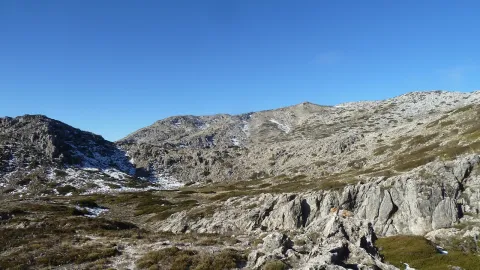
In this summit crest is the roof of the province: the Pico Magina, with 2,167 meters of height, which is the third highest altitude of Andalusia, after the massizos of Sierra Nevada and the Sierra de Baza. The vegetation and conditions are typical of the high Mediterranean mountain.

Ubicación
Latitud
37.730270
Longitud
-3.445830
Distrito
Ubicación en el mapa
POINT (-3.44583 37.73027)
Tipos de punto de interés
Imágenes carrusel
imagen
Image
17%20Magina.JPG
Imagen principal
Desactivado
imagen
Image
naturaleza_14268337_20191208114422%20%281%29.jpg
Imagen principal
Desactivado
imagen
Image
9788440Master%20%282%29.jpg
Imagen principal
Desactivado
Imágenes cabecera
imagen
Image
P1240066%20%282%29.jpg
Imagen principal
Activado
Microsite al que pertenece
Loading map
Preparing points of interest and routes...

Town Planning of Aldeaquemada

Submitted by brandcode_deweloper on
Id
5869042
Descripción
Descripción larga

We can also find other architectural monuments in Aldeaquemada, which come from the time of the colonization of Charles III, highlighting:

• Church of the Purple Conception (18th century). A colonial-type church with a single ship. A vertical trend in relation to the rest of the buildings. Its facade is made of brick and is articulated in two bodies. In the first one, in rectangular form, the only differentiated elements are a narrow cover with a half-point arch and above, two lunetes that keep the line of horizontality. In the second body, a slight swordsman with a bell tower is triangulated, culminating in a small front. There are two houses on both sides of the church, corresponding to the old house of the priest and the post commander.

• The Comandante's House has also come to serve as a city hall for many years and even... The poultry house where bulls and bravas were locked up during the holidays of San Miguel! It is now the Retired Home, renovated and opened in April.

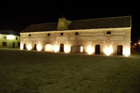
• Diezm and Labrador site (18th century). Building of the time of colonization and present in all the foundations of Charles III. It was dedicated to housing the cereals harvested by the farmers and as a warehouse in times of famine. Current town hall of the town, it is built in brick, of rectangular floor, of two floors and roof to two waters where it has a discreet structure of grabbard brick that houses the city's watch. New atypical uses: some of their rooms have performed the role of dungeon, home of the retired, butcher's shop, teleclub and, of course, municipal warehouse.

Breve descripción

Aldeaquemada was born as a crossroads of roads, faithful to that function is the layout of its streets: rectangular urbanism, with long rectilinear axes. Aldeaquemada, is certainly the "Perla urbanística de Sierra Morena," for its urban innovations of structuring the streets on cross-sectional axes that divide it into squares and for the conservation of its original layout, hence it can be considered the entire urban town of the town as one more monument. The streets are perfectly aligned with the cardinal points, and the church with the altar
East.

Telecomunicaciones
Sitio web
www.aldeaquemada.com
Teléfono de contacto
680 104 199
Correo electrónico
turismo.aldeaquemada@gmail.com
Ubicación
Código Postal
23215
Latitud
38.412120
Longitud
-3.373310
Distrito
Municipio
Ubicación en el mapa
POINT (-3.37331 38.41212)
Tipos de punto de interés
Imágenes carrusel
imagen
Image
Aldeaquemada.png
Imagen principal
Desactivado
imagen
Image
Urbanismo_Aldeaquemada.jpg
Imagen principal
Desactivado
Imágenes cabecera
imagen
Image
Aldeaquemada%202.jpg
Imagen principal
Activado
Loading map
Preparing points of interest and routes...

19th-century Clock Tower

Submitted by brandcode_deweloper on
Id
1735371
Descripción
Descripción larga

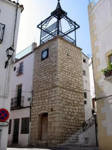
It's a square-floor turret. The construction in 1883 of this bell tower, in which new techniques of work with cast iron were used and a new public watch was installed, was a symbol of modernity that reflected the influence of the industrial revolution that was taking place at the national level.

At the end of the 19th century, Albanchez lives a period of expansion thanks to the agriculture of the olive tree, doubling the population.

The iron inscription of the watch reads:

"Coised with municipal funds being mayor Don Sebastian Ogayar León Year 1883".

Breve descripción

Square floor turret built with masonry. It is topped by a bell tower of cast iron structure built in 1883.

Telecomunicaciones
Sitio web
www.albanchezdemagina.es/el-municipio/patrimonio-historico.html
Teléfono de contacto
953 347 009
Correo electrónico
ayuntamiento@albanchezdemagina.es
Ubicación
Código Postal
23538
Latitud
37.791732
Longitud
-3.463718
Dirección
C/ Abogado Mesías, 8
Distrito
Ubicación en el mapa
POINT (-3.463718 37.791732)
Tipos de punto de interés
Imágenes carrusel
imagen
Image
t.%20del%20reloj%20XIX%202.jpg
Imagen principal
Desactivado
Imágenes cabecera
imagen
Image
main_image_43951.jpeg
Imagen principal
Activado
Horario
24 h.
Microsite al que pertenece
Loading map
Preparing points of interest and routes...
Interés

Tower of the Lucero

Submitted by brandcode_deweloper on
Id
7984365
Descripción
Descripción larga

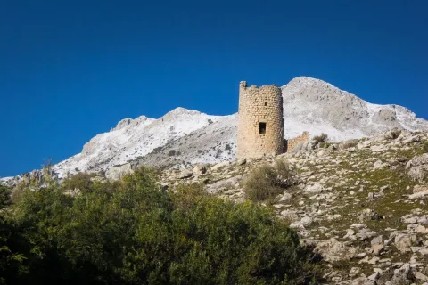
According to the description of several authors, 3? 4? 5? more than a watchtower would be a chastisement. Built in well-trimmed masonry, its plant is cylindrical with a semicircular wall that protects the entrance. It is located in height (about 2 meters above the ground level) and still retains remains of wood lintel from the door and its cap. There must have been a second floor, as inside the tower remains of beams from the wooden roof that separated both floors. It has two overlapping interior rooms and a terrace. The bottom of the tower is solid. The plants were covered with semi-spherical vaults, communicating with a 1.18 meters wide terraced staircase.

In general it is kept in good condition, although a great crack threatens to break it down

Breve descripción

The Torre del Lucero is an important atalaya located at the highest point of the hill of the same name, at 1275 meters high. The hill rises to the northwest of the present town of Bélmez de la Moraleda, Jaén province, Spain, dominating it. 2

Telecomunicaciones
Sitio web
www.belmezdelamoraleda.es/el-municipio/patrimonio-historico.html
Ubicación
Código Postal
23568
Latitud
37.731800
Longitud
-3.394850
Distrito
Ubicación en el mapa
POINT (-3.39485 37.7318)
Tipos de punto de interés
Imágenes carrusel
imagen
Image
Torre-del-lucero-belmez-de-la-moraleda%202.jpg
Imagen principal
Desactivado
Imágenes cabecera
imagen
Image
Torre-del-lucero-belmez-de-la-moraleda.jpg
Imagen principal
Activado
Microsite al que pertenece
Loading map
Preparing points of interest and routes...

Tower of the Homenaje

Submitted by brandcode_deweloper on
Id
1908944
Descripción
Descripción larga

The Tower of Tribute is built with irregular stone armchairs except for corners, which are embellished and reinforced by regular armchairs. The basement, which was used as an aljibe, is only accessible through a trap on the ground floor. To collect the rainwater from the roof it had a conduction of ceramic tubes, and so they were stored in the aljibe.

Access to the ground floor is made from the outside. This plant is covered by an ojival vault. The first floor is accessed from the inside by a narrow staircase led on the ground floor; this floor is the main stay of the Tower and is covered by a dome made from a brick row approach, supported by pechines, also brick. Finally, when you reach the roof you get a great visibility and control of the city. This Tower was restored and is currently a visitor reception centre.

Breve descripción

The Tribute Tower is an important place in the Marteña architecture and in the panoramic image of Martos. To this day he has lost the raison d'être of defending the city but helps us to understand what it was one day: the capital of the Calatrava Endowment. It is the most significant element of the defensive architecture of the lower fortress of Martos. It is a milestone in its location as it is visible from the different accesses to Martos: roads of Alcaudete, Jaén, Monte Lope Alvarez and Santiago de Calatrava.

The Tower was built by the demand of the Order of Calatrava in the 14th century, serving at the same time as a watchtower and a headquarters of government. It has a square floor, 10 x 10 m. and consists of a basement, ground floor, first floor and roof. It is 25 m high from the basement and 22 m above the street level.

Ubicación
Latitud
37.723755
Longitud
-3.966906
Dirección
C/ Primero de Mayo, s/n
Distrito
Municipio
Ubicación en el mapa
POINT (-3.966906 37.723755)
Tipos de punto de interés
Imágenes carrusel
imagen
Image
castillo_de_la_villa2-jpg
Imagen principal
Desactivado
imagen
Image
_mg_5748-jpg
Imagen principal
Desactivado
imagen
Image
_mg_5753-jpg
Imagen principal
Desactivado
Imágenes cabecera
imagen
Image
martos-170-jpg
Imagen principal
Activado
Microsite al que pertenece
Loading map
Preparing points of interest and routes...
Tower of the Cabeza

Submitted by brandcode_deweloper on
Id
4658496
Descripción
Breve descripción

It is a cylindrical masonry turret with a monitoring and communication function. It was built in its current state by the Constable Miguel Lucas de Iranzo between 1462 and 1470, although it is likely to rise on the ruins of another previous one. In fact, this tower is part of a set of them that crossed the province in the North-South direction. At this one, there were two more towers today in meltdown.

Telecomunicaciones
Sitio web
www.ayto-pegalajar.org
Teléfono de contacto
953 360 003
Correo electrónico
pegalajar@promojaen.es
Ubicación
Código Postal
23110
Latitud
37.712700
Longitud
-3.641780
Distrito
Municipio
Ubicación en el mapa
POINT (-3.64178 37.7127)
Tipos de punto de interés
Imágenes carrusel
imagen
Image
torre-de-la-cabeza-2.jpg
Imagen principal
Desactivado
Imágenes cabecera
imagen
Image
torre-de-la-cabeza.jpg
Imagen principal
Activado
Microsite al que pertenece
Loading map
Preparing points of interest and routes...
Pond and Orchard Irrigation Systems de Pegalajar

Submitted by brandcode_deweloper on
Id
5848991
Descripción
Breve descripción

Set qualified by the Council of Culture of the Junta de Andalucía as a Place of Ethnological Interest, and included in the General Catalogue of Historical Heritage of the Junta de Andalucía. System of Muslim-medieval origin, for the storage of water, irrigation and exploitation of a system of traditional gardens in banks built in masonry. It is currently in serious danger of deterioration and change of use, despite its protection.

Ubicación
Latitud
37.740730
Longitud
-3.645870
Distrito
Municipio
Ubicación en el mapa
POINT (-3.64587 37.74073)
Tipos de punto de interés
Imágenes carrusel
imagen
Image
huerta3%20%282%29.jpg
Imagen principal
Desactivado
Imágenes cabecera
imagen
Image
huerta-banc%20%282%29.jpg
Imagen principal
Activado
Microsite al que pertenece
Loading map
Preparing points of interest and routes...

Small Mountain Range of Pegalajar

Submitted by brandcode_deweloper on
Id
5848471
Descripción
Breve descripción

Landscape of high interest to be located in the vicinity of Pegalajar, where the cave house district is located, some of them for rent. On the northern side there are stunning views of the capital, Jaén, and the Guadalquivir River countryside. To the south the Serrezuela looks at the massif of Sierra Magina and the valley of the Guadalbullion River.

Ubicación
Latitud
37.742398
Longitud
-3.661094
Distrito
Municipio
Ubicación en el mapa
POINT (-3.661094 37.742398)
Tipos de punto de interés
Imágenes carrusel
imagen
Image
serrezuelapegalajar1.png
Imagen principal
Desactivado
Imágenes cabecera
imagen
Image
serrezuelapegalajar.png
Imagen principal
Activado
Microsite al que pertenece
Loading map
Preparing points of interest and routes...

Small Mountain Range of Bedmar

Submitted by brandcode_deweloper on
Id
5845460
Descripción
Breve descripción

A very steep limestone formation that is located east of the town of Bedmar and above it. On the other side of these scarves is the neighbouring town of Jódar. The climbing lovers will find here magnificent ways to practice their favorite sport. In the center of it you can see an obscene with an Arab wall known as the Air Cave.

Ubicación
Latitud
37.832416
Longitud
-3.423530
Distrito
Municipio
Ubicación en el mapa
POINT (-3.42353 37.832416)
Tipos de punto de interés
Imágenes carrusel
imagen
Image
serrezuelabedmar1.png
Imagen principal
Desactivado
Imágenes cabecera
imagen
Image
serrezuelabedmar.png
Imagen principal
Activado
Microsite al que pertenece
Loading map
Preparing points of interest and routes...