
GR-48
Id
2575177
Descripción larga
The entire route has been divided into 28 linear stages and one circular alternative route in the province of Seville. All of them can be comfortably completed during a single day of hiking. Each stage begins and ends either in one of the municipalities through which the trail passes or in places where food and overnight accommodation are available, such as the Sanctuary of the Virgen de la Cabeza in the Sierra de Andújar.
In the province of Jaén, the GR 48 is divided into five stages. Some of these are among the longest in the whole of Sierra Morena and, without detracting from the routes through the other three provinces, they are among the most highly appreciated by hikers because of their exceptional beauty.
The Jaén section of the GR 48 is characterised by its varied landscapes. Along the route, the typical wooded pastureland of Sierra Morena, where livestock graze, alternates with the steep slopes of the Sierra de Andújar and the foothills of Despeñaperros. Here, gorges, ravines and medium-altitude mountains create an evocative landscape reminiscent of high-mountain regions.
The Sierra Morena trail in Jaén is divided into five stages, taking us from Marmolejo to the centre of Santa Elena. Along the way, the route passes close to important landmarks such as the Sanctuary of the Virgen de la Cabeza, the outstanding historical heritage of Baños de la Encina and the former mining pasturelands around La Carolina. The journey crosses constantly changing landscapes in which Mediterranean woodland blends with more rugged natural surroundings, creating spectacular scenery whose colours vary throughout the year and are at their finest in autumn and spring.
However, this route offers much more than scenery. The absence of major towns in the heart of the mountains has allowed the area to remain exceptionally well preserved, making it relatively easy to observe birds and mammals at almost any point along the GR 48.
The great biodiversity of this territory provides an opportunity to observe unique species of both fauna and flora. The Sierra de Andújar is one of the last remaining strongholds of the Iberian lynx, as well as being home to other protected species such as the cinereous vulture and the golden eagle. As this area is one of the most important hunting regions in Spain, sightings of large mammals such as red deer, fallow deer and wild boar are very frequent and almost commonplace. Extensive cattle-grazing estates with herds of fighting bulls are another attraction, becoming more common as the trail continues towards the north-east of the province, particularly along the central section between the Sierra de Andújar Natural Park and the Despeñaperros Natural Park.
In addition to the species already mentioned, those interested in herpetology will find a significant amphibian population along the Jaén section of the GR 48. This includes species found exclusively on the Iberian Peninsula, such as the Iberian painted frog, the Iberian newt and the Iberian midwife toad.
The vegetation encountered along the route consists mainly of typical Mediterranean woodland and scrub, dominated by holm oak forests with rockroses, mastic trees and wild olive trees. These are complemented by examples of the conifer plantations established in the mid-20th century, particularly the pine forests around the Sierra de Andújar and near Santa Elena in Despeñaperros. Along the streams and rivers crossed by the GR 48, hikers can also appreciate riverside woodland, such as that found along Los Santos Stream during the first stage, the Jándula River during the second and the Campana River during the final stage.
When walking the GR 48, it should be remembered that the stages cover long distances and are best completed over full days. Food and supplies are available at the beginning and end of each stage. Nevertheless, particularly on the longer stages, it is advisable to carry plenty of water, as Sierra Morena is typically dry and there are few springs where hikers can quench their thirst. The time of year should also be considered carefully, as summers in Sierra Morena are extremely hot, with very high temperatures during the summer months. Anyone wishing to complete the trail during July or August should therefore plan their schedule carefully and alternate periods of walking with adequate rest.
In addition to the sensory pleasure of walking along this trail, each stage leads to fascinating places that reveal the rich heritage left in the province by different civilisations. Throughout the route, there are numerous reasons to make short detours and explore the past: archaeological sites and prehistoric cave paintings provide a connection with ancient history; the magnificent medieval heritage of Baños de la Encina and the nearby battlefield of the Battle of Las Navas de Tolosa in Santa Elena recall the Middle Ages; while the elegant urban layouts of the New Settlements of Sierra Morena and the surrounding mining remains provide evidence of the province’s more recent history.
Breve descripción
The GR 48 Path of Sierra Morena is the long-distance route that allows you to cross this mountain range from west to east. They are 590 Km of signposted itinerary and conditioning that begin their journey in the Portuguese town of Barrancos, on the border of Andalusia with Portugal, and from there it leads us to a tour of the provinces of Huelva, Sevilla, Córdoba and Jaén, ending in the municipality of Santa Elena, opening the door to the Natural Park of Despeñaparos.
Latitud
38.052907
Longitud
-4.238353
Distrito
Municipio
Ubicación en el mapa
POINT (-4.238353 38.052907)
imagen
Image
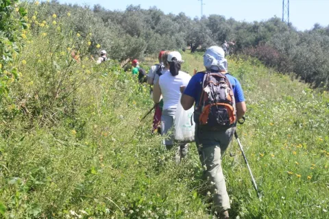
Imagen principal
Activado
imagen
Image
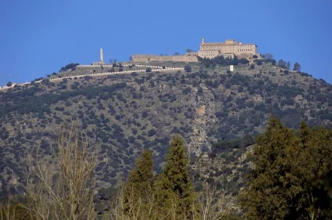
Imagen principal
Desactivado
imagen
Image
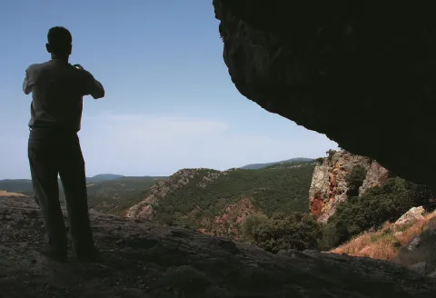
Imagen principal
Desactivado
imagen
Image

Imagen principal
Desactivado
imagen
Image

Imagen principal
Desactivado
imagen
Image
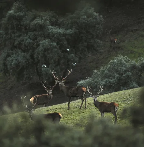
Imagen principal
Desactivado
GR-48
Spring and autumn
Activado
Coordenadas / Huso 30S
30S x = 391352 and = 4212409
Nuevas Poblaciones Carolinas
Id
9306904
Breve descripción
At the end of the 18th century, some 6,000 foreigners, mainly Germans and Flemish, came to the village of Sierra Morena. At that time this was a desert territory, the grass of banditry. The beginnings were not easy; they had to work hard to uncover and rotate the land and to build villages and villages in this beautiful but inhospitable territory. This amazing adaptation to a natural environment is what is done on this route: Aldeaquemada, Arquillos, Carboneros, La Carolina, Guarroman, Montizón and Santa Elena. To travel the area of the New Populations is to look back 200 years ago to know a project that was born under the new philosophy of the Enlightenment and its new ideas of the world, man and nature.
The colonization of Sierra Morena, which in the 18th century launched a handful of illustrations, led by King Charles III and under the intendence of Pablo de Olavide, was one of the largest reform projects in Spain and Europe. This project was a whole utopia in the middle of the Light century in which it was intended to put into operation a model rural society, based on equal cores and founded on the work of the earth as the main source of wealth.
It was a large urbanizing company that saw the creation of forty-four towns and eleven cities in Yermos places of La Parrilla and Sierra Morena. It was intended to both populate and plant semi-desertic areas, and to make the journey Cadiz- Madrid for travellers and goods safer.
The capital of the new towns was La Carolina, which has an orderly urban plot that has been valid for the appeal of Joya Urbanística de Andalucía.
Latitud
38.2756
Longitud
-3.6089
Distrito
Municipio
Ubicación en el mapa
POINT (-3.6089 38.2756)
imagen
Image

Imagen principal
Activado
imagen
Image

Imagen principal
Desactivado
imagen
Image

Imagen principal
Desactivado
Baja
Nuevas Poblaciones Carolinas
Desactivado
Trail Balcón de Despeñaperros
Id
7396151
Descripción larga
If taken in the sense of the clockwise from the point of start, the path enters
quickly in a pine pine pineapple pineapple pineapple with some
Pines resineros, cypresses and oaks. The first 350 meters of path run through an area
trees with abundant shadows and free of shrubs, as it constitutes the safety zone against
camping fires. This makes this section an ideal site for mushroom search in the autumn.
The path continues another 170 meters through a more intricate area of Mediterranean vegetation in the
that abounds the rosemary and the jars under the tree, which leads us to a spectacular lookout
Panoramic suspended on the old road N-IV. From the viewpoint you have an unparalleled vision
of the Natural Park, as the path is located on the South end. The panoramic view of 180
degrees allows to see the whole mountain of Despeñacos from the Collado de la Estrella, the Port of the King, he
Salto del Fraile, Navavacas, the Castle of Castro Ferral and following the line of the Collado de la
Star to the East, you can see the Paso de Despeñacolos and to its right the Collado de los
Gardens from where the park looks at Aldeaquemada.
Leaving the lookout behind, the path runs 900 meters through an old wooden draw track
completely flat through a lush mixed forest of pine, cypress, oak and cork,
where again the noble bush of the Mediterranean mountain gives a touch of naturality to the visitor
which loses the notion of distance to the people, but which, let us not forget, is just over 1 km from
distance.
Arrived at the end of the track, the path turns abruptly to the right to return to St. Helena
using a wider forest path, which also runs under a canopy of pineapple pine
Great. It is from that point where the only difficulty of the path is found, for during
400 meters is raised by a light cost with a slope about 5% to reach the
limit of the park where again it becomes completely flat. The final section runs through an area of
transition between forest and agricultural space, bordering just the southern perimeter of the campsite
Cracking dogs, passing through their access door and ending right where it started.
The path shows as main attractions its closeness to the people of St. Helena, its affability,
the abundance of shadows for hot days, the great botanical biodiversity and, above
all, the privileged views from the viewpoint that invites to let the imagination fly contemplating
this unparalleled landscape and, why not, to reflect on the countless travelers of so many cultures
who have used this natural passage between the plateau and Andalusia.
Breve descripción
This new path has a length of almost 4 km. and being circular can be performed in both
senses. It starts in the corner that gives access to the Camping Despeñacolos, next to the old section of
the N-IV, on the outskirts of the town of St. Helena.
Latitud
38.4003
Longitud
-3.5201
Distrito
Municipio
Ubicación en el mapa
POINT (-3.5201 38.4003)
imagen
Image

Imagen principal
Activado
imagen
Image
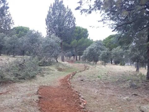
Imagen principal
Desactivado
1 h
Baja
Document
Sendero Balcón de Despeñaperros
3,8 km
On foot
All year round
Desactivado
- In front of COVID19, keep the safety distance and carry a mask, avoid agglomerations and contact with surfaces, wash your hands frequently, use hydroalcoholic gel and consult the available digital materials. Take care of your health and others.
- It works to prevent fires. Do not throw cigarettes or any other object that produces combustion.
- By consuming local products and having companies in the area you will contribute to rural development.
- He lives with the local people and other users. It respects private property and property.
- Unwind in a sustainable way: public transport, bike, walk, shared vehicle...
- Noise is another form of pollution. In silence you will enjoy your experience more.
- It facilitates the use of people with special needs.
- The trash doesn't come back alone. Take her with you to the nearest container. Reduce, reuse, recycle.
- Don't leave a mark on your way through nature.
- It practices a responsible and committed tourism with the environment. Be a real ecotourist!
- Respect the facilities at your disposal. We all pay for your maintenance.
- Check the weather forecast before starting your activity.
- Avoid going out alone. If you do, it communicates tour and time of return to other people.
- Extreme caution under adverse conditions and with the occasional presence of animals or motor vehicles.
- Please provide prior information on the possible existence of cynegetic activity.
- It has water, sun protection, proper clothes and shoes.
- It carries a mobile with enough battery in case of emergency (112), but remember that there is not always coverage.
- Don't even bother animals. You would negatively alter his behavior.
- For your safety and the safety of the environment, don't get out of the signposted road or take shortcuts.
- Remember that the capture of animals, light fire, fish and collect plants or minerals is prohibited.
- If you bring a dog, take him with his strap and make sure he doesn't bother other animals or people.
- Your safety is our concern, but it's your responsibility.
Thank you for your cooperation!
It starts in the urban centre of Santa Elena, next to the campsite Despeñacolos (C / Infanta Elena
s / n).
Tramo de asfalto o cemento
Tramo de pista o camino forestal
Tramo de vía pecuaria
Tramo de senda
Trail los Estrechos de Miranda
Id
4971329
Descripción larga
The first stretch of the path runs under the electric line that supplies Miranda del Rey, which we will leave 400 meters later to turn left, along the track that reaches the first compulsory stop place: The Cortijo of the Americas. It is seen from other times in which the population was established in the rural environment, and despite the state of deterioration in which it is found, it still retains in perfect condition its morune oven, an ethnographic element of vital importance in the past, as the population who lived away from the population cores depended on its own means of making their food, and among them the most basic: bread.
From here we will begin to descend gently by way of a sidewalk to the river La Campana, through a mixed forest with magnificent specimens of alcornoque (Quercus suber) and oak (Quercus ilex), intermingled with repopulation pine; since we are across the public mountain La Aliseda, one of those who were subjected to forced repopulation in the 1960s.
A kilometer later we will have reached the river, and we will be able to accompany it upstream or downstream thanks to the parallel road to the same that runs on the pecuary road called "Vereda del Camino Empedrado or del Puerto del Rey." If we do it down, this is, to the left, its riverside vegetation (among which we can highlight the twig, the reels and the majuelos) will delight us for a little more than a kilometre until we reach a bridge that crosses it, place of completion of the path. On the other side of the bridge is the return point of the Rio de La Campana Path, next to an excessive bearing mast that forces the photo camera to be removed. From this point, the La Aliseda Recreative Area is just 500 metres away.
If we decide to remount the La Campana River, that is, to follow the right in the fork, the delicate sound of the running of its waters and the incessant singing of the infinity of birds that inhabit its riverside will accompany us for a kilometre, until we start to separate from it by turning right to, 500 meters later, reach the pedany of Miranda del Rey. The crossroads of roads we will reach allows us to draw our visit again at free choice. If we pull right we will be able to visit the population, which emerged around a post house and then become one of the characteristic colonized villages of the time of Charles III. Although today most of his home is destined for holiday residence, old houses from that time can still be observed.
If from the crossroads of roads we decide to turn left, we will begin the Mill of the Batan path, which will allow us to visit the westernmost part of the Natural Park Despeñacolos. Finally, if we continue to face, we will begin the Empedraillo path, which will enter us in the heart of the park, approaching this historic road that is part of the so-called Royal Way.
Breve descripción
The Public Way The Straits of Miranda is the link between the Llano de las Américas visitor center and other public-use equipment of the Despeñacolos Natural Park; a path that will allow us to enter the park without having to move by vehicle.
This equipment is designed to allow the visitor who has just visited Llano de las Américas to approach the La Campana River (1.8 km away), and from there decide whether to approach the La Aliseda Recreative Area, managed by the City Council of St. Helena, of great tradition in the area (1.3 km away), or Miranda del Rey (1.6 km away), from where you can connect with either of the two public-use trails that leave from this pedanía to the heart of Despeñacolas.
Latitud
38.0102
Longitud
-2.7401
Distrito
Municipio
Ubicación en el mapa
POINT (-2.7401 38.0102)
imagen
Image

Imagen principal
Activado
imagen
Image

Imagen principal
Desactivado
1 h 30 min
Baja
Document
Sendero los Estrechos de Miranda
4,7 km
On foot
All year round
Desactivado
- In front of COVID19, keep the safety distance and carry a mask, avoid agglomerations and contact with surfaces, wash your hands frequently, use hydroalcoholic gel and consult the available digital materials. Take care of your health and others.
- It works to prevent fires. Do not throw cigarettes or any other object that produces combustion.
- By consuming local products and having companies in the area you will contribute to rural development.
- He lives with the local people and other users. It respects private property and property.
- Unwind in a sustainable way: public transport, bike, walk, shared vehicle...
- Noise is another form of pollution. In silence you will enjoy your experience more.
- It facilitates the use of people with special needs.
- The trash doesn't come back alone. Take her with you to the nearest container. Reduce, reuse, recycle.
- Don't leave a mark on your way through nature.
- It practices a responsible and committed tourism with the environment. Be a real ecotourist!
- Respect the facilities at your disposal. We all pay for your maintenance.
- Check the weather forecast before starting your activity.
- Avoid going out alone. If you do, it communicates tour and time of return to other people.
- Extreme caution under adverse conditions and with the occasional presence of animals or motor vehicles.
- Please provide prior information on the possible existence of cynegetic activity.
- It has water, sun protection, proper clothes and shoes.
- It carries a mobile with enough battery in case of emergency (112), but remember that there is not always coverage.
- Don't even bother animals. You would negatively alter his behavior.
- For your safety and the safety of the environment, don't get out of the signposted road or take shortcuts.
- Remember that the capture of animals, light fire, fish and collect plants or minerals is prohibited.
- If you bring a dog, take him with his strap and make sure he doesn't bother other animals or people.
- Your safety is our concern, but it's your responsibility.
Thank you for your cooperation!
The path has its point of origin next to the center of visitors Llano of the Americas, for its right side. To get to the visitor center we will take the exit 257 of the A-4 in its way through Despeñacolos, to connect with the road JA-7102 that links the core of St. Helena with its pedanía of Miranda del Rey. The visitor center will find you at point 2 of this road, on the left. It has parking for both cars and buses.
Trail Empedraillo
Id
4971213
Breve descripción
An ancient paved road, of supposed Roman origin, gives a name to this path that is part of Miranda del Rey, paedania of St. Helena, and has as attractive a wide variety of vegetation - called the Mediterranean forest - some waterfall and the freshness of the Arroyo del Rey swamp. The journey ends up taking back the old Royal Way, from which a hill called the King's Table is looted.
All the milestones recall the importance of other dates that the place had. This is where the armies who fought in the crucial battle of the Saves of Tolosa in 1212 camped and fought.
Latitud
37.9803
Longitud
-3.0804
Distrito
Municipio
Ubicación en el mapa
POINT (-3.0804 37.9803)
imagen
Image

Imagen principal
Activado
imagen
Image
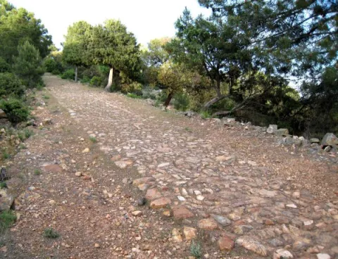
Imagen principal
Desactivado
3 h 40 min
Baja
Document
Document
Sendero Empedraillo
8,3 km
On foot
All year round
Desactivado
- In front of COVID19, keep the safety distance and carry a mask, avoid agglomerations and contact with surfaces, wash your hands frequently, use hydroalcoholic gel and consult the available digital materials. Take care of your health and others.
- It works to prevent fires. Do not throw cigarettes or any other object that produces combustion.
- By consuming local products and having companies in the area you will contribute to rural development.
- He lives with the local people and other users. It respects private property and property.
- Unwind in a sustainable way: public transport, bike, walk, shared vehicle...
- Noise is another form of pollution. In silence you will enjoy your experience more.
- It facilitates the use of people with special needs.
- The trash doesn't come back alone. Take her with you to the nearest container. Reduce, reuse, recycle.
- Don't leave a mark on your way through nature.
- It practices a responsible and committed tourism with the environment. Be a real ecotourist!
- Respect the facilities at your disposal. We all pay for your maintenance.
- Check the weather forecast before starting your activity.
- Avoid going out alone. If you do, it communicates tour and time of return to other people.
- Extreme caution under adverse conditions and with the occasional presence of animals or motor vehicles.
- Please provide prior information on the possible existence of cynegetic activity.
- It has water, sun protection, proper clothes and shoes.
- It carries a mobile with enough battery in case of emergency (112), but remember that there is not always coverage.
- Don't even bother animals. You would negatively alter his behavior.
- For your safety and the safety of the environment, don't get out of the signposted road or take shortcuts.
- Remember that the capture of animals, light fire, fish and collect plants or minerals is prohibited.
- If you bring a dog, take him with his strap and make sure he doesn't bother other animals or people.
- Your safety is our concern, but it's your responsibility.
Thank you for your cooperation!
Exit 257 from the A-4 at its pass through Despeñacolos, to connect with the JA-7102 road that links the core of St. Helena with its pedanía of Miranda del Rey. We must pass the village house without leaving the road until we find a crossing at 150 m, where the path is started on the right. You can also get on foot from the Llano de las Américas visitor center, through the Strait of Miranda trail, in its ascent branch of the La Campana River.
Tramo de asfalto o cemento
Tramo de pista o camino forestal
Tramo de vía pecuaria
Tramo de senda
Trail Cerro de Monuera
Id
4970889
Descripción larga
Once we walk the first 200 meters from where we left the car, we find the bifurcation by which it is made circular, having to take the track on the left. It is from this moment on that we will enter into a darkness that will show us the best floral representation of this path: a melojar of Quercus pyrenaica, mixed with mustards (Sorbus tormentinalis) that will not leave us indifferent, especially if we make the itinerary in autumn or spring. They will accompany us for about 800 meters, mixed with magnificent copies of alcornoque (Quercus suber) and oak (Quercus ilex), until we reach a new fork that we will take back to the left. If we have been careful enough, we will have observed that, on our left, we have been able to enjoy some magnificent panorama of the Aldeaquemada core.
For 900 meters more the vegetation will become black pineapples (Pinus pinaster), accompanied by madroños (Arbutus unedo) and juniperus communis. It is easy that, so far, we have already seen some other piece of deer start his career when he has heard us, as it is a zone of love of this species. Right now we'll get to a firewall we have to go through. This forest fire defence infrastructure points to the limit between Mount El Chortal (owned by the Junta de Andalucía, for which we had been walking so far) and Mount Dehesa Navalacedra (owned by the City Council of Aldeaquemada). For 700 meters we will go through a mixed mass with pine pineer (Pinus pinea) as a more important species at first, which will then leave way for the cherries (with good examples of complaint, Quercus faginea) when we begin to accompany a small vaguada on our left.
In the end we turn into a forest track that we will take to the right, to leave it about 800 meters later taking the sidewalk that comes from the right. We just entered the public mountain El Chortal again. For about 2 kilometers we will be walking on a soloana, in the shadow of pine pines that will make us the most leading road. We can observe three stone canchals at our pace, typical of these natural spaces. Once we have reached an observation turret of fauna, our path will become a sidewalk with some slope (the most difficult part of the path) that will descend to the bottom of the valley, to go back to it.
It is the Arroyo del Tomadero, which in its first meters will delight us with a lush riverside vegetation with the aliso (Alnus glutinosa) and the strawberry (Fraxinus angustifolia) as protagonists, accompanied by a sotoscala that does so in some impenetrable points. In the middle of the way, a (non-potable) source will help us refresh in order to finish the promotion of this vaguada. A kilometer and a half upstream we will cross the Tomadero Arroyo to leave it behind, going up the path for another kilometer until we reach the main track. Taking it to the right will lead us, 400 meters later, to the fork with which we started the path. If we are attentive, we will be able to see on this final stretch, on our right, a fire surveillance turret that looks at us from above the Cerro Monuera, which we will have surrounded for just under 3 hours.
Breve descripción
On horseback between the Natural Park Despeñacolos and the Natural Park Cascada de la Cimbarra, this path will allow us to know in all its splendor what Sierra Morena offers us in just over 8 kilometers.
We are in the municipal term of Aldeaquemada, one of the new populations created by Charles III, and whose visit is compulsory to restore strength when we finish this ameno path. This is a circular type, curling in the sense of the watch needles.
Latitud
38.3501
Longitud
-2.6002
Distrito
Municipio
Ubicación en el mapa
POINT (-2.6002 38.3501)
imagen
Image
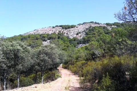
Imagen principal
Activado
imagen
Image
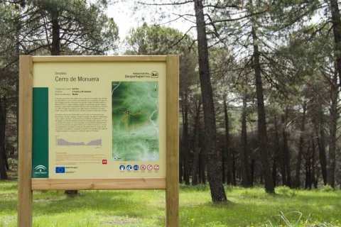
Imagen principal
Desactivado
imagen
Image

Imagen principal
Desactivado
2 h 45 min
Medium
Document
Document
Sendero Cerro de Monuera
8,7 km
On foot
Spring and autumn
Desactivado
- In front of COVID19, keep the safety distance and carry a mask, avoid agglomerations and contact with surfaces, wash your hands frequently, use hydroalcoholic gel and consult the available digital materials. Take care of your health and others.
- It works to prevent fires. Do not throw cigarettes or any other object that produces combustion.
- By consuming local products and having companies in the area you will contribute to rural development.
- He lives with the local people and other users. It respects private property and property.
- Unwind in a sustainable way: public transport, bike, walk, shared vehicle...
- Noise is another form of pollution. In silence you will enjoy your experience more.
- It facilitates the use of people with special needs.
- The trash doesn't come back alone. Take her with you to the nearest container. Reduce, reuse, recycle.
- Don't leave a mark on your way through nature.
- It practices a responsible and committed tourism with the environment. Be a real ecotourist!
- Respect the facilities at your disposal. We all pay for your maintenance.
- Check the weather forecast before starting your activity.
- Avoid going out alone. If you do, it communicates tour and time of return to other people.
- Extreme caution under adverse conditions and with the occasional presence of animals or motor vehicles.
- Please provide prior information on the possible existence of cynegetic activity.
- It has water, sun protection, proper clothes and shoes.
- It carries a mobile with enough battery in case of emergency (112), but remember that there is not always coverage.
- Don't even bother animals. You would negatively alter his behavior.
- For your safety and the safety of the environment, don't get out of the signposted road or take shortcuts.
- Remember that the capture of animals, light fire, fish and collect plants or minerals is prohibited.
- If you bring a dog, take him with his strap and make sure he doesn't bother other animals or people.
- Your safety is our concern, but it's your responsibility.
Thank you for your cooperation!
The path starts a few meters from the A-6200 road that comes from the A4 motorway (exit km 250, towards Cadiz) towards Aldeaquemada. The start is at approximately 16 kilometric point on the right.
