Saltar al contenido principal

Trail Balcón de Despeñaperros

Submitted by brandcode_deweloper on
Id
7396151
Descripción larga

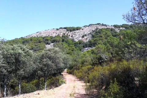
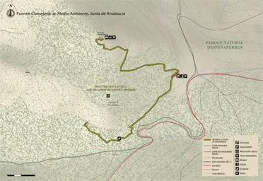
If taken in the sense of the clockwise from the point of start, the path enters
quickly in a pine pine pineapple pineapple pineapple with some
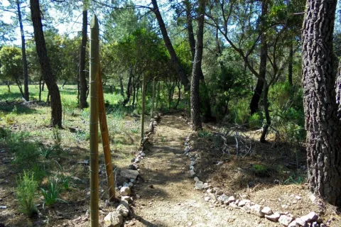
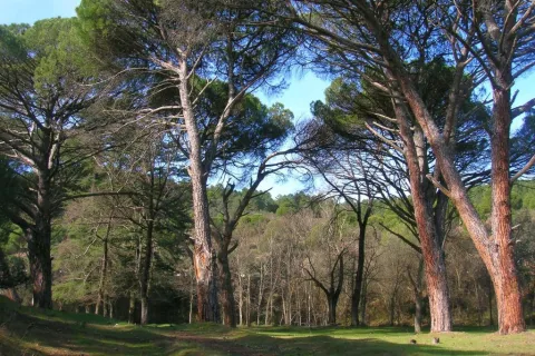
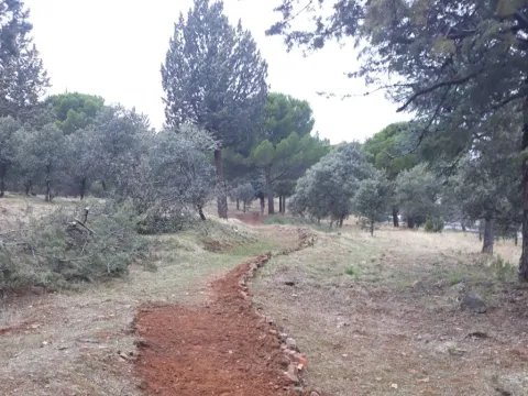
Pines resineros, cypresses and oaks. The first 350 meters of path run through an area
trees with abundant shadows and free of shrubs, as it constitutes the safety zone against
camping fires. This makes this section an ideal site for mushroom search in the autumn.
The path continues another 170 meters through a more intricate area of Mediterranean vegetation in the
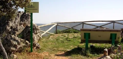
that abounds the rosemary and the jars under the tree, which leads us to a spectacular lookout
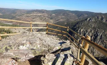
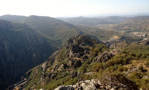
Panoramic suspended on the old road N-IV. From the viewpoint you have an unparalleled vision
of the Natural Park, as the path is located on the South end. The panoramic view of 180
degrees allows to see the whole mountain of Despeñacos from the Collado de la Estrella, the Port of the King, he
Salto del Fraile, Navavacas, the Castle of Castro Ferral and following the line of the Collado de la
Star to the East, you can see the Paso de Despeñacolos and to its right the Collado de los
Gardens from where the park looks at Aldeaquemada.

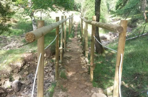
Leaving the lookout behind, the path runs 900 meters through an old wooden draw track
completely flat through a lush mixed forest of pine, cypress, oak and cork,
where again the noble bush of the Mediterranean mountain gives a touch of naturality to the visitor
which loses the notion of distance to the people, but which, let us not forget, is just over 1 km from
distance.


Arrived at the end of the track, the path turns abruptly to the right to return to St. Helena
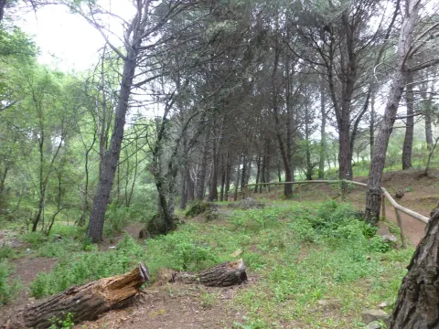
using a wider forest path, which also runs under a canopy of pineapple pine
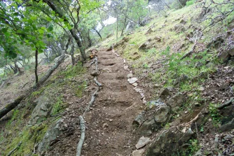
Great. It is from that point where the only difficulty of the path is found, for during
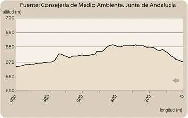
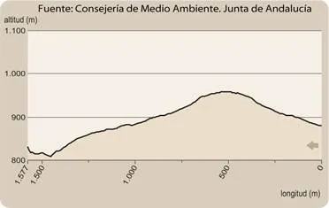
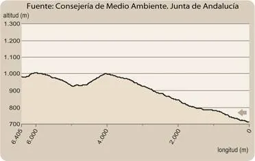
400 meters is raised by a light cost with a slope about 5% to reach the
limit of the park where again it becomes completely flat. The final section runs through an area of
transition between forest and agricultural space, bordering just the southern perimeter of the campsite
Cracking dogs, passing through their access door and ending right where it started.

The path shows as main attractions its closeness to the people of St. Helena, its affability,
the abundance of shadows for hot days, the great botanical biodiversity and, above
all, the privileged views from the viewpoint that invites to let the imagination fly contemplating
this unparalleled landscape and, why not, to reflect on the countless travelers of so many cultures
who have used this natural passage between the plateau and Andalusia.

Breve descripción

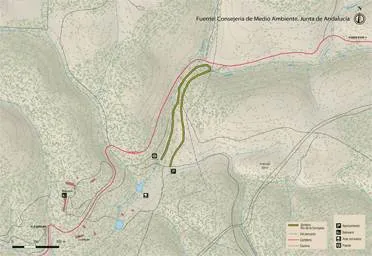
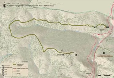
This new path has a length of almost 4 km. and being circular can be performed in both
senses. It starts in the corner that gives access to the Camping Despeñacolos, next to the old section of
the N-IV, on the outskirts of the town of St. Helena.

Latitud
38.4003
Longitud
-3.5201
Distrito
Municipio
Ubicación en el mapa
POINT (-3.5201 38.4003)
imagen
Image
Sendero%20Balc%C3%B3n%20de%20Despe%C3%B1aperros.jpg
Imagen principal
Activado
imagen
Image
Sendero%20Balc%C3%B3n%20de%20Despe%C3%B1aperros1.jpg
Imagen principal
Desactivado
1 h

Nature

icon-intereses-naturaleza

Friends

icon-intereses-amigos

Adventure

icon-intereses-aventura

Culture

icon-intereses-cultura

Sport

icon-intereses-deporte

Eco-friendly

icon-intereses-eco-friendly

For couples

icon-intereses-en-pareja

Family

icon-intereses-familia

Gastronomy

icon-intereses-gastronomia

Municipality

icon-intereses-municipio

Low-cost tourism

icon-intereses-turismo-low-cost

Solo travel

icon-intereses-viajar-solo
Baja
Sendero Balcón de Despeñaperros
3,8 km
On foot
All year round
Desactivado
  • In front of COVID19, keep the safety distance and carry a mask, avoid agglomerations and contact with surfaces, wash your hands frequently, use hydroalcoholic gel and consult the available digital materials. Take care of your health and others.
  • It works to prevent fires. Do not throw cigarettes or any other object that produces combustion.
  • By consuming local products and having companies in the area you will contribute to rural development.
  • He lives with the local people and other users. It respects private property and property.
  • Unwind in a sustainable way: public transport, bike, walk, shared vehicle...
  • Noise is another form of pollution. In silence you will enjoy your experience more.
  • It facilitates the use of people with special needs.
  • The trash doesn't come back alone. Take her with you to the nearest container. Reduce, reuse, recycle.
  • Don't leave a mark on your way through nature.
  • It practices a responsible and committed tourism with the environment. Be a real ecotourist!
  • Respect the facilities at your disposal. We all pay for your maintenance.
  • Check the weather forecast before starting your activity.
  • Avoid going out alone. If you do, it communicates tour and time of return to other people.
  • Extreme caution under adverse conditions and with the occasional presence of animals or motor vehicles.
  • Please provide prior information on the possible existence of cynegetic activity.
  • It has water, sun protection, proper clothes and shoes.
  • It carries a mobile with enough battery in case of emergency (112), but remember that there is not always coverage.
  • Don't even bother animals. You would negatively alter his behavior.
  • For your safety and the safety of the environment, don't get out of the signposted road or take shortcuts.
  • Remember that the capture of animals, light fire, fish and collect plants or minerals is prohibited.
  • If you bring a dog, take him with his strap and make sure he doesn't bother other animals or people.
  • Your safety is our concern, but it's your responsibility.

Thank you for your cooperation!

It starts in the urban centre of Santa Elena, next to the campsite Despeñacolos (C / Infanta Elena
s / n).

Tramo de asfalto o cemento
 
Tramo de pista o camino forestal
 
Tramo de vía pecuaria
 
Tramo de senda
 

Trail los Estrechos de Miranda

Submitted by brandcode_deweloper on
Id
4971329
Descripción larga

The first stretch of the path runs under the electric line that supplies Miranda del Rey, which we will leave 400 meters later to turn left, along the track that reaches the first compulsory stop place: The Cortijo of the Americas. It is seen from other times in which the population was established in the rural environment, and despite the state of deterioration in which it is found, it still retains in perfect condition its morune oven, an ethnographic element of vital importance in the past, as the population who lived away from the population cores depended on its own means of making their food, and among them the most basic: bread.

From here we will begin to descend gently by way of a sidewalk to the river La Campana, through a mixed forest with magnificent specimens of alcornoque (Quercus suber) and oak (Quercus ilex), intermingled with repopulation pine; since we are across the public mountain La Aliseda, one of those who were subjected to forced repopulation in the 1960s.

A kilometer later we will have reached the river, and we will be able to accompany it upstream or downstream thanks to the parallel road to the same that runs on the pecuary road called "Vereda del Camino Empedrado or del Puerto del Rey." If we do it down, this is, to the left, its riverside vegetation (among which we can highlight the twig, the reels and the majuelos) will delight us for a little more than a kilometre until we reach a bridge that crosses it, place of completion of the path. On the other side of the bridge is the return point of the Rio de La Campana Path, next to an excessive bearing mast that forces the photo camera to be removed. From this point, the La Aliseda Recreative Area is just 500 metres away.

If we decide to remount the La Campana River, that is, to follow the right in the fork, the delicate sound of the running of its waters and the incessant singing of the infinity of birds that inhabit its riverside will accompany us for a kilometre, until we start to separate from it by turning right to, 500 meters later, reach the pedany of Miranda del Rey. The crossroads of roads we will reach allows us to draw our visit again at free choice. If we pull right we will be able to visit the population, which emerged around a post house and then become one of the characteristic colonized villages of the time of Charles III. Although today most of his home is destined for holiday residence, old houses from that time can still be observed.

If from the crossroads of roads we decide to turn left, we will begin the Mill of the Batan path, which will allow us to visit the westernmost part of the Natural Park Despeñacolos. Finally, if we continue to face, we will begin the Empedraillo path, which will enter us in the heart of the park, approaching this historic road that is part of the so-called Royal Way.

Breve descripción

The Public Way The Straits of Miranda is the link between the Llano de las Américas visitor center and other public-use equipment of the Despeñacolos Natural Park; a path that will allow us to enter the park without having to move by vehicle.

This equipment is designed to allow the visitor who has just visited Llano de las Américas to approach the La Campana River (1.8 km away), and from there decide whether to approach the La Aliseda Recreative Area, managed by the City Council of St. Helena, of great tradition in the area (1.3 km away), or Miranda del Rey (1.6 km away), from where you can connect with either of the two public-use trails that leave from this pedanía to the heart of Despeñacolas.

Latitud
38.0102
Longitud
-2.7401
Distrito
Municipio
Ubicación en el mapa
POINT (-2.7401 38.0102)
imagen
Image
1%20%281%29%20%281%29.jpg
Imagen principal
Activado
imagen
Image
Sendero%20los%20Estrechos%20de%20Miranda.jpg
Imagen principal
Desactivado
1 h 30 min

Nature

icon-intereses-naturaleza

Friends

icon-intereses-amigos

Adventure

icon-intereses-aventura

Culture

icon-intereses-cultura

Sport

icon-intereses-deporte

Eco-friendly

icon-intereses-eco-friendly

For couples

icon-intereses-en-pareja

Family

icon-intereses-familia

Gastronomy

icon-intereses-gastronomia

Municipality

icon-intereses-municipio

Low-cost tourism

icon-intereses-turismo-low-cost

Solo travel

icon-intereses-viajar-solo
Baja
Sendero los Estrechos de Miranda
4,7 km
On foot
All year round
Desactivado
  • In front of COVID19, keep the safety distance and carry a mask, avoid agglomerations and contact with surfaces, wash your hands frequently, use hydroalcoholic gel and consult the available digital materials. Take care of your health and others.
  • It works to prevent fires. Do not throw cigarettes or any other object that produces combustion.
  • By consuming local products and having companies in the area you will contribute to rural development.
  • He lives with the local people and other users. It respects private property and property.
  • Unwind in a sustainable way: public transport, bike, walk, shared vehicle...
  • Noise is another form of pollution. In silence you will enjoy your experience more.
  • It facilitates the use of people with special needs.
  • The trash doesn't come back alone. Take her with you to the nearest container. Reduce, reuse, recycle.
  • Don't leave a mark on your way through nature.
  • It practices a responsible and committed tourism with the environment. Be a real ecotourist!
  • Respect the facilities at your disposal. We all pay for your maintenance.
  • Check the weather forecast before starting your activity.
  • Avoid going out alone. If you do, it communicates tour and time of return to other people.
  • Extreme caution under adverse conditions and with the occasional presence of animals or motor vehicles.
  • Please provide prior information on the possible existence of cynegetic activity.
  • It has water, sun protection, proper clothes and shoes.
  • It carries a mobile with enough battery in case of emergency (112), but remember that there is not always coverage.
  • Don't even bother animals. You would negatively alter his behavior.
  • For your safety and the safety of the environment, don't get out of the signposted road or take shortcuts.
  • Remember that the capture of animals, light fire, fish and collect plants or minerals is prohibited.
  • If you bring a dog, take him with his strap and make sure he doesn't bother other animals or people.
  • Your safety is our concern, but it's your responsibility.

Thank you for your cooperation!

The path has its point of origin next to the center of visitors Llano of the Americas, for its right side. To get to the visitor center we will take the exit 257 of the A-4 in its way through Despeñacolos, to connect with the road JA-7102 that links the core of St. Helena with its pedanía of Miranda del Rey. The visitor center will find you at point 2 of this road, on the left. It has parking for both cars and buses.

Trail Cerro de Monuera

Submitted by brandcode_deweloper on
Id
4970889
Descripción larga

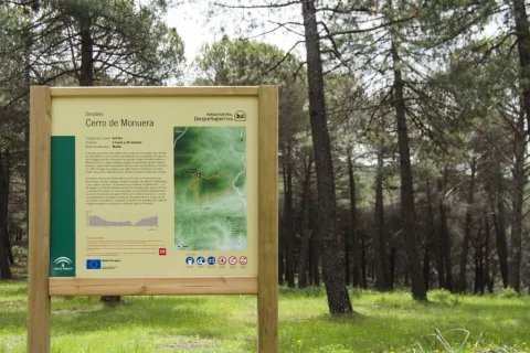
Once we walk the first 200 meters from where we left the car, we find the bifurcation by which it is made circular, having to take the track on the left. It is from this moment on that we will enter into a darkness that will show us the best floral representation of this path: a melojar of Quercus pyrenaica, mixed with mustards (Sorbus tormentinalis) that will not leave us indifferent, especially if we make the itinerary in autumn or spring. They will accompany us for about 800 meters, mixed with magnificent copies of alcornoque (Quercus suber) and oak (Quercus ilex), until we reach a new fork that we will take back to the left. If we have been careful enough, we will have observed that, on our left, we have been able to enjoy some magnificent panorama of the Aldeaquemada core.

For 900 meters more the vegetation will become black pineapples (Pinus pinaster), accompanied by madroños (Arbutus unedo) and juniperus communis. It is easy that, so far, we have already seen some other piece of deer start his career when he has heard us, as it is a zone of love of this species. Right now we'll get to a firewall we have to go through. This forest fire defence infrastructure points to the limit between Mount El Chortal (owned by the Junta de Andalucía, for which we had been walking so far) and Mount Dehesa Navalacedra (owned by the City Council of Aldeaquemada). For 700 meters we will go through a mixed mass with pine pineer (Pinus pinea) as a more important species at first, which will then leave way for the cherries (with good examples of complaint, Quercus faginea) when we begin to accompany a small vaguada on our left.

In the end we turn into a forest track that we will take to the right, to leave it about 800 meters later taking the sidewalk that comes from the right. We just entered the public mountain El Chortal again. For about 2 kilometers we will be walking on a soloana, in the shadow of pine pines that will make us the most leading road. We can observe three stone canchals at our pace, typical of these natural spaces. Once we have reached an observation turret of fauna, our path will become a sidewalk with some slope (the most difficult part of the path) that will descend to the bottom of the valley, to go back to it.

It is the Arroyo del Tomadero, which in its first meters will delight us with a lush riverside vegetation with the aliso (Alnus glutinosa) and the strawberry (Fraxinus angustifolia) as protagonists, accompanied by a sotoscala that does so in some impenetrable points. In the middle of the way, a (non-potable) source will help us refresh in order to finish the promotion of this vaguada. A kilometer and a half upstream we will cross the Tomadero Arroyo to leave it behind, going up the path for another kilometer until we reach the main track. Taking it to the right will lead us, 400 meters later, to the fork with which we started the path. If we are attentive, we will be able to see on this final stretch, on our right, a fire surveillance turret that looks at us from above the Cerro Monuera, which we will have surrounded for just under 3 hours.

Breve descripción

On horseback between the Natural Park Despeñacolos and the Natural Park Cascada de la Cimbarra, this path will allow us to know in all its splendor what Sierra Morena offers us in just over 8 kilometers.

We are in the municipal term of Aldeaquemada, one of the new populations created by Charles III, and whose visit is compulsory to restore strength when we finish this ameno path. This is a circular type, curling in the sense of the watch needles.

Latitud
38.3501
Longitud
-2.6002
Distrito
Municipio
Ubicación en el mapa
POINT (-2.6002 38.3501)
imagen
Image
3%20%281%29.jpg
Imagen principal
Activado
imagen
Image
Sendero%20Cerro%20de%20Monuera.jpg
Imagen principal
Desactivado
imagen
Image
Sendero%20Cerro%20de%20Monuera2.jpg
Imagen principal
Desactivado
2 h 45 min

Nature

icon-intereses-naturaleza

Friends

icon-intereses-amigos

Adventure

icon-intereses-aventura

Culture

icon-intereses-cultura

Sport

icon-intereses-deporte

Eco-friendly

icon-intereses-eco-friendly

For couples

icon-intereses-en-pareja

Family

icon-intereses-familia

Gastronomy

icon-intereses-gastronomia

Municipality

icon-intereses-municipio

Low-cost tourism

icon-intereses-turismo-low-cost

Solo travel

icon-intereses-viajar-solo
Medium
Sendero Cerro de Monuera
8,7 km
On foot
Spring and autumn
Desactivado
  • In front of COVID19, keep the safety distance and carry a mask, avoid agglomerations and contact with surfaces, wash your hands frequently, use hydroalcoholic gel and consult the available digital materials. Take care of your health and others.
  • It works to prevent fires. Do not throw cigarettes or any other object that produces combustion.
  • By consuming local products and having companies in the area you will contribute to rural development.
  • He lives with the local people and other users. It respects private property and property.
  • Unwind in a sustainable way: public transport, bike, walk, shared vehicle...
  • Noise is another form of pollution. In silence you will enjoy your experience more.
  • It facilitates the use of people with special needs.
  • The trash doesn't come back alone. Take her with you to the nearest container. Reduce, reuse, recycle.
  • Don't leave a mark on your way through nature.
  • It practices a responsible and committed tourism with the environment. Be a real ecotourist!
  • Respect the facilities at your disposal. We all pay for your maintenance.
  • Check the weather forecast before starting your activity.
  • Avoid going out alone. If you do, it communicates tour and time of return to other people.
  • Extreme caution under adverse conditions and with the occasional presence of animals or motor vehicles.
  • Please provide prior information on the possible existence of cynegetic activity.
  • It has water, sun protection, proper clothes and shoes.
  • It carries a mobile with enough battery in case of emergency (112), but remember that there is not always coverage.
  • Don't even bother animals. You would negatively alter his behavior.
  • For your safety and the safety of the environment, don't get out of the signposted road or take shortcuts.
  • Remember that the capture of animals, light fire, fish and collect plants or minerals is prohibited.
  • If you bring a dog, take him with his strap and make sure he doesn't bother other animals or people.
  • Your safety is our concern, but it's your responsibility.

Thank you for your cooperation!

The path starts a few meters from the A-6200 road that comes from the A4 motorway (exit km 250, towards Cadiz) towards Aldeaquemada. The start is at approximately 16 kilometric point on the right.

Trail Castañar de Valdeazores

Submitted by brandcode_deweloper on
Id
4970684
Descripción larga

The first section runs from its beginning parallel to the Barranco de Valdeazores, sometimes crossing it and partly coinciding with the driving that supplies the gardens of Despeñacolos. The slope of this first part is soft, and will allow us to delight with a well-preserved gallery forest of mainly strawberries and alms. In spring, the peonies will give a touch of color to our march.

After a mile and a half, majestic chestnut specimens will give us a beautiful landscape in which to stop and take a breath, taking advantage to refresh us in the source of the spring that provides the driving.

After a break, we will resume the march and move on to the second stretch. This part of the path is a little more abrupt, running along the right bank of the Barranco. During this stretch, the vegetation that will accompany us will be made up of pine trees, oaks, dyes, junips, pans, jars and other species typical of the Mediterranean mountain.

Already reaching the end of the path, we will find a large number of complaints, above which, even if we do not reach the view, there is one of the best preserved melojars of the Natural Park Despeñacolos. It is not surprising that, already in the first botanical treaties, the illustrious Professor Font Quer defined this place as a "true botanical paradise."

The path made in this sense ends on the track of Las Correderas, the turning point of the Barranco de Valdeazores path, where we will have the option to go down to the road by the House of Valdeazores (to the right) or to continue on the left towards the lookout the Organs (where there are indescribable views of the Natural Monument of Los Organos); from where we will drop back to the N-IV by the Barranco de la Nimuco path.

In the opposite or descending sense, those users who come back from the lookout or who have come up through the house of Valdeazores can return to the N-IV by coming down this new path.

Breve descripción

Covered by the bottom of the ravine of the Valdeazores stream, the path will lead us between strawberries and alles to beautiful examples of chestnut that leave no one indifferent, going up the water, we will be able to delight ourselves with the spectacular tones that the darkness in front of us in certain seasons of the year, thanks to species such as the whine, the melo, the mustard or the wild pear.

It is a two-way path, leaving users at their choice whether to walk it upstream or downstream. If you decide to start it at the bottom (from the N-IV), the path is ascending in all its path, although we find two different sections.

Latitud
38.0304
Longitud
-2.7703
Distrito
Municipio
Ubicación en el mapa
POINT (-2.7703 38.0304)
imagen
Image
1%20%281%29.jpg
Imagen principal
Activado
imagen
Image
Sendero%20Casta%C3%B1ar%20de%20Valdeazores.jpg
Imagen principal
Desactivado
imagen
Image
Sendero%20Casta%C3%B1ar%20de%20Valdeazores2.jpg
Imagen principal
Desactivado
1 h 30 min

Nature

icon-intereses-naturaleza

Friends

icon-intereses-amigos

Adventure

icon-intereses-aventura

Culture

icon-intereses-cultura

Sport

icon-intereses-deporte

Eco-friendly

icon-intereses-eco-friendly

For couples

icon-intereses-en-pareja

Family

icon-intereses-familia

Gastronomy

icon-intereses-gastronomia

Municipality

icon-intereses-municipio

Low-cost tourism

icon-intereses-turismo-low-cost

Solo travel

icon-intereses-viajar-solo
Baja
Sendero Castañar de Valdeazores
2,8 km
On foot
All year round
Desactivado
  • In front of COVID19, keep the safety distance and carry a mask, avoid agglomerations and contact with surfaces, wash your hands frequently, use hydroalcoholic gel and consult the available digital materials. Take care of your health and others.
  • It works to prevent fires. Do not throw cigarettes or any other object that produces combustion.
  • By consuming local products and having companies in the area you will contribute to rural development.
  • He lives with the local people and other users. It respects private property and property.
  • Unwind in a sustainable way: public transport, bike, walk, shared vehicle...
  • Noise is another form of pollution. In silence you will enjoy your experience more.
  • It facilitates the use of people with special needs.
  • The trash doesn't come back alone. Take her with you to the nearest container. Reduce, reuse, recycle.
  • Don't leave a mark on your way through nature.
  • It practices a responsible and committed tourism with the environment. Be a real ecotourist!
  • Respect the facilities at your disposal. We all pay for your maintenance.
  • Check the weather forecast before starting your activity.
  • Avoid going out alone. If you do, it communicates tour and time of return to other people.
  • Extreme caution under adverse conditions and with the occasional presence of animals or motor vehicles.
  • Please provide prior information on the possible existence of cynegetic activity.
  • It has water, sun protection, proper clothes and shoes.
  • It carries a mobile with enough battery in case of emergency (112), but remember that there is not always coverage.
  • Don't even bother animals. You would negatively alter his behavior.
  • For your safety and the safety of the environment, don't get out of the signposted road or take shortcuts.
  • Remember that the capture of animals, light fire, fish and collect plants or minerals is prohibited.
  • If you bring a dog, take him with his strap and make sure he doesn't bother other animals or people.
  • Your safety is our concern, but it's your responsibility.

Thank you for your cooperation!

Important warning.As a preventive measure to prevent the contagion of COVID19, this path must be carried in the sense indicated in the starting sign.

To access the starting point of the path, take the old N-IV, in the direction of Seville to the point of kilometer 248.6 (about 250 m after the restaurant of the Jardines)

Tramo de asfalto o cemento
 
Tramo de pista o camino forestal
 
Tramo de vía pecuaria
 
Tramo de senda
 

Trail Ravine of la Niebla

Submitted by brandcode_deweloper on
Id
4969942
Descripción larga

The first 1,000 meters of the path are of pronounced ascent, until they reach a somewhat more flat area. This is where the path continues on an existing path, which we must continue for about 500 meters until we are forced to leave it in the east direction, to reach the confluence with the Barranco de Valdeazores path. From here, and following the latter, we can reach the Collado de la Aviación Refugio, and a little later we can enjoy a spectacular view of the Natural Monument of Los Organos, in addition to being able to see, on days of good visibility, much of the province of Jaén.

It is at this point that we are offered two possibilities. On the one hand, the visitor will be able to continue his return on the Path of the Barranco de Valdeazores, or to choose to turn to the point of departure of the Path Barranco de la Niebla, but on a different path from that of ascending, which makes him a circular path.

Along our way we will have been able to enjoy one of the best representations of what is the rest of the natural park in terms of different types of vegetation. The repopulations with species of the genus Pinus interspersed with areas of Mediterranean tiles in which the ocine and the cork are the predominant species in the solanas, while in the umbria the complaint is opened. All this, accompanied by a rich forest of juniors, madroños, olive trees and a long et cetera that provide support to the populations of ungulates that have made this natural park so popular.

Breve descripción

The explanade that we find at the beginning of the path will serve as parking, there is an old fountain that has been restored. The vegetation we can observe, as it happens at other points of the former National IV, is not the one we would expect to meet in a place like this. This is a consequence of a landscaping project that was the object of the Natural Park Despeñacolos in the 1950s, and that introduced exotic species such as cypresses and cedars, which today give us a contrast more than to enjoy.

Latitud
37.9702
Longitud
-3.1001
Distrito
Municipio
Ubicación en el mapa
POINT (-3.1001 37.9702)
imagen
Image
2.jpg
Imagen principal
Activado
imagen
Image
Sendero%20Barranco%20de%20la%20Niebla.jpg
Imagen principal
Desactivado
2 h 30 min

Nature

icon-intereses-naturaleza

Friends

icon-intereses-amigos

Adventure

icon-intereses-aventura

Culture

icon-intereses-cultura

Sport

icon-intereses-deporte

Eco-friendly

icon-intereses-eco-friendly

For couples

icon-intereses-en-pareja

Family

icon-intereses-familia

Gastronomy

icon-intereses-gastronomia

Municipality

icon-intereses-municipio

Low-cost tourism

icon-intereses-turismo-low-cost

Solo travel

icon-intereses-viajar-solo
Alta
Sendero Barranco de la Niebla
4,8 km
On foot
All year round
Desactivado
  • In front of COVID19, keep the safety distance and carry a mask, avoid agglomerations and contact with surfaces, wash your hands frequently, use hydroalcoholic gel and consult the available digital materials. Take care of your health and others.
  • It works to prevent fires. Do not throw cigarettes or any other object that produces combustion.
  • By consuming local products and having companies in the area you will contribute to rural development.
  • He lives with the local people and other users. It respects private property and property.
  • Unwind in a sustainable way: public transport, bike, walk, shared vehicle...
  • Noise is another form of pollution. In silence you will enjoy your experience more.
  • It facilitates the use of people with special needs.
  • The trash doesn't come back alone. Take her with you to the nearest container. Reduce, reuse, recycle.
  • Don't leave a mark on your way through nature.
  • It practices a responsible and committed tourism with the environment. Be a real ecotourist!
  • Respect the facilities at your disposal. We all pay for your maintenance.
  • Check the weather forecast before starting your activity.
  • Avoid going out alone. If you do, it communicates tour and time of return to other people.
  • Extreme caution under adverse conditions and with the occasional presence of animals or motor vehicles.
  • Please provide prior information on the possible existence of cynegetic activity.
  • It has water, sun protection, proper clothes and shoes.
  • It carries a mobile with enough battery in case of emergency (112), but remember that there is not always coverage.
  • Don't even bother animals. You would negatively alter his behavior.
  • For your safety and the safety of the environment, don't get out of the signposted road or take shortcuts.
  • Remember that the capture of animals, light fire, fish and collect plants or minerals is prohibited.
  • If you bring a dog, take him with his strap and make sure he doesn't bother other animals or people.
  • Your safety is our concern, but it's your responsibility.

Thank you for your cooperation!

Important warning.As a preventive measure to prevent the contagion of COVID19, this path must be carried in the sense indicated in the starting sign.

Warning.The signposted path for only pedestrian use is not allowed to move on a bicycle.

From the old route of National IV, in its direction towards Cadiz, after passing the tunnel just 50 meters to the right. If you access from the Aldeaquemada link, you should also take the tunnel as a reference, and be careful to go slowly once we see it so we can move left before it.

Trail Río de la Campana

Submitted by brandcode_deweloper on
Id
2573150
Descripción larga

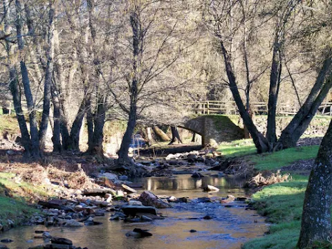
The path has its start and end in the popular recreational area La Aliseda (see on the map), which is accessed by the JA-7,100 road that runs between St. Helena and a point of the E-05 motorway near La Carolina. At the kilometer 4.3 of that road, a track goes down to the Campana River, which leads us to La Aliseda in just over three hundred meters. Next to the road we will have repaired in the ruins of a spa of the early 20th century that used the ferruginous waters of a spring known from ancient for its medicinal properties.

We are located in the public mountain La Aliseda, where is the La Olivilla Iberian Lince breeding center, integrated in the strategy put in place by the public administrations to recover this species in grave danger of extinction. We leave the recreational area, one of the most crowded in the province, by the stone bridge in front of the parking lot. We will see the river of the repressive Bell and chestnuts, strawberries and alms among other trees. Just out of this wooded area, some clues come out. We'll take the left one that goes parallel to the river at a certain distance from it. From it we will see the forest in a gallery that extends along the bank and, on our right, a pine of repopulation.

A few hundred meters later we arrived at a crossroads in which, on our right, the old road from La Aliseda to St. Helena converge. We continue to face, in a north direction, parallel to the river. In a few hundred more meters we reach a plain with pine trees, characterized by its large round and cedar cups, and very close to the road that access La Aliseda. If we get close to the bridge, we can see a very impressive strawberry on the same shore. Here we will make a 180-degree turn in our direction, entering the riverbank forest and returning to the recreational area in a south direction, the same as the waters of the river.

The five hundred meters back will be done by the sidewalk that goes by the river, under a lush mass of trees. The Campana River runs ten kilometres downstream in the Grande River, not far from La Carolina. This, in turn, feeds the Rumblar reservoir, in the vicinity of Baños de Encina, which was built in the forty years of last century for the creation of an important regable area.

The bank is a space that is transformed according to the seasons. The trees, benefiting from greater moisture, are of a caduca leaf, varying their volumes and colors at each moment, while the flow rates, which are the same as the Mediterranean climate. In the autumn, under the symphony of colors that create the decadent leaves, mushrooms and mushrooms proliferate on the ground and in fallen trunks. We will go through a pine tree, which will give way to a sketch of alyses, pizzas, skirmishes... until again we arrive at La Aliseda, ending the path here.

Breve descripción

This comfortable tour along the banks of the Campana River will allow us to meet one of the historic reference places of Sierra Morena in the vicinity of Despeñacolos and its Natural Park. The Aliseda, in fact, attracts from ancient times the attention of naturalists and therapists for the attractiveness of its landscapes and the quality of the waters of its springs, which were used by a spa of romantic air. Now the place is preserved in its natural purity, opening to the enjoyment of the many people who take advantage of their public facilities.

Latitud
38.0303
Longitud
-2.7204
Distrito
Municipio
Ubicación en el mapa
POINT (-2.7204 38.0303)
imagen
Image
18650258Master.jpg
Imagen principal
Activado
imagen
Image
Sendero%20R%C3%ADo%20de%20la%20Campana.jpg
Imagen principal
Desactivado
16 min

Nature

icon-intereses-naturaleza

Friends

icon-intereses-amigos

Adventure

icon-intereses-aventura

Culture

icon-intereses-cultura

Sport

icon-intereses-deporte

Eco-friendly

icon-intereses-eco-friendly

For couples

icon-intereses-en-pareja

Family

icon-intereses-familia

Gastronomy

icon-intereses-gastronomia

Municipality

icon-intereses-municipio

Low-cost tourism

icon-intereses-turismo-low-cost

Solo travel

icon-intereses-viajar-solo
Baja
Image
99299475-e0f5-c5ce-e9b1-f131e520a5c9?t=1588960963117
Image
314f791f-4a68-5888-a712-f94d8ef1b953?t=1588962465309
Sendero Río de la Campana
14m
14m
2
1
2
1
On foot
All year round
Desactivado

It is recommended to wear safe drinking water and clothing and adequate footwear. Ensure the potability of the water from the sources. Be careful with the traffic. This path can be realized throughout the year. In summer, due to the special conditions of height, the insolation is very strong and requires important solar protection.

- Medicinal water spring in La Aliseda.
- Ruined spa of the early 20th century.
- River of the Bell.
- The Iberian Lince Breeding Center "La Olivilla."
- Recreation areas

From St. Helena you have to take the road JA-7,100. A track that goes down to the Campana River and the La Aliseda recreational area, where the path begins, is located 4.3 km from the town.

Trail Molino del Batán

Submitted by brandcode_deweloper on
Id
2569103
Descripción larga

We will find traces of industrial facilities (batans or mills), of medieval origin, moved by the force of the running waters, a type of renewable energy that in the past was of the few available, and which is now revalued.

Continuing about a hundred and fifty meters along the JA-7.102 road, which has taken us to Miranda del Rey from the E-05 highway, we will find a road crossing that is where we start our path (see on the map). Here we will choose the track to the front, to the west, and we will walk without complications through a plain.

After six hundred meters we will cross the river of the Bañas, which is very close to that of the Noguera to form the Campana River. We will approach that second stream and walk on its left bank about seven hundred meters, northwest direction, until we reach the cortijo de la Noguera, which today became a school of nature. In four hundred meters we reach a hill in which there are two firewalls that serve as the limit of the Natural Park, where there is a barrier that we will have to cross while maintaining our course. The track is flanked by eucalyptus, which will later be replaced by pine trees, also of repopulation. The oak and other indigenous plants grow under these artificially introduced masses, as they are prepared to a particular reconquest. The road makes a uve to cross the stream of the Noguera, which we used to accompany, after which you reach a port with some cornoques around. From here, views are opened to the ravine of the Batan stream, to which we address, and the paths ahead of us can therefore be seen. We walk, in plural, because first we will go down the oblique slope to our right, next to the acequia of the Padilla Jump, until its derivation. The stream is covered by a riverside forest in which there are plenty of strawberries and alles that invite us to stop to enjoy its rich and ambient placid nature, from which is part a water birth with a curious anti-linear (convex folding) crowning it.

Between jaras and rosemos we will take the nine hundred meters to the crossing of the port, from where we will go back down, but now on the main road that is left, in a southwest direction. We are open to good views of the Calderon saw and the Star hill, to the north; and to the west the valley that forms the Dona Dama ravine and the Rope of the Stairs.

Our way, after crossing the waterfall again, runs in parallel to the stream, in which we can see the ruins of ancient mills, including the one that gives name to the path, the Batan Mill and another more flour built at the same time. In a little more than a kilometer of road, we will reach a sharp curve, after which we arrived at the bottom of the ravine where there is a water storage for the fire vehicles and a source, being this the end of the path.

Breve descripción

If we accept the proposal that we are made with this path, we will discover agricultural sites and representative landscapes of Despeñacolos, where the pulse of nature - flora, fauna, hydrography, geology... - still beats with strength, and human work is perceived as a historical challenge in pursuit of coexistence rather than domination.

Latitud
37.7796
Longitud
-3.7849
Distrito
Municipio
Ubicación en el mapa
POINT (-3.7849 37.7796)
imagen
Image
706_SS_01.jpg
Imagen principal
Activado
imagen
Image
Sendero%20Molino%20del%20Bat%C3%A1n.jpg
Imagen principal
Desactivado
2 h 50 min

Nature

icon-intereses-naturaleza

Friends

icon-intereses-amigos

Adventure

icon-intereses-aventura

Culture

icon-intereses-cultura

Sport

icon-intereses-deporte

Eco-friendly

icon-intereses-eco-friendly

For couples

icon-intereses-en-pareja

Family

icon-intereses-familia

Gastronomy

icon-intereses-gastronomia

Municipality

icon-intereses-municipio

Low-cost tourism

icon-intereses-turismo-low-cost

Solo travel

icon-intereses-viajar-solo
Baja
Image
a080e20c-f759-841d-d7ca-6ee1ff0fe4e8?t=1588960487655
Sendero Molino del Batán
20,7 km
980m
980m
1
2
2
2
On foot
All year round
Desactivado

It is recommended to wear safe drinking water and clothing and adequate footwear. Ensure the potability of the water from the sources. Be careful with the traffic. This path can be realized throughout the year. In summer, due to the special conditions of height, the insolation is very strong and requires important solar protection.

- Remains of mills and hydraulic batans of medieval origin.
- Miranda del Rey village.
- Las Nogueras School of Nature.
- Barrio of the Batan stream.

From Jaén, on the E-05 motorway, you have to take Exit 259 to Santa Elena, go to the town and go to the Visitors' Centre Puerta de Andalucía, where you take the road JA-7.102 to Miranda del Rey. We must pass the village house without leaving the road until we find a crossing at 150 m., where the path begins.

TRAIL OF THE CUEVA DE LOS MUÑECOS

Submitted by brandcode_deweloper on
Id
2567104
Descripción larga

The path begins at the Centre for the Interpretation of the Historical and Cultural Heritage of the Natural Park of Despeñacolos (see on the map), which is reached by the road A-6,200 from the E-05 motorway, towards Aldeaquemada. The center has been built on an old aprisco at the foot of the hill of the Castle. On the contrary side of this run through the historic passage of Despeñapeas the highway of the South.

However, on this side where we find the intense traffic of the fast track seems far away. The visit to the centre is certainly recommended, as it provides information on the natural and cultural heritage of the environment and also of this path. Around the center we see places of great ecological significance. On the umbria slopes, facing north, we will see forest formations with tree leaves, like the whine, and shrubs like doves or madroños. On the other hand, in the solana, the mountain is dominated by cobblestones with little sodoscala, made up of pyruetans, jars, rosemary, etc.

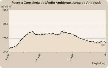
The path consists of two sections of about five hundred meters each, starting both from the interpretation center. One goes up to the hill of the Castle - towards the west - and the other goes down to the cave of Los Muñecos, in a southwestern direction. Although the order to travel them is indifferent, as in any case we must return to the interpretation center, we will assume that we will first take the climb to the hill. The sinuous path that we will take goes through a relatively lush encore that disappears around the 920 meters. Then, until the top of the hill, at 961 m, we will see more naked rock than vegetation.

There are in the high remains of a possible Iberian village and a lookout towards the plateau with overwhelming views, with St. Helena to the south and the port of the Muradal to the Plateau. In front, the impressive pettic structure of Mount Los Organos and, under us, the highway that follows the itinerary that with great difficulty opened at the end of the 18th century, as an alternative to the road of Las Ventes (by Los Pedroches) and other itineraries in use between the ports of Cadiz and Sevilla - doors of Américo - and the capital of the kingdom.

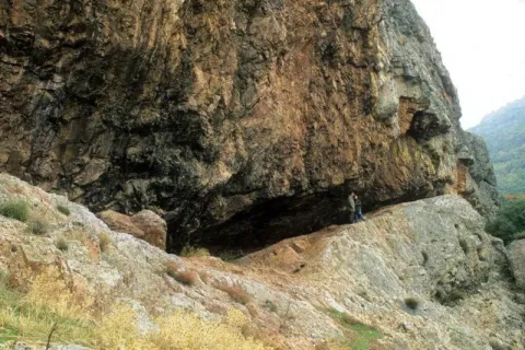
After walking the way to the center of interpretation, we will head towards our second destination, the cave of Los Muñecos. We will descend on a soft slope by the skirt of the hill of the Castle, and in parallel to the electric slope, towards the road we arrived for, we will cross the lower part of the same oak that we have already met up to the hill, in which we will also see alcornoques and junips of great bearing.

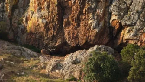
In two hundred and fifty meters we will reach a point very close to the road, where we will change course to surround the cut we see on our right, in which environment we can distinguish maples of Montpellier and abundant cornicabra. We must be careful with some slopes and pozas of the numerous excavations around here, as we are in a rich area of archaeological deposits, with the cave of Los Muñecos as the center of them, where the path ends.

Breve descripción

The culture of the Iberians keeps many mysteries that may never be explained. Their beliefs are almost unknown, but no one is surprised that they had in these places one of their main places of worship, and even more so that the Romans would take on him to satisfy their gods.

Latitud
37.9801
Longitud
-3.0504
Distrito
Municipio
Ubicación en el mapa
POINT (-3.0504 37.9801)
imagen
Image
7bf891e7cd51422669fbe9bfa4ec577e.jpg
Imagen principal
Activado
imagen
Image
Sendero%20de%20la%20Cueva%20de%20los%20Mu%C3%B1ecos2.jpg
Imagen principal
Desactivado
imagen
Image
Sendero%20de%20la%20Cueva%20de%20los%20Mu%C3%B1ecos.jpg
Imagen principal
Desactivado
1 h 42 min

Nature

icon-intereses-naturaleza

Friends

icon-intereses-amigos

Adventure

icon-intereses-aventura

Culture

icon-intereses-cultura

Sport

icon-intereses-deporte

Eco-friendly

icon-intereses-eco-friendly

For couples

icon-intereses-en-pareja

Family

icon-intereses-familia

Gastronomy

icon-intereses-gastronomia

Municipality

icon-intereses-municipio

Low-cost tourism

icon-intereses-turismo-low-cost

Solo travel

icon-intereses-viajar-solo
Medium
Image
b5e34fb6-b091-5c60-4d06-3974839debc2?t=1588960148343
Image
addfdc00-5c39-b0e1-c182-ea84a4571baa?t=1588960133035
Sendero de la Cueva de los Muñecos
3,2 km
150m
150m
2
2
2
1
On foot
All year round
Desactivado

It is recommended to wear safe drinking water and clothing and adequate footwear. Ensure the potability of the water from the sources. This path can be realized throughout the year. In summer, due to the special conditions of height, the insolation is very strong and requires important solar protection. Caution with the strong slopes of the last stretch and the pozas of archaeological excavations.

- Centre for the Interpretation of the Historical and Cultural Heritage of the Natural Park of Despeñacolos
- Cueva de los Muñecos, which dates back to the 6th century BC and is considered one of the oldest Iberian extra-urban shrines, and also of those who had a certain character of territorial control.
- Cerro del Castillo, at 961 m altitude, old Iberian settlement.
- The organs.

The path begins at the Centre for the Interpretation of the Historical and Cultural Heritage, which is reached by the road A-6,200 which, coming from the highway A-4 (exit in the km 250, towards Cadiz), leads to Aldeaquemada.

Tramo de asfalto o cemento
 
Tramo de pista o camino forestal
 
Tramo de vía pecuaria
 
Tramo de senda
 

Trail Ravine of Valdeazores

Submitted by brandcode_deweloper on
Id
2557141
Descripción larga

We will have to be located in the forest house of Valdeazores, which is accessed from the A-4 motorway, only in the sense of Madrid- Cádiz, by a track that leaves to the right in the km 245.3, two hundred meters after passing the signal that indicates the entrance to Andalusia and shortly before the lookout of the Garden of Despeñacolos. We will climb three hundred meters along this track until we reach a forest house, from which parking is on the path.

We will go north, but at the very least we will be heading towards the west, which is the one that we will keep in the first half of the way to the head of the Valdeazores stream, following at first a water drive. As in much of the way, we will go up a smooth but continuous slope. We will see mixed forests around us that are the result of repopulations, in which pine trees abound in the solanas, and cypresses in the umbria. The indigenous vegetation is gaining ground with the height, also remaining in important stains on the other side of the stream - dark - that have a humid Mediterranean mountain with oaks, alcornoques, complaints, oaks, or oaks. On the riverside there are formations in a gallery of alles and strawberries, splintered with willows, tampas and tampas.

When we have already walked about two and a half miles, we reach a chestnut in which there is a spring that supplies the driving that accompanied us. It is a good place to rest and enjoy the beak of expired leaves, taking strength to continue with the rise. A kilometer later, already at the head of the stream, we will give with the track that goes down from the port of Muladar to the castle of Castro Ferral, which is located about a mile away. We can choose to approach this medieval fortress that protected the passage of La Losa, which was finally taken to the Almohades by Christian armies in the framework of the battle of the Saves of Tolosa. It is in ruins because it was later abandoned and destroyed to prevent its use by outlaws.

If we rule out the variant of the castle on the track we will only do about 50 meters, and we will leave it on a road that leaves it to the right in the direction of the Aviation Collado, as the signs indicate, completing a 180º turn that will set us to the east, walking on the crest of the right bank of the ravine. The humid Mediterranean mountain we saw from the other side is below us, which now again we are surrounded by pine trees.

We will walk two and a half miles further to crown the hill of Los Organos (natural monument), where there is the refuge of the Aviation Collado, a small air surveillance post of the Civil War, later used by pastors and fire devices. Following the path that continues in the same direction that we brought, we will cross a bosquet of pine trees, oaks, alcornoques and moans, to go out to a clear place where there is a small lookout with magnificent views of the Despeñacolos parade, which is where the path ends.

Breve descripción

The Valdeazores stream has a short perpendicular route to the Despeñafueros parlor, where it flows. The path borders its entire basin, a ravine of regular forms covered in one part by a rich and diverse Mediterranean mountain, and in another by coniferous introduced by forest populations. To the considerable natural values of the place are added other of historical or cultural type, related to the strategic character of the parade, from which we will have juicy views from a viewpoint located on it.

Latitud
38.0204
Longitud
-2.7802
Distrito
Municipio
Ubicación en el mapa
POINT (-2.7802 38.0204)
imagen
Image
1928831Master.jpg
Imagen principal
Activado
imagen
Image
Sendero-Barranco-de-Valdeazores-033.jpg
Imagen principal
Desactivado
5 h 30 min

Nature

icon-intereses-naturaleza

Friends

icon-intereses-amigos

Adventure

icon-intereses-aventura

Culture

icon-intereses-cultura

Sport

icon-intereses-deporte

Eco-friendly

icon-intereses-eco-friendly

For couples

icon-intereses-en-pareja

Family

icon-intereses-familia

Gastronomy

icon-intereses-gastronomia

Municipality

icon-intereses-municipio

Low-cost tourism

icon-intereses-turismo-low-cost

Solo travel

icon-intereses-viajar-solo
Medium
Image
8a951538-46cd-102e-4868-5e313957e4c2?t=1588958697173
Image
3668f15d-8b96-b9ff-ca1e-0d0c63f7738d?t=1588958670866
Sendero Barranco de Valdeazores
12,8 km
300m
300m
1
2
2
2
On foot
All year round
Desactivado

It is recommended to wear safe drinking water and clothing and adequate footwear. Ensure the potability of the water from the sources. This path can be realized throughout the year. In summer, due to the special conditions of height, the insolation is very strong and requires important solar protection.

- Parade and step of Parade.
- Arroyo de Valdeazores
- Ruins of the medieval Castle of Castro Ferral
- Natural Monument of the Organs

On the A-4 highway, towards Cadiz, we will take the track that goes right in the km. 245.3, about two hundred metres from the signal that indicates the entrance to Andalusia, which will take us - after going 300 meters - to the forest house of Valdeazores, next to which the path begins.