Saltar al contenido principal

Hotel Orellana Perdiz Nuevas Poblaciones

Submitted by brandcode_deweloper on
Id
10332778
Descripción
Breve descripción

Hotel Orellana Perdiz Nuevos Poblos is located on foot of the motorway of Andalusia A4 SUR km. 266 to Madrid

Información de contacto
Teléfono
953 660 600
Sitio web
https://www.orellanaperdiz.es/alojamiento/hotel-orellana-perdiz-nuevas-poblaciones/
Correo electrónico
info@orellanaperdiz.es
Ubicación
Código Postal
23200
Latitud
38.282058
Longitud
-3.591720
Dirección
Autovía de Andalucía A-4 Sur, km. 266 (Dirección Madrid)
Distrito
Municipio
Ubicación en el mapa
POINT (-3.59172 38.282058)
Tipo de alojamiento
Imágenes
imagen
Image
HABITACION_03-1.jpg
Imagen principal
Activado
imagen
Image
HABITACION_08%20%281%29.jpg
Imagen principal
Desactivado
imagen
Image
HABITACION_09.jpg
Imagen principal
Desactivado
imagen
Image
HABITACION_10.jpg
Imagen principal
Desactivado
imagen
Image
SERVICIO_06-1.jpg
Imagen principal
Desactivado
Las habitaciones

air-conditioned rooms and flat-screen TV. Free Wi-Fi will keep you in touch with your own; you can also watch your favorite program on digital TV. The private bathroom is equipped with a deep bath and free personal hygiene.

Número de estrellas
3
Loading map
Preparing points of interest and routes...
El Hotel

He knows the Castle that named the Battle of the Navas de Tolosa, visits the ruins of ancient mines of Plomo and Plata as well as its villages and enjoys fantastic mining landscapes, discovers the world of the Toro Bravo from within and "champion" next to the cattle of the "Toros de Orellana Perdiz."

Hotel Orellana Perdiz Castillo Navas de Tolosa

Submitted by brandcode_deweloper on
Id
10333304
Descripción
Breve descripción

The Hotel Orellana Perdiz Castillo Navas de Tolosa is located on foot of the motorway of Andalusia, at a strategic point to know the province of Jaén.

Información de contacto
Teléfono
953 660 600
Sitio web
https://www.orellanaperdiz.es/alojamiento/hotel-orellana-perdiz-castillo-navas-de-tolosa/
Correo electrónico
info@orellanaperdiz.es
Ubicación
Código Postal
23200
Latitud
38.295407
Longitud
-3.588323
Dirección
Autovía de Andalucía A-4 Sur, km. 265 (Dirección Sevilla)
Distrito
Municipio
Ubicación en el mapa
POINT (-3.588323 38.295407)
Tipo de alojamiento
Imágenes
imagen
Image
Habitacion%20OPI.jpg
Imagen principal
Activado
imagen
Image
29%20HOTEL%20ORELLANA%20PERDIZ%20I.JPG
Imagen principal
Desactivado
imagen
Image
170531412_933868294035150_221133106912795958_n.jpg
Imagen principal
Desactivado
imagen
Image
DSC_0398.jpg
Imagen principal
Desactivado
imagen
Image
PISCINA_VERANO_07-1.jpg
Imagen principal
Desactivado
Las habitaciones

All rooms at the hotel are equipped with a wardrobe, a flat-screen TV and a private bathroom.

Qué ofrece

Located in The Carolina in the Highway of Andalusia A-4 South at the Pk 265-266 a both margins of the Highway and in Sierra Morena in the vicinity of the Natural Park of Despeñacolos, you will enjoy a welcoming hotel with family treatment, where the gastronomy based on the hunting kitchen and on the roasts in our wood furnaces are the main incentive to taste our specialties in Perdiz scapeñada and Pate de Perdiz.

Inside our facilities is the Castle of the Navy of Tolosa, included within the Route of the Castles and the Battle, as well as the Route of the Nazaris of the Andalusian Legate, surrounded by the Livestock de Reses Bravas "Toros de Orellana Perdiz," as well as our facilities are splashed from former mining villages where Galena Argentífera was used to be removed from the Linares Mining District - The Carolina.

Número de estrellas
2
Loading map
Preparing points of interest and routes...
El Hotel

He knows the Castle that named the Battle of the Navas de Tolosa, visits the ruins of ancient mines of Plomo and Plata as well as its villages and enjoys fantastic mining landscapes, discovers the world of the Toro Bravo from within and "champion" next to the cattle of the "Toros de Orellana Perdiz."

Finca El Vizconde Country Estate

Submitted by brandcode_deweloper on
Id
4395802
Redes sociales
Facebook
https://facebook.com/fincaelvizconde/
Instagram
https://instagram.com/fincaelvizconde/
Descripción
Breve descripción

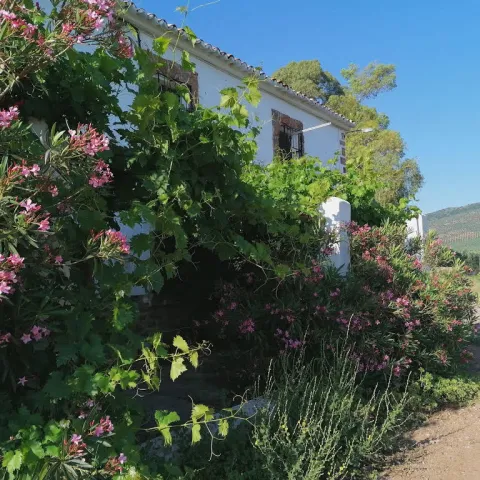
Finca el Vizcondeis a rural house located in the north of the province of Jaén, near Sierra Morena, with 200 Ha. of dehesa around. Ideal forgo to the country with children.

Información de contacto
Teléfono
629 411 052
Sitio web
www.cortijovizconde.com
Correo electrónico
david@cortijovizconde.com
Ubicación
Código Postal
23230
Latitud
38.165562
Longitud
-3.448812
Dirección
Ctra. A-312, km. 26
Distrito
Municipio
Ubicación en el mapa
POINT (-3.448812 38.165562)
Tipo de alojamiento
Imágenes
imagen
Image
portada%20del%20cortijo.jpg
Imagen principal
Activado
imagen
Image
Finca%20El%20vizconde2.jpg
Imagen principal
Desactivado
imagen
Image
Finca%20Vizconde%20%281%29.jpg
Imagen principal
Desactivado
imagen
Image
Finca%20Vizconde2.jpg
Imagen principal
Desactivado
Aforo
10
Idiomas
Las habitaciones

The bedrooms.There are 5 of them, one of them is prepared for people with reduced mobility and a bathroom right next door. The bedrooms are spacious and also have a wardrobe with their respective hangers as well as chairs to be able to sit for a while.

The bathrooms.There are 2 in total, with shower plate, hairdryer and a large mirror in each of them, in addition to the soap dryer with its dispenser, kit, and other bathroom accessories.

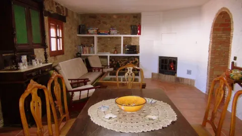
There are two rooms,One of them has a fireplace to cook with a total surface of 30 square meters. With his table, sofas, chairs and chairs. The other also has 30 square meters of surface with wood stove. They have tables, sofa, chairs, chairs and even a football.
There's a TV in the small room, but there's a lot of books all over the house. For the little ones we have table games, puzzles, books and many toys.

Qué ofrece

accommodation in an Andalusian cortijo surrounded by a dehesa of oak, a cereal field and the marsh of the guadalen

Loading map
Preparing points of interest and routes...
El Hotel

It is reached by 300 m ofasphalt roaddirectly from road A-312.

It has two floors, it is a rural building of several centuries that has been continuously inhabited until a year ago. With sober rustic decoration and warm atmosphere. Extensive possibilities offlexibility for room distributionand environments according to the number of occupants. We adapt to the needs of the traveller.

There is a fully equipped kitchen, has a dishwasher, washing machine, oven, gas kitchen, bell, microwave, fridge, coffee maker, toaster, squeezer, mixer, pot, pots, pans, paella rosco, grills, water heater, etc. And the full crockery of glasses, dishes, cutlery, kitchen linen,

It has Biomasa heating, which demonstrates our commitment to the environment, with pre-installation for solar plates, which we will be riding in the future. The lamps are of low consumption.

On the outside, there is a wide space for parking inside the estate, with an old age attached, where the work of the trilla was previously done (separate the grain from the spike). There is also a barbecue with wood, to roast the roast, as well as a related garden to be able to play cards, read or whatever it takes.

La Finca el Vizconde is aisland in the sea of Jaén olive trees, the world's largest humanized forest. The house is surrounded by 200 Ha. of dehesa where a flock of sheep pours. You can walk all over the estate enjoying the magnificent landscapes offered by Jaén's dehesas.

In addition to this, the whole estate is separated by a fence of the Guadalén swamp that surrounds us, making us a peninsula. In the swamp can developwater activities or sports fishingprovided that the relevant licence of the board of Andalusia is available.

From the Finca el Vizconde we have prepared severalroutes to make by carfor a few hours so that you can quickly know the tourist points closest to the estate, which are not few. Ask us for this information when you're with us.

It is the ideal place for family meetings at an intermediate point. Interestingly the transit time from the Viscount to the following points is the same:

Madrid 2: 45 from the Vizconde 2: 42 from Seville
Madrid 2: 45 from the Vizconde 2: 45 from Malaga
Madrid 2: 45 from the Vizconde 2: 43 from Almería
Valencia 3: 47 from the Vizcount 3: 42 from Cadiz
Valencia 3: 47 from the Vizcount 3: 33 from Huelva

So if you want to split the driving time and spend a few days together this is your place.

Colonos Rural Accommodation

Submitted by brandcode_deweloper on
Id
13544959
Redes sociales
Facebook
https://www.facebook.com/colonos.alojamientosrurales
Descripción
Breve descripción

We have different charming rural accommodation located in Guarromán in the province of Jaén, very close to Despeñacolos in Sierra Morena, where you can enjoy a quiet and pleasant stay in contact with the nature of the place surrounding our rural complex. In Colonos we want to offer personalized attention, with exclusive services for our customers. You just have to show us your preferences and we'll set you up for a few days.

These houses are named after our ancestors, people who inhabited the place. Thus, we have the house of Pajar de Thürriegel, Felipe Mitelbrun, María Fischer and Margarita Ripoll, keeping inside their portraits and family memories. These are documents that prove their history outside of the New Populations: letters from Olavide, remittances from settlers, agrarian measures of the time, furniture, artisanal works carried out by colonists of the fourth generation...; all to create an environment that seduces the guest and introduces him into the mystery and curiosity of a time not far but perhaps something unknown. To watch over our dreams the Immaculate Conception that presides over the headers of all beds will be taken care of.

Información de contacto
Teléfono
637 467 908
Sitio web
www.colonosaldeaaltico.com/
Correo electrónico
reservas@colonosaldeaaltico.com
Ubicación
Código Postal
23210
Latitud
38.214314
Longitud
-3.667722
Dirección
Aldea El Altico
Distrito
Google Maps Url
https://maps.app.goo.gl/XFAvrPKcT9BySxUc8
Municipio
Cómo llegar (URL de Google Maps)
https://www.google.com/maps/embed?pb=!1m18!1m12!1m3!1d671.117265085915!2d-3.668062606786804!3d38.21425736047237!2m3!1f0!2f0!3f0!3m2!1i1024!2i768!4f13.1!3m3!1m2!1s0xd6e9ed68939c5e9%3A0x4dac5455510e7198!2sAlojamientos%20Rurales%20%22Colonos%22!5e1!3m2!1ses!2ses!4v1747226292655!5m2!1ses!2ses" width="600" height="450" style="border:0;" allowfullscreen="" loading="lazy" referrerpolicy="no-referrer-when-downgrade
Ubicación en el mapa
POINT (-3.667722 38.214314)
Tipo de alojamiento
Imágenes
imagen
Image
zona-comun_8-jpg
Imagen principal
Activado
imagen
Image
zona-comun_22-jpg
Imagen principal
Desactivado
imagen
Image
felipe-m_6-jpg
Imagen principal
Desactivado
imagen
Image
felipe-m_42-jpg
Imagen principal
Desactivado
imagen
Image
zona-comun_38-jpg
Imagen principal
Desactivado
imagen
Image
zona-comun_25-jpg
Imagen principal
Desactivado
imagen
Image
margarita-r_7-jpg
Imagen principal
Desactivado
imagen
Image
margarita-r_27-jpg
Imagen principal
Desactivado
Aforo
18
Las habitaciones

The "Los Colonos" rural complex is a renovated and adapted rural accommodation to offer our guests a unique experience in the heart of nature. To stress that our rural accommodation share wonderful facilities to ensure a pleasant stay to our customers. The complex has a house adapted for the elderly or disabled, cradle and parquet-cradle for children.

Colonos consists of three rural accommodation, fully equipped with the best facilities and decorated with care, each house has two floors with hardwood ceilings, where the bedrooms are located.

Qué ofrece

In Colonos we want to offer personalized attention, with exclusive services for our customers. You just have to show us your preferences and we'll set you up for a few days.

  • Guided tours to the heritage cities of Ubeda and Baeza humanity.
  • Horseback riding, equestrian initiation activities.
  • Routes through the natural park of Despeñacolos (hiking, rough painting routes, history, flora and fauna.; night routes...).
  • Oleoturism.
Loading map
Preparing points of interest and routes...
El Hotel

These are 3 fully independent accommodation:

• Maria Fischer with capacity for nine people, but can be rented in two independent parts of 4 and 5 people respectively. The first stay consists of 2 double rooms, living room, kitchen and a bathroom and the second stay, called Parar de Thürriegel, consists of a triple room, a double room, living room, kitchen and 1 bathroom.
• Felipe Mitelbrum for five people, has a triple room, a double room, living room, kitchen and a bathroom.
• Margarita Ripoll for four people, with a double room, a double room, living room, kitchen and a bathroom.

Santa Elena

Submitted by brandcode_deweloper on
Id
750455
Perfil de redes sociales
Facebook
https://www.facebook.com/AyuntSantaElena/
Twitter
https://twitter.com/santaelenajaen
Youtube
https://www.youtube.com/user/santaelenajaen
Descripción
Breve descripción

Nice town, located in the northernmost area of the Sierra Morena regionnext to the provincial border with Ciudad Real.

The northern part of its term is found within the Natural Park of Despeñapores and its geographical position makes it the greatest point of passage between Andalusia and the plateau so it receives the nickname "Puerta de Andalucía. "

It is one of the few municipalities with little agricultural interest, only 1% of its term is cultivated land.

Its economy is based mainly on the exploitation of the mountain, among which the forest, cynegetic, mushroom collection and livestock, usually cattle. The passage of the motorway of Andalusia has developed a relevant hotel offer.

It has two nests: Miranda del Rey and Venta Nueva.

From its historical heritage we highlight the St. Helena Parish Church, Iberian Shrine of the Collado de los Jardines, Urban Helmets and Rupestrian Paints in St. Helena.

Telecomunicaciones
Teléfono
953 664 010
Sitio web
www.santaelena.es
Fax
953 664 253
Correo electrónico
santaelenajaen@gmail.com
Ubicación
Nombre
Santa Elena
Latitud
38.340230
Longitud
-3.539800
Distrito
Municipio
Ubicación en el mapa
POINT (-3.5398 38.34023)
Imágenes
imagen
Image
56f3a98d-b73d-3f55-8527-4d32fc56ae8f?t=1621425534983
Imagen principal
Desactivado
imagen
Image
e0fb7c79-3e7f-346a-cc16-3c8006bb9462?t=1610986998582
Imagen principal
Desactivado
imagen
Image
3429e098-1c49-2cdf-4ef5-179be64fce14?t=1621425535119
Imagen principal
Desactivado
imagen
Image
4e91cd6e-bea0-d427-df82-939c7ce7f23c?t=1621425535162
Imagen principal
Desactivado
imagen
Image
10c50cba-ee4b-ebcf-0e3e-0d11e8e97728?t=1621425535219
Imagen principal
Desactivado
imagen
Image
0c44f832-9d15-336d-b8e7-72044fea6e76?t=1610986998629
Imagen principal
Desactivado
imagen
Image
b5682c3b-4bf3-f730-fe45-52d0391f170c?t=1621425535421
Imagen principal
Desactivado
imagen
Image
78ede978-44df-d8c2-c363-f10c79bea024?t=1621425535584
Imagen principal
Desactivado
Información adicional
Curiosidades

OFICINAS DE INFORMACIÓN Centro de Visitantes LLANO DE LAS AMÉRICAS

  • Autovía A4, salida 257. Ctra. Miranda del Rey, Km. 2   
  • (Abierto de jueves a domingo)
  • Tfno.: 610 282 531
  • Email: puertanatura@hotmail.com
Imágenes cabecera
imagen
Image
Santa Elena
Imagen principal
Desactivado
Datos de interés

Tourist area: Sierra Morena / Despeñacolos

Distance to the capital (km): 78

Altitude over sea level (m): 742

Extension (Km2): 144

Number of inhabitants: 1,003

Gentilicon: Santaeleneros

Postal code: 23213

Videos
Video file
Cultura
  • St. Helena Parish Church: It was erected in 1793 on an ancient medieval hermitage, which had been raised to commemorate the Christian victory in the battle of the Navas de Tolosa, which had these sites on stage and to guard the Cross to which the miracle was attributed. Built of redesigned and painted masonry, with a simple facade, of small dimensions. A staircase stands out the access door, composed of a half-point arch on imposts, flanked by Tuscan pillars that give way to an inlet finished with triangular fronton and two bones, one on each side. On the top of the first body, the pyramidal structure is raised to three levels, with pinacles at the ends and half-point holes for bells. Inside it is a single drawer ship, covered with a half-canyon vault and double lunetes on the sides. The presbyterium is opened with a spinal arch, covered with an arista vault and illuminated with two large bone-shaped windows. The header is presided over by the image of its patron saint, St. Helena, between dogrous columns that support an injunction and a curved fronton. It was remodeled in 2001.
  • Iberian Shrine of the Collado de los Jardines: It is located in the heart of Sierra Morena Oriental, on the most important traditional road of communication between Alta Andalucía and the Plateau. For the Iberian shrines they chose places, usually caves, located next to springs and forests, where it was thought that the divinity lived and where the faithful went to worship, pray and deliver offerings to their divinities. These offerings were what we know as "exvotes," small statues, between eight and twenty cm, made of bronze, stone or mud. In Iberian Shrine of the Collado de los Jardines There have been many exvotes, most of them bronze, representing men and women offering, priests, warriors and objects. It is part of the whole town that was excavated on the hill adjacent to the castle, where a wall, a sacred enclosure and a cast of metal exvotes have appeared. We meet before one of the three great Iberian shrines of the peninsula.
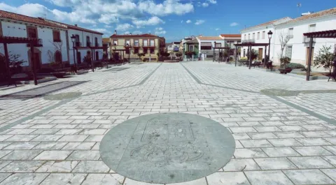
  • St. Helena's Urban Helmets:Given its geographical location, a forced passage between the plateau and Andalusia, has experienced many historical events. The Battle of the Navas de Tolosa in 1212 in which King Alfonso VIII of Castile defeated the Almohades. To commemorate this battle, a hermitage was erected in honor of the Empress St. Helena, who would later name this place and the new population, which King Charles III founded in 1767. In the colonizing urbanism of Sierra Morena, the most important element is the large rectangular square, from which they leave streets on each side and where are the important buildings, such as the Church, the City Hall and the posite of Diezmos and Labradores. The rest of the town is organized from the Plaza. The streets are dominated by axial perspectives, houses of the same height and proportions, reticular fabric and geometric structure. It only deviates from the neoclassical model on its perimeter, to adapt to the road. It has been declared Good for Cultural Interest.

  • Rupestrian Paints: The province of Jaén has more than forty points with rock paintings, declared World Heritage Sitewithin the whole Mediterranean arc. Some of them are found in St. Helena with exceptional testimonies of schematic and seminaturalist paintings, located in coats of the area, including those of the Cave of the Cows of the Retamoso in the area of the bodies, Cave of the Holy, the Cave of the Schools and some more.
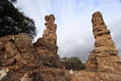
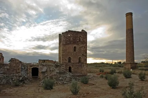
  • Mining Heritage. The landscape of ancient mines and Mediterranean mountains of the former Minero District extends to eight municipalities: Linares, La Carolina, Bailén, Baños de la Encina, Vilches, Guarroman, Santa Elena and Carboneros. This mining activity has left in these municipalities an exceptional concentration of remains, unique vestiges in the world and representative of the industrial revolution in the 19th century.
Naturaleza

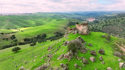
St. Helena is located in the northernmost sector of the northern region, next to the border with the province of Ciudad Real.

It is of the few municipalities of the province without agricultural vocation, only 1% of the total area. So its economy is based on development of the mountainincluding forest, cicnetic, mushroom collection and livestock (cattle).

The passage of the highway of Andalusia through the municipality has developed in the town a certain hotel offer of importance.

By its term the rivers run Caraway and Bell.The northern part of the municipality of St. Helena belongs to the Natural Park of Despeñacolos, of great landscape, faunistic and botanical interest.

The Park includes, among others:

  • Place of the bodies, declared a Natural Monument of Andalusia. A place where a set of huge rock columns that resemble the tubes of the organ of a cathedral. Increases the beauty of this place the chromatic contrast of the grey of the coas with the intense yellow and orange of the different species of lichens that survive in them. On these rocks, oaks, alcornoques and shrubs form a Mediterranean forest in which they inhabit ginets, chickpeas and numerous rapacious birds.
  • Embryo de los Organos: It is an affront place that was inhabited from very old, as shown by the rock paintings found. From here we can discover the pineapples of repopulation (carrascos, black, pineapples), sodas of alcornoques, complaints, oaks and madroños.
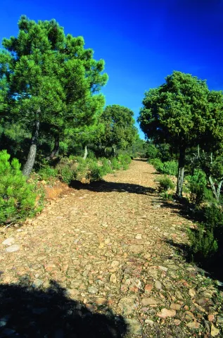
  • The Empedraillo: These are the interesting remains of a small section of the Roman road that unites Catulo (Linares) and the Galena mines of El Centenillo with Toledo.
  • Quejigal del Collado de los Jardines: Also located in the Natural Park of Despeñacolos, its biodiversity stands out. In the plant species we find complaints, alcornoques, maples and other species typical of the Mediterranean forest. With regard to the faunistic species that inhabit this place quote the wolf, lince, the otter, imperial eagle, royal eagle and azor.

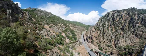
If anything characterizes Despeñacolos are their unique geological formations. The Despeñapoerno de Despeñaperes, with 4 km of extension is the product of the erosion of the stream of the same name on a natural failure of the Iberian Macizo and the main means of communication between Castilla La Mancha and the lower lands of the Guadalquivir valley.

Fiestas y Eventos
  • Sunday of Resurrection: From the Central European settlers who came in the 18th century, only the tradition of painting cooked eggs, which are eaten in the area of La Aliseda, is left. Before you have to meet the rite of making them roll by a earring of grass so they don't break. This has meant that, in St. Helena, the feast of this very well-known day is known as Rolaeggs.
  • Romeria de San Isidro: On May 15, the neighbors of St. Helena accompanied San Isidro, in gilded carrots for that party until the site of The Aliseda. In this place, of incomparable beauty, a mass is held in honor of the Holy and a whole day of field is spent.
  • Patron parties: In honor of their patron saint St. Helena, parties are held between 17 and 21 August. During all these days there are many and varied leisure and sports activities. On the 17th, with the traditional repeat of bells, the beginning of the parties is announced and the three rocket warnings indicate the beginning of the cobblestones in the streets of the town. In the afternoon, taurino show. We arrived at 18 August, big day. In the morning Mass in honor of the Holy and invitation to all attendees in one of the houses. At night, the most important event of the whole fair that is the procession of the Patronthat accompanied by a music band runs through the streets of the village. On the 20th and 21st days, the morning and evening cobwebs and taurino festival return. The fair ends with a powerful haze on the 21st of the morning.
Gastronomía

St. Helena for its location in Sierra Morena is a very suitable place to take mountain meat, either from major game (deer, boar or gamo) or from small game (perdiz, rabbit or hare).

  • Andrajos: Made with a mass of flour (andrajo) that is cooked in a broth of hare meat with a saffrito of peppers and tomatoes flavoured with mint.
  • Pipirrana: Salad made from roasted peppers, olives, cooked eggs, tuna and olive oil.
  • Sage in salsa: It is made with deer meat, onion, tomato, flour, water, thyme, rosemary, peppers, olive oil and almonds.
  • Niselos al ajillo: Niscalos, olive oil, ham, garlic, parsley white wine and salt.
  • Tortilla Alfonso XIII: Made of eggs, ham, lamb kidneys, mushrooms, salt, fried tomato and olive oil.

Warehouse:

  • Sweet Gachas: With toast, hot milk or boiler honey, flour, sugar, cinnamon powder olive oil. They are preparing for the feast of All Saints.
  • Pestiños: They are made with olive oil, wine, dry spirits, sugar, cinnamon and flour.
  • Lis flower: Eggs, flour, milk, sugar and olive oil, salt and cinnamon or melted honey for irrigation.
  • Risol: A drink made with sweet anis, coffee, mejana and water.
Historia

The area has been occupied from prehistoric periodAs shown by the rock paintings located in the area's coats, with more than five thousand years old and declared a World Heritage Site in 1998.

In time of the Iberiansin the term of St. Helena was one of the most important centres of worship: Shrine of the Collado de los Jardineswhere many Iberian exvotes and the remains of what could have been a village have been located, not only in Iberian times but also in Roman and medieval times. The sanctuary also known as Cave of the Dolls has been used by the Romans for religious worship.

In the Age of Mediathe most important event is the Battle of the Navas de Tolosain 1212. The town is very close to it, in the vicinity is the Museum of the Battle de las Navas de Tolosa. The Almohade army was defeated and King Alfonso VIII of Castilla, ordered to build in the place a hermitage to guard the Cross to which they attributed the miracle of victory and a window-castle, to commemorate the triumph over the Almohades and that currently It is part of the Route of the Castles and the Battle.

In this same place in the 18th century, one of the New populations of Sierra Morena, project driven by the King Charles III. One of these populations is St. Helena. With the settlers, farmers from Centroeuropa (French, German and Flemish), efforts were made to establish a population and generate wealth in the depopulated areas of Sierra Morena while ensuring the passage of Despeñacolos.

In 1793, the population was in a ruinous state and it was King Charles IV who ordered it to demolish and build a new colonial type..

Otra información

It has recently been built in the municipal term, the Museum of the Battle of the Navas de Tolosa. The museum is one of the most interesting points on the route of the Castles and the Battle and is the starting point for the seventeen municipalities that make up this tourist product. Very close is the Iberian Sanctuary of La Cueva de los Muñecos and The "Llano de las Américas" Interpretation Center.

Loading map
Preparing points of interest and routes...
Imagen principal
imagen
Image
Santa Elena
Imagen principal
Activado

Montizón

Submitted by brandcode_deweloper on
Id
747343
Perfil de redes sociales
Facebook
https://www.facebook.com/Excmo-Ayuntamiento-de-Montiz%C3%B3n-134300986955139/
Descripción
Breve descripción

Montizón is a municipality located to the north of the district of El Condado, on the provincial border with Ciudad Real, just on the north-east end of Sierra Morena.

It is one of the nuclei of the "New Populations of Sierra Morena," founded in the 18th century by Charles III, to repopulate this area within the Sierra Morena colonization plan.

Three population centres form the municipality: Aldeahermosa, Venta de los Santos and Montizón. Although the latter gives the municipality the name is the smallest of the three in number of inhabitants.

The economic activity of Montizón is based on agriculture, complementing its income, in addition to forest activity, major and minor hunting and some sheep cattle. The olive tree is the economic engine of the area, being the main source of wealth, income and job creation. In the municipality there are three almazaras.

The enclaves of environmental interest are numerous, with good examples of Mediterranean ecosystem being preserved. The environment of the "El Dañador" swamp is the area of most natural interest.
Hunting has always been an appeal to lovers of this activity. The municipal term has more than thirty hunting grounds.

Telecomunicaciones
Teléfono
953 469 007
Sitio web
www.montizon.es
Fax
953 469 035
Correo electrónico
ayuntamiento@montizon.es
Ubicación
Nombre
Montizón
Latitud
38.342520
Longitud
-3.103700
Distrito
Municipio
Ubicación en el mapa
POINT (-3.1037 38.34252)
Imágenes
imagen
Image
2778e019-f266-f26b-590a-6a39866d1a5c?t=1605149536172
Imagen principal
Desactivado
imagen
Image
a478ad8d-9323-efb8-015f-6ccf1384e2b2?t=1605149536205
Imagen principal
Desactivado
imagen
Image
3c8a68ec-f50b-be98-4ce8-04a05300e136?t=1605149536330
Imagen principal
Desactivado
imagen
Image
156a5a1a-fe81-19a2-6537-e421b6121e43?t=1605149536427
Imagen principal
Desactivado
Imágenes cabecera
imagen
Image
Montizón
Imagen principal
Desactivado
Datos de interés

Tourist area: Sierra Morena and Despeñacolos
Distance to the capital (km): 128
Altitude over sea level (m): 643
Extension (km ²): 212
Number of inhabitants: 2017
Gentillo: Montizoneros
Postal code: 23266

Videos
Video file
Cultura

The urban design responds to geometric planning, and its perimeter, perfectly quadrangular only if it has changed since its foundation in the 18th century.

The arrangement is of a damsel with a large square presided over by the church. The straight streets, drawn to the cordel, with the grid structure.

From its heritage, it highlights:

  • Church of the Immaculate Conception, in Montizon, from the 18th century, it has a simple cover with a narrow arch entrance of half-point peralted and, on the axis, a sword- bell.
  • Church of St. John the Baptist, in Aldeahermosa.
  • Remains of the ancient hermitage of San Ildefonso. It is located very close to Aldeahermosa. It is very damaged, although parts of the dome and the baking are preserved in good condition.
  • Big House. It is the house of the Orozco, which in principle was the house of the Posite, and then the barracks of the Migueletes.
Naturaleza

Montizón is the first town in Jaén, from the natural passage between Andalusia and Castilla La Mancha that through Sierra Morena links with Villamanrique (Ciudad Real).

It is a particularly agricultural municipal term, where the agricultural and mountain lands are distributed, in the latter the land of forest use dominates.

The farmland is located south of the term and is distributed between cereals and olive trees. The olive culture is very rooted in these villages, in all directions we see olive trees, being the most characteristic landscape of the area. The olive tree is the main source of wealth, from which most families get their income.

The main economic activity is the agriculture contribution forest, major and minor hunting.
Within the municipal term is the Dañador reservoir, belonging to the hydrographic confederation of Guadalquivir and which is a natural reserve of great wealth.

The flora It is made up of: oak, alcornoques, complaints, oilseeds, sodas of Mediterranean nobleman, madroños, brezo, lentils, cornicabra, coscoja and repopulation pines, as well as gallery forests in the water courses.

The fauna The site is also very diverse: major and minor hunting species, presence of protected mammals such as the wolf, lince or meloncillo. Birds related to the aquatic environment and rapacious birds of special interest such as the imperial eagle, leonate vultures or the royal owl.

Among the natural enclaves with the greatest landscape interest are:

  • "The Danger." It is the swamp that supplies water to the region of "El Condado." The construction works were completed in 1965, and three years later became operational. Its environment is an area of great natural interest, of recreation and of major hunting. It is supplied by the Dañador River, a tributary of the Guadalén, which in turn is the Guadalimar and eastern Guadalquivir. This enclave is a magnificent example of Mediterranean forest, as it is located in the heart of Sierra Morena, and from here we can see "in situ" the fauna and flora of the place. A zone rich in cynegetic species (deer, boar, rabbit, perdiz, hare, zorzal, tortola...) that has many hectares spread over a thirty hunting grounds.
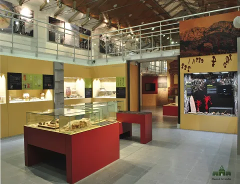
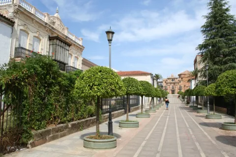
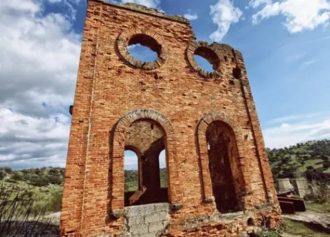
  • Avellanar mine. It is located near Aldeahermosa and was a galena mining mine that remained active until very recently.
  • Wolf's Barrio. Located near Venta de los Santos, it was the scene of the battle against the French troops, which were defeated in a bloody fight.
Fiestas y Eventos

Festivals in Montizón are often full of events and activities, competitions, sports competitions, verbenas and loose of nozzles and bulls. The village is full of chiringhites and attractions.

Among the most important parties are:

  • Romeria de San Isidro: The third weekend of May is held in the recreational area of the "El Dañador" swamp. People camp at the place on the weekend of the celebration.
  • Saint John the Baptiston June 24. Business party in Aldeahermosa, that celebrates its fair and parties with verbenas and loose of nozzles and bulls.
  • James Apostle, July 25. Montizon celebrates his patron party with verbenas in the town square.
  • The Christ of Expiration. It is celebrated on September 14 and is the patron party for the sale of the Saints. Neither will the verbenas nor the loose of the loins be missing.
  • St. Anton's night, January 17. The celebration of the party begins the night before. They put on fires in the squares and streets of the village, they take food and drink to hold on the cold nights of January.
  • Carnival: Neighbors dress up and walk the streets. There are often competitions to reward the best-known.
  • San Marcos, April 25. Peñas or groups of friends buy food and drink, get together in the field and spend the holiday. These days you eat the rosco of San Marcos.

Gastronomía

In the gastronomy of Montizón there are three basic lines that are present when making their dishes:

  • The extra virgin olive oil made in the village will be present in most of your dishes.
  • The peas carry the the taste of the vegetables of their extraordinary gardens, that they grow with care during the year.
  • The products of the slaughter and hunting meat will be the star ingredients of many of your dishes.

These are the dishes with the most roots in this municipality:

  • Migas: bread from the previous day, green peppers, chorizo, pancake, and olive oil to soften it.
  • Gachamas, which is made from olive oil, flour, water and potatoes. You can eat with chorizos, torreznos...
  • Ajo- flour: potatoes, flour, cod, pepper, tomato, onion, garlic, cumin and pepper.
  • Cranberries: olive oil, rabbit or field hare, potatoes, onions, garlic, dry pepper, tomato, sweet pepper, mint and laurel. For cakes, flour, water and salt.
  • Galians. Galianeras (bread cakes without yeast), rabbit, tomato, green pepper, olive oil, water and salt are needed.
  • Killing sausages: chorizo, salchichon, morcilla, ham, orza loin... This will be the pantry that the kitchens will spread all year round.
  • Warehouse: pericones, skillet rosses, anis rosses, floricles, bake, gypsy arm, San Marcos rosco...
Historia

Given his strategic position as a place of passage between Levante and La Mancha with the Guadalquivir valley, Montizon has been a place transited from Prehistory.

From the antiquity of the first inhabitants bear witness to the found remains: arrows with a pedernal tip, axes and carved stones, collected in the place called Torre-Albert, and ceramic in Head Girl.

From the Roman times, with the drive to the road infrastructure has increased its prestige as an enclave in the communications network: remains of Roman tracks, near Aldeahermosa was found a military, which indicated the distance from this place to Contrebia in the Ebro valley, and which has been identified as "Hannibal Road." During this time it was under the dependence of Ilugo (Santisteban del Puerto).

In Islamic times Should have to be a grinder that would be conquered with the rest of the region by Fernando III the Holy in 1226.

In the 14th and 15th centuries, the house would be abandoned, becoming a dehesa dependent on Santisteban del Puerto.

It will be in the 18th century, in 1767when this dehesa known as "Barranco Hondo," was chosen by Pablo de Olavide, Intendent of King Charles III, to find one of the nuclei of the New Populations They were aimed at defending the road to Andalusia with La Mancha, where the bandits raided the donkey caravans that carried the goods from one region to another.

The First settlers who populated Montizon were Central European:: Germans, Flemish, Swiss, French, Alsatians and Italians. To those who were given the tools of labrance, a house, a junta, several flocks of mountain to sow and repopulate olive trees.

Montizon would be head of felligresy with two villages, Aldeahermosa and Sale of Saints.

Loading map
Preparing points of interest and routes...
Imagen principal
imagen
Image
Montizón
Imagen principal
Activado

La Carolina

Submitted by brandcode_deweloper on
Id
739288
Perfil de redes sociales
Facebook
https://www.facebook.com/AyuntamientoLaCarolina
Twitter
https://twitter.com/aytolacarolina
Youtube
https://www.youtube.com/channel/UCBY6A3TaSP3JqhViYdshufw
Instagram
https://www.instagram.com/ayto_la_carolina/
Descripción
Breve descripción

La Carolina is a city at the foot of Sierra Morena and the Caraway, natural mountain port that links Castilla with Andalusia.

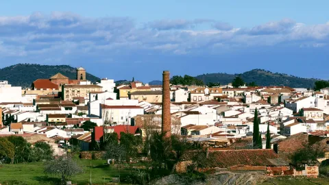
Its area is made up of extensive olive trees, but also the dehesas and the half-mountain areas populated by oak and pine trees. It is easy to find abandoned mine chimneys, clear signs of their past related to this activity.

It was the capital of the New People of Sierra Morena, a political project by the enlightened king, Charles III, in 1767. The main objective was to colonize and take advantage of the lands of Sierra Morena and to provide security to the mountain port, as it was a very unsafe place, where bandits and malefactors were camping. The population is made of settlers who came from central Europe, France and Germany mainly. A close collaborator of King Charles III, Pablo de Olavide, would be appointed responsible for the project, with the title of Superintendent of the New Populations of Sierra Morena.

The municipality of La Carolina is composed of five population centres: La Carolina, as main, Navas de Tolosa, La Fernandina, la Isabela and the Guindo. It is surrounded by natural areas such as the nearby Natural Park of Despeñacolos, the Fernandina reservoir or the small urban nucleus of the Guindo, which evokes its mining past.

In its artistic heritage are: The Palace of the Intendente Olavide, in Baroque style; the parish church of the Immaculate Conception, the seat of the ancient Carmelite foundation of San Juan de la Cruz, the Torrecillas del Molino de Viento and the Torres de la Aduana.

Telecomunicaciones
Teléfono
953 660 034
Sitio web
www.lacarolina.innovasur.es
Fax
953 681 626
Correo electrónico
info@lacarolina.es
Ubicación
Nombre
La Carolina
Latitud
38.274240
Longitud
-3.615270
Distrito
Municipio
Ubicación en el mapa
POINT (-3.61527 38.27424)
Imágenes
imagen
Image
f91faa0d-bd7e-a921-740d-33c048ef2e8f?t=1619532688353
Imagen principal
Desactivado
imagen
Image
1aacd6bf-6d2b-6336-9456-d95923815de8?t=1594142871900
Imagen principal
Desactivado
imagen
Image
9e49b509-9667-17c5-697b-fc861d03bf8c?t=1619532688419
Imagen principal
Desactivado
imagen
Image
e2b43921-6f14-e958-7cb1-de980f088f48?t=1594142869986
Imagen principal
Desactivado
imagen
Image
131f904e-ba6e-379c-daec-e19a7d0d88b4?t=1619532826514
Imagen principal
Desactivado
imagen
Image
4b85bd84-f1c0-34bb-d56a-a343c5bea6c1?t=1619532688547
Imagen principal
Desactivado
imagen
Image
07cad3d1-017c-774f-16d7-c166133050a9?t=1619532688596
Imagen principal
Desactivado
imagen
Image
fc7e8a03-c91f-3245-be11-c83899c22fe4?t=1603128351869
Imagen principal
Desactivado
Información adicional
Imágenes cabecera
imagen
Image
La Carolina
Imagen principal
Desactivado
Datos de interés

Tourist area: Sierra Morena / Sierras de Andújar and Despeñacolos
Distance to the capital (km): 66
Altitude over sea level (m): 595
Extension (km ²): 201
Number of inhabitants: 15,261
Gentilicon: Carolinenses
Postal code: 23200

Videos
Video file
Cultura
  • The municipal term of La Carolina is full of archaeological vestiges from Prehistory. Places like La Calera, El Minado or El Ochavo, so they testify. We met with Rupéstre art fields like Dona Lady, the Puntal or the Guindo. And also former mining holdings, mainly Roman, like Fountain Spis, or El Guindo.
  • The Church of the Immaculate Conception, built as a church of the convent of the barefoot Carmelites of the Peñuela, after the Colonization it is extended to serve as a parish to the nascent population. It has undergone several reforms over the years, and in 1899 the tower was built.
  • Palacio del Intendente Olavide, which was the residence of Mr Pedro Olavide, executive of the Sierra Morena Repopulation project. It was built in 1775, in neoclassical style and is located in the center of the village, right next to the parish church.
  • La Carolina Museum,The Centre for the Interpretation of the History of Mining in the New Populations of Jaén, integrated in the majestic building of the Palacio del Intendente Olavide, offers countless possibilities of knowledge, culture, history and research of the city, with the latest technologies, an unbeatable infrastructure and a human team that make it an inescapable cultural and tourist resource when visiting the city.
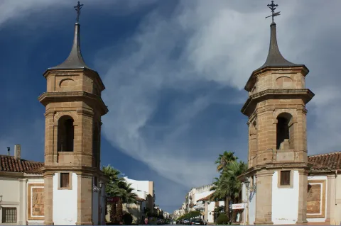
  • The Customs Towers, neoclassical style and airy architecture flank the main entrance to the city coming from Madrid.
  • Castillo de Navas de Tolosa: For more than two hundred years, it served as a defense and vigilance for the Muslim kingdom of what we know today as the passage of Despeñacolos, once Paso del Muradal. Today the silhouette of its tower stands out in a typical Sierra Morena dehesa in which you can also see braves.

Other monuments of interest are:

  • Hermitage of San Juan de la Cruz.
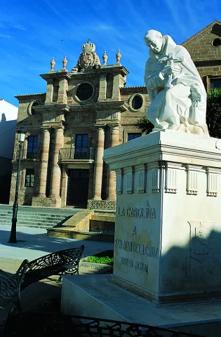
  • Monument to San Juan de la Cruz.
  • Old jail.
  • Monolitos de la Fundación.
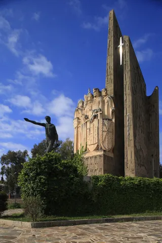
  • Monument to the Battle of the Navas de Tolosa.
  • Mining heritage.
Naturaleza

Its enclave at the foot of Sierra Morena and at the limits of the Natural Park of Despeñacolos, makes La Carolina a municipality especially attractive to nature lovers. The visitor has the opportunity to enjoy a landscape full of contrasts, with steep mountains and wide dehesas, on which it is easy to see majestic birds.

The cultivated land represents only 10% of its extent, mostly dedicated to olive trees. The main agricultural activities are the cultivation of olive trees, livestock and hunting, greater and lesser. It also highlights its mining landscape, heritage of an industry that supported the life of the Carolinians: remains of abandoned mines, lavatories, remains of smelters...

The vegetation is very abundant and heterogeneous: olive, oak, cork, chestnut, eucalyptus, alms and oaks. The fauna, both in larger game animals (boar, goose, cords, reels...) and smaller (rabbits, hares, parrots, quail) is very abundant. There are also cattle of wild cattle, sheep and goats.

Part of the term La Carolina covers the mountains of Sierra Morena to the north, while towards the south the landscape becomes adhesitated, thus offering beautiful and contrasting landscapes. In the area of saw, the highest peak of the mountain range, La Estrella, with 1,300? m altitude. The nearby Natural Parks of Despeñacolos to the East and the Sierra de Andújar to the West.

To the South, the Embalse de La Fernandina allows sports fishing and presents beautiful images of the Mediterranean forest, being an ideal place for the development of a rich extensive livestock.

The villages abound in their term as well as the natural sites, making La Carolina a municipality of special human and natural appeal. It has three urban cores or pedanias, these being:

  • The village of Los Guindos, to the north of the term and in the surroundings of the saw, evokes its mining past.
  • Aldea La Fernandina: presents one of the simplest traces of the New Populations, of rectilinear and orthogonal design.
  • Aldea La Isabela: The route of this village, presents reminiscent of the European city of the Enlightenment.
Fiestas y Eventos

In addition to the Christmas and Carnival celebrations, the most rooted celebrations in the town are as follows:

  • Festivals of the Foundationthey are held from 3 to 5 July, in an attempt to link present and past from La Carolina, to value in a fun way its history, traditions and origin. The acts include the reading of the court and the tribute to the Colonoan act to claim the persons who still keep foreign surnames.
  • May Fair, has its origin in a cattle party that is very famous and that competed with the most important in Spain. A Selected livestock morphological competition (berrenda cow, seaweed sheep and serrana goat)
  • Festivals of San Juan de la Cruz, Patron from La Carolina. The last weekend of November is held. The tradition of Shake a live pig after the celebration of the Eucharist.
  • San Carlos Borromeo, which is celebrated on November 4 and is also co-patron of the city.
  • Romeria de San Isidroon the 15th of May, and is celebrated with a Romeria to the natural area of La Aliseda, a beautiful recreational area that is located in the village of Santa Elena, at the foot of Despeñacolos.
  • Carnivals, of the most renowned in the province of Jaén.
Gastronomía

Hunting is very present in the local gastronomy, so among the most traditional dishes we have:

  • Monkey meat, first adobada and then stew in sauce.
  • Pate of perdiz, typical Jaén dish that was born on these lands.
  • Scattered perdiz, a dish that can get cold.
  • Chickpeas, which is consumed preferably in Lent.
  • Migas and Pipirrana.
  • Jars with hare.
  • Trick asparagus.
  • Cod wet.

In the pastry shop, the following are typical:

  • Sweet gazes of the holiday of All Saints.
  • Summer gazhas: with fish and peppers, according to the recipe of the miners who came from Almería and Granada.
  • Oil nuts, Rice with milk, fried milk and drunks.
Historia

In the 18th century, the enlightened king Carlos III and its ministers (Aranda, Jovellanos and Campomans) decide to create the New Populations in Sierra Morena. At the head of the repopulation he put the Superintendent Pedro Olavidewho would be responsible for the settlement of settlers from France, Germany, the Netherlands and Switzerland.

In 1767, the The strength of the New Populationsestablishing the regulations and rules governing these new settlements, different from those of the rest of the country. This year, and near La Peñuela, a former Carmelite convent, La Carolina is founded, which would be the capital of all the new settlements in Sierra Morena.

The beautiful city of La Carolina is the best example of the city of Enlightenment. It is known as the City Jewel of the Holy Kingdom. This was designed as a Roman camp; that is, following two axes that are crossed, one from N to S, which is called cardo and another called decumano, from E to O that in the City Hall square is where they are, indicating this crossing the city center, according to the design of Simon Desnaux, supervised by Olavide. The avenues of Las Huertas and Juan Carlos I are the main lines for the division of the land. The result of its urbanization is an orthogonal mesh that divides it into squares, with streets and straight and wide avenues.

In the mid-19th century, La Carolina began the exploitation of its rich Argentine lead filons. Previous mining work already existed, but it will now be when a large-scale exploitation begins that will lead you, in the early and mid-20th century, to become the world's largest Argentine lead producer along with the nearby Linares, under the territorial delimitation of Linares- La Carolina mining district.

This led to a strong immigration of workers from nearby provinces that significantly changed their demography and sociology, even to the birth of populations around these farms such as El Centenillo or El Guindo.

But the mining crisis meant the closure of all the mines in the 1970s. Thus today, the buildings linked to this activity have become part of the landscape as witnesses to its industrial past, being inscribed in the catalogue of the Institute of Historical Heritage of Andalusia.

For a few decades, La Carolina has been in the industrialization sector and is now a city full of future.

Otra información

The village of The Guindsbecause of its geographical location it is a great place to make astronomical observations, especially in the autumn and winter months. In fact, it is included as a Mirador within the "Reserve Certification and Starlight Tourist Destination of Sierra Morena."

Loading map
Preparing points of interest and routes...
Imagen principal
imagen
Image
La Carolina
Imagen principal
Activado

Guarromán

Submitted by brandcode_deweloper on
Id
731643
Perfil de redes sociales
Facebook
https://www.facebook.com/Ayuntamiento-de-Guarrom%C3%A1n-831865326909031/
Descripción
Breve descripción

Municipality located in the central part of the northern region, next to the motorway of Andalusia. In its term it abounds the uncultivated area, consisting of dehesas of pastures with oak, Mediterranean bushes and forest species of repopulation. Its origin dates back to the 18th century, the result of the colonizing policy carried out by Charles III in Sierra Morena.

The peculiarity of its name comes from the location chosen for its creation: the old Sale of Guadalroman.

It is well known the handmade pastry shop of Guarroman, especially its hillbillies.
Among its historical heritage are the Parish Church of the Immaculate Conception of the late 18th century and the Posite of Labradores, built in 1789, both raised in the architectural style of the New Populations.

Telecomunicaciones
Teléfono
953 615 004
Sitio web
www.guarroman.es
Fax
953 615 306
Correo electrónico
ayuntamiento@guarroman.es
Ubicación
Nombre
Guarromán
Latitud
38.183570
Longitud
-3.685900
Distrito
Municipio
Ubicación en el mapa
POINT (-3.6859 38.18357)
Imágenes
imagen
Image
124d0a65-51b5-da9e-f9bb-d8bf4b505476?t=1611060716139
Imagen principal
Desactivado
imagen
Image
6771bae0-f4e6-975d-4a21-a8a2e238575d?t=1611060936891
Imagen principal
Desactivado
imagen
Image
25245ee9-f6eb-57bc-fcf2-61324d09a0b4?t=1611061069689
Imagen principal
Desactivado
imagen
Image
230eae28-2fb8-1760-814e-6897bdc30a51?t=1611061294939
Imagen principal
Desactivado
imagen
Image
301ce244-3651-741b-0cab-a603ad50d022?t=1611061424689
Imagen principal
Desactivado
imagen
Image
91a7f707-0980-4ced-8a50-548ab25c1a85?t=1611061483112
Imagen principal
Desactivado
Información adicional
Curiosidades

Ayuntamiento de Guarromán,, Calle Iglesia, 18
953615004
http://www.guarroman.es/ciudad/conoce-la-ciudad/guia-turistica-guarroman/
 

Imágenes cabecera
imagen
Image
Guarromán
Imagen principal
Desactivado
Datos de interés

Tourist area: Sierra Morena Near P.N. Sierra de Andújar and P.N. Caraway
Distance to the capital (km): 52
Altitude over sea level (m): 350
Extension (km ²): 96
Number of inhabitants: 2,724
Gentillo: Guarromanos
Postal code: 23210

Videos
Video file
Cultura

Main monuments:

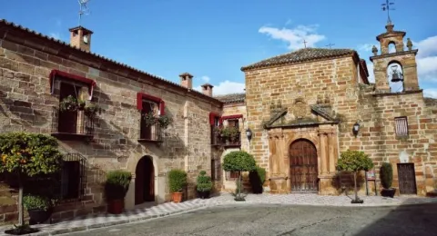
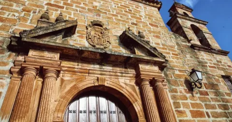
  • Church of the Immaculate Conception. It was the first parish built in the New Populations. Its simple-drawn facade is built of red sandstone. It has a small cover with a half-point arch and three small gaps at half-height and a colonial-style swordsman. The size of the Virgin of the Jienese sculptor Jacinto Higueras (father), as well as the main altar that was brought from Ubeda, must be highlighted.
  • Labrador site. It is completed in 1789, with the colonial structure of these buildings intended to keep the grain, the seed, control and regulate the production. Made of thick walls covered with sandstone silery and resistant internal arches. It originally consisted of a single plant and was then built a second. It is currently dedicated to the Municipal Library.
  • Palace of the Intendent. Built in 1807 by the Intendent of the New Populations of Sierra Morena, Pablo Olavide. The sun clock located on one of the corners, installed there to give the time to the steps that made their stop at the post house, stands out. It has now become a hotel.
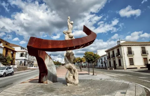
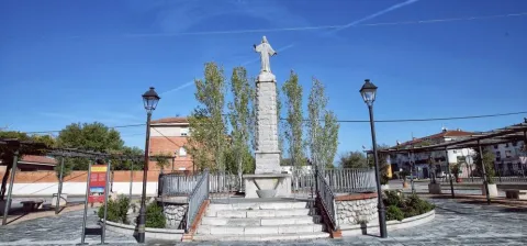
  • Plaza de Nicolás Kerche. In honor of the first born in this town. In the center of the square is a sculpture in homage to all the settlers arrived in 1767.
  • Monument to the Sacred Heart of Jesus, located on a piled pillar and surrounded by a fence. He rose in 1937 to imitate the Christ of the Concorvado of Rio de Janeiro.
  • Monument to the Mineros des sculptor Javier Ruiz Abel, in memory of the granadine and almerian miners who came to work in the mines of the district of Linares- La Carolina.
Naturaleza

Located on a plateau and bordered by the river valleys Guarrizas y Rumblarin Guarroman the area of uncultivated land and which forms pastures with oaks, Mediterranean bushes and repopulation forest species.

If we lie in the villages of Zocueca or El Altico, both at the foot of Sierra Morena, we can observe the most steep slopes of the saw, as well as the valley that forms the Rumblar river, tributary of the Guadalquivir, and the reservoir that bears the same name. Thanks to the water of this river and to those of the reservoir the orchard of Saint Vincent, true hortelan pantry of the region is watered.

The vegetation in the municipal term is very varied, predominating the oaks, olive groves, complaints, Mediterranean bushes, pines, and other tree species of repopulation. By the river Rumblar we will find the vegetation of riverside, alamos, willows, mimberas...

Abundant and varied is also its fauna, and here we will find boars, corzos, go, hares, rabbits, badges... It is very easy to observe the majestic flights of the rapacious birds that nest in the areas of the rocky. An extensive area of soft slopes between Sierra Morena and the valleys that form the rivers of the area.

Fiestas y Eventos

The traditions for a people are a sign of identity, and a reason for the return of the Guaromans living outside the town. Among the main festive events are the following:

  • Commemorative Feast of the Fuero of 1767. The next weekend to October 26, the day of the birth of the first Guarromanense, the "Festivals of the Fuero" are held, to commemorate the promulgation of it in 1767. During that weekend, Guarromanos, which are tied with the clothing of their ancestors, can enjoy different activities, such as traditional games, musical performances, tasting of typical dishes, signing of luck or walking and buying in the traditional market full of jobs with artisanal products. To highlight the theatrical route in which the neighbors tell the history of the municipality.
  • Romeria de San Isidro. The most near Sunday to May 15 is the San Isidro Romeria in the dehesa "Rock Stone," a beautiful place located next to the river Guadiel. This day, carrots are made of agricultural trailers and the cavalry is made.
  • Festival of the Olivarwhich is celebrated in July, around the day of Santiago. This feast is not under the title of any saint, but is dedicated to the emblematic tree of agricultural activity: the olive tree. There are many activities organized for this day, in which popular verbenas are also programmed.
  • EggsThe Holy Week, which has five hermandades in Guarromán that process through its streets, has its festive outpost on Easter Sunday, when the Guarromans celebrate in a family party and campera the "Pintaoclos," tradition brought by German settlers to decorate eggs cooked with vivid colors and drawings, which are then to end up being part of a pyrran of peppers, with black olives and a lot of olive oil.
  • Heart of Jesuswhich takes place in the eighth of Corpus Christi, is the pattern of the town, and to whom a special devotion is professed, immortalized in the monument that in 1950 was erected on the central promenade of Guarroman.
  • Immaculate Conception: On December 8, what is popularly known as the "Day of Pure," the Immaculate Conception, patron of Guarroman, is celebrated by the express desire of Charles III.
  • Festivals in the villages: the villages that belong to the City of Guarroman also celebrate their patron parties. So, San Isidro is held in Martín Malothe oldest in Guarroman; San Antonio in the Village of the Riosand Our Lady of Zocueca, patron of Bailén, in which he was the former population of Rumble, annexed to Guarroman in the early 19th century.
Gastronomía

Guarromanense cuisine is based on the use of natural and land products, such as triguero asparagus, peppers, eggs, rabbit or hare.
Among the most traditional dishes are:

  • Pipirrana or egg paint. The orchards of the Guadiel River, and the new greenhouse crops, provide the red peppers that, once roasted by the olive oil and black olives, will be the basis of the "piirrana," in which the eggs painted on the Sunday of Resurrection will be finished.
  • Harapos, so called by the broken fabric aspect of the mass, and are made with hare and perfumed with mint.
  • Wild kitchen. The proximity to Sierra Morena provides the so-called kitchen "stone asparagus" of exquisite bitter taste, which are usually taken in tortilla or accompanied by a "rice with hare," dish that introduces us in the kitchen of the hunters.

But Guarroman's best known product is its Tin cakes, which are still being developed in the traditional wood kilns. Of these pastries we have two modalities: Blonde pastrieswhere the peel is filled with angel's hair, and the white pastries, called by the white layer of sugar that covers the tin, the biscuit and the cream from which they are made, and which are also known as "Germans," a name that refers to the origin of the settlers who founded this real population...

Guarroman is home to the prestigious gastronomic society of the Very Illustrous and Noble Order of the Knights of the Knife of Palo, which has its origins in the 18th century and which defends the Culture of the Olive. Every year in January, for the festivity of San Antón, he gives his increasingly appreciated "stick spoons" to relevant personalities from the world of culture, society and politics.

Historia

Guarroman was founded as part of the Sierra Morena colonization project that contemplated the Population Force of 1767, promulgated by Charles III.

It was Pablo Olavide who founded it with the name Muzquia, in the place that occupied the Sale of Guadalroman. Its first settlers were mostly German settlers. In the first documents of the foundation it is called Real Population of the Site of Guarroman. The name is believed to be the result of the castellanization of Arabic Uadi-r-Romman (river or stream of the pomegranates), which evolved phonetically to Guadalroman and later to Guarroman, now known as Tamujoso.

But those farmers would not be the only ones to give life to this land or to this people. Almost a century later, in 1861, under the protection of the resurgence of the lead and silver mines of Sierra Morena, they began to reach Guarroman miners from Almería, mainly, and from the lower Alpujarra of Granada, which together with the descendants of the German settlers ended up setting up the one that is today Guarroman.

A village open to an innovative agriculture of under-cover cultivation and to an industrial and service projection around the real road, today the A-IV motorway, former National IV.

Otra información

A peculiar name.

The first peculiarity that Guarroman exhibits is his own name, which, in whom he first hears it, provokes the outline of a smile without malice and the most strange evocations about its meaning.

But for the Guarromanans, far from hiding the name, they exhibit it as their first flag, to such a extent that it is Guarroman the headquarters of the International Association of Peoples with Faithful Names, Rare and Peculiar, in which it is studied and promoted that all the good and interesting that is hidden behind a shocking name is known.

Loading map
Preparing points of interest and routes...
Imagen principal
imagen
Image
Guarromán
Imagen principal
Activado

Carboneros

Submitted by brandcode_deweloper on
Id
726651
Perfil de redes sociales
Facebook
https://es-es.facebook.com/ExcmoAyuntamientodeCarboneros/
Descripción
Breve descripción

Carboneros is a small municipality in the northern part of Jaén, and is located on the southern façade of Sierra Morena, next to the Madrid- Sevilla motorway.

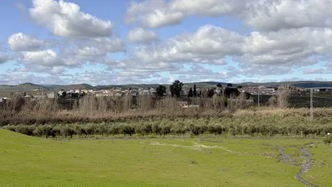
In its municipal term, the adhesitated land in which some wineries have been installed prevails, and is also rich in minor hunting. Currently its economic base is the cultivation of olive trees. And in it, we can distinguish three areas: the northern area, with very strong slopes between 700 to 1300 m of altitude; the southern area, close to Vilches, Linares and Baños of the oak, which has a soft morphology and with moderate slopes, linked to the Guadiel and Guadalén rivers; and a central area of relief varied from 6 to 500 meters.

This population was founded in 1768, at the initiative of King Charles III, as part of the illustrated project that was named "Nuevos Poblos de Sierra Morena y Andalucía," and which were governed by a specific Population Force for these new settlements.

In the vicinity, there are other population centres dependent on Carboneros: La Mesa, El Acebuchar and Los Cuelos.

The parish church of the Immaculate Conception, built in the second half of the 18th century, in a neoclassical style, stands out from its artistic heritage, with two Tuscan pilasters and two large side niches.

Telecomunicaciones
Teléfono
953 661 179
Sitio web
www.carboneros.es
Fax
953 661 104
Correo electrónico
ayuntamiento@carboneros.es
Ubicación
Nombre
Carboneros
Latitud
38.230190
Longitud
-3.631390
Distrito
Municipio
Ubicación en el mapa
POINT (-3.63139 38.23019)
Imágenes
imagen
Image
1d899c1c-7483-9905-be68-cd90f48d4e6c?t=1594226959186
Imagen principal
Desactivado
imagen
Image
fde63a40-497e-3f49-8251-c8ac096c1920?t=1594226958578
Imagen principal
Desactivado
imagen
Image
cd0206a5-431d-e71f-4719-4d80f6122e79?t=1594226957871
Imagen principal
Desactivado
imagen
Image
39ec2a92-f048-2810-8642-ce63928f6bd9?t=1617623069429
Imagen principal
Desactivado
imagen
Image
39594e3d-0fd9-92d9-d1d7-442ac012d448?t=1594227035862
Imagen principal
Desactivado
imagen
Image
b3057608-2098-2fe5-dd8b-b60e232f7904?t=1594226956305
Imagen principal
Desactivado
Imágenes cabecera
imagen
Image
carboneros
Imagen principal
Desactivado
Datos de interés

Tourist area: Sierra Morena / Sierras de Andújar and Despeñacolos
Distance to the capital (km): 60
Altitude over sea level (m): 403
Extension (km ²): 58
Number of inhabitants: 691
Gentillo: Carbonerenes
Postal code: 23211

Videos
Video file
Cultura

From the artistic heritage we highlight:

  • The parish church of La Immaculate Conceptionwhich is its most significant building, built in the last third of the 18th century, has an architectural packaging within the purest neoclassical. Its back-moving cover is of magnificent silvery and features pilasters on the corners. The central body is half-point arch, crowned by a fronton and two large niches. On the second floor there are four large bones.
  • The Posite, located in front of the church is a work of dyed masonry, also from the last third of the 18th century. It stored the farmers' grains as a reserve for famine times.

Naturaleza

Carboneros is delimited by two rivers, the Gloves and Rumble. They and their main tributaries, La Campana, Guadiel, Guadalén, travel and drain the lands of their municipal term.

Its enclave in the southern part of Sierra Morena makes it especially attractive for nature lovers. Here we have the opportunity to enjoy a landscape full of contrasts: to the north, with more steep mountains, and in the central and southern area with adhesitated spaces and the presence, mainly, of oak trees; they are ideal places for extensive livestock.

It has an abundant and heterogeneous vegetation, highlighting the olive, oak, cork, chestnut, oaks, eucalyptus...

Of his fauna We point out the abundance of small game animals: hares, rabbits, partridges, quail... We meet with cattle cattle, sheep and goats. And it is very easy to witness the majestic flight of the multiple rapes that overfly these territories.

The environment of the reservoirs presents beautiful images of the Mediterranean forest, which makes us connect with the characteristic nature of Sierra Morena.

The reservoir of La Fernandina is a leisure area for the carbonarians and visitors where they can perform outdoor and aquatic recreational activities.

Fiestas y Eventos

The people of Carboneros founded by settlers from different countries of Central-Europe have as their patron, as in other populations, the "Immaculate Conception," and celebrate the parties in their honor from 7 to 9 December.

These other festivities are also celebrated:

  • Festivals of the Foundation, take place in August with different activities and competitions. To recall the Central European origin of its predecessors.
  • Romeria de San Isidro, the next weekend to the 15th of May, the feast of San Isidro Labrador, carry the image in procession to El Acebuchar, where in an improvised altar the Eucharist is celebrated. The next day the image is returned to Carboneros.
  • Day of the Cross, which takes place in the pedany of La Mesa, so called for being located in a flat promontory.
  • "Party of the Eggs", takes place on Sunday of Resurrection, and the neighbors decorate cooked eggs on Saturday to add them to the "piirrana" on Sunday. A party that seems to have its origin in the European settlers who colonized the lands of Sierra Morena.

Gastronomía

The unique location of Carboneros, located between the saw, the olive field and the Madrid- Sevilla motorway, has led to the development of a varied and rich gastronomy. The hunting and the animals that are raised in this area have a special protagonism, without forgetting the pure olive oil, an ingredient that can never be missed in the kitchen.

Among the dishes with the most roots in the area, we highlight:

  • "Hare to the belly", chopped meat and saffrite cooked in white wine or beer, accompanied by peppers, raw tomatoes, onion and guindilla. The hare is left in a sauce that simulates the mud, hence the name of this dish.
  • Roast, be it lamb, choto or pig.
  • Of the massacres, which on cold or rainy days it seems that the body asks for these stronger meals, we have: orza loin, turreznos for the crumbs, chorizo, morcilla...
  • For the days of departure to the field: "Comine salad.", "Gachas of pebble flour", provided they are accompanied by a tasty "Pipirrana".
  • "I kiss the roast.", has its motive in the truckers who carried the fish from the Andalusian coast to Madrid.
  • "Potting of chickpeas with cod", a dish that is not missing on the tables during Holy Week.
  • In pastry, traditional "flowers" during Holy Week and "sweet peas." on the Day of All Saints.

Historia

The name of "Carboneros" it mentions its wealth and ancient mining activity that dates back to the times of General Cartaginese Anibal.

The written sources of the silver mines in the area of Catulus mention the Well of Baebelo, identified in the mining village of Palazuelos, in the municipal term of Carboneros. In this mine, large amounts of silver were obtained.

After the Roman conquest, the mine continues to operate as the sources and ceramic materials testify.

The current urban and landscape configuration has the imprint of the people of Colonization founded by the king Charles III in 1767, within the New villages of Sierra Morena.

In Carboneros the process begins with the construction of five houses, a church, a prison compound and a posite. The process was consolidated and the population continued to increase, while specializing in olive cultivation. The new planning, in addition to seeking a new social project, also carries out a different urbanism, with straight streets, with a main street that flows into the square, in which the church and the buildings of the civil and religious powers are located.

Dependents of Carboneros, several villages are created as The Ajuchar, The Bureau and The necks. It is sought with these new population centres, that the peasants dwell closer to the lands they have to cultivate to avoid investing time in displacement.

These new sites are built under the classic precepts of symmetry and order that were established for the rest of the locations of the Colonization.

In 2017, the 250 anniversary of the New Populations was celebrated in this town, and in others around it, with the organization of numerous events and activities, including an International Congress.

Otra información

Carboneros presents diversity of craft activities related to processing of plant fibres (esparto, anea, pita and wicker), with wood (ebanistería, artisanal production and furniture restoration), textiles (embroidery, ball lace, mesh, crochet), the forge, the quarry and food processing (pastry, chacinas, jams and liquors).

Today, an effort is being made to ensure that these artisanal knowledge is maintained and transmitted to the new generations.

"The Oil of Life" It is the name that receives the solidarity program of the sponsorship of olive trees, which the Lumière Foundation has been developing for a decade, but which in recent years is transcending internationally thanks to the participation of institutions of great social importance. This solidarity initiative contributes, through the sponsorship of olive trees, to the financing of different social and cultural projects throughout Spain, in order to protect the environment and promote the conservation of the centenary olive trees of the Spanish geography, and includes the transfer of what was collected to NGOs, associations or foundations, upon request, so that they can develop their own social, cultural, sports or environmental projects.

To "El Oil de la Vida" has recently joined the City of Carboneros, which on 24 September 2019 signed with Antonio Mayoralas, president of the Foundation, a cooperation agreement to work together on the solidarity program of the sponsorship of olive trees giving the City a place that will host the headquarters of the programme that the Lumière Foundation develops for all of Andalusia. In addition, on December 13 of that same year, the Lumière Foundation signed with Scholas in, the Vatican, the agreement to sponsor an olive tree for its holiness The Pope located in Carboneros, under the motto "Take care of an olive tree, take care of life."

Loading map
Preparing points of interest and routes...
Imagen principal
imagen
Image
carboneros
Imagen principal
Activado

Arquillos

Submitted by brandcode_deweloper on
Id
723845
Perfil de redes sociales
Facebook
https://es-es.facebook.com/AytodeArquillos/
Descripción
Breve descripción

A population located at the foot of Sierra Morena, next to the Embalse de Guadalén, in a landscape of olive-populated lomas.

It is a small municipality founded by Carlos III in the 18th century and located to the south-west of the region of El Condado, where the areas of cultivation, in which the olive grove dominates, are alternated with those of pastures and dehesas dedicated to livestock and small hunting. The saw area has natural areas of interest, especially those located next to the Guadalén reservoir, where you can also practice the fishing of cyprinids.

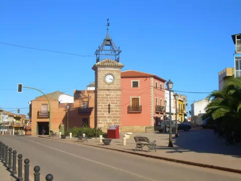
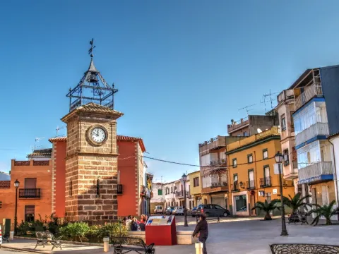
Among its historical-artistic heritage is the Church of the Immaculate Conception, which was built in 1769 following the model implanted in the rest of the temples of colonization. It has a simple neoclassical façade on which an angry swordsman is placed in two bodies. The Clock Tower, on the other hand, was built in the 18th century and arouses great interest among visitors.

Telecomunicaciones
Teléfono
953 633 000
Sitio web
www.arquillos.es
Fax
953 633 236
Correo electrónico
ayuntamiento@arquillos.es
Ubicación
Nombre
Arquillos
Latitud
38.181380
Longitud
-3.426740
Distrito
Municipio
Ubicación en el mapa
POINT (-3.42674 38.18138)
Imágenes
imagen
Image
10fac7d9-62a1-494b-da97-8e0657c1409a?t=1610982640405
Imagen principal
Desactivado
imagen
Image
0f5047a5-8e97-e36e-34dc-3b8e7ec31734?t=1610982640455
Imagen principal
Desactivado
imagen
Image
e5509d24-0416-c2a7-50ed-d81b3bc0d5b4?t=1610982640586
Imagen principal
Desactivado
imagen
Image
a290ffb0-6531-820d-6b6a-ab40ab774828?t=1610982640982
Imagen principal
Desactivado
imagen
Image
bb41bdbe-3148-4978-145c-419a687936ec?t=1610982641174
Imagen principal
Desactivado
imagen
Image
b2718552-ae04-8c00-1195-a35e929cd700?t=1610982641311
Imagen principal
Desactivado
imagen
Image
ac98228f-2488-787d-db70-e97367bff288?t=1603734785201
Imagen principal
Desactivado
Información adicional
Imágenes cabecera
imagen
Image
arquillos
Imagen principal
Desactivado
Datos de interés

Tourist area: Sierra Morena / Sierras de Andújar and Despeñacolos
Distance to the capital (km): 83
Altitude over sea level (m): 378
Extension (Km2): 65
Number of inhabitants: 1767
Gentillo: Articuleros
Postal code: 23230

Videos
Video file
Historia

Although the birth of this municipality is linked to the Sierra Morena colonization project, launched by Charles III in the 18th century, this foundation was made on another settlement of remote origins. The oldest documents in which the town of Arquillos is mentioned date from 1254, in which Alfonso X the Sage gives the village to Baeza for protection and defence. On another document, in which the king grants Ubeda the villages of Cabra and Santiesteban, and indicates that he had taken Arquillos to this city to deliver it to Baeza, it follows that the village would have at least one Islamic origin. In the 13th century it was occupied by Fernando III and handed over to the Council of Ubeda.

The belonging to the Arcipregamiento de Baeza still attests to the Ximena Jurado in its 1852 Anals. Arquillos, located on the county gate, forced passage on the roads from Granada to Cuenca and Valencia to Sevilla, met from ancient times the conditions for the settlement of a population based on agricultural and livestock development. For the same reason it is not surprising that he was chosen by the superintendent Pablo de Olavide for the location of one of the colonisation cores, whom he had the desire to call Campomia, although he did not finally succeed.

This project of colonization of Sierra Morena in the 18th century was a great urbanizing company that saw the creation of forty-four towns and eleven cities in Yermos places of the Parrilla and Sierra Morena. It was intended to both populate and plant semi-desertic areas, and to make the journey Cadiz- Madrid for travellers and goods safer.

The territory was ordered according to a preconceived plan and the new villages and villages were designed a priori following the classicist patterns that prevailed at the time. One of the places that have best maintained this urbanism is Arquillos, a route in damer, governed by principles of symmetry, uniformity and order, with a varied set of squares and with the civic and religious center on the western edge, next to the crossing of roads. Arquillos was a long time dependent on Santiesteban from the Port until, in 1833, Queen Elizabeth II granted her independence for having given, ten years earlier, to General Riego, a symbol of revolutionary liberalism, refugee there in the last insurrection.

Otra información

Clock Tower

The tower is square and starts from a zocalo. The whole factory is a bartender. Of its two bodies, the first has twice its height and in it is opened a half-point arch with pillows. On this door a flask window opens that gives light to its interior and is repeated on the other three sides. A triple molding separates the first from the second body, in which the clock appears, a small square window and docile pilasters at the ends. On the ledge there is an artisan iron structure, added in 1884 to house the bell and the veleta. In the 18th century the hours were marked by the bells of the churches. To raise a municipal tower with the sole function of indicating the hours was unusual at the time and symbolizes the confrontation between the civil and ecclesiastical powers that stars the reign of Charles III.

Church of the Immaculate Conception

Built in 1769, it has a typical facade of the 18th century colonized villages. It has a simple neoclassical front-crowned cover that maximizes its straight lines. On it is raised an angry swordsman that has the particularity of articulating in two bodies: on the bottom two twin holes are opened to blow up bells, while the upper body, with a single bell hole, is losing thickness to culminate in a triangular front that, in turn, hosts a tiny bell.

Loading map
Preparing points of interest and routes...
Imagen principal
imagen
Image
arquillos
Imagen principal
Activado