
Trail Cruz de la Chimba
The path begins at the same source of the Cañada de las Azadillas, before a small round where the asphalt road ends. To the right of the fountain and to the empty, we go up perpendicularly from the road about 80 m. We make a turn of something more than 90 ° to the left where a horseshoe path is born that passes on the hillside of the fountain. Once on the road there is no loss as it is very marked, only some fallen trees cross the road, but these do not have difficulty avoiding them.
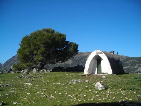
This first stretch is a constant rise and the good route of the path facilitates progression. As you gain height, the cups of the bushes adjacent to the path partially occupy some areas of the path, but in no case makes the footprint difficult or hidden. Already at the top the slope is softer and soon in a clear area we find the remains of a low-marked lane that lead to an explanade where forest cars turn, and start of the track. This point is the place of access and to which we must return, if we want to visit the forest shed Cruz de la Chimba at about 200 meters, hidden by the thickness of the pines. There is no path marked as such, so it is easy to get confused even though the distance is short. The best option is to walk on the track about 20 m from where the vehicle pass begins and is marked, perpendicularly to the lane and to the right of the track (west direction, direction 247th) we enter the pine in an area of path little defined, but with traces of the passage of the people, and that goes slightly up to reach a meadow where the shed is.
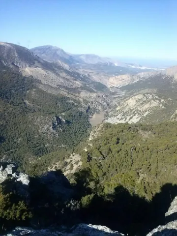
The Chimba Cross. It's the star point of the excursion. It has one of the best panoramic views of the Sierra de Jaén. Behind the shed is La Pandera, below the valley of the Quiebrajano River, and towards the north, the Castle of Otiñar and to the bottom of Jaén. It is in a semi-exclusive state thanks to the respectful care of its visitors. Caution should be exercised if we are accompanied by children or have vertigo, as the shed is in the vicinity of a steep area without any protection.
For return to the track the same route is used in the one way. Again on the forest track you have to continue to the right, the land is flat. This area is known as the Llanos de Navalopos. The track has no confusion. At its step and on the left it passes close to a plain and later borders a second plain up to a hill. At this point, the track goes down continuously until it returns to the Azadillas Canyon. But first we will find a chain that cuts the way to the cars and just beyond there is a crossing with the track that links the Azadillas Canyon with the Llanos de Palomares and the Pueblo de Carchelejo. We continue on the left descending, direction to the Cañada de las Azadillas. At the entrance to the Hall of Nature we will have finished the tour.
It is located in the area of the Cañada de las Azadillas, inside the Jaén Periurban Park, at 18.5 Km. Its forest and abrupt orography are of a great beauty and landscape wealth that deserves to visit it. Their isolation because it is not a place of passage, has helped to remain practically intact. There is a recreational area, known and visited by the Jiennenses and people of neighbouring villages on weekends to make picnic hiking, etc. There is also a Nature Hall dedicated to environmental education. The previous approach is made from Jaén, from the Alcantarilla district, by regional road JA-3210 to the Sierra Bridge. From there, follow to the right, the road towards the Quebrajano Pantano, Otinar and Cañada de las Azadillas. In the Km 14 of the road, under the Castle of Otiñar, we take the left road across the bridge and about 3 km away we will reach the Cañada.
Recreational area of the Cañada de las Azadillas
Source of the Cañada de las Azadillas (non-drinking water) at the beginning of the path
It is located at 18.5 km. of the city of Jaén, in the area of the Cañada de las Azadillas well known for the recreational area of the same name. A vehicle is currently needed to access the start of the path quickly. Take the JA-3210 communal road leading to the Sierra Bridge. From there, we take to the right the road towards the Quebrajano Pantano, Otinar and Cañada de las Azadillas.
In the Km. 14 of the road, under the castle of Otiñar, we take the left road crossing the bridge over the river until we reach the canyon. The path begins at the source of the Cañada de las Azadillas, before a small round don ends the asphalt road.
