Saltar al contenido principal

Trail Fundición de la Tortilla

Submitted by brandcode_deweloper on
Id
2150089
Descripción larga

After passing through an alpechenera and under an old bridge of the mining railway the path ascends along the stony coast of San Pedro to the Cañada de Incosa; from which we continue, to the right, a stretch that presents, to the west, magnificent views of the population of Baños de la Encina.

Walking this path is moving in memory to a period in the history of Linares.

After 1.4 Km we connect with the road and by a wooden step we take the Green Way until we reach a crossing (connection to the path of the Gitana Mine PR-A 264), then we pass through the solid waste treatment plant and continue on the old steep path of Siles that will lead us back to Linares.

Breve descripción

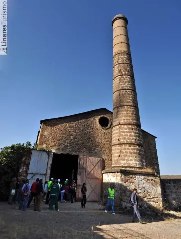
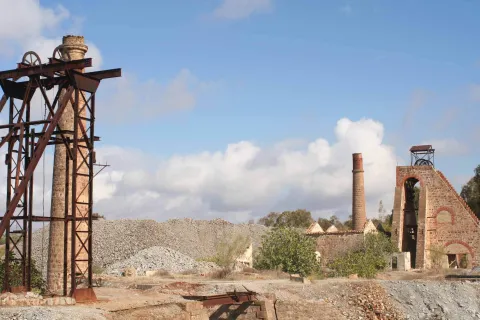
To walk this path is to move in memory to a period in the history of Linares: its mining industry which, during the 19th and mid-20th centuries, meant the way of life for many Linarians and whose heritage is scattered throughout its term. Mines, wells and smelters, today abandoned, where you can still see the melted granite constructions, the high chimneys of the smelters and the old "Cabrias" for the extraction of the material. A path that runs along the road of the Tortilla, very passed by the Linarians and that has no loss. 2 km. is found the Foundry of the Tortilla, a crossroads of roads and numerous buildings in ruins denote its importance in the mining past of Linares.

Latitud
38.0956
Longitud
-3.6369
Distrito
Municipio
Ubicación en el mapa
POINT (-3.6369 38.0956)
imagen
Image
20111022-118.jpg
Imagen principal
Activado
imagen
Image
Sendero%20Fundici%C3%B3n%20de%20la%20Tortilla.jpeg
Imagen principal
Desactivado

Friends

icon-intereses-amigos

Adventure

icon-intereses-aventura

Culture

icon-intereses-cultura

Sport

icon-intereses-deporte

Eco-friendly

icon-intereses-eco-friendly

For couples

icon-intereses-en-pareja

Family

icon-intereses-familia

Gastronomy

icon-intereses-gastronomia

Municipality

icon-intereses-municipio

Nature

icon-intereses-naturaleza

Low-cost tourism

icon-intereses-turismo-low-cost

Solo travel

icon-intereses-viajar-solo
Sendero Fundición de la Tortilla
On foot
All year round
Activado
Tramo de asfalto o cemento
 
Tramo de pista o camino forestal
 
Tramo de vía pecuaria
 
Tramo de senda
 

Trail del Paño Pico

Submitted by brandcode_deweloper on
Id
2149913
Descripción larga

In the well restoration, open between 1844 and 1850, the building that housed the garage and locomotives workshop of the mining railway stands out. In the well of San José, next to the road, you can still see the place called "Bajada de la Reina," made for a visit by Elizabeth II to the first gallery.

We pass by the well Cadenas and later through the Vimora Lavadero, example of natural regeneration of the vegetation of the area...

The path continues to Paño Pico (geodetic vertex) and the Mina de La Mexicana, don enclaves from where it is possible to enjoy an unbeatable panorama of the area: far away La Carolina and Baños de la Encina, closer to the Hoyo de San Bartolomé, Cerro de las Manciebas, etc. From Mexico an ancient road between oak trees, interrupted by an olive grove, leads to the Fireplace de la Cruz, one of the highest in the area that reached a height of 100 m (today it is 57 m), and where the path reshares route with the PR-A 261. We passed by the Pozo Cadenas and later on through the Vimora Lavadero, an example of natural regeneration of the vegetation of the area, to go around the urbanization until the end of the La Cruz Foundry, where all types of lead products were made, and that will be the seat of the future Interpretation Centre.

Breve descripción

This practically flat-profile Path, born in the Barrio de Arrayanes and follows one of the most important roads that the Minas de Arrayanes communicated with Linares. The itinerary after passing the Pozo Acosta, where the house of extraction machines, fireplace and auxiliary buildings are still preserved, crosses on two occasions the tracks of the old mining tram, today dismantled: one, at its pass through the Pozo Restoration, and another, before reaching the Pozo San José and the Central Electric. The stretch between the two wells is consistent with the path PR-A 261 "Cerro de las Manciebas" which allows us to combine the route.

Latitud
37.8001
Longitud
-3.4902
Distrito
Municipio
Ubicación en el mapa
POINT (-3.4902 37.8001)
imagen
Image
MINA_DE_SAN_VICENTE_linares.jpg
Imagen principal
Activado

Nature

icon-intereses-naturaleza

Friends

icon-intereses-amigos

Adventure

icon-intereses-aventura

Culture

icon-intereses-cultura

Sport

icon-intereses-deporte

Eco-friendly

icon-intereses-eco-friendly

For couples

icon-intereses-en-pareja

Family

icon-intereses-familia

Gastronomy

icon-intereses-gastronomia

Municipality

icon-intereses-municipio

Low-cost tourism

icon-intereses-turismo-low-cost

Solo travel

icon-intereses-viajar-solo
Sendero del Paño Pico
On foot
All year round
Activado
Tramo de asfalto o cemento
 
Tramo de pista o camino forestal
 
Tramo de vía pecuaria
 
Tramo de senda
 

1. Viewpoints and forest landscapes of the Sierras de Cazorla, Segura and Las Villas Natural Park. A general tour of its forest legacy.

Submitted by brandcode_deweloper on
Id
13767729
Descripción larga

The tour begins at the edge of the city centre of Jaén, next to the municipal sports complex Las Fuentezuelas. The first 2 km, used by hiking and cycling, have several rest areas. From here on, we will cross, on a service road, the north-west circumvalation of Jaén to resume the trail to the town of Torredelcamp. After passing through a new alternative road that saves the A-316 motorway, we arrive at the Torredelcampo station (km. 11,100) located in this urban nucleus.

After two tunnels (the first lit 333 meters long), two viaducts and the rest area of the Quebradas, we will reach the nearby town of Torredonjimeno. From Torredonjimeno Station (Km. 1,600) we will continue in the direction of Martos, for which we will have to cross two long metal walkways that allow the crossing with the road A-316. La Via Verde crosses the city centre of Martos and offers the possibility to make interesting visits to the city.

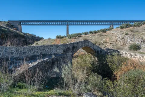
We left Martos, in a southwestern direction, towards the border with the province of Córdoba. New intersections with the national road are resolved by installing a lower step and a new gateway. In Km. 33, coinciding with the proximity of the Salado stream, the landscape changes and becomes more abrupt and serrano, already in the foothills of the Sierra Sur massif. The railway crosses rivers and streams in the middle of impressive ravines, through metal viaducts with lengths between 70 m and 224 m. These complex engineering works, which were designed by the French Alessandre and Delapierre, date back to the end of the 19th century, magnificent examples of oblonted architecture, and which constitute extraordinary views on the rural landscapes of the province of Jaén.

The rest area of the isolated station of Vado-Jaén is located at km 37. The old railway platform continues its course in the direction of the Alcaudete Station, passing the impressive viaduct on the Víboras River (224 m long and 80 m high), the remains of an abandoned balast quarry, called La Muela, and some sections of lush Mediterranean vegetation in which they stand out oak, retama and majajelos, as well as old almonds.

Leaving the Alcaudete station behind, at 48,400 km, we will reach a crossing with the A-316 road, saved by a high gateway.

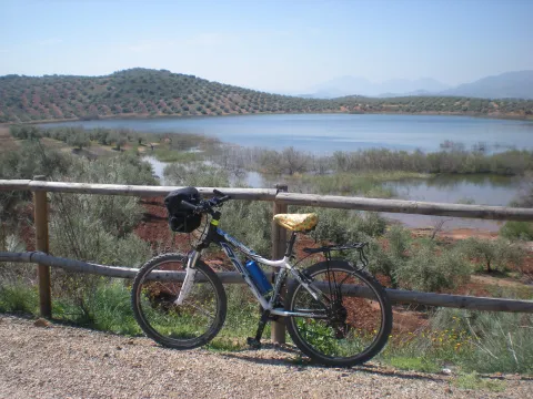
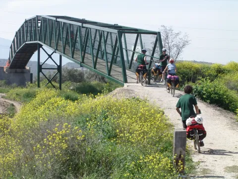
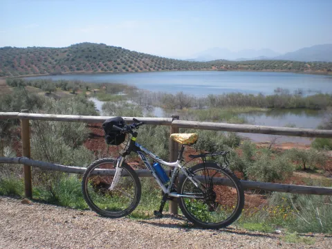
After passing through the building for the railway houses, the Green Way of Oil connects with the Biking Routes of Sierra Sur de Jaén (signposted), which enter the cycloturist in the heart of the massif of the same name, and runs right next to the Laguna Honda Natural Reserve (Km. 50,500); at this point you can see the abundant and rich avifauna that dwells in this 65 Has. wetland of extension: evil, real anade, squid or small zampullin.

On the right bank of the Green Way, a road leads to another natural space protected from the environment: the Natural Reserve of Laguna del Chinche, of 6.5 Has. of extension and with an interesting perilagunar vegetation. The last miles pass through a very eroded site where deep ravines are frequent, in whose slopes the thyme and the spartum occupy a land, not suitable for the olive tree, which sometimes offer excellent panoramic views of the Vadomojón reservoir. The jiennese part of the Green Way of Oil concludes on the great iron bridge over the Guadaljoz River, right in the tail of the reservoir, 199 m long.

From this point the green track connects with that of the Cordobese Subbetic.

Latitud
38.2167
Longitud
-2.7228
Distrito
Municipio
Ubicación en el mapa
POINT (-2.7228 38.2167)
imagen
Image
foto-4_rncc_2540-jpg
Imagen principal
Activado
imagen
Image
perfil-aceite-fusion-1-jpg
Imagen principal
Activado
imagen
Image
vva-jpg
Imagen principal
Desactivado
imagen
Image
patricia-aybar-en-via-verde-jpg
Imagen principal
Desactivado
imagen
Image
vva-1-jpg
Imagen principal
Desactivado
imagen
Image
vva-2-jpg
Imagen principal
Desactivado
imagen
Image
vva-3-jpg
Imagen principal
Desactivado
imagen
Image
vva-4-jpg
Imagen principal
Desactivado
imagen
Image
vva-5-jpg
Imagen principal
Desactivado
imagen
Image
vva-6-jpg
Imagen principal
Desactivado
imagen
Image
74422248_140452477303677_4407740479924338688_o-jpg
Imagen principal
Desactivado
imagen
Image
vva-7-jpg
Imagen principal
Desactivado
imagen
Image
vva-8-jpg
Imagen principal
Desactivado
imagen
Image
aceite08-jpg
Imagen principal
Desactivado
imagen
Image
aceite10-jpg
Imagen principal
Desactivado
imagen
Image
aceite13-jpg
Imagen principal
Desactivado
imagen
Image
rcc_2082-1-jpg
Imagen principal
Desactivado
imagen
Image
cantera-de-la-muela-1-jpg-1
Imagen principal
Desactivado
7 h 30 min

Friends

icon-intereses-amigos

Nature

icon-intereses-naturaleza

Solo travel

icon-intereses-viajar-solo

Gastronomy

icon-intereses-gastronomia

For couples

icon-intereses-en-pareja

Family

icon-intereses-familia

Adventure

icon-intereses-aventura

Culture

icon-intereses-cultura

Sport

icon-intereses-deporte

Municipality

icon-intereses-municipio

Low-cost tourism

icon-intereses-turismo-low-cost

Eco-friendly

icon-intereses-eco-friendly
Baja
Document
Image
fc880c76-e19a-7c1e-4cfb-785b4441a694?t=1604415740731
1. Miradores y paisajes forestales del Parque Natural Sierras de Cazorla, Segura y las Villas. Un recorrido general por su legado forestal.
115 km
892m
All year round
Desactivado
Image
perfil-aceite-fusion-1-jpg

6, from Jaén (The Fuentezuelas' polysports complex) and from each of the five stations.

Users: cyclists, walkers and wheelchair people.

Regardless of the way you decide to travel this route, it is recommended to use comfortable clothes and footwear and adapted to the time of the year. Although it is not convenient to do so in the middle of summer due to the heat. You must not forget to wear enough water and, if you go on a bike, it is always recommended to wear a helmet.

For more information visit:http: / / www.viasverdes.com

Cultural heritage: Monumental set of Jaén. The medieval castle of Alcaudete. Medieval Bridge of the Vipers. Archaeological route of the Torreones. Urban assemblies of Luque, Zuheros, Doña Mencía, Cabra and Lucena. Cueva de los Murcielagos en Zuheros.
Ramal a Baena: Urban complex of Luque and Baena, archaeological park of Torreparedones, the Historical and Archaeological Museum of Baena, church of the ancient Convent of the Agustinos Descalzo in Luque.

The starting point is located in the village of Vadillo-Castril. The latter is followed by the A-319 road that links the towns of Peal de Becerro and Hornos de Segura. We must take the detour located at the kilometer 31.7 and continue for 5 km by the JF-7091 until the entrance detour to Vadillo-Castril and the Training and Forest Experiment Centre.

The route has been broken down in stages, assuming that it will be of interest to cycloturists, although it could be carried out by car as it travels on roads open to traffic.

  1. Km 115 - Sequero de Siles.

Coordinates 38.39197, -2,58255

Siles is a village of 2200 inhabitants located on the north end of the Natural Park. There is an old artificial pineapple sequero, which has been musealized and transformed into the current Centre for Interpretation and Reception of Visitors of the Sierra de Segura. It is located in the street Carretera de Hellín no. 21, and has several exhibition spaces that report on the natural values of the Sierra de Segura, the history of the human population in the territory, the serrano trades and, in an outstanding way, on the sequero itself, from which the original machinery is preserved.

Tramo de asfalto o cemento
97.39%
Tramo de pista o camino forestal
2.61%
Tramo de vía pecuaria
0
Tramo de senda
0

Greenwaand (Vía Verde) del Aceite

Submitted by brandcode_deweloper on
Id
6622232
Descripción larga

The tour begins at the edge of the city centre of Jaén, next to the municipal sports complex Las Fuentezuelas. The first 2 km, used by hiking and cycling, have several rest areas. From here on, we will cross, on a service road, the north-west circumvalation of Jaén to resume the trail to the town of Torredelcamp. After passing through a new alternative road that saves the A-316 motorway, we arrive at the Torredelcampo station (km. 11,100) located in this urban nucleus.

After two tunnels (the first lit 333 meters long), two viaducts and the rest area of the Quebradas, we will reach the nearby town of Torredonjimeno. From Torredonjimeno Station (Km. 1,600) we will continue in the direction of Martos, for which we will have to cross two long metal walkways that allow the crossing with the road A-316. La Via Verde crosses the city centre of Martos and offers the possibility to make interesting visits to the city.

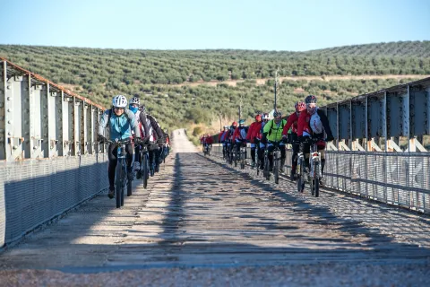
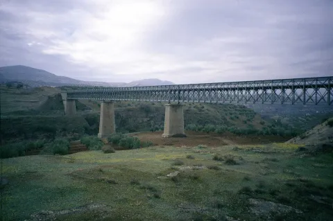
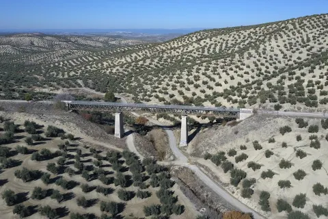
We left Martos, in a southwestern direction, towards the border with the province of Córdoba. New intersections with the national road are resolved by installing a lower step and a new gateway. In Km. 33, coinciding with the proximity of the Salado stream, the landscape changes and becomes more abrupt and serrano, already in the foothills of the Sierra Sur massif. The railway crosses rivers and streams in the middle of impressive ravines, through metal viaducts with lengths between 70 m and 224 m. These complex engineering works, which were designed by the French Alessandre and Delapierre, date back to the end of the 19th century, magnificent examples of oblonted architecture, and which constitute extraordinary views on the rural landscapes of the province of Jaén.

The rest area of the isolated station of Vado-Jaén is located at km 37. The old railway platform continues its course in the direction of the Alcaudete Station, passing the impressive viaduct on the Víboras River (224 m long and 80 m high), the remains of an abandoned balast quarry, called La Muela, and some sections of lush Mediterranean vegetation in which they stand out oak, retama and majajelos, as well as old almonds.

Leaving the Alcaudete station behind, at 48,400 km, we will reach a crossing with the A-316 road, saved by a high gateway.

After passing through the building for the railway houses, the Green Way of Oil connects with the Biking Routes of Sierra Sur de Jaén (signposted), which enter the cycloturist in the heart of the massif of the same name, and runs right next to the Laguna Honda Natural Reserve (Km. 50,500); at this point you can see the abundant and rich avifauna that dwells in this 65 Has. wetland of extension: evil, real anade, squid or small zampullin.

On the right bank of the Green Way, a road leads to another natural space protected from the environment: the Natural Reserve of Laguna del Chinche, of 6.5 Has. of extension and with an interesting perilagunar vegetation. The last miles pass through a very eroded site where deep ravines are frequent, in whose slopes the thyme and the spartum occupy a land, not suitable for the olive tree, which sometimes offer excellent panoramic views of the Vadomojón reservoir. The jiennese part of the Green Way of Oil concludes on the great iron bridge over the Guadaljoz River, right in the tail of the reservoir, 199 m long.

From this point the green track connects with that of the Cordobese Subbetic.

Breve descripción

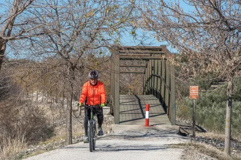
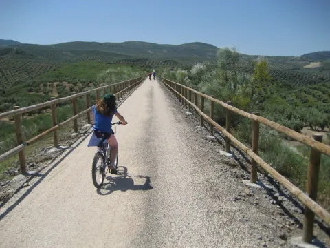
The Green Way of Oil is presented as a new and attractive offer of interior tourism based on the development and recovery of the infrastructure of the old abandoned railway Jaén-Campo Real (Córdoba) as a green corridor, for the practice of cycling, hiking and other sports in direct contact with nature.

Built between 1882 and 1893, this railway belonged to the line Linares- Puente Genil, which was dedicated throughout much of the 20th century to the transport of different metals from the linarian mines and, especially, from the abundant olive oil to the port of Málaga and the markets of the southern Peninsula, so it was popularly called the Oil Train. Technical and commercial reasons motivated their abandonment in 1971, and the transport of passengers and goods was finally closed on 1 January 1985.

All of its layout, from Jaén to the provincial limit, runs by sepentating olive-countryside grounds that make up a landscape of authentic olive-sea splattered by typical Andalusian cortijos. The presence of the Serras de Jabalcuz, la Grana, la Caracolera and del Achillos, located very close to the South and the East of the Via Verde, provide diversity to the relief and the landscape.

Latitud
37.7206
Longitud
-3.9726
Distrito
Municipio
Ubicación en el mapa
POINT (-3.9726 37.7206)
imagen
Image
Foto%204_R%C3%B1CC_2540.jpg
Imagen principal
Activado
imagen
Image
VVA.jpg
Imagen principal
Desactivado
imagen
Image
Patricia%20Aybar%20en%20V%C3%ADa%20Verde.JPG
Imagen principal
Desactivado
imagen
Image
VVA%20%281%29.jpg
Imagen principal
Desactivado
imagen
Image
VVA%20%282%29.jpg
Imagen principal
Desactivado
imagen
Image
VVA%20%283%29.jpg
Imagen principal
Desactivado
imagen
Image
VVA%20%284%29.jpg
Imagen principal
Desactivado
imagen
Image
VVA%20%285%29.jpg
Imagen principal
Desactivado
imagen
Image
VVA%20%286%29.jpg
Imagen principal
Desactivado
imagen
Image
74422248_140452477303677_4407740479924338688_o.jpg
Imagen principal
Desactivado
imagen
Image
VVA%20%287%29.jpg
Imagen principal
Desactivado
imagen
Image
VVA%20%288%29.jpg
Imagen principal
Desactivado
imagen
Image
Aceite08.jpg
Imagen principal
Desactivado
imagen
Image
Aceite10.jpg
Imagen principal
Desactivado
imagen
Image
Aceite13.jpg
Imagen principal
Desactivado
imagen
Image
RCC_2082%20%281%29.jpg
Imagen principal
Desactivado
imagen
Image
cantera-de-la-muela-1-jpg
Imagen principal
Desactivado
5 h

Friends

icon-intereses-amigos

Nature

icon-intereses-naturaleza

Solo travel

icon-intereses-viajar-solo

Gastronomy

icon-intereses-gastronomia

For couples

icon-intereses-en-pareja

Family

icon-intereses-familia

Adventure

icon-intereses-aventura

Culture

icon-intereses-cultura

Sport

icon-intereses-deporte

Municipality

icon-intereses-municipio

Low-cost tourism

icon-intereses-turismo-low-cost

Eco-friendly

icon-intereses-eco-friendly
Baja
Document
Image
fc880c76-e19a-7c1e-4cfb-785b4441a694?t=1604415740731
Vía Verde del Aceite
55 km
250m
Suitable and practical with some sections with inclination, more information at: www.viasverdisaccesibles.es
All year round
Desactivado
Image
e89bb8eb-4c68-4c94-c1c4-16b8446ab220?t=1607013766463
2
9
3
5
3
1

6, from Jaén (The Fuentezuelas' polysports complex) and from each of the five stations.

Users: cyclists, walkers and wheelchair people.

Regardless of the way you decide to travel this route, it is recommended to use comfortable clothes and footwear and adapted to the time of the year. Although it is not convenient to do so in the middle of summer due to the heat. You must not forget to wear enough water and, if you go on a bike, it is always recommended to wear a helmet.

For more information visit:http: / / www.viasverdes.com

Cultural heritage: Monumental set of Jaén. The medieval castle of Alcaudete. Medieval Bridge of the Vipers. Archaeological route of the Torreones. Urban assemblies of Luque, Zuheros, Doña Mencía, Cabra and Lucena. Cueva de los Murcielagos en Zuheros.
Ramal a Baena: Urban complex of Luque and Baena, archaeological park of Torreparedones, the Historical and Archaeological Museum of Baena, church of the ancient Convent of the Agustinos Descalzo in Luque.

Greenwaand (Vía Verde) de Segura

Submitted by brandcode_deweloper on
Id
6591286
Descripción larga

Km 114.5

The Segura Natural Trail–Greenway, promoted by the Provincial Council of Jaén and developed by the Ministry of Agriculture, Fisheries and Food in 2015, is a truly unspoilt route surrounded by nature and landscapes. Visitors should be aware that the nearby towns, and therefore opportunities to obtain supplies, are located some distance from the route. It begins beside the kilometre 217 marker on the Bailén–Albacete national road (N-322), two kilometres from Arroyo del Ojanco and one kilometre from its abandoned railway station. There is no designated car park on the left-hand side of the road when travelling towards Albacete, although there is sufficient space to park several vehicles. Information panels and signs indicate the starting point.

The first kilometre descends towards the Guadalimar River viaduct, a monumental concrete structure with a 175-metre-long deck supported by five wide arches. The viaduct also provides an exceptional viewpoint overlooking the river’s gallery forest. The Guadalimar River is the lowest point on the route.

After crossing the Guadalimar River, the route of the former railway has been occupied for 1.5 km by the access road to a biogas plant. The alternative is a parallel path which, in order to negotiate the overpasses, includes several ascending and descending slopes.

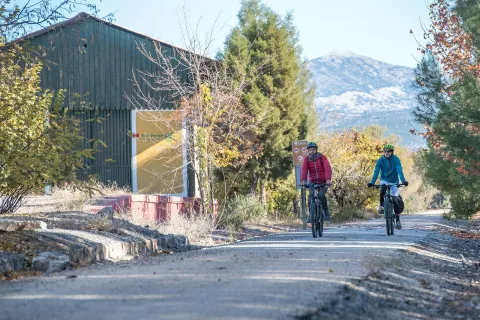
When the asphalt road branches away at km 118, the route once again takes over the former railway platform. The Segura Greenway regains the advantages of the original railway route and begins a long journey through a landscape of rolling hills, dominated by orderly rows of olive trees and alternating areas of uncultivated land covered with Spanish broom, dotted with isolated trees and small patches of pine forest. In the distance, high mountains rise on both sides, their olive groves extending upwards until they meet the dense pine forests crowning the summits.

Across such difficult terrain, the railway was able to maintain long straight sections thanks to its most characteristic engineering structures. High embankments built over stream valleys alternate with cuttings through raised terrain and cut-and-cover tunnels in places where the earthy walls of the cuttings were too unstable.

From km 122 onwards, it becomes easier to see a deep gorge opening in the mountain range that closes off the southern horizon on the right. The Guadalimar River has carved a passage through the Sierra de Segura, where the town of La Puerta de Segura occupies a strategic location. In the distance, beyond the gorge and perched on a hill, the castle and village of Segura de la Sierra can be seen overlooking the boundaries of the Sierras de Cazorla, Segura y Las Villas Natural Park.

Within sight of the hamlet of La Agracea, at km 124.5, there is another important point on the route. A shooting range stands to one side, and its bar is the only place near the greenway where visitors can obtain supplies. 

Km 125

At km 125, the original route of the Baeza–Utiel railway has been severed by the N-322 road. The gravel path ends at the intersecting JV-7001 road. As the former railway alignment has disappeared, the alternative is to share the lightly trafficked road with other vehicles. Turning right, the road rises over an overpass and crosses above the N-322 in the direction of La Puerta de Segura, located 6 km from the greenway. This interruption, which is clearly signposted, is marked by an old steamroller raised on an unusual pedestal: a former railway track overpass.
Around 200 metres further on, a gravel track on the left descends to rejoin the original railway alignment and allows vehicles to reach the car park provided beside the first station on the route.
 
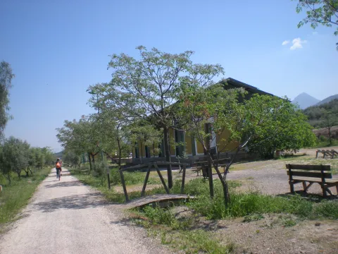
The former Puente de Génave station, at km 125.3, follows the same architectural design as the other stations. It consists of a main passenger building and a goods warehouse, each with its respective platform. Here, however, there is also a livestock loading platform, which is not present at the other stations, alongside which a rest area has been provided.
 
It is worth mentioning that there is a new 5 km cycle lane between the town of Puente de Génave and La Puerta de Segura. This provides an excellent opportunity to reach this beautiful town and the heart of the Natural Park safely.
 
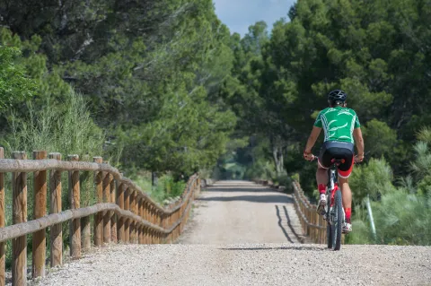
Beyond the station, the railway route winds around the courses of the Gavilán and Moral streams. The alignment curves around deep valleys with steep slopes. In this unspoilt environment, pine forest begins to spread towards the route, first reaching it through the intermittent ravines crossed by high embankments and eventually becoming the dominant feature. The pine trees enhance the route between the hamlet of Bonache, at km 126.7, shortly before crossing into the Natural Park, and the cutting at km 129. This section includes a rest area at km 128.2, an idyllic place to stop, where the greenery and shade of the pine trees create an oasis.

As the route crosses the Sierras de Cazorla, Segura y Las Villas Natural Park, the dominant landscape of olive groves and uncultivated land returns. The vegetation changes, but the surrounding stream valleys continue to shape the route. The Segura Greenway then enters a large cutting with high rocky walls that curves to the left, rises over two high embankments providing views across the deep valley and finally passes underground. The Génave Tunnel, at km 132, is the longest on the route and consists of a straight, 277-metre gallery in excellent condition. However, it has no lighting, so visitors are advised to bring a torch or bicycle lights.

Km 133.5

A long straight section through uncultivated land leads to Génave station, at km 133.5, where there is a rest area, a car park and access from the Génave road, the JV-7053.

Beyond Génave station, the rolling landscape returns. The former railway platform once again follows long straight sections between olive groves and uncultivated fields. The surroundings are similar, although the panoramic views are different. On the left-hand side, towards the north, Sierra Morena gradually descends and the landscape opens up. The view extends across the boundaries of the province of Jaén and may even reach the Campos de Montiel region in Ciudad Real. 

Km 137

The section through the Natural Park comes to an end beside an overpass near the Santa María farmhouse. The ruined buildings and rugged surroundings create a strong sense of isolation. From this farmhouse onwards, the landscape changes radically. Olive groves are no longer ever-present. They continue to dominate the distant mountains, but along the edges of the route they alternate with fields of herbaceous crops and uncultivated land covered with Spanish broom and holm oaks. The latter even form a small woodland extending for around one hundred metres.
 
Villarrodrigo station, at km 140, has a rest area and an access point. Beyond the station lies the final section of the route: a gentle 1.5 km descent through flat cereal fields. The Segura Greenway ends at the provincial boundary with Albacete, at km 141.5. However, the journey can continue for another 19.5 km along the Sierra de Alcaraz Greenway, or even as far as the city of Albacete, although a further 16 km section beyond Reolid station and towards the town of Alcaraz has not yet been restored. 

Facilities
Information and evacuation panels, direction signs, railings, bollards and replanted vegetation along the edges of the route. Rest areas with tables, benches, litter bins and bicycle parking facilities. Access points at the stations.
 
The beginning of the Segura Greenway is marked as km 114.5 with a view to its future integration with other already signposted sections in both Jaén and Albacete. At km 131.5, there is an original series of railway markers bearing the initials B-U, standing for Baeza–Utiel. These belonged to the former Baeza–Utiel railway, whose starting point, km 0, was located in Linares. 

Breve descripción

The route of the old Baeza railway - Use its steps in the province of Jaén in the region of the Sierra de Segura. On the way to the province of Albacete, it unfolds between a landscape of lomas and hills dominated by the olive grove. And one of its sections goes through the Natural Park Sierras de Cazorla, Segura and Las Villas.
This Natural Road - Via Verde has been implemented under the Natural Walking Programme of the Ministry of Agriculture, Food and the Environment.
Latitud
37.7796
Longitud
-3.7849
Distrito
Municipio
Ubicación en el mapa
POINT (-3.7849 37.7796)
imagen
Image
PA200236%20-%20copia.jpg
Imagen principal
Activado
imagen
Image
PA200223%20-%20copia.jpg
Imagen principal
Desactivado
imagen
Image
Foto%201_RAF1305.jpg
Imagen principal
Desactivado
imagen
Image
Foto%202_RAF1230.jpg
Imagen principal
Desactivado
imagen
Image
Foto%203_RAF1232.jpg
Imagen principal
Desactivado
imagen
Image
Foto%204-203237.png
Imagen principal
Desactivado
imagen
Image
Foto%205_RAF1295.jpg
Imagen principal
Desactivado
imagen
Image
Foto%207_RAF1315.jpg
Imagen principal
Desactivado
imagen
Image
PA200215%20-%20copia.jpg
Imagen principal
Desactivado
imagen
Image
PA200280%20-%20copia.jpg
Imagen principal
Desactivado
imagen
Image
DGJK5601.jpg
Imagen principal
Desactivado
imagen
Image
thumb.png
Imagen principal
Desactivado
imagen
Image
PA200265%20-%20copia.jpg
Imagen principal
Desactivado

Friends

icon-intereses-amigos

Nature

icon-intereses-naturaleza

Solo travel

icon-intereses-viajar-solo

Gastronomy

icon-intereses-gastronomia

For couples

icon-intereses-en-pareja

Family

icon-intereses-familia

Adventure

icon-intereses-aventura

Culture

icon-intereses-cultura

Sport

icon-intereses-deporte

Municipality

icon-intereses-municipio

Low-cost tourism

icon-intereses-turismo-low-cost

Eco-friendly

icon-intereses-eco-friendly
Medium
Image
d3c1c77a-e613-630f-1a91-091aa05883f1?t=1604419293738
Vía Verde de Segura
27 km
Suitable though difficult between the km. 116.2 and 117.7.
All year round
Desactivado
Image
1bce61fa-87f2-0deb-4b00-f9ee11d10e13?t=1607013708900

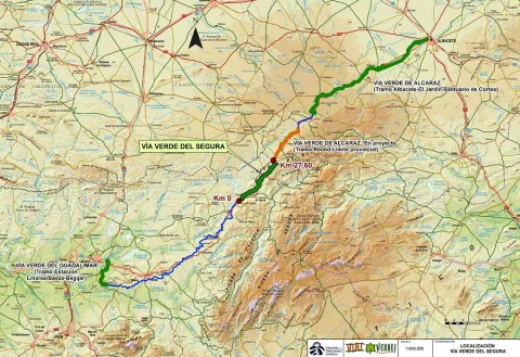
Between the km 217 of the N-322 road (municipal term of Arroyo del Ojanco) and the provincial limit Jaén-Albacete (T.M. de Villarrodrigo).

Tramo de asfalto o cemento
 
Tramo de pista o camino forestal
 
Tramo de vía pecuaria
 
Tramo de senda