
Route Source of Segura
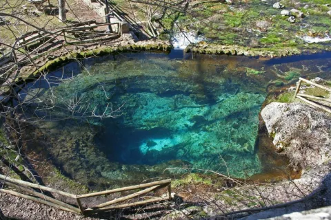
This circular route, which coincides in its first half with the GR-7 and the Safe Source Path (perfectly marked by the Environmental Council of the Junta de Andalucía), runs through the valley between the slopes of the Mariasnal and the rocky soils of Los Corralejos, passing through the villages of Fuente Segura and the birth of the Segura River, a spectacular crystalline poza of about 7 m diameter by 6 m depth, whose state is very variable according to the weather of the year.
The water runs through the mouth of a poza that forms part of the underground system that collects the precipitation that falls into the nearby altiplanicie of the fields of Hernán Perea.
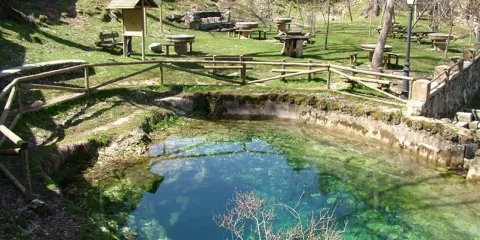
Pontones has various services and at the birth of the Segura there is a recreational area, with a fountain and chiringuito (open from Easter to autumn).
Recommended epoch spring and especially autumn.
We leave Pontones in the direction of Santiago de la Espada and at 200 m to the right there is a manganche where we can leave the car, next to a park adapted with a fountain.
On the A-317 road to Pontones (The Lower Ponton).
