Saltar al contenido principal

Route Source of Segura

Submitted by brandcode_deweloper on
Id
5974145
Breve descripción

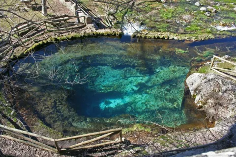
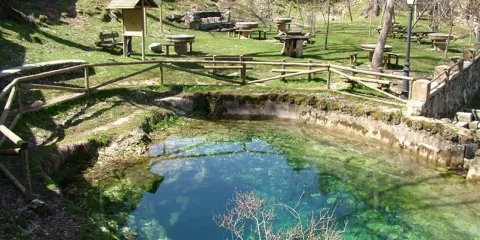
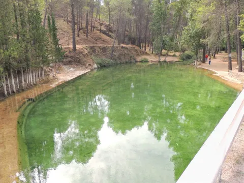
This circular route, which coincides in its first half with the GR-7 and the Safe Source Path (perfectly marked by the Environmental Council of the Junta de Andalucía), runs through the valley between the slopes of the Mariasnal and the rocky soils of Los Corralejos, passing through the villages of Fuente Segura and the birth of the Segura River, a spectacular crystalline poza of about 7 m diameter by 6 m depth, whose state is very variable according to the weather of the year.

The water runs through the mouth of a poza that forms part of the underground system that collects the precipitation that falls into the nearby altiplanicie of the fields of Hernán Perea.
Latitud
38.0947
Longitud
-2.6583
Distrito
Municipio
Ubicación en el mapa
POINT (-2.6583 38.0947)
imagen
Image
1.jpeg
Imagen principal
Activado
imagen
Image
nacimiento-del-rio-segura.jpg
Imagen principal
Desactivado
1 h 15 min

Nature

icon-intereses-naturaleza

Friends

icon-intereses-amigos

Adventure

icon-intereses-aventura

Culture

icon-intereses-cultura

Sport

icon-intereses-deporte

Eco-friendly

icon-intereses-eco-friendly

For couples

icon-intereses-en-pareja

Family

icon-intereses-familia

Gastronomy

icon-intereses-gastronomia

Municipality

icon-intereses-municipio

Low-cost tourism

icon-intereses-turismo-low-cost

Solo travel

icon-intereses-viajar-solo
Baja
Ruta Nacimiento del Segura
9,6 km
99m
All year round
Desactivado

Pontones has various services and at the birth of the Segura there is a recreational area, with a fountain and chiringuito (open from Easter to autumn).

Recommended epoch spring and especially autumn.

We leave Pontones in the direction of Santiago de la Espada and at 200 m to the right there is a manganche where we can leave the car, next to a park adapted with a fountain.

On the A-317 road to Pontones (The Lower Ponton).
Tramo de asfalto o cemento
 
Tramo de pista o camino forestal
 
Tramo de vía pecuaria
 
Tramo de senda
 

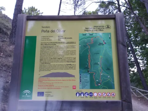
Circular Route Peña del Olivar

Submitted by brandcode_deweloper on
Id
5973466
Breve descripción

Northern area of the Natural Park, municipality of Siles.

Latitud
38.3883
Longitud
-2.5817
Distrito
Municipio
Ubicación en el mapa
POINT (-2.5817 38.3883)
imagen
Image
1.jpg
Imagen principal
Activado
imagen
Image
Ruta%20Circular%20Pe%C3%B1a%20del%20Olivar.jpg
Imagen principal
Desactivado

Nature

icon-intereses-naturaleza

Friends

icon-intereses-amigos

Adventure

icon-intereses-aventura

Culture

icon-intereses-cultura

Sport

icon-intereses-deporte

Eco-friendly

icon-intereses-eco-friendly

For couples

icon-intereses-en-pareja

Family

icon-intereses-familia

Gastronomy

icon-intereses-gastronomia

Municipality

icon-intereses-municipio

Low-cost tourism

icon-intereses-turismo-low-cost

Solo travel

icon-intereses-viajar-solo
Medium
Document
Document
Ruta Circular Peña del Olivar
1,3 km
4480m
All year round
Desactivado

In the recreational area of La Peña del Olivardis it puts the fountain, tables, bathing area and a kiosk that usually opens during the holiday period. There is also water in the Nogueron Fountain (Km 1),

From Siles: on the JF-7012 road, marked "The Way of the Azeas."

Recreative area of the Peña del Olivar, in the Km 2 of the said road, next to the ceramic panel.

Circular Route Alto del Montero

Submitted by brandcode_deweloper on
Id
5969785
Descripción larga

In Hornos de Segura we take the road A-317 towards Pontones and take a right turn, at the height of the village of Hornos el Viejo, towards La Plantera. We passed a few meters from this village and reached another crossing, where the asphalt is finished, we turned left, in the direction of the Fountain de la Higuera. The beginning of the path is 3.5 km (approx.) from this crossing. This forest track borders the Embalse del Tranco, we will leave to the right a recreational area, called Fountain de la Higuera and just 200 meters to the right begins our route, initially by a forest track with a little use.

A very good path for the observation of fauna, especially the boar and deer. It is recommended to go in silence and very attentive. Animals usually go down to drink, and sometimes they are surprised very close to the itinerary. In addition, the semi-abandoned olive groves in the area of Arroyo Montero are exceptional areas of grass. This path can also be realized from the area of Coto Ríos, entering the forest track of Llanos de Arance and following it to the end, where we would find the Arroyo Montero, by being circular, we could also do it from there in its entirety.

Breve descripción

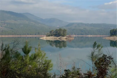
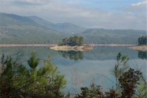
Proximities of the Embalse del Tranco, near the Hornos de Segura (approx. 10 km).

Latitud
38.2804
Longitud
-2.6402
Distrito
Municipio
Ubicación en el mapa
POINT (-2.6402 38.2804)
imagen
Image
6%20%281%29.jpg
Imagen principal
Activado
imagen
Image
Ruta%20Circular%20Alto%20del%20Montero%20%281%29.jpg
Imagen principal
Desactivado
4 h 30 min

Nature

icon-intereses-naturaleza

Friends

icon-intereses-amigos

Adventure

icon-intereses-aventura

Culture

icon-intereses-cultura

Sport

icon-intereses-deporte

Eco-friendly

icon-intereses-eco-friendly

For couples

icon-intereses-en-pareja

Family

icon-intereses-familia

Gastronomy

icon-intereses-gastronomia

Municipality

icon-intereses-municipio

Low-cost tourism

icon-intereses-turismo-low-cost

Solo travel

icon-intereses-viajar-solo
Alta
Document
Document
Ruta Circular Alto del Montero
18,9 km
342m
All year round
Desactivado
Image
a3ec287d-faae-f015-1436-6b812ece7703?t=1607022723091

In the middle of the tour, we will find the Montero stream, which we will have to cross on two occasions. It is a very appropriate place to make a stop and rest.

Past Higuera Source, the forest track seems to leave the reservoir to start climbing. Right at that point, to the right, it starts this path, on a small forest track.