Direct climb from Albanchez de Magina to one of the most emblematic summits of Sierra Magina. A short but demanding rise, by mixed firm, that combines traces of the serrana life and a wide panoramic end.
The route proposes a direct rise from Albanchez de Magina to the top of the Aznaitín (1,745 m), on a path of rise by initial asphalt, forest track and stony path. The itinerary starts next to the City Hall and gains height on the street of Ohorno between houses set to the exit of the village and facing the north-east side of the saw.
As it rises, the landscape becomes more austere and clearly mountainous. The slope is constant and the gap is concentrated within a few kilometres, so it is appropriate to maintain a regular pace. In the middle section are the first testimonies of traditional life in height: the remains of a snow well, used for the collection and transport of ice between the 18th and 19th centuries, and the ruins of a shack of pastors, simple dry stone constructions linked to the grazing and the development of the saw.
The final stretch leaves the track to take a clear path that gains height with decision between stone and limestone, until reaching the summit of the Aznaitín, a true natural balcony. From here, the views open in all directions: the heart of Sierra Magina, the region of La Loma and the Guadalquivir valley, the dark line of Sierra Morena, the saws of Cazorla and Las Villas and the summits of the Sierra Sur. A complete lookout that rewards the effort of promotion.
The route ends at the top, returning on the same itinerary.
General recommendations
Recommended route for well-formed trails. Check the weather before the exit, use mountain shoes with good grip and the use of sticks in the strands of strong slope and pedestal is recommended. It has enough water and prevents ascension in extreme heat or strong wind.
Breve descripción
A round-trip Itinerary that ascends from the urban centre of Albanchez de Magina to the top of the Aznaitín (1,745 m). The tour combines a forest track and an increasingly stony mountain path, with continuous slopes that require good physical form and regular passage. The remains of an old snow well and of shepherds' huts are visited along the climb, before reaching a panoramic summit over the Natural Park of Sierra Magina and the olive sea of La Loma.
The track runs on the northwest face of Mount Bucentaina. When we have been walking for about 20 minutes we will reach the source of the Noguerón, from which there is plenty of water. In this place, the path PR-A 175 is separated by a path to the left. We're still on the main road.
At first we will see the mountains and olive groves around Siles, and then enter the forest. It is one of the best pineapples of carrasco pine the Natural Park. Just as the village of Puentehonda appears before us, we see on the left, on the same road, two gigantic and venerable specimens of carrasco pine, which are included in the Inventory of Singular Trees of Andalusia with the names of Pino de los Barrilos de Puentehonda and Pino del Cerro Bucentaina and respectively. The latter is 32 m high and 4.5 m in diameter at its base.
We will also find in our way an indication to go up a narrow and steep path to the remains of the castle of Puentehonda, whose ruins, corresponding to two towers, are half hidden in the thickness of the forest.
The village of Puentehonda, at the foot of the Peñalta, has a small recreational area with a fountain in which it is worth resting. The way back and forth, doing so quietly, will take about four hours.
Breve descripción
This route, of just under 5 km, runs along a narrow forest track that we recommend to walk. Its main attraction is the carrasco pine forest that crosses, under which grows a closed forest of oak, madroños and doves. The first kilometer is quite steep, but the rest is barely at a level. To reach the village of Puentehonda it is enough to follow the track, without taking any detour, until it ends up in another of greater width. The other side of the village is the village.
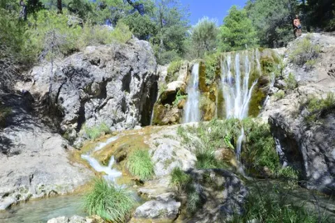
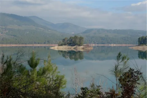
Once the asphalt ramp is over, the most painful stretch of the road, we reach an excellent lookout that allows us to enjoy a good view of the reservoir and the Valentine Barrio. A little later the track runs parallel to the river. When it wanders the way, without crossing, we follow the shore to the corners full of charm that we will meet. Later we will be forced to leave the shore to access a lane. We continue upstream, until we reach the Dike Cascade, very easy to distinguish because in its crown it has stone walls. A little lower, hidden in the bush, a beautiful leap of water is hidden that we must not miss.
Overcoming the Cascade of the Dique, part of a path that, at first, crosses the channel twice and takes us to the head of the river. Leaving the bottom of the ravine for a long time, and then returning to it, when the road ends on a forest track, we reach the bottom of the Cerrada de Navas, where the Guazalanco offers one of its most beautiful pictures.
However, to get to this point from above and to make the way down the stream, you can make an interesting route from the Nature Hall and Botanical Garden of El Hornico: Route of Guazalamanco on the Prays of Arredondo. This circular itinerary is signposted and has 13.2 (circular) length. If two vehicles are available and leaving one on the Cuesta del Cement, we reduce the route to 8.8 km and, in addition, we avoid the most flat and monotonous part of the route, the Dehesa del Rincón.
The most direct access to the Guazalamanco River is by the Dehesa del Rincón. From Pozo Alcón you have to take the A-326, up the Avenida de la Bolera, direction to Castril. By passing the campsite de la Bolera and the Km. 7, we take a detour that comes to our left and that borders the Forest House of la Bolera (it indicates to the Hornico). On an unasphalted road, always following the main road, 6,7 km from its start a fork to the left, in a slope, is left, which is asphalted (Cuesta del Cement). Although with an apron we can reach the Pasada de Guazalamanco, by a forest track parallel to the channel, the most recommended option is to leave the vehicle at the foot of the hill and take a small walk to the Cascade del Dique (round and round 2.5 km), and enjoy the many corners that this beautiful and wild mountain stream offers us.
Breve descripción
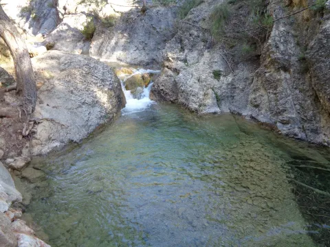
Guazalamanco is a mountain channel of permanent and turbulent waters, loaded with oxygen and gelid glass. Each of its corners invites us to recreate our senses, to remain still, in silence, as if we wanted to merge with nature and return to our origins. If you forget the camera in the car, when you discover the stream you will return to your steps to restart the road, now with the machine ready.
As soon as you have started to climb, the Pancorbo Residence lane is left to the right. The height gained by a few reels, already allows to enjoy the panoramic views above all the Barranco del Río fría, under the coat of the Sierra de La Pandera. In the autumn, when the colors become toasted, the place acquires quite spectacular tones.
At 50 minutes a crossing is reached: we must continue to climb to the right. Later on, a side lane is left, also to the right. Then the slope soften. After a cortijo, the lane ends in a depression, after an hour and a half of marching. At this point it is necessary to turn left, on a narrow signposted path that leads in 15 more minutes to the Port of the Hoya.
On the other side a lush pine covers the slopes. The path that encourages you to discover the forest, starts from the same hill and soon links with a forest track. Later on, it comes into a crossing: to the left, and in ten minutes, you reach the forest house of the Hoya del Caño.
This point presents the alternative of going up to the port of the Navy and linking with the route that descends to the Port of the Coberteras on the side of Valdepeñas de Jaén. In front of the ruins continues a path that first descends to a stream and crosses it. It is soon transformed into a sidewalk that zigzaguea way to the port.
Breve descripción
The rise to the port of the Hoya begins in the area known as Rio fría, very close to the recreation area. The road comes from the same communal road between Los Villares and Valdepeñas de Jaén. The tour connects with the route Barranco de la Hoya-La Pandera, proposed in the section of the trails in the surroundings of Jaén capital of the same website.
Without leaving the path, at the front and below we find the path of the Fuente la Zarza, the forest opens and leaves room for the olive tree. Without going down to the lane, to the left, on the hillside, a narrow path diagonally ascends towards the right flank of the pine near the olive grove. Here begins a progressive, and pleasant promotion. This path connects with an access lane to an olive grove. At this point and without separating from the pine tree we go up to the left, for a short and steep stretch that softens and leads us first on a path and then on a track to the Neveral Hospital.
Due to the constant works in the vicinity of the Hospital and the lack of continuity of the original route of the path that previously surrounded the center through the back area, it is easier to continue straight by the asphalt, so we enter the hospital compound Dr. Sagaz, El Neveral and we cross it to its exit. At the entrance already on the road and to avoid moving on it, to the right, we take advantage of the trails of the recreational area of the Neveral that will take us away from the road traffic. We take a narrow road to the left, on a basketball field and cross the forest track, (common section with the PR-A127: Pinares del Neveral) the road marked, continues close to the vaguada, and the cross later to connect with the road again, about 50 meters from the Caño Quebrado Center. Caño Quebrado is the only source we find throughout the course. (End of common section with the PR-A127 Neveral Pines).
In Caño Quebrado they connect the road to Jaén, the road of the Castle of Santa Catalina and Parador Nacional, with the road to the Neveral Hospital, where we have passed before. In front of the Caño Quebrado Fountain. Just to the left of the road that goes up to the Castle of Santa Catalina and the Parador. Take a lane that descends next to some old chalet, below and to the right continue on a very good road that opens way between the pines and that will return us back to the crossing that is next to the Wall, which we cross again, this time in the opposite direction, to return to the beginning of the Path.
Breve descripción
This circular path, has its beginning in the city centre of Jaén, specifically begins on the bypass road, opposite No. 126. In front of this point a road in good condition, next to an electric transformer ascends on the north side of the hill of the Castle of Santa Catalina. The track with a strong slope, then turns right and softens, rushing through the castle wall. Once we cross the wall, we find an olive tree and the road forks. At this point we will return to the descent, as from here it begins circular section of the path. We take the right road, right through the olive line. From this flat section, you can see the San Vicente de Paul (below), the Magdalena Quarter, and the San Juan Quarter on the right. As we reach the pine tree, we continue on a path descending a few meters and then slightly ascending, opening the way between the pine trees. At about 150 m there is a crossing that we must continue on the right. Later on it passes through a (open) gate of one fenced, the path crosses this fencing, and it leaves it coming out later by a similar gate. Both cancels are generally open.
From Segura de la Sierra we take the Sierra road (JV-7032), and at 8.3 km we find a crossing called La Era del Fustal, where we turn right, towards Santiago de la Sword. About 400? m later we took to the left a long forest track that flows into the Albaceteña village of Parolís. It is a wide track and in good condition, at the beginning of which there are signs of speed and weight limitation.
From Siles we take the road called the Road of the Azebeas (JF-7012). At 14 Km we arrive at the crossing that goes to Segura de la Sierra on the right (The Era del Fustal). We ignore it and continue to face it by finding about 400? m to the left the forest track mentioned above.
The only point of water is the Fountain of the Hoya del Trigo at 2,2? Km from the beginning. It can dry in summer.
Type of Signals:Beacons with white arrows and mojones. From the km 1.3 and to the top we will also find white and yellow signs of international signage such as the Path of Small Tour (PR) of the PR-A 178.
At 6.9 Km from the start of the track, and as we go down to the stream of the Fountain of the Tejo, just before reaching it, a track to the stream of the Fountain of the Tejo, just before reaching it, a track to the right, which in 1.6 Km will place us next to the front of the path. There are wooden rails that delimit the parking area.
In Hornos de Segura we take the road A-317 towards Pontones and take a right turn, at the height of the village of Hornos el Viejo, towards La Plantera. We passed a few meters from this village and reached another crossing, where the asphalt is finished, we turned left, in the direction of the Fountain de la Higuera. The beginning of the path is 3.5 km (approx.) from this crossing. This forest track borders the Embalse del Tranco, we will leave to the right a recreational area, called Fountain de la Higuera and just 200 meters to the right begins our route, initially by a forest track with a little use.
A very good path for the observation of fauna, especially the boar and deer. It is recommended to go in silence and very attentive. Animals usually go down to drink, and sometimes they are surprised very close to the itinerary. In addition, the semi-abandoned olive groves in the area of Arroyo Montero are exceptional areas of grass. This path can also be realized from the area of Coto Ríos, entering the forest track of Llanos de Arance and following it to the end, where we would find the Arroyo Montero, by being circular, we could also do it from there in its entirety.
Breve descripción
Proximities of the Embalse del Tranco, near the Hornos de Segura (approx. 10 km).
In the middle of the tour, we will find the Montero stream, which we will have to cross on two occasions. It is a very appropriate place to make a stop and rest.
Past Higuera Source, the forest track seems to leave the reservoir to start climbing. Right at that point, to the right, it starts this path, on a small forest track.
Forest track that starts at km 28 of the JH-1755 (Transversal de las Villas) road, to the right, right next to the river Aguascebas de Gil Cobo, very close to Recreative Area of the same name.
Breve descripción
The wide road enters the San Ginés closed, parallel to the stream. The channel has been capriciously modeled by the action of water, giving rise to unique jumps and small water pods. Some sections are flanked by abrupt rocky brown. On its shores we find an exceptional vegetation with various endemic species, as well as tides, stalks and even some birches, a purely northern and very scarce tree in the Natural Park.
We continue as far as the track forks and follow our left, accompanied by magnificent pinars. The sinuous route of the road allows us a smooth rise to the Collado del Perenoso, where we have a spectacular view of this whole environment. This is the starting place towards the peak of the Blanquillo or Pedro Miguel.
The tour here has plenty of attractive to do, but if we want stronger emotions, we can ascend to this extraordinary summit. We take to our right a narrow path that runs through a soft hill between salgarean pines in its first stretch.
We continue along this path, through a small ledge that diagonally crosses a rocky wall, and with great caution we pass some sections that have some difficulty. We follow the path, passing a stream that descends from the summit, and we reach a small plain, which is named "La Carrasquilla," from where we see the dominant limestone mole, the modesty vegetation of the high mountain and the shaded pine trees that indicate the extreme weather conditions of this place.
From here we see the final section of this route. We will head towards a small hill and from there we follow the rope, where the arrival to the top is more serene. Once at the summit we have before us all the immensity and beauty of these unusual places.
Once at the top, approach the pinar that is observed to the north, known as Black Pinar. It is a forest made up of centenary and unique examples of salgarean or laritian pine trees (Pinus nigra ssp. salzmanii), in which there is a small fountain with its wooden tornachs, which the mountain-flocks use as a watershed.
The possibility to make the descent through the rope in a southwestern direction towards the hill of White Water and descent through the vaguada, towards the main track of the Cerrada San Gines.
This stage of the Southern Forest trail runs through the Altiplanicie of Los Campos de Hernán Perea, which is one of the largest and most authentic landscapes of the natural park. It is a land with very few levels, but full of dolins and simas, very representative of the karmic landscape, and flanked by the great heights of the park, such as Empanadas, Puerto Lézar and El Banderillas. With its more than five thousand hectares, Los Campos has sometimes been characterized as a lunar landscape, where the craters would be the dolins, with its inverted funnel form.
It is a livestock route, as during part of the route it runs through the livestock. This is home to most of the livestock cabin of the natural park, whose great protagonist is the Segureña sheep, a race very adapted to these mountains. The particular nature of the area we will be going through is that it is the only area in the natural park where the main economic resource of its inhabitants is not the olive tree, but the sheep cattle.
According to the season of the year when we make this tour, we will get a different impression. In winter it is an area of intense snow and in spring water and green pastures abound. In summer and autumn the landscape is harder, drier, but it is probably when there is more life, with the thousands of cattle that pasture here. At any season of the year, this is an essential stage for those who know the natural park in an integral way.
At the end of this stage we found two alternatives. A kilometer before the end begins the 5-derivation, towards the summit of El Banderillas. Next to the Campos del Espino shelter, the GR 247.2 variant is started in a dizzy and exciting descent to the Guadalquivir valley.
Immediately from the Refugio de Rambla Seca, Refugio de la Cañada del Rincón (aljibe), well 1.3 km from the previous point, Refugio Campo del Espino (aljibe).
On the path: No Near the path: No
GR 144
In the beginning: Refugio de Rambla Seca; In the end: Refugio Campo del Espino.
Transhumanity is still alive.
This stage runs through a clearly livestock area where the ancient practice of transhumanism is still alive, which some of the farmers of Santiago- Pontones - especially from the village of La Mate- continue to carry out. Each winter, when the pastures of the high areas of the natural park are not profitable, they take the long way down to the pastures of the Sierra Morena jiennense and Manchega, where the sheep spend several months feeding on the pastures that are encouraged by the benign winter climate of the lowlands. When the spring is completed and the pastures of these areas are exhausted, they will make the way back to their original boreholes in the Sierra de Segura, where the pastures begin to be grown and juicy and where they will feed during the spring and summer.
It is a very ecological way to take advantage of the natural herbides by bringing the cattle to the right place at the right time, because it saves artificial feed and therefore the water and energy needed to make and transport them. In addition, pastures rest for a few months, avoiding their overexploitation. But transhumanism is hard for pastors, subject to all the inconveniences and infirmities of the journey, which lasts between a week and ten days during which they travel from 150 to 300 kilometres. Today, some pastors of the park have been able to add an ecotouristic perspective to transhumanism, so that this ancient journey is in some way a true adventure, which is lived as a personal experience of union with nature by the people who accompany them.
The fishing routes, which are the roads on which the flocks are moved, amount to 741 kilometres in the park and occupy an area of 2242 hectares, constituting a public heritage of great ecological, social and cultural importance. They cannot be built and free passage cannot be prevented.
La etapa parte del Refugio de Rambla Seca por pista forestal sobre vía pecuaria en dirección noreste. A 150 metros dejamos a la derecha la fuente y abrevadero de Rambla Seca y nos adentramos poco a poco en esta altiplanicie. Hacia la derecha tenemos el Puerto de Lézar y el Empanadas (2107 metros).
En la primera parte del recorrido, este tramo del sendero Bosques del Sur coincide con otro sendero de gran recorrido, el Sendero de la Trashumancia GR 144, de aproximadamente 80 kilómetros, que va desde Rambla Seca hasta Puente Mocho en Beas de Segura, siempre por vías pecuarias. En esta zona inicial, aunque no lo parezca, hay terrenos fértiles que hacen que aún se cultiven algunos cereales para alimentar al ganado, por lo que es frecuente encontrar alguna parcela arada o sembrada con variedades adaptadas a estas condiciones.
Km 2,8
Bifurcación
Encontramos una bifurcación de pistas forestales y en este punto abandonamos a la derecha el GR 144, que nos llevaría hasta la aldea de Don Domingo. Continuamos por la pista izquierda, que pronto empieza a serpentear, para salvar las numerosas dolinas del terreno. Una dolina es una depresión típica de los relieves kársticos, formados por la disolución de las rocas calizas. En estas dolinas, cuando abunda el agua y se satura su capacidad de recepción hacia el interior del macizo rocoso, se pueden formar lagunas que en invierno llegan a helarse. Otras formaciones kársticas de esta zona son las simas y las cuevas, a veces asociadas al centro de las dolinas. Caminamos siempre por encima de los 1600 metros, teniendo a nuestra izquierda una cresta montañosa en torno a los 1750 metros de altitud. La zona es más rocosa que el tramo inicial. A casi dos kilómetros del desvío, dejamos a la izquierda una tinada o aprisco de ganado y la pista continúa en ligero ascenso.
Km 7,6
El Alto
Siguiendo por la pista llegamos a este punto que, con una altitud de 1748 metros, un punto importante desde el que podemos contemplar la casi la totalidad del recorrido que hemos realizado y varios de los kilómetros que transitaremos más adelante. Si no fuera porque en los flancos de Los Campos siempre tenemos a varios centinelas montañosos de mayor altitud, sería muy difícil orientarnos, ya que el paisaje en el que estamos inmersos es muy homogéneo y tiene escasas referencias que destaquen claramente. Sin habernos dado cuenta, desde Rambla Seca, hemos ascendido 150 m de altitud en un paisaje de aspecto predominantemente plano. A partir de este momento hay un ligero descenso para volver a subir más tarde.
Km 8,6
Refugio de Cañada del Rincón
A nuestra izquierda queda este refugio, similar al resto de los que encontramos en la zona de Los Campos, que fueron construidos por el Instituto para la Conservación de la Naturaleza (ICONA) en los años 70 del pasado siglo, usados tradicionalmente por los pastores y restaurados recientemente. Tras él está el Calar del Pino, montaña predominantemente rocosa que se eleva sobre el altiplano. Son muy habituales los pozos superficiales para acumular agua para el ganado en los meses estivales. Encontraremos uno de ellos a 1,3 kilómetros del refugio, a pie de pista, a la derecha. Antiguamente se utilizaban troncos de madera, que se vaciaban para hacer los abrevaderos (tornajos), aunque en tiempos recientes se han sustituido muchos de ellos por piletas metálicas, lo que supone una lamentable pérdida en términos de estética.
Km 10,6
Cruce de pistas
Justo delante del Calar de Camarillas llegamos a un cruce de pistas donde debemos girar hacia la izquierda; la pista de la derecha nos llevaría hacia la aldea de Don Domingo por el Barranco del Borbotón.
Nuestro camino sigue en ascenso, hasta llegar a un collado a unos 400 metros del cruce citado. En este punto aparece una pista menos transitada hacia la izquierda que debemos obviar. Además, es imprescindible apartarnos momentáneamente apenas 100 metros a la izquierda de nuestra ruta para bajar a la parte más honda del gran cuenco –dolina– sobre el que nos encontramos. Podremos contemplar la Sima del Hundimiento, que es un embudo casi perfecto de unos 16 m de profundidad, con un primer tramo vertical y dos galerías descendentes paralelas entre sí.
Km 11,5
Mirador Natural Campo del Espino
A los 500 metros del anterior collado, habiendo dejado a la izquierda una plantación de pinos laricios, y antes de empezar a descender desde los 1776 metros de altitud que hemos alcanzado, encontramos a la izquierda una colina de forma cónica a cuya cima suben huellas de vehículos 4x4. Merece la pena subir a la misma porque es un excepcional mirador del Campo del Espino, Pinar Negro, Cordillera del Banderillas y el Calar de las Palomas, entre otros lugares. A lo lejos ya divisamos el refugio del Campo del Espino, más allá del solitario chopo que constituye el único vestigio de las arboledas que existieron en esta zona en tiempos pasados.
Km 12,8
Cruce de pistas en Campo del Espino
A la derecha, y cerrada al tráfico con barrera, hay una pista con señales del GR 247. Se trata de una de las más atractivas derivaciones (d-5) del sendero Bosques del Sur, la que asciende a la Cumbre de El Banderillas, que se describe también en esta guía y desde la que se disfruta de una de las mejores vistas montañeras de Andalucía.
Km 13,7
Refugio Campo del Espino
La etapa finaliza en este refugio de pastores, que cuenta con aljibe para recoger el agua de lluvia, con una bomba manual para su extracción. Hay que recordar que es un agua sin tratamiento sanitario alguno. Desde el refugio tenemos varias opciones. De un lado, la citada derivación a la Cumbre del Banderillas; por otro, una de la etapas que componen la variante 247.2 de este sendero Bosques de Sur y que nos llevaría hasta el poblado de Coto Ríos; y, finalmente, la etapa 17 del trazado principal que nos llevará a Pontones.