
Saltar al contenido principal

Circular Route Navalespino

Submitted by brandcode_deweloper on
Id
5972751
Descripción larga

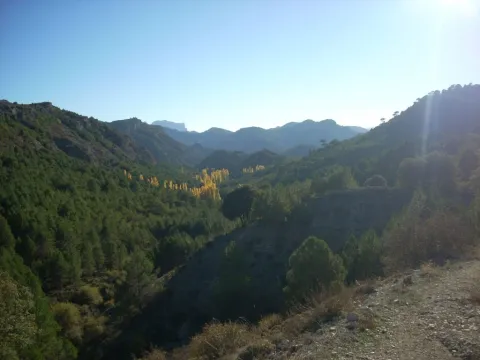
From Segura de la Sierra we take the Sierra road (JV-7032), and at 8.3 km we find a crossing called La Era del Fustal, where we turn right, towards Santiago de la Sword. About 400? m later we took to the left a long forest track that flows into the Albaceteña village of Parolís. It is a wide track and in good condition, at the beginning of which there are signs of speed and weight limitation.

From Siles we take the road called the Road of the Azebeas (JF-7012). At 14 Km we arrive at the crossing that goes to Segura de la Sierra on the right (The Era del Fustal). We ignore it and continue to face it by finding about 400? m to the left the forest track mentioned above.

Latitud
38.276424
Longitud
-2.543725
Distrito
Municipio
Ubicación en el mapa
POINT (-2.543725 38.276424)
imagen
Image
2.jpg
Imagen principal
Activado
imagen
Image
turismoActivo9.jpg
Imagen principal
Desactivado
2 h 30 min

Nature

icon-intereses-naturaleza

Friends

icon-intereses-amigos

Adventure

icon-intereses-aventura

Culture

icon-intereses-cultura

Sport

icon-intereses-deporte

Eco-friendly

icon-intereses-eco-friendly

For couples

icon-intereses-en-pareja

Family

icon-intereses-familia

Gastronomy

icon-intereses-gastronomia

Municipality

icon-intereses-municipio

Low-cost tourism

icon-intereses-turismo-low-cost

Solo travel

icon-intereses-viajar-solo
Medium
Ruta Circular Navalespino
7,7 km
250m
All year round
Desactivado

The only point of water is the Fountain of the Hoya del Trigo at 2,2? Km from the beginning. It can dry in summer.

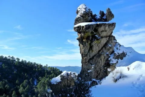
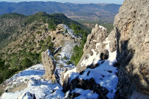
Type of Signals:Beacons with white arrows and mojones. From the km 1.3 and to the top we will also find white and yellow signs of international signage such as the Path of Small Tour (PR) of the PR-A 178.

At 6.9 Km from the start of the track, and as we go down to the stream of the Fountain of the Tejo, just before reaching it, a track to the stream of the Fountain of the Tejo, just before reaching it, a track to the right, which in 1.6 Km will place us next to the front of the path. There are wooden rails that delimit the parking area.
Coordenadas / Huso 30S
539909 mE / 4236584 mN
Tramo de asfalto o cemento
 
Tramo de pista o camino forestal
 
Tramo de vía pecuaria
 
Tramo de senda
 

Circular Route el Yelmo Chico

Submitted by brandcode_deweloper on
Id
5970388
Breve descripción

Between the Garganta de Hornos and the El Yelmo peak, near the village of La Capellanía in the municipality of Hornos de Segura.

In the village of the Capellania, right at the entrance, as the first building is passed to our right, the path starts. There is an indicative arrow and the corresponding start panel.

Latitud
38.212083
Longitud
-2.686295
Distrito
Municipio
Ubicación en el mapa
POINT (-2.686295 38.212083)
imagen
Image
1.jpg
Imagen principal
Activado
imagen
Image
Ruta%20Circular%20el%20Yelmo%20Chico%20%281%29.jpg
Imagen principal
Desactivado
4 h

Nature

icon-intereses-naturaleza

Friends

icon-intereses-amigos

Adventure

icon-intereses-aventura

Culture

icon-intereses-cultura

Sport

icon-intereses-deporte

Eco-friendly

icon-intereses-eco-friendly

For couples

icon-intereses-en-pareja

Family

icon-intereses-familia

Gastronomy

icon-intereses-gastronomia

Municipality

icon-intereses-municipio

Low-cost tourism

icon-intereses-turismo-low-cost

Solo travel

icon-intereses-viajar-solo
Medium
Document
Document
Ruta Circular el Yelmo Chico
14,8 km
580m
All year round
Desactivado

Along the route we will find several places suitable for refreshment and rest, two of them, on foot of the route, are corresponding to cattle forks. But we recommend to visit the area of La Fuente de los Ganados just 5 minutes from our route, a very suitable place for the rest where we will find an old forest house.

To reach this path you have to go to the village of the Capellanía, which is accessed by a short signposted detour from the road of Hornos de Segura to Rio Madera A-317, old road to Pontones.

Coordenadas / Huso 30S
527463 mE / 4229393Nm
Tramo de asfalto o cemento
 
Tramo de pista o camino forestal
 
Tramo de vía pecuaria
 
Tramo de senda
