Saltar al contenido principal

Pegalajar Climbing Areas

Submitted by brandcode_deweloper on
Breve descripción

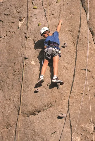
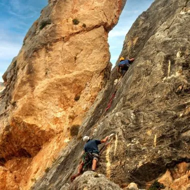
The Pegalajar Climbing Area is one of the most complete and well-established spots in the Sierra Mágina. It is a climbing school on high-quality grey and orange limestone, combining sport climbing, traditional and adventure climbing, and bouldering, in a natural setting close to the town but with a distinct mountain character.

Although the cliffs of the Peña de los Buitres stand out from the motorway linking Jaén and Granada, for years it was a little-visited area. Since 2011, thanks to the ongoing work of local climbers such as José Robles, José E. Carrillo and the Al-hayar Youth Association, the climbing school has developed significantly, especially in the sport climbing and bouldering sectors, becoming today a provincial benchmark.

The variety of styles, orientations and grades makes Pegalajar a suitable destination for both beginners and experienced climbers, provided the sometimes variable rock quality in certain sectors is taken into account.

The sectors and their features are detailed below:
1. Sport climbing sectors
These sectors have modern bolting and single-pitch routes:

  • Iniciación: The sector closest to the village, ideal for beginners. It has between 22 and 23 routes on grey limestone with plenty of pockets and "water drops," with grades ranging from IV to 6c.
  • Arabaico: Located at the foot of the Portichuelo crag, this is an expanding sector with long routes (an 80 m rope is recommended) of great technical quality. It has around 16 routes with grades between IV+ and 7c.
  • Aromático: Located next to the Serrezuela trail, it offers short but intense routes with magnificent views. It has 15 routes with difficulties between 6a and 7a.
  • El Escondite (Sport): A sector that includes routes such as El pecho de un lagarto (6a) and Smile time (7b).

2. Traditional and adventure climbing sectors

Areas of large walls where multi-pitch routes, self-belay and greater technical commitment predominate.

  • Portichuelo: Large cliffs with routes up to 100 metres and 5 pitches. Notable routes include Gripe (6a+) and Bienvenida (6a+).
  • Peña de los Buitres: The main crag, home to committing routes such as D.D.T. (6a+), Manuela (6a) and Fisura Salomón.
  • Peña Grajera: A north-facing sector, located 3 km from the village towards Mancha Real. It features routes such as Diedro Lucifer (6a+) and Ensalada templada (7a+).

3. Bouldering sectors

Pegalajar has more than a hundred boulders, spread across different areas, mainly beneath the Portichuelo. The rock is generally of excellent quality, especially in the beginner sectors, although there are stretches with loose blocks that require caution.

  • Perdigón: The most developed and well-known sector, located in the shade of the pine trees. Due to its size, it is divided into several specific sub-sectors:
    • Rockland: With high-difficulty boulders such as Rockland (8A).
    • La Estrecha: Includes lines such as Serrano Airlines (7A) and Kinderheim 511 (8A).
    • El Capitán: With grade 6 lines and arêtes.
    • El Vacín: Includes boulders such as Sugurus victory (6C) and Sandrova (7B).
    • El Hombre: Boulders such as Levitación (7A) and Aromas de Chefchaouen (6A).
    • Puto Bloke: An area with grade 5 and 6 boulders.
    • Villa Calzones: With boulders such as Kraken (7B) and Lagarto pegalajero (7A).
  • Solera: Located just above Perdigón, on the scree slope beneath the Portichuelo.
  • Peñorares (or Peñonares): A smaller area with more scattered boulders.
  • El Ático: Located next to the Serrezuela trail.
  • Escondite (Boulder): Located near the access to the Arabaico sector.

Warnings and restrictions

  • On the long routes at Portichuelo and Peña de los Buitres, climbing is strictly forbidden from January to July, due to raptor nesting, particularly of the Bonelli's eagle.
  • There are stretches with poor-quality rock and loose blocks, especially on the long routes, so extra caution is recommended.
  • Some equipped long routes are not suitable for beginners and require prior experience, as well as sound route-reading skills.

Orientation and recommended season

The variety of orientations allows for climbing almost all year round, by choosing the sector according to the season.

  • South-facing sectors work well in winter.
  • Peña Grajera, north-facing, is cooler, but not excessively shaded.
  • In the Portichuelo and Peña de los Buitres sectors, climbing is strictly forbidden from January to July. These walls serve as shelter and nesting sites for species such as the Bonelli's eagle.
imagen
Image
escalada pegajalar
Imagen principal
Desactivado
Puntos del trazado
Latitud
37.73634
Longitud
-3.65611
Desactivado

Cambil Via Ferrata

Submitted by brandcode_deweloper on
Breve descripción

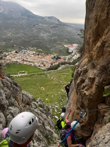
The Cambil Via Ferrata is a new addition to the network of via ferratas in the province of Jaén. Located in the municipality of Cambil, this route offers a unique experience combining active tourism with mycotourism and nature. Opened in March 2025, the via ferrata lies to the west of the Mata-Bejid Visitor Centre, on a rocky outcrop. From the visitor centre's car park, a 1,400-metre trail leads to the start of the via ferrata, where the adventure begins.
The Cambil Via Ferrata is known for its three bridges of different sizes (13, 10 and 29 metres), which add an extra challenge for participants, together with a compulsory 39-metre zip line and an 11-metre ladder. Along the route, participants will face slight overhangs and will make use of the rock's natural shapes to progress in a more organic way, adding a unique touch to the experience.
Thanks to its strategic location, the route offers spectacular views of the Sierra Mágina Natural Park. Once the highest point of the route is reached, adventurers can enjoy a flat area to rest before setting off on the zigzagging descent across the meadow, among rocks, until reaching the final obstacle: an equipped descent through the ravine of around 50 metres, which brings us back to the base of the rock face.

Imagen principal
Desactivado
1:30h
Puntos del trazado
Latitud
37.7160
Longitud
-3.5510
Medium
1286m

3,26 km

Desactivado

It is essential to use approved via ferrata-specific equipment (harness, helmet and energy absorber/lanyard). It is recommended to check the weather forecast before the activity, as well as to carry enough water. Although there are no escape routes along the way, the descent is properly equipped.

Al-Manzur Via Ferrata in the Serrezuela de Bedmar

Submitted by brandcode_deweloper on
Descripción larga

The route alternates vertical rock face with an exposed ridge that offers a commanding view over the valley from a privileged position. After the initial stretches of continuous progression, the cable-bridge sector (K4) is reached, more physical and demanding, where balance and arm management are key.
The route culminates with a 65-metre zip line, adding a dynamic and spectacular element before the descent.

Breve descripción

The Al-Manzur Via Ferrata is located in the Serrezuela de Bedmar, at the foot of the Castillo Nuevo, with wide views over the Cuadros river valley and its sea of olive trees. It is a modern facility, opened in September 2025, designed as an active tourism resource to diversify the sporting offer of the region.
It is a very complete route combining vertical sections, an equipped ridge, a more demanding cable-bridge sector (K4) and a final 65-metre zip line. The via ferrata maintains a medium difficulty (K3) along most of the route, with occasional more physical sections and the odd overhang that add intensity and continuity.
Its west-facing orientation and the calm surroundings make it an appealing alternative to other, busier via ferratas in Andalusia.

imagen
Image
escalada
Imagen principal
Activado
imagen
Image
escalada grupo de personas
Imagen principal
Desactivado
imagen
Image
escalada vistas
Imagen principal
Desactivado
4h
Puntos del trazado
Latitud
37.8322
Longitud
-3.4235
Medium
946m
Desactivado

It is essential to use approved via ferrata-specific equipment (harness, helmet and energy absorber/lanyard).
If you do not have the necessary experience and knowledge, it is recommended to hire a certified, qualified guide.
It is advisable to check the weather forecast before the activity and to carry enough water. Although there is an alternative route to avoid getting wet when water flow is high, it doesn't hurt to leave a change of clothes in the vehicle.

Cerro Golondrina

Submitted by brandcode_deweloper on
Id
RUT-0012
Descripción larga
Cerro Golondrina is a rock formation located at the foot of the Sierra Magina Natural Park, a few kilometres from Jódar and Bedmar. It stands out for its vertical plates full of holes, its open environment and its wide views over the environment, making it one of the most unique climbing areas of the region. It is a school of a sports and classic character, with demanding ways both technical and psychological, where a correct reading of the terrain is essential. The rock, of high quality in general, has in some sections sharp and safer edges more distanced on the older routes, which reinforces its character of compromised escalation. Sector Country: The Country Sector is the main sector of Cerro Golondrina. It was equipped in 2012 by Carlos del Campo and has about 20 tracks, mostly of sports climbing, although it also has classic tours. The tracks are developed on vertical hole plates, with technical climbing and maintenance. Due to the length of some routes and the distance between insurance on certain routes, the use of 80-meter rope is recommended for greater safety. Representative routes: Extreme Ubeda (6c +) Sefarad (V +) Knives (6b) Lala (6c) The sector also includes classic routes, such as the main Spolon, with a tour of approximately 100 meters, which provides a more alpine character to the area. Access The access is made by road to Mancha Real, then continued by the A-320. After passing Bedmar, it is linked with the A-401 in the direction of Huelma. At about 500 meters, you can park to the right in a small rest area located next to the entrance to an unobvious track. From the parking lot, the road is crossed and raised directly to the base of the walls, reaching the first tracks in approximately 10 minutes on foot. Orientation and recommended time The main direction of the hill is south-west, although there are sectors with north-west orientation. These features allow you to climb in spring and autumn as the best times, although the area can be practical for much of the year by selecting the tracks and the time.
Breve descripción
Cerro Golondrina is a rock formation located at the foot of the Sierra Magina Natural Park, a few kilometres from Jódar and Bedmar. It stands out for its vertical plates full of holes, its open environment and its wide views over the environment, making it one of the most unique climbing areas of the region.
Latitud
37.8204
Longitud
-3.4502
Distrito
Municipio
Ubicación en el mapa
POINT (-3.4502 37.8204)
imagen
Image
1.jpg
Imagen principal
Activado
imagen
Image
1 (15).png
Imagen principal
Desactivado

Sport

icon-intereses-deporte
Cerro Golondrina
Spring and autumn
Desactivado

Castle of la Guardia

Submitted by brandcode_deweloper on
Id
RUT-0011
Descripción larga
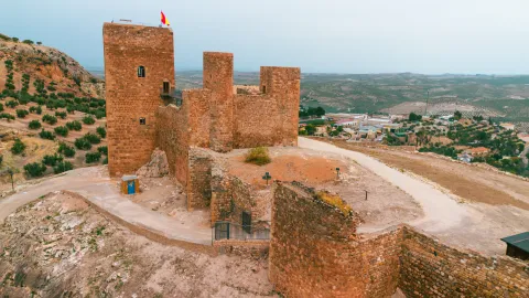
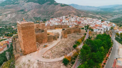
The Escalada del Castillo de la Guardia is a small, unfrequented school, located just under the walls of the rosé on which the castle of the town is located. Its proximity to the urban core and its historical environment give it a unique character, ideal for quiet and unmassified climates. It is a sports climbing sector, with long, well-defined routes and on limestone. Although the number of tracks is small, the school is interesting for the variety of degrees and their orientation. The sector has a total of 9 ways, with difficulties ranging from V to 7b, predominating the fifths and sexts, which makes it suitable for both intermediate climbers and for those who seek a comfortable day near the village. Highlights: Spolon (V +) Le Petit Verdon (V +) Land as you can (6a) What a club (6c) Access Access is made directly through the town centre of La Guardia, reaching the vicinity of the castle. From the village, the walls are visible and the base of the sector is reached in a few minutes on foot. Orientation and recommended time The overall orientation of the sector allows to climb for much of the year, being especially pleasant in spring and autumn, when the thermal conditions are softer.
Breve descripción
The Escalada del Castillo de la Guardia is a small, unfrequented school, located just under the walls of the rosé on which the castle of the town is located
Latitud
37.7301
Longitud
-3.7103
Distrito
Ubicación en el mapa
POINT (-3.7103 37.7301)
imagen
Image
1.jpg
Imagen principal
Activado
imagen
Image
Castillo la guardia de jaen 1 dng.jpg
Imagen principal
Desactivado
imagen
Image
Castillo la guardia de jaen 2 dng.jpg
Imagen principal
Desactivado
imagen
Image
Castillo la guardia de jaen 3 jpg.jpg
Imagen principal
Desactivado

Sport

icon-intereses-deporte
Castillo de la Guardia
Spring and autumn
Desactivado
Tramo de asfalto o cemento
 
Tramo de pista o camino forestal
 
Tramo de vía pecuaria
 
Tramo de senda
 

Valdeinfierno

Submitted by brandcode_deweloper on
Id
1909543
Descripción larga

Best time:From autumn to spring

Where to drink. -In the village.

How to get there. -From Andújar take the road to the Sanctuary of the Virgin of the Head. Between kilometer 15 and 17 we will see the area of walls and blocks on our right. Parking by the road. The scalable walls and blocks are evident.

Breve descripción

Landing school hard to locate. Explosive climb over granite. Reliable security equipment. The average height is 8 meters. The maximum height is 15 meters.

Latitud
38.368688
Longitud
-4.125104
Distrito
Municipio
Ubicación en el mapa
POINT (-4.125104 38.368688)
imagen
Image
shutterstock_532809607.jpg
Imagen principal
Activado
imagen
Image
shutterstock_1048500664.jpg
Imagen principal
Desactivado
imagen
Image
shutterstock_527300206.jpg
Imagen principal
Desactivado

Friends

icon-intereses-amigos

Nature

icon-intereses-naturaleza

Adventure

icon-intereses-aventura

Solo travel

icon-intereses-viajar-solo

Gastronomy

icon-intereses-gastronomia

Sport

icon-intereses-deporte

Municipality

icon-intereses-municipio

For couples

icon-intereses-en-pareja
Valdeinfierno
Spring and autumn
Desactivado

Number of routes:50

You're up to V:10%

Votes from V + to 6c +:55%

Vies from 7a to 7c +:35%

Eight-way:0%

Coordenadas / Huso 30S
30S x = 401714 and = 4247322
Tramo de asfalto o cemento
 
Tramo de pista o camino forestal
 
Tramo de vía pecuaria
 
Tramo de senda
 

Tajos del Canjorro

Submitted by brandcode_deweloper on
Id
1909505
Breve descripción

A very suitable place for the scale. Good rock (limestone) with a variety of styles and tracks, some very technical. You could say it's one of Jaén's best schools. Very recommended in winter. The average height is 20 meters, although maximum heights of 55 meters are reached. Verticality and sports climbing define this school. Insurance equipment is reliable.

Latitud
37.745447
Longitud
-3.791118
Distrito
Municipio
Ubicación en el mapa
POINT (-3.791118 37.745447)

Friends

icon-intereses-amigos

Nature

icon-intereses-naturaleza

Adventure

icon-intereses-aventura

Solo travel

icon-intereses-viajar-solo

Gastronomy

icon-intereses-gastronomia

Sport

icon-intereses-deporte

Municipality

icon-intereses-municipio

For couples

icon-intereses-en-pareja
Tajos del Canjorro
Desactivado
Coordenadas / Huso 30S
30S x = 430302 and = 4177867

Tajos de las Alcandoras

Submitted by brandcode_deweloper on
Id
1909469
Descripción larga

Best time:From autumn to spring

Where to drink. -On the meringers on the access road.

Information and books. -Revista Desnivel No. 93

Notes and warnings. -Do not obstruct the passage when parking.

How to get there. -From the recreational area of Otiñar, take the track and then the road that leads us to the area.

Breve descripción

It has excellent routes, both artificial and free. It's a huge cliff over the stream. Still, among the places of classics of Andalusia would occupy a place on the podium. The limestone tapes are very vertical, and given their large length they require much continuity. They're resistance pathways. The average height is 150 meters. The maximum height is 220 meters. The scale is very technical and most insurance and meetings have to be installed with emitters or similar.

Latitud
37.656911
Longitud
-3.716362
Distrito
Municipio
Ubicación en el mapa
POINT (-3.716362 37.656911)
imagen
Image
IMG_1222.JPG
Imagen principal
Activado
imagen
Image
3.JPG
Imagen principal
Desactivado
imagen
Image
1-guia-montana-escalada-deportiva-clasica-1024x768.jpg
Imagen principal
Desactivado

Friends

icon-intereses-amigos

Nature

icon-intereses-naturaleza

Adventure

icon-intereses-aventura

Solo travel

icon-intereses-viajar-solo

Gastronomy

icon-intereses-gastronomia

Sport

icon-intereses-deporte

Municipality

icon-intereses-municipio

For couples

icon-intereses-en-pareja
Tajos de las Alcandoras
Spring and autumn
Desactivado

Number of routes:45

You're up to V:30%

Votes from V + to 6c +:60%

Vies from 7a to 7c +:10%

Eight-way:0%

Coordenadas / Huso 30S
30S x = 436813 and = 4167991
Tramo de asfalto o cemento
 
Tramo de pista o camino forestal
 
Tramo de vía pecuaria
 
Tramo de senda
 

Salto de la Cabra

Submitted by brandcode_deweloper on
Id
1909427
Descripción larga

The road, very busy in holidays and weekends, is the foot of the road. The climbing is very technical in sections, with steps taken out. The tracks are equipped for sports climbing. The average height is 25 meters. The maximum height is 60 meters.

Breve descripción

It is a limestone wall with plenty of roofs and beatings that have very comfortable access. The insurer is located on the road, so special caution will have to be taken.

Latitud
37.780088
Longitud
-3.814369
Distrito
Municipio
Ubicación en el mapa
POINT (-3.814369 37.780088)

Friends

icon-intereses-amigos

Nature

icon-intereses-naturaleza

Adventure

icon-intereses-aventura

Solo travel

icon-intereses-viajar-solo

Gastronomy

icon-intereses-gastronomia

Sport

icon-intereses-deporte

Municipality

icon-intereses-municipio

For couples

icon-intereses-en-pareja
Salto de la Cabra
Desactivado
Coordenadas / Huso 30S
30S x = 428287 and = 4181728

Pantano de La Lancha

Submitted by brandcode_deweloper on
Id
1909332
Descripción larga

Where to drink. -In the village.

How to get there. -Head from Andújar to the boat. Zone under the containment wall.

Breve descripción

It is a traditional climbing area in the province of Jaén, little visited and quiet. It is well equipped for sports climbing. The rock is granitic, so the climbing is based on adhesion. There are explosive escalation steps. The average height is 15 meters. The maximum height is 90 meters.

Latitud
38.260413
Longitud
-3.934609
Distrito
Municipio
Ubicación en el mapa
POINT (-3.934609 38.260413)
imagen
Image
shutterstock_1048500664%20%285%29.jpg
Imagen principal
Activado
imagen
Image
shutterstock_361795829%20%281%29.jpg
Imagen principal
Desactivado
imagen
Image
shutterstock_532809607.jpg
Imagen principal
Desactivado

Friends

icon-intereses-amigos

Nature

icon-intereses-naturaleza

Adventure

icon-intereses-aventura

Solo travel

icon-intereses-viajar-solo

Gastronomy

icon-intereses-gastronomia

Sport

icon-intereses-deporte

Municipality

icon-intereses-municipio

For couples

icon-intereses-en-pareja
Pantano de La Lancha
Desactivado

Number of routes:25

You're up to V:10%

Votes from V + to 6c +:57%

Vies from 7a to 7c +:33%

Eight-way:0%

Best time:From autumn to spring

Coordenadas / Huso 30S
30S x = 418234 and = 4235122