Saltar al contenido principal

Etnosur

Submitted by brandcode_deweloper on
Id
11879624
Descripción
Descripción larga

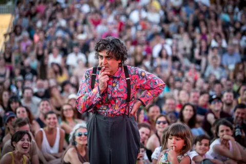
The 2026 edition arrives with an early line-up announcement confirming its global outlook: the legendary Cuban orchestra Los Van Van, the Dhoad Gypsies of Rajasthan from India, the Galician group Fillas de Cassandra, the Tanzanian Zawose Queens, the Afro-Cuban project Afrosideral and Argentina's Luqui Salvadori are all part of a programme bringing together acts from nine countries. An eclectic mix that keeps the festival true to its essence as a melting pot of cultures and sounds.

Breve descripción

The Ethnic Gatherings in the Sierra del Sur (Etnosur) were created with the aim of bringing together and blending distant cultures with nearby ones through music. It features a huge range of activities: workshops, circus performances, forums, film screenings and literary gatherings all shape a free, multidisciplinary festival.

Ubicación
Código Postal
23680
Latitud
37.464177
Longitud
-3.925342
Distrito
Municipio
Ubicación en el mapa
POINT (-3.925342 37.464177)
Imágenes
imagen
Image
Etnosur%20%281%29.jpg
Imagen principal
Activado
Enlace reserva
https://etnosur.com/
Fecha Inicio
16 Jul 2026 00:00
Fecha Fin
19 Jul 2026 00:00
Microsite al que pertenece
Evento anual (=Periodicidad)
Activado
Tipo de evento
Loading map
Preparing points of interest and routes...
Interés
Evento cancelado
Desactivado

Torres

Submitted by brandcode_deweloper on
Id
853598
Perfil de redes sociales
Facebook
https://www.facebook.com/aytotorres/timeline
Twitter
https://twitter.com/aytotorres
Descripción
Breve descripción

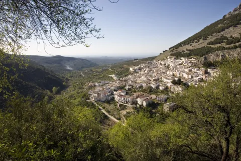
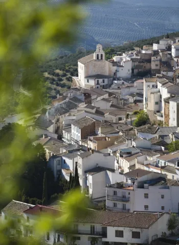
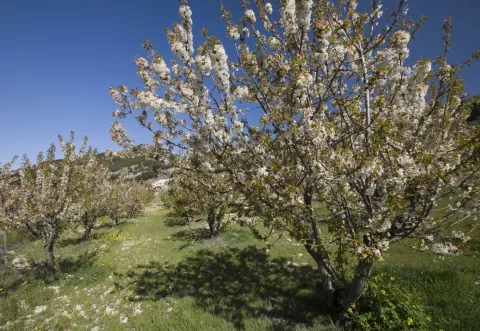
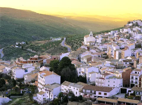
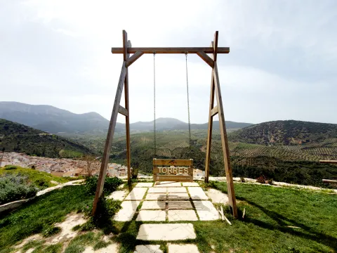
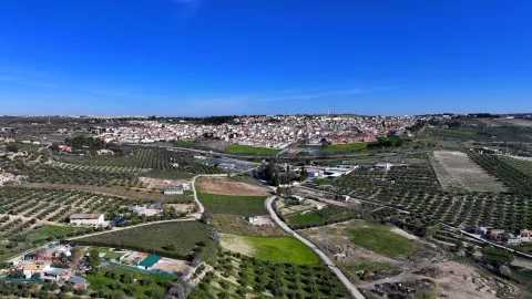
Location of the Sierra Mágina region and located in the skirt of the hill of the Old. Its term is found within Natural Park of Sierra Magina and offers spectacular landscapes, mainly in spring, with the flowering of the cherry trees. Because of its geographical location it has abundant water springs. Its altitude, more than800 m,causes temperatures to be pleasant in summer and cold in winter.

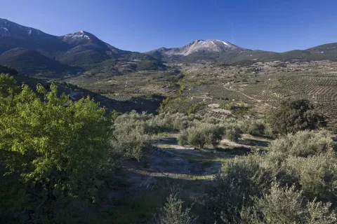
Torres has a population of more than a thousand eight hundred neighbors and its municipal term extends along the length and width of about eighty square kilometres, by the Torres River Valley. The olive in the lower lomas of the town and the high summits that extend through the Natural Park. The major summit is Almadén, which rises above 2,032 meters.

In addition to the cultivation of the olive tree, being about a third of irrigation, and the gardens, we must highlight the of the cherry. The wide plantations of this fruit make Torres one of the most important cherries producers.

Telecomunicaciones
Teléfono
953 363 011
Sitio web
www.aytorres.es
Fax
953 363 150
Ubicación
Nombre
Torres
Latitud
37.784650
Longitud
-3.508180
Distrito
Municipio
Ubicación en el mapa
POINT (-3.50818 37.78465)
Imágenes
imagen
Image
f77f7bbc-301b-4685-2f5d-c3eccfd67f1c?t=1621509323240
Imagen principal
Desactivado
imagen
Image
a6e721b5-a793-e490-7d17-1ce2edfa85b5?t=1621509323398
Imagen principal
Desactivado
imagen
Image
cedbf36e-96f4-acee-1928-e0d663aa3135?t=1621509323445
Imagen principal
Desactivado
imagen
Image
6761f008-fd64-8426-c19d-2b7d8081b4c8?t=1621509323496
Imagen principal
Desactivado
imagen
Image
0d771b4d-a801-02ab-6e3b-8a70dcec406f?t=1621509323543
Imagen principal
Desactivado
imagen
Image
10a0ed17-11b0-e705-3f1a-aa4c452ca12b?t=1621509323589
Imagen principal
Desactivado
imagen
Image
a4ffbc5c-8d7a-c4fc-c01d-77b8edf4236d?t=1621509323633
Imagen principal
Desactivado
imagen
Image
f721ac9d-0b72-b2b0-5ca7-eb3444c02e53?t=1603141818032
Imagen principal
Desactivado
imagen
Image
b8324910-820c-a086-df30-48f4090c5e92?t=1621509323675
Imagen principal
Desactivado
imagen
Image
e40ccf24-c25d-50d5-f62a-04b236835f2c?t=1603723731423
Imagen principal
Desactivado
Información adicional
Curiosidades

Concejalía de Turismo del Ayto. de Torres

Plaza de España, 1

23540 Torres | Jaén

953 363 011 - Ext. 28

info@torresturismo.es

http://www.torresturismo.es/

Imágenes cabecera
imagen
Image
Torres
Imagen principal
Desactivado
Datos de interés

Distance to the capital (km): 31
Altitude over sea level (m): 888
Extension (km ²): 80
Number of inhabitants: 1,665
Gentillo: Torreños
Postal code: 23540

Videos
Video file
Cultura
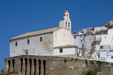
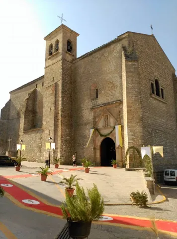
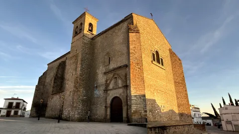
  • Church of Santo Domingo de Guzmán: It is found in a steep terrain, sustained by contrasts that draw eight arches of stone seen. The Renaissance church was built between the 16th and 17th centuries. Inside it extends into a single ship divided into three sections, covered by vaulted vaults. There is a chorus at the feet and chapels of baroque tardo style with venerated images at local Holy Week. One of the baptismal batteries of the temple is of Mudejar Gothic style.

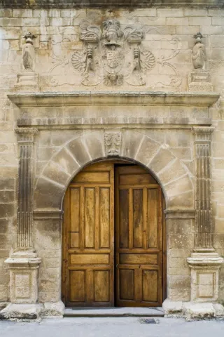
  • The Palace of the Cobos: The call of the Marquis de Camarasa was built in the 16th century, the works were to be completed in 1565, as it appears in the inscription of the friso on the cover. Renaissance style, remember the splendor that the people lived from the moment Carlos I sells it to his secretary D. Francisco de los Cobos. The cover is divided into two bodies by an injunction. At the bottom is a half-point arc with acanto highlighted key and framed by acanto pilasters. The upper body is crowned laterally by two vases on pedestal and in the center a shield with a dome and cross of Santiago between columns decorated with reliefs. In 1997 it was included in the catalogue General of the Historical Heritage of Andalusia.

  • The Church of the Holy One: It is made up of stone and built in the 20th century and consists of a single ship with presbytery on steps and chorus at the feet. The exterior is very simple and the main facade finished in hastial. Of this Church we are interested in its interior where it is preserved an oil on canvas with the iconography of Ecce Homo of the 17th century: a sitting Christ that responds to the baroque aesthetics of the dark, another 18th century oil of the Divine Pastor of popular theme and great chromatic contrast and of the 20th century, a wooden size of a Crucified, with careful anatomical study.
  • The Cave of the Morron: It is one of the great Paleolithic-era rock sanctuaries they are located in the Alto Guadalquivir. The paintings are in a small room in the Cave. These are two different chromatism, one red and one black. It is very likely that we are facing a sanctuary in which the paintings have a magical propitiatory purpose for hunting, which was the main means of life of the surrounding populations. These rock paintings have been declared Good for Cultural Interest.

On the outskirts is "The Bridge" which is as popularly known the bridge that Andrés Vandelvira built in 1565, on behalf of Maria de Mendoza.

Naturaleza

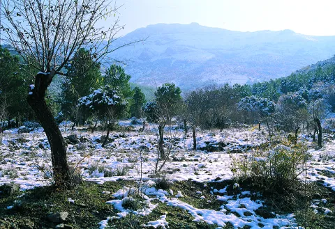
The municipal term of Torres has an area of 80 km2of which much are included in the Natural Park of Sierra Mágina, with large areas of tree vegetation in which indigenous pine trees, oak trees and complaints predominate; shrubs (majuelo, juniper, torvisco...). Very abundant are also the aromatic plants (rosemary, alhucema and thyme).

Currently takes advantage of this saw to do sport in nature: hiking, mountain bike, climbing, bulder, free flight... It has views with splendid panoramic views of the mountain environment.

Between her fauna big highlights Rape (perishable eagle, common fencing), Rape night (royal owl, mocha and autillo) and mountain goats in the rocky areas.

Torres has interesting places from where to observe the spectacular panorama of the surroundings of the town:

  • Fuenmayor recreational area. Fuenmayor in a camping area and a road, located in the middle of a large mass of trees, which has plenty of water as there is a spring there. The recreation area extends along the Fresnos de Fuenmayor stream, with a source of water leaps and a pond, as well as stationery, banks and picnic tables. The Fuenmayor is surrounded by long chopos between which you can see and hear some birds of forest and riverside like the listed reyezuelo, the common agateador or the cascade lavender. It is located to the south of the town, in the Natural Park of Sierra Magina, just on the slopes of the Almadén peak, about 7 km. Torres. The recreational area is accessed through an asphalt road that leaves the village and leads directly to Fuenmayor.
  • Mount Aznaitín. Authentic the milestone of the Natural Park It reaches 1,720 m. This is one of the most significant mountain units in the Park. The panoramic views are impressive. On this mountain is the Cave of the Morron, which retains primitive remains of rock paintings. It is located to the north of the town, just on the border with the term Jimena.
  • Monteacto. At 1,683 m high it is a natural lookout exceptional to view beautiful and impressive panoramic views of the Natural Park. It is located to the southeast of the town, on the border with the municipal term of Albanchez de Mágina.
  • Area of Hundacabras Apampada: The landscape surrounding this equipment, located on the rest of a pecuary road, is typically olive-growing and invites hiking. The facilities, with a capacity for a hundred people, have areas for tents, roofed dining, kitchen, toilets and showers.
    It is accessed from the JA-1107 road that goes from Torres to Albanchez de Magina; after walking about two km, in the middle of a curve, to the right, it connects a lane that, with a total length of one kilometre, leads us directly to this camping area of the Sierra Magina Natural Park called Hondacabras.
Fiestas y Eventos
  • Patrons of Our Father Jesus of the Column,between 20 and 24 September. During these five days the festive activities are many and very varied, indicated for all ages. Children's shows and games, concerts, verbenas, sports and cultural activities, taurino show, traditional games are organized. By this time everything is fun in the streets and squares of Torres.
  • Christmas party.The next weekend to the 20th of May marks the feast of the Jornaleros, a religious holiday in which the Crucified Christ is sold. On Sunday morning a Mass is held in honor of Christ, in which the children of Torres make their First Communion and in the afternoon the Christ of the Jornaleros goes out in procession, adorned with spikes and brown bread, which will be distributed back to the church to the attendees. In addition to religious acts, several playful activities are also organized, such as pasacalles and verbenas. The uniqueness of this party is that the request for donations by the houses to cover the expenses is maintained. The organization is in charge of "the Brothers of the Lord," which are usually four couples who are relieved each year.
  • Festival Imagina Funk.During two days of July you can enjoy the best funk music bands on the national and international scene. An indispensable date for those who feel the funk's call inside and want to feel the magnificent atmosphere of the festival and its surroundings.

Gastronomía

The region of Sierra Mágina has an ancient tradition "matancera," hence some dishes of its gastronomy are products derived from the "slaughter of the pig, " like the orza loin, chorizo mass, onion bite, "rye"orbitun, "name given to the mass of the black muzzle, which once cooked is served hot and taken with tender bread.

  • Migas with torrezos and chorizos: Made of bread, garlic, olive oil, chorizo and torreznos.
  • Pates with garlic: Potatoes, bread, garlic, choriceros peppers, cumins and olive oil are needed.
  • Mojili torreño: It is an austere gazpacho, which only has tomato, garlic, olive oil, vinegar, bread, water and salt.
  • The morrococcus: Traditional turreño dish with which the chickpeas that are left over from the cooking are used, to which tomato, potato, oil and cooked broth are added.

Pens and Licores.

It has a wide pastries such as jets, made with a mass of milk and flour, old papayos, bannazos, whites, alfajores... For liquors: guindas in spirits, nuts, risol and exquisite ponches.

Historia

In the municipal term of Torres is one of the oldest evidence of the human presence in the province of Jaén,the cave of Morron, Paleolithic period.

The urban centre From Torres it must have originated, between the 8th and 9th centuries, in one of the alqueras that according to Arab sources populated the area of Sumuntan (Sierra Magina) and which was located on the banks of the Torres River.

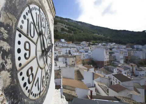
Because of its location in the border area between Muslims and Castilians, it had a very uncertain activity during the Middle Ages, was taken by some and recovered by others on several occasions. In 1231 was conquered by Fernando III integrated inside the Alfoz de Baezawhere she remained until she was donated to the Order of Calatrava, which began important works of protection, building a new alcazar and building a defensive wall around the population. Of both, virtually nothing is preserved except for the remains in the Wall Clock.

During 15th centuryTorres was a battlefield between the masters of this Order and the supporters of Henry IV. As the conquest progressed, Torres moved away from the border and the population was increasing. It is believed that these new inhabitants came from Cuenca, Valencia and the Catalan area. For them, life under the mandate of the co-ordinators was not easy, until 1486 the Capitulation of Arjonilla,which limited mutual rights and obligations.

In the 16th century, given the economic needs of Charles I, he sold the territories of the Order, Torres among them, to his secretary Francisco de los Cobos. Here he ordered to build his house palace and the bridge that today is known as The Bridge.

Loading map
Preparing points of interest and routes...
Imagen principal
imagen
Image
Torres
Imagen principal
Activado

Torreperogil

Submitted by brandcode_deweloper on
Id
4892283
Perfil de redes sociales
Facebook
https://www.facebook.com/AytoTorreperogil/
Twitter
https://twitter.com/torreperogil
Youtube
https://www.youtube.com/user/AyTorreperogil
Descripción
Breve descripción

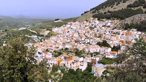
Municipality located in the the heart of the region of La Loma, 8 km fromUbeda with which it maintains a close link. Surrounded by olive groves, with a picturesque urban core of white, crouched and well-known houses.

Part of its term is included in the Natural Area of Alto Guadalquivir. This natural area is made up of the reservoirsBridge of the Closed (Torreperogyl),Dona AldonzaandPedro Marínand the river and river sections between the swamps.

This river, which runs south of the municipality, borders the municipality of Cazorla.

Highlights the olive tree as a majority of its land, also the cultivation of chickpeas and vegetables in the vegas of the Guadalquivir Valley to the south of the municipality and a small area of its land, dedicated to the vine, which provides a quality wine. There is a protected geographical indication of "Wines of the land of Torreperogil."

As for its industry, it is important to point out the construction, as is the predominant sector. In the crafts, the size of olive wood stands out.

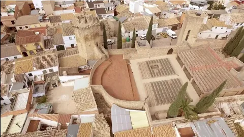
Of his Historical Heritage The Parish Church of Santa Maria Major, which is the most unique monument, the so-called Dark Towers (remains of the old fortress of But Gil) and hermitage of the Virgin of Mercy.

Torreperogil has a wide range of historical houses dated between the 19th and 20th century.

Telecomunicaciones
Teléfono
953 776 000
Sitio web
www.torreperogil.es
Fax
953 776 025
Correo electrónico
info@torreperogil.es
Ubicación
Nombre
Torreperogil
Latitud
38.034620
Longitud
-3.287700
Municipio
Ubicación en el mapa
POINT (-3.2877 38.03462)
Imágenes
imagen
Image
93d7675a-bc97-bc16-810e-bbfa259065f5?t=1605042473338
Imagen principal
Desactivado
imagen
Image
db133356-2c60-54a1-263f-1b54d869f3dc?t=1598963760580
Imagen principal
Desactivado
imagen
Image
bade3139-c0ac-0add-0f76-07e9f0cba84e?t=1598963783568
Imagen principal
Desactivado
Imágenes cabecera
imagen
Image
Torreperogil
Imagen principal
Desactivado
Datos de interés

Tourist area: Ubeda / Baeza

Distance to the capital (km): 63

Altitude over sea level (m): 749

Extension (Km2): 90 '87

Number of inhabitants: 7,276

Gentillo: Peroxileños or Torreños

Postal code: 23320

Videos
Video file
Cultura
  • Dark Towers: They are the most representative element of the urban complex of Torreperogil. They were part of the old castle - a fortress built in the 13th century, between 1230 and 1240 and which gave rise to the villa that was built after the battle of the Navas de Tolosa. At the end of the 19th century there were four towers, but at present only two are preserved. One of them is a square floor, it is accessed inside by an intellized door. It has a single floor covered by a pointed vault and it has aspillers in its paraments. The other, known as the ochavada tower, has an octagonal plant, is built of thick armchair and crowned with powerful shoes for the support of the matacans. To access its interior, it has a narrow warhead door and is given light by small saetera windows. They have been rehabilitated in recent years of the 20th century how Municipal Auditorium.The Ochavado Torreon and the Square Torreon eThey are declared a Historical Monument.
  • Church Santa Maria la Mayor, also known as the Assumption, dates from the first decades of the 16th century. It is a work of Gothic tracewith a single, slender polygonal headboard, divided into three sections with starry and very high Gothic vaults. It's proven that The main vault is work of Andrés de Vandelvira, which was decorated with Renaissance paintings of the seven virtues. On the outside four powerful counterforces. It has two covers, one of them works by Diego de Alcázar, disciple of Vandelvira, It shows on the bow and central space a hornant with the stone image of Our Lady of the Assumption with the Child in arms. The main cover is attractive and great. The access with a refined double arch and on it, stone images of Santa María la Mayor and San Juan Evangelista. Inside, a magnificent altarpiece, dated 1571, known as the "Stone Altar ", the work of Alonso de Vandelvira, with a high relief that represents the Descending Christ on the Cross and the city of Jerusalem at the bottom. The altar bank conserves the 16th century Sevillian tile and on it the figure of the lying Christ. It has been declared Good of Cultural Interest with the type of monument, in 2010.
  • Hermitage of the Vthe irgen of Mercy: Built between 1593 and 1634. Inside it is a rectangular-floor ship, which has been restored in 1960, covered with a half-barrel vault with lunetes and articulated with five hornant chapels on each side. The presbyterium is covered with half orange on pechines and communicates with the shrimp by means of a half-point arc on double mends. The Camarín, with baroque bills, with 18th-century gypsies, stands out. The main façade was built between 1960 and 1965, while the southern cover, of Renaissance style, was from the 16th century. The image of the Virgin of Mercy, patron of Torreperogil is an anonymous author and was sculpted in 1939, although it was restored in 1960.

Naturaleza

Torreperogyl has an extension of 90,87 km2 and at an average altitude of 749 m. on the sea level, it is on the top of the plateau of La Loma, framed by the Guadalimar River to the north, and by the Guadalquivir River to the south.

The cultivation of chickpeas and vegetables becomes important in the fruit and vegetable fields of the Guadalquivir valley.

There is also, a small part of the dedicated land to the cultivation of life. The result is one of the few Jiennense municipalities with wine production. It also has a geographical indication of "Wines of the land of Torreperogil," which also covers other nearby locations.

By the term of Torreperogil, among many other species are moved as emblematic as the grubb, cappuccino herrererillo, royal anade (azulon), ash aguilucho, common badger, fox, European otter, boar, gineta or musk cat, gamo, deer, montess goat, Guadiana boga, barbo andaluz, trout and crebra of stairs.

From the urban centre panoramic that are visible are spectacular: to the north the foothills of Sierra Morena, to the south Magina saw and the depression of Guadalquivir, and to the east the Serras of Cazorla, Segura and Las Villas.

At present the olive tree has been displacing the other cropsin the driest areas the almonds spatter in white in the spring.

But in addition to this great framework in which it is located, Torreperogil has places of special interest, among them we will mention:

  • El Paso Real Canyon. On a millennial road, Cañada Real de la Meseta, a recreational area has been built with parking, shadow areas and children's playground. A place to spend a nice family day.
  • Close Bridge. It is a basin regulatory reservoir, belonging to the Guadalquivir River, where you can enjoy the typical landscape of the wetland (especially carrizos), as well as the abundant aquatic fauna that forms the ecosystem: avetoro, large tick, squid, duck ral, duck spoon, common focha...

The confluence of such environments makes this place a space of great diversity, which has served your declaration asSpecial Protection Area for Birds.

Fiestas y Eventos
  • San Antón January 17. Around the bonfires, they taste roasted chickpeas accompanied by punch, drink made from Torreperogil wine, soda and sugar.
  • Carnival in February. It is commemorated in the municipality since time immemorial. It is a tradition that has never ceased to be celebrated and in which the "masked," which is a character who is disguised in old garments increases the concurrence becoming the most genuine of the carnival.
  • Romeria in honor of James the Apostle. In the hermitage of the Holy built on the estate El Pósito, every First of May is celebrated the rosemary and the bathroom in the river of the image of Santiago Apostle, mounted on a horse. The most unique of this party is found in the horse racing with flamenco-bound rider, which in the morning and in the afternoon mark the beginning and end of the party.
  • Celebrations in honor of Saint Gregory and the Virgin of Mercy. In Torreperogil they celebrate their patron parties in the second week of September. The most prominent are the braggard coils, the brandy bull in the morning, the fire bulls, a man who under a bull costume covered in flares admonishes the attendees, and the flamenco and rock festivals.

There is also the Corpus Christi, San Isidro, the Cruces de Mayo...

Gastronomía

The gastronomy of Torreperogil is based on the good products of the earth. We highlight the following dishes:

  • Aeggplant knife. Typical dish, made with eggplant of the earth, green onion bread, tomatoes, olive oil, garlic, parsley cumins and salt.
  • Caldy rice with rabbit. A dish that cannot be missed on the days of field food. We need: Rabbit, rice, green and red peppers, tomatoes, garlic, laurel, black pepper ground sweet pepper, saffron salt and parsley.
  • Cod scallops. The alrajos is a typical meal in the region of La Loma: flour, oil, tomato, onion, red and green pepper cod, mushrooms, cumin, pepper, peppermint, garlic, parsley, pepper and colouring.
  • Dizziness: Overcooked chickpeas, onions, olive oil, Pimenton and dry red pepper.
  • Pipirrana: Potatoes, olive oil, cod, onions, pepper.
  • Gachamita. With olive oil, garlic, potatoes, water flour and salt.

From your confectionery we quote: Drinks, Ochíos, Hornazos, Roscos de frying pan, Sweet panecetes....

Wine types: White, pink and dyes.

TheS.C.A. Our Lady of Mercywas born in 1956. During the visit you will know the modern facilities opened in 2005 and the most advanced techniques for the development of theOlive oilsandWines with protected geographical indication Wines from the land of Torreperogil.

The white varieties of grapes that they produce represent approximately 70% of the surface, the most representative being the Jaén Blanco variety. Pedro Ximénez, Airén and, to a lesser extent, Palomino Fino, Cirial, Jaén colorado and others are also grown. The remaining 30% of the surface is dedicated to the cultivation of red varieties, especially early ring and ink garnacha although Cabernet Sauvignon and Merlot are also grown.

Products Degusta Jaén: In addition to the wines mentioned, there are breads, sweets and beer, meat and sausages such as the white butyfarra with the label "Degusta Jaén Quality" which gives them recognition at national and European level.

Historia

It was founded by the Phoenicians. During the Roman era it became more important. In the period of Al-Andalus its fortifications were reconstructed.

The name Torreperogil has His origin in the master of the tower around which the people were built: But Xil of Zatia.

This man was a Spanish gentleman who distinguished himself in the Christian conquest of Ubeda in 1231 at the orders of Fernando III and one of those who settled in the villages of the Loma de Ubeda

Under the jurisdiction of the Gil remained up 1369, date on which his personal lord and friend of Peter I was killed next to him in Montiel. After his death, Henry II granted Torreperogil to Ubeda in lordship, for the support received. He achieved his independence in 1635, granted by Philip IV, something that Ubeda does not accept and this makes his declaration of villa is delayed until 1642.

For the centuries XVI and XVII consolidates its urban centre and its population. In the 19th century the villa had been distinguished for its struggle against the French in 1808, its cooperation in the Carlist wars with the maintenance of the national militia and for having been the first people to proclaim Alfonso XII kingand so this monarch granted him the title of Very Illustre Villa de Torreperogil.

Loading map
Preparing points of interest and routes...
Imagen principal
imagen
Image
Torreperogil
Imagen principal
Activado

Martos

Submitted by brandcode_deweloper on
Id
747103
Perfil de redes sociales
Facebook
https://es-es.facebook.com/AytoMartos/
Twitter
https://twitter.com/aytomartos?lang=es
Descripción
Breve descripción

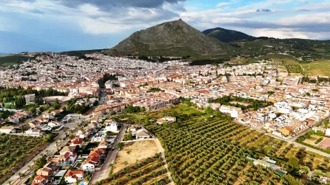
Martos is located to the north of the Sierra Sur region, being the largest municipality and population of this region. There are other populations that are part of the municipality, such as Monte Lope Álvarez, Las Casillas, La Carrasca and Villarbajo.

Its municipal term is essentially olive tree, in its landscape of countryside the olive tree is the protagonist, extending to the horizon. Because of the great quantity and quality of olive oil produced in the city, it is called the "Olivar Cot." Around it has developed an important olive industry that together with the automotive-related factories and their auxiliary industries are the engine of employment and wealth for the municipality and its region.

It has an important historical heritage, among other monuments we quote: the Old Cárcel and Cabildo, Castles of the Peña and the Villa, Puente Romano, Urban Wall, Castle of the Endowment, Pilar of the New Source; with respect to the religious architecture: Royal Parish Church of Santa Marta, Sanctuary of Mary Most Holy of the Villa, Monastery of the Most Holy Trinity, Ermita of San Bartolomé, parish of San Amador and Santa Ana, etc.

This is the cultural wealth and beauty of its historical ensemble, which since 2003 has had the status of Good Cultural Interest.

Telecomunicaciones
Teléfono
953 210 000
Sitio web
https://turismo.martos.es/
Fax
953 553 309
Correo electrónico
turismoycomercio@martos.es
Ubicación
Nombre
Martos
Latitud
37.722260
Longitud
-3.970320
Distrito
Municipio
Ubicación en el mapa
POINT (-3.97032 37.72226)
Imágenes
imagen
Image
7470103a-fede-6cf5-54b2-edb356074e03?t=1603121821734
Imagen principal
Desactivado
Información adicional
Imágenes cabecera
imagen
Image
Martos
Imagen principal
Desactivado
Datos de interés

Tourist area: Sierra Sur and Jaén
Distance to the capital (km): 24
Altitude over sea level (m): 753
Extension (Km2): 259
Number of inhabitants: 24520
Gentillo: Marteños
Postal code: 23600

Videos
Video file
Cultura

Old Jail and Cabildo. Building built in the 16th century, considered a masterpiece of Spanish mannerism. It is currently the City Hall of the city.

In his spectacular main façade We can highlight the huge, dogrous columns with piled armchairs, the sculptures of Justice and Prudence, (both were beheaded), the great doors and their bronze aldabones and a great shield of the Austrians crowning the whole. It was declared a National Historical Monument in 1931. Below the City Hall, the Convent of the Trinitarian, work of the late 16th century, and on the same street, but in the opposite sense the Hospital of San Juan de Dios, of baroque bill of the 18th century. All this high part of the intramurous historical centre is of great quaint and from it you can enjoy beautiful panoramic.

  • Santa Marta Parish Church. It rose in the 13th century, in the years following the taking of the city by Fernando III the Holy, on an Arab mosque. It is consecrated to the patron of the city and has the title of Real since 1617. Gothic Mudejar style. The Baptisterium, the Major Chapel, was later built and embellished with the slate-cross vaults and a large cover of the isabelin Gothic. In the 16th century the interior is expanded and remodeled, raising large columns of Tuscan order and building the original Bell Tower with three bodies.
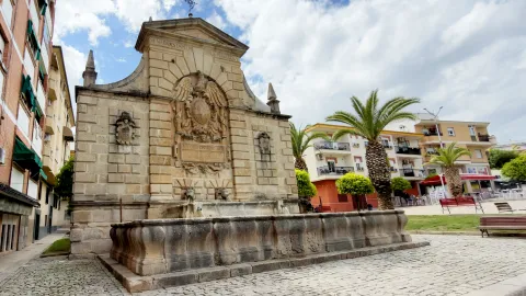
  • Pilar of the New Source. Ornamental source located in the Manuel Carrasco Municipal Park. It was built in the 16th century, reflecting the most new and outstanding aspects of the Manier architecture. The set stands out for its monumental beauty and austerity. It consists of an abrevadero pillar and a smaller one in which two lions make water pipes. In the center is the Austrian shield, and on the sides is the shield of Martos and that of Governor Aboz Enríquez.
  • The hermitage of San Bartolomé. Located in the skirts of the Peña de Martos, dates from the 14th century and houses the venerated image of Mary Most Holy of the Victory, Queen and Lady of the Peña.
  • Roman Bridge of Martos. Important engineering work, built in the Roman era on the Salado stream in the vicinity of Martos to facilitate the passage between the two shores.
  • Sanctuary of Mary Most Holy of the Villa. Temple in which Mary Most Holy of the Villa, known as "La Labradora," is sold. It was built on dates near the delivery of Martos to the Kingdom of Castilla. In the 16th century the temple was remodeled and a bell tower was built. This sanctuary was burned and destroyed during the Spanish Civil War. The current was rebuilt in the 1940s of the last century, in a Neobaroque style. The Torre-Campanario dates from the 16th century, is separated from the main building and is the only original element of the ancient Sanctuary. It has a square floor with half-point arches.
  • The ruins of Castillo de la Peña which we know today are not those built by Muslims but correspond to the strength that the Calatravos built from 1340. The floor of the castle is trapezoidal adapted to the surface of the plateau on which it sits and its entrance, for security reasons, marked a zigzag drawing. The compound was divided into alcázar and a courtyard of weapons protected by a walled enclosure. The alcázar, where the tower of tribute is raised, takes advantage of a natural podium that lifts it about three meters above the courtyard of weapons, separated by a wide, also natural.

  • Castle of the Villa. It was an alcazaba or citadel surrounded by canvases of almenada wall, as well as passageways and towers, leaving the central space for the construction of administrative and religious buildings: church of Santa Catalina, headquarters of the governorate, cavalries, tahonas, lagores, aljibes, etc. According to evidence from an inspection carried out by the Visitors of the Order of Calatrava in the 16th century in order to repair the deficiencies of the Lower Fortress.

Naturaleza

The orography of the municipal term of Martos is characterized by being quite accidental, with plenty of mountain grounds above all the southern part, instead the north-western part corresponds to soft reliefs and plain characteristic of the Guadalquivir depression, which extends in the west and north of Martos.

Among the greatest levels are the Sierra de la Caracola, with 1340 m., located in the south and to the north is located the Sierra de La Grana with 1254 m. and this is the extension of the Sierra de Jabalcuz, and we would like to mention the well-known Peña de Martos with its 1003 m. on whose slopes the city of Martos is located.

The hydrographic network is composed of a set of rivers and streams which are used for both human consumption and irrigation.

They are two rivers the main ones that pass through the municipality: Eliche Riverwhich is born by the saw of the Grana, and the river Víboras which is born in the term of Valdepeñas de Jaén. The channel of this river is used in the a reservoir of the same name, next to the pastry of Las Casillas.

The flora of the term is dominated by the olive, located in a large percentage of the land of the municipality. It also exists indigenous vegetation of the Mediterranean forest in the mountain areas, where we see species such as: the oak, coscoja, white jara, complaining and abundant number of aromatic plants such as lavender, rosemary or thyme.

In the banks of the river Víboras coexist riverside species as they can be: white, strawberry, elves, olms, zarzamoras and carrizos.

In the fauna exists a great diversity of species, from rapacious birds, both diurnal and nocturnal; aquatic birds, paseriforms, reptiles, amphibians and minor-game mammals.

For nature lovers, Martos offers an interesting natural offer to make different routes, climb to the top of the Peña, offers unparalleled views of the countryside landscape and the surrounding mountains.

Other very interesting routes are also the rise to the Sierra de la Grana, the Sierra de la Caracolera and the setting that forms the reservoir of the Víboras River and the Víboras Castle.

Fiestas y Eventos

Among the main festive celebrations of Martos are:

  • Romeria in honor of the Virgin of Victory. The last weekend of May is held. The festivities begin on Friday with the departure of the procession of the image from the hermitage of San Bartolomé to the Church of Santa Marta with the streets where it passes adorned with flags, reunions, retamas, altars and rosemary in typical suits. The next day the Virgin leaves the parish to go to the hermitage of the Virgin of Peña followed by carts, chariots and horsemen. On Sunday, the day of the rosemary, the virgin returns to her hermitage carried on a cart thrown by oxen and accompanied by gilded carrots with floral ornaments and various decorations. During the tour the atmosphere is fun and cheerful. They sing songs, they eat cheese, ham and rebujito. Once in the Peña, the solemn mass is celebrated and at the end of the rosemary they prepare to eat in the surroundings of the hermitage. This party is declared the Festival of Tourist Interest of Andalusia.
  • Fair and parties in honor of San Bartolomé. At the end of August, Martos is preparing for the largest celebration. Many and many different activities are organized during the days of pre-fair and fair, such as concerts, theatre, cultural and sports activities, horseback riding, pasacalles and taurinos (traditional the brandy torillo). The festivities begin with the official turn on of the cover and the fun is centralized in the fairgrounds, where various musical performances are offered.
  • Olive party. Typical celebration of Martos that symbolizes the official start of the olive collection campaign and pays tribute to the olives that work in the campaign. It takes place during several days of December with the celebration of many cultural activities related to the olive grove. The brooch of party end takes place on December 8, with the most outstanding events: reception of authorities at the City Hall, followed by a floral offering at the Monument to the Olives and the invitation to the attendees of a olive hole (bread, oil, cod and olives). And to put the final point to the party, the Martos' almazara teachers extract the first olive oil of the year.Declared holiday of Tourist Interest of Andalusia.
  • Holy Week. It is one of the most important popular and religious manifestations of Martos. The existence of co-fradies in the 16th century is recorded. Part of its Reciprocity in the narrow, tortuous and very considerate streets for which the hermandades run. All this linked to the incomparable frame offered by the millennial city of La Peña and the beauty of the images and thrones. It has been declared Tourist Interest Festival of Andalusia in 2002.
Gastronomía

In the gastronomy of Martos, extra virgin olive oil is a fundamental ingredient.

  • HoyoIt's bread and oil.

It retains two salads with origins of the Arabian-Andalusian cuisine: The orange chopper and the granate salad, where other vegetables are accompanied by orange or seasoned grenade grains.

  • Potage of beans and eggplants.

Meat dishes:

  • The rabbit with olives, which is prepared in the pastry of Las Casillas from which is found its replica in North Africa.

Dishes attached to the festive cycle:

  • Carnival filling, onions of Easter, the Sweet peas typical of the holiday of All Saints.

The of the Trinity mothers like the crotch or the buds, among many others.

Many traditional Martos dishes are shared with the rest of the Mexican cuisine Like, crumbs, gazpacho, pipirrana, white...

Historia

The origins of Martos they go back to Prehistory. Its strategic location, the existence of springs and the natural defense it offered were factors that caused the human settlement in the area.

There is evidence of different lytic materials belonging to the Paleolithic, however, the oldest documented statements are from the Neolithic. Remains of this period have been found in "El Molinillo," "Huertas Viejas" and "La Alberquilla." They are underground housing, funeral and defensive structures.

The city is known from very old, the Iberians named it Tucci and an important Iberian oppidum located in the upper part of the Peña is cited in the works of Ptolemy. There will be many settlements around Martos, such as Castlejo de Belda, La Atalaya, El Alamillo...

The Iberian city of Tucci, being occupied by the Romans, it became a colony that was named after Augusta Gemella Tuccitana. Many remains of this time are preserved such as mosaics, coins, ceramics, weapons, marble portraits..., the most important being the collection of Roman tombstones exposed on the façade of the Casa Consistorial de Martos.

From the visigode period, the paleocristian sarcophagus which is preserved in the Provincial Museum is the most important archaeological piece appeared in the town.

In the year 711 The Visigodic monarchy on the Iberian peninsula ends with the arrival of Muslims. Since the 9th century it was a very disputed border city. From this time are the castle of the Peña, the walls and torreons of the castle of the Villa. In 1225, Martos became part of the kingdom of Castilla, which King Fernando III will donate to the Order of Calatrava.

From the 13th century it acquired great splendor that will be increased with King Fernando the Catholic and the arrival of settlers from Castile and the Moorish of the Alpujarras.

The 16th century was a stage of economic, social expansion and of great transformation of the villa with the construction of new buildings, the remodeling of others and the expansion of the urban town.

During the 20th century, With the development of the olive grove, the arrival of the railway and the road there was a great population growth that decreased in the decades of the 50 and 60 of the last century caused by emigration.

The urban, social and demographic development of the city has now been increased by industrialization, being considered as one of the main industrial centres of Andalusia.

Loading map
Preparing points of interest and routes...
Imagen principal
imagen
Image
Martos
Imagen principal
Activado

Virgen del Castillo Hermitage-Sanctuary

Submitted by brandcode_deweloper on
Id
3984792
Descripción
Descripción larga

Located on the top of the hill of the Castle, it offers beautiful views of the entire town of Vilches. On this hill was located the Castle of Vilches, of which to this day few remains are preserved due to the construction of the church of Santiago - and later of the Ermite - on its courtyard of weapons.

The Hermitage houses the image of the patron of Vilches, who every 14 August is brought down in procession to the parish of San Miguel for the celebration of the parties to which it gives name.

Breve descripción

Arrested on the ancient medieval church of Santiago, the Ermita- Sanctuary of the Virgin of the Castle dates back to the 18th century.

Telecomunicaciones
Sitio web
www.ayuntamientovilches.es/es/
Teléfono de contacto
953 630 075
Ubicación
Código Postal
23220
Latitud
38.204470
Longitud
-3.507490
Dirección
Plaza Mayor
Distrito
Municipio
Ubicación en el mapa
POINT (-3.50749 38.20447)
Tipos de punto de interés
Imágenes carrusel
imagen
Image
Mon374.jpg
Imagen principal
Desactivado
imagen
Image
7.jpg
Imagen principal
Desactivado
Imágenes cabecera
imagen
Image
CastillodeVilches%202.jpg
Imagen principal
Activado
Microsite al que pertenece
Loading map
Preparing points of interest and routes...

River Vault of Cerezuelo

Submitted by brandcode_deweloper on
Id
9346072
Descripción
Descripción larga

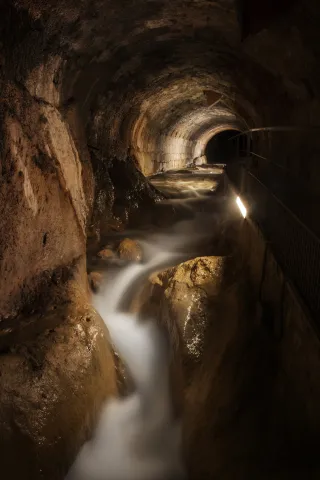
When he received the assignment, the Albacetean architect found it very difficult not to have a space of the size that Francisco de los Cobos asked for, so he solved it by building a vault on the River Cerezuelo; above the vault, the square of Santa Maria and on the square, the church, disproportionate by its enormous size, as they only lived a thousand inhabitants in the town, and yet almost cathedralicia. The project dated from 1535 and was a major engineering challenge for the media of the time.

It is said to be the only church in the world built on a river, and it is today, without a doubt, along with the vault on which it rises, the great tourist attraction in the city of Cazorla.

Breve descripción

The vault covering the Cerezuelo River was designed by Andrés de Vandelvira to be able to carry out the commission of Francisco de los Cobos, secretary of Charles V, as advance of Cazorla, of the construction of the church of Santa María. It is half-canyon, very compact, and adapts to the river's riverlevels throughout the plaza de Santa María, extending from the beginning of the plaza to the temple's header wall. The length of the tour is approximately 120 meters long.

Telecomunicaciones
Sitio web
www.turismoencazorla.com/dondeiryquever/monumentosycentros/bovedariocerezuelo.php
Teléfono de contacto
953 710 102
Correo electrónico
turismo@cazorla.es
Ubicación
Código Postal
23470
Latitud
37.909143
Longitud
-3.001215
Dirección
Plaza Sta. María
Municipio
Ubicación en el mapa
POINT (-3.001215 37.909143)
Tipos de punto de interés
Imágenes carrusel
imagen
Image
B%C3%B3veda%20r%C3%ADo%20Cerezuelo%202.jpg
Imagen principal
Desactivado
Imágenes cabecera
imagen
Image
B%C3%B3veda%20r%C3%ADo%20Cerezuelo%201.jpg
Imagen principal
Activado
Horario
Tuesday to Sunday: 10: 00 - 13: 00 and 16: 00 - 20: 00. Non-festive Monday closed. Guided tours every 30 minutes from 10: 00.
Loading map
Preparing points of interest and routes...

Un Mar de Canciones Festival

Submitted by brandcode_deweloper on
Id
990234
Redes sociales
Facebook
https://www.facebook.com/unmardecanciones/
Twitter
https://twitter.com/mardecanciones
Instagram
https://www.instagram.com/unmardecanciones/
Descripción
Breve descripción

The “Un Mar de Canciones” Festival is held at the open-air auditorium of Torres Oscuras in Torreperogil. Now more than two decades old, it has become one of the leading summer events on the Andalusian cultural scene, featuring musical performances, exhibitions, storytelling, short-story competitions, crafts and other activities. High-quality artists have performed at this festival, notable for being dedicated to singer-songwriter music and for its charitable spirit, since it partners with different community groups every year.

The mix of established artists and emerging talent, combined with strong organisation and the audience's energy, promises to make this event an unforgettable experience for all music lovers.


Telecomunicaciones
Sitio web
http://www.unmardecanciones.es/
Ubicación
Código Postal
23320
Latitud
38.032258
Longitud
-3.287588
Dirección
C/ las Torres
Municipio
Ubicación en el mapa
POINT (-3.287588 38.032258)
Imágenes
imagen
Image
un-mar-de-canciones-2-jpg
Imagen principal
Activado
Fecha Inicio
11 Jul 2026 00:00
Fecha Fin
11 Jul 2026 00:00
Microsite al que pertenece
Evento anual (=Periodicidad)
Activado
Tipo de evento
Loading map
Preparing points of interest and routes...
Interés

Imagina Funk Festival

Submitted by brandcode_deweloper on
Id
8179096
Redes sociales
Facebook
https://www.facebook.com/imagina.funk
Twitter
https://twitter.com/imaginafunk
Youtube
https://www.youtube.com/user/ImaginaFunk
Instagram
https://www.instagram.com/imaginafunk/
Descripción
Breve descripción

Over two days in August, visitors can enjoy the best funk bands on the national and international scene. An unmissable event for anyone who feels the call of funk and wants to experience the wonderful atmosphere of the festival and its surroundings.

Imagina Funk is held in an unspoilt, privileged setting, bordered by the valleys of the Guadalentín and Guadiana Menor rivers and crowned by the Sierra del Pozo, part of Spain's largest natural park (Cazorla, Segura y Las Villas) and the second largest in Europe.

Over its 15 editions, the event has brought together, in the province of Jaén, the leading names in black music on the national and international scene. As such, it is considered the great gathering of its genre, in festival format, in southern Europe. The festival includes concerts, a pool party, DJ sets, exhibitions, talks, jam sessions and more. It is also a great opportunity to enjoy the active tourism and nature-based activities on offer in the area.


Telecomunicaciones
Sitio web
https://www.imaginafunk.com
Ubicación
Código Postal
23485
Latitud
37.698031
Longitud
-2.938082
Dirección
Pozo Alcón
Municipio
Ubicación en el mapa
POINT (-2.938082 37.698031)
Imágenes
imagen
Image
imagina-1-jpg
Imagen principal
Activado
Fecha Inicio
01 Aug 2026 00:00
Fecha Fin
02 Aug 2026 00:00
Microsite al que pertenece
Evento anual (=Periodicidad)
Activado
Tipo de evento
Loading map
Preparing points of interest and routes...
Interés

Vértigo Estival

Submitted by brandcode_deweloper on
Id
370498
Redes sociales
Facebook
https://www.facebook.com/VertigoEstivalIndependiente
Twitter
https://twitter.com/vertigoestival?lang=es
Instagram
https://www.instagram.com/vertigoestival/
Descripción
Breve descripción

Martos's independent music festival continues to champion both big names on the national independent scene and new, young acts with a promising future.

Immerse yourself for two days in Vértigo Estival! An explosion of the best music and partying. Discover new talent and enjoy your favourite artists. More than 12 hours of non-stop music in the perfect setting: music, festivity and a huge open-air venue to enjoy with friends: the Bellavista pool, with more than 1,000 square metres of lawn and spectacular views.


Telecomunicaciones
Sitio web
http://acvertigo.es/
Ubicación
Código Postal
23600
Latitud
37.716674
Longitud
-3.976839
Dirección
C/ Cerrillo, 4
Distrito
Municipio
Ubicación en el mapa
POINT (-3.976839 37.716674)
Imágenes
imagen
Image
estival-1-jpg
Imagen principal
Activado
Fecha Inicio
25 Jul 2026 00:00
Fecha Fin
26 Jul 2026 00:00
Microsite al que pertenece
Evento anual (=Periodicidad)
Activado
Tipo de evento
Loading map
Preparing points of interest and routes...
Interés

Bluescazorla

Submitted by brandcode_deweloper on
Id
370305
Redes sociales
Facebook
https://www.facebook.com/Bluescazorla-Blues-Battle-593068227570041/
Twitter
https://twitter.com/blues_cazorla?lang=es
Youtube
https://www.youtube.com/user/BluesCazorla
Instagram
https://www.instagram.com/bluescazorlafestival/?hl=es
Descripción
Breve descripción

The 'Bluescazorla' International Blues Festival is a commitment to a different kind of music, but one steeped in history; it was launched on 13 September 1994 with guest artists 'Caledonia Blues Band' and 'La Blues Band de Granada' in the Santo Cristo park. Thirty years on, four stages are dressed for the occasion, over three days, to host the very best of world blues.

BluesCazorla is a dynamic, mature festival with a loyal following, one that has skilfully blended legend and future, turning blues from a niche musical style into a mass phenomenon that year after year draws more than 20,000 spectators.

The festival's prestige is confirmed by its win of the 2014 International Festival Award, presented by the Blues Foundation's 35th Blues Music Awards in the category of best festival in the world, as well as several nominations at the 'Fest' awards.


Telecomunicaciones
Sitio web
https://www.cazorla.es/bluescazorla06/
Ubicación
Nombre
Diversos escenarios
Código Postal
23470
Latitud
37.912893
Longitud
-3.003887
Municipio
Ubicación en el mapa
POINT (-3.003887 37.912893)
Imágenes
imagen
Image
bluescazorla-1-jpg
Imagen principal
Activado
Fecha Inicio
03 Jul 2026 00:00
Fecha Fin
05 Jul 2026 00:00
Microsite al que pertenece
Evento anual (=Periodicidad)
Activado
Loading map
Preparing points of interest and routes...
Interés