Saltar al contenido principal
Image
Destinos Turísticos Starlight

Frailes

Submitted by brandcode_deweloper on
Id
4844517
Perfil de redes sociales
Facebook
https://es-es.facebook.com/ayuntamiento.frailes/
Twitter
https://twitter.com/ayto_frailes
Descripción
Breve descripción

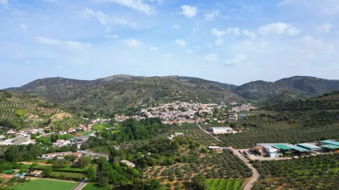
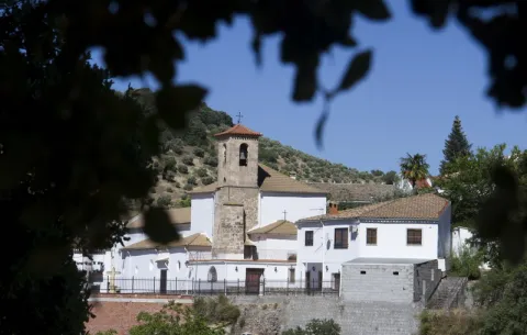
Fries is a small municipality in the province of Jaén, located to the south and limited to the province of Granada. It was a place of recreation for its wealth in waters and its nostalgic spa.

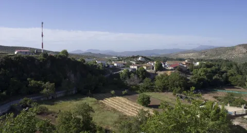
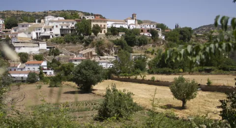
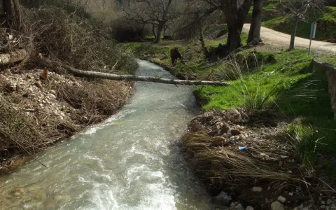
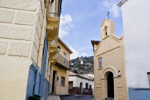
Located half the hill and left by the rivers Chorrillo and Soto Redondo, its streets are steep and zigzagueante with small slopes that are used as family gardens. When you walk through your streets, you have the feeling of walking on agricultural land as well as urbanized.

The water is born in its own heart and seems to circulate everywhere in sources, venerations and springs, through streams and streams. So much so, that we can say that water is the essence of Friars.

Its population is 1775 "friars" which are distributed by a large urban town, due to the inseparable binomial of the house-garden. The silence of the people is only broken by the sound of the bells of their parish or of one of their hermitage. No doubt a place with a special charm.
Telecomunicaciones
Teléfono
953 593 002
Sitio web
www.frailes.es/
Fax
953 593 002
Correo electrónico
ayuntamientofrailes@frailes.es
Ubicación
Nombre
Frailes
Latitud
37.486220
Longitud
-3.837320
Distrito
Municipio
Ubicación en el mapa
POINT (-3.83732 37.48622)
Imágenes
imagen
Image
057c1bbc-54d5-3672-c4ea-b18d61284f63?t=1585834430583
Imagen principal
Desactivado
imagen
Image
53638264-2737-a071-a4a0-8c3ad0bdb81f?t=1585834430793
Imagen principal
Desactivado
imagen
Image
d760df32-868c-99b7-8fca-57f04516c13a?t=1585834431444
Imagen principal
Desactivado
imagen
Image
dd0be176-1e6a-4962-66cf-de1905959029?t=1585834431170
Imagen principal
Desactivado
imagen
Image
8cf70f12-0d4d-792a-dad9-e47e107e2560?t=1585834432000
Imagen principal
Desactivado
imagen
Image
1f13571e-06bf-426d-b9b7-c029c70e617d?t=1585834432159
Imagen principal
Desactivado
imagen
Image
10687b7e-9f74-2907-db30-244c6024100b?t=1585834431808
Imagen principal
Desactivado
imagen
Image
460e7454-c52e-094b-3340-198c78116f62?t=1585834429945
Imagen principal
Desactivado
Imágenes cabecera
imagen
Image
frailes
Imagen principal
Desactivado
Datos de interés

Tourist area: Sierra Sur and Campiña de Jaén
Distance to the capital (km): 80
Altitude over sea level (m): 780
Extension (km ²): Number 40
Population: 1,575
Name: Friars
Postal code: 23690

Videos
Video file
Cultura

From its artistic heritage we highlight:

  • The parish church of Saint Lucia. Built in the 16th century on the remains of an ancient hermitage, with the passage of time will be suffering expansion of the ship to accommodate the growing number of friars. In the last reform carried out at the end of the last century, a magnificent craftsman was incorporated in Granada.
  • The House of the Dean of Mudarra. Built in the late 20th century of the last century, it has a sober three-storey façade, highlighting the beautiful grating of the first floor balconies.
  • Casa de José Escribano. It is located a few meters from the Dean de Mudarra, and it is from the same time. The glare with a balustrade and pilastras with floral motifs stands out.
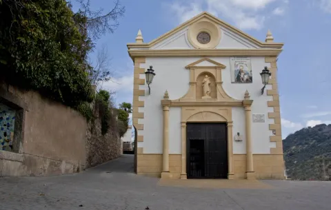
  • Calvary hermitage. Located in the highest part of the city centre, it is reached by a winding road excavated on the hill side, between oaks and almonds.
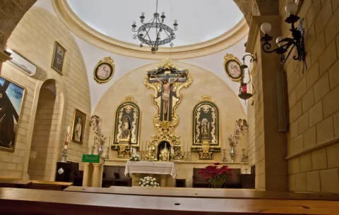
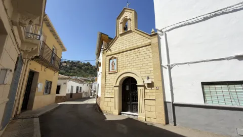
  • Hermitage of San Antonio. It is the largest hermitage in which the cult is most active. Its outer building is topped by a swordsman with a bell that sounds every time a devotee enters or leaves the hermitage. The image of St. Anthony with the Child Jesus on his hand is the hermitage.
  • Hermitage of San Pedro. Located in the Era de Mecedero, it is the last building in the village, following the road to Valdepeñas de Jaén. It is a very small hermitage, as it is a room that a neighbor gave to the worship of the Holy. Press the inside the image of the hermitage holder.
Naturaleza

The privileged climate of Fries, with very fresh summers, and water running everywhere, invites you to enjoy nature in that unique space.

The peak ofLa Martinawith its 1552 meters, it is the highest point of the saw to which it gives its name. Many hiking and cycling routes run along their slopes for those who want to enjoy these areas.

As we go up, the olive trees in the lower part are giving way to shrubs, complaints and oaks. The slopes of this saw are an ideal hunting place just 5 km away. of the city centre.

The Fountain of the Satin, At 1100 meters high, it is the ideal place to view the orography of the area and have contact with Mediterranean vegetation. Here the water goes to buckles, to refresh visitors or to follow the way to the Genil.

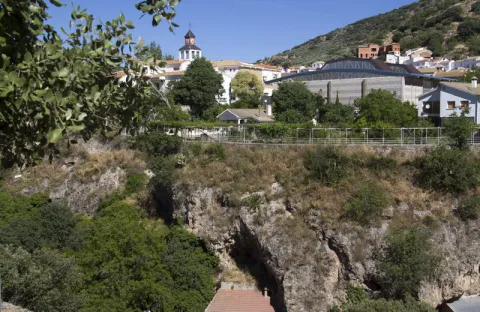
It's interesting to visit what the natives callThe Tagus, a number of orchards formed on limestone rocks by the effect of erosion, which in the past the inhabitants used as housing.

Surround the houses there is a set ofvegas, humid and fertile lowlands where the best fruits and vegetables are given.

Fiestas y Eventos

The stage of the Friars' festivities is marked by the seasons of the year and by the Christian liturgy. These would be the main festivities of the town:

  • Holy Week: The representation of the "Easter Steps" by the neighbors is a very rooted custom in the town since the 17th century. Attached in costumes of the time of Jesus Christ are the different scenes of the Passion.
  • Corpus Christi: Since 1779, Fries has had a fellowship of the Holy Sacrament, and in recent years the feast is having a special splendor. That day, the streets through which custody passes are carefully adorned by the neighbors of the village.
  • San Antonio: On June 13, after celebrating Mass in his hermitage, the image is processed through the streets of his own neighborhood.
  • San Pedro: It is the local patron party. On June 29, after the Mass, the image is processed and a verbena is held, where boys and big men dance in crowded movements.
  • August party: The first week of August, the town was dressed as a gala to celebrate its fair with activities for all ages: pasacalles, popular marathon, horse-ribbon racing, vegetable competition, and dances until the morning.
  • Wine and gastronomic day: At the end of the winter, when the wine of the harvest is already in a position to be tasted, this expected day is celebrated. Since 1997, the City Council has promoted this day the typical products of the massacre, as well as the traditional sweets that are still being produced in the bakeries of the town.
Historia

The name Fries comes from Alphthalyaswhose origin is thought to be not Arabic.

When King Alfonso XI in 1341 conquered Alcalá la Real, to which the vessel and the tower of Alfralyas belonged, these territories are incorporated into the crown of Castilla.

In the mid-16th century, the Saint Lucia hermitage was built near the first settlements. As early as 1621, the surrounding area of the hermitage was renamed "Huerta de Saint Lucia," and the population settlements were increasing.

From this date on, there are several attempts to independence of these new settlements of Alcalá la Real, although they will only come to a successful conclusion in 1836, thus starting their solo walk with the title of Villa.

During the Civil War of 1936, the town will remain faithful to the command of the Republic, which cost him the bombing of the national army, with the logical consequences of destruction, pain and death.

Today, Fries, is a town close to the 2000 inhabitants, with a wonderful climate and extraordinary beauty.
Loading map
Preparing points of interest and routes...
Imagen principal
imagen
Image
frailes
Imagen principal
Activado

Andalusian Astronomical Observatory

Submitted by brandcode_deweloper on
Id
2897118
Descripción
Descripción larga

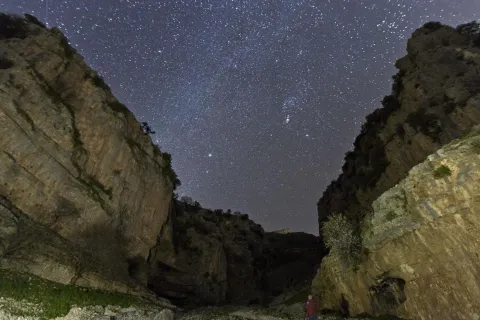
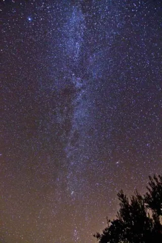
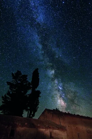
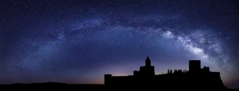
The South Sierra de Jaén, which obtained the Starligth Reserve certificate in 2014, retains the natural lighting and nocturnal conditions of the night sky intact. It is also a space where a commitment has been made to the defence of the quality of the night sky, access to the light of the stars and the different associated values.

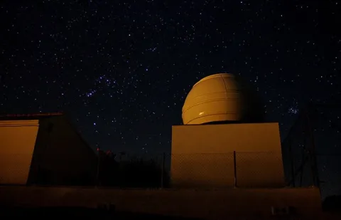
The main building, about 70 square meters, houses the multi-purpose room and library, observatory control room, small kitchen, toilet and archive.

To the north of the main building and completely independent, is the observatory itself. The lower floor serves as a storage room for the various instrumentation and accessories of the telescopes and has a small workshop for the repairs.

The 4-meter-in-diameter Scope Dome dome, installed on the top, has a Meade S / C LX200-ACF GPS telescope of 0.30 meters of opening at f / 10, in an equatorial fork mount, supported by an independent rigid column.

The whole of the Andalusian Observatory of Astronomy: Dome, telescope as well as its battery of accessories and instrumentation can be operated remotely from anywhere.

On the terrace of the control room there is a weather station specially designed for use in an astronomical observatory and an AllSky automatic camera for meteor detection.

Breve descripción

In the village of La Pedriza, 8 km from Alcalá la Real with an impressive dark sky, the Einstein Society of Astronomy, with the collaboration of the Alcalá la Real City Council, has first-class facilities for astronomical observation and dissemination: the Andaluz Observatory of Astronomy.

Telecomunicaciones
Sitio web
www.astroalcala.es
Teléfono de contacto
661 090 957
Correo electrónico
espartero@astroalcala.es
Ubicación
Código Postal
23688
Latitud
37.414820
Longitud
-3.953560
Distrito
Municipio
Ubicación en el mapa
POINT (-3.95356 37.41482)
Tipos de punto de interés
Imágenes carrusel
imagen
Image
starlight-mota-1536x584.jpg
Imagen principal
Desactivado
imagen
Image
C-2020-F3-Neowise-blog.png
Imagen principal
Desactivado
Imágenes cabecera
imagen
Image
observatorioandaluzastronomia_jaen2.jpg
Imagen principal
Activado
Microsite al que pertenece
Loading map
Preparing points of interest and routes...
Marcas de calidad

Control Checkpoint of La Cabrera

Submitted by brandcode_deweloper on
Id
2854602
Descripción
Descripción larga

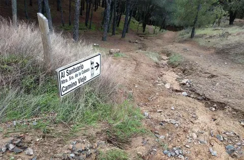
The access road runs through a relatively easy forest track; this track is taken from the same town of Marmolejo, after crossing the bridge over the Guadalquivir River at the height of the spa.

Right on the north bank of the river a right turn is taken towards the Aliseda, follow those signs and this way for 12.5 km until you reach the closed control door. There you can leave the vehicle and put things on the other side by entering the pedestrian door.

This point is especially suitable for those fans with telescopes and their own means in search of an outstanding sky and with light-taking to connect their equipment.

Breve descripción

Another privileged place is La Cabrera Control, in Marmolejo. The great advantage of this enclave is that it currently has an electric current that can be taken directly from an external plug that is located on the wall of the guard's surveillance shed.

Telecomunicaciones
Sitio web
www.andalucia.org/es/marmolejo-turismo-cultural-control-de-la-cabrera
Ubicación
Latitud
38.044893
Longitud
-4.170983
Distrito
Municipio
Ubicación en el mapa
POINT (-4.170983 38.044893)
Tipos de punto de interés
Imágenes carrusel
imagen
Image
Sendero%20Control%20de%20la%20Cabrera-Santuario%20Virgen%20de%20la%20Cabeza2.jpg
Imagen principal
Desactivado
Imágenes cabecera
imagen
Image
JJG_1117%20%281%29.jpg
Imagen principal
Activado
Microsite al que pertenece
Loading map
Preparing points of interest and routes...

Alto de la Pandera

Submitted by brandcode_deweloper on
Id
2853258
Descripción
Descripción larga

The northern horizon is impractical due to the proximity of the city of Jaén, however, looking east and south we find a true spectacle. It is a highly recommended place for those most expert fans who not only seek dark conditions but also good looking conditions, and is that at more than 1,800 meters high the atmospheric transparency is excellent, being one of the best points for planetary observation and photography.

To arrive there is only to take the detour on the road that links Los Villares with Valdepeñas de Jaén and ascend to the heliport, located on the top.

Note: some days of laminar air flow may occur in which case it is preferable to observe in the explanade that is next to the buildings rather than in the heliport.

Breve descripción

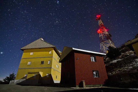
The old military base of La Pandera is the highest point in the Starlight Reserve of the South Sierra de Jaén and an emblematic place for the observation of the firmament. At its top there is a great explanade where in the past there have been important remains of astronomy fans that brought together hundreds of people.

Ubicación
Latitud
37.630386
Longitud
-3.774541
Distrito
Ubicación en el mapa
POINT (-3.774541 37.630386)
Tipos de punto de interés
Imágenes carrusel
imagen
Image
24.jpg
Imagen principal
Desactivado
imagen
Image
Astroturismo1.JPG
Imagen principal
Desactivado
Imágenes cabecera
imagen
Image
alto-pandera.jpg
Imagen principal
Activado
Loading map
Preparing points of interest and routes...
Marcas de calidad

Hamlet of Los Guindos

Submitted by brandcode_deweloper on
Id
2854730
Descripción
Descripción larga

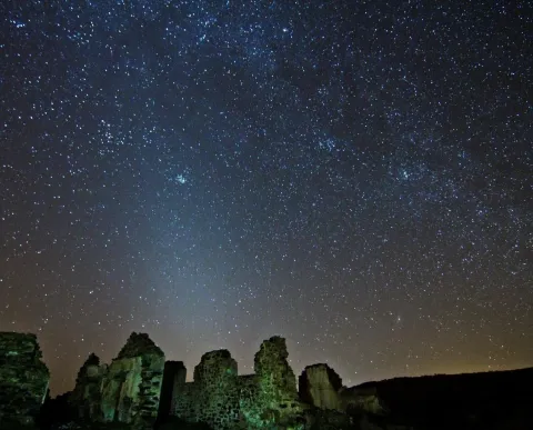
The village of Los Guindos, in the town of La Carolina, has a spectacular north and west horizon, where on winter nights it is possible to observe the elusive zodiacal light.

Especially recommended in the autumn and winter months with the arms of Perseus and Orion hiding in the west.

With easy access and very close to the A-4 motorway, we are facing a magnificent enclave from which to enter into the wonders of the universe within the framework of the Reserve and Starlight Tourist Destination of Sierra Morena.

Breve descripción

The ancient mining complexes in the northern province of Jaén are magnificent observation sites, the presence of ancient mineral loading and discharge structures offer the possibility to install our telescopes in large, barrier-free vents.

Ubicación
Latitud
38.308570
Longitud
-3.683200
Distrito
Municipio
Ubicación en el mapa
POINT (-3.6832 38.30857)
Tipos de punto de interés
Imágenes carrusel
imagen
Image
JJG_1255.jpg
Imagen principal
Desactivado
Imágenes cabecera
imagen
Image
Aldea de Los Guindos
Imagen principal
Activado
Microsite al que pertenece
Loading map
Preparing points of interest and routes...
Marcas de calidad