Saltar al contenido principal

Arroyo Salado

Submitted by brandcode_deweloper on
Id
4676895
Descripción
Descripción larga
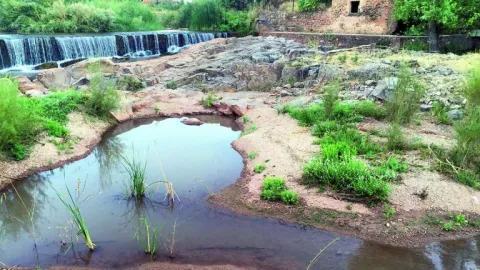
The highest point in the municipality corresponds to the Haza de la Sierra geodesic marker (479 m), while the lowest point lies at around 350 m, in the bed of the Arroyo Salado, the main watercourse crossing the district from south to north. The remaining streams are of minor importance and have an intermittent flow, all of them tributaries of the Salado.
Breve descripción
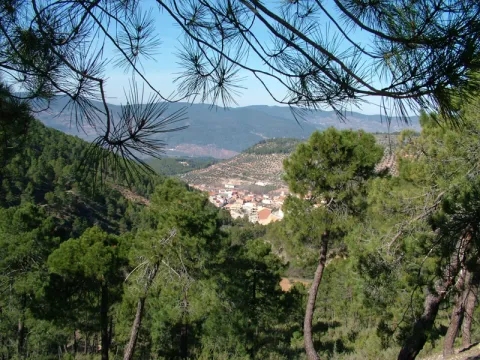
The municipal district of Higuera de Calatrava lies right within the Guadalquivir basin. It is therefore easy to deduce that its topography is gentle, with rolling landforms.
Ubicación
Latitud
37.78917
Longitud
-4.14597
Dirección
Higuera de Calatrava
Distrito
Ubicación en el mapa
POINT (-4.14597 37.78917)
Imágenes carrusel
imagen
Image
Higuera_de_Calatrava%20%281%29.jpg
Imagen principal
Desactivado
Imágenes cabecera
imagen
Image
12.JPG
Imagen principal
Activado
Loading map
Preparing points of interest and routes...

Charca de Pajarejos

Submitted by brandcode_deweloper on
Id
4521732
Descripción
Descripción larga
Location: North-east of the town, close by. Distance: 5 km. Means of access: By car, by bicycle or on foot. Access route: Directly from the town, leaving via the JV-2.334 towards Fuerte del Rey.
Breve descripción
This natural pond, which only forms after heavy rainfall, functions as a temporary wetland ecosystem where various waterbirds nest.
Ubicación
Código Postal
23659
Latitud
37.83971
Longitud
-4.00149
Dirección
Villardompardo
Distrito
Municipio
Ubicación en el mapa
POINT (-4.00149 37.83971)
Imágenes carrusel
imagen
Image
Charca%20de%20Pajarejos3.jpg
Imagen principal
Desactivado
imagen
Image
Charca%20de%20Pajarejos.jpg
Imagen principal
Desactivado
Imágenes cabecera
imagen
Image
1539949207_996559_1539949275_noticia_normal.jpg
Imagen principal
Activado
Loading map
Preparing points of interest and routes...

Valley of the Segura

Submitted by brandcode_deweloper on
Id
2980198
Descripción
Descripción larga

The road goes parallel to the river and, on its sides, there are impressive calares with magnificent views of the saw. As you pass the village of La Toba, the river remains in the charming reservoir of Las Anchuricas, one of the most beautiful of the Sierras de Cazorla Natural Park, Segura and Las Villas, The valley offers pleasant visits around you that will allow us to know more about the Sierra de Segura, such as the village of La Toba, a place where water is the great protagonist, or the nearby populations of La Fuente del Esparto, La Peguera del Madroño or Las Gorgollitas.

On the JF-7038 road, from The Utrera Strike to Miller's Boards.

Breve descripción

In the village of Huberga Utrera, the Segura River receives its first tributary, the Madera River. From this point on, the Segura, with an already important flow, advances through its valley through bridges and visiting villages that were born on its bank and that survived thanks to it.

Ubicación
Código Postal
23298
Latitud
38.118420
Longitud
-2.670480
Dirección
Carretera A-317
Distrito
Municipio
Ubicación en el mapa
POINT (-2.67048 38.11842)
Imágenes carrusel
imagen
Image
R%C3%ADo%20Segura%20%28La%20Toba%29.jpg
Imagen principal
Desactivado
Imágenes cabecera
imagen
Image
9.jpg
Imagen principal
Activado
Loading map
Preparing points of interest and routes...

Jandulilla River

Submitted by brandcode_deweloper on
Id
8114425
Descripción
Descripción larga

Former Xandulilla. Influent on the left bank of the Guadalquivir River. Collect the waters from the northeastern face of the Sierra Magina massif. The associated valley is given the same name. Unwind in the Guadalquivir River, in the area of Ubeda the old one. The Arab geographer Al-Zuhrí, mentions him by the name of Wadi-l-Ard, or Rio de la Tierra.

He named the former population of Xandulilla, of which there are many archaeological remains of great importance spread throughout the area. In the 17th century it was known as "Villa de Felix" with its own jurisdiction. It is a river with a normally low and variable flow rate and without regulatory structures. It is born under the Port of the Gallardos, also known in its first stretch as Rio Huelma, its main tributaries, both on the left are the Gualijar River and the Garganton River that are born in the main massif of Magina and after a very short journey they result in the Jandulilla, apart from numerous intermittent rags and ramps.

Breve descripción

The Jandulilla River is a short river in the south of Spain, tributary to the left bank of the Guadalquivir River that runs through the province of Jaén and collects the waters of the northeastern face of the Sierra Magina massif. The associated valley is given the same name. Unwind in the Guadalquivir River, in the area of Ubeda la Vieja.

Telecomunicaciones
Teléfono de contacto
953 390 210
Ubicación
Código Postal
23560
Latitud
37.650300
Longitud
-3.459550
Distrito
Municipio
Ubicación en el mapa
POINT (-3.45955 37.6503)
Imágenes carrusel
imagen
Image
r%C3%ADo%20Jandulilla%202%20%281%29.jpg
Imagen principal
Desactivado
Imágenes cabecera
imagen
Image
r%C3%ADo%20Jandulilla.jpg
Imagen principal
Activado
Microsite al que pertenece
Loading map
Preparing points of interest and routes...
Río Guadalimar

Submitted by brandcode_deweloper on
Id
4528704
Descripción
Descripción larga
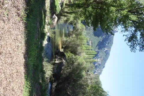
It crosses the Sierra de Cazorla, Segura y las Villas, collecting the waters of numerous smaller streams and rivers: its course receives water from the Onsares, Guadalmena, Guadalén, Cortillas, Frío, Carrizas, Morles and Trujala rivers. The river and its main tributaries have a gentle slope and a rather limited flow, but among its streams are spots of spectacular beauty. Its waters slow down at the Giribaile reservoir, the second most important reservoir in the province, where barbel, carp, largemouth bass and pike can be fished. It marks the boundary of the Torreblascopedro district along its entire north-eastern side, giving rise to a typical riparian ecosystem and creating a fertile plain characterised by cotton and wheat farming. It is accessible via the JV-3003/4 and must be crossed via its bridge to reach Linares from our municipality.
Breve descripción
The Guadalimar river rises at the foot of the Almenara hill, at an altitude of 1,200 m, in the Sierra de Alcaraz, in Albacete, and flows towards the Natural Park of the Sierras de Cazorla, Segura y las Villas, joining the Guadalquivir river within the municipal district of Torreblascopedro. It takes its name from the colour of its waters, as "Guadalimar" derives from wad al-Ihmar, "red river".
Ubicación
Municipio
Imágenes carrusel
imagen
Image
guadalimar.jpg
Imagen principal
Desactivado
Imágenes cabecera
imagen
Image
4%20%281%29.jpg
Imagen principal
Activado

Guadalén River

Submitted by brandcode_deweloper on
Id
6552251
Descripción
Descripción larga

It receives from the right to the rivers Onsares, Guadalmena and Guadalén. On the left to the rivers Cotillas, Arroyo Frio, Carrizas, Morles, Trujala and the creek of Peñolite. On its way through the Sierra de Segura.

In Roman times it was called the Tago, Tagus or Tugio River, just as its birth was the Sierra de Tugia. Its Arabic name "wad al-ihmar" means "red river," which is curiously as it is called in the area, by the red color of its waters.

Breve descripción

The Guadalimar River is a river in the south of Spain, a tributary of the Guadalquivir River that is born at the foot of the Sarga peak (1770 m.), in the Alcaraz Sierra, in the province of Albacete, resulting from the confluence of several streams in the surroundings of Villaverde de Guadalimar. It provides its waters to the Guadalquivir in the municipality of Jabalfifth (Jaén province).

Ubicación
Latitud
38.180950
Longitud
-3.427055
Distrito
Municipio
Ubicación en el mapa
POINT (-3.427055 38.18095)
Imágenes carrusel
imagen
Image
7e0b619bb599cba0f135d1f24a105a0f.jpg
Imagen principal
Desactivado
imagen
Image
00945f1.jpg
Imagen principal
Desactivado
Imágenes cabecera
imagen
Image
5678744Master.jpg
Imagen principal
Activado
Microsite al que pertenece
Loading map
Preparing points of interest and routes...

Bridge honda

Submitted by brandcode_deweloper on
Id
5631322
Descripción
Descripción larga

Location: east of the city centre, in the pedanía of Puente Honda.

Distance: 4 km.

Medium: by vehicle tourism.

Access: local road to Puente Honda.

Breve descripción

It is a recreational area in thepedanía de Puente Honda. 4 km. from the town of Benatae, and it is worth observing from this atalayo the Natural Park of the Sierra de Cazorla, Segura and Las Villas.

Telecomunicaciones
Sitio web
www.benatae@promojaen.es
Teléfono de contacto
953 480 378
Ubicación
Código Postal
23390
Latitud
38.352720
Longitud
-2.652320
Distrito
Municipio
Ubicación en el mapa
POINT (-2.65232 38.35272)
Imágenes carrusel
imagen
Image
benatae%20%281%29.jpg
Imagen principal
Desactivado
Imágenes cabecera
imagen
Image
c4d3ccf2_y.jpg
Imagen principal
Activado
Loading map
Preparing points of interest and routes...

Bridge of la Cerrada

Submitted by brandcode_deweloper on
Id
4892938
Descripción
Breve descripción

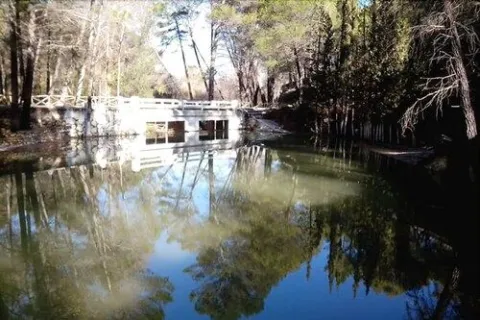
It is a basin regulatory reservoir, belonging to the Guadalquivir River, where you can enjoy the typical landscape of the wetland (especially carrizos), as well as the abundant aquatic fauna that forms the ecosystem: avetoro, large tick, squid, real duck, spoon duck, common focha...

Ubicación
Código Postal
23320
Latitud
37.958410
Longitud
-3.188940
Municipio
Ubicación en el mapa
POINT (-3.18894 37.95841)
Imágenes carrusel
imagen
Image
puentecerrada%20%281%29.jpg
Imagen principal
Desactivado
Imágenes cabecera
imagen
Image
puente%20%281%29.jpg
Imagen principal
Activado
Microsite al que pertenece
Loading map
Preparing points of interest and routes...

Dam of Mengíbar

Submitted by brandcode_deweloper on
Id
4619362
Descripción
Descripción larga

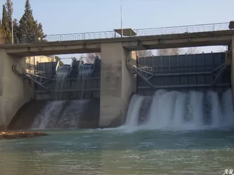
The Mengibar Dam was an important civil work in its time, as it was among the first hydraulic power plants to be built in Spain with mobile doors. Until then, the dams were fixed and, if they exceeded their capacity, overflowed. However, in the case of Mengibar, in anticipation of possible floods, Mengemor engineers designed to install mobile doors that allow the water to be depacked in a controlled way to the river. Built from load walls, with natural stone masonry, lacquered and assembled by concrete mortar. The holes form a half-point arc with material of similar characteristics. Covered with flat ceramic tile, mounted on metal fences. It is in good conservation and is currently used to generate electrical power and inject it into the network.

Breve descripción

Located on the Guadalquivir River and inaugurated on 30 November 1916 by King Don Alfonso XIII, the project was the work of architect Antonio Palacios Ramilo and built by the company Mengemor.

Telecomunicaciones
Sitio web
www.mengibarturismo.com
Teléfono de contacto
677 222 285
Correo electrónico
turismo@aytomengibar.com
Ubicación
Código Postal
23620
Latitud
37.987049
Longitud
-3.792523
Dirección
Carretera de la Presa
Distrito
Municipio
Ubicación en el mapa
POINT (-3.792523 37.987049)
Imágenes cabecera
imagen
Image
main_image_97200.jpeg
Imagen principal
Activado
Microsite al que pertenece
Loading map
Preparing points of interest and routes...
Giribaile Reservoir

Submitted by brandcode_deweloper on
Id
4554856
Descripción
Breve descripción

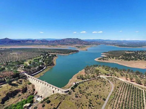
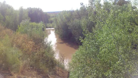
It affects the municipal terms of Ibros, Vilches, Rus, Canena, Ubeda, Navas de San Juan and Sabiote, in the skirts of theNatural area La Lambrain Rus. It is of the compaction type (80% of land).
The swamp collects the waters of the Guadalimar River, which belongs to the Guadalquivir watershed.

Ubicación
Código Postal
23430
Latitud
38.113562
Longitud
-3.461869
Municipio
Ubicación en el mapa
POINT (-3.461869 38.113562)
Imágenes carrusel
imagen
Image
Embalse%20de%20Giribaile.jpg
Imagen principal
Desactivado
Microsite al que pertenece
Loading map
Preparing points of interest and routes...