Saltar al contenido principal

La Fuente de Lupión

Submitted by brandcode_deweloper on
Id
8089117
Descripción
Descripción larga
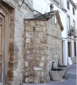
It was built in 1788, as shown by an inscribed stone on its front. It is built of both regular and irregular ashlar. It features a moulding in the form of a pediment, crowned by a stone cross. It has two spouts pouring water into inverted truncated-cone-shaped basins. The whole is decorated with a ceramic tile showing the Sacred Heart in the act of blessing.
Breve descripción
In the Plaza del Ayuntamiento stands a 19th-century fountain of considerable presence despite its austerity. Built of both regular and irregular ashlar, it has a front topped by a cross-shaped gable cornice with curved sides. Two spouts set above inverted truncated-cone-shaped basins provide water, and it is decorated with ceramic tiles bearing religious imagery.
Telecomunicaciones
Sitio web
www.lupion.es/el-municipio/patrimonio-historico.html
Ubicación
Código Postal
23528
Latitud
37.99670
Longitud
-3.54646
Dirección
Plaza Ayuntamiento, 9A
Municipio
Ubicación en el mapa
POINT (-3.54646 37.9967)
Tipos de punto de interés
Imágenes carrusel
imagen
Image
La%20fuente%20de%20Lupi%C3%B3n2.jpg
Imagen principal
Desactivado
Imágenes cabecera
imagen
Image
La%20fuente%20de%20Lupi%C3%B3n-ok.jpg
Imagen principal
Activado
Loading map
Preparing points of interest and routes...
Ayozar Fountain Area

Submitted by brandcode_deweloper on
Id
8090292
Descripción
Descripción larga

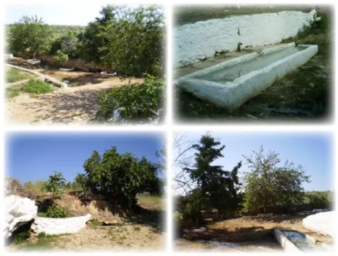
The fountain is accessed by Ayozar Street, located about 800 metres from the town. This source may be the most appreciated by the citizens, has a very good reputation for their water for use in the kitchen. It was formerly a place where the elders went with their grandchildren to take walks and make clay castles.

Breve descripción

The route from Castellar to the Pilar del Ayozar is ideal for hiking; since it is a small area, biodiversity is scarce. However, among the fauna of the area, we can highlight some frogs, creams, lizards and birds, while of their flora we can mention the fig trees, morale and alamos.

Telecomunicaciones
Sitio web
www.castellar.es/patrimonio-natural
Teléfono de contacto
953 460 005
Ubicación
Código Postal
23260
Latitud
38.253580
Longitud
-3.129160
Distrito
Municipio
Ubicación en el mapa
POINT (-3.12916 38.25358)
Tipos de punto de interés
Imágenes carrusel
imagen
Image
fuente%20del%20ayozar%20%281%29.jpg
Imagen principal
Desactivado
imagen
Image
fuente%20del%20ayozar2.jpg
Imagen principal
Desactivado
Imágenes cabecera
imagen
Image
fuente%20del%20ayozar9%20%281%29.jpg
Imagen principal
Activado
Loading map
Preparing points of interest and routes...
Monument to Félix Rodríguez de la Fuente

Submitted by brandcode_deweloper on
Id
8108303
Descripción
Descripción larga

Built in 1980

Breve descripción
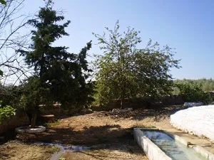
Source dedicated to the memory of Félix Rodríguez de la Fuente, a lover of nature. It has a tile plate where the honorado and the year of construction are named.
Telecomunicaciones
Teléfono de contacto
953 566 001
Ubicación
Código Postal
23658
Latitud
37.746690
Longitud
-3.906610
Dirección
Camino de la Sierra, 1
Distrito
Municipio
Ubicación en el mapa
POINT (-3.90661 37.74669)
Tipos de punto de interés
Imágenes carrusel
imagen
Image
Monumento%20a%20F%C3%A9lix%20Rodr%C3%ADguez%20de%20la%20Fuente3.jpg
Imagen principal
Desactivado
Imágenes cabecera
imagen
Image
Monumento%20a%20F%C3%A9lix%20Rodr%C3%ADguez%20de%20la%20Fuente.jpg
Imagen principal
Activado
Loading map
Preparing points of interest and routes...
La Cerradilla

Submitted by brandcode_deweloper on
Id
8094084
Descripción
Descripción larga

Location: To the north-east of the city centre, very close to it and at the limits of the Natural Park of Cazorla, Segura and Las Villas.

Distance: 3 km.

Medium: On foot.

Access route: By a road that leaves directly from the city centre towards Los Rinnes.

Breve descripción

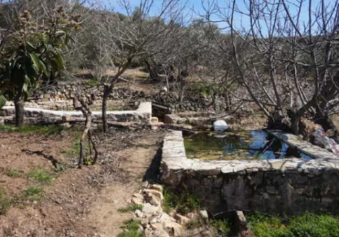
To the north-east of the city centre, very close to it and at the limits of the Natural Park of Cazorla, Segura and Las Villas, beautiful natural enclave that stands out for the presence of a natural water source, as well as the remains of an Arab castle.

Telecomunicaciones
Sitio web
www.huesa.es/el-municipio/patrimonio-natural.html
Correo electrónico
huesa@promojaen.es
Ubicación
Código Postal
23487
Latitud
37.764200
Longitud
-3.077910
Municipio
Ubicación en el mapa
POINT (-3.07791 37.7642)
Tipos de punto de interés
Imágenes carrusel
imagen
Image
Rinc%C3%B3n%20Alto%20.%20La%20Cerradilla.%20%281%29.jpg
Imagen principal
Desactivado
Loading map
Preparing points of interest and routes...

Fountain Taza de Pozo Alcón

Submitted by brandcode_deweloper on
Id
8109717
Descripción
Descripción larga

Located on a side of the Church of the Incarnation. Decorative source of vertical pipe type cup that spills to an octagonal pillar. It has two side pipes on the perimeter of the pillar that they used to serve to fill the cantars.

Breve descripción

Dodecagonal source with a single pipe on one side

Telecomunicaciones
Teléfono de contacto
953 738 041
Correo electrónico
ayuntamiento@pozoalcon.es
Ubicación
Código Postal
23485
Latitud
37.705600
Longitud
-2.933550
Dirección
C/ Monje, 2. Pozo Alcón
Municipio
Ubicación en el mapa
POINT (-2.93355 37.7056)
Tipos de punto de interés
Imágenes carrusel
imagen
Image
Fuente%20Taza2%20%281%29.jpg
Imagen principal
Desactivado
imagen
Image
Fuente%20Taza3%20%281%29.jpg
Imagen principal
Desactivado
Imágenes cabecera
imagen
Image
Fuente%20Taza%20%281%29.jpg
Imagen principal
Activado
Loading map
Preparing points of interest and routes...

Fountain of the Espino

Submitted by brandcode_deweloper on
Id
1869147
Descripción
Descripción larga

Location: To the south of the city centre, on the road to the mountains.

Distance: 4 hours.

Medium: On foot.

Access route: By mountain sidewalk.

Breve descripción

It is a water birth located in the middle of the Mediterranean mountain, with geological and vegetable formations of high natural value.

Ubicación
Latitud
37.740100
Longitud
-3.461470
Distrito
Ubicación en el mapa
POINT (-3.46147 37.7401)
Tipos de punto de interés
Imágenes carrusel
imagen
Image
Fuente%20del%20Espino%202.jpg
Imagen principal
Desactivado
Imágenes cabecera
imagen
Image
Espino1.png
Imagen principal
Activado
Microsite al que pertenece
Loading map
Preparing points of interest and routes...
Fountain of the Escribano

Submitted by brandcode_deweloper on
Id
4970637
Descripción
Descripción larga

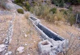
The source of the scribe has a very low flow rate, approximately between 0-1 l / s, although it is rarely exhausted. The use of water from this spring is now rural and livestock. Today the water of the spring is used very little, but in the past century, it was a source very frequented by the arjonilleros, using a part of it as a forklift for the cavalry and the rest of cattle, and another part for human supply. At the source the arjonilleros collected water, in pitchers and flyers, which they used for their domestic use, to refresh in the agricultural work...

There is no doubt that the picture presented by the source of the scribe earlier, according to the testimonies that come to us from the mouth of the older, must be bewildered. Men and women with the pitcher at their expense, or donkeys and carrying animals that were carrying in the serons the pitchers and flyers.

Breve descripción

It has traditionally been a watershed for animals and pour its water into the stream of the Fountain of the scribe. This old source was rebuilt in 1947 and 2015.

Telecomunicaciones
Sitio web
www.arjonillapatrimoniohistorico.blogspot.com/2017/09/la-fuente-del-escribano.html
Ubicación
Código Postal
23750
Latitud
37.967830
Longitud
-4.126910
Distrito
Municipio
Ubicación en el mapa
POINT (-4.12691 37.96783)
Tipos de punto de interés
Imágenes carrusel
imagen
Image
Fuente%20del%20Escribano.jpg
Imagen principal
Desactivado
imagen
Image
Fuente%20del%20Escribano%202.jpg
Imagen principal
Desactivado
Imágenes cabecera
imagen
Image
fuente-escribano.jpg
Imagen principal
Activado
Loading map
Preparing points of interest and routes...

Fountain of the Comendador

Submitted by brandcode_deweloper on
Id
4861505
Descripción
Descripción larga

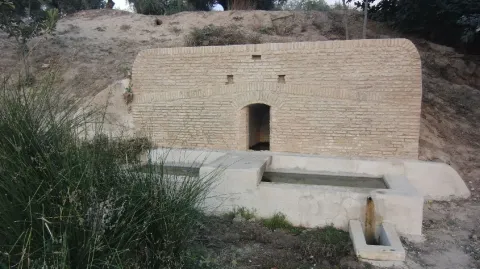
With double deck and pool. Next to the modern source is another very old one of possible Ibero-Roman origin.

Breve descripción

It is a beautiful area, easily accessible, with a natural water spring.

Telecomunicaciones
Sitio web
www.porcuna.jaenescondido.es/fuente-del-comendador.html
Correo electrónico
contacto@jaenescondido.es
Ubicación
Latitud
37.871140
Longitud
-4.183990
Distrito
Municipio
Ubicación en el mapa
POINT (-4.18399 37.87114)
Tipos de punto de interés
Imágenes carrusel
imagen
Image
Fuente%20del%20Comendador.jpg
Imagen principal
Desactivado
imagen
Image
Fuente%20del%20Comendador%202.jpg
Imagen principal
Desactivado
Imágenes cabecera
imagen
Image
fuente.jpg
Imagen principal
Activado
Loading map
Preparing points of interest and routes...
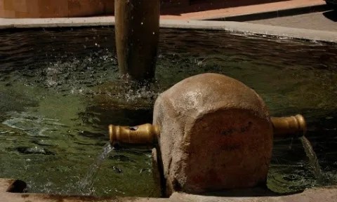
Fountain of the Reja

Submitted by brandcode_deweloper on
Id
4658611
Descripción
Descripción larga

In the Fuente de la Reja we find a commemorative canvas decorated with heraldic elements, the weapons of Philip III and those of the villa itself. which reads as follows:

"King D. Philip III reigned in Spain. He ordered to do this work the village of Pegalajar year 1605.?

The lack of water in recent years has led to the implementation in 2007 of the aquifer extraction plan to recover the spring and to take measures to value it as a resource for local development.

The set composed of the Fuente de la Reja, la Charca and la Huerta de Pegalajar is an essential part of the historical-cultural-economic heritage of Pegalajar, as recognized by its declaration as a place of ethnic interest made by the Council of Culture of the Junta de Andalucía.

Telecomunicaciones
Sitio web
www.pegalajar.org/articulos/la_fuente_de_la_reja.htm
Teléfono de contacto
953 360 003
Correo electrónico
pegalajar@promojaen.es
Ubicación
Código Postal
23110
Latitud
37.741540
Longitud
-3.646940
Dirección
C/ Fuente la Reja
Distrito
Municipio
Ubicación en el mapa
POINT (-3.64694 37.74154)
Tipos de punto de interés
Imágenes carrusel
imagen
Image
fuente%20de%20la%20reja.jpg
Imagen principal
Desactivado
imagen
Image
fuente%20de%20la%20reja%202.jpg
Imagen principal
Desactivado
Imágenes cabecera
imagen
Image
fuentelareja2001.jpg
Imagen principal
Activado
Microsite al que pertenece
Loading map
Preparing points of interest and routes...

Fountain of the Corregidora

Submitted by brandcode_deweloper on
Id
4696970
Descripción
Descripción larga

The fountain of La Corregidora is less than 1 km from the urban centre of Sabiote, in the
place known as the Corridor. To access it, you have to go down by an unusual cut through those areas of La Loma, and it gradually opens up by discovering a beautiful view in which you can see the entire province, passing through Villacarillo and Iznatoraf (or Torafe as they call it through those areas and the Sierra de Segura). It is a dark and very humid area, as the sun never comes. It has a 4-year-old fountain, which in the past and now serves to give the cattle and the people to drink. The stream that forms, called the corridor, as its source, flows into the Guadalimar basin. In the surroundings there are only heras, olive trees and fruit crops, such as cherry and almonds.

Breve descripción

One of the most important natural sites we own in the region of the Loma and the Villas, is this stream that forms a waterfall in the vicinity of Sabiote, a place that for its freshness and for having around it the stone that has made great the monuments of this villa.

Telecomunicaciones
Sitio web
www.sabiote.com
Teléfono de contacto
953 773 002
Ubicación
Código Postal
23410
Latitud
38.068423
Longitud
-3.291115
Municipio
Ubicación en el mapa
POINT (-3.291115 38.068423)
Tipos de punto de interés
Imágenes carrusel
imagen
Image
Fuente%20de%20la%20Corregidora.jpg
Imagen principal
Desactivado
Imágenes cabecera
imagen
Image
img_0227.jpg
Imagen principal
Activado
Loading map
Preparing points of interest and routes...