Saltar al contenido principal
Image
pueblos-magicos-de-espana

Villanueva del Arzobispo

Submitted by brandcode_deweloper on
Id
787624
Perfil de redes sociales
Facebook
https://www.facebook.com/villanuevadelarzobispo/
Twitter
https://twitter.com/ayuntvillanueva
Instagram
https://www.instagram.com/turismo_vva_del_arzobispo/?hl=es
Descripción
Breve descripción

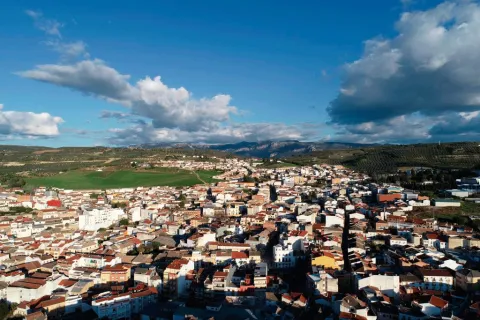
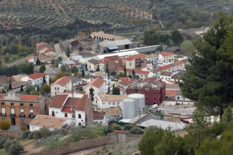
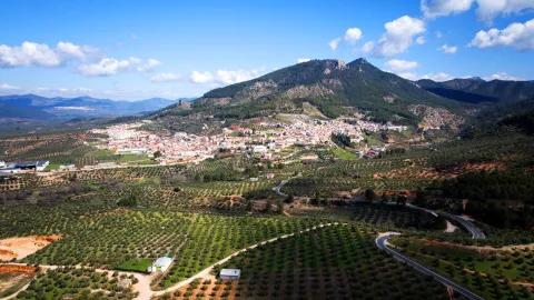
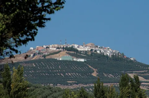
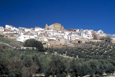
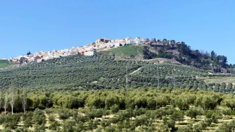
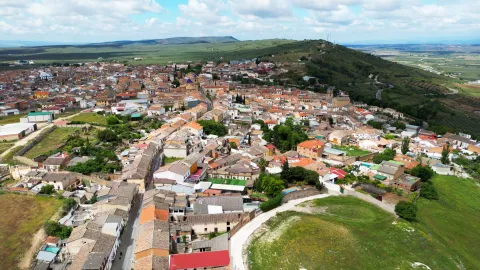
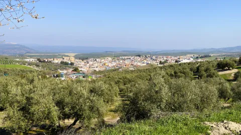
Villanueva del Archbishop is a population in the the eastern end of the region of the Villas. Part of its term is included in the Natural Park of the Sierras de Cazorla, Segura and Las Villas, where there are many areas of extraordinary environmental and landscape value.

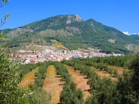
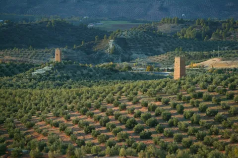
The geographical situation of the municipality should be noted, as it is the meeting area of four comarcas: County and their red lands, the Loma and its extensive olive fields, Safe with the largest natural park of Jaén of extraordinary beauty and that of Las Villas, made up of four municipalities, Villanueva being one of them. The Conistorio also includes the localities of Gútar and Montesina Barrio.

An important area is irrigated by the rivers Guadalquivir and Guadalimar, which leads to fertile lands that favour agricultural crops, including large olive fields.

Its economy is based primarily on the olive cultivation and obtaining olive oil. It also has an industry mineral water bottling machine.

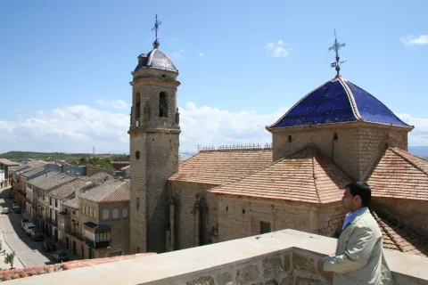
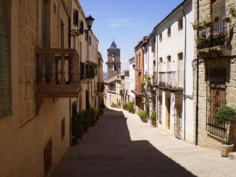
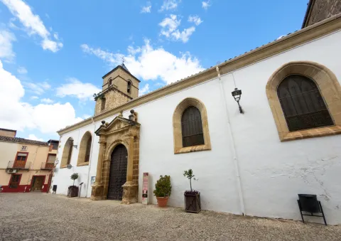
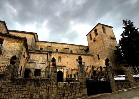
Its monumental heritage is important. Among others are the church of San Andrés, the church of the Vera Cruz, the Convent of Sana Ana, the bullring, the Calvary Sanctuary, the House of Arcos and, on the outskirts, the Sanctuary of the Virgin of the Fuensana.
Telecomunicaciones
Teléfono
607 184 628 
Sitio web
www.villanuevadelarzobispo.es
Fax
953 451 278
Correo electrónico
turismovillanuevadelarzobispo@gmail.com
Ubicación
Nombre
Villanueva del Arzobispo
Latitud
38.168770
Longitud
-3.007650
Ubicación en el mapa
POINT (-3.00765 38.16877)
Imágenes
imagen
Image
532806cd-619f-7cc9-44c2-092f56943a53?t=1599779812435
Imagen principal
Desactivado
imagen
Image
7990b2d2-d948-48a8-a614-11375318478c?t=1599779812524
Imagen principal
Desactivado
imagen
Image
738190d2-92fe-d42a-cd21-dee89312ab66?t=1621521463540
Imagen principal
Desactivado
imagen
Image
fccf37b3-51ea-0d40-d2d3-208d29d4b0fb?t=1599779812628
Imagen principal
Desactivado
imagen
Image
98803030-2a13-91ec-885d-33c12edb2ac3?t=1599779812669
Imagen principal
Desactivado
imagen
Image
ab294870-3b1c-2c43-c6d9-d9e82cd58348?t=1621521463664
Imagen principal
Desactivado
imagen
Image
fa16b75d-5183-daa9-6ae1-50f481dec7f2?t=1621521463705
Imagen principal
Desactivado
imagen
Image
4ead314e-cf27-6335-e563-707c37a36d70?t=1621521463848
Imagen principal
Desactivado
imagen
Image
80863fbc-ff97-c637-eddd-c388f63d4e11?t=1599779812778
Imagen principal
Desactivado
imagen
Image
660ffa23-8ba0-ab1e-b463-727ca59414bb?t=1621521463960
Imagen principal
Desactivado
imagen
Image
52d201af-c51c-763e-9c0c-8ef4115edc82?t=1599780126028
Imagen principal
Desactivado
imagen
Image
88ddd9fb-5893-6275-8058-a9c69b5ed6e2?t=1621521464134
Imagen principal
Desactivado
imagen
Image
73c4d06c-c93d-e031-dd46-d8ed1d675189?t=1599780126074
Imagen principal
Desactivado
imagen
Image
69c1c5b9-c705-6242-ea11-b4458d3a582b?t=1599780267391
Imagen principal
Desactivado
Información adicional
Curiosidades
  • Punto de información en el Ayuntamiento: Avda. de la Constitución 5, lateral derecho del edificio.

  • https://villanuevadelarzobispo.es/turismo/  

  • OFICINA DE TURISMO 
    Avenida de la Constitución Nº5. Tel. 607 184 628
 

Imágenes cabecera
imagen
Image
Villanueva del Arzobispo
Imagen principal
Desactivado
Datos de interés

Tourist area: Serras de Cazorla, Segura and the Villas
Distance to the capital (km): 99
Altitude over sea level (m): 688
Extension (km2): 177
Number of inhabitants: 7,703
Gentillo: Villanovens
Postal code: 23330

Videos
Video file
Cultura
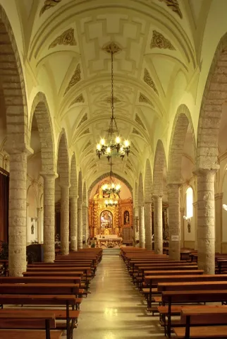
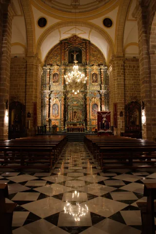
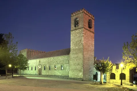
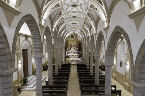
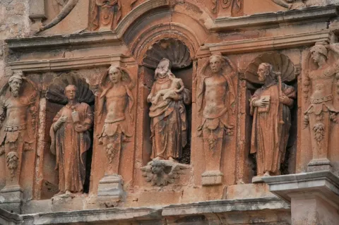
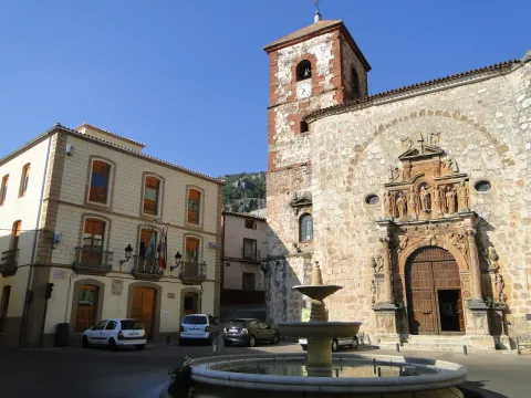
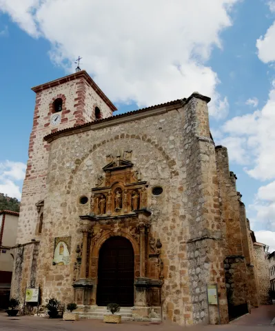
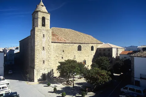
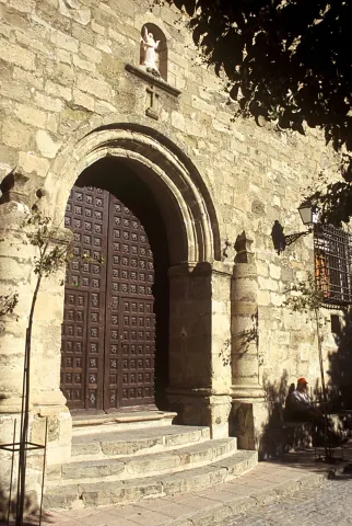
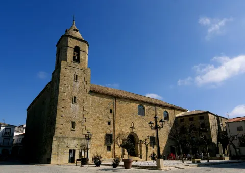
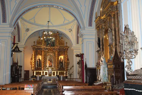
  • The Church of St. Andrew. It dates from the 16th century and is located in the historical center of the town. It rose on the pillars of the ancient medieval fortress, from which two of the four original towers, attached to the temple, are preserved, perfectly synthesizing the military and religious architecture. It has a mixture of different architectural and artistic styles: the Renaissance, Gothic baroque and classicist, due to its long construction. On top of the main door, which is of a classicist style, we observe a hornaine that contains the image of St. Andrew and that crown a half-point arch. Inside it consists of a single ship with side chapels that are linked through half-point arches on a ledge that runs through the temple. The major altarpiece is baroque. It has been declared Good of Cultural Interest and Spanish historical heritage.

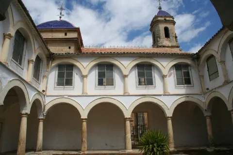
  • Convent of Santa Ana. It is located in the old town. It was founded in 1540 and from the beginning became one of the most important of the Four Villas. In the walls of the refectory, the 16th century wall paintings and the shield of Santo Domingo are preserved. Inside is the church of Santa Anawith baroque altarpiece and a courtyard with Renaissance arches.

  • The church of the Vera Cruz. Built in the 16th century, with a Renaissance style façade. It consists of one ship in two sections, with chapels on each side. In its interior we find an extraordinary size of the Christ of the Vera Cruz, work of Mariano Benlliure, which replaced the primitive image stolen during the civil war. Rest on an extraordinary 1899 silver cross. The Christ of the Vera Cross is the patron of the town.

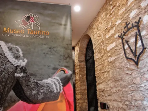
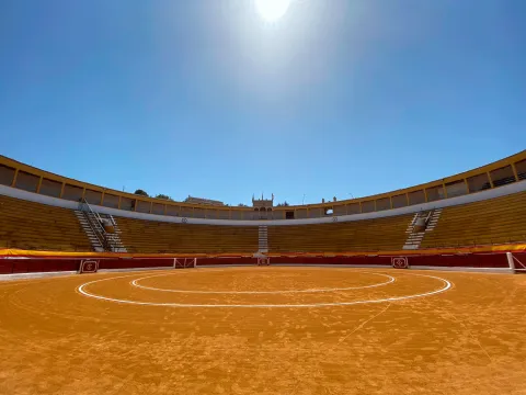
  • Toros Square. Built in 1928 it is neomudéjar style, where the use of brick and horseshoe arches that provide originality and elegance stands out. It is one of the largest bulls in the province, has all the necessary services and capacity for 6,000 people. The interior of the square houses the Taurino Museum of Villanueva del Archbishop.

  • Sanctuary of the Fuensana. It is of Romanesque style and was founded in the 13th century. It has subsequently been reformed. Because of its construction and the existing matacans it is considered that it was first a defensive fortress. Here is the image of the patron of Villanueva of the Archbishop, the Virgin of the Fuensanta. It has been governed by the Trinitarian religious order since 1884. The patron's holiday is held on September 8.

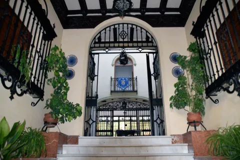
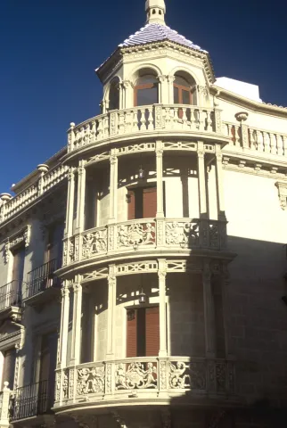
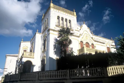
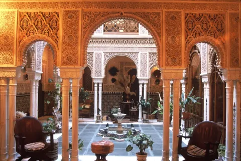
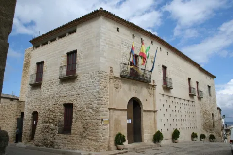
  • House of the Arches. It was built in 1928. With Renaissance lines on the fronts, they are combined with the baroque filiggranes of the bars and the Andalusian ceramics that kill the facade. It is chaired by six arches crowned by so many other ceramic vases. Its courtyard is a Nazi replica that imitates the palaces of the Alhambra. This building received the provincial beautification award.

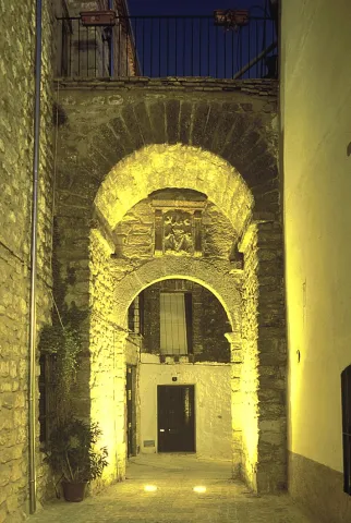
Other heritage monuments: Hermitage of Jesus of the Mount, Hermitage of Saint Blas, Viaducto / Old railway way. The municipality is splashed with lordship houses like the Palacete de la Familia Cosano, Old Casino or Commercial Circle, House of the Arches, House of the Vélez Family or Sagrada Familia Palaceamong others.

Naturaleza

Villanueva del Archbishop is one of the four villas that, together with Villacarillo, Iznatoraf and Sorihuela del Guadalimarthey make up the region called Las Villas.

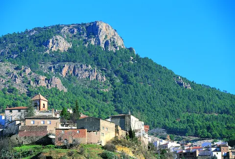
A town where there are many sites of extraordinary environmental and landscape value that are the gateway to the fascinating Sierra de las Cuatro Villas.

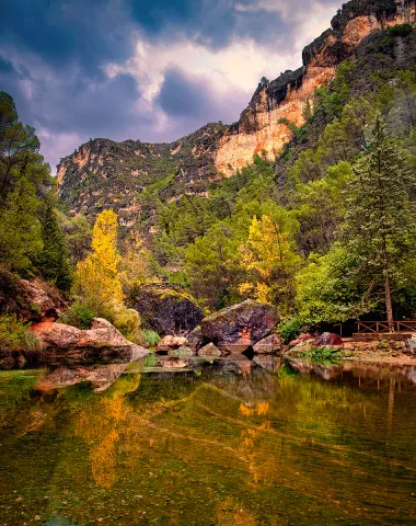
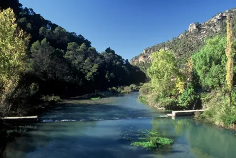
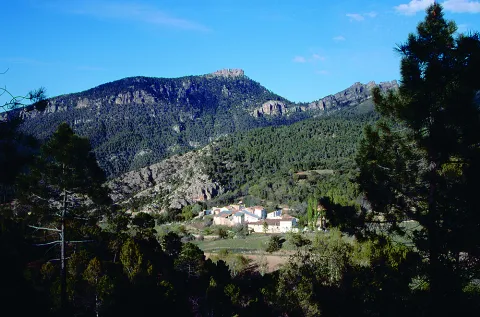
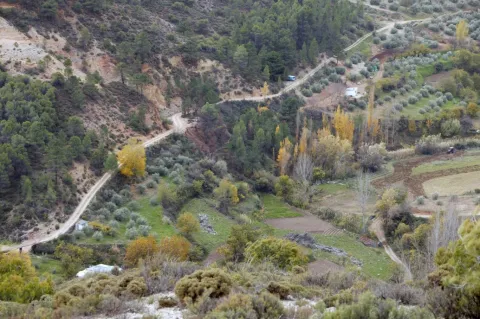
By its municipal term the rivers run Guadalquivir and Guadalimarwhich add beauty to the landscape, wealth to both vegetation and fauna. Surrounded by a sea of olive trees and cereal fields, part of its territory is included in the Natural Park of the Serras de Cazorla, Segura and Las Villas.

It is one of the localities where the vegetation has a greater variety, along with the species of the Alta mountain, such as the laricio pine or the acebo, coexist with other species that develop at a lower height, such as the black pine, the tejo or the boj and with those that develop in the lower area: melojo oak, the oak, the oak, the cucumber, olive trees, and other endemic and aromatic plants.

To this vegetation we will add the one that develops on the banks of the rivers: chopos, willows, mumberas, tarais...

The fauna, in line with the plant variety and the many habitats in the term, is also abundant and diverse.

To the raptures and scavengers of the mountains, eagles, broken bones, lethonated vultures, are joined the species, both of major hunting, deer, maflon, boar; as of minor hunting, rabbit, hare, parrots, gits, badges, kernels...

Without forgetting the typical birds of the olive tree, which either live in it, or feed on the migratory movements: curuca, verderon, zorzal, petirroja... Nor fail to mention the fauna of the rivers of crystal waters in their high courses: trout, barbo, nutrites, salamandra... Just like reptiles and amphibians.

A privileged world where Nature is the main attraction of these lands. Nothing better than to discover it in one of the many places in municipal terms, we will point out two recreational areas and have good accessibility:

  • The Charco of the Pringue or Charco of the oil. Located about 20 km. of the city centre, is a recreational area that has a water remnant in the same river Guadalquivir. It has a wall and a gate, which allows to empty it completely. The water outlet is a roundabout, which in addition to continuously renewing the water from the remnant, serves to allow us to pass from one side to the other of the river. The name so curious, is because they tell that a donkey loaded with pear of oil precipitated from the narrow upper path and fell into the remnant, stained with oil water.
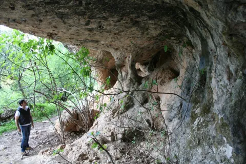
  • Cueva del Peinero. It is one of the most abrupt and steep places in the park. Its natural exit is the impressive throat where the river runs Avocados Grande, cThe crystal clear waters descend into successive waterfalls. On the contrary, in the recreational area, the river is sorely and silently spread between the thick vegetation of willows, chopos and nozzles. The huge lanterns that close the site rise more than 600 meters, forming scalated poyos covered with fully virgin vegetation by the difficult access. It tells the tradition that this cave was inhabited in the summer by a craftsman who was dedicated to making boj wood utensils, very abundant material in the area, and among other objects, made hair combs.

Fiestas y Eventos

The main parties in Villanueva del Archbishop are:

  • San Antón. January 17. They turn on "luminaires" in different places and the neighbors gather around drinking the traditional artisan wine.
  • San Blas. It is held on February 3. This day the villanovens come to the hermitage of the Holy, lighting a lumnaria around it and celebrating the tradition of passing the garrot through the throat so that San Blas will protect their health throughout the year.
  • Holy Week. Living representations are held dating back to the 17th century. They stand out for their realism and expressiveness. The different cofradies and cofrades process throughout the week. It has a great heritage in sizes and images that represent the passion of Christ.
  • Festivals of the Christ of the Vera Cross. These parties are held in the days before and after May 3. On that day, the Christ goes out in procession through some streets of the town and blesses the fields in the era of the Virgin of the Head. Verbenas and cultural activities accompany religious acts.
  • San Isidro. It is celebrated on May 15 and is the patron of farmers. In the parish of San Andrés The Eucharist is celebrated, followed by a procession with the Holy one on the streets, accompanied by tractors, agricultural machinery, horses... And at the end of the day a sisterhood meal is held.
  • San Fernando. It is held in Gútar May 30 with a traditional Eucharist, meals, drinks and verbena.
  • Corpus Cristi. The streets of the procession tour are embellished with flowers, carpets, paintings, plants to magnify the passage of Corpus Cristi. End of May, early June.
  • The Night in White. In July, with increasing demand and participation, a cultural night is celebrated: theatre, guitar, music bands, little children, dances... A very cultural and emotional night.
  • Festivals of Our Lady of the Fuensana. Between 7 and 11 September, the great days of Villanueva del Archbishop take place. On the 7th and 8th, in the morning, the procession and the traditional Romeria are held in the vicinity of the Sanctuary. From that day on the party is moved to the city centre with taurino shows, concerts and lots of activities. The final clasp put it, the last day, the fireworks.
Gastronomía

The gastronomy is traditional and varied, highlighting these dishes:

  • Cod onions, Cod stew, potatoes and onion.
  • Ajoharina, tomato saffrito, potatoes and eggplants with red pepper, garlic, cumins and water. Add flour to thinner.
  • Whites, salty, hard and crispy cakes accompanied by tomato and raw beans.
  • Garlic, rice with chopped onion, pig blood, butter and fences.
  • Gachamita, potatoes, garlic, oil, flour and water.
  • Other: Pipirrana, crumbs, gachas, "sleeping" cakes.

Warehouse:

  • Drunk, mass of flour, roasted olive oil, spirits, lemon, cinnamon and sugar.

Typical drinks:

  • Membile or fig liquor, crow, misteland traditional came from San Antón.

Historia

In the Arab era, Villanueva del Archbishop, was one of the fortresses that reinforced the village of Iznatoraf. It was a village like a few inhabitants, called "La Moraleja." The Arabs who lived in those places chose it as a leisure area, where horse races were organized and the artisans set up their workshops.

After the conquest by Fernando III of Iznatoraf, the village of "La Moraleja" was donated by the king, in the early 13th century, to Cazorla's advance.

The town as such in 1396, thanks to the request made by the Archbishop of Toledo to King Henry III, who granted him a Letter from Privilegio which is preserved in the Town Hall of the Villa. By this Charter the city was founded with all the privileges possible at that time: market, police and cessation of the payment of taxes to Iznatoraf. But an obligation was imposed on him: to lift a wall with two doors and to close the city in five years.

The municipality became the most important core of Señorío de Cazorlawith several flour mills on the Guadalquivir River.

Miguel de Cervantes lived for some time in this village as a tax collector.
Why did the municipality get this name? Villa, for the title given; new, because until that moment it did not exist as such and Archbishopin honor of Mr Pedro Tenorio, who was called the ecclesiastical office.

The city was moving forward and Philip II granted him criminal jurisdiction in 1573.

During War of IndependenceThe people became a refuge for guerrillas who harassed the French troops. As a result of these events, some convents were damaged and the Charter of Privilegio disappeared. After many years she appeared in Linares, she was restored and kept well guarded in the City Hall because she is the oldest document we have.

In 1920 he received the title of City from King Alfonso XIII.
Loading map
Preparing points of interest and routes...
Imagen principal
imagen
Image
Villanueva del Arzobispo
Imagen principal
Activado

Vilches

Submitted by brandcode_deweloper on
Id
787264
Perfil de redes sociales
Facebook
https://www.facebook.com/profile.php?id=100068958337736
Descripción
Breve descripción

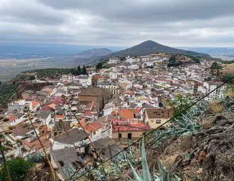
Vilches is a municipality located in the north of Jaén, in the district of El Condado, located in the foothills of Sierra Morena. The pedanias of Guadalén and Miraelrio are also part of it.

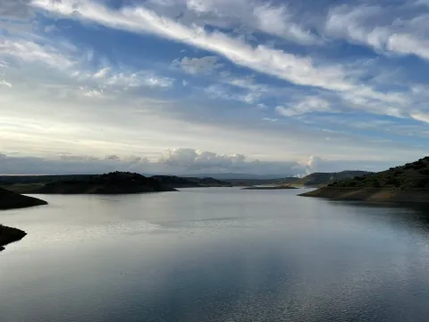
Its municipal term is crossed by the Guadalén, Guarrizas and Guadalimar rivers, which pour their waters in the reservoirs of Guadalén, La Fernandina and Giribola, respectively.

Its varied landscape has great tourist potential, highlighting its areas of environmental interest, reservoirs, oak dehesas, extensive olive trees, farmland, not forgetting its cynetic and fish resources.

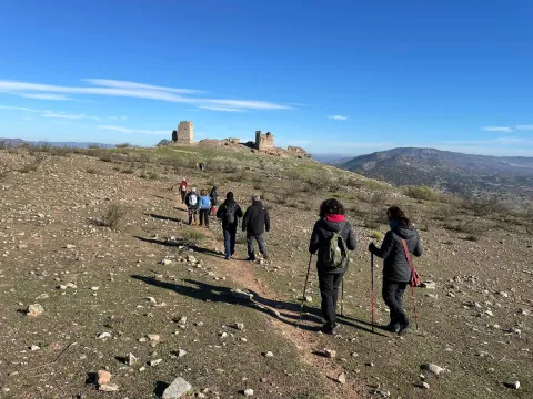
The historical-artistic heritage is relevant. The church of San Miguel, the hermitage of the Virgin of the Castle, the remains of the castles of Vilches and Giribola, belonging to the Route of the Castles and the Battle of Jaén, and archaeological sites such as Giribola, of Iberian times, are highlighted.

Telecomunicaciones
Teléfono
953 63 00 75
Sitio web
www.turismovilches.com
Correo electrónico
turismo@vilches.com
Ubicación
Nombre
Vilches
Latitud
38.211660
Longitud
-3.512960
Distrito
Municipio
Ubicación en el mapa
POINT (-3.51296 38.21166)
Imágenes
imagen
Image
c4eb1866-6864-211d-8b8d-5d6240b72c0e?t=1687277240860
Imagen principal
Desactivado
imagen
Image
e203e5aa-0c7b-55bc-bb18-7f2ad2a50893?t=1687277240664
Imagen principal
Desactivado
imagen
Image
36f5d348-3269-39d2-d70f-6d5b005c43c2?t=1687277240761
Imagen principal
Desactivado
imagen
Image
61e83072-e72e-55d4-da7b-2cbab669b212?t=1585852470283
Imagen principal
Desactivado
imagen
Image
b8aaede2-095b-503f-349d-1f204fe0ddee?t=1687277240934
Imagen principal
Desactivado
imagen
Image
de02a0ed-f04e-7e2f-c703-d8c7d6baea37?t=1687277240590
Imagen principal
Desactivado
Imágenes cabecera
imagen
Image
Vilches
Imagen principal
Desactivado
Datos de interés

Tourist area: Sierra Morena / Sierras de Andújar and Despeñacolos
Distance to the capital (km): 80
Altitude over sea level (m): 543
Extension (Km2): 273
Number of inhabitants: 5086
Gentillo: Vilcheños
Postal code: 23220

Videos
Video file
Cultura

Its artistic heritage includes:

  • Church of San Miguel Archangel, This church dates back to the last third of the 16th century. The main cover is simple and with a half-point arch. It appears decorated with a stone shield made of quarry, typical of the Renaissance and Spanish mannerism. On a side it has a cover with a tile image of the Virgin of the Castle. The tower is of rectangular floor, which is unusual, and with relief decoration of the bell tower, similar to work in brick. The interior is one-ship and at the bottom is a half-barrel vault with the arms shields of Bishop Calderón. The majestic baroque altarpiece of the 18th century, the work of sculptor Diego de Briones, the chapel in which the so-called "trophies" of the battle of the Navas de Tolosa are kept (1212) and, in another chapel, a canvas of the Final Judgment are kept.
  • Ermita- shrine of the Virgin of the CastleHe rose in the 18th century on the ancient church of Santiago, at the top of the hill of the castle. It houses the image of the patron of Vilches, who every August 14, on the occasion of the holidays in his honor, is brought down in procession to the parish of San Miguel.
  • Vilches Castlelocated on a high hill to which it gives name and from where you can enjoy a wonderful view, is the castle of Vilches. A fortress castle that played a very important role as a point of defense of the high Guadalquivir, served as a refuge for the inhabitants of the environment in the face of the advance of Christian troops during the Reconquest and starred in famous war episodes, in the Middle Ages, between Arabs and Christians. Although we know that the hill has been populated since the time of the Iberians, the origins of the castle are uncertain. There are only a few remains of the fortress: a esquinero turret, known as "Cube de la Villa," part of another turret and a passage with a slightly pointed vault of armchair. With the passage of the years and the consolidation of Christian culture, much of the towers and parts of the walls of the castles were used to build small churches and hermitage. In the courtyard of arms the church of Santiago was built, on which the hermitage of the Virgin of the Castle was later built. It was declared Good of Cultural Interest in 1985.
  • Archaeological site of Giribola. It is an archaeological site of great importance located in the confluence of the Guadalimar and Guadalén rivers, from where you can enjoy excellent panoramic surroundings. From what has been known so far, it is known that it was home to an Iberian city, which some scholars associate with Orisia, which was destroyed in the Second Punio War, a prehistoric sanctuary, a Paleocrist or Visigode cenobium and a Almohad castle built after the battle of the Tolosa Navas.
Naturaleza

TheNorthfrom the term Vilches extends through Sierra Morena, with altitudes reaching 800 m. The vegetation in this higher part is very varied and is associated with the Mediterranean forest: encinars, alcornocals, complaints. There are also shrubs and areas of wood pine plantations.

More to Southin the foothills of Sierra Morena, with altitudes between 400 and 500 m., the adhesitated surfaces and pastures predominate. With a soft orography of constant undulations, where the olive grove predominates and we also find low mountain with acuchals and madroños.

Here live numerous animal species, such as birds, mammals and arthropods, easily observable in their natural habitat.

Thewet areass are around the reservoirs(Guadalén, Girirbola and Fernandina), in theriver banksGuadalén, Guadalimar and Guarrizas. The banks of the rivers and streams welcome mimberas, tarays, adelfas and other tree species such as the white chopo or the black Alamo.

The reptiles abound, highlighting the populations of theleprous galapagoin the rivers Guadalén and Guarrizas, as well as theViper de Latastein the Sierra. They will also be easily observable fishing and real eagles, common and black vultures, royal owls, lynches, gines, badges, etc.

Fiestas y Eventos

Vilches is a municipality of deep-rooted traditions, with popular celebrations, both religious and profane, that take place throughout the year and with activities for all ages.

  • San Antónwhich is held on 17 January. The streets are filled with bonfires of olive branches, which come from the pruning of these trees, to honor the pattern of the animals.
  • San Sebastián, Vilches pattern, which is held on January 20. That day the saint leaves his hermitage to process the streets.
  • Carnival parties, in which the neighbors participate, in which they dress up and sing mockery cokes (the City Council awards the best). They take place in the Caves del Zahaní district.
  • Holy Week. A week marked by religious acts and processions from Palm Sunday to Resurrection Sunday.
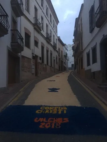
  • Festival of Corpus Christi. After Mass, in the church of St. Michael, the Lord will take a tour of the people accompanied by children of first communion. It is tradition to paint the streets using multi-color sawdust to reproduce allegorical drawings to the day of Corpus.
  • Saint GregoryOn May 9, in the neighborhood of the Mesones, a mass is held in the church of St. Gregory. At the end of the day, the rosses of blessed bread are distributed and the image of the saint is moved to the church of San Miguel.
  • Patrons in honor of the Virgin of the Castleon the 14th of August the transfer of the patron from her hermitage to the parish is carried out, remaining there until 8 September. The next day, on the 15th, the Holy Mass is celebrated in his honor and the floral offering. The festivities will last five days, in which there will be sports events, enclosures, capeas, gastronomic samples and popular verbenas.
  • The Vilches bell-bearers, they are a gang of Vilcheños who, when Christmas comes, go through the streets, singing their stanza. They sing ancient and villain senses. It is a tradition in which Arab reminiscent is observed, both in its melodies and in its stanza. The song is initiated by a soloist and the chorus chorus. The accompaniment is very unique: guitar, bandurry, laud, bell, triangle, Spartan alpargata, plow, wooden drawer, almirez and saucers.
Gastronomía

Vilches is a municipality very fond of its traditions and this is also reflected in its gastronomy. Meat obtained from hunting is often used to make its dishes.

We highlight among the best known:

  • The harls, a hare stew, flour, tomato, onion, olive oil and pepper.
  • The countrysideA stew with hare and potatoes.
  • The brain, on this dish is cod, with onion, tomato and olive oil, which takes the lead.
  • The crumbswhich consists of bread, garlic, olive oil, all accompanied by some products from the slaughter of the pig.

From the pastry shop we want to highlight:

  • PapajotesIt's traditional sweet. This dessert is consumed at breakfast or at snack, and is one of the most widespread sweets in the province.
  • Sweet peas for the Day of All Saints.
  • Tickles, drunks and flowersHoly Week.
  • Bake and bread with matalauva in San Gregorio.
Historia

In the municipal term of Vilches, about a hundred archaeological sites have been invented. From the Copper age the field of Santagon. The occupation of this settlement had to end at the beginning of the Bronze Age, when the consolidation of metallurgical activity and the fertility of the surrounding lands involved the emergence of small villages in the area, some of them fortified, such as the Cañada de Malaguo, Giribola or Cerro Santo. This settlement has the novelty of having a large defensive tower.

In the Iberian stage, GiridanceThe metallurgical centers were controlled from here. The town has an urban layout defined by streets, houses and public areas, delimited by a large wall. From this Iberian period, many settlements and small fortifications have been invented, including the first occupation of the castle hill.

In the Roman times Vilches is identified as BaesucciAccording to a stone located on the hill of the castle. The Emperor Vespasian granted him the title of municipality. In Santagon, remains of ancient villas with mosaics have been found in the noble areas.

Also the people Visigode He settled in Vilches. A visigode architrabe has been found and is preserved in the Jaén Provincial Museum.

It's in the Islamic period when the current Vilches site is consolidated, being occupied from 711. It was part of al- Andalus for five centuries, from the first years of the 8th to the 13th century. This long period makes Vilches a typical Muslim cityfrom which we can guess vestiges today. As the 12th century progressed, the castle of Vilches became very vulnerable by the proximity to Despeñacolos, where the Spanish-Latvian troops practiced acts of harassment over the possessions of al- Andalus.

In 1212, the Christian kings of Castile, Aragon and Navarra, beat the Muslims in the the battle of the ships of Tolosa. Three days later, the castle is conquered and the population exterminated, which will force this area to be repopulated with inhabitants from beyond Sierra Morena. The Christians will stay in the Vilches castle And the Muslims will return to Giribola.

It will be King Fernando III who gives up the territory of Vilches to the Council of Baeza, until Felipe IVin 1627, release him and grant him the The title of Villa.

The number of Vilches with railway station, already in 1900.

Loading map
Preparing points of interest and routes...
Imagen principal
imagen
Image
e2fdf917-2e2c-2a08-49fc-21c32566e218?t=1687277240494
Imagen principal
Activado

Orcera

Submitted by brandcode_deweloper on
Id
749362
Perfil de redes sociales
Facebook
https://www.facebook.com/ayuntamiento.orcera/
Descripción
Breve descripción

Municipality belonging to the region Sierra de Segura, within the Natural Park of the Serras de Cazorla, Segura and Las Villas. Eminently forest and full of landscape attractions.

This municipality has the particularity of to be divided into two enclaves: one south-eastern, in which is the town of Orcera, and one in the north-western area of the region, bordering the province of Ciudad Real.

The cultivated land are in the west of the municipal term. The town is hidden in the skirts of Mount Peñalta, with an urban interiors and an excellent medieval town.

Economic activity It depends on the olive grove, the oil industry, the hunting, the forest and the tourism, as it is the gateway to the Natural Park of the Sierras de Cazorla, Segura and Las Villas.

Among its historical heritage we highlight: the Parroquial Church of the Assumption, the Towers of Santa Catalina, The fountain of the Chorros and its Old Town, among others.

Telecomunicaciones
Teléfono
953 480 154
Sitio web
www.orcera.es
Fax
953 480 155
Correo electrónico
ayuntamiento@orcera.es
Ubicación
Nombre
Orcera
Latitud
38.318020
Longitud
-2.661050
Distrito
Municipio
Ubicación en el mapa
POINT (-2.66105 38.31802)
Imágenes
imagen
Image
4d801f2d-0fbe-80cd-e9b3-da943df1b529?t=1621271852271
Imagen principal
Desactivado
imagen
Image
7564df32-691f-5fe6-5772-200271f90ab8?t=1596037186672
Imagen principal
Desactivado
imagen
Image
a3ef91bb-6788-aeb3-3ce1-52c63c6a049b?t=1596037276689
Imagen principal
Desactivado
imagen
Image
93ea953b-b7fb-00f7-6751-442e27f9d852?t=1621271784259
Imagen principal
Desactivado
imagen
Image
4b2b369e-2226-4eec-d0a4-6c1aa7068997?t=1596037329344
Imagen principal
Desactivado
imagen
Image
adf5b266-0623-263e-e83e-858b83feb20b?t=1603729407461
Imagen principal
Desactivado
imagen
Image
67588f5f-1456-f1f3-2a99-9ff944435ff8?t=1603729570170
Imagen principal
Desactivado
imagen
Image
6b96b240-e7be-da17-68df-cbe38bd19e5b?t=1621271852323
Imagen principal
Desactivado
imagen
Image
49fdaa46-c7f3-a242-9a12-4c6be0414434?t=1621271852458
Imagen principal
Desactivado
Información adicional
Curiosidades

C/ Joaquín Payá, s/n

Imágenes cabecera
imagen
Image
Orcera
Imagen principal
Desactivado
Datos de interés

Tourist area: Serras de Cazorla, Segura and the Villas

Distance to the capital (km): 151

Altitude over sea level (m): 797

Extension (Km2): 126

Number of inhabitants: 1,894

Gentillo: Orcerners

Postal code: 23370

Videos
Video file
Cultura
  • Church of Our Lady of the Assumption. It began to be built in 1530, finishing the works in 1570. The building is of a single ship divided into three sections that separate semi-columns with half-point arches covered with Gothic-style starvaults.
  • The major chapel also covered with a starry cross vault is accessed to it through a half-point backbone. It has side chapels.. The most important thing who owns is his magnificent mannerist coverfrom the ancient monastery of Santa María de la Peña. Data from last third of the 16th century and it is divided into two bodies: in the first one the arch door of half point is opened framed by Corinthian columns, with allegorical figures in the shrouds; in the upper body, a triple hornaine and the whole is removed by a triangular fronton divided with pinnacle. The tower is settled on a torreon of the primitive castle Medieval, it is quadrangular and consists of two bodies and bell tower, with soga and tendon reinforcements at the highest corners. On one side it has a magnificent window with a half-point arch on jambas caried between menillas, crowned by a triangular fronton. The other window displays in its half-point arch a whole decorative program: highlighted plates, cherubim in the key or semidesnude figures. This element is completed by lateral clumps. It was declared Good of Cultural Interest in 1985.
  • Fuente de los Chorros. Monumental source made of stone and brick, perhaps at the end of the 18th century. It is made up of a somewhat irregular silical frontis, in the central part of which two half-point arches and a triangular fronton that in its center carries a shield. They remove the fronton three pineapples, one at the vertex and the other at the ends.
  • Torres de Santa Catalina. Situations across the river OrceraWe see three Muslim towers dating back to the 12th century, when the advance of Christian troops required a strengthening of defensive structures. These atalayas and the one that rises in the church square, and that makes as the bell tower of the temple, will constitute the defensive line of the house. They have been declared Good of Cultural Interest.
  • Old helmet. Posee Orcera a medieval neighborhood who resist the vicissitudes of times. The old town of the population is perfectly adapted to the medium, with narrow alleys, intricate and unmistakable Islamic regent. The houses are built with slimmed masonry walls, and complicated asymmetric volumes, low height, original chimneys and Arab roofs.
Naturaleza

The municipal term of Orcera has 126 km2 and has the particularity that it is found divided into two enclaves:

  • The South-East enclavewhere the main population of the Orcera and is located within the Natural Park of the Sierras de Cazorla, Segura and Las Villas.
  • The second sector is in the North-West of the region, bordering the province of Ciudad Real in the foothills of Sierra Morena.

Orceradue to its location in the largest Natural Park in Spain has many picturesque areas and interesting placesincluding Armujus, with a huge river pool, The Straits, Cascade of the Hueta, Orcera Lagoon and Wood River.

The population centre is 795 m above sea level, on the hill of the Villares.

  • Key area:Its eastern part is very accidental from the orographic point of view, concentrating here the highest heights of the municipality: Peña Blonde (1625 m.), Engarbo (1595 m.), Navalhora (1419 m.), Los Villares (1209 m.) With a surface of 70 km2 is made up of forest mass (pineapples) and crossed by a warlike Wood River. The western part is the area of the valley, vertebrated by Orcera and Trujala rivers. Being the first tributary of the second, and this in turn, of the Guadalimar River. It is the most populated area of the municipality where the town's town centre and its villages are located. Here they concentrate. agricultural land, highlighting the olive tree, followed by cereal and orchards.
  • Northwest enclave:It is located to the northwest of the region, in the left bank of the Guadalmena River, which makes the border during a good stretch of the province of Jaén and Ciudad Real. It has a extension of 50 km2.The landscape is different from that of the other enclave, formed by shrubs, pastures, burning and scattered pine. It's a lower one on the mountain. The Marañosa (846 m.) maximum height.

Population is concentrated in the main core or municipal capital, the rest does in small villages or villages: La Hueta, La Marañosa, Linarejos, Los Arroyos and Valdemarin. Some of them, like Linarejos, are completely abandoned.

A space with many ecosystems in which infinity of species that make up rich and varied fauna:: from the rapacious birds, the carrionies, the cynetic species, both of major and minor hunting, the fish, amphibians, reptiles, as well as the characteristic fauna of the riverside vegetation that exists next to the stream and river.

No doubt, a true paradise where nature seems to be recreating. It is almost compulsory to make direct contact with one of the wonderful places that this territory hides, where in addition to observing "in situ" both vegetation and fauna, we can enjoy a fabulous panoramic view of the mountains and the jienese countryside.

Fiestas y Eventos
  • La Candelaria, February 2. This holiday has always been commemorated in Orcera. The celebration consists of a day of coexistence in the area known as The Convent. The typical snack of that day is "the Candelaria or Hornazo Rosca," that carries a hard egg in the center painted in colors. They also sing and dance a series of popular songs.
  • Holy Week. It's curious the custom that takes place on Good Friday in the procession of the Meeting, with the steps of Jesus of Nazareth. The Roman squadron that escorts Jesus of Nazareth prevents the procession of the Virgin of Soledad from approaching. At that time, an angel-dressed child will recite verses requiring soldiers to depose their attitude.
  • San Isidroon May 15. It has been held since the middle of the last century. A Mass is held in honor of the Holy and once finished, the gilded carrots for the occasion begin the way to the place known as Armujoaccompanied by all the orchards who wish to. It is tradition to distribute and consume a "crow."
  • Patrons in honor of Our Lady of the Assumption. These parties take place in honor of your patron from 10 to 15 August. They have a wide range of activities, including religious acts, pregon, verbenas, concerts, championships and traditional "cobblestones." One of the championships is of the Turkish bowling, the indigenous game of the Sierra de Segura that was almost lost and Orcera has been the pioneer of the resurgir of it, organizing in 1969 the "First Comarcal Championship."
Gastronomía

Orcera participates in the culinary wisdom of the serrana region to which it belongs. The wheat culture is manifested in many of its dishes.

  • Garlic of flour with walnuts: potato, flour, nests, garlic, green pepper, tomatoes, pepper, olive oil, salt and pepper.
  • Ajo-atao: potatoes, salt, garlic, olive oil, egg and vinegar.
  • Andrajos: saffrito of tomato, garlic, hare or mountain rabbit, mint and "the rags," homemade pasta made with water and flour.
  • Ajopringue: a dish of medieval origin, the main ingredient of which is the liver of the cooked, ground and seasoned pig with olive oil, red pepper, garlic, chopped parsley, tomato and miga of bread and all this seasoned with pimenton and saffron.

We must also mention the "roulette crumbs," made from corn flour. Among the products of the pig, in addition to the sausages, we must name the "fried," which is a long and slow frying of swine meat, tomato sauce, roasted peppers and other vegetables such as beans.

In his pastry shop, "The Traps," frying flour and eggs are then cooked in a roasted sugar syrup with orange, matalahuva and saffron peel.

The crow. is a drink made of wine, water, sugar and fruit. It is distributed in most acts as a symbol of brotherhood and hospitality.

Historia

It has been found that during the Neolithic valleys of the rivers as the Guadalimar were very populated, with centers of height like the Cerro de la Atalaya and Peñón Utrero, with abundant fortified remains and lower position sites, such as Cerro de la Coja. The first news we have about Orcera goes back to previous dates the Bronze age. In the Iberian period there is again news of a small occupation, which will increase during the stay of the Romans. Iberian and Roman remains have been found.

In the Islamic period, Orcera It was a small house located by the Orcera River. From the 11th century, and in the face of the danger of the Spanish armies of the 12th and 13th centuries, Orcera and the rest of the houses They raised defensive enclosures.. The three towers of Santa Catalina are preserved in the municipality. It was conquered in 1230 by the alfoz de Alcaraz of the current province of Albacete and belonged until 1258 to this jurisdiction of Alcaraz, going on this date to be part of the Segura Common and their land for a privilege of the king Sancho IV, which is preserved in the National Historical Archive. It will be donated as an Arrabal of Segura to the Order of Cavalry of Santiago, then owner of Segura.

In the area known as the "Convent" there was the Franciscan monastery of Our Lady of the Peña, in which in 1580 the procurators of the villas of the common to draw up "Orders of the Common of the village of Segura and its land," which was intended to save, preserve and manage the mountains of Segura.

These ordinances were confirmed by Philip II and were in force until 1744date on which the Segura Maritime Provincewhose seat and minister were located in Orcera, which was still in the area of Segura de la Sierra. In 1836 this maritime province was abolished, and the following year, 1837, Orcera became independent de Segura de la Sierra becoming an independent villa.

Loading map
Preparing points of interest and routes...
Imagen principal
imagen
Image
Orcera
Imagen principal
Activado

Iznatoraf

Submitted by brandcode_deweloper on
Id
735238
Perfil de redes sociales
Facebook
https://www.facebook.com/Ayuntamiento-Iznatoraf-519195424913359/
Youtube
https://www.youtube.com/channel/UCT7zde11OeQ44D2itW1x3mw
Descripción
Breve descripción

Iznatoraf (also known as Torafe) is one of the most beautiful places in Jaén, one of the highest in Andalusia and one of the most surprising to the traveller. It is located to the north-east of the region of Las Villas and is located on a hill of 1,036 m, as a lookout post over tens of kilometres of olive trees in all directions. The view of the Sierra de Las Villas is spectacular.

It is an almost unique viewpoint to see much of the province and a crucible of cultures (Arab, Jewish and Christian) that have left a rich artistic legacy. It retains its urban layout of narrow, slimmed and winding streets within an Arab-based walled enclosure.

Its term is divided into two separate enclaves: one to the west, where the urban core is located and above all the olive tree; and the other to the east, essentially forest and within the limits of the Natural Park of the Sierras de Cazorla, Segura and Las Villas.

Several are the houses inhabited by the municipal term, such as Batanejo, 15 km away and others like Santa Marina or Sillero, in the Sierra de Las Villas.

Economic activity is the olive tree and the oil industry. Tourism in this region has virtually not developed.

Among its historical heritage are the Church of the Assumption, the remains of the medieval wall with its access doors and the Hermitage of the Christ of the Veracruz, among others.
The old town of Iznatoraf was declared an Artistic Historical Set on May 15, 2012.

Since 2020, Iznatoraf has had the distinction of Flor de Andalucía, with the category of four flowers, given by the Multisectoral Association of the Andalusian Gardening, being the only municipality in Gienese that obtained this qualification. It also belongs to the network of Magical Peoples of Spain, the only people in the province, which unites peoples with charm from various European and Ibero-American countries.

Telecomunicaciones
Teléfono
953 451 507
Sitio web
www.iznatoraf.es
Fax
953 452 492
Ubicación
Nombre
Iznatoraf
Latitud
38.157030
Longitud
-3.032730
Municipio
Ubicación en el mapa
POINT (-3.03273 38.15703)
Imágenes
imagen
Image
e44ccc0f-c0c8-5efb-6379-aaeaec9b5995?t=1595512030295
Imagen principal
Desactivado
imagen
Image
36109a4f-dd90-ee2e-1589-5eec29c2fa9d?t=1618496951759
Imagen principal
Desactivado
imagen
Image
img_9498-jpg
Imagen principal
Desactivado
imagen
Image
1b5bb631-9d13-f9d1-5545-ed0298066094?t=1595512273130
Imagen principal
Desactivado
imagen
Image
97ae8a28-43f2-a8ca-bdf2-26f5097dd6f6?t=1618497158369
Imagen principal
Desactivado
imagen
Image
28e4e19c-3103-3488-ac95-935e087e61b5?t=1618497158473
Imagen principal
Desactivado
imagen
Image
bbd2ff61-a4c0-4bcd-d582-78965f65205e?t=1618497158542
Imagen principal
Desactivado
imagen
Image
6a0fd625-07c8-a8bd-b6a8-e16db69ebff4?t=1618497158595
Imagen principal
Desactivado
imagen
Image
img_9499-jpg
Imagen principal
Desactivado
Información adicional
Curiosidades

Zona turística: Sierras de Cazorla, Segura y las Villas
Distancia a la capital (km): 102,9
Altitud sobre el nivel del mar (m): 1036
Extensión (Km²): 86,47
N° de Habitantes: 960
Gentilicio: Torafejos o torafeños
Código postal: 23338

Imágenes cabecera
imagen
Image
Iznatoraf
Imagen principal
Desactivado
Videos
Video file
Cultura

From its monumental heritage we detail:

  • Parish Church of the Assumption. Data from the late 16th century and early XVII years. In it are mixed the baroque and mannerist styles. Its interior is Vandelvirian, of almost square floor, four large pillars divide it into three ships; the decks are vaulted vaults and of the edge, highlighting in all of them a delicate mannerist decoration that augurs the end of the Renaissance, no doubt traces from the followers of the Master, perhaps Alonso Barba. At the foot of the temple is the choir with baroque silery of great beauty and quality. The sacristy with the shield of Bishop Andrade and Castro is baroque. On the side of the main façade is a body for parish dependencies and its small tower compared to the rest of the building. The church keeps a dazzling wealth. Cartons, rolls and heraldic motifs, but the the greatest treasure is the sacristy and the set of ornaments and liturgical pieces it hosts. It has a table of black marble and abalastro of the 18th century with huge walnut drawers with excellent stems with magnificent Renaissance reliefs, dated in the early years of the 16th century, as well as an important goldsmiths: crosses, custodians, chalices... and liturgical dresses.
  • Walls and Arches. The wall of Iznatoraf was an imposing fortification built in masonry of Arab origin, consisting of eleven fortines and nine doors arches to facilitate the entry and exit of the enclosure, made in irregular masonry and argamase. They are covered with arches of half-point imperfect trace and vertebra the inner space. Some 500 metres of the wall of the ancient Arab fortress, as well as several of the access arches and ten of the eleven towers that were at that time, are preserved. In the popularly known as Castle or house of Ali Menon, We can admire an authentic Arab bass made up of ceramic conductions and, within it, an aljibe. The remains of the The Gate of Arms and the Gate of the Virgin of the Postigo, composed of half-point arches with wooden beams and double brick arches inside, they are among the few such samples that are preserved. The Gate of the Virgin of the Postigo was declared Historical Monument in 1985. From the end of the 16th century, the exits and entrances were carried out through the various doors of access to the intramuro core: Puerta del Campo, del Arrabal..., the latter, also called the Royal Gate, is of Renaissance style, raised in line with the wall, with a half-point arch of quarry on imposts on its outer side and irregular silery as a whole. Inside it, it has a half-canyon vault with a hornacino that welcomes a relief of the Virgin, classicist, framed by small pilasters and cornices, also of irregular silery as a whole. The urban wall of Iznatoraf has been declared in 1985 Good for Cultural Interest.
  • Hermitage of the Christ of the Vera Cross. The hermitage is a religious building built between the 17th and 18th centuries. It was rebuilt in the 19th. Its plant is of Latin cross covered by half-canyon vault, on the cruise it is oval and on the half-orange shrimp with the four evangelists in high relief in the pechines and decorated with baroque-style vegetable motifs. On the outside, swordsmanship and on its cover scarlet arch and smooth jambas.
Naturaleza

Iznatoraf is one of the four villas which, along with Villacarillo, Villanueva del Archbishop and Sorihuela del Guadalimarthey make up the region called Las Villas.

A town where there are many sites of extraordinary environmental and landscape value that are the gateway to the fascinating Sierra de las Cuatro Villas.

By its municipal term the rivers run Guadalquivir and Guadalimar, that add beauty to the landscape wealth to both vegetation and fauna. Surrounded by a sea of olive trees and cereal fields, part of its territory is included in the Natural Park of the Serras de Cazorla, Segura and Las Villas.

It is one of the localities where the vegetation has a greater variety, with the species of the High mountain, such as the larix pine or the acebo, they live with other species that develop to lower height, such as black pine, tile or boj and with those that develop in the lowest area: melojo oak, the oak oak, coscoja, olive trees, and other endemic and aromatic plants.
To this vegetation we will add the one that develops in the river banks: Chopos, willows, mumberas, tarais...

The faunain line with the plant variety and the numerous habitats in the term, abundant and diverse.

A raptures and mountain scavengers, eagles, broken bones, lethargy vultures, the cynetic speciesboth major hunting, deer, muflon, boar, like the minor hunting, rabbit, hare, partridges, gines, badgers, quail...

Without forgetting the typical olive birdswho either live in it, or feed on migration movements: curuca, verderon, zorzal, petirred... The fauna of the rivers of crystal clear water in its high courses: trout, barbo, otters, salamanders... Just like reptiles and amphibians.

A privileged world where Nature is the main attraction of these lands. Nothing better than to discover it in one of the many places in municipal terms, we will point out three recreational areas and have good accessibility:

  • Cueva del Peinero. It is one of the most abrupt and steep places in the park. Its natural exit is the impressive throat where the river runs Huascebas Grande, whose crystal waters descend into successive waterfalls. There is a road with areas of shade, barbecues and drinking water, as well as a forest shelter, which is an ideal starting point for excursions inside the Natural Park. In the recreational area, the river is sorely and quiet between the thick vegetation of willows, chopos and nozzles. The huge lanterns that close the site rise more than 600 meters, forming scalated poyos covered with fully virgin vegetation by the difficult access. It tells the tradition that this cave was inhabited in the summer by a craftsman who was dedicated to making boj wood utensils, very abundant material in the area, and among other objects, made hair combs.
  • Landscape of La Parra. It is a road with shadow areas from where you can enjoy beautiful landscapes; there is a forest house, being an ideal starting point for excursions inside the Natural Park.
  • The place of Jesus of the Mount. The Cañada de la Madera has access to this natural setting, with good views of the park and a well-equipped road with drinking water and a hermitage. In this same place stands the Fuente del Avellano.
Fiestas y Eventos

Among the holidays of Iznatoraf we will highlight the Festivals of San Isidro and the Corpus and those with the most popular roots:

  • Holy Week. Very interesting are the celebrations that take place on Thursday and Good Friday, with representations of passages of the Passion. They have always been characterized by their great simplicity and austerity, being followed with deep recollection.
  • Patrons in honor of the Virgin of the Fuensana and the Christ of the Veracruz. Iznatoraf celebrates its patron parties in honor of the Holy Christ of the Vera Cruz during the first week of September, being the afternoon of day 3 when the Holy One is honored with the image procession.The day 7 is celebrated the rosemary in honor of the patron, in the splanade of the Sanctuary of the Fuensanta. The next day has place la procession of the image of Our Lady of the Fuensana, Patrona de las Cuatro Villas y Señora del Olivar. Many cultural, sports and playful activities are planned. Among them, the most successful are the nocturnal cores of raves, who go through the streets of the population. These bulls are the only ones in the province who have the privilege of being nocturnal, this is due to their great tradition, for after the conquest of the king, Fernando III, he authorizes his parties with the cumshot of braves.

Gastronomía

It shares its traditional cuisine with which it is unique to the region of the Four Villas to which it belongs, but it stands out the products that are obtained from the traditional slaughter of the pig, being the "chickenpox" The most characteristic.

  • "Kale-hole.". It is made of fried onion, cooked rice, abundant garlic, spices, undisturbed pork butter and the blood of the pig. It takes hot with tender bread.
  • "Pipirrana". Made of cooked potatoes, dried peppers and fried fried, oil, garlic and salt.
  • "Chickpeas with muffins". They are chickpeas with meatballs made of bread, garlic and chopped parsley. It's like Holy Week.
  • "Tarrafeña". It's a way to prepare the rabbit in sauce. The name can be a phonetic deformation of the word "Torafeña" or "Torafeño," which is what is known as those born in the municipality.

In pastry shops:

  • "Wind coffins.", of hollow interior, which demonstrate the Arab presence in the origins of its kitchen.

Historia

Although discontinuous in time, the settlement is very early in this area. The first evidence of occupation in Iznatoraf dates from the Bronze Age (II millennium BC). It's supposed to have, like, to control the road to the mines of Sierra Morena.

The human presence continues to the Iberians since the 6th century BC, perhaps with a small atalaya. The plateau would then function as an oppidum in the Iberorroman period and it is also known of the visionary military population thanks to the archaeological finding of pieces of this period.

In Muslim times, the Torafeño enclave expands south, covering the rest of the plateau. Possibly in the 11th century and above structures an important defensive square was erected with its walls and alcázar, as a system of protection of the inhabitants of the environment, thus increasing the strategic value of the enclave.

The name of Iznatoraf is of Arab origin and refers to its wall ("Castle of the Way" or of the Street). As in other cases, it was not conquered by weapons but by negotiation.
Its narrow streets and its solid fortification, speak of the military importance it had to have.

In 1235 Fernando III obtained possession of the villa, granted to Iznatoraf, once repopulated, of Cuenca and their lands are declared realingoIn other words, it is not given to any master or military order or to the Church. From this moment on, the walls are reinforced and the castle is erected, the residence of the authority and now disappeared.

But this lasted for a short time, because Alfonso X, in 1252, gave the place to the Archbishop of Toledo, thus becoming part of the Cazorla's advance.

With the advance of the Reconquista, it loses military importance, but it becomes a strong economic center, to such a extent that the population overflows its walls and is established outside them, leading to the growth of the populations around it. Thus, La Moraleja becomes a village and is renamed Villanueva del Archbishop in 1396, and in 1450, Archbishop Alfonso Carrillo independence the Tower of Mingo Priego which will take the name Villacarillo.

In 16th century the municipality is head of the arzimortamiento and the construction of the church of Our Lady of the Assumption begins.

For a long time the history of Iznatoraf is that of an agricultural villa that knows a certain prosperity by highlighting its oil production.

Loading map
Preparing points of interest and routes...
Imagen principal
imagen
Image
Iznatoraf
Imagen principal
Activado

Castellar

Submitted by brandcode_deweloper on
Id
727183
Perfil de redes sociales
Facebook
https://www.facebook.com/excmo.ayto.castellar
Twitter
https://twitter.com/aytocastellar
Instagram
https://www.instagram.com/ayto.castellar/
Descripción
Breve descripción

Castellar is a municipality in the north-eastern part of the province of Jaén. It is located in the central part of the district of El Condado, between the mountain ranges of La Loma and Sierra Morena.

The crops occupy more than half of their municipal term and are located to the south, where the olive grove predominates, although the Vega del Guadalquivir gives rise to horticultural, industrial and forage crops. The main activity is in agriculture and in particular in olive farming.

This municipality has witnessed the passage of millennial cultures that have left its mark. The rupestre sanctuary of the Cave of the Lobera where remains of the Iberian era have been found, and the 17th-century ex-collegiate Church of Santiago, which has been declared a Historical-artistic Monument in 1983, is noteworthy.

Telecomunicaciones
Teléfono
953 460 005
Sitio web
www.castellar.es
Fax
953 460 006
Correo electrónico
info@castellar.es
Ubicación
Nombre
Castellar
Latitud
38.251690
Longitud
-3.131480
Distrito
Municipio
Ubicación en el mapa
POINT (-3.13148 38.25169)
Imágenes
imagen
Image
62138201-faa9-3c39-b466-c842034c7b2d?t=1617623743189
Imagen principal
Desactivado
imagen
Image
45effd2a-8662-3921-c160-ec621270acc1?t=1594657620241
Imagen principal
Desactivado
imagen
Image
d7ca5134-6c43-1033-5bd4-fd66d29903f1?t=1617623743257
Imagen principal
Desactivado
imagen
Image
e4b3a80e-476d-092c-d0ec-2005f348ffa8?t=1617623743320
Imagen principal
Desactivado
imagen
Image
1303f3fd-29bd-5937-e9a9-722618a26dee?t=1617623743388
Imagen principal
Desactivado
imagen
Image
30b4529e-0e6c-ebd1-44f5-0c366ace828b?t=1617623743463
Imagen principal
Desactivado
imagen
Image
294387e5-91e3-def1-a9b4-48c35ec956b6?t=1617623743578
Imagen principal
Desactivado
imagen
Image
8fedaf5c-26e2-acbd-fc31-3fe132b1125f?t=1617623743638
Imagen principal
Desactivado
Imágenes cabecera
imagen
Image
castellar
Imagen principal
Desactivado
Datos de interés

Tourist area: Sierra Morena / Sierras de Andújar and Despeñacolos
Distance to the capital (km): 110
Altitude over sea level (m): 757
Extension (km ²): 157
Number of inhabitants: 3,654
Gentillo: Castellariegos, Castellarenses or Alcucillas
Postal code: 23260

Videos
Video file
Cultura
  • Former Collegiata de Santiago, declared an Artistic Historical Monument, is a sober construction of elegant proportions dating from the 17th century. In 1692 he was raised to the rank of a collegiate by Pope Inocencio XII.
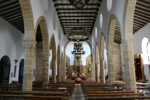
  • The parish Church of Our Lady of the Incarnationsettled on an old Visigode castle rebuilt in the 10th century by the Arabs and whose torreon served as the base of the tower of the present temple. Its interior is protogotic (14th century), but its cover is neoclassical from the 17th century.
  • Palace of the House of Medinaceli, 16th century Renaissance palace, current city hall.
  • The Iberian Sanctuary of the Cave of the Loberalocated 1.5 km. de Castellar, on a rocky ledge that houses caves that were used as houses in past civilizations, is an emblematic settlement of Iberian archaeology. Place known as Altos de Sotillo, numerous bronze exvotes from Iberian times have been found, which can be visited at the Iberian Sanctuary Museum.
  • The Museum of Iberian Art, popularly known as the Museum of the Exvote, it is located within the 14th century tower of tribute, known as the Pallarés Castle. It presents one of the largest collections of exvotes exposed to the public.
  • The House of the Diez Family, is a living-16th century palace of which stands out its plateresque cover carved in stone and topped with an imposing shield.

Naturaleza

The municipal term of Castellar has a very irregular form, in the north-south direction it reaches 39 km, while in the east-west it does not reach 10 km. of a maximum width of less than 0,5 km near the Montizon River.

The northern part of the term, known as Sierra del Oro, is mountainous and belongs to Sierra Morena. It presents the typical Mediterranean forest, steep and pedestal areas.

The characteristic fauna is the same as that of Sierra Morena, in which the cynetic species abound: deer, boars, goos, foxes, rabbits, partridges...

The flora is made up of low mountain and native Mediterranean forest: oaks, juniors, madroños, acuches, complaints...

South of the municipal term, being part of the Guadalquivir basin, extends the valley area, more suitable for the cultivation of olive trees, pastures, forage plants and garden areas.

Fiestas y Eventos

Among the main festivities, we will mention the following:

  • Great Fair, is held in August, from 10 to 15, are its patron parties, in which the bull, with different taurino shows, is the protagonist of these parties.
  • San BenitoOn March 21, the Spanish people celebrate the feast of their patron. This day, the saint, is moved to his hermitage as a form of romance in the midst of different religious and playful activities.
  • Our Lady of Consolation, patron of the town and is held from 1 to 3 May. There is a rosemary with the later transfer of the patron to the town.

Gastronomía

The gastronomy of Castellar is rich and varied, its base being the olive oil.

Its inhabitants presuppose to produce the best triguero or campero asparagus in the province, and prepare them in many ways.

The most traditional dishes are not missing:

  • Calandrajoswith either hare or cod. In other places they are called rags, rags or wink.
  • The Galians, which makes us think this has been a land of transhuman shepherds.
  • "Ajoharina", it's a stew of vegetables, potatoes and flour with pepper.
  • "Ajopringue"and consists of the liver of pig seasoned with spices and "print"either pork butter or olive oil.
  • "Gachasmigas"It's a great breakfast for the men who were going to do a hard job in the field.
  • Other variants, where "garlic" means "crushed": "Burn." and "Hairdresser".

Within the traditional sweetness, stand out the entangled, stained olives, roses of spirit and olive oil, flowers, drunks, papajotes...

The work on olive wood is worth noting.

Historia

The archaeological vestiges located in its municipal term go back to the Neolithic, and one of the most interesting findings is that of the Cave of the Sima, with a collective burial set.

Castellar was an important place in the time of the Iberians, as it was in the territory of the Oretania, and here is located one of the great centres of worship of the Iberians, the Rock Shrine of the Cave of the Lobera, located in the Altos del Sotillo.

From the period of Roman domination there have also been found a multitude of vestiges and settlements characterized as the sites of Campillo and El Dorado.

It was one of the first localities conquered by King Fernando III by the Nazari Muslims in 1226. During the Middle and Modern Ages, Castellar was linked to the Casa de los Benavides. Under his patronage, the collegiate of Santiago Apostolo is built.

This dynasty of the Benavids, would become condes in 1473, and its county comprised three villages: Navas, Castellar and Santisteban. Conflicts between the three localities over disputes over common land membership were very frequent and would continue for a long time. They would be ended in 1978 with the "Scripture of Concord".

Otra información

It should be noted that in Castellar there is an important shellfish factory, even if it seems to be a contradiction for being this town of the earth inside. From this factory, high quality seafood are produced and distributed from the most distant coasts.

Loading map
Preparing points of interest and routes...
Imagen principal
imagen
Image
castellar
Imagen principal
Activado