
Ascent to Pandera
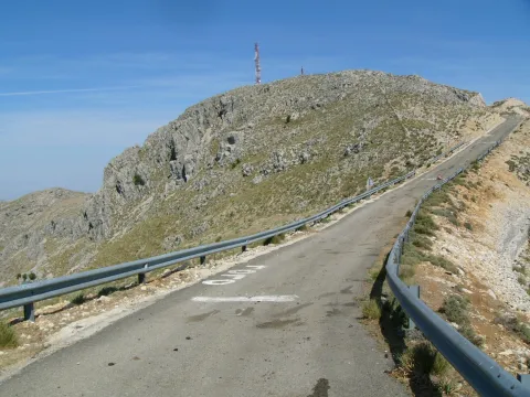
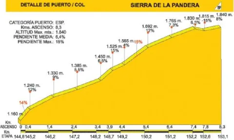
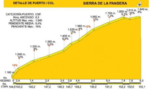
The road that leads to La Pandera, which is accessed from the road A-6.050 Jaén-Valdepeñas de Jaén-Castillo de Locubín, through a detour to the left located at the point of 24,500, is an asphalt and narrow itinerary built to access the military facilities at its top. In recent years it has become a forced quote from La Vuelta Ciclista to Spain, being considered as one of the mountain queen stages. For the first 3 km. We are accompanied by the typical landscape of the Mediterranean forest, with plenty of shrubs splashed by oak trees.
When you reach a quarry, the first important ramps appear, with slopes about 15% changing the vegetation as the altitude rises: lavender, thyme, aulagas, thorn, rosemary, cardo... The road, even in the dark, is becoming more and more difficult and offers the cycloturist the first landscape panorama. The environment is gradually becoming more arid, but the visual basin is greatly expanded and the views of Los Villares, Valdepeñas de Jaén or the capital itself, surrounded by olive fields, are impressive.
The area has abundant snow wells, used until the 20th century, of which snow was extracted that would then be transformed into ice, to be used for medical purposes and as a water revival.
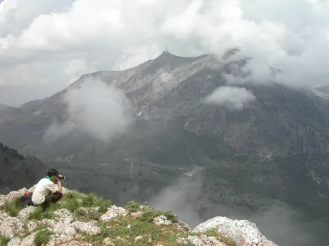
The Alto de La Pandera is a great lookout for the entire Jiennense province and other areas. Thus, in clear sky conditions, it is possible to see Sierra Nevada and the Sierra de Alhama (Granada), the Cordobese subbetic saw, the Ronda serrania and the Málaga Mountains, the Alpujarra almerienne and even Gibraltar.
The access road to Alto de La Pandera is closed to the traffic of vehicles so it is necessary to request the key of the cancel in the City of Valdepeñas de Jaén (Tel. 953 310 111) or Los Villares (Tel. 953 320 005).
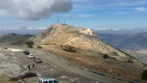
The tour ends on the top of the Pandera, just in the place where the quartering is located, which, taking advantage of its strategic position, was the seat of a military detachment specialized in communications.
