Saltar al contenido principal

Juniper and Savin Forests rastreros

Submitted by brandcode_deweloper on
Id
923306
Descripción
Descripción larga

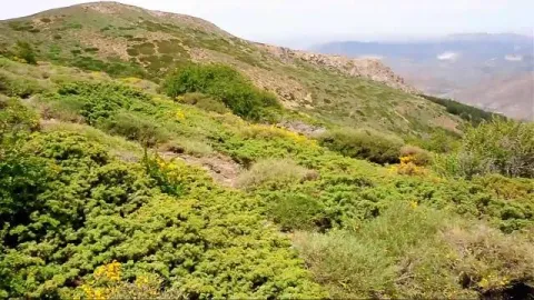
When we enter the fields of Hernán Pelea we are open to the landscape, and we will discover true vegetable monuments that charge a large extent of soil.

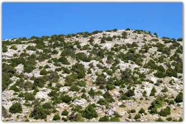
The rake savannas colonize the rocky soils, so we find them in the scarves and cresteries, as well as in the highest of the summits. On the contrary, rake juniors prefer more developed soils, although it is not difficult to see them together. They are very long-lived species, being able to reach 1000 years of age. They do not raise much from the ground, rarely more than a meter high, but a single example can extend more than 20 m ².

They are almost mono-specific plant formations, that is, of a single dominant species, to which only some salgarean pine (Pinus nigra salzmannii), thorns (Berberis vulgaris australis) and on the slopes some maple (Acer granatense) or mustard (Sobus aria) are accompanied. But in the summit areas, the rareras are the queens of the landscape, competing with piornal and lastonar.

These two species came to our saws with the glaciations of the Quaternary. Today, with a more arid climate, they only survive in the highest and coldest of the mountains. Their regeneration is difficult and scarce, and they are also used as food by herbivores, so their future is not the most flattering.

LOCATION

Following the track that goes into the fields of Hernán Perea from Don Domingo, we take the one that goes through the rample of Juan Fría, in which is the Galapan pine, we overcome it and as we pass through the cortijo of the Pinadilla, we are opened a splendid sabinar rastrero.

Breve descripción

Campos de Hernán Pelea

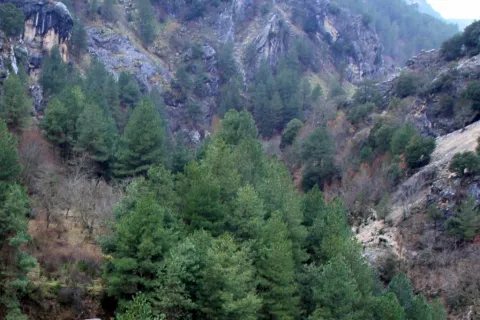
We cannot speak of the high mountains, their summits, their stony slopes and cresteries, without mention of one of their most emblematic inhabitants, the hillbillies or chaspines (Juniperus sabina) and the hillbillies (Juniperus comunnis hemisphaerica), true vegetable monuments of our mountains, to which can be given the qualification of The Elders of the Summits. They are plants that cover our summits in dark green and give shelter to a number of animals.

Ubicación
Latitud
37.772886
Longitud
-3.788329
Ubicación en el mapa
POINT (-3.788329 37.772886)
Imágenes carrusel
imagen
Image
4.png
Imagen principal
Desactivado
Imágenes cabecera
imagen
Image
86746483001_5836777155001_5826845296001-vs.jpg
Imagen principal
Activado
Loading map
Preparing points of interest and routes...

Wildlife Observation Sites

Submitted by brandcode_deweloper on
Id
921316
Descripción
Descripción larga


A continuación referimos los senderos y algunas de las especies de más interés que se pueden observar en cada una:

Cerrada del Utrero

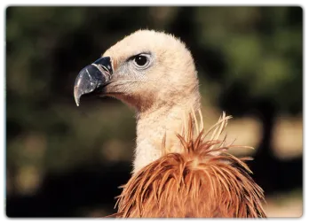
Buitre leonado, martín pescador, mirlo acuático, chova piquirroja, oropéndola, vencejo real.

Laguna de Valdeazores

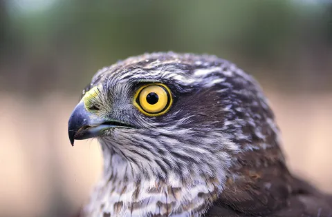
Gavilán, azor común, garza real, zampullín común, gallineta común, ánade azulón, focha común, somormujo lavanco, cárabo, oropéndola.

Río Borosa

Azor común, búho real, águila real, gavilán, cárabo, mirlo acuático, martín pescador, oropéndola, lúgano, golondrina dáurica.

Cueva de La Malena

Buitre leonado, halcón peregrino, ratonero, martín pescador, reyezuelo listado, piquituerto, mosquitero papialbo.

El Chorro

Águila calzada, buitre leonado, alimoche, azor, halcón común, avión roquero, piquituerto.

La Presilla

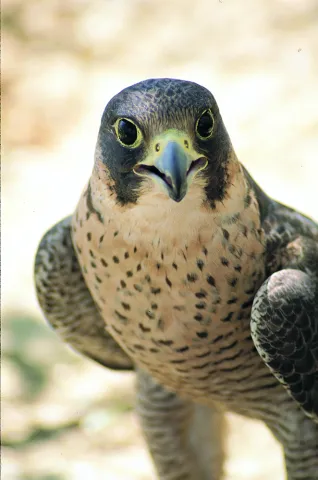
Halcón peregrino, buitre leonado, mochuelo, chova piquirroja, collalba negra, escribano soteño, roquero solitario, avión roquero, lúgano, zorzal alirrojo.

Paraje Natural del Alto Guadalquivir – Puente de la Cerrada

Gallineta común, aguilucho lagunero, aguilucho cenizo, milano negro, rascón europeo, ánade friso, pato cuchara, porrón europeo, carricero común, andarríos chico, chorlitejo grande.

El Chillar

Halcón peregrino, cernícalo vulgar, búho real, mochuelo, alcaraván, collalba rubia, buitrón, bisbita pratense, gorrión chillón, abejaruco, carraca, garcilla bueyera.

Barranco del Guadalentín

Quebrantahuesos, águila real, águila culebrera, águila calzada, águila perdicera, halcón peregrino, gavilán, azor, verderón serrano, oropéndola, mirlo acuático, reyezuelo listado, mosquitero papialbo.

Arroyo Guazalamanco

Gavilán, ratonero, azor, críalo europeo, golondrina dáurica, rabilargo, mirlo acuático, chochín, oropéndola, petirrojo.

ZONAS DE AVISTAMIENTO DE FAUNA SALVAJE

El avistamiento relativamente frecuente de fauna salvaje es uno de los atractivos más conocidos y destacados del Parque Natural. Ciervos, gamos, muflones, cabras monteses, jabalíes y diversas aves rapaces son muy abundantes, como consecuencia de lo agreste del territorio, de su gran extensión y de su buen estado de conservación.

Pero es preciso tener en cuenta una serie de consideraciones para no ver defraudadas tus expectativas y para que tu actividad no perturbe la vida animal:

  • La presencia de los animales salvajes es siempre imprevisible. En ningún lugar ni en ningún momento se puede asegurar que va a haber avistamientos. Aunque sea obvio, no olvides que el Parque no es un zoo.

  • La mayoría de los avistamientos se producen a larga distancia. Es importante llevar prismáticos.
  • La observación de fauna en estado salvaje depende de diversas condiciones ambientales, sobre todo las climatológicas, así como de la época del año y de la hora del día. Generalmente, para ver grandes herbívoros hay que aprovechar las primeras y últimas horas del día. Sin embargo, las grandes rapaces se hacen más visibles durante las horas centrales del día, ya que aprovechan las cálidas corrientes térmicas para el vuelo.
  • El color del pelaje de los grandes herbívoros los camufla en el medio, por lo que es preciso tener paciencia y constancia en la observación. Lo más frecuente es detectar su presencia cuando se mueven.
  • Las alteraciones que producimos cuando estamos en el medio en el que viven los animales deben ser mínimas. Algunas normas y actitudes te facilitarán la observación y supondrán menos molestias para ellos:
    • Ante todo, sé respetuoso y mero espectador de la naturaleza.
    • Intenta pasar desapercibido. Es mejor ir solo o en pequeños grupos, y con vestimenta apropiada de colorido poco llamativo. Ten en cuenta que, con toda probabilidad, los animales detectarán tu presencia mucho antes que tú la suya, ya que el temor hacia nosotros está inscrito en su memoria genética tras miles de años de ser perseguidos por el ser humano.
    • El silencio es imprescindible. Aprovecha para escuchar e interpretar los mil sonidos de la naturaleza que suelen pasar desapercibidos.
    • Jamás intentes perseguir a los animales o acercarte a su medio más íntimo, como nidos o zonas de paridera y cría. Puedes causar daños irreparables y exponerte a respuestas agresivas.
    • Se recomienda no salir de las pistas y senderos.
    • Todas las especies están protegidas por la normativa correspondiente, que hay que respetar. Siguiendo los consejos anteriores, no tendrás ningún problema.
  • En el Parque Natural hay empresas especializadas que están autorizadas para llevar a los visitantes en vehículos todoterreno por zonas donde está prohibido el acceso a coches particulares. Son zonas donde el avistamiento de fauna es frecuente.
  • La berrea del ciervo es uno de los acontecimientos más seguidos en el Parque. La zona tradicionalmente más popular es la de Bujaraiza, en el embalse del Tranco. Pero hay otras de berrea menos frecuentadas, muy cerca del Parque Natural, en las estribaciones de Sierra Morena cercanas a Génave, Puente de Génave y Arroyo del Ojanco. Se trata de grandes fincas privadas dedicadas a la caza mayor, donde los venados son muy abundantes, aunque hay que observarlos desde el otro lado de las vallas de cerramiento de las propiedades.
  • En el Parque de Fauna Silvestre de Collado del Almendral podrás ver con gran comodidad ciervos, gamos, muflones y cabras monteses en semicautividad.

Por otra parte, ten presente que, además de los grandes herbívoros y las rapaces, el Parque Natural está lleno de otros muchos animales cuya observación te puede resultar muy gratificante.

Las ardillas son abundantísimas, así como las avecillas forestales (carboneros, herrerillos, mitos, pinzones, etc.) y otros muchos pájaros. El inconfundible canto de pequeñas rapaces nocturnas, como el cárabo y el autillo, son habituales en los bosques del Parque y en el entorno de pueblos y aldeas.

En los ríos podrás ver al mirlo acuático, habitante de las aguas rápidas y limpias. Y, por supuesto, a las truchas. Miles de especies de invertebrados, así como pequeños anfibios y reptiles se ofrecerán a tu vista… a veces, no hay escena de caza más apasionante que la de una simple salamanquesa que acecha con infinita paciencia a los mosquitos posados sobre las blancas paredes de un cortijo, en las frescas y estrelladas noches del verano.

En todo el Parque Natural se puede avistar fauna salvaje, pero en este mapa te sugerimos una serie de áreas y enclaves donde es más fácil la observación de los grandes herbívoros y las rapaces.

Breve descripción

SENDERS OF ORNITOLOGIC INTEREST

In the southern area of the Park and its nearby environment there are ten paths of Ornithological Interest. They are all in easily accessible places of great landscape beauty and at the beginning they have a panel with very complete information about the species of birds that can be observed, the route and the environment.

Ubicación
Latitud
37.772886
Longitud
-3.788329
Distrito
Municipio
Ubicación en el mapa
POINT (-3.788329 37.772886)
Imágenes carrusel
imagen
Image
2.png
Imagen principal
Desactivado
imagen
Image
1.png
Imagen principal
Desactivado
imagen
Image
3.png
Imagen principal
Desactivado
imagen
Image
Natu083.jpg
Imagen principal
Desactivado
imagen
Image
Natu094.jpg
Imagen principal
Desactivado
imagen
Image
Natu098.jpg
Imagen principal
Desactivado
imagen
Image
Natu156.jpg
Imagen principal
Desactivado
imagen
Image
Natu136.jpg
Imagen principal
Desactivado
imagen
Image
Natu186.jpg
Imagen principal
Desactivado
imagen
Image
Natu193.jpg
Imagen principal
Desactivado
imagen
Image
Natu207.jpg
Imagen principal
Desactivado
imagen
Image
Natu155.jpg
Imagen principal
Desactivado
imagen
Image
Natu212.jpg
Imagen principal
Desactivado
imagen
Image
Natu240.jpg
Imagen principal
Desactivado
imagen
Image
Natu262.jpg
Imagen principal
Desactivado
imagen
Image
Natu257.jpg
Imagen principal
Desactivado
imagen
Image
Natu256.jpg
Imagen principal
Desactivado
imagen
Image
Natu244.jpg
Imagen principal
Desactivado
Imágenes cabecera
imagen
Image
muflon.png
Imagen principal
Activado
Loading map
Preparing points of interest and routes...

Iberian Lynx

Submitted by brandcode_deweloper on
Id
1914733
Descripción
Descripción larga

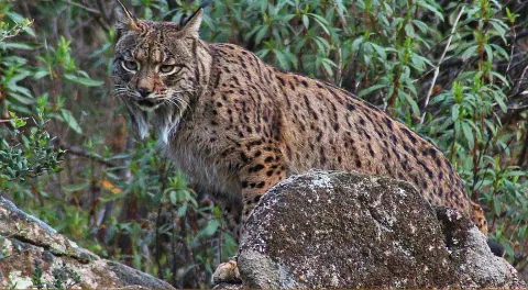
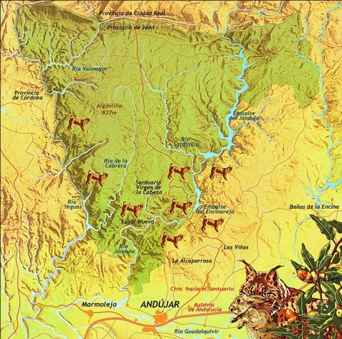
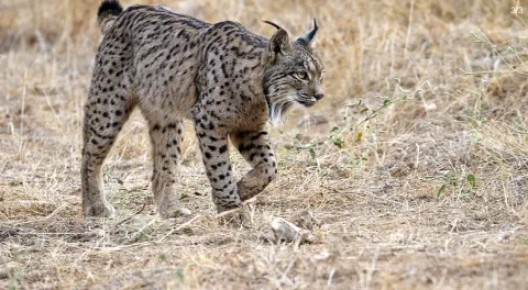
Although Iberian lince has been a protected species since 1966, this wonderful feline is in danger of extinction. At present, only two populations are viable and consolidated for the development and proliferation of this species: the one in Doñana and the one in the natural spaces Sierra de Cardeña and Montoro Natural Park and Sierra de Andújar Natural Park, where the most important population of the nail cat is located.

To see a lince in Andújar

To try to locate and observe an Iberian lince we must look for a good observatory from which we see a lot of saw, many slopes, rosquets, bushes and above all, many clear pasture. Among the best areas for an observation day are:

Road of the boat on its last stretch.

Road and recreational area of the Encinarejo.

Embalse of the Encinarejo from the north bank.

All the viewpoints in the south of the park.

Jabali Path.

Recreative area of the line in New Place.

Located at the observatory, it is essential to be always very attentive and silent, so, even in plain sight, we can distinguish a lineage moving if it is not too far away. We will also start a sweep of the area by means of binoculars. With them we will be looking at the clear and the exits of the land; so we can discover some cat placed on a rock. The telescope should be left for the last search, to go looking further and to go looking very slowly or even to look at the animal once we have discovered it.?

As with almost all predators, the corvids are also very aggressive with the Iberian lince (perhaps this is the animal with which they are most rattled), so we have to be very long-awaited of the movements and demands of the urracas. 50% of the success of observing a lince can come from being able to interpret the corvids.

For the sake of the species and the future visitors who seek to see the great cat, we must respect all the rules of public use, be respectful of the environment, always remain silent and do not in any way disturb animals. Nor should we enter privately owned farms without authorization or deviate from established paths.

Breve descripción

The largest number of the nail cat population

Ubicación
Latitud
38.039236
Longitud
-4.050560
Distrito
Municipio
Ubicación en el mapa
POINT (-4.05056 38.039236)
Imágenes carrusel
imagen
Image
Anotaci%C3%B3n%202020-04-16%20083233.jpg
Imagen principal
Desactivado
imagen
Image
Anotaci%C3%B3n%202020-04-16%20083330.jpg
Imagen principal
Desactivado
Imágenes cabecera
imagen
Image
Anotaci%C3%B3n%202020-04-16%20083259.jpg
Imagen principal
Activado
Microsite al que pertenece
Loading map
Preparing points of interest and routes...

Torre del Vinagre Botanical Garden

Submitted by brandcode_deweloper on
Id
920758
Descripción
Descripción larga

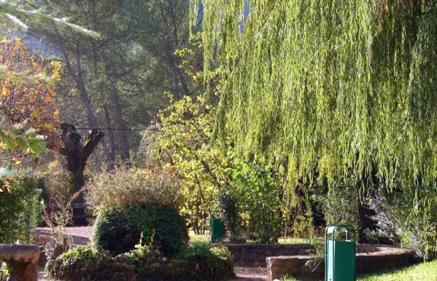
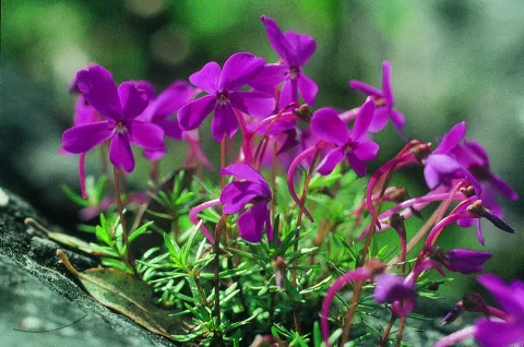
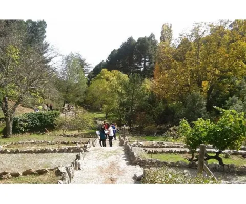
In the Garden are the different plant formations that, depending on the height and humidity, we can find naturally in the Park, such as the high mountain, the larix pineapples, the deciduous bosquets or the riverside forests. There is a space dedicated to the exclusive species of the Park (endemisms), such as the Cazorla violet.

We suggest...

  • Any season is good for visiting the Garden, but in autumn the deciduous trees are dressed in yellow and in spring you can see the flowers of some endemic plants.
  • Attention should be paid to the activities organized by the Garden, such as photography workshops, medicinal plants or plant dyes. There are also activities for children. They are free and have a remarkable quality. You can call or subscribe to your mailing list.
  • Torre del Vinagre is one of the most strategic places in the Park, which has two Visitors' Centres and the beginning of the emblematic route of the Borosa. It can be worth using a whole day.
Breve descripción

This large Botanical Garden has a wide and careful selection of plants from the Natural Park, from small herbaceas to large trees. It is a perfect place to observe and learn to distinguish them or simply to take a pleasant walk between lush vegetation. Your visit will help you understand that the extraordinary botanical wealth of these saws is one of the main reasons for them to be declared as Protected Space. The entrance is free.

    Ubicación
    Latitud
    38.014000
    Longitud
    -2.872970
    Ubicación en el mapa
    POINT (-2.87297 38.014)
    Tipos de punto de interés
    Imágenes carrusel
    imagen
    Image
    jardin2.jpg
    Imagen principal
    Desactivado
    imagen
    Image
    24vinagre_ribera.jpg
    Imagen principal
    Desactivado
    imagen
    Image
    646_JB_01.jpg
    Imagen principal
    Desactivado
    imagen
    Image
    Natu210%20%281%29.jpg
    Imagen principal
    Desactivado
    Imágenes cabecera
    imagen
    Image
    506_img.png
    Imagen principal
    Activado
    Loading map
    Preparing points of interest and routes...

    Botanical Garden el Hornico

    Submitted by brandcode_deweloper on
    Id
    920700
    Descripción
    Descripción larga

    The Arroyo del Vidrio divides the Garden into two, and passing through a wooden bridge with eastern air, we reach a natural area where we can know the plants integrated into their natural habitat, some of them in danger of extinction. This part has a circular path around the channel, where, in addition to vegetables, more than forty species of birds can be observed, as well as squirrels and amphibians. This ravine is the ideal framework to begin to contemplate in situ the particular contrast of the area, from a lookout located at the highest part of the tour.

    The slope of the right margin, in umbria, is occupied by a pineapple pineapple (Pinus nigra ssp. salzmanii). In front, in the dolomitic herring where the parking is located, the black pine (Pinus pinaster) is the only tree able to overcome the presence of magnesium on the ground. Next, in the rocky carasol, the carrasco pine (Pinus halepensis), the most characteristic Mediterranean pinacea of arid areas, dwells on very permeable substrates, where drought becomes extreme. The fact that the three native pine species of this Natural Park naturally coexist in such a small space, deletes the special ecological characteristics of this area.

    We suggest...

    • The Botanical Garden of El Hornico, marked as the Collection of Autotonous Plants in the public-use organization chart of the Natural Park, is currently managed by the municipality of Pozo Alcón and is only open to the public in times of maximum tourist influx. For an organized and scheduled visit it is best to contact the municipal tourist information point (Tfno. 953 739 005)
    • Next to the botanist is the El Hornico Nature Hall, which develops environmental education activities within the garden and in its nearby environment. It is an ideal place to organize school and group activities.

    The Botanical Garden of the Hornico is 9 km from Pozo Alcón and 17 km from Hinojares. From Pozo Alcón you have to take the A-326, up the Avenida de la Bolera, direction to Castril. By passing the campsite de la Bolera and the km 7, we take a detour that comes to our left and that borders the Forest House of la Bolera (it is marked as an entrance to El Hornico). On an unasphalt road, 2 km later, we take another turn to the left, after passing a bridge, which leads us to the park of the Garden a few meters later.

    Breve descripción

    The diversity and contrast in the landscape, essential characteristics of the southern end of the Natural Park, are manifested, above all, in the composition and structure of the plant formations that cover the territory. With a short and pleasant walk through the Botanical Garden of El Hornico we will know the forest ecosystems present in the protected natural space and the plants that make up them, from the subdesert dungeons of the Guadiana Menor, to the piornal and pine trees of the high mountain of the mountain, passing through the different forests present along the length and width of its surface. In these facilities, reaching the summits from the basal area, it only costs effort and a few minutes.

    Ubicación
    Latitud
    37.774490
    Longitud
    -2.923710
    Municipio
    Ubicación en el mapa
    POINT (-2.92371 37.77449)
    Imágenes carrusel
    imagen
    Image
    jardin-botanico-el-hornico.jpg
    Imagen principal
    Desactivado
    imagen
    Image
    jardin-botanico-el-hornico%20%282%29.jpg
    Imagen principal
    Desactivado
    Imágenes cabecera
    imagen
    Image
    jardin-botanico-el-hornico.png
    Imagen principal
    Activado
    Loading map
    Preparing points of interest and routes...

    Holm Oak and Juniper Forests

    Submitted by brandcode_deweloper on
    Id
    920671
    Descripción
    Descripción larga

    They are found on the stony and slope slopes, forming clear forests in which they coexist with some pine of several species (Pinus nigra salzmannii, Pinus pinaster and Pinus halepensis), according to the altitude and orientation of the slope, as well as cornicabra (Pistacia terebinthus), ruscos (Ruscus aculeatus) and a herbaceous entourage such as charts, rompesacos and cerveres (Poa bulbosa, Cynosurus echinatus, Aegilops, and the acrachacellus (Arrachacus), and the acellus (Arrachatus), and the other (Arrachus).

    From the Recreative Area of Linarejos, we walk along the track that goes up the hill. We will go through a quarry and a barrier, these are two indicators that confirm that we are on the right track. At 3 km from the Recreative Area we will see a detour to our left, a track that enters us into a rock maze. It is a torque, in which this formation of oaks and juniper is extended. Two leads are coming out to our left, one after the other, and they both get us into this torcal. If we do not want to go too far, because it is a difficult ground to go through, from the main track we see this plant formation in the same way.

    Breve descripción

    The Navillas, Peña Gallinera

    The oak (Quercus ilex ballota) and juniperus oxicedrus (Juniperus oxicedrus) are a unique feature of these limestone saws. It is difficult to see a formation of these pure characteristics, since it is normal to see them intermingled in enclosures, pine trees and in slices of Mediterranean forests, but in a few places, like this, we can see them with their characteristic elements.

    Ubicación
    Latitud
    37.912893
    Longitud
    -3.003887
    Municipio
    Ubicación en el mapa
    POINT (-3.003887 37.912893)
    Imágenes carrusel
    imagen
    Image
    encinares_enebrales.png
    Imagen principal
    Desactivado
    imagen
    Image
    ales%20%281%29.jpg
    Imagen principal
    Desactivado
    Imágenes cabecera
    imagen
    Image
    4eladera%20del%20espinar%2C%20barranco%20de%20la%20pinada%2C%20barranco%20de%20las%20esparragueras%2C%20barranco%20de%20las%20liebres.jpg
    Imagen principal
    Activado
    Loading map
    Preparing points of interest and routes...

    Laricio or Salgareño Pine Forest

    Submitted by brandcode_deweloper on
    Id
    921538
    Descripción
    Descripción larga

    After walking through this pine tree and returning to the track we have accessed, if we look south, the clear days look perfectly Sierra Nevada and looking north the Gualay valley opens. The track opens through the rocky moles of the Cabañas peak and the lastras of the Cagasebo rope.

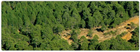
    This forest is dominated by the salgarean pine (Pinus nigra salzmannii), which is sometimes accompanied by maple (Acer granatense), mustard (Sorbus aria) and whine (Quercus faginea), and in the sotoquela by rastera savines (Juniperus sabina), rake juniperus (Juniperus communis hemisphaerica), thorns (Berberis vulgaris australis), tirelles (Prunus postrata), enamubios (a), and other species (the celium (a), as well as the celium (a), and the celibelium (a), and the celium (a).

    The name that has always been known in these saws to this pine is that of Salgareño. The etymology of his name is as beautiful as the pine itself; salgareño comes from sarga, a vulgar name with which several willows are known. It alludes to the fine and slender of the branches, as does the pine bear when young, slender and right. By this slender and fine figure, the ancient inhabitants of the saws baptized this pine of the high mountain of Serrana as Salgareño.

    We access Puerto Llano on the track from the birth of the Guadalquivir to Pozo Alcón. Puerto Llano is the highest point of the track, where we are surrounded by a splendid pine pine pines, called salgareños in these saws.

    Breve descripción

    This forest is one of the botanical and landscape jewels of the Park. The plant formation we are going to describe is considered endemic to this saw, as it only exists in the high mountain of the Park. In the endemic pinar of Puerto Llano we recommend walking without haste. Most of the pine trees that form it are over 600 years old.

    Ubicación
    Latitud
    37.702695
    Longitud
    -2.935057
    Municipio
    Ubicación en el mapa
    POINT (-2.935057 37.702695)
    Imágenes carrusel
    imagen
    Image
    pinar.jpg
    Imagen principal
    Desactivado
    imagen
    Image
    P9080814.JPG
    Imagen principal
    Desactivado
    Imágenes cabecera
    imagen
    Image
    unnamed.jpg
    Imagen principal
    Activado
    Loading map
    Preparing points of interest and routes...

    Cornicabrales

    Submitted by brandcode_deweloper on
    Id
    920498
    Descripción
    Descripción larga

    Once we get to Central, we're already in the middle of the cornicabral. A mile earlier, from the Nidillo Strike, we will be accompanied by the cornicabra to our right on a very stony and pending slope. At the end of the route, in front of the bridge that crosses the Borosa River to access the central one, on the hillside that extends to our left after crossing the bridge, we will observe large trees, which look like oak trees, but if you look at us it will surprise us that they are large cornicabra. In the fall we are presented with a multitude of warm colors ranging from orange to dark red.

    The cornicabral that we see is associated with little vegetation in its lowland, this is because the presence of cattle (wild or domestic ungulates) benefits the cornicabra, its outbreaks and spills of seed are very toxic and not appetizing to the cattle, so it is not easy to see other species accompanying the cornicabral, and more in areas frequented by the cattle. However, they are usually seen in oak (Quercus ilex ballota), arces de Montpelier (Acer mosnpessulanum), agracejos (Phillyrea latifolia), sabinas (Juniperus phoenicea), lentisco (Pistacia lenticus), rosemos (Rosmarinus officinalis), torvizcos (Daphne gnidium), esamujos (Rosa ssp.) and among herbaceas we highlight the peony or rose of mountain (Paeonia broteroi), as well as in the gradivos (Rachos), as in the gradivázos, as in the gradivánas in the gracos (Rachos, as in the gradius, as in the gradivás, as in the gradivázos, as in the gracos (Rachos), as in the gradius, as in the gradivávás, as in the gradius in the gracas in the gracos, as in the (Poa bulbosa, Agrostis ssp., Cynosurus echinatus, Aegilops geniculata, Arrhenatherum elatinus, etc.).

    The name of the cornicabra is due to the protuberances in the form of goat horn so characteristic in leaves and stems, which are gills produced by the bite of an insect, which uses them as food for its larvae.

    We suggest:

    • The cornicabral are present in others in many mountains and more or less stony slopes of the Park, as in this type of environment it is where the cornicabra (Pistacia terebinthus) finds its habitat. Extensive cornicabral can be seen on the slopes of the Zumeta River, near the Ticiano Sale, in the gutters of Peña Corba (Las Villas), on the slopes of the Yelmo Chico, in the Cerrada del Utrero, etc.

    Route of the Borosa, from the place known as La Central. To reach the cornicabral we must remount the Borosa River along the track that passes to its vera, and that ends up in a hydroelectric power plant. We take it on the farm of Borosa, a well-known place. We have 8 km ahead of us, but they don't have much slope and can be done easily, and we go all the way through the Borosa River, which is one of the most spectacular and popular routes of the Park.

    Breve descripción

    Pilate boat, Borosa River

    This cornicabral is extended by the Pilate Boat, at the head of the Borosa River, where there are the largest copies of those in the Park.

    When enjoying plant formations, preference is often given to those that are starring in trees, but in these saws many are dominated by shrubs. This is the case with the cornicabral, of great ecological and landscape importance, especially in the autumn, when they become almost red.

    Ubicación
    Latitud
    38.252679
    Longitud
    -2.890872
    Distrito
    Municipio
    Ubicación en el mapa
    POINT (-2.890872 38.252679)
    Imágenes carrusel
    imagen
    Image
    Natu154.jpg
    Imagen principal
    Desactivado
    Loading map
    Preparing points of interest and routes...

    Valley Floor Deciduous Forests

    Submitted by brandcode_deweloper on
    Id
    920264
    Descripción
    Descripción larga

    In the area of Tejina we have a splendid deciduous forest made up of complaints (Quercus faginea) that have leaves that are larger and more lustrous than those of high mountains, mapes of Montpelier (Acer monspessulanum), serbales (domestic Sorbus), pespejones (Sorbus tormentinalis) and pyruetans or wild perals (Pyrus bourgeana).

    They are accompanied by shrubs such as majuelos (Crataegus monogina), endrines (Prunus spinosa), skirmishes or tapasses (Rosa spp.) and species of the Mediterranean forest, such as madroños (Arbutus unedo), agracejos or lebiernagos (Phylirea latifolia), wild jazmines (Jazminum fruticans), hedras (Hedera helix). In wet areas there are zarzas (Rubus ulmifolius), and in the forest and stony areas there are splits (Lavandula latifolia).

    Among the herbaceous plants are grasses such as Brachypodium phoenocoids, Holcus lanatus, other species such as orchids (Ophrys lutea, O. apifera, O. tenthredinifera), trees (Trifolium campestre, T. strellatum), violets (Viola odorata) and others such as Bupleurum rigidum, Bellis perennis, etc.

    We suggest:

    • When you are in places like this, very few, remember that these deciduous forests are authentic ecological shelters for fauna, because the fruits of many of its plant species mature in winter, which makes many birds survive when food is scarce in all other places. In turn, these birds help in the dispersion of the seeds. The human transformation of these areas threatens the stability of this ecosystem and involves serious biodiversity losses. Today many of the plant components of this forest are protected by law in Andalusia. We cannot afford to lose the most precious natural treasures, our forests.
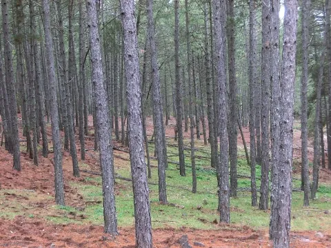
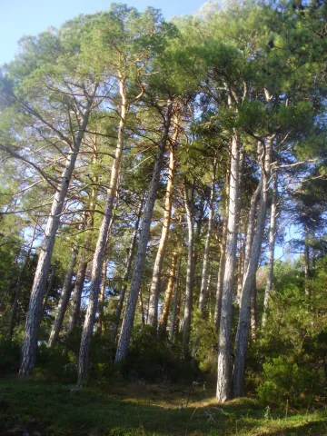
    Valle del Guadalquivir, on the road A-319 (km 42), a little below the Puente del Hacha, in the area known as Tejina.

    Breve descripción

    At the bottom of some valleys, deep and fertile soil coexist with thermal investment processes. These particular conditions of soil and climate make it possible to establish deciduous forests. These forests are very restricted to small enclaves in the Guadalquivir valley, as their ancient domains have been strongly transformed by human beings over the centuries.

    Ubicación
    Latitud
    37.921120
    Longitud
    -2.991910
    Municipio
    Ubicación en el mapa
    POINT (-2.99191 37.92112)
    Imágenes carrusel
    imagen
    Image
    valle.jpg
    Imagen principal
    Desactivado
    Imágenes cabecera
    imagen
    Image
    _fotodeeduardoviuales_6d80611f.jpg
    Imagen principal
    Activado
    Loading map
    Preparing points of interest and routes...

    High Mountain Deciduous Forests

    Submitted by brandcode_deweloper on
    Id
    879671
    Descripción
    Descripción larga

    The site is really special for the great variety of species we found. In it we can walk and enjoy one of the few high mountain deciduous forests that have left in the Natural Park.

    Today we can no longer define as forests the few remaining stains, even though in past times they spread across large areas of the high mountain of these saws, wearing the valleys and vessels of lush forests. At present their presence is limited to small holes, rails and rails in which deep and fertile soil is accumulated.

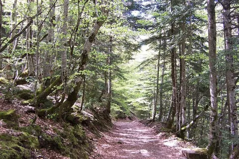
    These beautiful bosquets are made up of maple (Acer granatense), mustard (Sorbus aria), cereal (Prunus mahaleb) and whine (Quercus faginea), accompanied by a shrub of spiners with majuelos (Crataegus monogina), rars (Berberis vulgaris australis), skirmishes (Rosa spp.), madreselvas (Lonicera spladada, L. etrusca), sanjuaneros (Lonicera arborea) and spinos (Cratagulata).

    We suggest:

    • Later there is Nava Noguera and the control of Rambla Seca, which marks the entrance to the Campos de Hernán Pelea, one of the most original and overwhelming landscapes of the Park.
    • There are other very accessible places where we can enjoy these exceptional bosquets, such as the surroundings of the Collado del Ventano in the Calar de Navalespino and the Barranco del Guadalentín.
    • Don't miss these sketches in the fall.

    LOCATION

    We access the road that goes from Vadillo Castril to Santiago de la Espada, which becomes a ground track from Los Collados, but the firm is good and we can reach the destination point without great problems. Once we have ascended to the Saves of San Pedro, we are already on the line, we arrive at the junction of the Laguna of Valdeazores, which is about 9 km from the Navy. We look at the extraordinary landscape, as we take the Guadalanimin ravine to our right. As we pass through the Collado de la Zarca (where there is a track to our right, cut to traffic with a chain), we lose sight of the Barranco del Guadalentín and enter a few rails. Less than a kilometre after a few curves are presented to our right, in the sense of the march, a few holes full of trees.

    Breve descripción

    Necklace of the Beer

    Ubicación
    Latitud
    37.702695
    Longitud
    -2.935057
    Municipio
    Ubicación en el mapa
    POINT (-2.935057 37.702695)
    Imágenes carrusel
    imagen
    Image
    613_img.png
    Imagen principal
    Desactivado
    imagen
    Image
    bosque.jpg
    Imagen principal
    Desactivado
    Imágenes cabecera
    imagen
    Image
    caduci.jpg
    Imagen principal
    Activado
    Loading map
    Preparing points of interest and routes...