Saltar al contenido principal

Natural Monument El olivo de Fuentebuena

Submitted by brandcode_deweloper on
Id
6726352
Descripción
Descripción larga

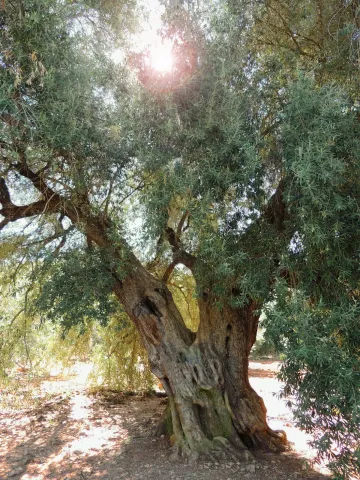
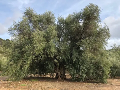
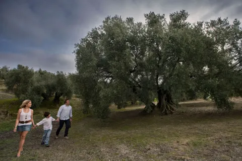
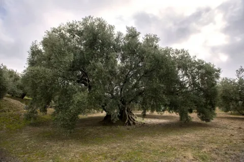
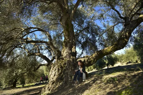
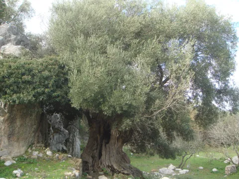
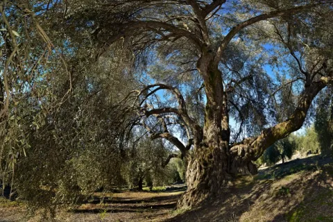
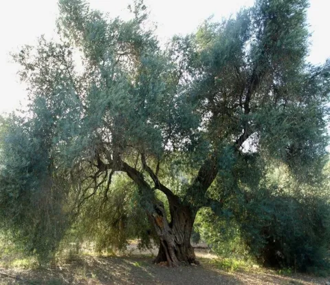
If by anything it is characterized by Jaén it is by its olive trees. There are very old people and there are also large ones (which is not about their age) spread over different municipalities in the provincial geography. The uniqueness of the Arroyo del Ojanco olive tree lies, rather than its age, in its gigantic dimensions, so it has been proposed to be declared a Natural Monument of Andalusia. It is said that it is the largest olive tree in the world, and possibly it is, because the figures that cast its measures, referred to in the tab at the beginning of the article, tell us of a single copy. This should be added to its productive capacity, which is around 600 kg. olive per campaign (an adult irrigated olive tree usually does not reach 70 kg).


The two large branches (2.10 and 2.80 m of perimeter) that are bifurcan from its thick fuse bear all the weight of the cup, which becomes of such magnitude - especially when the fruit develops - which forces its dense foliage to rest on the ground at many ends of the cup. Anyway, everything in this portentous specimen is Guinness record.


So long a centenary history has generated some legendary accounts around this olive tree, as it was planted in the Roman era (which indeed built a magnificent villa a few hundred metres from Fuentebuena) or by friars after the Christian reconquest of these lands. Another version states that its size, so different from that of the olive trees around it, is because it was born from a blessed bouquet on a Palm Sunday.

To access the Fuentebuena olive, you have to go from the urban core of Arroyo del Ojanco to the local road JV-7.005 towards Beas de Segura. As you pass the crossing of Prados de Armijo, the olive tree is about 50 metres from the road.

Breve descripción

The millennial olive tree of Fuentebuena, declared by the Junta de Andalucía Monumento Natural, is one of the symbols of Arroyo del Ojanco. This is a privileged vestige that has resisted so many generations between corns and bandages, between ice of raw winters and summers of extenuating dryness.
Ubicación
Latitud
38.320028
Longitud
-2.905589
Distrito
Municipio
Ubicación en el mapa
POINT (-2.905589 38.320028)
Imágenes carrusel
imagen
Image
olivo.jpg
Imagen principal
Desactivado
imagen
Image
Oliva-de-Fuentebuena.jpg
Imagen principal
Desactivado
imagen
Image
DSCN3042.JPG
Imagen principal
Desactivado
Imágenes cabecera
imagen
Image
Olivo-de-Fuentebuena20180317-01.jpg
Imagen principal
Activado
Microsite al que pertenece
Loading map
Preparing points of interest and routes...

Estaca Grande

Submitted by brandcode_deweloper on
Id
7461237
Descripción
Descripción larga
  • Your access is made on foot field through.
  • The person who best knows and has studied the centenary olive trees in Martos is Mr. Ciriaco Castro Toro, retired technician of the City Council.
Breve descripción

La Estaca Grande is a unique olive tree, about 300 years old, located about 450 metres from the Via Verde del Oil, right in the area called Cañada del Abandado, in the municipal term of Martos. In Jaén the olive trees are also known as stacas, in reference to their primary phase and to one of the planting methods.

Telecomunicaciones
Sitio web
https://www.martos.es/
Teléfono de contacto
953 704 005
Correo electrónico
concejal.jerena@martos.es
Ubicación
Nombre
Cañada del Abandonado
Código Postal
23600
Latitud
37.735290
Longitud
-3.970170
Distrito
Municipio
Ubicación en el mapa
POINT (-3.97017 37.73529)
Tipos de punto de interés
Imágenes carrusel
imagen
Image
estca-grande-2.jpg
Imagen principal
Desactivado
imagen
Image
olivo-estaca.jpg
Imagen principal
Desactivado
Imágenes cabecera
imagen
Image
estaca-grande-1.jpg
Imagen principal
Activado
Microsite al que pertenece
Loading map
Preparing points of interest and routes...

Millenary Holm Oak

Submitted by brandcode_deweloper on
Id
4573103
Descripción
Descripción larga

We can deduce that this was the dominant landscape a few centuries ago, when after the Reconquista arrived in this village the first inhabitants attracted by the wealth of this dehesa and the possibilities it offered, not only for its cattle, but also to make it "land of bread."

Until the 19th century there were still many oak feet, but it was during this and especially during the first years of the last 20th century that they were significantly reduced, in some cases to devote the land to cereal, vineyard or olive trees and in others to obtaining charcoal. However we can still see some spots of indigenous vegetation in the vicinity of Cabeza Montosa and the hill of the Peones.

This fierce struggle of man against the dehesa has allowed some of the oak to be kept so that its shadow would cover the reapers and the flocks that took advantage of the rashes, or to collect the stones that were taken from the fallow. The fact is that in cases like this, in the face of lack of competition, it is possible that the few specimens of oak have grown more vigorously.

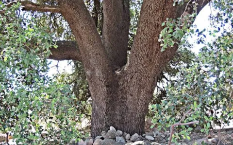
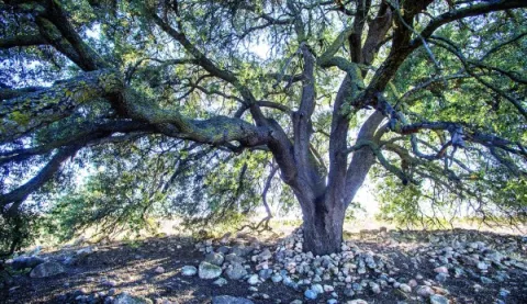
Its trunk has a considerable bearing for an oak and its cup is the widest in the entire province with about 30 meters in diameter and 300 meters in perimeter. This oak is part of the catalogue of unique trees in Spain and is waiting to be declared as Good of Natural Interest, not in vain is of the few millennia trees left on the peninsula.

It is located very close to the railway station of Cabra del Santo Cristo, next to the cortijo of "La Viña." We can access up to the millennial oak through an asphalt road, in good condition, that leaves from the passage to the level that is in the Station. We just have to follow the direction of the signage and within 2 km we will have no doubt when we see it to the left of the road, while to the right the above-mentioned cortijo of the Viña will serve as a reference.

From Cabra we can also walk along the lane that runs through the Fifth, Alamedilla and Gamelloncillo, for which we will walk through space of about 6 km (only one way). It is advisable to finish our route at the station of Cabra and stay in your canteen to take a refreshment with good viandas to recover from the effort, or, if we want to continue to know this ancient dehesa, continue track and return to Hidalgo and the Mill Barranco, but then we will extend our route to about 18 km and have walked by asphalt for a considerable part of the road.

Breve descripción

The area known as the Llanos de la Estación, or of Hidalgo, is today a very anthropolized landscape where the alternative crops of olive and cereal predominate, although it is easy to notice considerable specimens of oak, as well as numerous chaps on the linds that demarcate the agricultural farms.

Ubicación
Latitud
37.704030
Longitud
-3.286990
Distrito
Ubicación en el mapa
POINT (-3.28699 37.70403)
Tipos de punto de interés
Imágenes carrusel
imagen
Image
Encina%20Centenaria.jpg
Imagen principal
Desactivado
imagen
Image
Encina%20Centenaria%202.jpg
Imagen principal
Desactivado
Imágenes cabecera
imagen
Image
17.jpg
Imagen principal
Activado
Microsite al que pertenece
Loading map
Preparing points of interest and routes...
Interés

Acebuche de Las Hoyas

Submitted by brandcode_deweloper on
Id
7459299
Descripción
Descripción larga
  • In some places it is described as a millennial and in others, a centenary.
  • Access is made by asphalt road on foot or by car.
Breve descripción

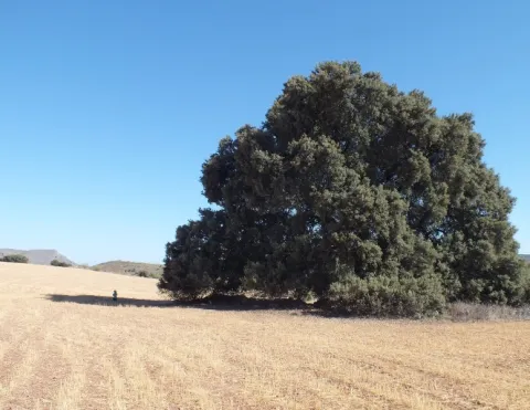
The Acebuche de Las Hoyas is distinguished both by its extraordinary dimensions and by its age. It is located near the limit of the Natural Park Sierras de Cazorla, Segura and Las Villas. It stands out its height of 15 meters and a large conical-shaped comb that measures almost 10 meters of perimeter at its base. The projection of the cup is 132.73 m ². The fuse has very obvious and longitudinal ostenses and filigranes, especially on the foot, which show the second reason for singularity, age, as it is sure to exceed 350 years.

Ubicación
Código Postal
23476
Latitud
37.938670
Longitud
-2.991190
Dirección
Carretera de La Iruela a Los Prados, Km. 2,500. Paraje de las Hoyas
Municipio
Ubicación en el mapa
POINT (-2.99119 37.93867)
Tipos de punto de interés
Imágenes carrusel
imagen
Image
eb6c7c01c4e98e1f2578f9959463b973_XL%20%281%29.jpg
Imagen principal
Desactivado
imagen
Image
Acebuche.jpeg
Imagen principal
Desactivado
Imágenes cabecera
imagen
Image
eb6c7c01c4e98e1f2578f9959463b973_2_XL.jpg
Imagen principal
Activado
Loading map
Preparing points of interest and routes...