Saltar al contenido principal

Cánava Pine Forest

Submitted by brandcode_deweloper on
Id
5845162
Descripción
Descripción larga

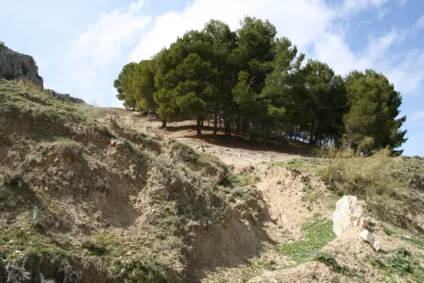
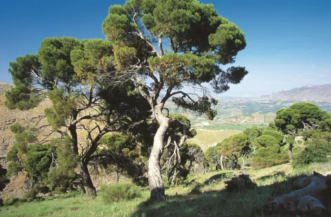
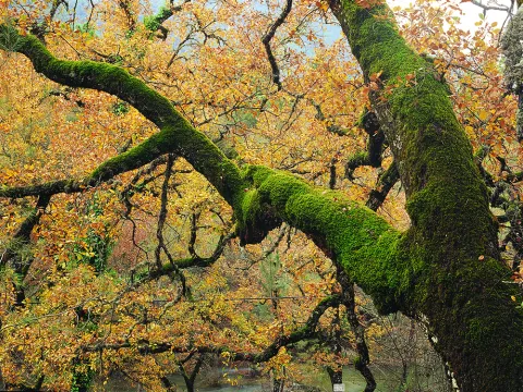
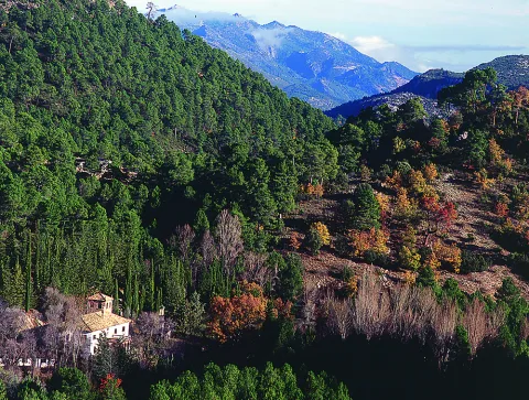
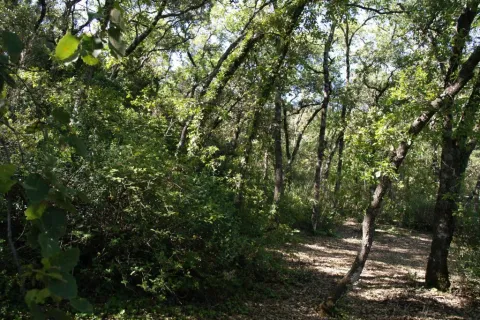
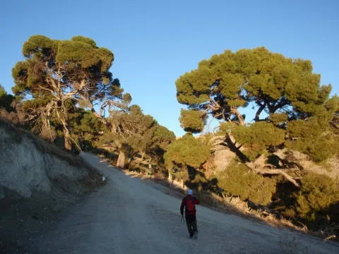
The Pinar de Cánava is an interesting forest ecosystem that has the carrasco pine as its protagonist. The uniqueness of this pineapple, of about 120 copies, is found in its high degree of naturality and, above all, in its longevity, with pine trees between 100 and 250 years old.

This pineapple has great value as an educational resource, as it offers a unique opportunity to understand the different stages of ripening of a forest. In addition, the appearance of a pine can be observed at a stage near old age. In front of the typical forms of young pineapples with straight trunks and conical cups, they contrast the twisted specimens of this Natural Monument. Its rounded, parasol-shaped cups remind of other tree species. The bush in this forest has almost disappeared. This complex aspect is the one that every forest would have in a natural way, but man's intervention changes this process, tending towards greater simplicity.

Breve descripción

Protected natural space, as a natural monument, of 5 ha of extension. The municipal term of Jimena. Interesting pine that shows the relish vegetation, ancient of the area. We could consider it a plant landscape, witness to ancient vegetation.

Ubicación
Nombre
Cerro de la Atalaya
Latitud
37.841470
Longitud
-3.478850
Distrito
Municipio
Ubicación en el mapa
POINT (-3.47885 37.84147)
Tipos de punto de interés
Imágenes carrusel
imagen
Image
image_248193.jpeg
Imagen principal
Desactivado
imagen
Image
imagen-166-pinar-jpg
Imagen principal
Desactivado
Imágenes cabecera
imagen
Image
Monumentos_naturales_2%20%281%29.jpg
Imagen principal
Activado
Microsite al que pertenece
Loading map
Preparing points of interest and routes...

Natural Monument Quejigo del Amo o del Carbón

Submitted by brandcode_deweloper on
Id
2193220
Descripción
Descripción larga

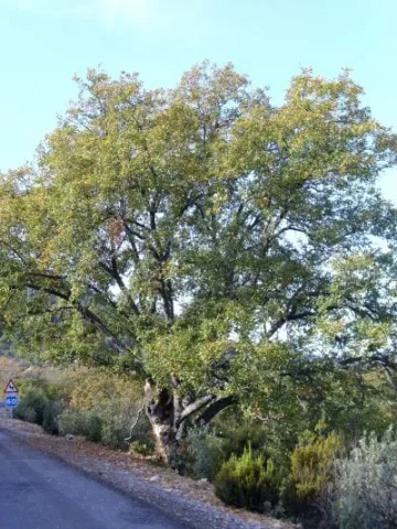
The complaint is one of the most representative trees of Mediterranean vegetation, especially of those territories with a subhumid climate. A few kilometers from the municipality ofValdepeñas de Jaénis found a centenary of this species, the Natural MonumentCoal Complaints.

Breve descripción

Located in the municipality of Valdepeñas de Jaén, this example of Quercus faginea Lam., representative of the native Mediterranean vegetation, is considered one of the largest dimensions of the Andalusian territory.

Ubicación
Latitud
37.594050
Longitud
-3.727670
Distrito
Ubicación en el mapa
POINT (-3.72767 37.59405)
Tipos de punto de interés
Imágenes carrusel
imagen
Image
PB120096.JPG
Imagen principal
Desactivado
imagen
Image
Quercus_faginea-400x533.jpg
Imagen principal
Desactivado
imagen
Image
Natu347.jpg
Imagen principal
Desactivado
Imágenes cabecera
imagen
Image
Natu014.jpg
Imagen principal
Activado
Microsite al que pertenece
Loading map
Preparing points of interest and routes...

Natural Monument Los Órganos de Despeñaperros

Submitted by brandcode_deweloper on
Id
5867289
Descripción
Descripción larga

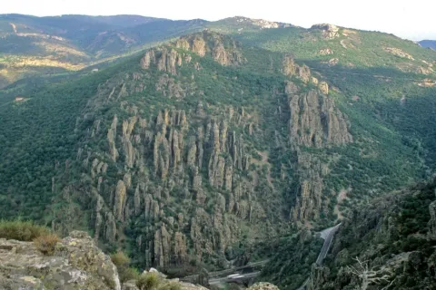
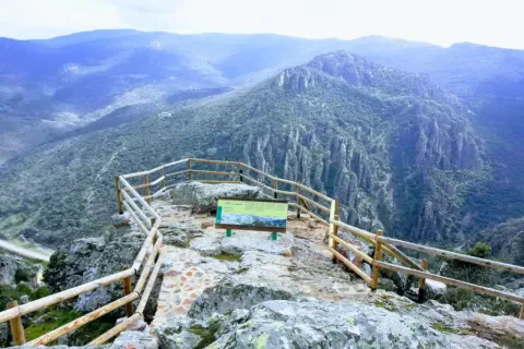
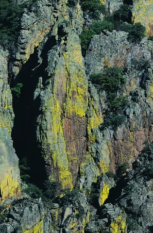
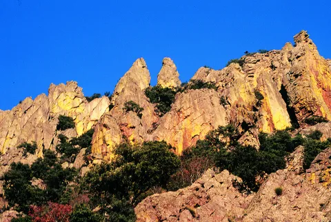
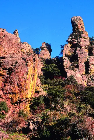
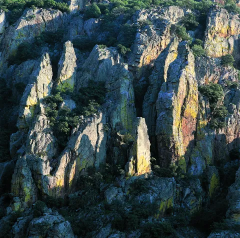
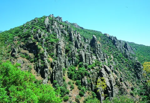
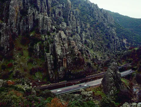
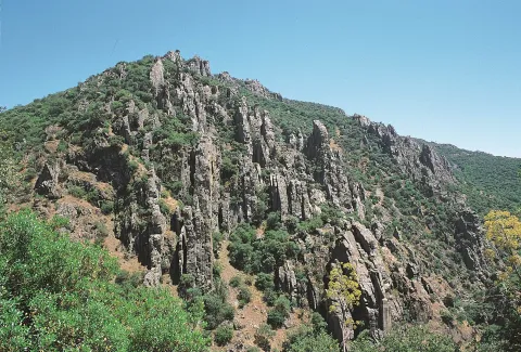
From the nearby viewpoint you can see this monument, whose origin is surprising. 500 million years ago the whole area was covered by the sea, though with little depth, so it was filled with sands and clays brought by the rivers that were flowing there from the Iberian plateau. It was 300 million years ago that the forces of the land made these lands emerge and since then, the erosion of the river, the rains and the wind have been sculpting the relief, creating beautiful forms like these organs. On these rocks, oaks, alcornoques and shrubs have found their substrate, forming a Mediterranean forest in which they inhabit ginets, chickpeas and numerous rapaces.

Breve descripción

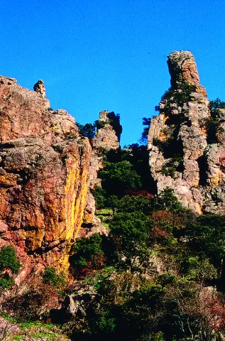
Declared Natural Monument of Andalusia. This Natural Monument is one of the most prominent places in the Despeñacolos Parade, where a set of huge rock columns are raised that resemble the tubes of an organ of a large cathedral. The beauty of this site increases the chromatic contrast of the rock grey with the intense yellow and orange of the different species of lichens that survive here.

Ubicación
Código Postal
23213
Latitud
38.411329
Longitud
-3.559652
Distrito
Municipio
Ubicación en el mapa
POINT (-3.559652 38.411329)
Tipos de punto de interés
Imágenes carrusel
imagen
Image
DESPENAPERROS%20%281%29.jpg
Imagen principal
Desactivado
imagen
Image
1615_MI_01.jpg
Imagen principal
Desactivado
imagen
Image
Natu020.jpg
Imagen principal
Desactivado
imagen
Image
Natu009.jpg
Imagen principal
Desactivado
imagen
Image
Natu066.jpg
Imagen principal
Desactivado
imagen
Image
Natu099.jpg
Imagen principal
Desactivado
imagen
Image
Natu392.jpg
Imagen principal
Desactivado
imagen
Image
Natu368.jpg
Imagen principal
Desactivado
imagen
Image
Natu331.jpg
Imagen principal
Desactivado
imagen
Image
Natu220.jpg
Imagen principal
Desactivado
imagen
Image
Natu160.jpg
Imagen principal
Desactivado
imagen
Image
Natu239.jpg
Imagen principal
Desactivado
Imágenes cabecera
imagen
Image
Parque_Natural_Despexaperros_3%20%281%29.jpg
Imagen principal
Activado
Loading map
Preparing points of interest and routes...

Natural Monument Huellas de Dinosaurio de Santisteban del Puerto

Submitted by brandcode_deweloper on
Id
2193311
Descripción
Descripción larga

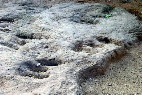
In this paleontological field there are a series of 24 tracks up to nine centimeters deep belonging to the Triassic bipedic dinosaurs. Prints on red clays, possibly belonging to the Arcosauri group, are more than 230 million years old. It is a very enigmatic field, since the almost parallel placement of the fingers and above all the central finger shorter than the two sides, make them, for now, unique in the world.

These tracks, also known as icnites, are not easy to locate, because for their formation there have to be several environmental conditions. Among them, the material on which these animals walked was different from the material on which it was later deposited. Almost certainly, these prints were printed on sediments of a river bed or lagoon to, later, be covered by some other material that allowed it to be preserved until today.

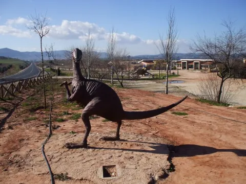
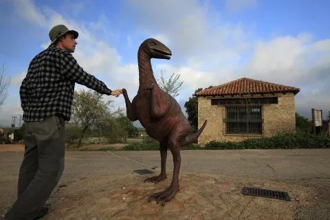
The shape of the prints reveals that these dinosaurs were walking on two legs, with movements similar to those of a kangaroo. You can even know data such as its approximate size and weight, age and social habits. The arrangement of the 24 icnites in the same direction suggests the scene of a group of animals heading to some particular place.

The remains of pollen or vegetation, also fossilized, reveal environmental conditions very different from the present ones, where the vegetation was made up of coniferous, palm and ferns, which were encouraged by a warmer and damp climate than the present.

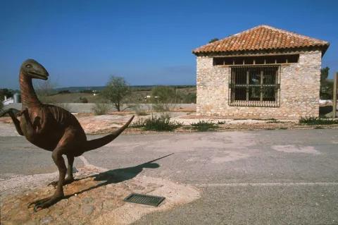
In the place a kind of cabin has been raised that protects them from unnecessary wear. A metal sculpture that reminds the "owner" of the prints has also been placed next to the prints. It should be mentioned that in the vicinity there are also interesting cave paintings, such as the Apolinary Cave dating from the Copper Age; all of them are very similar to those found in the nearby natural spaces of Despeñacolos and La Cimbarra.

More information by phone: 953 368 800

Breve descripción

This Natural Monument of the Dynosaur Footprints of Santisteban del Puerto transports to those who visit him to a very remote past, when man still did not walk on earth. Located one kilometre from the city centre of Santisteban del Puerto, the district of El Condado, it is one of the two icnite sites located in Andalusia.

Ubicación
Latitud
38.248435
Longitud
-3.206190
Dirección
Carretera A-312, km. 51,300
Distrito
Ubicación en el mapa
POINT (-3.20619 38.248435)
Tipos de punto de interés
Imágenes carrusel
imagen
Image
huellas%20de%20dinosaurios1%20%281%29.jpg
Imagen principal
Desactivado
imagen
Image
A7_05_05_D.jpg
Imagen principal
Desactivado
imagen
Image
image_248107%20%281%29.jpeg
Imagen principal
Desactivado
Imágenes cabecera
imagen
Image
Monumentos_naturales_3.jpg
Imagen principal
Activado
Microsite al que pertenece
Loading map
Preparing points of interest and routes...

Natural Monument El Piélago

Submitted by brandcode_deweloper on
Id
2193369
Descripción
Descripción larga

The "Natural Monument the Pat" is located to the north of the municipality of Linares. To get to it you have to follow the A-312 autonomous road towards Arquillos, after the station of Vadollano we find a detour to the left - Vilch- that leads us directly to the site.

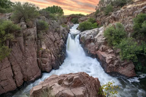
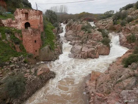
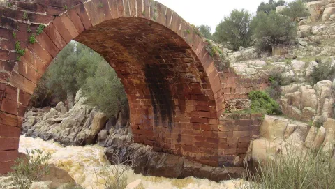
This is an area of special landscape and historical interest, since the beauty of the route of the river Guarrizas is joined by the existence of the Roman bridge of Vadollano, which is part of the route of the Via Augusta.

Just below the Roman bridge, we found the ruins of what was a chocolate factory, which used the driving force of the river water to generate energy.

Breve descripción

Area: 67,149 m ²

A place of special landscape interest whose uniqueness lies in the presence of a riverbank forest, a rich fauna and elements of enormous geological value, as well as the remains of a bridge and a Roman-era road.

Ubicación
Latitud
37.890735
Longitud
-3.565822
Distrito
Municipio
Ubicación en el mapa
POINT (-3.565822 37.890735)
Tipos de punto de interés
Imágenes carrusel
imagen
Image
el-pielago-jpg
Imagen principal
Desactivado
imagen
Image
linares3.jpg
Imagen principal
Desactivado
Imágenes cabecera
imagen
Image
1200px-El_Pi%C3%A9lago.jpg
Imagen principal
Activado
Microsite al que pertenece
Loading map
Preparing points of interest and routes...

Natural Monument El olivo de Fuentebuena

Submitted by brandcode_deweloper on
Id
6726352
Descripción
Descripción larga

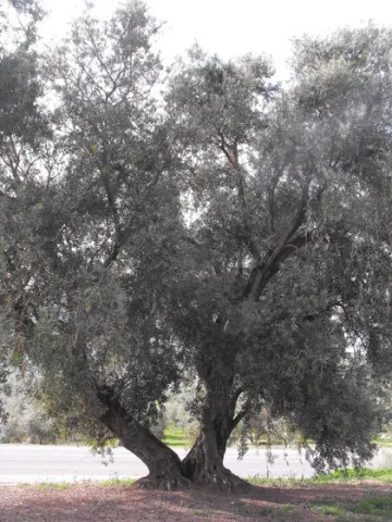
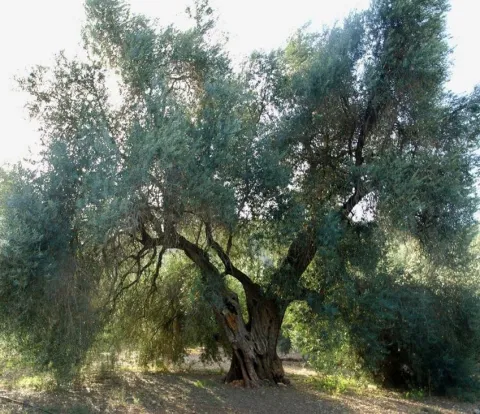
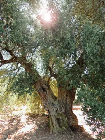
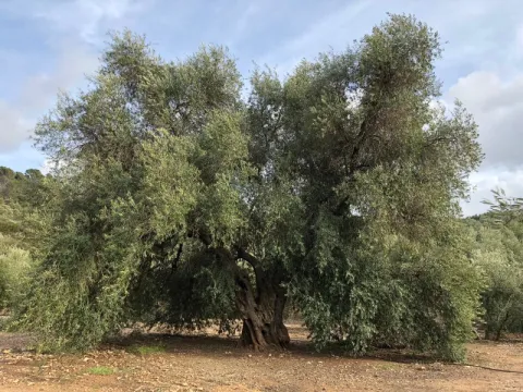
If by anything it is characterized by Jaén it is by its olive trees. There are very old people and there are also large ones (which is not about their age) spread over different municipalities in the provincial geography. The uniqueness of the Arroyo del Ojanco olive tree lies, rather than its age, in its gigantic dimensions, so it has been proposed to be declared a Natural Monument of Andalusia. It is said that it is the largest olive tree in the world, and possibly it is, because the figures that cast its measures, referred to in the tab at the beginning of the article, tell us of a single copy. This should be added to its productive capacity, which is around 600 kg. olive per campaign (an adult irrigated olive tree usually does not reach 70 kg).


The two large branches (2.10 and 2.80 m of perimeter) that are bifurcan from its thick fuse bear all the weight of the cup, which becomes of such magnitude - especially when the fruit develops - which forces its dense foliage to rest on the ground at many ends of the cup. Anyway, everything in this portentous specimen is Guinness record.


So long a centenary history has generated some legendary accounts around this olive tree, as it was planted in the Roman era (which indeed built a magnificent villa a few hundred metres from Fuentebuena) or by friars after the Christian reconquest of these lands. Another version states that its size, so different from that of the olive trees around it, is because it was born from a blessed bouquet on a Palm Sunday.

To access the Fuentebuena olive, you have to go from the urban core of Arroyo del Ojanco to the local road JV-7.005 towards Beas de Segura. As you pass the crossing of Prados de Armijo, the olive tree is about 50 metres from the road.

Breve descripción

The millennial olive tree of Fuentebuena, declared by the Junta de Andalucía Monumento Natural, is one of the symbols of Arroyo del Ojanco. This is a privileged vestige that has resisted so many generations between corns and bandages, between ice of raw winters and summers of extenuating dryness.

Ubicación
Latitud
38.320028
Longitud
-2.905589
Distrito
Municipio
Ubicación en el mapa
POINT (-2.905589 38.320028)
Imágenes carrusel
imagen
Image
olivo.jpg
Imagen principal
Desactivado
imagen
Image
Oliva-de-Fuentebuena.jpg
Imagen principal
Desactivado
imagen
Image
DSCN3042.JPG
Imagen principal
Desactivado
Imágenes cabecera
imagen
Image
Olivo-de-Fuentebuena20180317-01.jpg
Imagen principal
Activado
Microsite al que pertenece
Loading map
Preparing points of interest and routes...

Natural Monument Forest de la Bañizuela

Submitted by brandcode_deweloper on
Id
6498414
Descripción
Descripción larga

Here we can observe plant species such as the whining, coscoja, peach, yellow jasmine, clematides, madreselva and so to complete a multitude of trees and shrubs among which the Arrayan de La Bañizuela, a unique specimen, stands out. The arrayan or myrtle usually has an arbustive bearing, but the one we find in the Bañizuela Forest stands out precisely for its large size and the thickness of its trunk, more specific to a tree than to a bush. Another element that has made possible the recognition of this space as a natural monument has been the characteristic of its soil: limestones, dolomies and margocalizas belonging to the Jurassic period.

Breve descripción

The area called the Bañizuela Forest, located in Torre del Campo (Jaén) in an old garden of about two hectares of extension, now dominated by a rich Mediterranean forest mass in which we enjoy very old specimens.

Ubicación
Código Postal
23640
Latitud
37.756350
Longitud
-3.897150
Distrito
Municipio
Ubicación en el mapa
POINT (-3.89715 37.75635)
Tipos de punto de interés
Imágenes carrusel
imagen
Image
230_MN_05%20%281%29.jpg
Imagen principal
Desactivado
imagen
Image
1511_MI_02.jpg
Imagen principal
Desactivado
imagen
Image
230_MN_02.jpg
Imagen principal
Desactivado
Imágenes cabecera
imagen
Image
1511_MI_01.jpg
Imagen principal
Activado
Microsite al que pertenece
Loading map
Preparing points of interest and routes...

Mount Cuarto de Ardal

Submitted by brandcode_deweloper on
Id
8095030
Descripción
Descripción larga

At 1440 m high is the MONTE ARDAL, which can be accessed by the road that reaches San Bartolomé, to the crossing that is moving to the left. It is a classroom of nature located in a forest shelter, with views of the village, the surrounding mountains,... in addition to the shelter, there is also a recreation area, adapted don barbecues, tables, and covered by a porch.

Breve descripción

Northof the term, there is a mountain, theArdal Room, in which the oaks, together with the retama, predominate, the albar thorn, wild rosals, juniper, ivy and madreselva. An ideal ground for the cicnetic species of major hunting (boar, deer, corzo...), and also of pastures, especially for the cattle of ligia.

Telecomunicaciones
Correo electrónico
ayuntamiento@genave.es
Ubicación
Código Postal
23392
Latitud
38.429970
Longitud
-2.733050
Distrito
Municipio
Ubicación en el mapa
POINT (-2.73305 38.42997)
Imágenes carrusel
imagen
Image
Cuarto%20de%20Ardal%2C2.JPG
Imagen principal
Desactivado
Imágenes cabecera
imagen
Image
Cuarto%20de%20Ardal%2C%20%281%29.jpg
Imagen principal
Activado
Loading map
Preparing points of interest and routes...

Cave of the Agua de Tíscar

Submitted by brandcode_deweloper on
Id
7009656
Descripción
Descripción larga

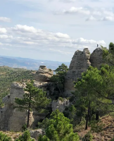
If you already know Covadonga and then discover this place, you will be amazed at the aesthetic, mystical and historical parallels between this and a place in the Cangas Valley, where it is said that Don Pelayo began the war against Muslims, and that, at that time, he was known as Cave Dominica. There are those who consider this overwhelming space as the Covadonga Andaluza and, according to tradition, here appeared the Virgin of Tiscar, an image exalted after the fall of the Arab fortress in the 14th century. The building is less majestic than the Asturian, but the sacred cave...

The enclave must have been sacred already from remote times. Tradition speaks of an appearance in the Water Cave, which is actually a closed cannon and sculpted by the Tícar Arroyo. This tradition also tells that it was already venerated at a time when the Arabs kept a square they considered unexpugnable, just above the grotto. On the main floor of the fortress, the present abode of Our Lady, dating back to the 15th or 16th centuries, was erected with subsequent remodeling.

In front of the entrance to the hermitage there is a fountain with a poem by Antonio Machado, dedicated to the patron of Quesada. From the old fortin is the majestic tower of tribute, with the shield of arms of Peter I (11th century) embedded in the armchair and the walled enclosure of the courtyard of arms, riding on a neckline hardly accessible to Peña Negra, a spectacular vertical wall, frequented by the mountain goats, vultures and eagles. You can climb up to him, from the sanctuary, by a metal step.

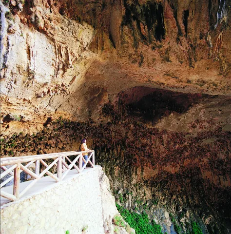
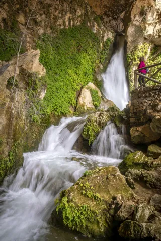
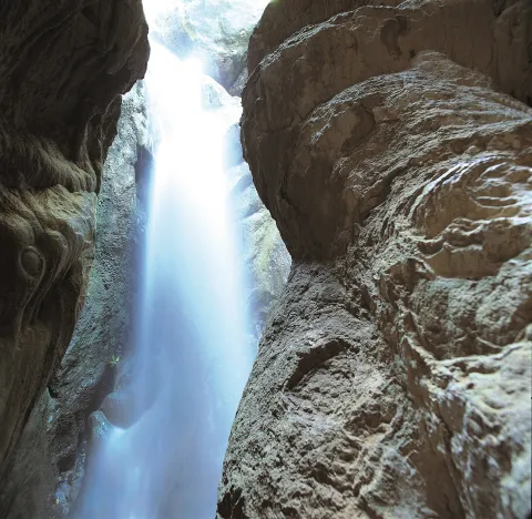
The Cueva del Agua is set down by an asphalt lane that leaves from the same A-6206, about 300 m from the sanctuary, where you can access a few small parking spaces, from where you will leave stairs that go down to a narrow and under tunnel (you have to bend down to cross it) through which a waterfall takes the water to the traditional gardens nearby. Through artificial oquity, the road offers us several alternatives to visit this magical place. Here, on a small obscene on the wall of the cave, there is a small replica of the Virgin, where the devotees, considering that this is their first and true abode, place their offerings. It is recommended to wear shoes with non-slip soles and to take precautions, as the floor and stairs are sometimes slippery.

We suggest...

  • Visit the birth of the Arroyo de Tíscar and the road of the Vadillo de Tíscar, very close to the sanctuary.

Tiscar is located at a crossroads of roads, right over the villages of Don Pedro and Belerda. The A-6206, also known as Tícar, which links Quesada with Hinojares and Pozo Alcón passes through a tunnel that crosses the rocky wall on which the Sanctuary and the Castle of Peña Negra are based and under which is the Cueva del Agua. This way Hinojares is 12 km, Quesada 15 km and Pozo Alcón 17 km. However, the nearest town is Huesa (10 km). From the same village a narrow local road is set up which, passing through Belerda, links with the previous one very close to the area.

Breve descripción

Tiscar is located at a crossroads of roads, right over the villages of Don Pedro and Belerda. The A-6206, also known as Tícar, which links Quesada with Hinojares and Pozo Alcón, passes through a tunnel that crosses the rocky wall on which the Sanctuary and the Castle of Peña Negra are based and under which is the Cueva del Agua. To the cave is down an asphalt lane that leaves from the same A-6206, about 300 m from the Sanctuary.
Ubicación
Código Postal
23489
Latitud
37.767970
Longitud
-3.024270
Dirección
C/ Diseminado de Don Pedro, 11-17
Municipio
Ubicación en el mapa
POINT (-3.02427 37.76797)
Tipos de punto de interés
Imágenes carrusel
imagen
Image
25csv-jpg
Imagen principal
Desactivado
imagen
Image
natu113-1-jpg
Imagen principal
Desactivado
Imágenes cabecera
imagen
Image
cueva-del-agua-1-jpg
Imagen principal
Activado
Loading map
Preparing points of interest and routes...