Saltar al contenido principal
icon-intereses-grupos

Adventure in Las Villas, enjoy a natural gymkhana at the Villanatura Leisure and Active Tourism Center

Submitted by brandcode_deweloper on
Id
13485999
Descripción larga
Designed for those looking for fun, adventure and connection to nature, this multi-adventure experience in the region of Las Villas allows participants to customize their experience: choose two activities between a wide variety thought for all tastes and ages. What can they do? Participants will be able to climb on the rocodrome or face the adrenaline of a natural ferrata track, feel the thrill of the tyrolin or get into the arborism circuits, test their aim with the archery or live the action of the paintball, learn with environmental education workshops or discover the secrets of sports orientation, experience the challenge of rappel, enjoy the starry sky, explore the environment through a guided hiking route, and much more. This natural gymkhana is prepared for all: families, groups of friends and of schoolchildren or nature lovers will find in Villanatura the perfect balance between sport, learning and fun. Difficulty: Medium - Low.
Latitud
38.169887
Longitud
-2.972749
Ubicación en el mapa
POINT (-2.972749 38.169887)
imagen
Image
_mg_8598-jpg
Imagen principal
Activado

Family

icon-intereses-familia

Groups

icon-intereses-grupos
Aventura en Las Villas, disfruta de una gymkhana natural en Centro de Ocio y Turismo Activo Villanatura
All year round
Desactivado
Coordenadas / Huso 30S
30S x = 502387 and = 4224665
Flavors and adventure: Route and gourmet tasting at Paraíso de Bardazoso

Submitted by brandcode_deweloper on
Id
13481724
Descripción larga
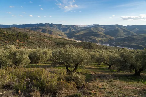
Get into a morning experience in the heart of the natural park where the magic of nature fuses with the tradition of the olive tree. "Roots and Wings: Ecotourism between Olivares and Birds of Segura" invites you to discover the biodiversity of the region through two fascinating worlds: ornithological tourism and oleoturism. Visit the organic olive groves of Oleai, where you will learn about the AOVE artisanal process and how sustainable agricultural practices create a shelter for birds. In addition, with the help of specialized binoculars and guides, you will learn how to identify birds and know their crucial role in the ecosystem. Dive into local culture with a tasting of oil accompanied by traditional products and explore how environmentally friendly agriculture not only produces an exceptional AOVE, but also preserves the rich biodiversity of the area. An experience that connects taste, nature and sustainability, in the purest natural environment of the province. Roots and Wings is a journey to conservation, taste and harmony with nature.
Latitud
38.168322
Longitud
-3.011633
Distrito
Municipio
Ubicación en el mapa
POINT (-3.011633 38.168322)
imagen
Image
dsc08137-1-jpg
Imagen principal
Activado

Seniors

icon-intereses-senior

Family

icon-intereses-familia

Groups

icon-intereses-grupos

Eco-friendly

icon-intereses-eco-friendly
Disfruta de un amanecer entre olivares y aves de Segura con AOVE Ecológico Oleaí
All year round
Desactivado
Coordenadas / Huso 30S
30S x = 498981 and = 4224491

Discover the Ruta de las Ermitas and the monasteries of Cazorla with Cazorlaventur

Submitted by brandcode_deweloper on
Id
13470668
Descripción larga
Cazorlaventur offers a guided tour to explore the surroundings of Cazorla and its religious legacy. The route begins in the area of San Isicio, with a first stage of difficulty moderate by its concrete slope. The first destination is the Monastery Monte-Zion, formerly inhabited by a monk of the Order of St. Paul and St. Anthony Abad. During the tour, participants will enjoy views of the natural park and its characteristic olive groves. The next stop is the view of Riogazas, from where you can see the castles of the Yedra and the Five Esquinas, as well as the hermitage of Our Lady of the Head. Along the way, the landscape becomes more wooded, with a wide variety of flora and fauna, such as squirrels, mountain goats and leonated vultures, which the guide explains in detail. The route goes down to Cazorla, passing through the Recreative Area of Riogazas, where you can rest and enjoy fresh water. The tour continues to the Ermites of San Sebastián or San Miguel Archangel, depending on the rhythm, to end in the birth of Nacelrio and the ruins of Santa María, in Cazorla.
Latitud
37.909095
Longitud
-3.005062
Municipio
Ubicación en el mapa
POINT (-3.005062 37.909095)
imagen
Image
_mg_3659-jpg
Imagen principal
Activado

Family

icon-intereses-familia

Groups

icon-intereses-grupos
Medium
Descubre la ruta de las ermitas y los monasterios de Cazorla con Cazorlaventur
All year round
Desactivado
Coordenadas / Huso 30S
30S x = 499555 and = 4195729

Enjoy nature via the La Mocha via ferrata with Tierraventura Cazorla

Submitted by brandcode_deweloper on
Id
13451523
Descripción larga
Through the ferrata track of La Mocha you will feel like a bird watching from the heights the nature of the saw and the olive fields characteristic of this territory. It is equipped in the peak of the Mocha next to the village of the Iruela. With easy access to both its entry and exit, it is a step-by-step route where the vertical, horizontal, collapse sections are alternated, with a horizontal crossing and a Tibetan bridge in the final part. The equipped tour is about 560 meters. It is possible to perform the final stretch with a simpler alternative route of 150 meters, however, if you are an intrepid person it is recommended to finish the route in its greatest difficulty. The way back will be on foot on a mountain path, to reach the starting point. However, if you want to explore this area more you can continue to the forest shed of Prado Redondo, hermitage Virgen de la Cabeza to end in La Iruela. The level of the ferrata track alternates between K2 and K3, for this reason it is possible that along the route it will find sections that are easier or more demanding.
Latitud
37.921767
Longitud
-2.989544
Municipio
Ubicación en el mapa
POINT (-2.989544 37.921767)
imagen
Image
_mg_4644-jpg
Imagen principal
Activado

Family

icon-intereses-familia

Groups

icon-intereses-grupos

For couples

icon-intereses-en-pareja
Baja
Disfruta de la naturaleza a través de la vía ferrata de La Mocha con Tierraventura Cazorla
All year round
Desactivado
Coordenadas / Huso 30S
30S x = 500919 and = 4197135
Tramo de asfalto o cemento
 
Tramo de pista o camino forestal
 
Tramo de vía pecuaria
 
Tramo de senda
 

Colonos Rural Accommodation

Submitted by brandcode_deweloper on
Id
13544959
Redes sociales
Facebook
https://www.facebook.com/colonos.alojamientosrurales
Descripción
Breve descripción

We have different charming rural accommodation located in Guarromán in the province of Jaén, very close to Despeñacolos in Sierra Morena, where you can enjoy a quiet and pleasant stay in contact with the nature of the place surrounding our rural complex. In Colonos we want to offer personalized attention, with exclusive services for our customers. You just have to show us your preferences and we'll set you up for a few days.

These houses are named after our ancestors, people who inhabited the place. Thus, we have the house of Pajar de Thürriegel, Felipe Mitelbrun, María Fischer and Margarita Ripoll, keeping inside their portraits and family memories. These are documents that prove their history outside of the New Populations: letters from Olavide, remittances from settlers, agrarian measures of the time, furniture, artisanal works carried out by colonists of the fourth generation...; all to create an environment that seduces the guest and introduces him into the mystery and curiosity of a time not far but perhaps something unknown. To watch over our dreams the Immaculate Conception that presides over the headers of all beds will be taken care of.

Información de contacto
Teléfono
637 467 908
Sitio web
www.colonosaldeaaltico.com/
Correo electrónico
reservas@colonosaldeaaltico.com
Ubicación
Código Postal
23210
Latitud
38.214314
Longitud
-3.667722
Dirección
Aldea El Altico
Distrito
Google Maps Url
https://maps.app.goo.gl/XFAvrPKcT9BySxUc8
Municipio
Cómo llegar (URL de Google Maps)
https://www.google.com/maps/embed?pb=!1m18!1m12!1m3!1d671.117265085915!2d-3.668062606786804!3d38.21425736047237!2m3!1f0!2f0!3f0!3m2!1i1024!2i768!4f13.1!3m3!1m2!1s0xd6e9ed68939c5e9%3A0x4dac5455510e7198!2sAlojamientos%20Rurales%20%22Colonos%22!5e1!3m2!1ses!2ses!4v1747226292655!5m2!1ses!2ses" width="600" height="450" style="border:0;" allowfullscreen="" loading="lazy" referrerpolicy="no-referrer-when-downgrade
Ubicación en el mapa
POINT (-3.667722 38.214314)
Tipo de alojamiento
Imágenes
imagen
Image
zona-comun_8-jpg
Imagen principal
Activado
imagen
Image
zona-comun_22-jpg
Imagen principal
Desactivado
imagen
Image
felipe-m_6-jpg
Imagen principal
Desactivado
imagen
Image
felipe-m_42-jpg
Imagen principal
Desactivado
imagen
Image
zona-comun_38-jpg
Imagen principal
Desactivado
imagen
Image
zona-comun_25-jpg
Imagen principal
Desactivado
imagen
Image
margarita-r_7-jpg
Imagen principal
Desactivado
imagen
Image
margarita-r_27-jpg
Imagen principal
Desactivado
Aforo
18
Las habitaciones

The "Los Colonos" rural complex is a renovated and adapted rural accommodation to offer our guests a unique experience in the heart of nature. To stress that our rural accommodation share wonderful facilities to ensure a pleasant stay to our customers. The complex has a house adapted for the elderly or disabled, cradle and parquet-cradle for children.

Colonos consists of three rural accommodation, fully equipped with the best facilities and decorated with care, each house has two floors with hardwood ceilings, where the bedrooms are located.

Qué ofrece

In Colonos we want to offer personalized attention, with exclusive services for our customers. You just have to show us your preferences and we'll set you up for a few days.

  • Guided tours to the heritage cities of Ubeda and Baeza humanity.
  • Horseback riding, equestrian initiation activities.
  • Routes through the natural park of Despeñacolos (hiking, rough painting routes, history, flora and fauna.; night routes...).
  • Oleoturism.
Loading map
Preparing points of interest and routes...
El Hotel

These are 3 fully independent accommodation:

• Maria Fischer with capacity for nine people, but can be rented in two independent parts of 4 and 5 people respectively. The first stay consists of 2 double rooms, living room, kitchen and a bathroom and the second stay, called Parar de Thürriegel, consists of a triple room, a double room, living room, kitchen and 1 bathroom.
• Felipe Mitelbrum for five people, has a triple room, a double room, living room, kitchen and a bathroom.
• Margarita Ripoll for four people, with a double room, a double room, living room, kitchen and a bathroom.

Archaeological Site of the Vega Baja

Submitted by brandcode_deweloper on
Id
13575393
Descripción
Breve descripción

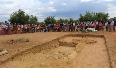
This site, located north of Mengibar, is an exceptional testimony of historical continuity, ranging from the Final Neolithic to the altomedieval period. Although not currently visible, their vestiges show intense human and economic activity over the centuries.

Telecomunicaciones
Sitio web
https://mengibarturismo.com/
Teléfono de contacto
677 222 285
Correo electrónico
turismo@aytomengibar.com
Ubicación
Latitud
37.968050
Longitud
-3.808780
Distrito
Municipio
Ubicación en el mapa
POINT (-3.80878 37.96805)
Tipos de punto de interés
Loading map
Preparing points of interest and routes...
Interés

Pillories and Jurisdiction Columns

Submitted by brandcode_deweloper on
Id
13581021
Descripción
Descripción larga

The title, granted by Philip II, allowed him to have full jurisdiction, made symbolized by the presence of rolls and picotas. While the former reflect the new administrative and legal status, picotta is the place where the prisoners were punished.

The rolls marked the jurisdictional limit and were commemorative monuments of the award of the title of Villa. The picotas were stone columns, more or less ornamented, where punishments and public scarings were applied. At present, the three conserved in the municipality are crouched and topped by crosses.

Breve descripción

Located in the historical set of Mengibar, the rolls and the picotas are evidence of their formation as a people with its own jurisdiction. The origin of the rolls is on the date of 1574, when the city of Jaén was emancipated and the title of Villa was acquired.

Telecomunicaciones
Sitio web
https://mengibarturismo.com/
Teléfono de contacto
677 222 285
Correo electrónico
turismo@aytomengibar.com
Ubicación
Código Postal
23620
Latitud
37.968050
Longitud
-3.808780
Dirección
C/ Santos Galindo, 1
Distrito
Municipio
Ubicación en el mapa
POINT (-3.80878 37.96805)
Imágenes cabecera
imagen
Image
cruz-del-rollo-jpg
Imagen principal
Activado
Loading map
Preparing points of interest and routes...

Niches / Shrines

Submitted by brandcode_deweloper on
Id
13577215
Descripción
Descripción larga

In the streets of Mengibar there are a large number of hornadoes, in which are venerated to crucified and images of the Virgin Mary in her various vocations: of Carmen, of the Head, etc. The origin of these dates back to the 17th century, when the ecclesiastical authorities of the city request the collaboration of the neighbors to build 14 hornaces on the streets for which the Holy Week processions would take place. In the hornadines, crosses were installed, providing the parishioners with the prayers relevant to the stations of the Holy Way Cruces.

Of all the hornacinas, the Hermanos Fernández with the Cross of Caravaca, very venerated by pregnant women in order to have good birth, Antonio José de la Chica or Pozuelo, whose devotion has been constant over the centuries, and García Morato or Alta, one of the most venerated and best decorated.

Breve descripción

The hornaces are hollow, usually shaped like arches, made in walls. A votive image was placed in them. Also, they get the name niche.

Telecomunicaciones
Sitio web
https://mengibarturismo.com/
Teléfono de contacto
677 222 285
Correo electrónico
turismo@aytomengibar.com
Ubicación
Código Postal
32620
Latitud
37.969240
Longitud
-3.807647
Dirección
C/ Hermanos Fernández, s/n
Distrito
Municipio
Ubicación en el mapa
POINT (-3.807647 37.96924)
Tipos de punto de interés
Imágenes cabecera
imagen
Image
fotografia_hornacinas-jpg
Imagen principal
Activado
Horario
10: 00 - 14: 00 and 17: 00 - 21: 00.
Loading map
Preparing points of interest and routes...
Interés

Arch of Jano

Submitted by brandcode_deweloper on
Id
13575693
Descripción
Descripción larga

The work for its location, carried out by the University Institute of Research in Iberian Archaeology of the University of Jaén with the support of the City of Mengíbar, began in 2018. In relation to its characteristics, it is proposed that the foundation found allows to interpret a large arc of 14.80 meters long, almost 5 meters wide and a single central vanity of 5.15 meters, where the Via Augusta was running.

The relevance of this finding served to be declared, with great haste (2019), as Good of Cultural Interest.

Breve descripción

Located in the vicinity of the city of Mengibar, a stone's throw from the Guadalquivir and next to the so-called "Way of the Romans," is the Arc de Jano or "Ianus Augustus," the door to the Betics while Rome was "owner of the known world." This is a first order territorial marker located next to the Roman road of the Via Augusta, the point from which the distances were measured and marked by militaries. It was also the limit place between the provinces of the Senatorial Betica and the Imperial Tarraconense.

Telecomunicaciones
Sitio web
https://aytomengibar.com/municipio/descubre-mengibar/
Teléfono de contacto
677 222 285
Correo electrónico
turismo@aytomengibar.com
Ubicación
Código Postal
23620
Latitud
37.998137
Longitud
-3.809457
Dirección
Carretera JV-2304. Camino de los Romanos
Distrito
Municipio
Ubicación en el mapa
POINT (-3.809457 37.998137)
Tipos de punto de interés
Imágenes cabecera
imagen
Image
a78a62de3d2fcbeb931803c84b06232b0e661efa-jpg
Imagen principal
Activado
Loading map
Preparing points of interest and routes...
Interés

Olmedo Bike Tour

Submitted by brandcode_deweloper on
13427334
Facebook
https://www.facebook.com/people/Manuel-Olmedo-Mart%C3%ADnez/100093466231940/?_rdr
Instagram
www.instagram.com/olmedo_tour
Descripción larga

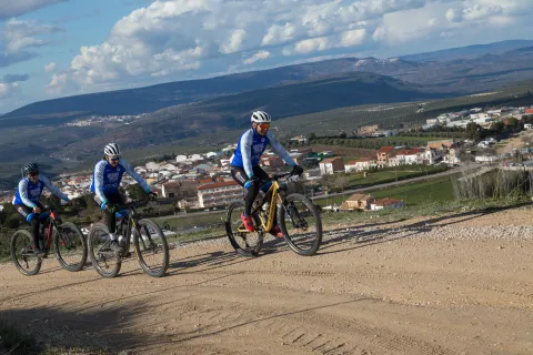
Olmedo Bike Tour is a company specializing in BTT bikes, offers a rental service for visitors to discover the Natural Park Sierras de Cazorla, Segura and Las Villas in a responsible way with the environment. In addition to organizing custom routes throughout the entire area of the natural park, adapted to each type of customer.

Teléfono
626 949 626
Sitio web
https://olmedobiketour.com/
Persona de contacto
Manuel Olmedo Martinez
Correo electrónico
info@olmedobiketour.com
Latitud
38.164151
Longitud
-2.86808
Dirección
C/ Ramón y Cajal, 213
Ubicación en el mapa
POINT (-2.86808 38.164151)
imagen
Image
_mg_6920-jpg
Imagen principal
Activado
imagen
Image
_mg_6934-jpg
Imagen principal
Desactivado
imagen
Image
_mg_6940-jpg
Imagen principal
Desactivado
imagen
Image
_mg_6942-jpg
Imagen principal
Desactivado
Desactivado
Loading map
Preparing points of interest and routes...