Saltar al contenido principal

Trail Control de la Cabrera-Santuario Virgen de la Cabeza

Submitted by brandcode_deweloper on
Id
4949600
Descripción larga

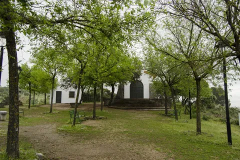
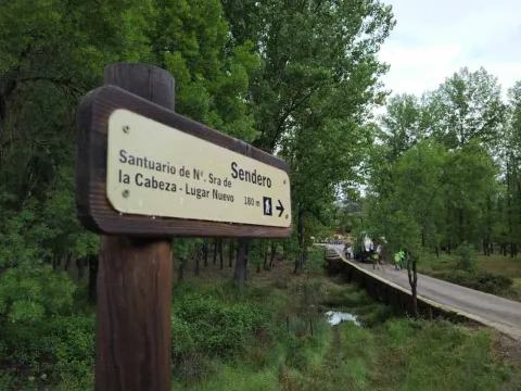
We started the tour on the access to the New Place Mount through the Cabrera Control. We go down a track that first crosses a lush forest of alcornoques and oaks and then a dehesa from where the Jandula River and the Sanctuary are seen.

We continue to descend on the track until we reach a granite gate crossed by a steel cable, known as the "Spinarejo Cable," which we cross and follow, on the same track, 150 m to then take a narrower path that goes to the right. Let us ascend through the pine until we reach the pedestrian door of the Majadillas, where we will leave the New Place Mount.

After a few more meters, we will link with a forest track that for about 4.7 km, crosses the heights of Navalasno and La Navarra. In this section we will observe a typical landscape of the granitic sector of the natural park, in which there are alternating broquets of oak and juniper, dehesas and rocky florings.

After reaching the ruins of the Cortijo de Navalasno Viejo we will soon go back to Mount Place Nuevo through the pedestrian door of the Fucovert.

It is now beginning a descent through a sidewalk between oak and granite that will take us to the Arroyo de los Santos. A beautiful seasonal channel flanked by large-scale strawberries. We will then ascend through a sidewalk through an open pinar until we reach another pedestrian door and a granite road that leaves for a forest track that we will take to the left and continue for 1.4 Km until we reach the Marmolejo Brotherhood, within the Sanctuary Village.

Breve descripción

The itinerary described above includes a section of the GR48 stage that can only be done on foot, by bicycle or by horse and runs along the traditional road from Marmolejo to the Sanctuary, coinciding with the Cordel de Marmolejo and other pecuary routes. It is a long tour, but it allows you to discover lonely places of enormous beauty.
Latitud
37.7796
Longitud
-3.7849
Distrito
Municipio
Ubicación en el mapa
POINT (-3.7849 37.7796)
imagen
Image
Sendero%20Control%20de%20la%20Cabrera-Santuario%20Virgen%20de%20la%20Cabeza.jpg
Imagen principal
Activado
imagen
Image
Sendero%20Control%20de%20la%20Cabrera-Santuario%20Virgen%20de%20la%20Cabeza2.jpg
Imagen principal
Desactivado
5 h 30 min

Nature

icon-intereses-naturaleza

Friends

icon-intereses-amigos

Adventure

icon-intereses-aventura

Culture

icon-intereses-cultura

Sport

icon-intereses-deporte

Eco-friendly

icon-intereses-eco-friendly

For couples

icon-intereses-en-pareja

Family

icon-intereses-familia

Gastronomy

icon-intereses-gastronomia

Municipality

icon-intereses-municipio

Low-cost tourism

icon-intereses-turismo-low-cost

Solo travel

icon-intereses-viajar-solo
Medium
Sendero Control de la Cabrera-Santuario Virgen de la Cabeza
15,5 km
On foot
All year round
Desactivado
  • In front of COVID19, keep the safety distance and carry a mask, avoid agglomerations and contact with surfaces, wash your hands frequently, use hydroalcoholic gel and consult the available digital materials. Take care of your health and others.
  • It works to prevent fires. Do not throw cigarettes or any other object that produces combustion.
  • By consuming local products and having companies in the area you will contribute to rural development.
  • He lives with the local people and other users. It respects private property and property.
  • Unwind in a sustainable way: public transport, bike, walk, shared vehicle...
  • Noise is another form of pollution. In silence you will enjoy your experience more.
  • It facilitates the use of people with special needs.
  • The trash doesn't come back alone. Take her with you to the nearest container. Reduce, reuse, recycle.
  • Don't leave a mark on your way through nature.
  • It practices a responsible and committed tourism with the environment. Be a real ecotourist!
  • Respect the facilities at your disposal. We all pay for your maintenance.
  • Check the weather forecast before starting your activity.
  • Avoid going out alone. If you do, it communicates tour and time of return to other people.
  • Extreme caution under adverse conditions and with the occasional presence of animals or motor vehicles.
  • Please provide prior information on the possible existence of cynegetic activity.
  • It has water, sun protection, proper clothes and shoes.
  • It carries a mobile with enough battery in case of emergency (112), but remember that there is not always coverage.
  • Don't even bother animals. You would negatively alter his behavior.
  • For your safety and the safety of the environment, don't get out of the signposted road or take shortcuts.
  • Remember that the capture of animals, light fire, fish and collect plants or minerals is prohibited.
  • If you bring a dog, take him with his strap and make sure he doesn't bother other animals or people.
  • Your safety is our concern, but it's your responsibility.

Thank you for your cooperation!

From the town of Marmolejo (Jaén), we take the road A-420 with direction to Cardeña (Córdoba), which goes to the spa of Marmolejo, next to the Guadalquivir River. In this place just after passing the Roman bridge we find a crossing, we must take to the right by the local race JV-5.001, for approximately 12 km (after walking the path La Centenera), we will take the detour to the left, by which the so-called Control of the Cabrera that gives access to the public mountain is accessed.

Trail Camino Viejo: tramo Santuario de Nuestra Señora de la Cabeza- Lugar Nuevo

Submitted by brandcode_deweloper on
Id
4935428
Breve descripción

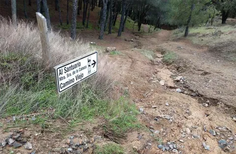
This path begins in Cerro del Cabezo, being all its descending path.

The first stretch of this path runs along the margin of the stream of the Virgin between jars, acebuchs and some aromatic plants such as the cantbone and the rosemary. On the left of this descent, called Cuesta de los Caracolillos, there is a magnificent view of Cerro del Cabezo, on which stands the sanctuary of the Virgin of the Head and of all the southern hillside of this, known as the Solanas of the Virgin.

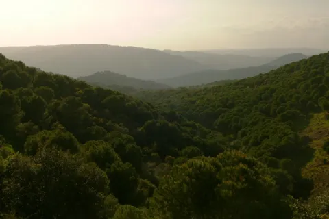
Around 1.7 km, you can reach the Old Way, from where you can see the Jandula River Valley as you pass through New Place. In addition, with a little luck, it can be seen, through the skies of the Sierra de Andújar Natural Park, the imperial eagle, the black vulture or the royal eagle, as on this area are often found.

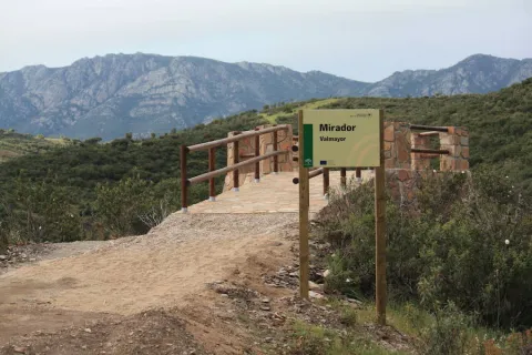
From the viewpoint, the path goes on to have a more pronounced slope, and caution must be extreme. After the descent, the vegetation changes and there appears to the left a repopulation of pine piñonero, and on the right margin, to the front, a dehesa of burning. Through that dehesa we arrive to a Roman bridge that crosses the Jandula River, on whose shores there is a rich vegetation of strawberry, alyses and adelfas.

Latitud
38.0394
Longitud
-4.0511
Distrito
Municipio
Ubicación en el mapa
POINT (-4.0511 38.0394)
imagen
Image
1%20%281%29%20%281%29.jpg
Imagen principal
Activado
imagen
Image
Sendero%20Camino%20Viejo%20tramo%20Santuario%20de%20Nuestra%20Se%C3%B1ora%20de%20la%20Cabeza.jpg
Imagen principal
Desactivado
2 h 30 min

Nature

icon-intereses-naturaleza

Friends

icon-intereses-amigos

Adventure

icon-intereses-aventura

Culture

icon-intereses-cultura

Sport

icon-intereses-deporte

Eco-friendly

icon-intereses-eco-friendly

For couples

icon-intereses-en-pareja

Family

icon-intereses-familia

Gastronomy

icon-intereses-gastronomia

Municipality

icon-intereses-municipio

Low-cost tourism

icon-intereses-turismo-low-cost

Solo travel

icon-intereses-viajar-solo
Baja
Sendero Camino Viejo: tramo Santuario de Nuestra Señora de la Cabeza- Lugar Nuevo
5,5 km
On foot
All year round
Desactivado
  • In front of COVID19, keep the safety distance and carry a mask, avoid agglomerations and contact with surfaces, wash your hands frequently, use hydroalcoholic gel and consult the available digital materials. Take care of your health and others.
  • It works to prevent fires. Do not throw cigarettes or any other object that produces combustion.
  • By consuming local products and having companies in the area you will contribute to rural development.
  • He lives with the local people and other users. It respects private property and property.
  • Unwind in a sustainable way: public transport, bike, walk, shared vehicle...
  • Noise is another form of pollution. In silence you will enjoy your experience more.
  • It facilitates the use of people with special needs.
  • The trash doesn't come back alone. Take her with you to the nearest container. Reduce, reuse, recycle.
  • Don't leave a mark on your way through nature.
  • It practices a responsible and committed tourism with the environment. Be a real ecotourist!
  • Respect the facilities at your disposal. We all pay for your maintenance.
  • Check the weather forecast before starting your activity.
  • Avoid going out alone. If you do, it communicates tour and time of return to other people.
  • Extreme caution under adverse conditions and with the occasional presence of animals or motor vehicles.
  • Please provide prior information on the possible existence of cynegetic activity.
  • It has water, sun protection, proper clothes and shoes.
  • It carries a mobile with enough battery in case of emergency (112), but remember that there is not always coverage.
  • Don't even bother animals. You would negatively alter his behavior.
  • For your safety and the safety of the environment, don't get out of the signposted road or take shortcuts.
  • Remember that the capture of animals, light fire, fish and collect plants or minerals is prohibited.
  • If you bring a dog, take him with his strap and make sure he doesn't bother other animals or people.
  • Your safety is our concern, but it's your responsibility.

Thank you for your cooperation!

Important warning.As a preventive measure to prevent the contagion of the COVID19, this path must be crossed in the sense of ascending from the San Ginés Pubo Nuevo section, not allowing itself to be done in the direction of Pubo Nuevo to avoid crossing of trails at a short distance.

From Andújar we go up to the Sierra by the A-6177, to the visitor center Viñas de Peñallana, where we take the exit the Alcaparrosa JV-5011. In km 8 of that road we will find the indications that will lead us to San Ginés. Also, from Andújar by the road of the Chain.

Tramo de asfalto o cemento
 
Tramo de pista o camino forestal
 
Tramo de vía pecuaria
 
Tramo de senda
 

Trail Camino Viejo: tramo San Ginés-Lugar Nuevo

Submitted by brandcode_deweloper on
Id
4929187
Descripción larga

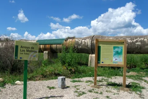
To take this path we will have to go to the northern part of the urban town of Andújar and from the cemetery take the Old Way or the San Amasio Way. The road is a track of land with good firm, up to the kilometer 1.9 where is the area known as Los Tubos, where the track is crossed by a huge tube of the Rumblar Canal.

In the area known as the "Tubos" is located the zero km of the route Camino Viejo - Cordel de los Molinos. From this point on the track through which we travel, it has worse firm, but it is passable by all-terrain vehicles for 900 meters more, until it reaches a rest area for the pilgrims and the sign of the beginning of the path. The starting signal is located next to a metal door that we will have to close to us to start the path on foot, on horse or by bicycle.

Breve descripción

The path runs along the Old Way to the Sanctuary, the route used by the rosemary to go from Andújar to The Sanctuary of Our Lady of the Head, for centuries. This rosemary is declared a party of national tourist interest.

We will enjoy beautiful panoramic views of the Sierra de Andújar Natural Park from the view of the Monument to the Pilgrim. A beautiful walk through a path full of history, culture and tradition in an incomparable framework.

The trail Los Cerrillos is part of the Old Way, used by the pilgrims to climb from Andújar to the Sanctuary of the Virgin of the Head. Part of the site known as Los Cerrillo and reaches the Hermitage of San Ginés, a traditional meeting point for pilgrims.

The path gently ascends from the countryside, crosses through areas of livestock pastures and goes into the Sierra, crossing mountains covered with oak trees, cantuesos and jaras. During the flowering season, in April and May, the landscape becomes especially attractive.

It is worth walking this path in order to see an interesting panorama of Andújar and the countryside of the Guadalquivir valley and to go through the intertwined paths excavated on the slate rocks by the continued passage of thousands of pilgrims: walkers, cyclists and riders

Latitud
38.0394
Longitud
-4.0511
Distrito
Municipio
Ubicación en el mapa
POINT (-4.0511 38.0394)
imagen
Image
1%20%281%29.jpg
Imagen principal
Activado
imagen
Image
Sendero%20Camino%20Viejo.%20tramo%20San%20Gin%C3%A9s.jpg
Imagen principal
Desactivado
imagen
Image
1315_SS_06.jpg
Imagen principal
Desactivado
imagen
Image
1315_SS_02.jpg
Imagen principal
Desactivado
imagen
Image
1636_SS_03.jpg
Imagen principal
Desactivado
imagen
Image
1636_SS_04.jpg
Imagen principal
Desactivado
imagen
Image
1636_SS_01.jpg
Imagen principal
Desactivado
2 h

Nature

icon-intereses-naturaleza

Friends

icon-intereses-amigos

Adventure

icon-intereses-aventura

Culture

icon-intereses-cultura

Sport

icon-intereses-deporte

Eco-friendly

icon-intereses-eco-friendly

For couples

icon-intereses-en-pareja

Family

icon-intereses-familia

Gastronomy

icon-intereses-gastronomia

Municipality

icon-intereses-municipio

Low-cost tourism

icon-intereses-turismo-low-cost

Solo travel

icon-intereses-viajar-solo
Medium
Sendero Camino Viejo: tramo San Ginés-Lugar Nuevo
5,6 km
On foot
All year round
Desactivado
  • In front of COVID19, keep the safety distance and carry a mask, avoid agglomerations and contact with surfaces, wash your hands frequently, use hydroalcoholic gel and consult the available digital materials. Take care of your health and others.
  • It works to prevent fires. Do not throw cigarettes or any other object that produces combustion.
  • By consuming local products and having companies in the area you will contribute to rural development.
  • He lives with the local people and other users. It respects private property and property.
  • Unwind in a sustainable way: public transport, bike, walk, shared vehicle...
  • Noise is another form of pollution. In silence you will enjoy your experience more.
  • It facilitates the use of people with special needs.
  • The trash doesn't come back alone. Take her with you to the nearest container. Reduce, reuse, recycle.
  • Don't leave a mark on your way through nature.
  • It practices a responsible and committed tourism with the environment. Be a real ecotourist!
  • Respect the facilities at your disposal. We all pay for your maintenance.
  • Check the weather forecast before starting your activity.
  • Avoid going out alone. If you do, it communicates tour and time of return to other people.
  • Extreme caution under adverse conditions and with the occasional presence of animals or motor vehicles.
  • Please provide prior information on the possible existence of cynegetic activity.
  • It has water, sun protection, proper clothes and shoes.
  • It carries a mobile with enough battery in case of emergency (112), but remember that there is not always coverage.
  • Don't even bother animals. You would negatively alter his behavior.
  • For your safety and the safety of the environment, don't get out of the signposted road or take shortcuts.
  • Remember that the capture of animals, light fire, fish and collect plants or minerals is prohibited.
  • If you bring a dog, take him with his strap and make sure he doesn't bother other animals or people.
  • Your safety is our concern, but it's your responsibility.

Thank you for your cooperation!

Important warning.As a preventive measure to prevent the contagion of COVID19, this path must be carried in the sense indicated in the starting sign.

From Andújar we go up to the Sierra by the A-6177, to the visitor center Viñas de Peñallana, where we take the exit the Alcaparrosa JV-5011. In km 8 of that road we will find the indications that will lead us to San Ginés. Also, from Andújar by the road of the Chain.

Trail Viewpoint Reand

Submitted by brandcode_deweloper on
Id
2555234
Descripción larga

La Lancha is a village that rose for the construction of the Jandula dam, started in 1927 and completed four years later. It was inhabited by about 3,000 people in the most active moments. It is about 30 kilometres from Andújar in an unpopulated territory where malaria was endemic at that time. There is only one unasphalted road that reaches the village, the JF-5004, which comes from Los Escoriales for a journey also offered as a path marked by the Natural Park.

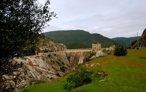
Already in La Lancha we must continue on the same road down to the dam, where the path begins. If we have reached here by car, we will leave it in this place to take a look at the Jandula reservoir first from the dam itself, and then make the short path. It has been almost eighty years since this great artificial lake was created, where the waters of the Jandula River are reinstated along about twenty kilometres from its channel, flooding its enclosed valley. The reservoir has a capacity of 322 Hm3 with a water sheet of 1,231 hectares. A new piece introduced in the geography of the saw which, of course, has had an important impact on the landscape, ecology and local and regional economy.

The variety of the local fauna, which we can see with some ease, is a clear example of such an induced transformation. Cormorans, with their lustful black plumages and bronze, are already common and it is not rare to see ducks or garzas. In the water there are species such as black-bass, carp or barb, and also a fish that is only found in these waters and tributaries of the Jandula, called the bogardilla.

From the side of the dam to which we have reached, we will take the road that goes south on the left side of the river, a hundred meters above it. Its appearance gives us clues on the landscapes before the construction of the dam. As we move away from the dam we gain perspectives on it, and we better explain its consideration as a historical monument.

Two hundred metres from the beginning of the road we find a stretch enlarged by a excavation at the foot of the village, which is nothing other than the granite quarry that was opened and exploited only for the construction of the dam and other works related to it, case of the village. Part of the image of integration of this great wall into the landscape is due to its stone coating of the place itself. We can see around some block of granite that was left unused, and also some other witnesses of the agitated activity during the construction of the dam. A little later, the road is close at a point where we end our route.

Breve descripción

This is a brief tour along with the Jandula dam, also known as La Lancha, which in itself is a monumental construction of a high heritage and, of course, economic and social value. It is located in an agribusiness and historically depopulated area of the interior of Sierra Morena. To the value of the Mediterranean mountain that naturally dominates it, this great artificial lake adds diversity to the landscape. The path is a follow-up to another one with a greater path that reaches the dam from the Scoriales.

Latitud
38.0394
Longitud
-4.0511
Distrito
Municipio
Ubicación en el mapa
POINT (-4.0511 38.0394)
imagen
Image
IMG_1821.jpg
Imagen principal
Activado
imagen
Image
Sendero%20Mirador%20del%20Rey.jpg
Imagen principal
Desactivado

Nature

icon-intereses-naturaleza

Friends

icon-intereses-amigos

Adventure

icon-intereses-aventura

Culture

icon-intereses-cultura

Sport

icon-intereses-deporte

Eco-friendly

icon-intereses-eco-friendly

For couples

icon-intereses-en-pareja

Family

icon-intereses-familia

Gastronomy

icon-intereses-gastronomia

Municipality

icon-intereses-municipio

Low-cost tourism

icon-intereses-turismo-low-cost

Solo travel

icon-intereses-viajar-solo
Baja
Image
41aee518-2679-dabc-b969-77dc1aea6436?t=1588958225609
Image
0d6c0d94-c307-8108-88b7-a2d0310c555f?t=1588958239153
Sendero Mirador del Rey
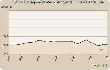
1,2 km
14m
14m
2
2
2
1
On foot
All year round
Desactivado

It is recommended to wear safe drinking water and clothing and adequate footwear. Take special care of possible falls. This path can be realized throughout the year. In summer, due to the special conditions of height, the insolation is very strong which, together with the lack of shadows, requires important solar protection.

- Granitic closed.
- Embalse of important dimensions with variable levels.
- The monumental Jandula dam, designed by the modernist architect Casto Fernández Shaw and associated village.
- granite quarry used for the construction of the dam and the village.

From Andújar you must take the road A-6177, north sense, to the sanctuary of the Virgin of the Head. After moving about 15 Km and passing the Park Visitors Center, you will turn right onto the JH-5002, towards the Jandula reservoir. We travel about 10 km to a crossing where we will have to turn left by the JF-5004. After another 10 Km we will reach the dam from where the path begins to our left

Tramo de asfalto o cemento
 
Tramo de pista o camino forestal
 
Tramo de vía pecuaria
 
Tramo de senda