Descripción larga
In the case of El Salvador de Úbeda, and previously in the Royal Chapel of Granada, the approach from the foundations is essentially funerary. Don Francisco de los Cobos and his wife, Doña María de Mendoza, in an absolutely novel way, conceived a free-standing building for their burial and that of their descendants, which in itself guarantees the importance and high social and economic rank achieved by Cobos, a second-rate Ubetense nobleman who came to hold, after a meteoric career, the most trusted administrative positions in the Court of Emperor Charles V.
To carry out such an important project in his hometown, Cobos obtained from Pope Paul III, on February 2, 1535, a bull to erect a temple-pantheon to which the chaplaincies and privileges granted in 1525 were transferred to build a funerary chapel in the parish of Santo Tomás, located very close to the family palace-house. As in other building projects, the person in charge of carrying out the plan was Dean Ortega. The chosen place was a large plot of land near the Hospital de los Honrados Viejos del Salvador and the aforementioned family palace, sumptuously renovated and expanded. After acquiring various plots of land from individuals and the aforementioned Hospital, Cobos agreed with the famous Burgos architect, Diego de Siloé, working in Granada on the construction of the Cathedral, for his ambitious project. Siloé undertook, among other things, to provide the conditions and drawing of the plant. In 1536 the works were finished by Andrés de Vandelvira and Alonso Ruiz, who had to follow at all times the instructions drawn up by Siloé, published by Don Manuel Gómez Moreno.
In 1539 Cobos ordered the suspension of the works, being advised by his relative, also royal secretary Juan Vázquez de Molina, on the convenience of transferring the construction of the sacred chapel to his manor of Sabiote. In 1540 they resumed, with Andrés de Vandelvira and Alonso Ruiz once again leading them. In this second contract, other works are required, such as the main façade, which must follow the model drawn by Siloé in the Forgiveness of the Cathedral of Granada, and the lateral ones, and Vandelvira is also in charge of the design of a new sacristy, an essential piece within the whole of the sacred chapel.
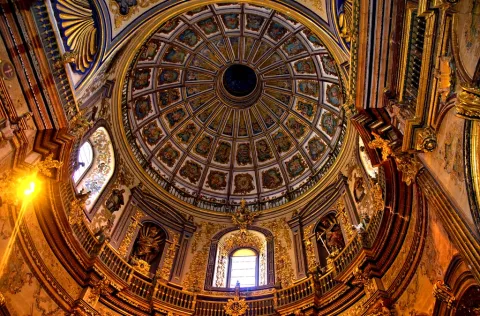
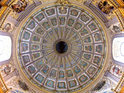
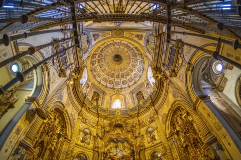
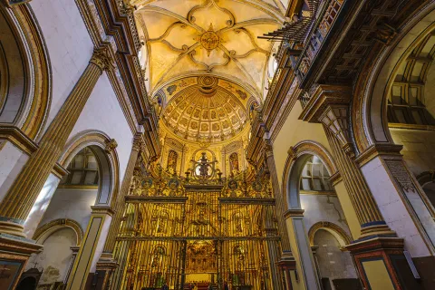
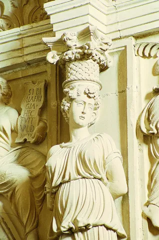
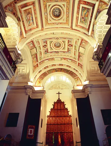
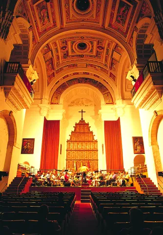
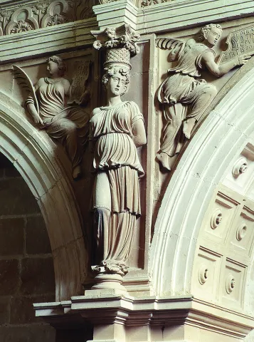
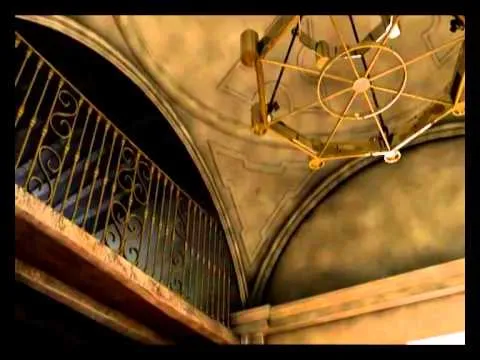
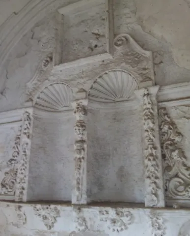
The floor plan is made up of a nave with late Gothic vaults with coffered chapels and a main chapel in the shape of a rotunda with coffered ceilings flanked by two beautiful vaults, one under the tower, the other giving access to the sacristy. This articulation had already been experimented by León Battista Alberti for the funerary temple of Sigismundo Malatesta in the Italian city of Rimini. Ultimately, the circle refers us to the Pantheon of Rome and the Santo Sepulcro de Jerusalén, the nave, for its part, responds to the demands of the cult. In the sacristy, which is accessed through a beautiful angled door, Vandelvira shows his extraordinary knowledge, as in the rest of his works, of the technique of stone cutting; Its rectangular floor plan is divided into three modules covered with hollow vaults (very Vandelvirian), with large arches placed on the walls, like niches, to house the drawers, framed by Sibyls and Prophets of excellent carving, due to the French sculptor Esteban Jamete.
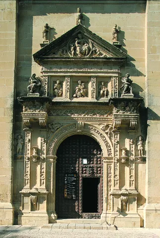
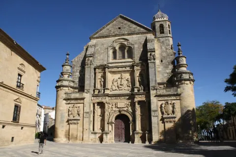
The great façade, which presides over the east side of the monumental Plaza de Santa María, is structured like a great triumphal arch; The upper one shows us the Transfiguration of Jesus on Mount Tabor, a motif also repeated in the main altarpiece, the lower one - due to the hand of Esteban Jamete - is more complete and deeper and in it are inserted, among many other motifs, scenes from both the Old Testament (Fall of the Manna and the Veneration of the Bronze Serpent) and the pagan world (Planets, from the intrados of the large central arch), but there is also abundant Plateresque carving.
Flanking this large doorway are two buttresses of Gothic tradition, featuring two of the seven labors of Hercules. (The fight against the centaurs and the bulls of Geryon). To the sides of them are two stands and below them on bases the shields of Don Francisco de los Cobos and Doña María de Mendoza supported by warriors and matrons, respectively. At the ends rise two graceful circular turrets decorated with plateresque elements. The emblems of the founders are inserted repetitively, both inside and outside The side covers are due to Andrés de Vandelvira; the southern one, like an altarpiece, with scenes from the Old and New Testament; The south, with delicate Plateresque work and the typical Vandelvirian composition of a triumphal arch, is dedicated to Santiago, patron saint of Spain.
A monumental bell tower, located on the Epistle side, completes this superb complex with a high symbolic value, present both architecturally and decoratively. Ultimately everything was designed to eternalize its founders. Andrés de Vandelvira, somewhat subject at first to the instructions of Diego de Siloé, appears much more personal to us as a result of the second contract of 1540, his great creative capacity emerging in the wonderful sacristy with its entrance door, but also in many other architectural elements.
In El Salvador, the desires for immortality sought by his mentor, Don Francisco de los Cobos, have been united with the architectural and sculptural quality fostered by great artists of the Renaissance: Diego de Siloé, Andrés de Vandelvira and Esteban Jamete. The church was consecrated in 1559. An inscription on one of the pillars of the nave remembers it: "This Holy Church was consecrated by the Most Reverend Don Diego Tavera, of good memory, bishop of Jaén. Sunday, October 8, 1539. Presiding in the chair of San Pedro, Pius the fourth and Philip II of this name reigning in Spain."
But what really links this temple to the figure of Muñoz Molina is its façade, where the representation of the “juancaballos” is carved, mythical creatures from the Sierra de Mágina that the author rescues to echo the phenomena and legends typical of rural spaces. The author, although the real image chiseled on the façade is from Greek mythology, Hercules fighting a Centaur, to give greater emphasis to the local history, deploys a story that enhances the real possibility of its existence in the characters of the novel.
“The proof that the juancaballos existed […] was, carved in stone, on the façade of the Church of the Savior, […], so that, if they had been sculpted in such a sacred place, next to the statues of the saints and under the relief of the Transfiguration of the Lord, my grandfather smilingly argued, one would have to be quite a heretic not to believe in them…”
Antonio Muñoz Molina. The Polish Horseman.
OTHER NON-ARCHITECTURAL ARTISTIC MANIFESTATIONS
Don Francisco de los Cobos and his wife, Mrs. María de Mendoza, endowed the Sacred Chapel with a rich movable heritage, increased by her descendants the Marquises of Camarasa. Little of that valuable treasure has come from the last heirs of the Camarasa. Of the abundant goldwork still kept in the sacristy, we highlight a late-Gothic gilt silver chalice from the end of the 15th century that, according to tradition, was given by Emperor Charles V to Cobos, a Venetian-style reliquary chest (15th century) and the cluster and barrel of a processional cross (disappeared), the work of the Toledo silversmith Francisco Martínez, carved in 1542; Also there is the reliquary bust of Santa Aurelia (16th century), carved in polychrome wood, and an ivory Christ (17th century).
Of the excellent pictorial collection treasured by Cobos, nothing remains in the Chapel, since even the pieces not destroyed in 1936 such as the Pieta (16th century), by Sebastián del Piombo, a Calvary (16th century) and a penitent Magdalene are currently deposited in the Casa de Pilatos. To alleviate these important losses, the Medinaceli Foundation has hung a replica of the aforementioned Pieta in one of the chapels of the nave. Only certain remains could be saved from the famous San Juanito, a sculpture sculpted in Carrara marble, which according to traditional and recent historiography is attributed to the great Michelangelo. In 1563, the image was deposited in the Sabiote castle, Cobos manor.
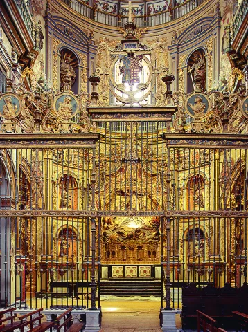
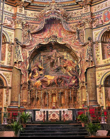
The large altarpiece of the High Altar, partially destroyed in 1936, represents - under an 18th century duster - the Transfiguration of Jesus on Mount Tabor, traditionally attributed to Alonso de Berruguete; The complex was restored by the sculptor José Luis Vassallo.
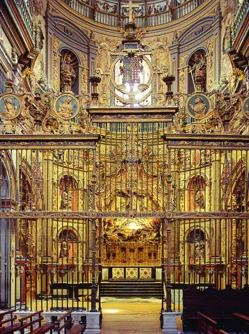
In the four niches that flank the altarpiece, the Evangelists are preserved, carved around 1634 by the Ubetense sculptor Pedro de Zayas, which are completed above with those by San Pedro y San Pablo, works from the 18th century. Part of the old upper ashlar masonry (16th century), carved by Blas Briñón according to the conditions of Andrés de Vandelvira, and the lower one (18th century) are preserved. Interesting are the collateral baroque altarpieces of the main chapel. The large grille, which separates the central space or rotunda from the rest of the nave, sits on the marble capitals of the patio of the nearby palace of Cobos and is one of the most relevant examples of Spanish ironwork, its execution being attributed to Francisco Martínez and Francisco de Villalpando; It is dated 1555, the year of consecration of this splendid funerary temple.