Saltar al contenido principal
icon-intereses-senior

Parish Church of Our Lady of Peace

Submitted by brandcode_deweloper on
Id
4276831
Descripción
Breve descripción

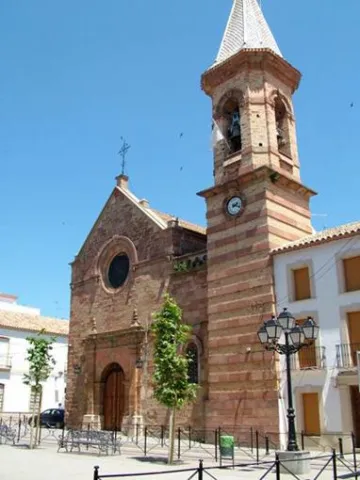
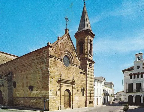
The Parish Church of Our Lady of Peace is located in Marmolejo. The origins of this church date back to the 14th century. This early foundation was added to the cruise in the 15th and 16th centuries and in the 18th the two covers. But the general configuration presented by this church today is the result of the reform carried out at the end of the 19th century by the architect Justino Flórez Llamas, under the historical and eclectic lexicography of the time, and which focused primarily on the west tower and facade.

Telecomunicaciones
Sitio web
www.villademarmolejo.es/urbanismo-y-monumentos/monumentos/iglesialapaz/
Teléfono de contacto
953 540 210
Ubicación
Código Postal
23770
Latitud
38.044960
Longitud
-4.170870
Dirección
Plaza de la Constitución, 3
Distrito
Municipio
Ubicación en el mapa
POINT (-4.17087 38.04496)
Tipos de punto de interés
Imágenes carrusel
imagen
Image
Parroqu%C3%ADa%20de%20Nuestra%20Se%C3%B1ora%20de%20la%20Paz3.jpeg
Imagen principal
Desactivado
imagen
Image
Parroqu%C3%ADa%20de%20Nuestra%20Se%C3%B1ora%20de%20la%20Paz.png
Imagen principal
Desactivado
Imágenes cabecera
imagen
Image
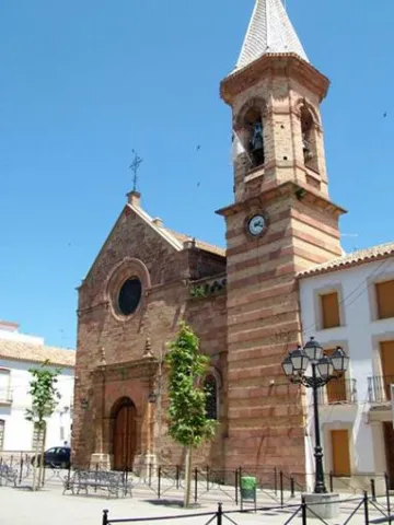
image_105936.jpeg
Imagen principal
Activado
Microsite al que pertenece
Loading map
Preparing points of interest and routes...
Parish of the Natividad de Nuestra Señora

Submitted by brandcode_deweloper on
Id
4523566
Descripción
Breve descripción

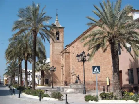
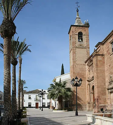
It was built on an earlier medieval temple and was founded in 1604 by Maria Notario de Lara, although its interior denotes Gothic traces. It is important to note its Major Retail of the S. XV). At the foot, it has a square base tower with two floors and a bell tower with half-point arches, which crown a pointed capital. On its northern side is the Chapel of the Rosary, an example of the Andalusian rococo of the first half of the 18th century.

Telecomunicaciones
Sitio web
www.vreina.com
Teléfono de contacto
953 537 127
Ubicación
Código Postal
23730
Latitud
38.005440
Longitud
-3.919940
Dirección
Plaza la Constitución, 9
Distrito
Ubicación en el mapa
POINT (-3.91994 38.00544)
Tipos de punto de interés
Imágenes carrusel
imagen
Image
Parroquia%20de%20la%20Natividad%20de%20Nuestra%20Se%C3%B1ora.jpg
Imagen principal
Desactivado
Imágenes cabecera
imagen
Image
villanuevareina.jpg
Imagen principal
Activado
Microsite al que pertenece
Loading map
Preparing points of interest and routes...

Jabalquinto Park

Submitted by brandcode_deweloper on
Id
8122790
Descripción
Descripción larga

The park is located in a public square in the centre of the city centre, with urban facilities and furniture dating back to the 1980s and which were old and in disuse. "It is a comprehensive project that will remodel this Freedom Park, which is almost 40 years old and has an image of deterioration," he adds. In this first phase, the entire infrastructure of supply, sanitation and public lighting is being changed. This performance will continue in a second phase in which all the urban furniture will be completed, consisting of banks running around the alcorques and the children's playground, as well as the covering of the fountain and the decorative lighting of the whole.

Breve descripción

New park on Avenida de Andalucía. It was designed to build a biosaludable park for outdoor sport with swing area for children.

Telecomunicaciones
Teléfono de contacto
953 617 056
Correo electrónico
jabalquinto@jabalquinto.es
Ubicación
Código Postal
23712
Latitud
38.019340
Longitud
-3.726970
Distrito
Municipio
Ubicación en el mapa
POINT (-3.72697 38.01934)
Tipos de punto de interés
Imágenes carrusel
imagen
Image
parque%20Jabalquinto%20%281%29.jpg
Imagen principal
Desactivado
Imágenes cabecera
imagen
Image
parque%20Jabalquinto2%20%281%29.jpg
Imagen principal
Activado
Loading map
Preparing points of interest and routes...

Manuel Jurado Park

Submitted by brandcode_deweloper on
Id
8521441
Descripción
Descripción larga

Park to extramuros south of the villa of Sabiote. Just where the south wall is attached to the west wall of the Sabiote wall. Located under the Pasaje de los Torreones and at the beginning of San Januario Street. In it is the Mill of the Manuel Jurado Park.

Breve descripción

For its strategic position, it is a lookout with beautiful views over Sierra Magina, as well as those of Cazorla, Segura and Las Villas. This park was opened in June 2003.

Telecomunicaciones
Teléfono de contacto
953 773 002
Ubicación
Código Postal
23410
Latitud
38.068360
Longitud
-3.305080
Dirección
C/ San Juanario, 6
Municipio
Ubicación en el mapa
POINT (-3.30508 38.06836)
Tipos de punto de interés
Imágenes cabecera
imagen
Image
parque_manuel_jurado.jpg
Imagen principal
Activado
Loading map
Preparing points of interest and routes...

The Verja Park

Submitted by brandcode_deweloper on
Id
8123608
Descripción
Breve descripción

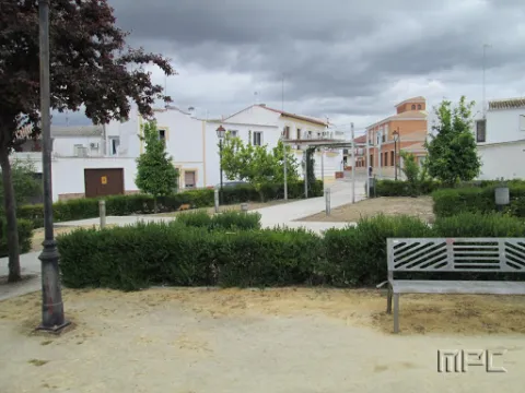
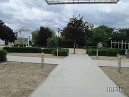
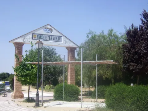
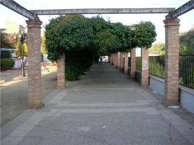
It is a green area full of gardens and vegetation as a walk, very frequented by the inhabitants of Lopera for sports practice.

Telecomunicaciones
Teléfono de contacto
953 516 250
Ubicación
Código Postal
23780
Latitud
37.944700
Longitud
-4.217430
Dirección
C/ Estanque
Distrito
Municipio
Ubicación en el mapa
POINT (-4.21743 37.9447)
Imágenes carrusel
imagen
Image
Parque%20La%20Verja3.jpg
Imagen principal
Desactivado
imagen
Image
Parque%20La%20Verja%20%281%29.jpg
Imagen principal
Desactivado
Imágenes cabecera
imagen
Image
Parque%20La%20Verja2.jpg
Imagen principal
Activado
Loading map
Preparing points of interest and routes...

Guadalquivir Park

Submitted by brandcode_deweloper on
Id
8147398
Descripción
Descripción larga

The different meanders formed by the Guadalquivir in its way through Villanueva de la Reina allow an exuberant vegetation with tree species, among which are willows, alms, chopos, zarzas and eucalyptos. Among the fauna, it is common to find real anades, storks, leper galapagos, real garzas, American red crabs, viperine creams, the fishing martin, beehive or nightingale. We have access for two areas: to the left on Calle la Tercia and, on the right, to the Paseo del Oil. The Park has landscaped recreational areas, a gateway to cross the river to the area of Las Viñas, and the fairground.

Breve descripción

The Guadalquivir Park is a magnificent landscaped area on the banks of the Guadalquivir River, about 500 metres long, divided into two parts: the park itself and the Paseo del Eil; on this walk we can find a real press of ancient oil. Inside the park also runs the bike lane that sepents and crosses the river.

Telecomunicaciones
Teléfono de contacto
953 537 110
Ubicación
Código Postal
23730
Latitud
38.005481
Longitud
-3.914568
Dirección
C/ Santa Potenciana, 14
Distrito
Ubicación en el mapa
POINT (-3.914568 38.005481)
Tipos de punto de interés
Imágenes carrusel
imagen
Image
Parque%20del%20Guadalquivir2.jpg
Imagen principal
Desactivado
imagen
Image
Parque%20del%20Guadalquivir3.jpg
Imagen principal
Desactivado
Imágenes cabecera
imagen
Image
Parque%20del%20Guadalquivir.jpg
Imagen principal
Activado
Microsite al que pertenece
Loading map
Preparing points of interest and routes...

Freedom Park

Submitted by brandcode_deweloper on
Id
8122637
Descripción
Descripción larga

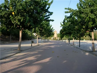
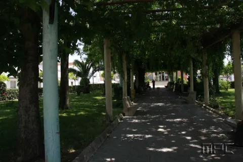
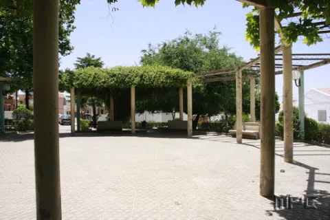
The Freedom Park has a large area for the walk and is the preferred meeting place for the inhabitants of Jabalfifth.

This park stands out for its magnificent shadows, ideal for the summer months and for the great accessibility it enjoys.

It has a children's playground.

Next to Park is the Bus Station.

Breve descripción

Built in 1988, it is a large, grass-filled and wooded complex with countless banks and two sources that invite us to rest.

Telecomunicaciones
Teléfono de contacto
953 617 056
Ubicación
Código Postal
23712
Latitud
38.020360
Longitud
-3.725910
Dirección
Av. Picasso, 32
Distrito
Municipio
Ubicación en el mapa
POINT (-3.72591 38.02036)
Tipos de punto de interés
Imágenes carrusel
imagen
Image
Parque%20de%20la%20libertad2.jpg
Imagen principal
Desactivado
imagen
Image
Parque%20de%20la%20libertad.jpg
Imagen principal
Desactivado
Imágenes cabecera
imagen
Image
Parque%20de%20la%20libertad3.jpg
Imagen principal
Activado
Loading map
Preparing points of interest and routes...

Jamilena Park

Submitted by brandcode_deweloper on
Id
8123471
Descripción
Breve descripción

It is a great space for the walk and rest with large wooded areas, seats for the rest and a nice kiosk of music.

Telecomunicaciones
Teléfono de contacto
953 566 001
Ubicación
Código Postal
23658
Latitud
37.746260
Longitud
-3.907840
Dirección
Paseo Fuente Mayor
Distrito
Municipio
Ubicación en el mapa
POINT (-3.90784 37.74626)
Tipos de punto de interés
Imágenes carrusel
imagen
Image
parque%20jamilena3.jpg
Imagen principal
Desactivado
imagen
Image
parque%20jamilena4.jpg
Imagen principal
Desactivado
Imágenes cabecera
imagen
Image
parque%20jamilena.jpg
Imagen principal
Activado
Loading map
Preparing points of interest and routes...

Cerrillo Blanco Archaeological Park

Submitted by brandcode_deweloper on
Id
4485896
Descripción
Descripción larga

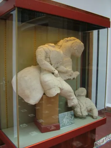
The sculptural ensemble located in this settlement is by far the most important and monumental that has provided Iberian archaeology and key to understanding this culture at the time of its full consolidation, during the fifth century before Christ. This sculptural ensemble is located in the Provincial Museum of Jaén. Other Iberian pieces are exhibited in the Municipal Archaeological Museum of Porcilla, located in the Tower of Boabdil.

Breve descripción

The settlement of Cerrillo Blanco is an extraordinary piece to understand not only the importance of the Iberian "oppidum" of Porcra, but also the very history of Alta Andalucía and the entire Iberian world in general.

Telecomunicaciones
Teléfono de contacto
666 445 513
Correo electrónico
info@museodeporcuna.com
Ubicación
Latitud
37.887160
Longitud
-4.179060
Distrito
Municipio
Ubicación en el mapa
POINT (-4.17906 37.88716)
Tipos de punto de interés
Imágenes carrusel
imagen
Image
museo%20arqueologico%20Cerrillo%20Blanco.jpeg
Imagen principal
Desactivado
imagen
Image
museo%20arqueologico%20Cerrillo%20Blanco%202.jpeg
Imagen principal
Desactivado
Imágenes cabecera
imagen
Image
Parque%20Arquel%C3%B3gico%20de%20Cerrillo%20Blanco.jpg
Imagen principal
Activado
Microsite al que pertenece
Loading map
Preparing points of interest and routes...
Ayozar Fountain Area

Submitted by brandcode_deweloper on
Id
8090292
Descripción
Descripción larga

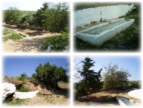
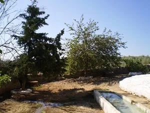
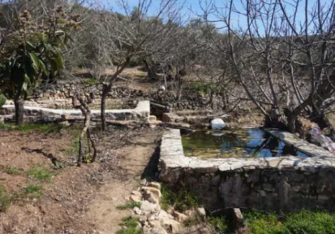
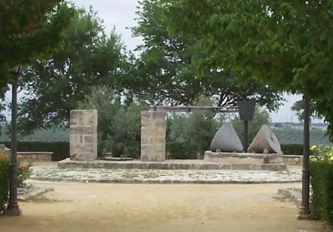
The fountain is accessed by Ayozar Street, located about 800 metres from the town. This source may be the most appreciated by the citizens, has a very good reputation for their water for use in the kitchen. It was formerly a place where the elders went with their grandchildren to take walks and make clay castles.

Breve descripción

The route from Castellar to the Pilar del Ayozar is ideal for hiking; since it is a small area, biodiversity is scarce. However, among the fauna of the area, we can highlight some frogs, creams, lizards and birds, while of their flora we can mention the fig trees, morale and alamos.

Telecomunicaciones
Sitio web
www.castellar.es/patrimonio-natural
Teléfono de contacto
953 460 005
Ubicación
Código Postal
23260
Latitud
38.253580
Longitud
-3.129160
Distrito
Municipio
Ubicación en el mapa
POINT (-3.12916 38.25358)
Tipos de punto de interés
Imágenes carrusel
imagen
Image
fuente%20del%20ayozar%20%281%29.jpg
Imagen principal
Desactivado
imagen
Image
fuente%20del%20ayozar2.jpg
Imagen principal
Desactivado
Imágenes cabecera
imagen
Image
fuente%20del%20ayozar9%20%281%29.jpg
Imagen principal
Activado
Loading map
Preparing points of interest and routes...