Saltar al contenido principal
icon-intereses-amigos

Guadalentín Headwaters via Fuente Acero

Submitted by brandcode_deweloper on
Id
911838
Descripción
Descripción larga

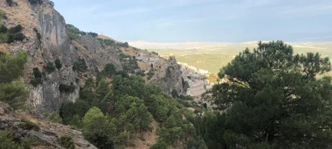
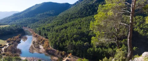
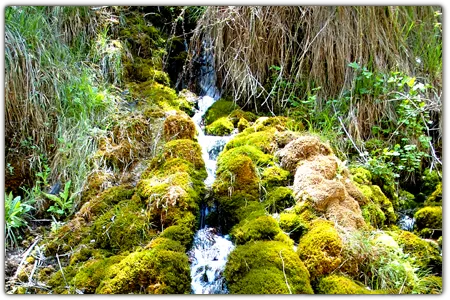
A road to the right is about 400 metres from the forest house of the source of Steel that will take us to the top of the Guadaltiín River.

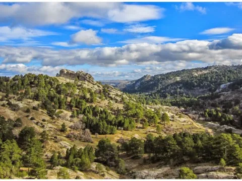
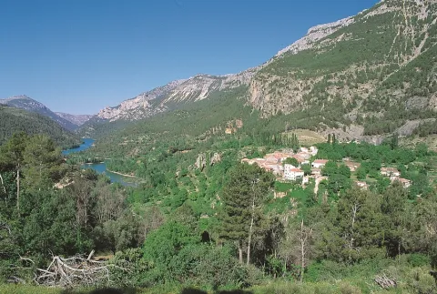
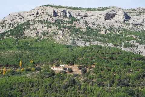
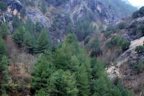
From the Fuente de los Chorros, which can be considered its birth, to Vado Carretas, the Guadalanimin is watched by a high wall, the Cabrilla saw, which rises almost 1000 meters above its waters, and is shown in a succession of poyos and cliffs. In this Sierra there are some of the highest peaks of the Natural Park, such as the Cerro de los Tornajos, the Pico las Covachas or the Empanadas, which exceed 2,000 m. This saw is also the limit with the province of Granada.

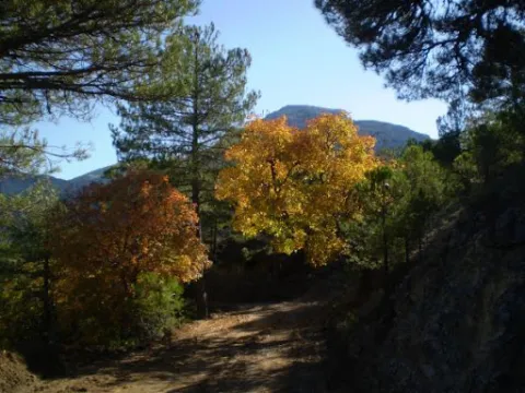
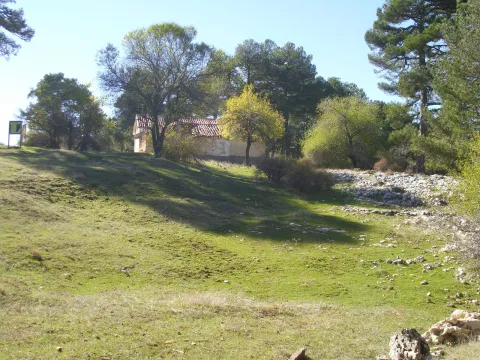
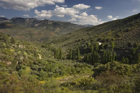
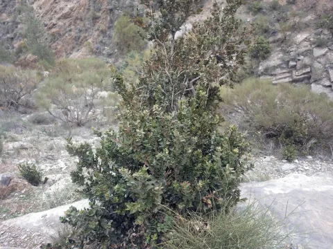
The river is surrounded by beautiful pastures, cortijos and fields of abandoned crops, and with them great nogueras and other fruit trees that show us life in other times. Some of these corijos are in places that are remnants of peace and invite us to make a stop and enjoy the landscape.

We suggest...

  • Make the route from Fuente Steel to the Vado de las Carretas in order to admire these landscapes as a whole.
  • Stop you in the forest of complaints you'll find on the way.

In Cazorla take the Sierra road (A-319) until the crossing known as the Empalme del Valle. Turn right on the JF-7092 road and after passing the bridge over the Guadalquivir River (4 km from the Empalme) follow the left track (JF-7091). Passing the Sail of San Pedro and the Strait of the Perals we find on the right the ruins of the forest house of Fuente Econo.

Breve descripción

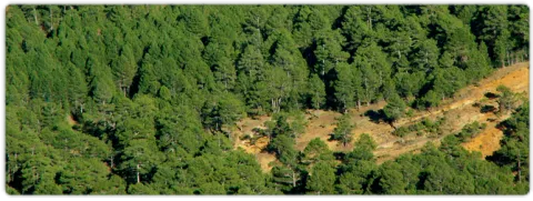
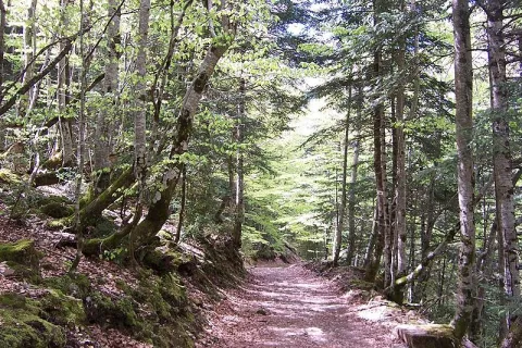
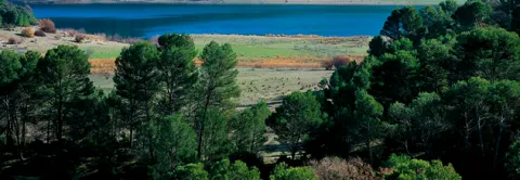
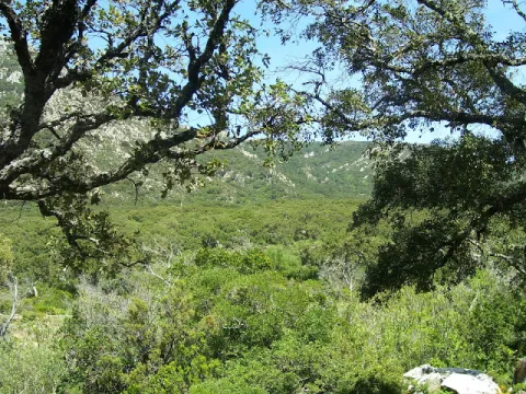
The Guadaltiín River in its journey has cultivated a valley of great beauty. Its shores are covered by lush vegetation: maples, strawberries, chopos, and complaints accompany it on its way. It stops in remnants of crystalline waters where the otter and the Iberian crab live; and sometimes the slopes narrow and form closed that accelerate the passage of the water. This is an essential excursion for anyone who wants to know this Natural Park.

Ubicación
Latitud
37.912893
Longitud
-3.003887
Municipio
Ubicación en el mapa
POINT (-3.003887 37.912893)
Imágenes carrusel
imagen
Image
1.png
Imagen principal
Desactivado
imagen
Image
3%20%281%29.jpg
Imagen principal
Desactivado
imagen
Image
4%20%281%29.jpg
Imagen principal
Desactivado
Imágenes cabecera
imagen
Image
9673418Master.jpg
Imagen principal
Activado
Loading map
Preparing points of interest and routes...

Burunchel

Submitted by brandcode_deweloper on
Id
659395
Descripción
Descripción larga

Since 2003, it has held a cattle fair in August, which had historically been one of the largest in the province of Jaén.

Breve descripción

Burunchel is settled on a hillside and still today you can perceive his past as an ancient dehesa. It is one of the entrances to the Natural Park and it is worth being approached by the hermitage of San Julián, from the 15th century and its facade.

Ubicación
Latitud
37.946090
Longitud
-2.954070
Municipio
Ubicación en el mapa
POINT (-2.95407 37.94609)
Tipos de punto de interés
Imágenes carrusel
imagen
Image
593_img.png
Imagen principal
Desactivado
imagen
Image
burunchel.jpg
Imagen principal
Desactivado
Imágenes cabecera
imagen
Image
burunchel%20%281%29.jpg
Imagen principal
Activado
Loading map
Preparing points of interest and routes...
Marcas de calidad

Gallery Forests

Submitted by brandcode_deweloper on
Id
879400
Descripción
Descripción larga

Many are the places where we can see a good forest in the gallery, both in the Segura River Valley and in the Guadalquivir Valley. The one we have chosen is on the upper stretch of the Segura River, in its way through the charming village of La Toba.

This defines the forests that accompany the rivers. Its components change along the river, from its birth to its mouth. The section we will see in the mountain areas of the Park corresponds to the sections of the high basin.

The forest we visit is made up of choperas (Populus nigra and Populus x canadensis), strawberries (Fraxinus angustifolia), saucedas formed by several willows (Salix eleagnos angustifolia, S. purpurea, S. atrcinerea and S. fragilis), zarzales (Rubus ulmifolius), and herbaceous formations of junches, molinies and cardics (Scripus holoschoenu, Juncus inflexius, Molinia caulea and Carpenex). We can also observe orchids such as daztilorrizas (Daztilorhiza elata) among these junkals.

Any time of the year is good for walking through this forest, with the most recommended autumn for its colors and the advanced spring for the great green nuance it presents and for the flowering of the orchids that populate it.

LOCATION

In the short detour that goes to the village of La Toba, as we pass the bridge over the Segura River, we park and we can enjoy directly a splendid riverside forest.

Breve descripción

Rio Segura, La Toba

Ubicación
Latitud
37.772886
Longitud
-3.788329
Ubicación en el mapa
POINT (-3.788329 37.772886)
Tipos de punto de interés
Imágenes carrusel
imagen
Image
La%20Toba%20%28Alonso%20Torrente%29.jpg
Imagen principal
Desactivado
imagen
Image
679_SS_09.jpg
Imagen principal
Desactivado
Imágenes cabecera
imagen
Image
_MG_3298.jpg
Imagen principal
Activado
Loading map
Preparing points of interest and routes...

Valley Floor Deciduous Forests

Submitted by brandcode_deweloper on
Id
920264
Descripción
Descripción larga

In the area of Tejina we have a splendid deciduous forest made up of complaints (Quercus faginea) that have leaves that are larger and more lustrous than those of high mountains, mapes of Montpelier (Acer monspessulanum), serbales (domestic Sorbus), pespejones (Sorbus tormentinalis) and pyruetans or wild perals (Pyrus bourgeana).

They are accompanied by shrubs such as majuelos (Crataegus monogina), endrines (Prunus spinosa), skirmishes or tapasses (Rosa spp.) and species of the Mediterranean forest, such as madroños (Arbutus unedo), agracejos or lebiernagos (Phylirea latifolia), wild jazmines (Jazminum fruticans), hedras (Hedera helix). In wet areas there are zarzas (Rubus ulmifolius), and in the forest and stony areas there are splits (Lavandula latifolia).

Among the herbaceous plants are grasses such as Brachypodium phoenocoids, Holcus lanatus, other species such as orchids (Ophrys lutea, O. apifera, O. tenthredinifera), trees (Trifolium campestre, T. strellatum), violets (Viola odorata) and others such as Bupleurum rigidum, Bellis perennis, etc.

We suggest:

  • When you are in places like this, very few, remember that these deciduous forests are authentic ecological shelters for fauna, because the fruits of many of its plant species mature in winter, which makes many birds survive when food is scarce in all other places. In turn, these birds help in the dispersion of the seeds. The human transformation of these areas threatens the stability of this ecosystem and involves serious biodiversity losses. Today many of the plant components of this forest are protected by law in Andalusia. We cannot afford to lose the most precious natural treasures, our forests.

Valle del Guadalquivir, on the road A-319 (km 42), a little below the Puente del Hacha, in the area known as Tejina.

Breve descripción

At the bottom of some valleys, deep and fertile soil coexist with thermal investment processes. These particular conditions of soil and climate make it possible to establish deciduous forests. These forests are very restricted to small enclaves in the Guadalquivir valley, as their ancient domains have been strongly transformed by human beings over the centuries.

Ubicación
Latitud
37.921120
Longitud
-2.991910
Municipio
Ubicación en el mapa
POINT (-2.99191 37.92112)
Imágenes carrusel
imagen
Image
valle.jpg
Imagen principal
Desactivado
Imágenes cabecera
imagen
Image
_fotodeeduardoviuales_6d80611f.jpg
Imagen principal
Activado
Loading map
Preparing points of interest and routes...

High Mountain Deciduous Forests

Submitted by brandcode_deweloper on
Id
879671
Descripción
Descripción larga

The site is really special for the great variety of species we found. In it we can walk and enjoy one of the few high mountain deciduous forests that have left in the Natural Park.

Today we can no longer define as forests the few remaining stains, even though in past times they spread across large areas of the high mountain of these saws, wearing the valleys and vessels of lush forests. At present their presence is limited to small holes, rails and rails in which deep and fertile soil is accumulated.

These beautiful bosquets are made up of maple (Acer granatense), mustard (Sorbus aria), cereal (Prunus mahaleb) and whine (Quercus faginea), accompanied by a shrub of spiners with majuelos (Crataegus monogina), rars (Berberis vulgaris australis), skirmishes (Rosa spp.), madreselvas (Lonicera spladada, L. etrusca), sanjuaneros (Lonicera arborea) and spinos (Cratagulata).

We suggest:

  • Later there is Nava Noguera and the control of Rambla Seca, which marks the entrance to the Campos de Hernán Pelea, one of the most original and overwhelming landscapes of the Park.
  • There are other very accessible places where we can enjoy these exceptional bosquets, such as the surroundings of the Collado del Ventano in the Calar de Navalespino and the Barranco del Guadalentín.
  • Don't miss these sketches in the fall.

LOCATION

We access the road that goes from Vadillo Castril to Santiago de la Espada, which becomes a ground track from Los Collados, but the firm is good and we can reach the destination point without great problems. Once we have ascended to the Saves of San Pedro, we are already on the line, we arrive at the junction of the Laguna of Valdeazores, which is about 9 km from the Navy. We look at the extraordinary landscape, as we take the Guadalanimin ravine to our right. As we pass through the Collado de la Zarca (where there is a track to our right, cut to traffic with a chain), we lose sight of the Barranco del Guadalentín and enter a few rails. Less than a kilometre after a few curves are presented to our right, in the sense of the march, a few holes full of trees.

Breve descripción

Necklace of the Beer

Ubicación
Latitud
37.702695
Longitud
-2.935057
Municipio
Ubicación en el mapa
POINT (-2.935057 37.702695)
Imágenes carrusel
imagen
Image
613_img.png
Imagen principal
Desactivado
imagen
Image
bosque.jpg
Imagen principal
Desactivado
Imágenes cabecera
imagen
Image
caduci.jpg
Imagen principal
Activado
Loading map
Preparing points of interest and routes...

Forest Lauroide Mediterráneo

Submitted by brandcode_deweloper on
Id
879507
Descripción
Descripción larga

This type of forest can be the purest and best preserved that we find in the low mountain of the Park, refugee in unaltered ravines and slopes, where a fertile and deep soil is accumulated. There are some delays of this first formation, and one of the places where we can see it is in the lower basin of the Borosa River. On its slopes is an impressive lauroid forest of madroños, gracegos and doves. The highest point of this forest in our tour is the entrance to the closed of Elias, where a plant vault of madroños and agracejo covers us during a good stretch.

But what is a lauroid forest?

In Mediterranean forests we find several types of vegetation, determined by their conservation status, and the presence of more or less deep fertile soil. In the enclaves with better soil, deep and rich in organic matter, the lauroid forests, made up of shrubs and perennial, lustrous and always green leaves, grow.

The main components of this forest are the madroño (Arbutus unedo), the agracejo or labiérnago (Phillyrea latifolia), the pedillo or barbadija (Viburnum tinus), and climbers such as madreselvas (Lonicera implexa) and the zarzaparilla (Smilax aspera). These shrubs are sometimes accompanied by trees such as complaints and oaks (Quercus faginea and Quercus ilex ballota), although in closed formations of madroños and agracejo, it does not develop under them anything but their own seedlings, due to the dense shadow they form. These lauroid forests are the richest phase of plant succession in the low mountain of the Park.

These forests come from the vegetation that dominated southern Europe before the quaternary glaciations. After them the lauroid forests, which had more elements (trees such as the laurel, hence its name), had no choice but to adapt to a drier and colder climate, lost elements and took refuge on the middle slopes of the mountains and valleys where they found soil and softer climate with subhumid namoclima. Other plant elements that arrived with the northern latitudes glaciations found in these forests a suitable habitat, such as the complaints (Quercus faginea), the maple of Montpelier (Acer monspessulanum) and the pespejon (Sorbus tormentinalis).

LOCATION

We'll access the Borosa for the A-319. At the height of the Visitor Reception Center Torre del Vinagre, we turn right to the farm, where we park and remount the river upstream. Soon, at the Shipyard's source, we began to see that Mediterranean formation of lauroid species. We can reach the end of the Cerrada de Elias, where we end our walk through the lauroid forests.

Breve descripción

Rio Borosa

Ubicación
Latitud
37.912893
Longitud
-3.003887
Municipio
Ubicación en el mapa
POINT (-3.003887 37.912893)
Tipos de punto de interés
Imágenes carrusel
imagen
Image
612_img.png
Imagen principal
Desactivado
imagen
Image
bosque-mediterraneo.JPG
Imagen principal
Desactivado
Imágenes cabecera
imagen
Image
borosa.jpg
Imagen principal
Activado
Loading map
Preparing points of interest and routes...

Bojedas

Submitted by brandcode_deweloper on
Id
879115
Descripción
Descripción larga

One of the most surprising plant formations in the Park is the nozzles. Their presence is extraordinary for several reasons: for more to the south of the Iberian Peninsula they no longer exist, for they find refuge in many northern species, because the boj (Buxus sempervirens) has created a culture of home utensils and because they keep the ground in channels and slopes.

There are many places where we can see a nozzle. In many streams and ravines it is almost impenetrable, but we can also see it on the slopes of the Banderillas colonizing to the same top. There are also nozzles in any ravine of the Las Villas saw, in the closed of Elias, in the Borosa river, by the stream of the Molinos in Siles, etc. All these are easily accessible by vehicle, but we are going to set ourselves in a place a little more apart from the traditional tourist circuits, although perfectly accessible: a ravine called La Bojeda.

In La Bojeda there is a formation of boj accompanied by deciduous species such as cures (Acer granatense), maple de Montpelier (Acer monspessulanun), mustards (Sorbus aria), pespejones (Sorbus tormentinalis) and complaints (Quercus faginea). In the inside of the bowl, vegetation is not thriving because of the lack of light and the high humidity that is maintained, so the appearance of a bowl is of a continuous, always green tapestry. Only when winters are very cold, the whole bowl takes a tone between dark green and reddish brown. This is a cold defense mechanism. Other species are stripped of their leaves, but the boj, which is of perennial leaf so they are ingested in this way.

LOCATION

To access the port of Tiscar, on the road from Quesada to Pozo Alcón, if our direction is in that sense. When we get to the port we must follow a mile or so, until we reach a crossing of a forest track that leaves us to the left. We can park and follow it walking, it will take a little more than 3 km, which will make us very short, as the panoramic view we will see throughout the tour is spectacular.

Breve descripción

La Bojeda, Puerto de Tícar

Ubicación
Latitud
37.842982
Longitud
-3.066921
Municipio
Ubicación en el mapa
POINT (-3.066921 37.842982)
Tipos de punto de interés
Imágenes carrusel
imagen
Image
609_img.png
Imagen principal
Desactivado
imagen
Image
bojeda%20%281%29.jpg
Imagen principal
Desactivado
Imágenes cabecera
imagen
Image
bojeda.jpg
Imagen principal
Activado
Loading map
Preparing points of interest and routes...

Belerda y Don Pedro

Submitted by brandcode_deweloper on
Id
911650
Descripción
Descripción larga

Despite the strong emigration suffered over the last half century, both villages are still populated and with some vitality, still keeping their environment calm. The same fate has not been achieved by another village that is located downstream, Arroyo Molinos, which has been completely depopulated.

Although it does not appear on the maps, there is no sign of it, nor is there any separation that can be observed clearly, there are two Belerdas: the high and the low, so it is common to hear the village in plural. Many popular customs are still preserved, even the old public laundry is still used. The inhabitants are farmers and farmers, although there are some services (bakery, shop, bar, etc.).

We suggest...

  • Visit the Larguillo Picón, a natural monument to the balance and geological whim.
  • Between Belerda and Don Pedro is the Blue Pilon, a natural pool between rocks, which has traditionally been used for the bathroom by the locals. The waters are cold, but the experience revitalizes.

The village closest to Belerda is Huesa, 5 Km., from which part a road, very narrow and with curves, that goes directly to the village (JA-7200) and that links 3 km later with the road of Tícar (JA-6206). On this last road, Quesada is 18 km away. (the crossing to Belerda at 15), Hinojares at 15 (the crossing at 12) and Pozo Alcon at 20 km.

Breve descripción

Belerda, or Las Belerdas, is very close to the Casillas of Don Pedro, a core with which he is linked a close social and historical relationship. Under the monumental, historical, natural and sacro set of Tiscar are the Casillas of Don Pedro, with the Larguillo Picón, challenging the balance and welcoming the traveller. This group of houses, with a charming urban disorder motivated by the difficult orography of the land and the social conditions of its inhabitants, receives this name in honor of the infant Don Pedro, uncle of Alfonso XI, who in 1319 took over the Norm Fortress of Tícar and its 4,500 inhabitants, the Arab Reyezuelo Mohamed Adon. At the bottom of Vallejo, on both sides of the Tíscar stream, is Belerda, protected by a natural wall where vultures and mountain goats live, at the foot of the Caballo hills, fully integrated into a wild and apparently hostile environment.

Ubicación
Latitud
37.844710
Longitud
-3.067440
Municipio
Ubicación en el mapa
POINT (-3.06744 37.84471)
Tipos de punto de interés
Imágenes carrusel
imagen
Image
belerda1.jpg
Imagen principal
Desactivado
Imágenes cabecera
imagen
Image
santuario-tiscar.jpg
Imagen principal
Activado
Loading map
Preparing points of interest and routes...

Basilica and Royal Sanctuary of Nuestra Señora de la Cabeza

Submitted by brandcode_deweloper on
Id
910348
Descripción
Descripción larga
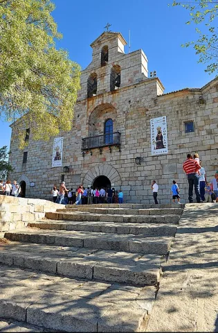
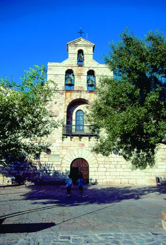
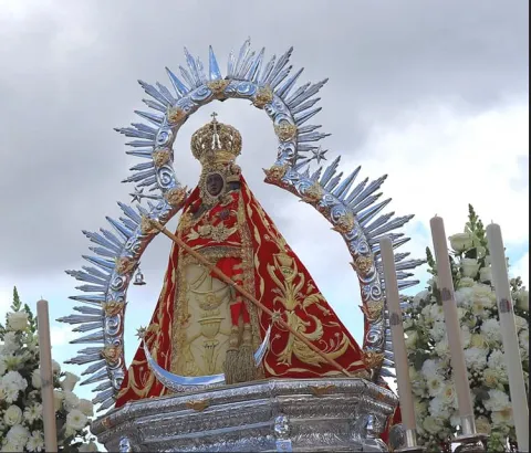
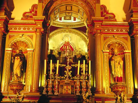
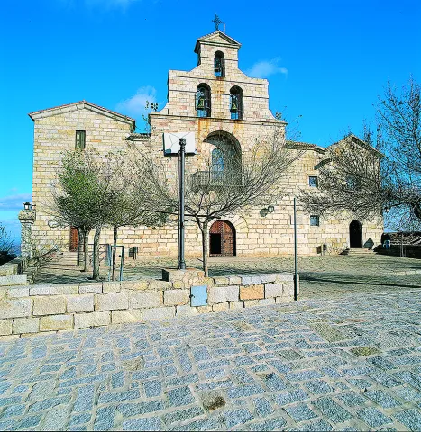
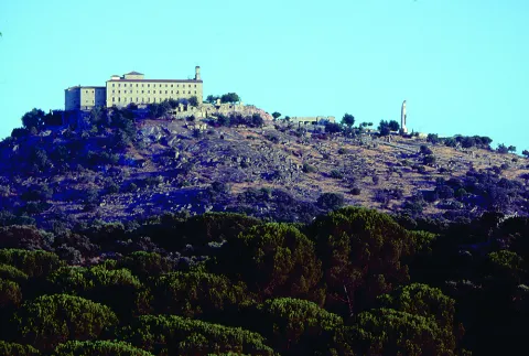
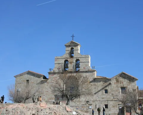
Nothing remains of the primitive hermitage, since throughout the 16th century and on its foundations, a sanctuary was built, a large part of it destroyed during the last Civil War (1936-1939). The siege and defense of the Sanctuary of the Virgin of Cabeza was magnified by the Franco regime. But until it became a parish headquarters, the Sanctuary has gone through different vicissitudes since its origin. According to all indications, the construction works began in 1287 and ended in 1304, first being a small hermitage that the people of Andújar built in the heart of Sierra Morena. However, the expansions and reforms have been almost constant throughout the ages, reaching their maximum splendor in the 16th century, between 1530 and 1590, when it became a Sanctuary, very similar to the one we know today. In 1945 the architect Prieto Moreno, conservator of the Alhambra, directed the restoration works of the architectural complex, which became one of the most precious symbols of the national Catholicism of the dictator Francisco Franco. The pilgrimage continues to be celebrated, as is custom and tradition, on the last Sunday of April, although the image that is venerated, carved by the Granada sculptor Navas Parejo, is not the original one, since it disappears in strange and still unclear circumstances in the aforementioned contest. Thanks to the Book of Chapters of the Brotherhood (1554-1565), preserved in the Diocesan Archive of Jaén (made known by J. Domínguez, R. Frías and S. Lázaro), we know numerous data about the level of work on the new Renaissance church during these years, although the process began years ago; The new factory began at the head, with the large main chapel being built between the years 1534 and 1541 according to a late Gothic plan, being separated from the rest by a beautiful Renaissance railing. The works on the rest of the temple passed through various hands and circumstances. The Trinitarian Community has addressed two new expansions. The first consisted of raising the projecting floor, building another pavilion in the rear area of ​​the North wing. Thus, the entire structure of the cloister patio was completed in a harmonious and functional way. The second phase was carried out in 1965 in the entire north wing, adding a three-story building to expand the rooms of the Trinitarian priests who attend to worship, permanently since 1930. The central nave is separated from the Main Chapel by a 16th century grille, restored by the School of Arts and Crafts of Granada, which closes an opening with a semicircular arch. The High Altar has a large space in the center, behind which is the Virgin's dressing room; carving by José Navas Parejo, which replaced the old one that disappeared during the civil war. The side chapels of the nave are occupied by different altars, containing various images, such as a Crucified by the sculptor Mariano Benlliure, the Virgin of Pilar, Blessed Marcos Criado, San Juan Bautista de la Concepción, the Holy Trinity and the Virgin of Carmen. In the choir there is a magnificent organ, a gift from the Civil Guard, inaugurated by the famous master organist Guridi. Behind the Main Chapel is the sacristy. In 1555, the master stonemason Domingo de Azpeitia undertook to build a temple with three naves with column supports, however, at the express wish of the prelate Don Diego Tavera (1555-1560), this approach was radically transformed, prohibiting the execution of the pillars. Don Diego Tavera sent Andrés de Vandelvira to give new plans for the church, as noted in the minutes of April 27, 1558 of the aforementioned Book of Cabildos. Vandelvira eliminated the pillars with the idea of ​​designing a different, larger church, with a single nave with chapels-niches open to it. In 1559, Vandelvira visited the works and presented new plans for its conclusion, as well as the design of the main façade. For less than a year the construction was under the control of Francisco del Castillo “El Mozo”, and the Brotherhood even required a certain report from Hernán Ruiz II. In 1562, the Brotherhood requested a new inspection of Andrés de Vandelvira, but he did not respond. In any case, the project continued with the stonemasons proposed by Vandelvira, Juan Martínez and Domingo de Jay, who executed what remained following the guidelines and the plan designed by the Master. This must have been the case, as can be seen from the description of the temple that Salcedo de Olid made in the 17th century: “It has a nave without columns (...) and the main chapel is distinguished, majestic and very attractive.” Based on the remains preserved after its destruction in 1936, the Vandelvirian temple actually included a church with a large nave, covered with a barrel vault and niche chapels, which was separated from the main chapel by a powerful main arch. From the exterior, quite compact, only the façade at the foot is notable with three axis elements: doorway, balcony and belfry. The ornamental nudity of the complex is contemporary with the latest work of Andrés de Vandelvira. The Trinitarian Community has addressed two new expansions. The first consisted of raising the projecting floor, building another pavilion in the rear area of ​​the North wing. Thus, the entire structure of the cloister patio was completed in a harmonious and functional way. The second phase was carried out in 1965 in the entire north wing, adding a three-story building to expand the quarters of the Trinitarian priests who attend to worship, permanently since 1930. OTHER NON-ARCHITECTURAL ARTISTIC MANIFESTATIONS. A Museum has been installed in the Sanctuary with diverse and varied pieces of varying artistic quality. Among all of them, we highlight two paintings from the 17th century with representations of the famous Nuestra Señora de la Cabeza Pilgrimage, an image lost in the last Civil War of 1936-1939. After the war, a new carving was commissioned from the Granada workshops of Navas Parejo, which is the one that has been venerated in Cabezo ever since. One of the few pieces saved from the destruction of the said Sanctuary was the grille of the main chapel, restored in 1941 at the School of Arts and Crafts of Granada. Hired in 1564, it depicts the apparition of the Virgin to the shepherd of Colomera. LITERATURE In the middle of the Civil War, the military rebellion in the province of Jaén failed, a group of civil guards along with their families settled in the Sanctuary of the Virgen de la Cabeza, this being the scene of a bloody siege by the Republican troops. A monument commemorates this event at the entrance to the Sanctuary and if you look closely, traces of shrapnel can still be seen on the side walls of the Basilica. Miguel Hernández will journalistically describe the assault of this siege, transmitting in detail its development, which will last from September 14, 1936 to May 1, 1937, when the besieged surrender. Southern Front. Number 15, May 13, 1937 (...) "The building of the Head dawns before the bloody and dark dawn. In it I saw the representation of a tricorn monster... (...)
Breve descripción
Basilica and Royal Sanctuary of Nuestra Señora de la Cabeza
Ubicación
Código Postal
23740
Latitud
38.179340
Longitud
-4.035280
Dirección
Carretera del Santuario
Distrito
Municipio
Ubicación en el mapa
POINT (-4.03528 38.17934)
Tipos de punto de interés
Imágenes carrusel
imagen
Image
Basi_lica_de_la_Cabeza_1.jpeg
Imagen principal
Desactivado
imagen
Image
Anotaci%C3%B3n%202020-04-16%20082134.jpg
Imagen principal
Desactivado
imagen
Image
Mon504.jpg
Imagen principal
Desactivado
imagen
Image
Captura%20Virgen%20de%20la%20Cabeza.PNG
Imagen principal
Desactivado
imagen
Image
Mon030%20%281%29.jpg
Imagen principal
Desactivado
imagen
Image
Mon134.jpg
Imagen principal
Desactivado
imagen
Image
Mon506.jpg
Imagen principal
Desactivado
Imágenes cabecera
imagen
Image
11072966_740607829371873_2670746898130716885_o%20%285%29.jpg
Imagen principal
Activado
Horario
Every day: 09:00 - 14:00 and 16:30 - 20:00.
Loading map
Preparing points of interest and routes...

Basilica of Santa María la Mayor

Submitted by brandcode_deweloper on
Id
912796
Descripción
Descripción larga

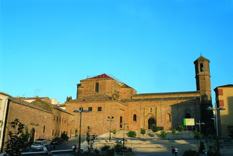
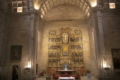
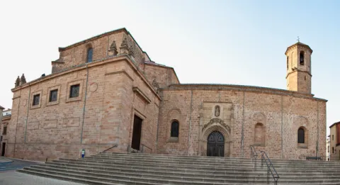
La vieja fábrica gótica de Santa María resultaba insuficiente para el culto, proyectándose un nuevo templo parroquial. Sin embargo, la falta de medios económicos determinó la paralización de las obras y tan solo se fabricó la Capilla Mayor, que quedó unida con el resto de la fábrica gótica en ochavo, y buena parte de la torre de campanas. Tal circunstancia ha generado un perfil del templo ciertamente singular al quedar unidas ambas arquitecturas tan dispares en altura, parcialmente contrarrestado gracias a la esbelta torre de campanas que se yergue a los pies. Documentalmente conocemos la intervención de varios maestros canteros, destacando entre ellos Andrés de Salamanca y Andrés de Vandelvira, director y tracista del nuevo templo renacentista.

El inicio del proceso constructivo de sustitución de la antigua iglesia gótica (siglos XIV-XV), tradicionalmente fijado en torno al año 1573, hay que retrotraerlo a los años 60 del mismo siglo. La primera noticia que conocemos sobre el desarrollo de las obras la aporta el padrón de vecinos de 1564, pues se cita entre los moradores de la calle del Pilar a un maestro de cantería llamado Andrés de Salamanca, del que se dice: en la actualidad trabaja en la obra de la iglesia mayor junto con sus oficiales, todos ellos solteros. Las primeras tareas se centraron en el derribo progresivo de la fábrica gótica, que comenzaron por la cabecera, según se desprende de la carta suscrita por Andrés de Salamanca el 27 de agosto de 1566 por la que se obligó a mudar el retablo viejo de la iglesia para que la obra siga adelante.

En 1568 se dio comienzo a la nueva Capilla Mayor, ya que en este año (16 de octubre) el cantero Fernán Cobo y su fiador Gabriel Jordán se obligan a sacar piedra para la obra de la iglesia mientras durase esta. De 1568 a 1571 las obras se desarrollaron a buen ritmo. El 24 de septiembre de 1571 se publican las condiciones para cubrir la Capilla Mayor, lo que evidencia que esta ya estaba construida; la obra, que consistía en enmaderar el conjunto de la Capilla, fue rematada en el carpintero Ginés de Zamora.

Tradicionalmente se ha especulado con una más que probable intervención en la obra del nuevo templo del arquitecto Andrés de Vandelvira. No ha de extrañarnos tal intervención, ya que por los años en que dio comienzo el arquitecto alcaraceño ya figuraba como maestro mayor de la Catedral de Jaén, cargo que conllevaba el de maestro de obras del Obispado. En buena lógica es fácilmente deducible que un proyecto de la envergadura de Santa María tendría que pasar por las manos de Vandelvira. Nuestras conjeturas pueden quedar avaladas, al margen del propio análisis de la pieza, a través de dos documentos. El primero, publicado por el cronista Sánchez Caballero, deja bien claro que Vandelvira viajó en 1573 a Linares para inspeccionar el nivel de la construcción, ver el modo de tirar pilares viejos y apuntar como ha de seguirse la obra nueva. Con arreglo a este planteamiento, el 2 de octubre de 1574 el cantero Andrés de Salamanca se obligó a llevar a cabo lo dictaminado y trazado por Vandelvira, es decir, a seguir con el derribo de elementos góticos para avanzar con el proyecto renacentista del crucero. En 1579 el visitador del Obispado, Francisco de Huete dispuso sin embargo, que “no pudiéndose continuar el proyecto que había sobre el resto de la iglesia, se liquidase dicha obra”. El proyecto vandelviriano, que entendemos contemplaba la sustitución completa de la estructura gótica, se interrumpió definitivamente. A finales del siglo XVI se remató la torre y en la centuria siguiente se labró la portada con arreglo al diseño del arquitecto catedralicio Juan de Aranda Salazar. La portada gótica, orientada al sur, procede

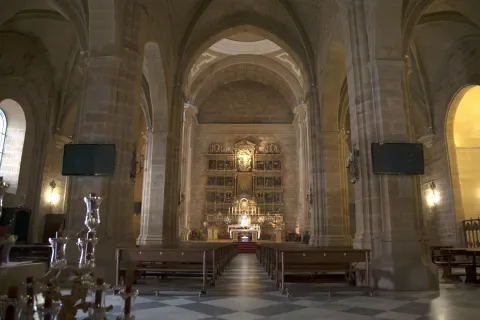
La Capilla Mayor de Santa María, se muestra al espectador como un organismo independiente, produciéndonos la sensación de un gran espacio centralizado, al estilo de S. Francisco de Baeza o de la iglesia de La Guardia, común según F. Marías a las capillas mayores renacentistas. En Linares este efecto se refuerza al quedar la cubierta gótica muy por debajo de la obra renacentista y además por la ausencia de la proyectada nave única de planta cruciforme con capillas-hornacinas que Vandelvira creemos planteó para esta nueva parroquia.

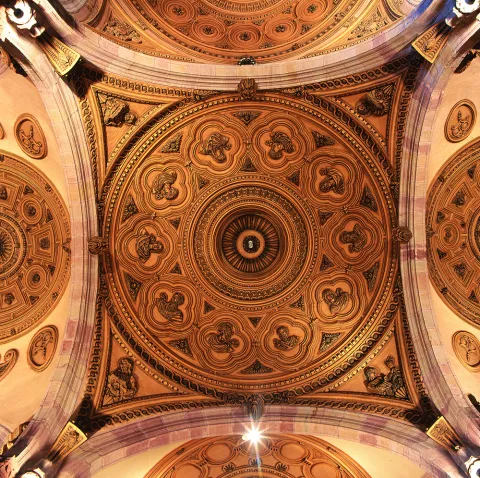
Como recuerdo del plan vandelviriano quedan los vestigios de las dos primeras capillas que debían abrirse a ambos lados de esta nave, cuyos arranques dan la idea que aquellas serían cubiertas con bóvedas de medio cañón por cruceros. Años atrás Vandelvira ya había ensayado el plan de la iglesia de Linares en la iglesia dominica de La Guardia, aunque en una escala menor. Este espacio centralizado de Santa María está conformado por cuatro arcos torales de medio punto que abren al presbiterio acasetonado, a dos capillas laterales igualmente acasetonadas y en el lado de las naves conecta con el “ochavo”; estos arcos apoyan en pilares de esquina de tradición siloesca con columnas adosadas y traspilastras en las que se alternan el orden dórico y corintio. El crucero se cubría con una bóveda vaída. El ochavo que enlaza el crucero con las naves góticas se materializó haciendo recaer el peso de los tres paños del mismo sobre el arco central apuntado del primer tramo gótico y sobre dos arcos escarzanos en diagonal sustentados entre los primeros pilares góticos y los semipilares de esquina. Las portadas, de haberse llevado a término el proyecto de Andrés de Vandelvira, tendríamos en Linares una importante muestra, ya casi final, de su trayectoria como arquitecto, pero en cualquier caso el conjunto gótico-renacentista es de gran interés.

OTRAS MANIFESTACIONES ARTÍSTICAS NO ARQUITECTÓNICAS

El patrimonio mueble conservado en esta parroquia es especialmente valioso. Sustituyendo al desaparecido retablo barroco de la capilla mayor, destruido en 1936, se alza en ella un hermoso retablo renacentista con pinturas sobre tabla, obra del Maestro de Ávila, en opinión de la profesora Luz de Ulierte. Procede este retablo del pueblo leonés de Villarrabines, y fue adquirido por D. José Yanguas Messía y su esposa Dª. Rosario Pérez de Herrasti. Antes de ser colocado fue recompuesto por el granadino José Navas Parejo e hijos. A este artista se deben otras piezas: tabernáculo y sagrario (labrados con plata procedente de las minas de Linares), mármoles de la capilla mayor y retablo de la capilla Yanguas, retablos en madera tallada y dorada dedicados a la Virgen del Carmen, San Isidro y la Inmaculada de la Medalla Milagrosa.

Sobresaliente es el conjunto de su imaginería, toda ella posterior a 1939. Destaca el impresionante conjunto de la Santa Cena, obra del escultor Víctor de los Ríos, a quien se deben también el Cristo de las Misericordias (venerado en la capilla enterramiento de Lolo, linarense en proceso de santificación) y un hermoso Ángel. La custodia de asiento del Corpus, aunque recompuesta, es una bella muestra del taller de los Morales (siglo XVI).

Breve descripción

Monument declared 02 / 07 / 1974 Linares, a village belonging to the end of Baeza since the 13th century, experienced throughout the 16th century an extraordinary economic and demographic development that led to his emancipation under the reign of Philip II. The proceedings, initiated in 1564, bear fruit on 15 August of the following year, the Council and neighbours being forced to pay the Crown the undespicable sum of 20,000 ducats. The increase in the population of Linares, which rose from 657 neighbours in 1528 to 1,059 in 1586, led to an increase in the number of feligresses.

Telecomunicaciones
Sitio web
www.basilicasantamarialinares.es/
Teléfono de contacto
953 691 759
Correo electrónico
santamariadelinares@gmail.com
Ubicación
Código Postal
23700
Latitud
38.092450
Longitud
-3.634760
Dirección
C/ Iglesia
Distrito
Municipio
Ubicación en el mapa
POINT (-3.63476 38.09245)
Tipos de punto de interés
Imágenes carrusel
imagen
Image
Mon251.jpg
Imagen principal
Desactivado
imagen
Image
IglesiaSantaMaria3.jpg
Imagen principal
Desactivado
imagen
Image
Mon520.jpg
Imagen principal
Desactivado
imagen
Image
IglesiaSantaMaria.jpg
Imagen principal
Desactivado
Imágenes cabecera
imagen
Image
Iglesia_SamtaMaria_Exterior%20%281%29.jpg
Imagen principal
Activado
Microsite al que pertenece
Loading map
Preparing points of interest and routes...