Saltar al contenido principal
icon-intereses-en-pareja

Bridge Romano

Submitted by brandcode_deweloper on
Id
4706810
Descripción
Breve descripción

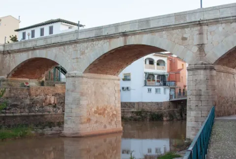
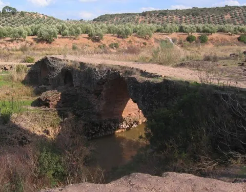
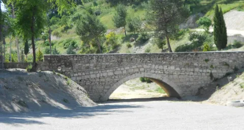
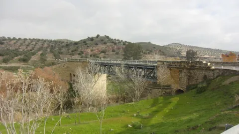
In Puente de Génave we find the Old Bridge or Roman Bridge, on the river Guadalimar, of stone, reduced arch and one eye, in which the masonry is alternated with the silery. They highlight the environment and configuration of the village, being a forming element of the settlement of the village around the river and an essential step to know the riverside and its implementation in the territory.

Telecomunicaciones
Sitio web
www.puentedegenave.es/el-municipio/patrimonio-historico.html
Correo electrónico
pgenave@puentedegenave.es
Ubicación
Código Postal
23350
Latitud
38.355380
Longitud
-2.803190
Distrito
Municipio
Ubicación en el mapa
POINT (-2.80319 38.35538)
Tipos de punto de interés
Imágenes carrusel
imagen
Image
Mon501.jpg
Imagen principal
Desactivado
Imágenes cabecera
imagen
Image
puente-romano.jpg
Imagen principal
Activado
Loading map
Preparing points of interest and routes...

Bridge Renaissance

Submitted by brandcode_deweloper on
Id
4276894
Descripción
Breve descripción

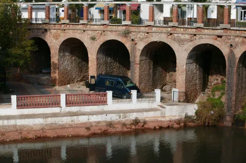
It is one of the most important historical and artistic milestones of Marmolejo, along with the Parish Church of Our Lady of Peace and the spa of medicinal waters that spring up next to the same channel of the Guadalquivir River. Precisely bridge and spa linked their existence since the discovery of the therapeutic utility of the waters of these springs at the end of the 18th century (whose first news appears in theTreaty on the main medicinal sources of AndalusiaJohn of God Help, 1794) and the first facilities began to be built. But before thousands of swimmers turned this quiet place into bustling, there was already an architectural element in the environment: the San Bartolomé Bridge, possibly called for opening the day of the onomastics of this Holy, on August 24.

Telecomunicaciones
Sitio web
www.villademarmolejo.es/urbanismo-y-monumentos/monumentos/puente-de-san-bartolome/
Ubicación
Código Postal
23770
Latitud
38.054040
Longitud
-4.193410
Distrito
Municipio
Ubicación en el mapa
POINT (-4.19341 38.05404)
Tipos de punto de interés
Imágenes carrusel
imagen
Image
puente%20renacentista-1.png
Imagen principal
Desactivado
Imágenes cabecera
imagen
Image
puente%20renacentista_marmolejo-1.png
Imagen principal
Activado
Microsite al que pertenece
Loading map
Preparing points of interest and routes...

Bridge Musulmán

Submitted by brandcode_deweloper on
Id
5709600
Descripción
Breve descripción

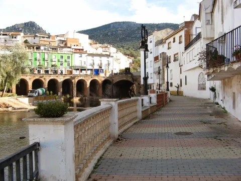
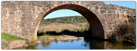
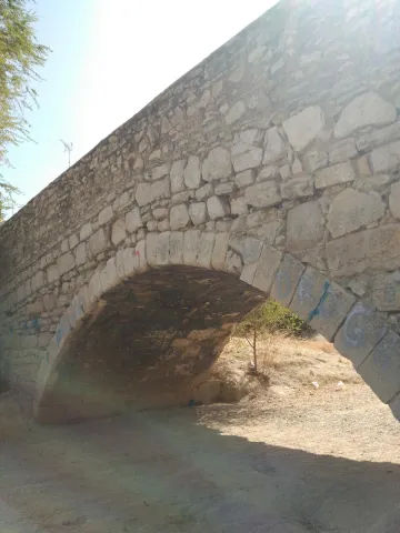
Built in Muslim times, it served as a prey in the event of danger, as it was covered with a door, the waters would remain and rise from level by flooding everything and leaving the bridge impracticable. Some medieval elements still remain semi-hidden, but most of the present part of it is modern: it is a long-term escarzan arch in a half-barrel vault that forms its only eye.

Telecomunicaciones
Sitio web
www.lapuertadesegura.es/el-municipio/patrimonio-historico.html
Correo electrónico
lapuerta@promojaen.es
Ubicación
Código Postal
23360
Latitud
38.349640
Longitud
-2.736660
Dirección
C/ de Pablo Iglesias, 37
Distrito
Ubicación en el mapa
POINT (-2.73666 38.34964)
Tipos de punto de interés
Imágenes carrusel
imagen
Image
tierras-de-jaen-042-2-jpg
Imagen principal
Desactivado
Imágenes cabecera
imagen
Image
puerta-de-segura-sobre-el-guadalimar-1-jpg
Imagen principal
Activado
Loading map
Preparing points of interest and routes...

Mocho Bridge

Submitted by brandcode_deweloper on
Id
919194
Descripción
Descripción larga
Puente Mocho constitutes an example of Roman architecture. The Romans carried out large civil constructions to guarantee communications within the different provinces that made up their domains and the mobility of the troops stationed in the different territories. In fact, in many cases it was the legionaries themselves who built some of the constructions that are preserved today, especially in the period known as the Pax Romana, in which there were no succession problems between the emperors and there was effective border control.
Breve descripción
Puente Mocho constitutes an example of Roman architecture. The Romans carried out large civil constructions to guarantee communications within the different provinces that made up their domains and the mobility of the troops stationed in the different territories. In fact, in many cases it was the legionaries themselves who built some of the constructions that are preserved today, especially in the period known as the Pax Romana, in which there were no succession problems between the emperors and there was effective border control.
Ubicación
Latitud
38.252679
Longitud
-2.890872
Distrito
Municipio
Ubicación en el mapa
POINT (-2.890872 38.252679)
Tipos de punto de interés
Imágenes carrusel
imagen
Image
Puente-Mocho-768x600.jpg
Imagen principal
Desactivado
imagen
Image
638_img.png
Imagen principal
Desactivado
Imágenes cabecera
imagen
Image
02-grand-01.jpg
Imagen principal
Activado
Loading map
Preparing points of interest and routes...

Bridge honda

Submitted by brandcode_deweloper on
Id
5631322
Descripción
Descripción larga

Location: east of the city centre, in the pedanía of Puente Honda.

Distance: 4 km.

Medium: by vehicle tourism.

Access: local road to Puente Honda.

Breve descripción

It is a recreational area in thepedanía de Puente Honda. 4 km. from the town of Benatae, and it is worth observing from this atalayo the Natural Park of the Sierra de Cazorla, Segura and Las Villas.

Telecomunicaciones
Sitio web
www.benatae@promojaen.es
Teléfono de contacto
953 480 378
Ubicación
Código Postal
23390
Latitud
38.352720
Longitud
-2.652320
Distrito
Municipio
Ubicación en el mapa
POINT (-2.65232 38.35272)
Imágenes carrusel
imagen
Image
benatae%20%281%29.jpg
Imagen principal
Desactivado
Imágenes cabecera
imagen
Image
c4d3ccf2_y.jpg
Imagen principal
Activado
Loading map
Preparing points of interest and routes...

Bridge of the Obispo Romano

Submitted by brandcode_deweloper on
Id
4380493
Descripción
Descripción larga

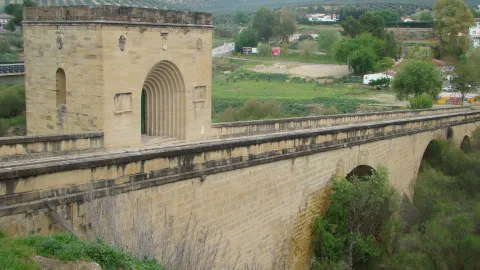
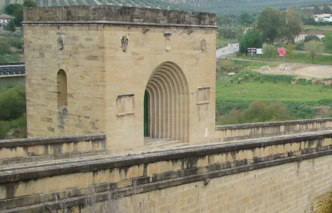
The tower has in its interior a chapel, which has access from the road of the bridge, through a door with arquivoltas, located on both sides of the same stone paths with inscriptions allusive to the bishop of Jaén, Mr Alonso Suárez of the Fuente del Sauce, who financed it. On the door, three shields reproduce the weapons of the prelate. On the three remaining sides of the tower, there are open and half-point windows, also topped by shields.

Breve descripción

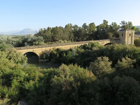
The Bishop's bridge, one of the first of the Hispanic Renaissance, consists of 4 unequal canyon vaults, of sandstone silery, accompanied by yarn of also unequal height. The trail is tilted, and has a quadrangular tower at its highest end. The batteries that hold the arches, they have Tajamars, and it is overcome with a factory pretil.

Telecomunicaciones
Sitio web
www.baezafotografiaehistoria.blogspot.com/2016/01/puente-del-obispo.html
Ubicación
Código Postal
23529
Latitud
37.954120
Longitud
-3.540120
Dirección
Av. Jaén
Municipio
Ubicación en el mapa
POINT (-3.54012 37.95412)
Tipos de punto de interés
Imágenes carrusel
imagen
Image
Puente_del_Obispo01.jpg
Imagen principal
Desactivado
imagen
Image
Puente_del_Obispo.jpg
Imagen principal
Desactivado
Imágenes cabecera
imagen
Image
Puente_del_Obispo.jpg
Imagen principal
Activado
Loading map
Preparing points of interest and routes...

Bridge of San Sebastián

Submitted by brandcode_deweloper on
Id
4884460
Descripción
Breve descripción

The bridge of San Sebastián, adjacent to the missing Gate of Martos on the one hand and with the pillar of the same name, rises on the salt stream. It responds to a Renaissance trail, made in quarry and beautiful proportions. It is made up of only half-point eye framed by strong stirring.

Telecomunicaciones
Sitio web
www.lahistoriadetorredonjimeno.blogspot.com/2016/05/puente-de-san-sebastian.html
Ubicación
Código Postal
23650
Latitud
37.764730
Longitud
-3.961190
Dirección
C/ Tintoretos
Distrito
Municipio
Ubicación en el mapa
POINT (-3.96119 37.76473)
Tipos de punto de interés
Imágenes carrusel
imagen
Image
pnte%20san%20sebastian.jpg
Imagen principal
Desactivado
Imágenes cabecera
imagen
Image
puente.jpg
Imagen principal
Activado
Loading map
Preparing points of interest and routes...

Bridge of Mazuecos

Submitted by brandcode_deweloper on
Id
915023
Descripción
Descripción larga

Thanks to an important documentation preserved in the Royal Chancellery of Granada, published by J. P. Cruz Cabrera, we know much of its constructive process. In 1561 the work was started according to a first trace designed by the Baezan quarry Ginés Martínez, reciting the material execution of the works in the Juanes de la Carrera and Pedro de Mazuecos, neighbors of Canena and Ubeda, respectively. The intervention of Pedro de Mazuecos in this work led to the popularly known bridge as "de Mazuecos" since the 17th century.

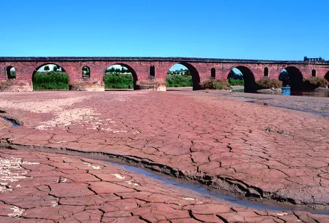
The bridge designed by Ginés Martínez was one-eye, wide light and 100 feet wide. Shortly after the works began, and after the inspections of various quarries, the project of this bridge, with a narrow and narrow profile, was abandoned to begin the construction of another of greater scale. From 1565 there is a documentary record of the intervention in the work of the famous singers Andrés de Vandelvira and Francisco del Castillo "El Joven," which gave a radical turn to the initial idea by projecting a monumental bridge more specific to a city than to a rural property. The traces, signed by both quarries and preserved in the above-mentioned documentation, allow us to know their configuration.

The plateau includes a large central arch of a half-point of 33 meters of light between four thick semi-cylindrical pillars with tachamars; the area facing the villa of Jimena is built directly into the rock in a descending way and only a small arc of discharge was worked; on the side facing Baeza, also descending, the composition is more complex due to the strong change of level, being formed by a sewer in the base and double line of half-point arches in the way of the Roman aqueducts, from which only the lower one is preserved; in this area of the bridge with the vaults were installed, in addition to a few of the vaults, and in a half-vaults.

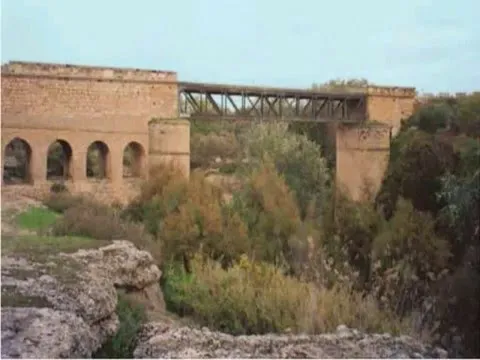
They were used for storage and even leased. The work as a whole presented a careful aesthetic, both in terms of its architectural composition and in the decorative details; the ancestors, the balls of the rivets, the cardines of the pillars, the molding with double thread of the great central arch, the tones of the gears, among other elements, certainly embellished its image, radically disfigured after the intervention practiced following the sinking of the great central arch at the beginning of the 20th century; the central arc was replaced by an adintel metal structure and to adapt it to the rogiven traffic other original compositives disappear.

Vandelvira and Castillo show on this bridge, once again, their extensive knowledge of classicism as well as an extraordinary practice of stereotomy or cutting of the quarry stone. The Mazuecos bridge, which has a great resemblance to that of Ariza, a work also of Vandelvira, is to be related to that of Benamejí (Córdoba), made by Hernán Ruiz "El Mozo" between 1550- 1556. Vandelvira and Castillo, perhaps more intensively, conceive a bridge in which ornamental and constructive details are inserted clearly Italian. We must not forget, however, that it will be Vandelvira who carries the bulk of the work, participating Castillo with him in the assessments. In addition, without subtracting merit from the contribution of Castillo, Vandelvira, when working on the bridge of Mazuecos, is already an experienced architect in this type of work, as close to those carried out by the council of Ubeda on the bridge of Ariza on the avenue of the Guadalimar, more distant those practiced on the great bridge of San Pablo in Cuenca, and, for the same time, those of the bridge on the river Guadalmena, between the current terms of Siles (Jaén) and Montiel (Ciudad Real), for the Order of Santiago, whose remains are still unseen in their ingraceful shores.

Breve descripción

The original "New Bridge" on the Guadalquivir channel was a project of the Baeza Council to enhance an alternative route of union between Granada and the Court that passed through Baeza, instead of doing so through Bailén and thus also enable better communication with other nearby villages such as Jimena and Bedmar, of which food and goods were provided.

Telecomunicaciones
Sitio web
www.baeza.net
Teléfono de contacto
953 740 150
Correo electrónico
sac@baeza.net
Ubicación
Código Postal
23440
Latitud
37.928360
Longitud
-3.452180
Dirección
Situado en el km 10 de la carretera J-303
Municipio
Ubicación en el mapa
POINT (-3.45218 37.92836)
Tipos de punto de interés
Imágenes carrusel
imagen
Image
Puente%20de%20Mazuecos%202.jpg
Imagen principal
Desactivado
imagen
Image
Puente%20de%20Mazuecos%20%281%29.jpg
Imagen principal
Desactivado
Imágenes cabecera
imagen
Image
unnamed%20%281%29.jpg
Imagen principal
Activado
Microsite al que pertenece
Loading map
Preparing points of interest and routes...

Bridge of the Ojos

Submitted by brandcode_deweloper on
Id
8109973
Descripción
Descripción larga

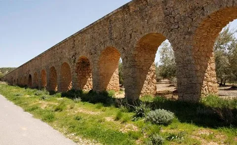
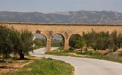
We arrive at the aqueduct by the Service Way that links Pozo Alcón with Cuevas del Campo, once we have overcome the Aqueducts of War and Caramaco we see at a distance the elongated silhouette of it. Its conservation status is quite good.

It is composed of 78 half-point arches of a plant, of masonry built with stone of the area - turroner - and argamase. It is about 400 m long and its arches are higher than those of the nearby aqueducts of War and Caramaco. Several of its arches have a height supplement to correct land irregularities.

Breve descripción

It is an aqueduct dating from the early 20th century, following the typology of Roman construction, built in stone and argamase.

Telecomunicaciones
Teléfono de contacto
953 738 041
Correo electrónico
ayuntamiento@pozoalcon.es
Ubicación
Código Postal
23485
Latitud
37.705420
Longitud
-2.968810
Dirección
Carretera Fontanar
Municipio
Ubicación en el mapa
POINT (-2.96881 37.70542)
Tipos de punto de interés
Imágenes carrusel
imagen
Image
Puente%20de%20los%20ojos2%20%281%29.jpg
Imagen principal
Desactivado
Imágenes cabecera
imagen
Image
Puente%20de%20los%20ojos%20%281%29.jpg
Imagen principal
Activado
Loading map
Preparing points of interest and routes...

Bridge of las Herrerías

Submitted by brandcode_deweloper on
Id
881939
Descripción
Descripción larga

They have in the area that in the 15th century, when Isabel La Católica was traveling to the conquest of Granada from Córdoba, it reached this point where Guadalquivir was so grown that it did not allow its passage. In one night, according to the book, his gentlemen raised this robust bridge that allowed him to reach Baza and Guadix.

The place is beautiful by itself: the bridge is surrounded by fig trees and wild rosals. And in the paths around it you can observe boj, strawberries and hazelnuts.

On the right side is joined the Maillar stream - with another beautiful stone bridge - which makes in rainy years the place an authentic vergel and a very busy bathing area.

We suggest:

  • Make walking some (or all) part of the road that leads to the birth of the Guadalquivir. They are about 11 km across the Navahondona- Guadahornillos Reserve Area, the most protected area of the Natural Park.

In Cazorla take the Sierra road (A-319) until the crossing known as the Empalme del Valle, 17 km. Turn right on the JF-7092 road and after passing the bridge over the Guadalquivir River (4 km from the Empalme) follow the right track (JF-7091) that after two kilometres reaches the Bridge.

Breve descripción

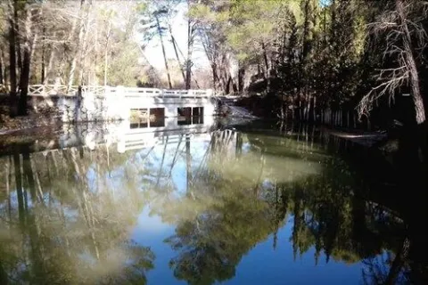
The Herrera Bridge and its surroundings are one of the best known places in the Alto Guadalquivir. It is a great place to start some of the most interesting routes of the Sierra de Cazorla, and the enranche that involves its recreational area will allow you to rest, refresh and enjoy a Guadalquivir river, which at this point already contains a considerable flow. The bridge, built on porous limestone armchairs - here called toba - is perfectly integrated into the landscape.

Ubicación
Latitud
37.900980
Longitud
-2.938540
Dirección
JF-7092
Distrito
Ubicación en el mapa
POINT (-2.93854 37.90098)
Tipos de punto de interés
Imágenes carrusel
imagen
Image
Puente%20de%20las%20Herrer%C3%ADas%202.jpg
Imagen principal
Desactivado
imagen
Image
Puente%20de%20las%20Herrer%C3%ADas.jpg
Imagen principal
Desactivado
imagen
Image
Puente%20de%20las%20Herrer%C3%ADas%20merendero.jpg
Imagen principal
Desactivado
Imágenes cabecera
imagen
Image
puente-herreras.jpg
Imagen principal
Activado
Loading map
Preparing points of interest and routes...