Saltar al contenido principal

Scenic Drive del Reservoir Tranco

Submitted by brandcode_deweloper on
Id
5713331
Breve descripción

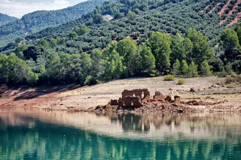
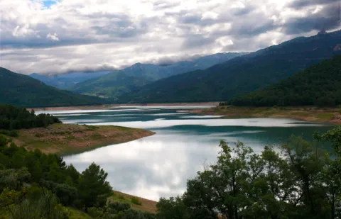
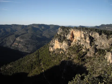
This 43 km route is one of the most classic of the Natural Park. It runs for the most part on the left side of the Tranco reservoir, so the landscape harmoniously combines the platitude of the great water sheet with the rotunity of the great mountains around it, many of them covered by dense pine trees. Not in vain, most of the area is especially protected under the figure of Bujaraiza Reserve Area.

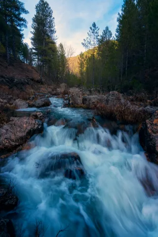
During the first miles, the road runs very close to the Guadalquivir, in the last stretch in which its waters run free before being packed in the Tranco.

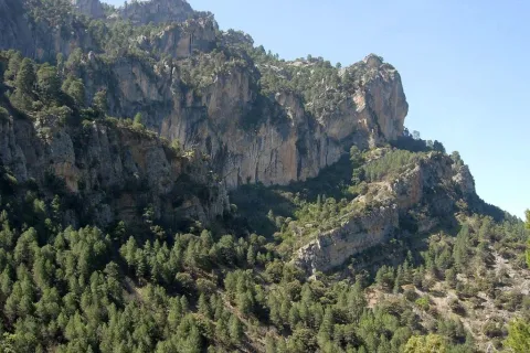
The landscape of the reservoir is purely forest, with the predominance of the carrasco pine under whose shade grows a very rich Mediterranean forest.

From the village of Cañada Morales, already near Hornos, the landscape is transformed into a mosaic of mountain olive groves, pine-covered mountains and small villages.

The route has many points to stop at, such as the views and recreational areas of the reservoir and, above all, some of the most relevant public facilities of the Natural Park, such as the Collado del Almond Wildlife Park, the Torre del Vinagre Visitors Center and the Botanical Garden of the same name. It is also worth knowing the villages near the Hornos de Segura.

Latitud
37.9801
Longitud
-2.7902
Distrito
Municipio
Ubicación en el mapa
POINT (-2.7902 37.9801)
imagen
Image
Ruta%20en%20coche%20del%20Embalse%20del%20Tranco%205.jpg
Imagen principal
Activado
imagen
Image
Ruta%20en%20coche%20del%20Embalse%20del%20Tranco.jpg
Imagen principal
Desactivado

Nature

icon-intereses-naturaleza

Friends

icon-intereses-amigos

Adventure

icon-intereses-aventura

Culture

icon-intereses-cultura

Sport

icon-intereses-deporte

Eco-friendly

icon-intereses-eco-friendly

For couples

icon-intereses-en-pareja

Family

icon-intereses-familia

Gastronomy

icon-intereses-gastronomia

Municipality

icon-intereses-municipio

Low-cost tourism

icon-intereses-turismo-low-cost

Solo travel

icon-intereses-viajar-solo
Ruta en coche del Embalse del Tranco
43 km
By car, on foot
All year round
Desactivado

We suggest...

  • The route deserves a full day, without the visit to Hornos.
  • Don't stop quietly in some of the sights and recreational areas. The views are unpayable.
  • It is appropriate to spare no time in El Collado del Almond and Torre del Vinagre, because the resources they offer will love you and will allow you to understand and admire the impressive ecological heritage of the Natural Park.
Tramo de asfalto o cemento
 
Tramo de pista o camino forestal
 
Tramo de vía pecuaria
 
Tramo de senda
 

Scenic Drive de los Miradores

Submitted by brandcode_deweloper on
Id
5713131
Breve descripción

This route runs the first 20 km that has the road A-317 from Hornos to Pontones and Santiago de la Espada. This is a very panoramic section whose seven viewpoints make it an authentic landscape route. All are equipped with parking, banks, stationery and wooden fences. Some also have tables to eat. The viewpoints have attractive ceramic panels, which serve to interpret the landscape and to know some aspects of the natural and cultural heritage of the environment.

The look at La Morra de Los Canalizos (km 31) has tables to eat. A little further we found the crosses to Hornos el Viejo and La Plantera. It is highly advisable to turn around this last village, with its scattered population and large oaks, and even down to the Tranco reservoir, to take a relaxing walk along its margin.

In the impressive Mirabuenos lookout (km 35) the views change quite a lot: from the humanized landscape of the previous lookout, with extensive olive areas and numerous cortijos and villages, we go to the vast panoramic high mountain, where the large forests dominate.

The view of Las Huelguecillas (km 36), which has tables to eat, is on an extensive promontory, and thanks to its situation as a small "peninsula" aerial we enjoy a very wide panoramic in all directions.

The Pradillos lookout (km) is the last and has a special charm for being at 1,340 m of altitude. This section of the A-317 ends when it stops climbing. You'll find a crossing and you'll have two options. If you keep going, you'll go to Pontoons and the birth of the Segura. You will find a livestock landscape, with very clear views. If you choose to turn left, you will enter a more forest landscape. You can complete your route in a circular way by returning to the Hornos de Segura on the roads of La Suma and la Garganta (A-317a).

Latitud
37.9204
Longitud
-2.9803
Distrito
Municipio
Ubicación en el mapa
POINT (-2.9803 37.9204)
imagen
Image
Ruta%20en%20coche%20de%20los%20Miradores2.jpg
Imagen principal
Activado
imagen
Image
Ruta%20en%20coche%20de%20los%20Miradores.png
Imagen principal
Desactivado
imagen
Image
MIR15.jpg
Imagen principal
Desactivado

Nature

icon-intereses-naturaleza

Friends

icon-intereses-amigos

Adventure

icon-intereses-aventura

Culture

icon-intereses-cultura

Sport

icon-intereses-deporte

Eco-friendly

icon-intereses-eco-friendly

For couples

icon-intereses-en-pareja

Family

icon-intereses-familia

Gastronomy

icon-intereses-gastronomia

Municipality

icon-intereses-municipio

Low-cost tourism

icon-intereses-turismo-low-cost

Solo travel

icon-intereses-viajar-solo
Ruta en coche de los Miradores
By car, on foot
All year round
Desactivado

Scenic Drive Cazorla - Cerrada del Utrero - Torre del Vinagre

Submitted by brandcode_deweloper on
Id
5712511
Descripción larga

Km 0. Caraway. The best way to enjoy Cazorla is to get lost in the streets of the old town and to discover some of its wonders, but on this occasion we propose some forced visits: the Plaza de Santa María, the Castle of the Yedra and some churches such as that of the Carmen or San Francisco of Renaissance style.

Km 1.5. The Iruela.Here we propose to stop you again, leave the car by the road and walk up one of the steep streets that lead to the castle that was owned by the Templars. From above you will have a beautiful view of the Guadalquivir depression. Next to the castle you can also visit the Church of Santo Domingo - and know the details of its foundation and history. Back in the car you will enjoy slimmed streets full of flowers that cheer the view.

Km 12. Air Pass lookout.We go up the road that leads us to the Natural Park and to say goodbye to the countryside, nothing better than to stop at this Mirador and enjoy its views. From here we change villages, castles and olive trees to valleys, rivers and mountains.

Km 13. View of the Port of the Doves (1200 m).The landscape changes dramatically. You will find a great panoramic view of the Alto Valle del Guadalquivir, surrounded by beautiful mountains, including the Poyos de la Mesa on the right, unmistakable by its steep cliffs. It is also a good point to observe rapacious birds such as the royal eagle or the leonate vulture.

Km 16. Valley splash.In fact, the Valley Empalme is not a stop but a crossroads. We can turn left and descend to Cold Arroyo, but at this point we will follow the right-hand option following the JF-7092 road that leads us to the Utrero Clock.

Km 19.5. Closed from the Utrel. 3.5 Km from the Empalme del Valle you can reach a bridge over the Guadalquivir River. At this point we have to leave the car. Here begins a circular route of approximately 45 minutes that we will walk. It is a charming walk next to a Guadalquivir that is going to fit in and that later receives the surprise from the air of the stream of Linarejos. Impossible.

Km 23. Valley splash.Back to the road crossing we now continue on the right, following the A-319 road towards Cold Arroyo.

Km 30. Cold Arroyo.At this point in the road we can visit the Ethnographic Museum of Arts and Customs of the Natural Park. Cold Arroyo is also a good place to take something or make some unexpected purchase.

Km 33. Tejina Recreative Area.A stop on the way to rest, relax and eat outdoors if that's your choice.

Km 40. Vinagre Tower.This is certainly a strategic place within the Park because of it some of the routes that will take you to places as famous as the Cerrada de Elias or the Laguna de Valdeazores. At this point there are also a number of facilities that allow you to know the Park. You will find information about this extraordinary enclave in the area "Passeos por el Valle."

Breve descripción

History and nature by the Guadalquivir River are the proposals for this route full of contrasts that leads us to some of the most significant points of the Natural Park of the saws of Cazorla, Segura and the Villas.

The great protagonist is, of course, the Guadalquivir River, which we will see docile in the olive and narrow and noisy countryside in the high parts of the valley where he has been in charge of modeling the magnificent landscapes we will see. You can appreciate the contrast between people full of history and culture, who live together with a natural environment that is invariable and full of life: you will find wild animals, forests that cover the whole landscape, high mountains and water everywhere.

Latitud
37.9143
Longitud
-3.0072
Municipio
Ubicación en el mapa
POINT (-3.0072 37.9143)
imagen
Image
Ruta%20en%20coche%20Cazorla%20-%20Cerrada%20del%20Utrero%20-%20Torre%20del%20Vinagre%205.jpg
Imagen principal
Activado
imagen
Image
Ruta%20en%20coche%20Cazorla%20-%20Cerrada%20del%20Utrero%20-%20Torre%20del%20Vinagre%20%281%29.jpeg
Imagen principal
Desactivado
imagen
Image
5vinagre_vista_bosque_caducifolio.jpg
Imagen principal
Desactivado
1 día

Nature

icon-intereses-naturaleza

Friends

icon-intereses-amigos

Adventure

icon-intereses-aventura

Culture

icon-intereses-cultura

Sport

icon-intereses-deporte

Eco-friendly

icon-intereses-eco-friendly

For couples

icon-intereses-en-pareja

Family

icon-intereses-familia

Gastronomy

icon-intereses-gastronomia

Municipality

icon-intereses-municipio

Low-cost tourism

icon-intereses-turismo-low-cost

Solo travel

icon-intereses-viajar-solo
Ruta en coche Cazorla - Cerrada del Utrero - Torre del Vinagre
40 km (solo ida)
By car, on foot
All year round
Desactivado

Caraway

The Vinagre Tower.

Tramo de asfalto o cemento
 
Tramo de pista o camino forestal
 
Tramo de vía pecuaria
 
Tramo de senda
 

Scenic Drive carretera de La Cumbre

Submitted by brandcode_deweloper on
Id
5712445
Breve descripción

This area is not what suggests its name, but a long and wide range of water between the basins of Guadalquivir and Segura. It is surrounded by the quiet road A-317a, through which you can enjoy a very wooded landscape dominated by larix pine pines, with some points from which a memorable panorama is dominated to the Tranco reservoir, the Las Villas saw and the Banderillas mountain range.

You can take advantage of this stretch of road to close a car circuit with the Miradores Route and the Hornos Grain road. If you want to walk, we recommend the public road that goes east in the direction of the village of Cabeza Gorda passing through the old forest house of the Fuente del Chorro, which passes through dense pine forests.

Latitud
37.9002
Longitud
-2.9701
Distrito
Municipio
Ubicación en el mapa
POINT (-2.9701 37.9002)
imagen
Image
499_img.png
Imagen principal
Activado
imagen
Image
Ruta%20en%20coche%20carretera%20de%20La%20Cumbre.jpg
Imagen principal
Desactivado

Nature

icon-intereses-naturaleza

Friends

icon-intereses-amigos

Adventure

icon-intereses-aventura

Culture

icon-intereses-cultura

Sport

icon-intereses-deporte

Eco-friendly

icon-intereses-eco-friendly

For couples

icon-intereses-en-pareja

Family

icon-intereses-familia

Gastronomy

icon-intereses-gastronomia

Municipality

icon-intereses-municipio

Low-cost tourism

icon-intereses-turismo-low-cost

Solo travel

icon-intereses-viajar-solo
Ruta en coche carretera de La Cumbre
By car, on foot
All year round
Desactivado

Trail Navazalto

Submitted by brandcode_deweloper on
Id
4447142
Descripción larga

From the town of Chilluévar we will take the road that is headed to the swamp of Aguascebas, past the forest house of the Fresnadilla, to the left, is the panel of beginning of the path.

Breve descripción

The Navazalto peak, located in the Sierra de las Villas, is an excellent look at the villages and landscapes of the Loma, Cazorla, County, and even the Sierra Magina region.

Latitud
38.0901
Longitud
-2.6504
Municipio
Ubicación en el mapa
POINT (-2.6504 38.0901)
imagen
Image
681_SS_01.jpg
Imagen principal
Activado
50 min

Nature

icon-intereses-naturaleza

Friends

icon-intereses-amigos

Adventure

icon-intereses-aventura

Culture

icon-intereses-cultura

Sport

icon-intereses-deporte

Eco-friendly

icon-intereses-eco-friendly

For couples

icon-intereses-en-pareja

Family

icon-intereses-familia

Gastronomy

icon-intereses-gastronomia

Municipality

icon-intereses-municipio

Low-cost tourism

icon-intereses-turismo-low-cost

Solo travel

icon-intereses-viajar-solo
Medium
Sendero Navazalto
2,4 km
On foot
All year round
Desactivado

Wear clean water and adequate clothing and footwear. At the summit there is a cliff 100 m high. Ensure the potability of the water.

We started our way on the Mogón road shortly after passing the Fresnedilla forest house

From there, this path will take us through a landscape dominated in the first instance by irrigated crops and that has its end in the Alto del Navazo (1,356 meters). We will also enjoy the presence of a beautiful karmic terrain and a sea of coniferous, while the leonate vultures fly over our heads.

Tramo de asfalto o cemento
 
Tramo de pista o camino forestal
 
Tramo de vía pecuaria
 
Tramo de senda
 

Trail la Osera

Submitted by brandcode_deweloper on
Id
4446222
Descripción larga

From Chilluévar take the mountain ridge towards the Embalse de Aguascebas. Continue on this road for the next 13.2 km. The beginning of the path is on the left according to the sense of progress. It is warned at the beginning of the path of the risk of stone falling. If we continue along that road we will find the Embalse of Aguascebas just under 300 meters.

Breve descripción

We find one of the most charming routes of the whole Sierra de las Villas. The Path of the Odera is located 18.600 Km east of Mogón within the Natural Park of Cazorla, Segura and Las Villas. Between large cut stone and valleys we will find a great wealth of flora (maple, boj, madroño, tejo, pinars, walnuts, oaks...) and fauna (golden vultures, eagles, hawks,...), as well as wonderful viewpoints from which we can observe unique landscapes.

Latitud
38.1804
Longitud
-2.6902
Municipio
Ubicación en el mapa
POINT (-2.6902 38.1804)
imagen
Image
la-osera-1-jpg
Imagen principal
Activado
imagen
Image
Sendero%20la%20Osera.jpg
Imagen principal
Desactivado
imagen
Image
la-osera-jpg
Imagen principal
Desactivado
4 h

Family

icon-intereses-familia

Friends

icon-intereses-amigos

Nature

icon-intereses-naturaleza

Adventure

icon-intereses-aventura

Solo travel

icon-intereses-viajar-solo

Culture

icon-intereses-cultura

Gastronomy

icon-intereses-gastronomia

Sport

icon-intereses-deporte

Municipality

icon-intereses-municipio

Low-cost tourism

icon-intereses-turismo-low-cost

Eco-friendly

icon-intereses-eco-friendly

For couples

icon-intereses-en-pareja
Alta
Sendero la Osera
4 km
On foot
All year round
Desactivado

Wear clean water and adequate clothing and footwear. Solar protection in the summer

The route begins by surrounding the reservoir of the Aguascebas from which we can observe the majestic peak of Navazalto at the front until we reach the enclave known as the passage of the Acuardo all of it surrounded by large pineas. From here we will continue to descend gradually through the valley of La Osera until we reach a viewpoint where we can see part of the region of Las Villas as well as the passage of the great protagonist of this valley as is the river Aguascebas Chico.

Trail Aguacebas Gil and Cobo

Submitted by brandcode_deweloper on
Id
4446105
Descripción larga

From Chilluévar take the Crta de la sierra towards the Embalse de Aguascebas and Charco de La Pringue (This road links with the Crta de Vva from the Archbishop to the Embalse del Tranco). Continue this road for the next 28? km, at that moment we will find the beginning of the path and the pleasant recreational area of the Cueva del Peinero.

Breve descripción

The river of Gil-Cobo, also called Aguascebas de la Cueva del Agua, is born in the Sierra de Las Villas because a cave with that name is nearby. The stream is a tributary of the river Aguascebas Grande, the most important channel of the saw. The road is, in fact, a throat, as it is strongly attached by the Four Villas saw, on the one hand, and The Rasos. In it, the strawberries, the walnuts, the tiles and even the stalks abound.

Latitud
38.2301
Longitud
-2.6603
Municipio
Ubicación en el mapa
POINT (-2.6603 38.2301)
imagen
Image
IMGP8869.jpg
Imagen principal
Activado
imagen
Image
Sendero%20Aguacebas%20Gil%20y%20Cobo.jpg
Imagen principal
Desactivado
10 min

Nature

icon-intereses-naturaleza

Friends

icon-intereses-amigos

Adventure

icon-intereses-aventura

Culture

icon-intereses-cultura

Sport

icon-intereses-deporte

Eco-friendly

icon-intereses-eco-friendly

For couples

icon-intereses-en-pareja

Family

icon-intereses-familia

Gastronomy

icon-intereses-gastronomia

Municipality

icon-intereses-municipio

Low-cost tourism

icon-intereses-turismo-low-cost

Solo travel

icon-intereses-viajar-solo
Baja
Sendero Aguacebas Gil y Cobo
1,9 km
On foot
All year round
Desactivado

Wear clean water and adequate clothing and footwear. Ensure the potability of water from the sources.

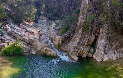
We start from the recreational area Aguascebas de Gil Cobo and we will walk the river, which maintains a fresh and abundant flow even in summer, which will find us pleasant surprises in the form of small waterfalls and, above all, the steep ravine known as Cerrada de San Ginés, which forms a unique stage.

Tramo de asfalto o cemento
 
Tramo de pista o camino forestal
 
Tramo de vía pecuaria
 
Tramo de senda
 

Trail río Cañamares

Submitted by brandcode_deweloper on
Id
4445720
Descripción larga

From the entrance of Chilluévar we head to the reservoir of Aguascebas, about two kilometres away we take an asphalt track to the right and we will travel about 2.7 kilometres to the left. After this detour we crossed the Cañamares River within a few meters in the area known as the Grey Molino; the point of beginning of the path.

Breve descripción

The Sierra de Cazorla in the Natural Park of the Sierras de Cazorla, Segura and the Villas, keeps on its strange well-known routes, being one of the doors to the Natural Park, but we can also find routes as beautiful as the Cañamares River, a little known place that surprises in positive to everyone who walks into it.

Latitud
37.8402
Longitud
-3.3404
Municipio
Ubicación en el mapa
POINT (-3.3404 37.8402)
imagen
Image
1397576Master.jpg
Imagen principal
Activado
imagen
Image
Sendero%20r%C3%ADo%20Ca%C3%B1amares.jpg
Imagen principal
Desactivado
4 h

Nature

icon-intereses-naturaleza

Friends

icon-intereses-amigos

Adventure

icon-intereses-aventura

Culture

icon-intereses-cultura

Sport

icon-intereses-deporte

Eco-friendly

icon-intereses-eco-friendly

For couples

icon-intereses-en-pareja

Family

icon-intereses-familia

Gastronomy

icon-intereses-gastronomia

Municipality

icon-intereses-municipio

Low-cost tourism

icon-intereses-turismo-low-cost

Solo travel

icon-intereses-viajar-solo
Medium
Sendero río Cañamares
3,81 km
On foot
All year round
Desactivado

Wear drinking water and clothing and footwear.

No public parking.

At the beginning of the Cañamares River trail, we find a poetry by the local poet Ramón Martínez Contreras, called "The Way."

Bike Route Siles - El Portichuelo - El Seminario - La Canalica - Siles

Submitted by brandcode_deweloper on
Id
2851934
Descripción larga

We will continue the main track in continuous rise. As you pass the indication to the Mirador de La Rayuela, which is essential to visit, there is a very pronounced curve to the left and there appears a track in slight descent to the front, which is the one we take. We continue in a well-deserved decline that will allow us to regain strength, and we contemplate unbeatable views of Siles and its surroundings, the olive grove in the lower area and the pine forests at medium and high altitudes. This area is very suitable for the observation of marine fossils, of ammonites above all, who lived at sea millions of years ago.

Just as we pass through a small water channelling shed that is at the foot of the track, we have a great view of the Anchorian and Calarejo ravine. Finally, we will cross a stream with permanent water and find a small building on our left that corresponds to a water survey that took place several years ago. From here on there is a profound change in the forest, as we went into a pinar of slender and high lard pine trees very rich in grass and much cooler than we had gone across the hill. We started going up again.

After 2 km. from the rise, we get to some cords that are left to our right. In the Cortijo Palerillas, we recommend a deviation before we return to our route: take the track that starts to the left, in a more sharp and counterman rise, to follow it to its end in 2 km. approximately. If we go to our right, at the base of the rocky cuts that rise upon us we will find several millennia of tejo. It is the most important weave of the Natural Park Sierras de Cazorla, Segura and Las Villas. Then we will return to the Cortijo Pancalillas, to continue the journey along the track. At 700 m we left to the left the great building of the Free Time Residence of Siles, known as The Seminary, and finally we reached asphalt road.

When we get to the road we turn right to go back down slightly until 1 km. down to a crossing where we have to turn left to get back on track and back up. Right at this point we find a magnificent source. We go to the Canalica Fountain Camping, to which we will have to deviate following the entry signs, but before passing through the access door, we will have to continue on a track that opens to the front. This will take us with a soft rise by places of great beauty, such as the Stone of the Hole and the Cerro Bucentaina, which we will surround, to view the valley of the Morles River, and already on a much more sharp and pleasant descent, we will reach the Peña del Olivar. It is a unique place suitable for the bathroom with a recreational area and a botanical collection. From there and by road we are headed for Siles. A few meters after exceeding the campsite Rio Los Molinos we will turn to our right, in the absence of 1 km. to reach Siles, thus avoiding more asphalted stretch and entering the town by land track.

Breve descripción

The circular tour begins in the town of Siles. We are headed for a forest track towards the hill of the Portichuelo, from which we have an unbeatable view of the village and the Vega de Castrobayona, before the nearby Albaceteña mountains and which shows the difficult agricultural life of the former inhabitants of the area. The Portichuelo is also the starting point of several signposted trails of small route.

Latitud
38.377909
Longitud
-2.579232
Distrito
Municipio
Ubicación en el mapa
POINT (-2.579232 38.377909)
imagen
Image
IMG_4539.jpg
Imagen principal
Activado
imagen
Image
Siles%20-%20El%20Portichuelo%20-%20El%20Seminario%20-%20La%20Canalica%202.jpg
Imagen principal
Desactivado
imagen
Image
Puntal%20Nieve%20invierno%20%282%29.jpg
Imagen principal
Desactivado
imagen
Image
Pico%20Navalperal%20y%20Las%20Acebeas.jpg
Imagen principal
Desactivado

Nature

icon-intereses-naturaleza

Friends

icon-intereses-amigos

Adventure

icon-intereses-aventura

Culture

icon-intereses-cultura

Sport

icon-intereses-deporte

Eco-friendly

icon-intereses-eco-friendly

For couples

icon-intereses-en-pareja

Family

icon-intereses-familia

Gastronomy

icon-intereses-gastronomia

Municipality

icon-intereses-municipio

Low-cost tourism

icon-intereses-turismo-low-cost

Solo travel

icon-intereses-viajar-solo
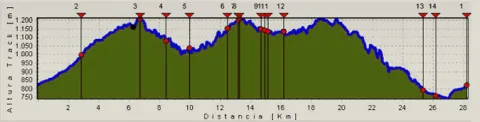
761 m.
CIRCULAR SILES - EL SEMINARIO - PEÑA DEL OLIVAR
28,6 km
1342m
1336m
In Bicycle, Horse, on foot
All year round
Desactivado
Image
582fc3e8-4a35-123b-e253-afabe37578ee?t=1589476117495

Peña del Olivar

Siles

821 m.

RECORRID: SILES - THE PORTICHUEL - BARRANCO OF THE ANCHURICAS - THE SEMINARY - SOURCE OF THE CANALIC - OLIVAR PEÑA - SILS

821 m.
Coordenadas / Huso 30S
30S x = 536752 and = 4247830
Tramo de asfalto o cemento
12.24%
Tramo de pista o camino forestal
87.76%
Tramo de vía pecuaria
0
Tramo de senda
0

Bike Route Río Madera - Valle de Los Anchos

Submitted by brandcode_deweloper on
Id
2851677
Descripción larga

1.7 km. We left the asphalt road, to turn left by forest track and between larium pinears, going down slightly to the stream and from there gradually going back to the Arroyo de los Asperones and leaving to the right the Cortijos del Jaral, until we reach the Collado de los Asperones where a small farm of the Segureña sheep is located.

From there, and in a dizzy descent next to the Arroyo de Romaguillo, we go down to the cortijos of the same name where we go back to the asphalt road. Once in this we turned right to continue downstream through the valley of Rio Madera, leaving corijadas on both sides of it that show the most ancestral way of life of these mountains, where the locals won small plots next to the houses to have small gardens of self-supply. We'll go down the road 3.7 km. until you reach the small village of Venta de Rampees, just as you cross a bridge on it opens to our left a narrow asphalt track that is marked as Los Anchos.

The track of the Anchos, in a smooth and continuous rise, runs first through the right margin of the valley, leaving to the left cornered as the Hoya del Azor, and once we cross to the left side we will find on our left the Cortijos de Majada Oscura where an ethnographic museum is located that well deserves a careful visit.

The larix forests splattered with some trees of caduca, chopos and fruit leaves spatter these sites next to rocky walls especially on the right side of the valley. Continuing our climb through it, we reach the two most important villages of it, it is the village of the Anchos and Pradomaguillo, places that deserve a small break to walk between its alleys.

At the entrance of Pradomaguillo we must turn left following the signs of GR 147, but it is worth getting off the bike and looking at 150 m., past Pradomaguillo, to see from the track that continues to walk this valley, in a true natural viewpoint, the Valley of the Anchos in all its splendor.

Just 400 m later, already on the GR-147, we found a small hill on our left without trees. We must go up to the same, for we will see great panoramic views of the valley and of the Calar that rise before us with its limestone walls. Then we continue our ground track to coronate at a few 300-400 m. along the Pradopurco Collado and once crowned simply follow the most transited track, in a sinuous but soft descent. We will see with the slender larity pine trees some small acebo bosquet and above all large pastures under the trees. To our right the Arroyo de las Tres Aguas and a vertical mole of limestone that is the Calar de Peñarrubia; just as we are in front of the Calar, below the stream we find ruins on a clear that belong to an ancient flour mill. A few 200-300 m. we will leave the GR-147 to the right to continue the track on which we were moving to the front. Soon this track descends and we cross the stream of the Three Waters, which only a few meters from the river Madera. Once we crossed the stream, we found a ruse, collaring and descent to wade the Wood River.

Cruzado Río Madera, we are in a very fresh and lush area, here is the area of Aparpada Controlada de la Morringa with its recreational area, it is worth moving 100 m. to the right to contemplate the remnants of the river and the facilities of the area.

We arrive again on the asphalt road, which we will have to follow to the right, to continue to climb up the valley of Rio Madera. At 1.2 km. We got to our starting point.


Breve descripción

The tour begins at the intersection of the village of Rio Madera, at the intersection of the JF-7,038 road with the JF-7,039, initially we go towards the village, by asphalt road, leaving to our right the mountain host and the small hermitage of the village and, just a few meters and to the left, the old laundry and the corrijada of Rocanas.

Latitud
38.240876
Longitud
-2.613059
Distrito
Municipio
Ubicación en el mapa
POINT (-2.613059 38.240876)
imagen
Image
R%C3%Ado%20Madera.jpg
Imagen principal
Activado
imagen
Image
Alma%20Serrana%201.JPG
Imagen principal
Desactivado

Family

icon-intereses-familia

Friends

icon-intereses-amigos

Nature

icon-intereses-naturaleza

Adventure

icon-intereses-aventura

Solo travel

icon-intereses-viajar-solo

Culture

icon-intereses-cultura

Gastronomy

icon-intereses-gastronomia

Sport

icon-intereses-deporte

Municipality

icon-intereses-municipio

Low-cost tourism

icon-intereses-turismo-low-cost

Eco-friendly

icon-intereses-eco-friendly

For couples

icon-intereses-en-pareja
1,176 m.
CIRCULAR RÍO MADERA VALLE DE LOS ANCHOS
23,29 km
788m
810m
In Bicycle, Horse, on foot
All year round
Desactivado
Image
fe6694c5-9e10-6264-7570-b3f67786aa8b?t=1589474581587

La Morringa

River Wood Cross on JF-7.038 with JF-7.039

1.178 m.

River Wood Cross in the JF-7038 with the JF-7039

1.178 m.
Coordenadas / Huso 30S
30S x = 533861 and = 4232612
Tramo de asfalto o cemento
0.19%
Tramo de pista o camino forestal
0.71%
Tramo de vía pecuaria
0
Tramo de senda
0