Saltar al contenido principal

Bar-Restaurant el Mirador

Submitted by brandcode_deweloper on
Id
6073349
Redes sociales
Facebook
https://www.facebook.com/elmiradorsiles/
Descripción
Breve descripción

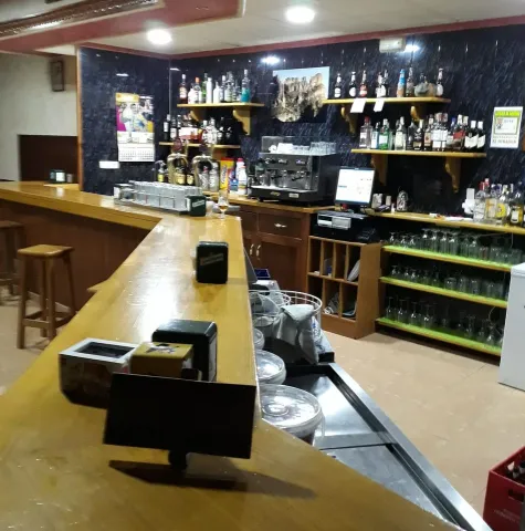
Bar Restaurante el Mirador is a great restaurant that offers an unbeatable atmosphere in its facilities. Good kitchen to taste and enjoy your dishes.

Información de contacto
Teléfono de contacto
677 542 952
Ubicación
Código Postal
23380
Latitud
38.391280
Longitud
-2.583380
Dirección
Ctra. Hellín, 15
Distrito
Municipio
Ubicación en el mapa
POINT (-2.58338 38.39128)
Tipo de restaurante
Imágenes
imagen
Imagen
mirador-de-siles-jpg
Imagen principal
Activado
imagen
Imagen
120047639_1336577343371015_4635003687194695124_n.jpg
Imagen principal
Desactivado
imagen
Imagen
62610206_942783326083754_3512250957033373696_n.jpg
Imagen principal
Desactivado
Loading map
Preparing points of interest and routes...

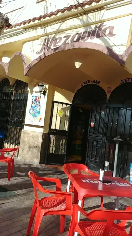
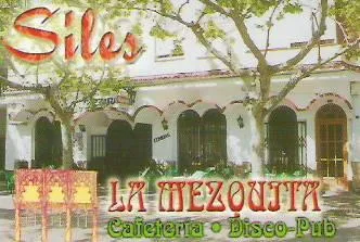
Bar Mezquita

Submitted by brandcode_deweloper on
Id
6071139
Descripción
Breve descripción

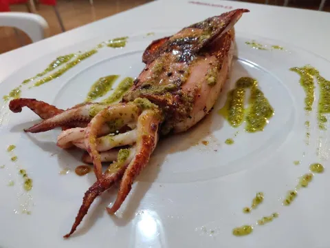
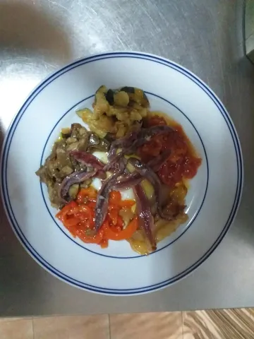
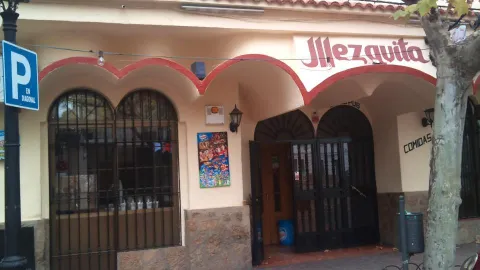
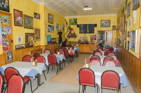
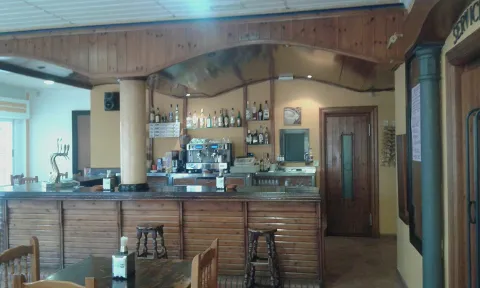
Bar Mezquita is a cozy place with a very good atmosphere. Known for its quality at good price.

Información de contacto
Teléfono de contacto
953 490 445
Ubicación
Código Postal
23380
Latitud
38.390340
Longitud
-2.584640
Dirección
C/ el Paseo, 16
Distrito
Municipio
Ubicación en el mapa
POINT (-2.58464 38.39034)
Tipo de restaurante
Imágenes
imagen
Imagen
103_506900709.jpg
Imagen principal
Activado
imagen
Imagen
2%20%282%29.jpg
Imagen principal
Desactivado
imagen
Imagen
bar-la-mezquita.jpg
Imagen principal
Desactivado
Tipo de cocina
Loading map
Preparing points of interest and routes...

Bar La Unión (Casa Del Músico)

Submitted by brandcode_deweloper on
Id
6080434
Descripción
Breve descripción

Bar the Musician the Union, come and meet us. We are proud of our products. We're waiting for you.

Información de contacto
Teléfono de contacto
953 738 080
Ubicación
Código Postal
23485
Latitud
37.701460
Longitud
-2.934240
Dirección
Av. Ntra. Sra. de los Dolores, 67
Municipio
Ubicación en el mapa
POINT (-2.93424 37.70146)
Tipo de restaurante
Imágenes
imagen
Imagen
musico.jpg
Imagen principal
Activado
imagen
Imagen
restaurantes_12.jpg
Imagen principal
Desactivado
Tipo de cocina
Loading map
Preparing points of interest and routes...

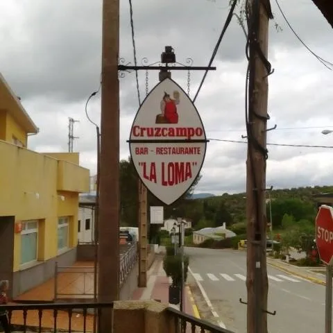
Bar La Loma

Submitted by brandcode_deweloper on
Id
6072138
Redes sociales
Facebook
https://www.facebook.com/pages/category/Bar/Bar-la-loma-2010399805851153/
Descripción
Breve descripción

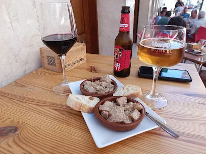
A magnificent atmosphere accompanied by an exquisite meal. Do not miss the opportunity to taste their tapas with flavors that will awaken all your senses.

Información de contacto
Teléfono de contacto
636 607 438
Ubicación
Código Postal
23380
Latitud
38.385310
Longitud
-2.585620
Dirección
C/ Sabina, 2
Distrito
Municipio
Ubicación en el mapa
POINT (-2.58562 38.38531)
Tipo de restaurante
Imágenes
imagen
Imagen
13177195_2010405015850632_3284890894930060120_n.jpg
Imagen principal
Activado
imagen
Imagen
13164219_2010402862517514_6937088386463455776_n.jpg
Imagen principal
Desactivado
Tipo de cocina
Loading map
Preparing points of interest and routes...

Bar Ignacio

Submitted by brandcode_deweloper on
Id
6093849
Descripción
Breve descripción

Restaurant bar that blends traditional cuisine with innovative copyright. Tapas and much more... In the heart of our town of Pozo Alcón and is ideal for your meetings with friends and family.

Información de contacto
Teléfono de contacto
953 738 337
Ubicación
Código Postal
23485
Latitud
37.704590
Longitud
-2.935350
Dirección
C/ Antonio Lazo, 17
Municipio
Ubicación en el mapa
POINT (-2.93535 37.70459)
Tipo de restaurante
Imágenes
imagen
Imagen
ignacio-1-jpg
Imagen principal
Activado
imagen
Imagen
restaurantes_11.jpg
Imagen principal
Desactivado
Tipo de cocina
Loading map
Preparing points of interest and routes...

Café-Bar El Velero

Submitted by brandcode_deweloper on
Id
6093683
Redes sociales
Facebook
https://www.facebook.com/pages/category/Tapas-Bar---Restaurant/El-Velero-30-111921540385770/
Descripción
Breve descripción

A magnificent atmosphere accompanied by an exquisite meal. Do not miss the opportunity to taste some dishes with flavors that will awaken all your senses

Información de contacto
Ubicación
Latitud
37.698830
Longitud
-2.937530
Dirección
C/ Higuerilla, 29
Municipio
Ubicación en el mapa
POINT (-2.93753 37.69883)
Tipo de restaurante
Imágenes
imagen
Imagen
restaurantes_5.jpg
Imagen principal
Activado
imagen
Imagen
restaurantes_13.jpg
Imagen principal
Desactivado
Tipo de cocina
Horario
Monday's closed. Tuesday to Saturday: 13: 30 - 15: 30 and 20: 30 - 23: 00. Sunday: 13: 30 - 15: 30.
Loading map
Preparing points of interest and routes...

Aleuri Olympo

Submitted by brandcode_deweloper on
Id
13438864
Redes sociales
Facebook
https://www.facebook.com/p/Aleuri-Olympo-61554497986412/
Instagram
https://www.instagram.com/aleuriolympo/
Descripción
Breve descripción

The Aleuri Olympo Restaurant, located in La Iruela, is adapted to all types of customers, from individuals as large groups. In a deafano space overlooking the Sierra de Cazorla olive grove and the Castillo de La Iruela, you can enjoy traditional cuisine of this territory with an innovative touch. They seek excellence in what they do and that the people who visit them have an experience with the 5 senses.

They measure a lot of lighting and acoustics to create a pleasant atmosphere for their customers.

Información de contacto
Teléfono de contacto
623 152 125
Correo electrónico
aleuriolympo@gmail.com
Ubicación
Código Postal
23476
Latitud
37.922614
Longitud
-2.994011
Dirección
Ctra. de Burunchel, 3
Municipio
Ubicación en el mapa
POINT (-2.994011 37.922614)
Tipo de restaurante
Imágenes
imagen
Imagen
_mg_3875-jpg
Imagen principal
Activado
Horario
Monday to Thursday: 13: 30 - 23: 30. Friday to Saturday: 13: 30 - 01: 00. Sunday: 13: 30 - 23: 30.
Loading map
Preparing points of interest and routes...

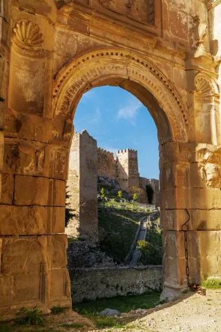
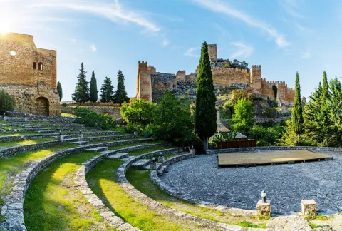
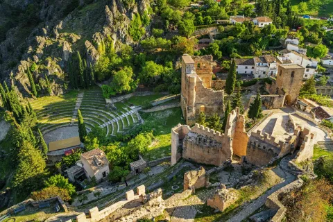
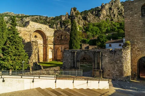
Castle of La Iruela

Submitted by brandcode_deweloper on
Id
2275391
Descripción
Descripción larga

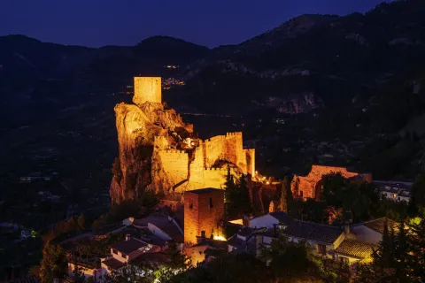
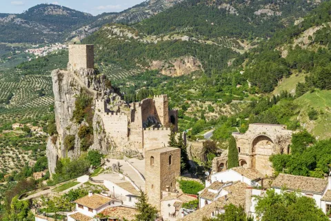
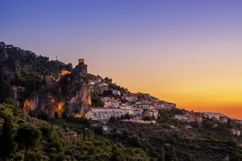
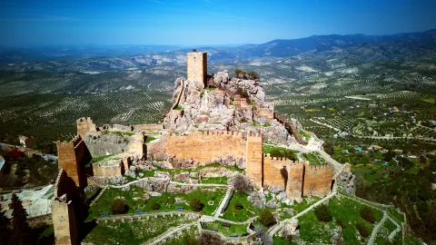
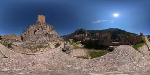
It is located at the highest point of a promontory that provides a natural defense, with strong cuts to the north and east, and which is extended to the west by a relatively wide and flat spur, from which the entrance tower to the castle is accessed.

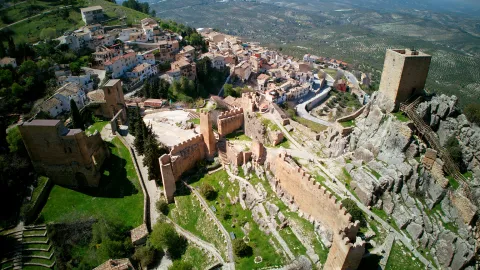
A Almohad occupation developed between the XII-XIII centuries, the oldest recorded, has been documented. In this period the fortress would be built, which is organized in three enclosures with towers of troncopyramidal section, steps from north to south and made in high-quality tapial with a lime mortar lining simulating a false silery split. To the south of this set would extend the Islamic village, around the area where a vaguada was running.

In the 14th century several works will be carried out in the village, such as the construction of the first church of the town or the wall surrounding the area of access to the castle and the village. It will also be when various repairs are made in the castle and the so-called Torre del Picacho is raised on the top of the rock.

In the 15th century, at the point where the access door to the fortress was located, which was inserted in the canvas that separated the population from the square of arms, it was replaced by a torre-gate, which currently continues to function as access to the castle. This structure has rectangular plant, the first body, the only original part that is preserved, since the upper bodies are very restored, was built slightly wider than the rest with the aim of giving it greater strength.

In the following century the church of Santo Domingo was built on the south flank of the castle. With a typical Renaissance living room, it is organized in three ships, the centre of double width than the sides, and flat tester. The header has two cylindrical turreons on the corners. Its state of deterioration in the 19th century would lead to the suppression of the cult in the church and the abandonment of it, using it as a municipal cemetery until the mid-20th century.

The origin of the population appears to be related to the construction of the Almohade castle, which rises on a rocky spur dominating the town. It is most likely to be built as a center of a castral district that would cover much of what will then be the Cazorla advance. The high level of construction seems to indicate the State's participation in its construction in order to strengthen the Al- Andalus border.

In 1231, Fernando III, before conquering the area, granted the lordship of the village of Quesada to the church of Santa María de Toledo. Months later the prized Archbishop of Toledo Don Rodrigo Ximénez de Rada began the conquest of this territory, including La Iruela, thus taking over the lands that will later constitute the Lordship of the advance of Cazorla. The conversion of Cazorla to the capital of the advance must have had an impact on the development of the populations of its surroundings, so that the castle of La Iruela would be almost abandoned when the strengths of Cazorla were built.

In the second half of the 14th century, during the civil war that faced King Peter I with his stepbrother Henry II Tratámara, while Cazorla remained faithful to the king, Iruela supported the Archbishop of Toledo, who had placed himself on the sublevate side. After the end of the conflict after the victory of Henry II, in thanks for the support given, Archbishop Don Pedro Tenorio granted him the status of a villa in 1378.

From now on, the town will experience a progressive development, which will be reflected in the emergence of new buildings and in the reform of its defensive structures. After the conquest of Granada the advance would remain until 1812, but already without the tutelage of the figure of the military advance, a direct result of the loss of its strategic and border position.

The population of La Iruela tripled in the 16th century, growth that resulted in the construction of the first urban town, breaking with the walled structure that had characterized the population during the Middle Ages.

In the course of the War of Independence the population would be attacked on several occasions by the Napoleonic troops, suffering significant damage.


Breve descripción

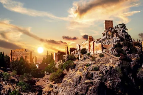
The castle of La Iruela dominates the homonymous town from a rocky promontory, located 1.5 km north-east of the town of Cazorla. The mothade-origin fortification consists of three walled enclosures with towers and arranged in a step in a north-south direction. It is an interesting ensemble that is accessed by a 15th century door tower, and from which stands out its Tribute Tower, located in the highest part of the river and visible from a great distance. Next to the castle you can see the ruins of the Renaissance church of Santo Domingo, from the 16th century.
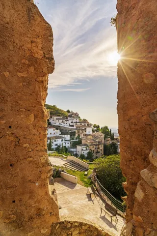
The Iruela had its origin in a small house associated with a strategic fortress. After his conquest, the prized Archbishop of Toledo Don Rodrigo Ximénez de Rada will be the lordship of the advance of Cazorla, of which he will be a part. His support for the archbishopric and Henry II Tratámara in his confrontation with King Peter I was worth the village's rank in 1378, with a strong development of the town. It currently maintains the urban plot, with steep and narrow alleys that adapt to the level curves and in which the usual serrana architecture is maintained.

Telecomunicaciones
Sitio web
www.ayuntamientolairuela.es
Teléfono de contacto
953 720 712 / 626 811 583
Correo electrónico
info@ayuntamientolairuela.es
Ubicación
Código Postal
23476
Latitud
37.921075
Longitud
-2.989891
Dirección
Carretera Santo Domingo, s/n
Municipio
Ubicación en el mapa
POINT (-2.989891 37.921075)
Tipos de punto de interés
Imágenes carrusel
imagen
Imagen
_DSC5265.jpg
Imagen principal
Desactivado
imagen
Imagen
_DSC4822.jpg
Imagen principal
Desactivado
imagen
Imagen
castillo de iruela
Imagen principal
Desactivado
imagen
Imagen
castillo de iruela
Imagen principal
Desactivado
imagen
Imagen
castillo de iruela
Imagen principal
Desactivado
imagen
Imagen
castillo de iruela
Imagen principal
Desactivado
imagen
Imagen
castillo de iruela
Imagen principal
Desactivado
imagen
Imagen
castillo de iruela
Imagen principal
Desactivado
imagen
Imagen
castillo de iruela
Imagen principal
Desactivado
Imágenes cabecera
imagen
Imagen
CyB_Iruela_01
Imagen principal
Desactivado
imagen
Imagen
CyB_Iruela_02
Imagen principal
Desactivado
Horario
Nov - sea: 10: 00 - 14: 00 and 16: 00 - 18: 00. 1 abr - 12 may: 10: 00 - 14: 00 and 17: 00 - 19: 00. 15 May - 19 Jun: 10: 00 - 14: 00 and 17: 00 - 20: 00. 19 Jun - 15 sept: 10: 00 - 14: 00 and 19: 00 - 22: 00. 18 sept - 29 sept: 10: 00 - 14: 00 and 17: 00 - 20: 00. October: 10: 00 - 14: 00 and 17: 00 - 19: 00. Monday and Tuesday closed.
Modelo 3D
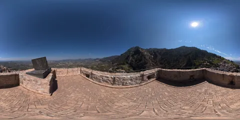
Experiencia 360
Imagen
CyB_Iruela
Imagen
CyB_Iruela
Loading map
Preparing points of interest and routes...
Marcas de calidad

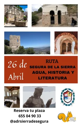
Guided Route in Segura de la Sierra: "Water, History and Literature"

Submitted by brandcode_deweloper on
Id
14062882
Descripción
Descripción larga

The route will pass through the Arab Baths, the Imperial Fountain of Charles V, the Fuente Morena and the Gontar washing place. A journey that unites nature and culture, memory and word, to reveal the essence of Segura de la Sierra: a place where water writes history, and literature illuminates it.

Breve descripción
In Segura de la Sierra, water is more than a resource: it's a flowing memory. On 26 April, the “Water, History and Literature” route invites visitors to explore the heart of this fortified town, following the clear thread of its fountains, its legends, and the words that, for centuries, have tried to capture its beauty.
Ubicación
Latitud
38.298857
Longitud
-2.651877
Distrito
Ubicación en el mapa
POINT (-2.651877 38.298857)
Imágenes
imagen
Imagen
segura-1-jpg
Imagen principal
Activado
Fecha Inicio
26 Apr 2026 11:00
Fecha Fin
26 Apr 2026 13:00
Loading map
Preparing points of interest and routes...
Interés
Evento cancelado
Desactivado

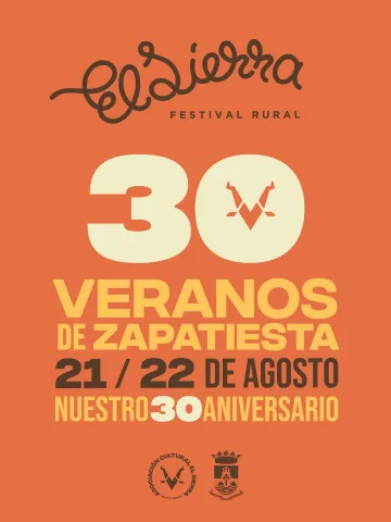
El Sierra. The Rural Festival

Submitted by brandcode_deweloper on
Id
14062911
Descripción
Descripción larga

One of the most celebrated features of El Sierra is its ability to weave heritage and landscape into every part of the programme. Performances are designed for the place, not the other way round. So a recital might take place in front of a medieval fountain, a dramatised reading might fill a cobbled alley, and a sound piece might resonate from a viewpoint overlooking the mountain horizon.

Breve descripción
Segura de la Sierra will once again become a meeting point for culture, territory and community with the celebration of El Sierra. The Rural Festival, an event that has established itself as one of the most distinctive gatherings on the Andalusian cultural scene.
Ubicación
Latitud
38.298857
Longitud
-2.651877
Distrito
Ubicación en el mapa
POINT (-2.651877 38.298857)
Imágenes
imagen
Imagen
el-sierra-1-jpg
Imagen principal
Activado
Fecha Inicio
21 Aug 2026 00:00
Fecha Fin
22 Aug 2026 00:00
Loading map
Preparing points of interest and routes...
Interés
Evento cancelado
Desactivado