Saltar al contenido principal

Río Guazalamanco

Submitted by brandcode_deweloper on
Id
913911
Descripción larga

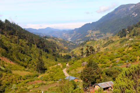
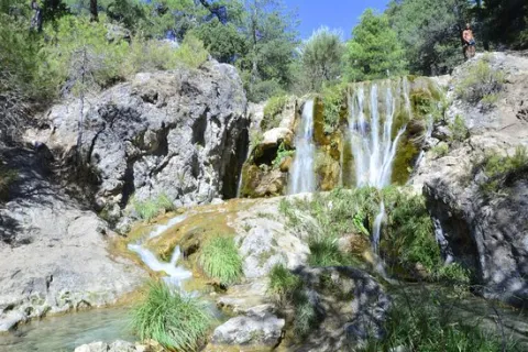
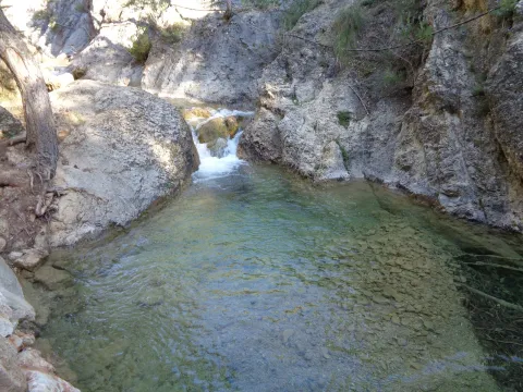
Once the asphalt ramp is over, the most painful stretch of the road, we reach an excellent lookout that allows us to enjoy a good view of the reservoir and the Valentine Barrio. A little later the track runs parallel to the river. When it wanders the way, without crossing, we follow the shore to the corners full of charm that we will meet. Later we will be forced to leave the shore to access a lane. We continue upstream, until we reach the Dike Cascade, very easy to distinguish because in its crown it has stone walls. A little lower, hidden in the bush, a beautiful leap of water is hidden that we must not miss.

Overcoming the Cascade of the Dique, part of a path that, at first, crosses the channel twice and takes us to the head of the river. Leaving the bottom of the ravine for a long time, and then returning to it, when the road ends on a forest track, we reach the bottom of the Cerrada de Navas, where the Guazalanco offers one of its most beautiful pictures.

However, to get to this point from above and to make the way down the stream, you can make an interesting route from the Nature Hall and Botanical Garden of El Hornico: Route of Guazalamanco on the Prays of Arredondo. This circular itinerary is signposted and has 13.2 (circular) length. If two vehicles are available and leaving one on the Cuesta del Cement, we reduce the route to 8.8 km and, in addition, we avoid the most flat and monotonous part of the route, the Dehesa del Rincón.

The most direct access to the Guazalamanco River is by the Dehesa del Rincón. From Pozo Alcón you have to take the A-326, up the Avenida de la Bolera, direction to Castril. By passing the campsite de la Bolera and the Km. 7, we take a detour that comes to our left and that borders the Forest House of la Bolera (it indicates to the Hornico). On an unasphalted road, always following the main road, 6,7 km from its start a fork to the left, in a slope, is left, which is asphalted (Cuesta del Cement). Although with an apron we can reach the Pasada de Guazalamanco, by a forest track parallel to the channel, the most recommended option is to leave the vehicle at the foot of the hill and take a small walk to the Cascade del Dique (round and round 2.5 km), and enjoy the many corners that this beautiful and wild mountain stream offers us.

Breve descripción

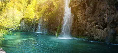
Guazalamanco is a mountain channel of permanent and turbulent waters, loaded with oxygen and gelid glass. Each of its corners invites us to recreate our senses, to remain still, in silence, as if we wanted to merge with nature and return to our origins. If you forget the camera in the car, when you discover the stream you will return to your steps to restart the road, now with the machine ready.
Latitud
38.1704
Longitud
-2.7002
Municipio
Ubicación en el mapa
POINT (-2.7002 38.1704)
imagen
Image
cascada-del-guazalamanco.jpg
Imagen principal
Activado
imagen
Image
guazalmanco.jpg
Imagen principal
Desactivado

Nature

icon-intereses-naturaleza

Friends

icon-intereses-amigos

Adventure

icon-intereses-aventura

Culture

icon-intereses-cultura

Culture of the Bull

icon-intereses-cultura-del-toro

Sport

icon-intereses-deporte

Eco-friendly

icon-intereses-eco-friendly

For couples

icon-intereses-en-pareja

Family

icon-intereses-familia

Gastronomy

icon-intereses-gastronomia

Municipality

icon-intereses-municipio

Low-cost tourism

icon-intereses-turismo-low-cost

Solo travel

icon-intereses-viajar-solo
Baja
Río Guazalamanco
Activado

Pine Tree Galapán

Submitted by brandcode_deweloper on
Id
913492
Descripción larga

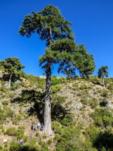
Because until you're with him you're not aware of his proportions. Embrace and surround it is impossible if 4 or 5 people do not join, as its perimeter reaches 5.40 meters. For its dimensions it is part of the Project "Trees: Legends vivables," a beautiful work of cataloging unique trees of the Iberian Peninsula.

This wonderful pine tree has survived the intense forest activity that developed on these lands for several centuries. Many of his companions, who are no longer present, were part of the ships that were built for the Spanish Navy between the 16th and 18th centuries. It was the time when the Serra de Segura saw was the Maritime Province. But the Galapan is still with us to show you its splendor.

We suggest...

  • Enjoy a good time sitting next to the Pino Galapán, under his cup, watching the water spread through the stream of the Juan Fría and appreciating this natural monument, which for centuries has been the inspiration of legends, stories, writings and traditions.
  • Since you have come to that you can continue on the forest track until you look at the fields of Hernán Perea, another of the natural treasures of the Park. You won't regret it.

From Santiago de la Espada you have to follow the road A-317 towards La Matea, and through this town continue to the village of Don Domingo. Once there you have to take a forest track in perfect condition, marked for hiking as GR 144. This track is directed towards Rambla Seca and the fields of Hernán Perea. As you pass a bridge you will find a first crossing where, on the right, the route to the Pino Galapán is indicated. 2.6 km from this crossing you will find it in the right margin of the road.

Breve descripción

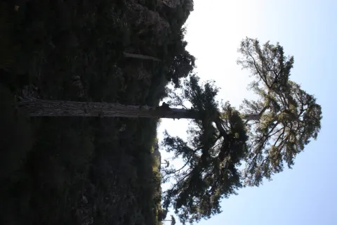
You have before you a magnificent example of larix pine, which here is called the Salgareño pine (Pinus nigra salzmanii), a living treasure of this territory that with its more than 400 years of age and 39 m of height is listed as one of the giants of the Spanish forests. It is the most emblematic tree in the Segura saw, and although it does not seem much to you from the forest track, you have to go down the path and get to its base to understand what is special.

Latitud
38.111768
Longitud
-2.551516
Ubicación en el mapa
POINT (-2.551516 38.111768)
imagen
Image
Pinogalapan450-x-600.jpg
Imagen principal
Activado
imagen
Image
Pino%20Galap%C3%A1n.jpg
Imagen principal
Desactivado

Friends

icon-intereses-amigos

Adventure

icon-intereses-aventura

Culture

icon-intereses-cultura

Culture of the Bull

icon-intereses-cultura-del-toro

Sport

icon-intereses-deporte

Eco-friendly

icon-intereses-eco-friendly

For couples

icon-intereses-en-pareja

Family

icon-intereses-familia

Gastronomy

icon-intereses-gastronomia

Municipality

icon-intereses-municipio

Nature

icon-intereses-naturaleza

Low-cost tourism

icon-intereses-turismo-low-cost

Solo travel

icon-intereses-viajar-solo
Pino Galapán
Desactivado
Coordenadas / Huso 30S
30S x = 539316 and = 4218311
Tramo de asfalto o cemento
 
Tramo de pista o camino forestal
 
Tramo de vía pecuaria
 
Tramo de senda
 

Embalse Úbeda la Vieja

Submitted by brandcode_deweloper on
Id
912924
Descripción larga

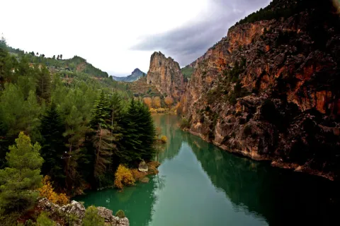
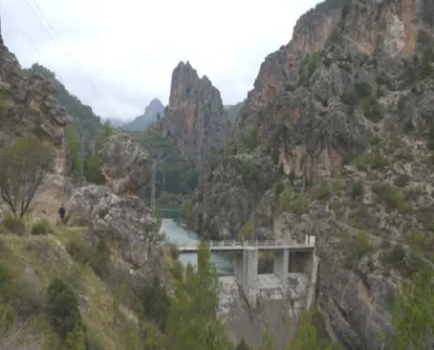
From the road you will find a road that goes down to the reservoir dam, where the vision is even more spectacular, with the impressive Pico Morrión standing out at the bottom.

This area of the Park represents better than any of the world of mountain villages: landscape, culture, gastronomy, odors, colors, life forms that when we come from the city we find unreal; as if it were not possible to live integrated into nature, living from the resources it provides but without damaging it.

Around the reservoir there are villages held in the time that each of them offers you different delicacies: the bread and the cakes of Tobos made in a historic wood oven, or the magnificent Vites spirit with which to make delicious artisanal liquors such as the pachan or the mistela.

We suggest...

  • Eating in the surroundings of the reservoir: Segureño lamb, slaughter viandas or any serrano dish will be safe of your liking.
  • Visit some of the villages near the reservoir, such as Marchena, La Muela or Miller.

This reservoir is located halfway between the town of Santiago de la Espada and the village of the Miller Boards, on the local road JF-7038, at the height of the village of Morrión.

Breve descripción

The vegetation-covered slopes and stone walls are reflected in the blue green waters of this tiny reservoir, which looks more like a natural lake of high mountain than a human construction. In it the Zumeta River retains its waters for an instant creating a peaceful and serene place, ideal for a moment of tranquility.

Latitud
38.0131
Longitud
-3.3706
Ubicación en el mapa
POINT (-3.3706 38.0131)
imagen
Image
embalse_lavieja%20%281%29.jpg
Imagen principal
Activado
imagen
Image
embalsedeLaVieja01.jpg
Imagen principal
Desactivado

Friends

icon-intereses-amigos

Adventure

icon-intereses-aventura

Culture

icon-intereses-cultura

Sport

icon-intereses-deporte

Eco-friendly

icon-intereses-eco-friendly

For couples

icon-intereses-en-pareja

Family

icon-intereses-familia

Gastronomy

icon-intereses-gastronomia

Municipality

icon-intereses-municipio

Nature

icon-intereses-naturaleza

Low-cost tourism

icon-intereses-turismo-low-cost

Solo travel

icon-intereses-viajar-solo
Embalse Úbeda la Vieja
Desactivado

Mogón Charco del Aceite

Submitted by brandcode_deweloper on
Id
858218
Descripción larga

We will find numerous cortijos, some standing and others in ruins, faithful examples of popular architecture. As we advance our journey, we are shown forests of majestic pine trees, authentic sabinars, dense riverside forests in the streams and centuries-old examples of oak trees and complaints.

Breve descripción

The winding and winding route of this road, which is perfectly framed in this beautiful environment, will discover a part of this unexplored and almost unknown paradise and will show us many landscapes of a prodigious beauty, where water is often the protagonist.

imagen
Image
fondo10.jpg
Imagen principal
Activado

Nature

icon-intereses-naturaleza

Friends

icon-intereses-amigos

Adventure

icon-intereses-aventura

Culture

icon-intereses-cultura

Sport

icon-intereses-deporte

Eco-friendly

icon-intereses-eco-friendly

For couples

icon-intereses-en-pareja

Family

icon-intereses-familia

Gastronomy

icon-intereses-gastronomia

Municipality

icon-intereses-municipio

Low-cost tourism

icon-intereses-turismo-low-cost

Solo travel

icon-intereses-viajar-solo
Mogón Charco del Aceite
Desactivado
Aquí tienes la traducción manteniendo la estructura HTML:

1.Km 0. Mogón. This beautiful village, which belongs to the municipality of Villacarrillo, is located in the Guadalquivir Valley. Its olive groves and fertile river plains are also watered by the Aguascebas River, as both waterways converge at this point. It has a large, well-equipped bathing area in the “El Molinillo” beauty spot.

2.Km 9.9. La Osera and Cerro Vilorto Viewpoints. On our left are these two viewpoints, which offer magnificent panoramic views of La Osera, one of the most emblematic natural areas in these mountains.

3.Km 14. Curva del Tambor. Its name comes from its pronounced circular layout. From here, looking eastwards, there are extensive views over the Cañamares River Valley, the waterfall and the vulture nesting site at Peña Palomera, as well as the towns of Cazorla, La Iruela and Burunchel.

4.Km 18.5. Chorrogil Waterfall. Approximately 500 metres before reaching the Aguascebas Reservoir, a dirt track begins on the right-hand side and leads close to this spectacular horsetail-shaped waterfall. Among the lush vegetation are several birch trees, a northern species whose presence at this latitude is truly exceptional. Its multicoloured rock face makes the area even more attractive.

5.Km 19. Aguascebas Reservoir. This charming artificial lake supplies drinking water to the towns throughout La Loma. It is also a high-mountain rainbow trout fishing reserve. Bathing is not permitted.

6.Km 22. La Fresnedilla. This is the main hub of this part of the Sierra de las Villas. It is a small village equipped with a primary school and a municipal hostel. Around 700 metres from this point, several tracks branch off to the left, providing access to charming places that are well worth exploring on foot, such as Arroyo del Torno, Nava del Milano and the summit of Navazalto.

7.Km 24. Collado del Lobo, Nava del Rico and Collado del Pocico. A particularly distinctive type of vegetation catches our attention here: the juniper woodland. Magnificent specimens of Phoenician juniper occupy the limited soil between the limestone rocks at Lancha del Sabinar. On our right, a track provides access to beautiful places such as Cruz de Juan Núñez, Cortijo de la Cruz, Las Castañetas and Prado de los Chopos.

8.Km 28. Cerrada de San Ginés. On our right begins the track that provides access to the highest areas of this remarkable mountain range and brings us closer to this natural site. The waters of the small Aguascebas de Gil Cobo River flow through the canyon, alternating between distinctive waterfalls and refreshing pools. The first section of this area is well worth exploring on foot, both for its undeniable beauty and for its extraordinary botanical wealth, which includes numerous endemic species and specimens of yew, holly and birch. The Gil Cobo Recreational Area is located just a few metres from the beginning of this forest track.

9.Km 34.5. Cueva del Peinero. A recreational area located in a setting of majestic beauty beside the Aguascebas Grande River, whose waters flow through lush riverside vegetation and between large stone blocks.

10.Km 40. Collado del Ojuelo. This location is a crossroads. To the left, the forest track leads to places such as Collado de la Tobilla, La Muela and Cañada de la Madera. To the right, the Tableros track, which is closed to vehicles by a barrier, provides access to lesser-known locations such as Prado de los Chortales, Cañada Somera, Collado de los Hermanillos and Caballo de Torraso.

11.Km 47. Agua de los Perros. This spectacular site is dominated by the enormous dome known as Iglesia de los Perros. Its centre is pierced by an opening resembling a skylight, through which the stream that flows into it falls like fine raindrops. At Piedra del Agujero there is an enormous opening carved into the rock by erosion, as well as a natural bridge shaped in the rock by the stream. Visitors can cool down at its spring of cold, crystal-clear water.

12.Km 48. Collado del Agua de los Perros. At an altitude of 1,200 metres, this location is well worth a stop to admire the views, the pine forests and the beautiful specimens of Spanish juniper.

13.Km 50. Mirador del Tapadero. An essential stop at this viewpoint overlooking the abyss. Below, the narrow and turbulent course of the Chillar Stream can be seen.

14.Km 55.4. Fuente de los Cerezos Regulated Campsite. Beside the road stands a beautiful fountain with two spouts. Near this location, approximately 300 metres to the right, beside the first stream, we can see one of the few surviving tar kilns, traditionally used to extract juniper tar, that remains fully intact within the Natural Park. It is a silent reminder of how people once made use of the natural resources of these mountains.

15.Km 58.2. Puente de los Agustines – Charco del Aceite. After crossing the bridge over the Guadalquivir River, a short turning on our right leads to a delightful bathing area. The Charco del Aceite Recreational Area is a natural setting where the Guadalquivir forms a large pool of clean, refreshing water.


Hinojares - Quesada (Route Nazarí)

Submitted by brandcode_deweloper on
Id
858134
Descripción larga

ROTOMETER:

Km 0.0. Departure.In the square of the Constitution of Hinojares (x = 500190; and = 4174475), at the height of the Fountain of the Frogs, we put the CK at 0.0 and we left the village upwards, on the street of the Church, towards the road of Tícar (A-6206).

Km 1.5 Cross of the Tranco de la Zorra (x = 501180; and = 4175910).In the stop we put the CK at 0.0 and turn left.

Km 1,1. Cuenca cross (x = 501825, and = 4175910).We left the main road, to turn right.

Km 3.7. Cuenca (x = 502725; and = 4176830).We park the car in the Consultorio, to visit the Birth of Seven Fuentes and the village; to reach the remains of the fortress and medieval village of the Castellones de Cuenca is complicated, but on the return to the main road, as we pass the last houses of the village, we can see the enclave on the other side of the ravine. When we reach the A-6206, in the stop we put the CK at 0.0 and turn right.

Km 10.2. Belerda Cross (x = 498490; and = 4180130).We're still on the front, direction Quesada. Another option is to turn left to visit The Casillas of Don Pedro and Las Belerdas and return back to this point, where we will follow left; the next point is 0.3 km.

Km 10.5. Entry into the Water Cave (x = 498220; and = 4180260).We turn left; 300 m away are the parking and access to a great open oquedad, crossed by the Arroyo de Tiscar, proposed as a Natural Monument; on leaving to the main road we turn left, to visit the Sanctuary and Castle of Peña Negra. We return to the A-6206, direction Quesada and to the entrance of the Vadillo Road (x = 498015; and = 4180895) we put the CK at 0.0.

Km. 4.8. Port of Tiscar (x = 496675; and = 4182345).We left the car in a space that we found on the right of the road, to go up, taking a walk, to the Atalaya del Infante Don Enrique (13th century) that is enabled as a lookout; behind the tower, the Picón del Rayal (1,834 m.), in the form of a colossal wave; "rayal" was synonymous with "border" in the Reconquista.

Km. 13.5. Quesada (x = 494160; and = 4188735).Here we can visit the Arc of the Saints, the Arc of the Maquita of Utrera, the remains of the Arab Alcazaba, the two churches and the Museum of Rafael Zabaleta.

Breve descripción

To weigh off natural areas of extraordinary beauty, the historical and cultural interest of this route is its main argument. We will cross a border land between Arabs and Christians that lasted three centuries, until the final take of Granada in 1492. It is essential to understand the culture and uniqueness of the lands of the ancient advance of Cazorla, dependent on the Archbishopric of Toledo, which was created in 1231 and which was abolished by the Cortes of Cadiz in 1811.

Latitud
37.844104
Longitud
-3.075856
Municipio
Ubicación en el mapa
POINT (-3.075856 37.844104)
imagen
Image
shutterstock_1403717486.jpg
Imagen principal
Activado
imagen
Image
quesada%20ruta%20%20de%20los%20nazaries%205.jpg
Imagen principal
Desactivado
imagen
Image
quesada%20ruta%20%20de%20los%20nazaries%202.jpg
Imagen principal
Desactivado

Nature

icon-intereses-naturaleza

Friends

icon-intereses-amigos

Adventure

icon-intereses-aventura

Culture

icon-intereses-cultura

Sport

icon-intereses-deporte

Eco-friendly

icon-intereses-eco-friendly

For couples

icon-intereses-en-pareja

Family

icon-intereses-familia

Gastronomy

icon-intereses-gastronomia

Municipality

icon-intereses-municipio

Low-cost tourism

icon-intereses-turismo-low-cost

Solo travel

icon-intereses-viajar-solo
Hinojares - Quesada (Ruta Nazarí)
All year round
Desactivado

The route starts from Hinojares, although by closeness it can be done, using almost the same time, from Pozo Alcón, due to the proximity of these two populations. The route is about 33 Km to Quesada and back. It is important to set in the description, to put the count to zero at the appropriate points.

Coordenadas / Huso 30S
30S x = 493326 and = 4188521
Tramo de asfalto o cemento
 
Tramo de pista o camino forestal
 
Tramo de vía pecuaria
 
Tramo de senda
 

Trail de Siles a Villarrodrigo

Submitted by brandcode_deweloper on
Id
8100491
Descripción larga

We will walk through a varied landscape of low and half mountain, between olive groves and masses of carrasco and black pine with abundant Mediterranean forest, spilled by beautiful walnuts, complaints and pineapples. We can also see well-preserved river vegetation.

Between the Dehesa del Oso and Villarrodrigo there are long sections from which we will enjoy a wide range of views of all theNatural Park. In the vicinity of Villarrodrigo you can see the last eastern foothills of Sierra Morena and the transition landscape formed by dehesas.

The corvids, such as the lard and the corneas, as well as the boar, are abundant. In the area of the Cambrón there is an interesting colony of leonate vulture.

Breve descripción

The Path of Siles to Villarrodrigo runs almost entirely through a forest track that unites these two localities, crossing the valleys of the Guadalimar and its tributary the Onsares.

Latitud
38.487184
Longitud
-2.636444
Distrito
Municipio
Ubicación en el mapa
POINT (-2.636444 38.487184)
imagen
Image
sendero%20de%20Siles%20a%20Villarrodrigo2.jpg
Imagen principal
Activado
imagen
Image
sendero%20de%20Siles%20a%20Villarrodrigo.jpeg
Imagen principal
Desactivado

Nature

icon-intereses-naturaleza

Friends

icon-intereses-amigos

Adventure

icon-intereses-aventura

Culture

icon-intereses-cultura

Sport

icon-intereses-deporte

Eco-friendly

icon-intereses-eco-friendly

For couples

icon-intereses-en-pareja

Family

icon-intereses-familia

Gastronomy

icon-intereses-gastronomia

Seniors

icon-intereses-senior

Low-cost tourism

icon-intereses-turismo-low-cost

Solo travel

icon-intereses-viajar-solo
Sendero de Siles a Villarrodrigo
On foot
All year round
Activado
Coordenadas / Huso 30S
30S x = 531707 and = 4259934
Tramo de asfalto o cemento
 
Tramo de pista o camino forestal
 
Tramo de vía pecuaria
 
Tramo de senda
 

La Espinareda

Submitted by brandcode_deweloper on
Id
660041
Descripción larga

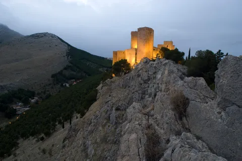
The ruins of the castle are impressive because of its elevated situation and the remains of houses and rooms made in tapial that are around it. From above you can observe much of the valley and see, right in front, the castle of Segura and a little below the Arab towers of Santa Catalina and Orcera. We suggest that you walk through the forest track that links this village with that of El Tobazo, by forest track with very little level marked for hiking like GR-146.

Breve descripción

It is one of the most charming villages for its location, very close to the remains of the small castle of Espinareda, of which it is named. narrow streets, white walls and small roofs extended on the hillside. A shaded ravine makes it a lookout over the rest of the valley.

Latitud
38.301671
Longitud
-2.735648
Distrito
Ubicación en el mapa
POINT (-2.735648 38.301671)
imagen
Image
aldeaespiraneda.png
Imagen principal
Activado
imagen
Image
Segura_de_la_Sierra_PM_091670_E.jpg
Imagen principal
Desactivado

Nature

icon-intereses-naturaleza

Friends

icon-intereses-amigos

Adventure

icon-intereses-aventura

Culture

icon-intereses-cultura

Culture of the Bull

icon-intereses-cultura-del-toro

Sport

icon-intereses-deporte

Eco-friendly

icon-intereses-eco-friendly

For couples

icon-intereses-en-pareja

Family

icon-intereses-familia

Gastronomy

icon-intereses-gastronomia

Municipality

icon-intereses-municipio

Low-cost tourism

icon-intereses-turismo-low-cost

Solo travel

icon-intereses-viajar-solo
La Espinareda
Activado
Coordenadas / Huso 30S
30S x = 523114 and = 4239320
Tramo de asfalto o cemento
 
Tramo de pista o camino forestal
 
Tramo de vía pecuaria
 
Tramo de senda
 

Huelga Utrera

Submitted by brandcode_deweloper on
Id
659543
Descripción larga

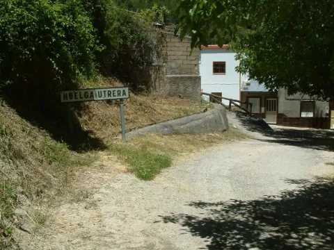
Ancient gardens turned into meadows when they are left without use, fruit, ferns, pine, oak, are present throughout the village. The houses are located around a square where we find silence only broken by the sound of the water of the fountain. Unpossible alleyways and windows of another time live together with rehabilitated houses and old laundry houses no longer used.

In the Utrera Strike there is a small path that goes towards the Water Cave that is worth the spectacular cave and the landscape surrounding the village.

Breve descripción

Utrera strike is surprised by its vegetation and the feeling of meeting us in forests of other latitudes. The water of the Segura River passes just below the village, leaving an impressive riverside with lush vegetation.

Latitud
38.167394
Longitud
-2.609647
Ubicación en el mapa
POINT (-2.609647 38.167394)
imagen
Image
huelgaUtrera%20%281%29.jpeg
Imagen principal
Activado
imagen
Image
huelga.jpg
Imagen principal
Desactivado

Nature

icon-intereses-naturaleza

Friends

icon-intereses-amigos

Adventure

icon-intereses-aventura

Culture

icon-intereses-cultura

Culture of the Bull

icon-intereses-cultura-del-toro

Sport

icon-intereses-deporte

Eco-friendly

icon-intereses-eco-friendly

For couples

icon-intereses-en-pareja

Family

icon-intereses-familia

Gastronomy

icon-intereses-gastronomia

Municipality

icon-intereses-municipio

Low-cost tourism

icon-intereses-turismo-low-cost

Solo travel

icon-intereses-viajar-solo
Huelga Utrera
Desactivado
Coordenadas / Huso 30S
30S x = 534194 and = 4224460

Route de los Maquis (Quesada)

Submitted by brandcode_deweloper on
Id
650419
Descripción larga

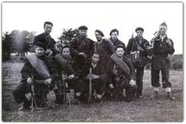
The Civil War unevenly affected the province of Jaén, which remained in the Republican area until 28 March 1939, almost the end of the War. In many municipalities, agricultural communities had been implemented and some initiatives had been abruptly interrupted after the end of the war. As was the case during the Napoleonic invasion, these saws facilitated the emergence of groups of armed resistance, known as maquis. Some of his family and friends always tried to help them, at the risk of reprisals for collaborating with the guerrilla.

In the Sierra de Segura, he highlighted Sixto García Espinosa, "that of Marchena," who led a group that resisted until 1950 in caves near the village of Marchena, near Santiago de la Espada, of which José Antonio Fernández, from the village of Miller, Juan Sáez, who was mayor of the neighbouring municipality of Nerpio, and Manuel Romero, secretary of the same municipality. They were all killed or arrested by the Civil Guard.

Another of the resistors was Pablo, that of Motril, although it was actually called Manuel Pérez Rubiño, who focused his activity until 1952 on the terms of Cazorla, Quesada and Pozo Alcón. Other names that have remained in the collective memory are those of "Fernandillo" or the "Red Terrinches," which now become known thanks to the latest historical investigations and the attempt to recover the historical memory of the period immediately after the Civil War.

Breve descripción

In 2007 Quesada designed 11 itineraries in which the time of the Maquis was interpreted and made known and their presence in the mountains of Cazorla and Segura recovering ancient paths, caves, natural shelters and cortijos by which the Maquis walked in an attempt to recover a chapter of our most recent history.

Latitud
37.843903
Longitud
-3.065956
Municipio
Ubicación en el mapa
POINT (-3.065956 37.843903)
imagen
Image
Ruta%20de%20los%20Maquis%20%28Quesada%29.jpg
Imagen principal
Activado
imagen
Image
640_img.png
Imagen principal
Desactivado

Nature

icon-intereses-naturaleza

Friends

icon-intereses-amigos

Adventure

icon-intereses-aventura

Culture

icon-intereses-cultura

Sport

icon-intereses-deporte

Eco-friendly

icon-intereses-eco-friendly

For couples

icon-intereses-en-pareja

Family

icon-intereses-familia

Gastronomy

icon-intereses-gastronomia

Municipality

icon-intereses-municipio

Low-cost tourism

icon-intereses-turismo-low-cost

Solo travel

icon-intereses-viajar-solo
Ruta de los Maquis (Quesada)
All year round
Desactivado
Coordenadas / Huso 30S
30S x = 494197 and = 4188498
Tramo de asfalto o cemento
 
Tramo de pista o camino forestal
 
Tramo de vía pecuaria
 
Tramo de senda
 

Piedra del Agujero

Submitted by brandcode_deweloper on
Id
5930013
Breve descripción

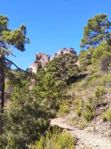
It is located between Navalperal and Cerro Bucentaina near the Camping de la Canalica.
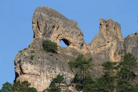
Also known as Horadada Stone, the Hole Stone marks a geomorphological milestone in the landscape.
It is part of a north-south mountain alignment, whose main reliefs are Navalperal and Bucentaina. The "Hole Stone" is a magnificent example of uniform relief in dolomies. These are dolomies with subhorizontal stratification with several caves that cross the peak, and with a very well developed "dentado" relief.
Access is only possible on foot, but the environment can be visited on the route "Circular Peña del Olivar" from the Sierra de Segura Road Network.

Latitud
38.388735
Longitud
-2.589807
Distrito
Municipio
Ubicación en el mapa
POINT (-2.589807 38.388735)
imagen
Image
1%20%281%29.jpg
Imagen principal
Activado
imagen
Image
Piedra%20del%20Agujero.jpg
Imagen principal
Desactivado

Nature

icon-intereses-naturaleza
Piedra del Agujero
Desactivado
Coordenadas / Huso 30S
30S x = 535823 and = 4249027
Tramo de asfalto o cemento
 
Tramo de pista o camino forestal
 
Tramo de vía pecuaria
 
Tramo de senda