Saltar al contenido principal

Monastery of Montesión

Submitted by brandcode_deweloper on
Id
918965
Descripción
Descripción larga

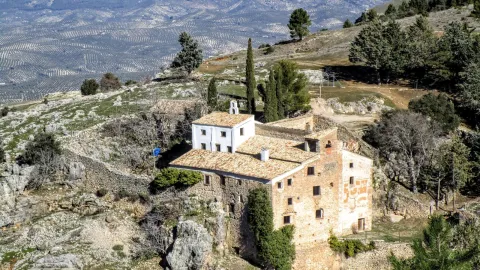
This is evident in the lack of materials and in the lack of furniture. Only the chapel with a Latin cross floor and a dome in which some frescoes are still preserved stand out.

The difficulties of the 17th century may have motivated the foundation of this monastery especially at a time when bad crops, hunger and bad weather caused the emergence of epidemics of the feared plague. The order of San Antonio Abad was dedicated to the healing of the sick and the fear of contagion caused these buildings to be far from the populations. Along with the plague, the economic crisis, the rise in prices, wars and in general the hardships led to an increase in the clergy and religious foundations in a context in which the Monarchy offered a contradictory vision that oscillated from splendor and misery or boom and decline.

Breve descripción

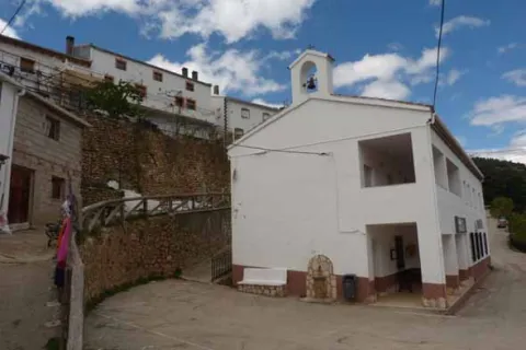
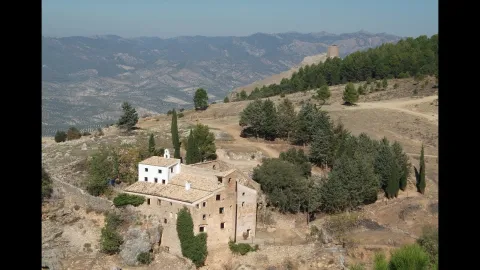
Soledad and remoteness are the adjectives that come to mind when we are next to the Monastery, in Cazorla. Every year, on the last Sunday of September a rosemary makes Montesión come back to life, as during the year there was only one person in it, the danger of ruin in the building being constant. The visitor can appreciate different stages in its construction although its foundation dates back to 1625. The monasteries under the advocation of St. Paul and St. Anthony Abad highlighted for their poverty and austerity as you can see if you approach Montession.
Ubicación
Latitud
37.912893
Longitud
-3.003887
Municipio
Ubicación en el mapa
POINT (-3.003887 37.912893)
Tipos de punto de interés
Imágenes carrusel
imagen
Image
maxresdefault.jpg
Imagen principal
Desactivado
imagen
Image
857187Master.jpg
Imagen principal
Desactivado
Imágenes cabecera
imagen
Image
2%20%283%29%20%281%29.jpg
Imagen principal
Activado
Loading map
Preparing points of interest and routes...
Marcas de calidad

Flour Mill and Frondosa Naturaleza Interpretation Centre

Submitted by brandcode_deweloper on
Id
2343514
Descripción
Breve descripción

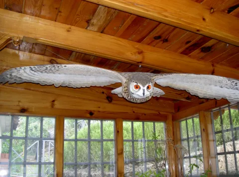
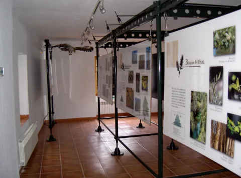
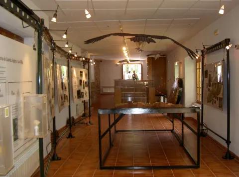
Frondosa Nature contains, among other elements, audiovisual, olfactory panels, images and sounds of the flora and fauna of this protected natural space, bird reproductions and a model of the Natural Park of Cazorla, Segura and the Villas.

Telecomunicaciones
Sitio web
www.almagaia.eu
Teléfono de contacto
953 721 330
Correo electrónico
info@almagaia.es
Ubicación
Nombre
La Casa de la Luz.
Código Postal
23470
Latitud
37.905224
Longitud
-2.998526
Dirección
Camino del Ángel, 7-9
Municipio
Ubicación en el mapa
POINT (-2.998526 37.905224)
Tipos de punto de interés
Imágenes carrusel
imagen
Image
PICT5925.jpg
Imagen principal
Desactivado
imagen
Image
PICT5929.jpg
Imagen principal
Desactivado
imagen
Image
PICT5927.jpg
Imagen principal
Desactivado
imagen
Image
PICT5926.jpg
Imagen principal
Desactivado
Imágenes cabecera
imagen
Image
PICT5936.jpg
Imagen principal
Activado
Horario
10: 30 - 13: 30 and 16: 00 - 19: 00.
Loading map
Preparing points of interest and routes...

Flour Mill el Gato

Submitted by brandcode_deweloper on
Id
8107962
Descripción
Descripción larga

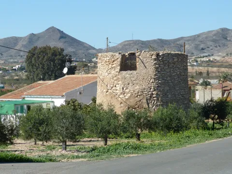
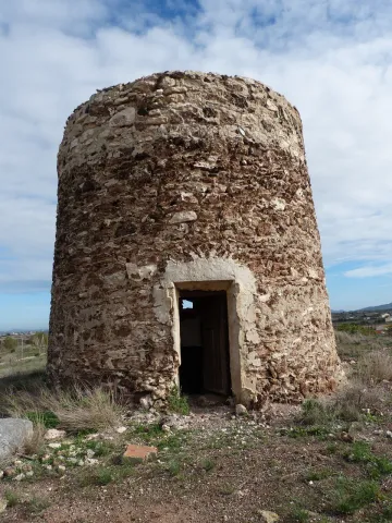
Dated between 1950 / 1959. Electric flour mill with elevators and threads that carry wheat and flour from one machine to another. It has atrojes for the storage of wheat, atroje for the damp, alfanje, milling stay and machine stay. The chunks are built in tapial and spun, the function being to store the grain. The alfanje, built in brick and wood, is where you will find the set of milling stones. Inside is the gear that moves the stone. The stay of the milling is where the process of milling the grain is carried out. The machine stay is the second floor where you will find the trickle, the clean and the fender.

Breve descripción

Located in the Hutar or Hutar Birth. It's the next mill to the Trinity Mill. He took advantage of the strength of the Hutar Arroyo water. The mill is within a newly built building. The waterfall remains with its blinded arches that brought water to the mill. In the surroundings are its mill stones

Telecomunicaciones
Sitio web
www.huesa.es
Correo electrónico
ayuntamiento@carboneros.es
Ubicación
Código Postal
23487
Latitud
37.764260
Longitud
-3.077970
Municipio
Ubicación en el mapa
POINT (-3.07797 37.76426)
Imágenes carrusel
imagen
Image
p1330838.jpg
Imagen principal
Desactivado
Imágenes cabecera
imagen
Image
p1330739-copia.jpg
Imagen principal
Activado
Loading map
Preparing points of interest and routes...

Viewpoint el Tapadero

Submitted by brandcode_deweloper on
Id
913206
Descripción
Descripción larga

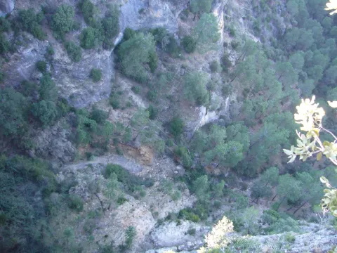
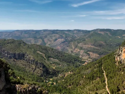
A tortuous sabina mora, with the trunk tanned by the passage of years and the inclemences of time, welcomes us to the lookout, from which you can see an impressive and majestic panorama of the saw of Las Villas, which as a balcony opens to show us, in a close-up, the delicious valley of Chillar stream and, at the bottom, the valley of the Guadalquivir River, which is lost among the olive lomas.

We suggest:

  • Continue our promotion, to the Collado del Agua de Los Perros, which with its 1200 m altitude, allows us to have a magnificent and spectacular view of this saw.
  • Consider the twilight on the horizon. The tenuous light that surrounds the place produces fantastic tones on the rocks and accentuates the powerful forms of its relief, accentuating the magical charm of the place.

Carretera JH-1755, which links the town of Villanueva del Archbishop with the village of Tranco, known as "Transversal de las Villas." The location of the lookout is well marked by a sign.

Breve descripción

This lookout is located on the top of a rocky wall, with more than 200 m of vertical fall, on an abyss whose vision produces impression. The steep slopes are populated by Mediterranean forest spots, which anchor their roots in the pure rock. It is common to observe the mountain goats climbing along the hillsides, as well as the majestic flight of great rapaces, especially leonate vultures, but also royal eagles, scallops, baskets, hawks, gavilanes... and, if there is luck, even the recently reintroduced bones.

Ubicación
Latitud
37.912893
Longitud
-3.003887
Municipio
Ubicación en el mapa
POINT (-3.003887 37.912893)
Tipos de punto de interés
Imágenes carrusel
imagen
Image
miradorT.jpg
Imagen principal
Desactivado
Imágenes cabecera
imagen
Image
mirador-tapadero.png
Imagen principal
Activado
Loading map
Preparing points of interest and routes...

Viewpoint El Portichuelo

Submitted by brandcode_deweloper on
Id
5925155
Descripción
Breve descripción

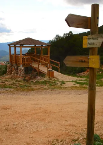
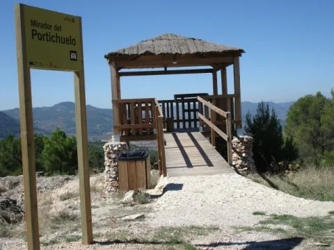
From this viewpoint we can get a wonderful and very close view of the village of Siles, as it is just 3 km from the Villa.
Access to this lookout is through a forest track accessible with any type of vehicle (car, bike, mountain bike, etc.) and access to the lookout is also adapted for people with disabilities.

Ubicación
Latitud
38.388600
Longitud
-2.581570
Distrito
Municipio
Ubicación en el mapa
POINT (-2.58157 38.3886)
Tipos de punto de interés
Imágenes carrusel
imagen
Image
miradorportichuelo.png
Imagen principal
Desactivado
Imágenes cabecera
imagen
Image
11.jpg
Imagen principal
Activado
Loading map
Preparing points of interest and routes...

Viewpoint of Las Majadillas

Submitted by brandcode_deweloper on
Id
5860740
Descripción
Breve descripción

Half way to the path of the Centenera, on the public mountain called the Baldius. The view of the Majadillas attracts by the divergence of its landscapes; on the one hand, an agricultural landscape where the olive trees predominate, although in the areas near the Vega del Guadalquivir, the irrigated crops stand out, and on the other, an agribusiness landscape dominated by plucked oak of Mediterranean mountain. The town of Marmolejo, known for its medicinal water springs, which led to the creation of the spa and which deal with kidney and digestive problems, can be seen at a distance. To the right of Marmolejo we see the Guadalquivir valley, which is seen between mountains. However, despite the fantastic views, we advise the visitor to turn from time to time the look to the sky, as it is possible to see eagles such as the scum or the real one, whose bearing will surprise us.

Ubicación
Código Postal
23770
Latitud
38.045009
Longitud
-4.170940
Distrito
Municipio
Ubicación en el mapa
POINT (-4.17094 38.045009)
Tipos de punto de interés
Imágenes carrusel
imagen
Image
miradormarmolejo.jpg
Imagen principal
Desactivado
Imágenes cabecera
imagen
Image
6345963Master.jpg
Imagen principal
Activado
Loading map
Preparing points of interest and routes...

Viewpoint of Camino Viejo

Submitted by brandcode_deweloper on
Id
5860474
Descripción
Breve descripción

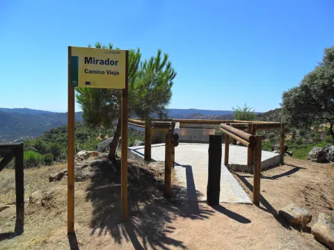
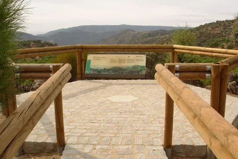
Near the Sanctuary of the Virgin of the Head, right on the path that goes from here to New Place. The Viewer of the Old Way of Andújar is located in a place where landscapes, history and tradition take their own life. The road leading to the lookout is traveled throughout the year by a multitude of pilgrims on their journey to the Sanctuary of the Virgin of the Head, Queen and Lady of Sierra Morena, which is also the oldest known Romry. To the attractive views of the place we must add this added value, as it is part of the culture, idiosyncrasy and fervor of its people. From the balcony we can see the refreshing beauty of the valley of the Jandula River (tributary of the Guadalquivir, to which it is joined later) with a typical and lush riverside forest, where the olmos take special prominence. Right across the street, covered with a pine cloak, the Marquitos hill stands out and, to its left down, the area called the New Place, where you can see the facilities of a forest nursery. The vegetation is typically Mediterranean, alternating areas of oak with pine and black areas.

Telecomunicaciones
Teléfono de contacto
953 549 030
Ubicación
Latitud
38.037700
Longitud
-4.053800
Distrito
Municipio
Ubicación en el mapa
POINT (-4.0538 38.0377)
Tipos de punto de interés
Imágenes carrusel
imagen
Image
miradorcaminoviejo.jpg
Imagen principal
Desactivado
Imágenes cabecera
imagen
Image
M_Camino_Viejo01.jpg
Imagen principal
Activado
Loading map
Preparing points of interest and routes...

Viewpoint Casco Histórico de Iznatoraf

Submitted by brandcode_deweloper on
Id
7504663
Descripción
Breve descripción

One of the highest towns in Andalusia, this urban town is located at 1000 meters of altitude, as a watchhouse over tens of kilometers of olive trees in all directions. The view of the Sierra de Las Villas is spectacular.

Ubicación
Código Postal
23338
Latitud
38.157390
Longitud
-3.033010
Municipio
Ubicación en el mapa
POINT (-3.03301 38.15739)
Tipos de punto de interés
Imágenes carrusel
imagen
Image
image_148449.jpeg
Imagen principal
Desactivado
imagen
Image
image_148455.jpeg
Imagen principal
Desactivado
Imágenes cabecera
imagen
Image
image_165313.jpeg
Imagen principal
Activado
Loading map
Preparing points of interest and routes...

Melojar

Submitted by brandcode_deweloper on
Id
880471
Descripción
Descripción larga

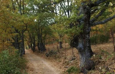
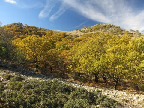
Just get out of the car, we will find ourselves surrounded by twins (Quercus pirenaica), in a thick and very closed forest. Melojar is one of the most demanding ecosystems in soil quality, depth of this and humidity, in the Park is poorly represented, only a few nuclei of the Segura saw. They maintain a entourage of plant species that accompany the melojo, forming one of the most important and interesting forests in the Park.

These forests were more abundant and extensive in past times, but the use of their wood, the transformation of the soil they occupy and sometimes the plunder to which they have been subjected, reduced them to small spots or enclaves, reaching very low today, especially in southern Spain. In the park already it must have been small the extension that would occupy this forest, but at present only a few very small enclaves remain, where the twins form bosquets, and there are also isolated specimens intermingled in the pineapples (salgareños).

The twins are oily and, therefore, to the melojar environment reminiscent of that of the Atlantic forests, moist, with bruises, of stray trunks and covered with moss, specific to Galicia, Asturias or Centro Europa. The melojar extends through the Atlantic area of the Iberian Peninsula, but also through the central system and other areas of the interior, reaching Sierra Morena.

In the melojar we find other arboreal elements such as the pespejón (Sorbus tormentinalis), the complaint (Quercus faginea) (with which it is sometimes hybrided producing a hybrid called Quercus x welwitschii), arches (Acer granatense) and salgarean pines (Pinus nigra salzmannii) generally repopulation. They also abound shrubs such as majuelos (Crataegus monogina), black thorns (Crataegus laciniata), aligustres (Ligustrun vulgare), skirmishes (Rosa spp.), magullos (Malus sylvestris), zarzas (Rubus ulmifolius, R. canescens) and some willows or sarctiles (Salix atronaea).

On the ground of the melojar we find herbaceas, including Poa nemoralis, Brachypodium sylvaticin and medium Briza, other companions are the gold button (Geum sylvaticum), primavera (Primula vulgaris), violets (Viola odorata), filipendales (Filipendula vulgaris), orchids (Orchis langei, O. coriophora), narcissos (Narcissus triandus palidulus), and species of Solomon (and the area of the idatus).

LOCATION

It is on the verge of the track that accesses Las Herrerias, which we take from the road that goes from Siles to Rio Madera (JF-7038), to take the detour after passing through the CEDEFO de Navalhora. We'll go up to see the start of a forest track that goes left, to counter if we go to the Wood River. It's well indicated as the Herrerías. We can park or continue by vehicle, we advise parking and walking on the track a few meters.

Breve descripción

Canyon of Poyo Torres

Ubicación
Latitud
38.387861
Longitud
-2.582637
Distrito
Municipio
Ubicación en el mapa
POINT (-2.582637 38.387861)
Tipos de punto de interés
Imágenes carrusel
imagen
Image
melojar.png
Imagen principal
Desactivado
imagen
Image
melojar.jpg
Imagen principal
Desactivado
Imágenes cabecera
imagen
Image
617_img.png
Imagen principal
Activado
Loading map
Preparing points of interest and routes...

Marchena

Submitted by brandcode_deweloper on
Id
918937
Descripción
Descripción larga

A spectacular rise in which we gain height in a dizzy way, elevation curves and great precipities that make them as natural glances: this is what you can find in Marchena. You can't miss the houses attached to the rock known as the Mound right in the village of the same name on the way to Marchena. We find the olive tree, fruit trees and orchards next to oak and pine trees.

In Marchena you can make three small paths PR-A 107 known as "Arab Alquerías," the PR-A 101 that goes from the Picachos to the Tutubiero Age and the PR-A 102 known as the Mirabete road.

Breve descripción

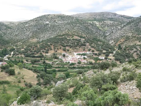
Marchena sits on a hillside next to a small valley. Streets, stairs, up and down. Rinses surrounded by silence and tranquility only broken by the sound of water. It is surprising the number of orchards, whose survival is explained by the remoteness from trading populations. Recovecos, windows and doors for statures of another time, calmed and dazzling alleys that contrast with the green of the forest surrounding the village.

Ubicación
Latitud
38.188620
Longitud
-2.498080
Ubicación en el mapa
POINT (-2.49808 38.18862)
Tipos de punto de interés
Imágenes carrusel
imagen
Image
fuente_1_7736.jpg
Imagen principal
Desactivado
Imágenes cabecera
imagen
Image
800px-Marchena%2C_Ja%C3%A9n_24J_01.jpg
Imagen principal
Activado
Loading map
Preparing points of interest and routes...
Marcas de calidad