Saltar al contenido principal
icon-intereses-turismo-low-cost

Forestrand Track mirador de Juan León

Submitted by brandcode_deweloper on
Id
5728071
Descripción larga

From the town of Pontones we left for the A-317 towards Santiago de la Espada. Immediately, we take to the right an asphalt road that ends at the birth of the Segura River. There begins a forest track marked as GR 144. About 2.5 km away we take a fork to the right corresponding to GR 7. From here, without leaving the road, we will reach an open area where the lookout is indicated within 10 minutes. From birth to the lookout there is a 1? h and 30 minutes walking.

Breve descripción

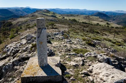
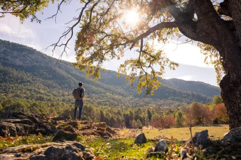
On this natural balcony made up of almond rocks located at 1700 m of altitude, you can enjoy a spectacular panoramic view. Before you the Sierra de las Villas to the west, to the south of Cazorla and to the east of Segura, all with its most representative peaks. If you look out with caution you will be impressed by the view of the Barranco del Lobo, next to which the abandoned village of Los Centenares is located. From the viewpoint you can still see the ages that their inhabitants used to feed the grain.

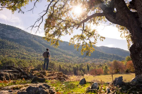
The forest track that leads you to the viewpoint of Juan León can be done by car, although it is worth taking a walk. In progressive ascension you will enjoy a pleasant landscape that is being transformed as you advance. You will find areas with imposing isolated pine trees, thick forests and noble shrubs with protected species, increasingly difficult to find. If it is spring you will be seduced by the great flowers of peony, of a striking fuchsia color.

At other times the landscape is opened, leaving to see rocky and piornal ones that tell us that we are many meters high. Along the climb you will see some dyes and tornips, buildings intended for the shelter and feeding of the cattle. Walking these paths and watching the landscape you will discover the life of these lands.

Already on the balcony you must be attentive, because at any time it can appear before your eyes some rapace with its majestic flight, perhaps pursued by the crows in their struggle for the territory.
Latitud
38.0004
Longitud
-2.7503
Distrito
Municipio
Ubicación en el mapa
POINT (-2.7503 38.0004)
imagen
Image
6942435Master.jpg
Imagen principal
Activado
imagen
Image
shutterstock_1060474277.jpg
Imagen principal
Desactivado

Nature

icon-intereses-naturaleza

Friends

icon-intereses-amigos

Adventure

icon-intereses-aventura

Culture

icon-intereses-cultura

Sport

icon-intereses-deporte

Eco-friendly

icon-intereses-eco-friendly

For couples

icon-intereses-en-pareja

Family

icon-intereses-familia

Gastronomy

icon-intereses-gastronomia

Municipality

icon-intereses-municipio

Low-cost tourism

icon-intereses-turismo-low-cost

Solo travel

icon-intereses-viajar-solo
Pista Forestal mirador de Juan León
Desactivado

Continue to the left by the rope of the viewpoints of which the one of Juan León is the beginning. After 1 km along a path you will reach the top of this mountain chain, which will allow you to see part of the Tranco reservoir and also, if the day is clear and clear, the mountains of Granada and Alcaraz.
Tramo de asfalto o cemento
 
Tramo de pista o camino forestal
 
Tramo de vía pecuaria
 
Tramo de senda
 

Forestrand Track de Despiernacaballos

Submitted by brandcode_deweloper on
Id
5727977
Descripción larga

On our way out of Pontones we are heading for Santiago de la Sword for the A-317. About 10 - 11 km is located on the right the Tina de la Cañá, a small construction to keep cattle, and just across the road begins this forest track that goes from the heights of Pontones and Santiago de la Espada to the Toba.
Breve descripción

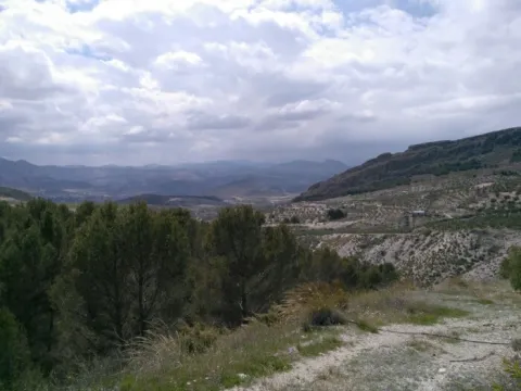
This track is very panoramic and links two nearby but contrasted areas: the heights of Pontones and the Segura valley. The descent on the track allows you to enjoy beautiful views of the Segura River and the mountains and risks that accompany you before giving yourself to the reservoir of Las Anchuricas. It can be done by car or walking, but it is ideal for making it by mountain bike.

The start is practically flat, and continues like this to the Collado Los Ruejos, where it begins another way to the right that is interesting, but it is not our route. So far the vegetation is mainly arbustive, with some repopulation pinars. The track then slowly descends until it is almost parallel to the Cañada Hermosa stream, and thus reaches the hill of Desevernacaballos, the huge limestone wall that gives name to the track.

From this point you will cross a dense black pine forest, while the road takes advantage of the level curves so that the slope is not too uncomfortable. Along this descent you will see the impressive mountains surrounding the Segura River: the Cerro del Garmonal and the Pichon del Tesoro on our right, the Calar del Pino in front of you, on the other side of the river.

The 11 km of track will allow you to appreciate the great contrast between the two areas: the high part that is unearthed and without just slope, while in the Segura valley, near La Toba, you will find a lot of trees and streams that nurture the orchards and fruits of the village.

Latitud
37.9602
Longitud
-2.9401
Distrito
Municipio
Ubicación en el mapa
POINT (-2.9401 37.9602)
imagen
Image
8040409Master%20%282%29.jpg
Imagen principal
Activado
imagen
Image
shutterstock_1060474277.jpg
Imagen principal
Desactivado
imagen
Image
Pista%20Forestal%20de%20Despiernacaballos%20%281%29.png
Imagen principal
Desactivado

Nature

icon-intereses-naturaleza

Friends

icon-intereses-amigos

Adventure

icon-intereses-aventura

Culture

icon-intereses-cultura

Sport

icon-intereses-deporte

Eco-friendly

icon-intereses-eco-friendly

For couples

icon-intereses-en-pareja

Family

icon-intereses-familia

Gastronomy

icon-intereses-gastronomia

Municipality

icon-intereses-municipio

Low-cost tourism

icon-intereses-turismo-low-cost

Solo travel

icon-intereses-viajar-solo
Pista Forestal de Despiernacaballos
Desactivado

It is required to visit the fountain of La Toba, a permanent spring that brings 150 litres per second to the Segura River, and is located in a curious cave of frozen water.

As you cross the denser vegetation area, it is worth stopping to discover maples, complaints or oaks in the wet areas. You'll always be able to cross with some deer or horse goat.

Hiking Route Senda de Pescadores

Submitted by brandcode_deweloper on
Id
5727942
Descripción larga


The Guadalanimín River is made up of small streams that come down from the Cabilla saw at the height of the Majal de la Carrasca, receives the Arroyo de los Arenales and already with a permanent channel flows through the bottom of a deep ravine in a south direction. It receives in the Vado de las Carretas to the stream of San Pedro, of intermittent waters, and in the Cerrada de la Canaliega to the stream of the Tornillos de Gualay. Always in the south direction and at the bottom of a deep ravine receives the streams of the Acebadillas and the Cold stream, at the height of the closed of the same name and flows into the Guadiana Menor river, at the height of the Negratin reservoir, between the municipalities of Cuevas del Campo and Zújar. Its channel serves as a divisive between the saw of the Cabrilla and that of the well
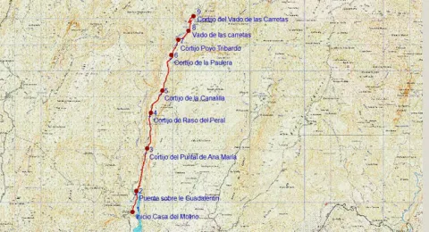
The tour begins on the track that runs through the reservoir of the Bolera by its left margin in the forest house of the Molinillo, which can be reached by ground track in any type of vehicle.

200 meters from the start signal, there is a fork, which we will take to the right, walking the tail of the Bolera reservoir.
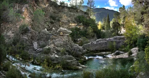
At 900 m we reach a bridge that crosses the Guadaltiín River, with crystal clear and pure waters, in a place of unique beauty that is the Cerrada de la Herradura. From here, and already on the right bank of the valley, a rise of approximately 3 km begins that will take us to the Cortijo del Raso del Peral. The rise is continued, just 200 m from passing the bridge are left the Cortijos de los Tontos, leaving also the edge of a cut on the Guadalanimin that well deserves to be seen, with several clings and closed. Later on we left to our left the cortijo of the Puntal de Ana María. The Cañada del Mesto, which we can travel through and which is used by flocks of sheep and goats in their annual journeys in search of fresh pastures, runs through this section.
As the Cortijo del Raso del Peral passes, the track begins a slight descent through numerous ruinous cortijadas and others in very good condition such as the Canalilla 5 km, the Paulera 6.5 km and Poyo Tribaldos 7.2 km from the beginning.
Finally the track reaches the river, in the area known as Vado de las Carretas, a pleasant and paradoxical place that well deserves a stop. The river will have to be watered, if we want to reach the cortijos of the Vado de las Carretas, to do so by crossing it we will have to follow the front and despise the track that goes to the right following the channel. These cortijos, still inhabited, are only 1,000 m from where we are.

Breve descripción

The Guadalanimín River is made up of small streams that come down from the Cabilla saw at the height of the Majal de la Carrasca, receives the Arroyo de los Arenales and already with a permanent channel flows through the bottom of a deep ravine in a south direction. It receives in the Vado de las Carretas to the stream of San Pedro, of intermittent waters, and in the Cerrada de la Canaliega to the stream of the Tornillos de Gualay. Always in the south direction and at the bottom of a deep ravine receives the streams of the Acebadillas and the Cold stream, at the height of the closed of the same name and flows into the Guadiana Menor river, at the height of the Negratin reservoir, between the municipalities of Cuevas del Campo and Zújar.

Latitud
37.876404
Longitud
-2.877082
Municipio
Ubicación en el mapa
POINT (-2.877082 37.876404)
imagen
Image
658_img.png
Imagen principal
Activado
imagen
Image
shutterstock_1060474277.jpg
Imagen principal
Desactivado
5 h 20 min (ida y vuelta)

Nature

icon-intereses-naturaleza

Friends

icon-intereses-amigos

Adventure

icon-intereses-aventura

Culture

icon-intereses-cultura

Sport

icon-intereses-deporte

Eco-friendly

icon-intereses-eco-friendly

For couples

icon-intereses-en-pareja

Family

icon-intereses-familia

Gastronomy

icon-intereses-gastronomia

Municipality

icon-intereses-municipio

Low-cost tourism

icon-intereses-turismo-low-cost

Solo travel

icon-intereses-viajar-solo
Medium
1164
Image
1dbd612a-b301-2f7c-6099-b1496d217079?t=1607022009228
Image
329bed14-b7c1-1544-5bc9-8b07893b576e?t=1607022019451
SENDA DE PESCADORES
9 km (solo ida)
386m
235m
2
1
1
3
Horse, on foot and bike
All year round
Desactivado
Image
f8cc619e-be85-15bc-f798-92ce55adb865?t=1607022131867

Point of revival or rest next to the Cortijo del Saso del Peral

The Vado de las Carretas is a link point with another very well-known path, which is circular and that runs through the upper part of the Barrio del Gualatentín, Fuente Steel, the Strait of Perales and the Trench.

The tour is marked by beacons with directional arrows.
It has great botanical wealth with spectacular examples of larix pine and centenary complaints.., abundant presence of large rapacious birds (leonate vulture, real eagle, real owl...)
Deep-ravine geomorphological formation (Guadalanimin and Cerrada de la Canaliega) between the Cortijo de la Paulera and the Cortijo de Poyo Tribaldos.

At the Casa del Molino, located later on the Hornico in the Bolera reservoir. It is accessed from Pozo Alcón by the A-326 taking a track that is in the km 7.9 to the left, that you have to travel 14 km to the Casa del Molino.

1015

Cortijo Vado de las Carretas

1164
Coordenadas / Huso 30S
30S x = 510810 and = 4192109
Tramo de asfalto o cemento
0
Tramo de pista o camino forestal
0.01
Tramo de vía pecuaria
0
Tramo de senda
0

Hiking Route Río Borosa

Submitted by brandcode_deweloper on
Id
5727693
Descripción larga


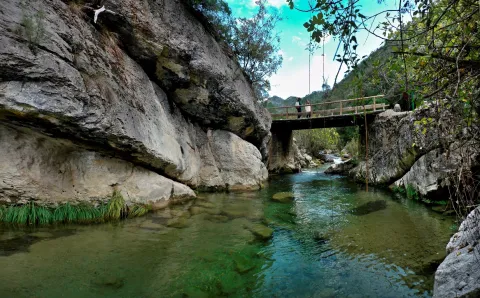
This hiking route is, of course, the most popular route in the Natural Park, which also implies the possibility of a certain massification at a short time. The set formed by the fast waters of the Borosa, the rocks in which the channel is fit and the closed riverside vegetation, is one of the most spectacular river scenarios in southern Spain.

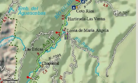
To start the route we go to the Visitors' Reception Centre of the Torre del Vinagre, in the Carrier A-319, and we take a detour to the River Borosa River River River River River River. The path begins right from the farm next door.

At first, the tour goes through a closed forest track to the traffic of private vehicles that always goes parallel to the river's path, being one of the most pleasant walks that can be made in the Natural Park, especially in its initial section.

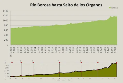
At first it coincides with the route of GR 7, up to the bridge of the Snails where we leave this Grand Tour, to continue parallel to the Borosa River. In the km 3.3 we left the track on which we went to the left to continue by the river, along the path and through the Cerrada de Elias, a rocky cling of the channel, full of clear and cold waters. Later on we go back to the track we were initially going through, to continue upstream on either side of the river until we reach the Hydroelectric Central of the Organs where the track ends.

Here begins a sinuous path with much more slope next to a much more tight, rocky and abrupt channel, full of spectacular water jumps. And it ends the tour in the organ jump, without a doubt one of the most spectacular waterfalls in the entire park. It is said that its name is due to the noise that, in past times, they did when the logs that were taken from these mountains fell through these water jumps.

Most of the tour runs along the edge of one of the Park Reserve Areas, an area with the highest level of protection due to the ecological values it houses. The Borosa River, along its 10 km, is one of the most cuddly tributaries of Guadalquivir within the Park. It is born at the base of the large underground aquifer that forms the altiplanicie of the fields of Hernán Perea, hence its annual flow and regularity. It is important to highlight in its channel several Cerradas that make up a spectacular landscape, continuous water jumps and pozas and a very good state of conservation of the channel, maintaining crystal clear and cold waters, with abundant fauna and lush riverside vegetation. This tour also offers us a true lesson in geology, with striking, sincere and anti-linear folds that are easily observed.

Breve descripción

This hiking route is, of course, the most popular route in the Natural Park, which also implies the possibility of a certain massification at a short time. The set formed by the fast waters of the Borosa, the rocks in which the channel is fit and the closed riverside vegetation, is one of the most spectacular river scenarios in southern Spain.

Latitud
37.969693
Longitud
-2.818145
Distrito
Municipio
Ubicación en el mapa
POINT (-2.818145 37.969693)
imagen
Image
Rio%20Borosa%201.jpg
Imagen principal
Desactivado
imagen
Image
Rio%20Borosa%202.jpg
Imagen principal
Desactivado
2 h 10 min

Nature

icon-intereses-naturaleza

Friends

icon-intereses-amigos

Adventure

icon-intereses-aventura

Culture

icon-intereses-cultura

Sport

icon-intereses-deporte

Eco-friendly

icon-intereses-eco-friendly

For couples

icon-intereses-en-pareja

Family

icon-intereses-familia

Gastronomy

icon-intereses-gastronomia

Municipality

icon-intereses-municipio

Low-cost tourism

icon-intereses-turismo-low-cost

Solo travel

icon-intereses-viajar-solo
Medium
1175
Document
Image
2ec036ff-ad31-ddd2-4b7f-81e7f2ac7e60?t=1607087625599
Document
Image
99f458a1-40f7-f2ca-ce5e-e777b5a80749?t=1607086468943
RÍO BOROSA A SALTO DE LOS ÓRGANOS
8,92 km
619m
143m
3
1
2
2
In Bicycle, Horse, on foot
All year round
Desactivado
Image
e57eeca2-fdbd-8aef-bbab-3a9084d4b61f?t=1607087616696

Badén and Los Rodeos Bridge

In its initial route that coincides with the GR 7 that separates from our route on the Bridge of the Snails, the path can be continued towards the Embalse of Aguas Negras and Laguna de Valdeazores crossing the tunnels, from the Jump of the Organs.

Access to the village of Loma de Mariangela, from the Interpretation Centre of the Vinagre Tower in the A 319, at the height of the farm and the River Borosa River River River River River River.

681 m

Leap from the bodies

1171 m
Coordenadas / Huso 30S
30S x = 515973 and = 4202468
Tramo de asfalto o cemento
0
Tramo de pista o camino forestal
71.75%
Tramo de vía pecuaria
0
Tramo de senda
28.28%

Hiking Route La Presilla

Submitted by brandcode_deweloper on
Id
5727646
Descripción larga

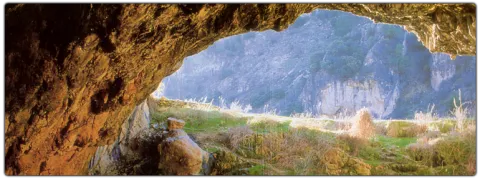
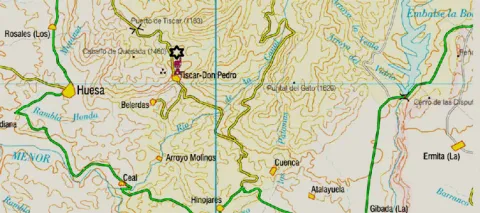
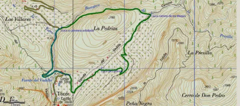
Next to the impressive Tiscar Sanctuary by the Vadillo River, where the beautiful Cueva del Agua opens and where the mountains offer a beautiful port, at Km 12.5 of the A-315, passing the Vadillo Restaurant towards Quesada, we find a sharp curve to the right. Before passing it, a lane with an ascending slope to the right is the beginning of the path.
It is a way of servitude from which different accesses to olive plots come. We must always take the main path by dismissing other secondary ones. The olive tree is dominated by almonds, an unproductive olive tree because of the altitude at which we are, but it was once the only way for the inhabitants of these mountains. At 900 m from the beginning, we reach a crossing that we must take to the right, leaving the Vadillo Vereda, which continues ascending but more in a straight line on our left.
The road runs between two rocky massizos: to the right a rocky cut and to the left La Pedriza, whose top is at 1179 m of altitude. Different paths can be taken, although if it runs through the main, we will end up in a flat area with some gardens.
2.6 km from the beginning we reach a road crossing, where we will have to turn left to continue to surround La Pedriza. We are in the Barrio de la Presilla and from now on we will go down it. At the front and following the rising stream, we can travel the Maquis Road, which commemorates the transit of men who fought in armed resistance against the Franco dictatorship in the 1940s.
At the base of the slices are paint and light. The lane floor slips if wet so it is not recommended to use car in this case. The best time to make the path is autumn and winter for the greatest presence of birds.
4 km from the start, we reach the asphalt road of the port of Tiscar, there we will have to turn left to reach the start point in just over 1 km.

Breve descripción

Next to the impressive Tiscar Sanctuary by the Vadillo River, where the beautiful Cueva del Agua opens and where the mountains offer a beautiful port, at Km 12.5 of the A-315, passing the Vadillo Restaurant towards Quesada, we find a sharp curve to the right. Before passing it, a lane with an ascending slope to the right is the beginning of the path.

Latitud
37.781485
Longitud
-3.021872
Municipio
Ubicación en el mapa
POINT (-3.021872 37.781485)
imagen
Image
656_img.png
Imagen principal
Activado
imagen
Image
shutterstock_1060474277.jpg
Imagen principal
Desactivado
1 h 50 min

Nature

icon-intereses-naturaleza

Friends

icon-intereses-amigos

Adventure

icon-intereses-aventura

Culture

icon-intereses-cultura

Sport

icon-intereses-deporte

Eco-friendly

icon-intereses-eco-friendly

For couples

icon-intereses-en-pareja

Family

icon-intereses-familia

Gastronomy

icon-intereses-gastronomia

Municipality

icon-intereses-municipio

Low-cost tourism

icon-intereses-turismo-low-cost

Solo travel

icon-intereses-viajar-solo
Medium
987
Image
ff7caf80-f2f4-ad07-e154-4763e2234224?t=1607024821041
Document
Image
3cb09274-ff1b-b4cf-52a0-ba294f50c7a4?t=1607024807235
LA PRESILLA
5,13 km
236m
245m
1
1
1
2
Horse, on foot and bike
All year round
Desactivado
Image
38e988e5-42f7-4cd9-344c-0f44af3fafa1?t=1607024815462

Tiscar Sanctuary

Path of the Tiscar Water Cave, near the beginning

The tour is marked by beacons with directional arrows.

12 km from Quesada, at the A-6206 and before arriving at the Tiscar Sanctuary, after a closed curk to the left, it starts a track of land to the left in ascension

922

Same point

922
Coordenadas / Huso 30S
30S x = 498074 and = 4181571
Tramo de asfalto o cemento
23.98%
Tramo de pista o camino forestal
17.54%
Tramo de vía pecuaria
0
Tramo de senda
58.48%

Hiking Route Poandos de La Mesa

Submitted by brandcode_deweloper on
Id
5727175
Descripción larga


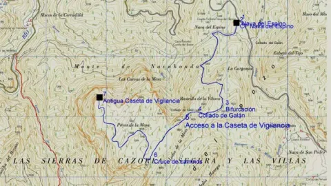
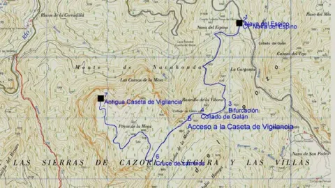
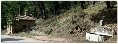
The ships are very fertile lands that are located at a certain height that have been exploited by man since time immemorial as fresh pastures or as agricultural grounds; in the first of them we find in the asphalt Track first and after land JF-7091, the Nava del Espino, is the beginning of this path, right next to the ruins of the forest house of the same name.

The route always by narrow track of land, closed to the traffic of private vehicles, runs through spectacular laricio forest with large pastures, and is gradually ascending along the slopes of Los Poyos de la Mesa. It is very common to observe the great herbivores of the park on this route, and to find up to the four species that exist along it.

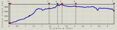
After walking 2.4 km we find a fork that we will have to follow to the right and gently continue the ascent.

In the km 3 after the Galan Collado the views to the right begin to be spectacular, for practically without realizing we are incarnate in one of the most classic calares we can find, we are really on the edge of a table. Here the limestone that we have just below acts as a great sponge that collects water in periods of abundance, to gradually release it several hundred meters below and months later. It is worth deviating from our route in km 3.3 to the left to climb to the moon fire surveillance shed that remains in the rocky crest that we have parallel and this is in use in the months of maximum risk.

Just a few meters later we find ourselves immersed in a high platform, full of dolins and minions with large forest clear very rich in fresh grass. It is an ideal place for wildlife observation. We will continue the track through which we travel without leaving it until we reach the km 4.1, there we find a track to the front that quickly begins to descend, we must despise it and continue on the one that turns to the right, continuing on the calar. Finally we will reach the edge of a cut rocky where the old surveillance house of the Poyos is located, a true natural viewpoint of the Guadalquivir valley.

Breve descripción

The ships are very fertile lands that are located at a certain height that have been exploited by man since time immemorial as fresh pastures or as agricultural grounds; in the first of them we find in the asphalt Track first and after land JF-7091, the Nava del Espino, is the beginning of this path, right next to the ruins of the forest house of the same name. The route always by narrow track of land, closed to the traffic of private vehicles, runs through spectacular laricio forest with large pastures, and is gradually ascending along the slopes of Los Poyos de la Mesa.

Latitud
37.896406
Longitud
-2.9216
Municipio
Ubicación en el mapa
POINT (-2.9216 37.896406)
imagen
Image
588_img.png
Imagen principal
Activado
imagen
Image
shutterstock_1060474277.jpg
Imagen principal
Desactivado
3 h 12 min

Nature

icon-intereses-naturaleza

Friends

icon-intereses-amigos

Adventure

icon-intereses-aventura

Culture

icon-intereses-cultura

Sport

icon-intereses-deporte

Eco-friendly

icon-intereses-eco-friendly

For couples

icon-intereses-en-pareja

Family

icon-intereses-familia

Gastronomy

icon-intereses-gastronomia

Municipality

icon-intereses-municipio

Low-cost tourism

icon-intereses-turismo-low-cost

Solo travel

icon-intereses-viajar-solo
Medium
1563
Image
60dade7b-9622-92be-dca7-1600c0c6e5fe?t=1607086462783
Image
99f458a1-40f7-f2ca-ce5e-e777b5a80749?t=1607086468943
POYOS DE LA MESA
6,43 km (solo ida)
225m
103m
2
1
1
3
In Bicycle, Horse, on foot
All year round
Desactivado
Image
792246db-fbed-0845-c94d-f9d77f09b0c9?t=1607086334333

La Garganta recreational area

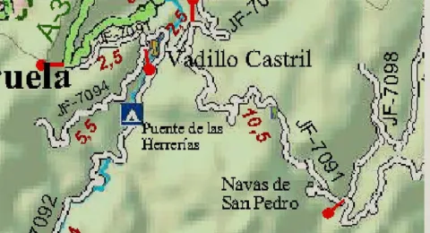
From the town of Cazorla and the Iruela or from the dam of the Tranco by the A- 319 you have to reach the Empalme del Valle located on the ascent to the port of the Doves from Arroyo Frio. There we take the JF 7091, leaving to the right the detour to the Parador, the detour to the village of the Vadillo-Castril and the detour to the birth of the Guadalquivir. We continue this asphalt road that then becomes a forest track towards the Navas and the path starts on the Espino Navy right on the Ruins of the Espino CF Nava that we find on our right.

1426 m

Former Bureau Poo Monitoring Hat

1628 m
Coordenadas / Huso 30S
30S x = 506893 and = 4194324
Tramo de asfalto o cemento
0
Tramo de pista o camino forestal
0.01
Tramo de vía pecuaria
0
Tramo de senda
0

Hiking Route El Pilarillo - Summit of Peñalta

Submitted by brandcode_deweloper on
Id
5726995
Descripción larga

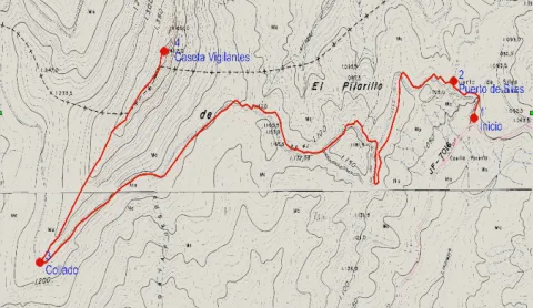
This route leads us from the vicinity of the Pilarillo Forest House to the Peñalta summit. It is mostly a black pine pineapple pineapple, under which it grows a rugged little forest of oak, crocodits, junips, jars and aromatic plants such as rosemary, thyme and spice. The yellow piorno appears in the areas where the rock rises.

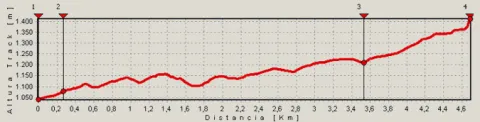
We will walk through a quiet forest track on a smooth rise to the southwest, then turn to the north-east with the largest slope. The last stretch, already by way of horseshoe, is made by a rocky and peeled environment typical of the high mountain of the Natural Park.

At the summit, which is the coronation of a sharp ballast, there is a fire surveillance shed. The park has a beautiful panoramic view of the mountains. To the north we see Benatae, Siles, the Cambrón Stone and the Almenaras peak, already in the Alcaraz saw, opening the panorama by the immensity of the plains of La Mancha. To the south stands the mole of El Yelmo, Segura de Sierra crowned by its castle and, at the bottom, the waters of the Tranco reservoir and the saws of Cazorla and Las Villas. And on the east, we look at the great following calares of Navalperal, El Espino and Cobos.

The fox, squirrel and boar are very abundant, and it is possible to contemplate mountain goats at the summit. Among the raptures are the pilgrim hawk, the leonate vulture and the seedling eagle, which every year arrives from Africa in spring to nesting in the area. As the afternoon falls, the ullar of the carb is heard in the depth of the forest.

Breve descripción

This route leads us from the vicinity of the Pilarillo Forest House to the Peñalta summit. It is mostly a black pine pineapple pineapple, under which it grows a rugged little forest of oak, crocodits, junips, jars and aromatic plants such as rosemary, thyme and spice. The yellow piorno appears in the areas where the rock rises.

Latitud
38.340531
Longitud
-2.637258
Distrito
Municipio
Ubicación en el mapa
POINT (-2.637258 38.340531)
imagen
Image
675_img.png
Imagen principal
Activado
imagen
Image
shutterstock_1060474277.jpg
Imagen principal
Desactivado
3 h 15 min (ida y vuelta)

Nature

icon-intereses-naturaleza

Friends

icon-intereses-amigos

Adventure

icon-intereses-aventura

Culture

icon-intereses-cultura

Sport

icon-intereses-deporte

Eco-friendly

icon-intereses-eco-friendly

For couples

icon-intereses-en-pareja

Family

icon-intereses-familia

Gastronomy

icon-intereses-gastronomia

Municipality

icon-intereses-municipio

Low-cost tourism

icon-intereses-turismo-low-cost

Solo travel

icon-intereses-viajar-solo
Medium
1412
Document
Image
aa097fac-d1e8-59c4-6f1a-ad69150c7e61?t=1607100087953
Document
Image
44dda4e9-9254-5185-944e-dc63d61d90cb?t=1607100067745
PILARILLO A CUMBRE DE PEÑALTA
4,77 km (solo ida)
499m
124m
1
1
2
3
Horse, on foot except for the 630 m final also by bike or 4x4
All year round
Desactivado
Image
598e3105-7f6e-204f-26b7-5e978924a9b1?t=1607100078413

The Straits, near the beginning and The Fountain of San Miguel near Benatae

It is necessary to walk with caution in the rocks near the surveillance shed.
The route is marked PR-A 180
Water at the Pilarillo fountain, at the beginning of the route.

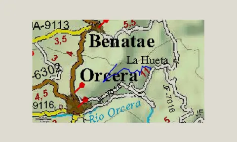
We left Orcera in direction Benatae and a small park with a fountain on the right. From there we take the narrow forest road to the right.

Starting point
At 6.1 km. of the said road (JF-7016), we find what was the forest house of Pilarillo, whose buildings have been rebuilt to become a mountain hostel. A few meters past is the start of the route.

1040 M

Peñalta Summit Surveillance Hat

1412 m
Coordenadas / Huso 30S
30S x = 531700 and = 4243661
Tramo de asfalto o cemento
0
Tramo de pista o camino forestal
85.95%
Tramo de vía pecuaria
0
Tramo de senda
14.05%

Hiking Route Montillana - Risca del Guijarrón

Submitted by brandcode_deweloper on
Id
5726925
Descripción larga

The beginning of the path is on the road on the A 319 between Cañada Morales and the Tranco dam, just above the Recreative Area of the Parrales and between the Camping Montillana and the Casa Rural Los Parrales just 200 m from both.

The route runs through a forest track usually closed to the traffic of vehicles, which ascends by the skirts of the Guijarrón, the final objective of the route. It has very panoramic sections, with excellent views of the Tranco reservoir, initially of the Horn tail and later of its most central area.

In the km 2,2 we find a fountain and a watershed that will allow us to supply for the rest of the tour. In the km 6.6 we will find a link to GR 144, Path of Trashumancia. Through this route we could return to Cañada Morales and from there, through the PR-A 193, return to our starting point, resulting in a circular tour of 27 km.

The final point of our route to the Guijarrón is the fire surveillance shelter, which rises on a cliff with spectacular views of the Tranco reservoir and large views of the Natural Park.

In the lower areas of the route we will pass through pineapple carrasco, which are becoming pineapple pineapple as we are gaining height. Under the pine tree grows a characteristic Mediterranean forest.

Breve descripción

The beginning of the path is on the road on the A 319 between Cañada Morales and the Tranco dam, just above the Recreative Area of the Parrales and between the Camping Montillana and the Casa Rural Los Parrales just 200 m from both.

Latitud
38.195088
Longitud
-2.803527
Distrito
Municipio
Ubicación en el mapa
POINT (-2.803527 38.195088)
imagen
Image
518_img.png
Imagen principal
Activado
imagen
Image
shutterstock_1060474277.jpg
Imagen principal
Desactivado
2 h 33 min (solo ida)

Nature

icon-intereses-naturaleza

Friends

icon-intereses-amigos

Adventure

icon-intereses-aventura

Culture

icon-intereses-cultura

Sport

icon-intereses-deporte

Eco-friendly

icon-intereses-eco-friendly

For couples

icon-intereses-en-pareja

Family

icon-intereses-familia

Gastronomy

icon-intereses-gastronomia

Municipality

icon-intereses-municipio

Low-cost tourism

icon-intereses-turismo-low-cost

Solo travel

icon-intereses-viajar-solo
Medium
Km. (from the beginning): 7.96
Image
5c3a9437-f5d2-438e-a307-cf3fea310c37?t=1607099424256
Image
74cbf89e-c5e1-8d5b-4719-2efb97b2984e?t=1607099411570
MONTILLANA- RISCA DEL GUIJARRÓN
7,96 km
602m
135m
2
1
1
2
Bicycle, Horse, walk, and all terrain.
All year round
Desactivado
Image
2f474108-5cf8-cc9c-4933-397d5be85a3a?t=1607099405218

RECREATIVE AREA THE PARRALES IN THE INITIUM

319 between the village of Cañada Morales and the Tranco dam. 100 m from Campsite Montillana.

748 m

Gear Risk Summit

1232 m
Coordenadas / Huso 30S
30 x = 0517204 and = 4227479 Z = 1232
Tramo de asfalto o cemento
0
Tramo de pista o camino forestal
98.74%
Tramo de vía pecuaria
0
Tramo de senda
1.26%

Hiking Route Laguna de Valdeazores

Submitted by brandcode_deweloper on
Id
5726842
Descripción larga


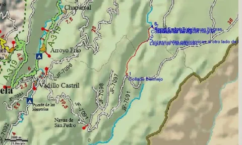
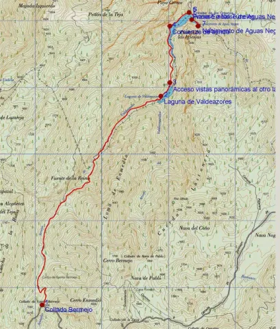
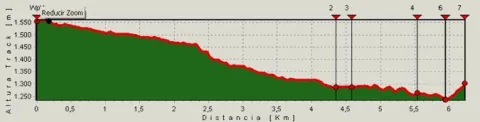
The Route begins from the runway of the Navas to the height of Collado Bermejo, to the left by the forest track, which has a barrier. It is a comfortable descent between forests of larix pine, ferns, maples, maples, complaints, oaks, olmos, some tiles, acebos, and we can also observe the most characteristic fauna in the area. 3 km from the beginning we find the Arroyo de la Reina that we must cross to continue the track, it is a high mountain stream attached between the mountains.
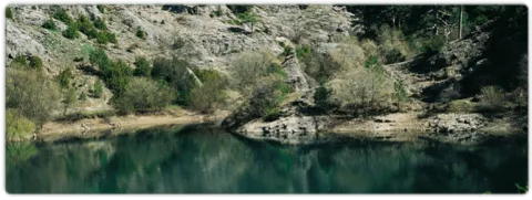
At 4.4 km we reach the Laguna de Valdeazores which is the only permanent natural lagoon in the Park. It was formed by a large landslide that overtook the Queen's stream, and the current containment wall was later built. From the other side of the wall you can see a beautiful panorama of the entire lagoon. It is home to an amazing lacustre flora and fauna, among which the royal anades, seals and water cocks stand out.
Downhill, at 900 m. the track, we enter into a large nozzle, which leads to an explanade of which, to the right, a sidewalk that will be bordering the Embalse of Black Waters, leaving a track to our left that begins to rise. The dam was created to channel the Borosa River for hydroelectric use. We pass over the dam and, right on the other side, we will have to turn right to continue to border the reservoir on a sidewalk that will take us, about 300 m to the birth of Aguas Negras, where the Borosa river runs, although in times of plenty of water this is nourished from the Arroyo del Inferno that flows into this place. It's one of the most cuddly births in the entire park.
If we cross the dam we could continue a path, through tunnels that would take us to the organ jump, the hydroelectric central, several spectacular closures and finally to the Borosa Piscifatoria, near the Vinagre Tower Interpretation Center and the village of the Loma de Mariangela.

Breve descripción

The Route begins from the runway of the Navas to the height of Collado Bermejo, to the left by the forest track, which has a barrier. It is a comfortable descent between forests of larix pine, ferns, maples, maples, complaints, oaks, olmos, some tiles, acebos, and we can also observe the most characteristic fauna in the area. 3 km from the beginning we find the Arroyo de la Reina that we must cross to continue the track, it is a high mountain stream attached between the mountains.

Latitud
37.966541
Longitud
-2.814031
Municipio
Ubicación en el mapa
POINT (-2.814031 37.966541)
imagen
Image
587_img.png
Imagen principal
Activado
imagen
Image
shutterstock_1060474277.jpg
Imagen principal
Desactivado
3 h 10 min (ida y vuelta)

Nature

icon-intereses-naturaleza

Friends

icon-intereses-amigos

Adventure

icon-intereses-aventura

Culture

icon-intereses-cultura

Sport

icon-intereses-deporte

Eco-friendly

icon-intereses-eco-friendly

For couples

icon-intereses-en-pareja

Family

icon-intereses-familia

Gastronomy

icon-intereses-gastronomia

Municipality

icon-intereses-municipio

Low-cost tourism

icon-intereses-turismo-low-cost

Solo travel

icon-intereses-viajar-solo
Medium
1237
Document
Image
4bb4107c-7a7e-074d-9a10-c45e2c6ff9ac?t=1607097708849
Document
Image
b351efc0-9977-4631-6228-e10e6ae31df4?t=1607097714672
COLLADO BERMEJO A NACIMIENTO DE AGUAS NEGRAS
6,28 km (solo ida)
104m
356m
2
1
1
3
In Bicycle, Horse, on foot
All year round
Desactivado
Image
24974f7e-9170-162e-c94b-f7bf14583a02?t=1607097688216

Tunes to Body Salto - Piscifatoria Del Borosa

Most of the Tour runs along the edge of one of the Park Reserve areas, an area with maximum protection level (Grade A) due to the ecological values it houses.

Bermejo Fang.
On the runway of the Navas, towards Rambla Seca from the bridge of the utrero lock in Vadillo-Castril. We went up an asphalt track at first, passing the San Pedro Navy, later the Strait of Perals, the forest house of Fuente Econo (which we left to the right) and we went up from there to the Collado Bermejo (there is a gate that closes a track in a altillo to the left), there are usually some garbage containers on the track curve. Up to Collado Bermejo there are no diversion options, as all tracks are closed to private vehicle traffic.

1555 m

Birth of Black Waters

1302 m
Coordenadas / Huso 30S
30S x = 516335 and = 4202119
Tramo de asfalto o cemento
0
Tramo de pista o camino forestal
88.38%
Tramo de vía pecuaria
0
Tramo de senda
11.62%

Hiking Route Huelga Utrera - Cave of Agua - Poandotello

Submitted by brandcode_deweloper on
Id
5726763
Descripción larga

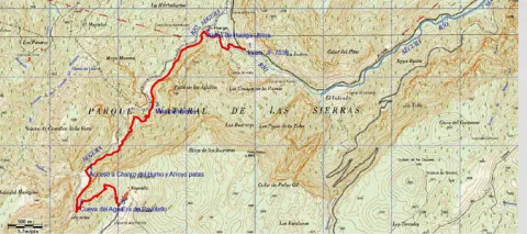
It is a beautiful route that has also been very well conditioned and marked. If it is addressed from bottom to top, the route begins at the detour by the cart that leads to Utrera Strike from the JF-7038, by asphalt track in just 900 meters. The route is described starting from here. From above it starts in Poyotello. At the entrance to this village, on the left, there is an era (steep platform) from which it starts our path.

From below, it begins near the quiet village of Huberga Utrera and goes back to the Segura River next to gardens and large nogueras, in the midst of a beautiful landscape of larice pine, of which powerful limestone canteens emerge. Next to the path are the hazelnut, the wild rosewood and the agribusiness, the maple, the sabina and the complaint are frequent, as well as terraces of gardens already abandoned with large nogueras,

The road is narrow becoming a horseshoe road that continues to ascend along the left bank of the Segura River. The valley is narrow and we walk flanked by impressive vertical walls, baked with numerous caves and abrupt hillsides covered by oak trees. From kilometer 2.4 we find a strong upward slope for 300-400 meters and then descend another 300 meters and we go up to km 4, where we find the signposted detour to the Charco del Humo, to the right, where the river is cleared with force in transparent poches in the midst of a dense vegetation of hazelnuts, willows and mountain olms. In spring we will be able to observe endemic species in flower such as the Cazola violet (Viola cazorlensis) and the grasilla or trapamosque (Pinguicola valisneriifolia)

Displacement to the Charco del Humo: the route is in the valley and we go through it from time to time On our right the valley begins to open, as the Arroyo Patas brings its waters to the Segura, and at this point we can turn to the right just 100 m, pass an old bridge and, under it, contemplate the impressive Charco del Humo, where the river is cleared with force in transparent poches in the midst of a dense vegetation of hazelnuts, willows and mountain olms.

We return through our steps to our route to continue to climb the Segura valley and reach after 4.7 km to the Cueva del Agua, one of the most attractive of this tour, which is a prominent exponent of the Karstico Segureño landscape. From this wide cavity, through which water usually circulates, good views are enjoyed over the Segura canyon.

If we continue the ascending route, leaving the valley behind, and now walking a more demanding path in effort, we can reach the village of Poyotello at the end of the route, at 6.056 km from the beginning, it is located on a natural balcony on the top of the Segura canyon at 1,440 m altitude. From here, already in a typical livestock landscape, you can see a wide range of views of the area.

Breve descripción

It is a beautiful route that has also been very well conditioned and marked. If it is addressed from bottom to top, the route begins at the detour on the road that leads to the Utrera Strike from the JF-7038, by asphalt track in just 900 meters. The route is described starting from here. From above it starts in Poyotello. At the entrance to this village, on the left, there is an era (steep platform) from which it starts our path.

Latitud
38.146376
Longitud
-2.623248
Distrito
Municipio
Ubicación en el mapa
POINT (-2.623248 38.146376)
imagen
Image
696_img.png
Imagen principal
Activado
imagen
Image
shutterstock_1060474277.jpg
Imagen principal
Desactivado
imagen
Image
Cueva%20del%20agua%20Poyotello.jpg
Imagen principal
Desactivado
4 h 10 min (ida y vuelta)

Nature

icon-intereses-naturaleza

Friends

icon-intereses-amigos

Adventure

icon-intereses-aventura

Culture

icon-intereses-cultura

Sport

icon-intereses-deporte

Eco-friendly

icon-intereses-eco-friendly

For couples

icon-intereses-en-pareja

Family

icon-intereses-familia

Gastronomy

icon-intereses-gastronomia

Municipality

icon-intereses-municipio

Low-cost tourism

icon-intereses-turismo-low-cost

Solo travel

icon-intereses-viajar-solo
Medium
1440
Image
4c3a7940-5d6c-ad70-4d2b-c0171cfd8995?t=1607096653856
Image
d5d56efc-49d4-ad76-0cb9-93ece2b5289e?t=1607096672326
HUELGA UTRERA A CUEVA DEL AGUA Y POYOTELLO
6,06 km (solo ida)
569m
154m
1
1
1
3
Horse, on foot
All year round
Desactivado
Image
fbcba4c1-f905-4c9a-0ff4-157b0da2d933?t=1607096662618

The birth of the Segura, La toba and La Morringa

The tour is marked by beacons and directional arrows such as PR-A 195.
Throughout it we find numerous streams, which are suitable places for rest. Special mention is worth the Charco del Humo and the Cueva del Agua, in the middle of the tour, places with special charm, which well deserve a longer stop.

This Path can be realized from two different villages: Utrera Strike (from where it is described here) and Poyotello. To get to Huberga Utrera, for this we must travel the JF-7038 that runs through the Segura River Valley, and just where it flows the Rio Madera in the Segura, we find a detour that leads us to the village of Huberga Utrera.
To reach Poyotello, you have to take the A-317, between Pontones and Santiago de la Sword. We will take a detour to the left, on a narrow and asphalt road (5 km) to reach the village.
It's described from Utrera Strike.

1004

Poyotello

1440
Coordenadas / Huso 30S
30S x = 533012 and = 4222123
Tramo de asfalto o cemento
14.85%
Tramo de pista o camino forestal
85.08%
Tramo de vía pecuaria
0
Tramo de senda
0