Saltar al contenido principal
icon-intereses-turismo-low-cost

Embalse Úbeda la Vieja

Submitted by brandcode_deweloper on
Id
912924
Descripción larga

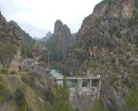
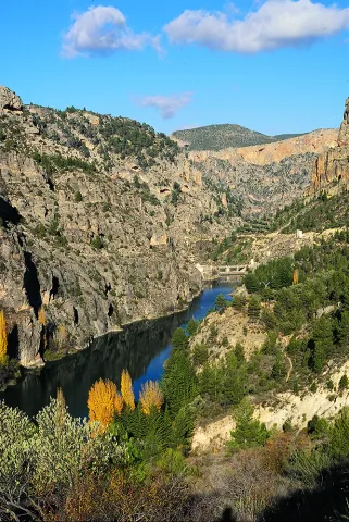
From the road you will find a road that goes down to the reservoir dam, where the vision is even more spectacular, with the impressive Pico Morrión standing out at the bottom.

This area of the Park represents better than any of the world of mountain villages: landscape, culture, gastronomy, odors, colors, life forms that when we come from the city we find unreal; as if it were not possible to live integrated into nature, living from the resources it provides but without damaging it.

Around the reservoir there are villages held in the time that each of them offers you different delicacies: the bread and the cakes of Tobos made in a historic wood oven, or the magnificent Vites spirit with which to make delicious artisanal liquors such as the pachan or the mistela.

We suggest...

  • Eating in the surroundings of the reservoir: Segureño lamb, slaughter viandas or any serrano dish will be safe of your liking.
  • Visit some of the villages near the reservoir, such as Marchena, La Muela or Miller.

This reservoir is located halfway between the town of Santiago de la Espada and the village of the Miller Boards, on the local road JF-7038, at the height of the village of Morrión.

Breve descripción

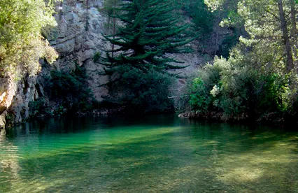
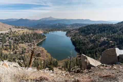
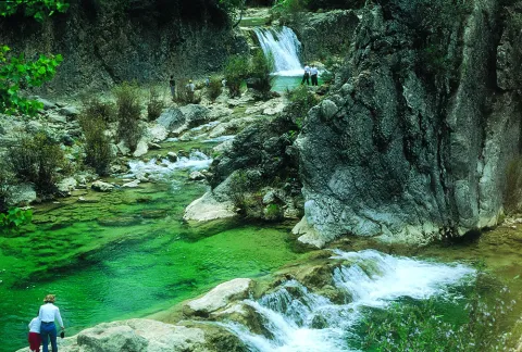
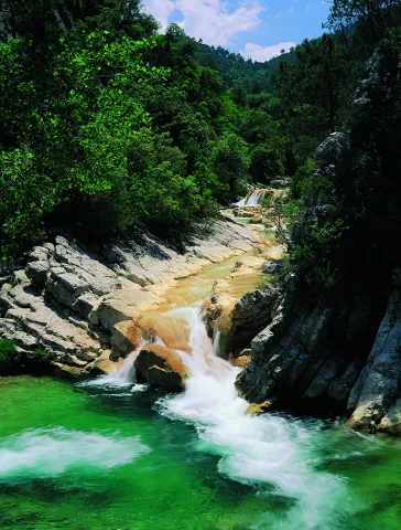
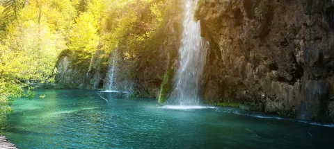
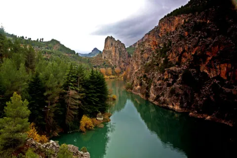
The vegetation-covered slopes and stone walls are reflected in the blue green waters of this tiny reservoir, which looks more like a natural lake of high mountain than a human construction. In it the Zumeta River retains its waters for an instant creating a peaceful and serene place, ideal for a moment of tranquility.

Latitud
38.0131
Longitud
-3.3706
Ubicación en el mapa
POINT (-3.3706 38.0131)
imagen
Image
embalse_lavieja%20%281%29.jpg
Imagen principal
Activado
imagen
Image
embalsedeLaVieja01.jpg
Imagen principal
Desactivado

Friends

icon-intereses-amigos

Adventure

icon-intereses-aventura

Culture

icon-intereses-cultura

Sport

icon-intereses-deporte

Eco-friendly

icon-intereses-eco-friendly

For couples

icon-intereses-en-pareja

Family

icon-intereses-familia

Gastronomy

icon-intereses-gastronomia

Municipality

icon-intereses-municipio

Nature

icon-intereses-naturaleza

Low-cost tourism

icon-intereses-turismo-low-cost

Solo travel

icon-intereses-viajar-solo
Embalse Úbeda la Vieja
Desactivado

Segura de la Sierra - Río Madera

Submitted by brandcode_deweloper on
Id
859335
Descripción larga

Its main attractions are the large forests of pine laricio, the head of the valley of the river Madera and some small villages.

Below we tell you how to make the route and suggest some possibilities:

Km 2.8.To the right part of the road to the small and hidden village of Moralejos, which is reached in a few minutes. We advise you to visit her, because she has a very harmonious environment and is well preserved.

Km 6.The Royos. From this tiny village you can see beautiful views of the header of the Trujala valley. Km 8.3. Important cross with many indications. We turn right, towards Rio Madera, on the JF-7016 road. To the left we would go to Las Azebeas and Siles. Here is a significant change in the plant environment, as we have entered the area of the pine pine larice.

Km 8.7.On the left, a forest track opens that gives access to Navalespino, the Collado de Góntar and the abandoned village of Prado de Juan Ruiz, among other areas of high quality landscape.

Km 9.5.Fountain and forest house of Navalhora. The pinar acquires all its splendor. Three hundred meters further, take the long forest track from Navalhora to El Robledo to the right, for which we recommend walking.

Km 10.1.At this crossing, our route follows to the left, towards Rio Madera, on the JF-7038 road. From here we go down and we'll see large copies of complaints and some twins. Km 12.3. Start a forest track to the left, to the counter. It gives access, without taking any detour, to the far-off villages of La Tobilla and Prado Espinosillo.

Km 13.5.Los Negros' controlled camp area. It has a fountain and tables, and is accessible for people with reduced mobility. An excellent place to rest under large larity pines. From here, during the 4.3 km that separate us from the village of Arroyo Canales, we recommend to walk quietly next to gardens and small cortijos, always close to the river Madera and in the middle of one of the best pine lario forests in Spain.

Km 17.8.The village of Arroyo Canales, sometimes given the name of the village of Rio Madera, is a strategic point throughout the area. At this very marked crossing, we turn right on the JF-7039 road. From here on the route rises and the forest is less lush, but you gain splendid views. We will find several forest tracks signposted to El Jaral, La Huelga de la Vigas and the Collado de Los Asperones. All of them are interned in magnificent places.

Km 22.4.Very marked cross where we turn right, on the JF-7016 road. Two hundred meters later, we ignored the left crossing towards the Hornos de Segura and followed the front. From here on the plain route and the environment becomes more lush.

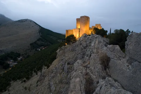
Km 23.7.We arrived at the location of El Campillo, where there is an old forest house. To the left, the asphalted forest track goes up to El Yelmo. Both on the road and at the summit, the views are extraordinary.

Km 32.5.We found again the crossing through which we went down to Rio Madera. From here on, we return to Segura de la Sierra on the same route we brought.

PRACTICAL PARTICULARS

The route is 42 km, and it starts and ends in Segura de la Sierra. The beginning from which we count the kilometers is at the exit of Segura de la Sierra on the road JV-7032, exactly at the point where the road to the castle comes right.

Breve descripción

This route, which is part of the small and beautiful village of Segura de la Sierra, leads along small mountain roads to the valley of Rio Madera, ascends to the vicinity of the Yelmo and returns to the starting point.

Latitud
38.3547
Longitud
-2.6487
Distrito
Ubicación en el mapa
POINT (-2.6487 38.3547)
imagen
Image
Natu048.jpg
Imagen principal
Activado
imagen
Image
1%20%285%29.jpg
Imagen principal
Desactivado
imagen
Image
2%20%284%29.jpg
Imagen principal
Desactivado
imagen
Image
3%20%284%29.jpg
Imagen principal
Desactivado

Nature

icon-intereses-naturaleza

Friends

icon-intereses-amigos

Adventure

icon-intereses-aventura

Culture

icon-intereses-cultura

Sport

icon-intereses-deporte

Eco-friendly

icon-intereses-eco-friendly

For couples

icon-intereses-en-pareja

Family

icon-intereses-familia

Gastronomy

icon-intereses-gastronomia

Municipality

icon-intereses-municipio

Low-cost tourism

icon-intereses-turismo-low-cost

Solo travel

icon-intereses-viajar-solo
Segura de la Sierra - Río Madera
Activado
Tramo de asfalto o cemento
 
Tramo de pista o camino forestal
 
Tramo de vía pecuaria
 
Tramo de senda
 

Santiago de La Espada - Juntas de Miller

Submitted by brandcode_deweloper on
Id
859170
Descripción larga

The morphology of the land also tells us of the thousands of years in which water has been the artisan hand that has built the landscape. As we go down this road, the oak and pine trees make way for lush riverside forests.

Among the options we propose to you:

Km 0.Santiago de la Sword. Located at 1350 m of altitude, its main economic activity is extensive livestock. It has the parish church of Santiago Apostle (16th century), built on an earlier hermitage dedicated to the same saint and which has a beautiful major altarpiece of Baroque style. In the square of the City Hall we find an old 16th century inn with a vistose wooden balconade.

Km 10.Mirador del Salto de la Nova or del Zumeta; 10 km from Santiago we find on the right hand side this mirador from which we see the limit of the Park and the province of Jaén. Watch out for hats, they can fly a long way.

Km 12.Tobos village. Compulsory stop to buy good bread and delicious cakes. Next to the road there is a simple laundry room that circulates the Tobos stream, with fresh and clean waters.

Km 13.Vites village. To get to the village of Vites you have to turn left and drive 2 km. In this village are raised magnificent white grapes, large and sweet, from which a powerful spirit is distilled. Ask the local neighbors.

Prado Moro.At the end of the village of Vites a left road ascends to Prado Moro. Here a centenary oak resists at the time that gives us a vision of the vegetation that in the past existed in the area.

Km 16.Embalse de la Vieja. A prominent peak called the Morrison announces the beginning of the Old Age reservoir. After the village of Morrión, a lane - not marked - goes down on the left to the reservoir.

Km 18.The Vadico. Two km from the reservoir there are houses on the right side of the road with a wall in front. Right across the street we found a way up to the Vadico. It's a nice walk, by a real vergel, which deserves to be made on foot. On the way there are sources to be able to refresh and collect water.

Km 18.5.Entrance to the villages of La Muela, Marchena and Marchenica. The Muela is 5.4 km from this point. In its vicinity is Hoya Somera, an important archaeological site of the bronze age. Later on there are Marchena and Marchenica. In its surroundings, there were Roman remains and an Arab necropolis.

Km 22.Miller's together. At this point the Zumeta River has come with us all the way and the Segura. A natural stone tunnel announces the arrival at this meeting place.

Miller village.From Las Juntas there is another road that reaches this historic village with more than 20 water births. It is a starting point for several routes that will make us known beautiful areas of the Sierra de Segura. When you pass the stone tunnel you have to follow the indication "Central and Miller."

PRACTICAL PARTICULARS

Distance:From Santiago to the Miller Boards there are 22 km away, by a mountain road. The route is extended if we enter the villages and recommended points.

Home:Santiago de la Sword village to which you can reach the A-317. The route is developed by the JF-7038 road

Breve descripción

The Zumeta Valley, through which this route runs, is a true journey in time. By the river there have been settlements from the Neolithic to today. We will find archaeological sites, rock paintings, small castles and villages that are authentic ethnological museums in the open air. In them it is still easy to see their inhabitants doing work of other times.

Latitud
38.0764
Longitud
-2.5222
Distrito
Ubicación en el mapa
POINT (-2.5222 38.0764)
imagen
Image
santiago-espada.png
Imagen principal
Activado
imagen
Image
Natu187.jpg
Imagen principal
Desactivado

Nature

icon-intereses-naturaleza

Friends

icon-intereses-amigos

Adventure

icon-intereses-aventura

Culture

icon-intereses-cultura

Sport

icon-intereses-deporte

Eco-friendly

icon-intereses-eco-friendly

For couples

icon-intereses-en-pareja

Family

icon-intereses-familia

Gastronomy

icon-intereses-gastronomia

Municipality

icon-intereses-municipio

Low-cost tourism

icon-intereses-turismo-low-cost

Solo travel

icon-intereses-viajar-solo
Baja
Santiago de La Espada - Juntas de Miller
Activado

Piscifactoría del Borosa

Submitted by brandcode_deweloper on
Id
859115
Descripción larga

The route is 45 km. It begins in the farm of the Borosa and ends in the Hornos de Segura. It is recommended at least one full day. There are many tourist accommodation on the route.

Km 0 - Piscifactory and River Borosa River Interpreting Center. In this Centre we will know the importance of water and river ecosystems in the Natural Park, in which emblematic species such as the common trout and the otter stand out.

Km 1,7 - Vinagre Tower. This area is one of the most crowded in the Park and is located in a geographically privileged area for its centrality. Here it is essential to know the Park Visitors Center, which has been recently modernized and has various interactive resources. It has a Natural Park Store, toilets, cafe, rest room and children's play area on the outside. Very close to this center is the Botanical Garden, a pleasant place with a wide and careful selection of natural park plants, from small herbaceas to large trees. It is a perfect place to observe and learn to distinguish them or simply to take a pleasant walk between lush vegetation.

Km 6.5 - Coto Ríos. This village, on the banks of the Guadalquivir, was built in the 1960s of last century to house families living in scattered villages and cortijos and whose houses were expropriated to create the National Cazorla-Segura Hunting Coto (now the Andaluza de Caza Reserve). It has medical assistance, shops and other services, in addition to several campsites.

Km 13.3 - Wild Fauna Park Collado del Almond. In their enclosure they pasture in semi-freedom deer, mountain goats, wos and muflons. You can see them and photograph them by walking a pleasant itinerary with fountains, banks and several viewpoints with splendid views of the Tranco reservoir and the ruins of the castle of Bujaraiza.

Km 14 - FRF look. It is one of the milestones of the Route of the same name, dedicated to the mythical naturalist Felix Rodríguez de la Fuente, who from this point of view filmed the famous scenes of the berrea of the deer in the 1970s. In front of it is Mount Bujaraiza, which sometimes, when the reservoir is very full, becomes an island, and is crowned by the ruins of an Arab turret.

Km 17.6 - Old-garden controlled area. This place is very nice to eat and rest, except on the dates you are occupied by some camp.

Km 19.2 - House of Crafts Los Casares. It is an old Forest House converted into a shop of crafts and products from the Park.

Km 26 - Old Control Recreative Area. It is a large and recently built area with magnificent views over the northern part of the Tranco reservoir. It has banks, tables to eat and fountain.

Km 28.4 Tranco Dam - This impressive dam, whose height on the Guadalquivir channel is 82 meters, is one of the largest in Spain. In its surroundings there are several restaurants, terraces and water sports facilities, as well as the village that was raised for the workers who built the dam.

Km 31.5 - The Parral Recreative Area. It is in the middle of the carrasco pine pinar and has a look-out with good views over the waters of the Tranco reservoir.

Km 35.7 - Cñada Morales. When it reaches this village the landscape is opened and no longer exclusively forest, to give way to large humanized areas with olive groves, orchards and scattered cortijos.

Km 44.6 - Safe Furnaces. This small town, built on the top of a peñasco, is in the center of the Natural Park. Its monuments, views and irregular alleys of the Arab past, served him the declaration of Artistic Historical Set.

Breve descripción

This route is one of the most classic and frequented of the Natural Park, as it brings together a very attractive landscape dominated by the water of the Tranco reservoir with the possibility of visiting a number of facilities, in which we will enjoy knowing and observing the natural wealth of this protected space. It is mostly due to the winding road A-319, for which it is appropriate to drive with caution, especially on the dates of the greatest tourist influx. You will find various viewpoints and recreational areas in which we recommend stopping you, but below we recommend a series of stops and almost mandatory visits. You will find expanded information from most of these places on this same website.

Latitud
38.01536
Longitud
-2.863737
Distrito
Municipio
Ubicación en el mapa
POINT (-2.863737 38.01536)
imagen
Image
shutterstock_742514128.jpg
Imagen principal
Activado
imagen
Image
Natu050.jpg
Imagen principal
Desactivado
imagen
Image
imgOptim2%20%282%29.jpeg
Imagen principal
Desactivado
imagen
Image
Natu126%20%281%29.jpg
Imagen principal
Desactivado
imagen
Image
Natu290.jpg
Imagen principal
Desactivado

Nature

icon-intereses-naturaleza

Friends

icon-intereses-amigos

Adventure

icon-intereses-aventura

Culture

icon-intereses-cultura

Sport

icon-intereses-deporte

Eco-friendly

icon-intereses-eco-friendly

For couples

icon-intereses-en-pareja

Family

icon-intereses-familia

Gastronomy

icon-intereses-gastronomia

Municipality

icon-intereses-municipio

Low-cost tourism

icon-intereses-turismo-low-cost

Solo travel

icon-intereses-viajar-solo
Piscifactoría del Borosa
Desactivado
Coordenadas / Huso 30S
30S x = 511961 and = 4207528
Tramo de asfalto o cemento
 
Tramo de pista o camino forestal
 
Tramo de vía pecuaria
 
Tramo de senda
 

Mogón Charco del Aceite

Submitted by brandcode_deweloper on
Id
858218
Descripción larga

We will find numerous cortijos, some standing and others in ruins, faithful examples of popular architecture. As we advance our journey, we are shown forests of majestic pine trees, authentic sabinars, dense riverside forests in the streams and centuries-old examples of oak trees and complaints.

Breve descripción

The winding and winding route of this road, which is perfectly framed in this beautiful environment, will discover a part of this unexplored and almost unknown paradise and will show us many landscapes of a prodigious beauty, where water is often the protagonist.

imagen
Image
fondo10.jpg
Imagen principal
Activado

Nature

icon-intereses-naturaleza

Friends

icon-intereses-amigos

Adventure

icon-intereses-aventura

Culture

icon-intereses-cultura

Sport

icon-intereses-deporte

Eco-friendly

icon-intereses-eco-friendly

For couples

icon-intereses-en-pareja

Family

icon-intereses-familia

Gastronomy

icon-intereses-gastronomia

Municipality

icon-intereses-municipio

Low-cost tourism

icon-intereses-turismo-low-cost

Solo travel

icon-intereses-viajar-solo
Mogón Charco del Aceite
Desactivado
Aquí tienes la traducción manteniendo la estructura HTML:

1.Km 0. Mogón. This beautiful village, which belongs to the municipality of Villacarrillo, is located in the Guadalquivir Valley. Its olive groves and fertile river plains are also watered by the Aguascebas River, as both waterways converge at this point. It has a large, well-equipped bathing area in the “El Molinillo” beauty spot.

2.Km 9.9. La Osera and Cerro Vilorto Viewpoints. On our left are these two viewpoints, which offer magnificent panoramic views of La Osera, one of the most emblematic natural areas in these mountains.

3.Km 14. Curva del Tambor. Its name comes from its pronounced circular layout. From here, looking eastwards, there are extensive views over the Cañamares River Valley, the waterfall and the vulture nesting site at Peña Palomera, as well as the towns of Cazorla, La Iruela and Burunchel.

4.Km 18.5. Chorrogil Waterfall. Approximately 500 metres before reaching the Aguascebas Reservoir, a dirt track begins on the right-hand side and leads close to this spectacular horsetail-shaped waterfall. Among the lush vegetation are several birch trees, a northern species whose presence at this latitude is truly exceptional. Its multicoloured rock face makes the area even more attractive.

5.Km 19. Aguascebas Reservoir. This charming artificial lake supplies drinking water to the towns throughout La Loma. It is also a high-mountain rainbow trout fishing reserve. Bathing is not permitted.

6.Km 22. La Fresnedilla. This is the main hub of this part of the Sierra de las Villas. It is a small village equipped with a primary school and a municipal hostel. Around 700 metres from this point, several tracks branch off to the left, providing access to charming places that are well worth exploring on foot, such as Arroyo del Torno, Nava del Milano and the summit of Navazalto.

7.Km 24. Collado del Lobo, Nava del Rico and Collado del Pocico. A particularly distinctive type of vegetation catches our attention here: the juniper woodland. Magnificent specimens of Phoenician juniper occupy the limited soil between the limestone rocks at Lancha del Sabinar. On our right, a track provides access to beautiful places such as Cruz de Juan Núñez, Cortijo de la Cruz, Las Castañetas and Prado de los Chopos.

8.Km 28. Cerrada de San Ginés. On our right begins the track that provides access to the highest areas of this remarkable mountain range and brings us closer to this natural site. The waters of the small Aguascebas de Gil Cobo River flow through the canyon, alternating between distinctive waterfalls and refreshing pools. The first section of this area is well worth exploring on foot, both for its undeniable beauty and for its extraordinary botanical wealth, which includes numerous endemic species and specimens of yew, holly and birch. The Gil Cobo Recreational Area is located just a few metres from the beginning of this forest track.

9.Km 34.5. Cueva del Peinero. A recreational area located in a setting of majestic beauty beside the Aguascebas Grande River, whose waters flow through lush riverside vegetation and between large stone blocks.

10.Km 40. Collado del Ojuelo. This location is a crossroads. To the left, the forest track leads to places such as Collado de la Tobilla, La Muela and Cañada de la Madera. To the right, the Tableros track, which is closed to vehicles by a barrier, provides access to lesser-known locations such as Prado de los Chortales, Cañada Somera, Collado de los Hermanillos and Caballo de Torraso.

11.Km 47. Agua de los Perros. This spectacular site is dominated by the enormous dome known as Iglesia de los Perros. Its centre is pierced by an opening resembling a skylight, through which the stream that flows into it falls like fine raindrops. At Piedra del Agujero there is an enormous opening carved into the rock by erosion, as well as a natural bridge shaped in the rock by the stream. Visitors can cool down at its spring of cold, crystal-clear water.

12.Km 48. Collado del Agua de los Perros. At an altitude of 1,200 metres, this location is well worth a stop to admire the views, the pine forests and the beautiful specimens of Spanish juniper.

13.Km 50. Mirador del Tapadero. An essential stop at this viewpoint overlooking the abyss. Below, the narrow and turbulent course of the Chillar Stream can be seen.

14.Km 55.4. Fuente de los Cerezos Regulated Campsite. Beside the road stands a beautiful fountain with two spouts. Near this location, approximately 300 metres to the right, beside the first stream, we can see one of the few surviving tar kilns, traditionally used to extract juniper tar, that remains fully intact within the Natural Park. It is a silent reminder of how people once made use of the natural resources of these mountains.

15.Km 58.2. Puente de los Agustines – Charco del Aceite. After crossing the bridge over the Guadalquivir River, a short turning on our right leads to a delightful bathing area. The Charco del Aceite Recreational Area is a natural setting where the Guadalquivir forms a large pool of clean, refreshing water.

 

Hinojares - Quesada (Route Nazarí)

Submitted by brandcode_deweloper on
Id
858134
Descripción larga

ROTOMETER:

Km 0.0. Departure.In the square of the Constitution of Hinojares (x = 500190; and = 4174475), at the height of the Fountain of the Frogs, we put the CK at 0.0 and we left the village upwards, on the street of the Church, towards the road of Tícar (A-6206).

Km 1.5 Cross of the Tranco de la Zorra (x = 501180; and = 4175910).In the stop we put the CK at 0.0 and turn left.

Km 1,1. Cuenca cross (x = 501825, and = 4175910).We left the main road, to turn right.

Km 3.7. Cuenca (x = 502725; and = 4176830).We park the car in the Consultorio, to visit the Birth of Seven Fuentes and the village; to reach the remains of the fortress and medieval village of the Castellones de Cuenca is complicated, but on the return to the main road, as we pass the last houses of the village, we can see the enclave on the other side of the ravine. When we reach the A-6206, in the stop we put the CK at 0.0 and turn right.

Km 10.2. Belerda Cross (x = 498490; and = 4180130).We're still on the front, direction Quesada. Another option is to turn left to visit The Casillas of Don Pedro and Las Belerdas and return back to this point, where we will follow left; the next point is 0.3 km.

Km 10.5. Entry into the Water Cave (x = 498220; and = 4180260).We turn left; 300 m away are the parking and access to a great open oquedad, crossed by the Arroyo de Tiscar, proposed as a Natural Monument; on leaving to the main road we turn left, to visit the Sanctuary and Castle of Peña Negra. We return to the A-6206, direction Quesada and to the entrance of the Vadillo Road (x = 498015; and = 4180895) we put the CK at 0.0.

Km. 4.8. Port of Tiscar (x = 496675; and = 4182345).We left the car in a space that we found on the right of the road, to go up, taking a walk, to the Atalaya del Infante Don Enrique (13th century) that is enabled as a lookout; behind the tower, the Picón del Rayal (1,834 m.), in the form of a colossal wave; "rayal" was synonymous with "border" in the Reconquista.

Km. 13.5. Quesada (x = 494160; and = 4188735).Here we can visit the Arc of the Saints, the Arc of the Maquita of Utrera, the remains of the Arab Alcazaba, the two churches and the Museum of Rafael Zabaleta.

Breve descripción

To weigh off natural areas of extraordinary beauty, the historical and cultural interest of this route is its main argument. We will cross a border land between Arabs and Christians that lasted three centuries, until the final take of Granada in 1492. It is essential to understand the culture and uniqueness of the lands of the ancient advance of Cazorla, dependent on the Archbishopric of Toledo, which was created in 1231 and which was abolished by the Cortes of Cadiz in 1811.

Latitud
37.844104
Longitud
-3.075856
Municipio
Ubicación en el mapa
POINT (-3.075856 37.844104)
imagen
Image
shutterstock_1403717486.jpg
Imagen principal
Activado
imagen
Image
quesada%20ruta%20%20de%20los%20nazaries%205.jpg
Imagen principal
Desactivado
imagen
Image
quesada%20ruta%20%20de%20los%20nazaries%202.jpg
Imagen principal
Desactivado

Nature

icon-intereses-naturaleza

Friends

icon-intereses-amigos

Adventure

icon-intereses-aventura

Culture

icon-intereses-cultura

Sport

icon-intereses-deporte

Eco-friendly

icon-intereses-eco-friendly

For couples

icon-intereses-en-pareja

Family

icon-intereses-familia

Gastronomy

icon-intereses-gastronomia

Municipality

icon-intereses-municipio

Low-cost tourism

icon-intereses-turismo-low-cost

Solo travel

icon-intereses-viajar-solo
Hinojares - Quesada (Ruta Nazarí)
All year round
Desactivado

The route starts from Hinojares, although by closeness it can be done, using almost the same time, from Pozo Alcón, due to the proximity of these two populations. The route is about 33 Km to Quesada and back. It is important to set in the description, to put the count to zero at the appropriate points.

Coordenadas / Huso 30S
30S x = 493326 and = 4188521
Tramo de asfalto o cemento
 
Tramo de pista o camino forestal
 
Tramo de vía pecuaria
 
Tramo de senda
 

Los Miradores

Submitted by brandcode_deweloper on
Id
856876
Descripción larga

The look at La Morra de Los Canalizos (km 31) has tables to eat. A little further we found the crosses to Hornos el Viejo and La Plantera. It is highly advisable to turn around this last village, with its scattered population and large oaks, and even down to the Tranco reservoir, to take a relaxing walk along its margin.

In the impressive Mirabuenos lookout (km 35) the views change quite a lot: from the humanized landscape of the previous lookout, with extensive olive areas and numerous cortijos and villages, we go to the vast panoramic high mountain, where the large forests dominate.

The view of Las Huelguecillas (km 36), which has tables to eat, is on an extensive promontory, and thanks to its situation as a small "peninsula" aerial we enjoy a very wide panoramic in all directions.

The Pradillos lookout (km) is the last and has a special charm for being at 1,340 m of altitude. This section of the A-317 ends when it stops climbing. You'll find a crossing and you'll have two options. If you keep going, you'll go to Pontoons and the birth of the Segura. You will find a livestock landscape, with very clear views. If you choose to turn left, you will enter a more forest landscape. You can complete your route in a circular way by returning to the Hornos de Segura on the roads of La Suma and la Garganta (A-317a).

Breve descripción

This route runs the first 20 km that has the road A-317 from Hornos to Pontones and Santiago de la Espada. This is a very panoramic section whose seven viewpoints make it an authentic landscape route. All are equipped with parking, banks, stationery and wooden fences. Some also have tables to eat. The viewpoints have attractive ceramic panels, which serve to interpret the landscape and to know some aspects of the natural and cultural heritage of the environment.

Latitud
37.9202
Longitud
-2.9801
Distrito
Municipio
Ubicación en el mapa
POINT (-2.9801 37.9202)
imagen
Image
la-historia.png
Imagen principal
Activado

Nature

icon-intereses-naturaleza

Friends

icon-intereses-amigos

Adventure

icon-intereses-aventura

Culture

icon-intereses-cultura

Sport

icon-intereses-deporte

Eco-friendly

icon-intereses-eco-friendly

For couples

icon-intereses-en-pareja

Family

icon-intereses-familia

Gastronomy

icon-intereses-gastronomia

Municipality

icon-intereses-municipio

Low-cost tourism

icon-intereses-turismo-low-cost

Solo travel

icon-intereses-viajar-solo
Los Miradores
Desactivado

We suggest...

  • The village of Los Goldines (km 40), depopulated and half-run, is testimony to the sad abandonment to which its inhabitants were forced when the National Caza Cote was created in 1960. Its ruins are an open book about the recent history of the Serrans.
  • The village of La Parrilla (km 41) remains populated. Since the rest of the villages were very isolated until the construction of this road in 2006.
  • Do not stop visiting the villages of La Ballestera and Montalvo, the latter in a superb location. They deserve a quiet walk because they keep the authenticity of traditional mountain villages. To enjoy the landscape more, we recommend you walk up to Montalvo, although you can go perfectly by car.

Cerrada del Utrero - Torre del Vinagre

Submitted by brandcode_deweloper on
Id
856851
Descripción larga

Among the options we propose to you:

Km 0. Caraway. The best way to enjoy Cazorla is to get lost in the streets of the old town and to discover some of its wonders, but on this occasion we propose some forced visits: the Plaza de Santa María, the Castle of the Yedra and some churches such as that of the Carmen or San Francisco of Renaissance style.

Km 1.5. The Iruela.Here we propose to stop you again, leave the car by the road and walk up one of the steep streets that lead to the castle that was owned by the Templars. From above you will have a beautiful view of the Guadalquivir depression. Next to the castle you can also visit the Church of Santo Domingo - and know the details of its foundation and history. Back in the car you will enjoy slimmed streets full of flowers that cheer the view.

Km 12. Air Pass lookout.We go up the road that leads us to the Natural Park and to say goodbye to the countryside, nothing better than to stop at this Mirador and enjoy its views. From here we change villages, castles and olive trees to valleys, rivers and mountains.

Km 13. Viewer of the Port of the Doves (1200 m).The landscape changes dramatically. You will find a great panoramic view of the Alto Valle del Guadalquivir, surrounded by beautiful mountains, including the Poyos de la Mesa on the right, unmistakable by its steep cliffs. It is also a good point to observe rapacious birds such as the royal eagle or the leonate vulture.

Km 16. Valley splash.In fact, the Valley Empalme is not a stop but a crossroads. We can turn left and descend to Cold Arroyo, but at this point we will follow the right-hand option following the JF-7092 road that leads us to the Utrero Clock.

Km 19.5. Closed from the Utrel. 3.5 Km from the Empalme del Valle you can reach a bridge over the Guadalquivir River. At this point we have to leave the car. Here begins a circular route of approximately 45 minutes that we will walk. It is a charming walk next to a Guadalquivir that is going to fit in and that later receives the surprise from the air of the stream of Linarejos. Impossible.

Km 23. Valley splash.Back to the road crossing we now continue on the right, following the A-319 road towards Cold Arroyo.

Km 30. Cold Arroyo.At this point in the road we can visit the Ethnographic Museum of Arts and Customs of the Natural Park. Cold Arroyo is also a good place to take something or make some unexpected purchase.

Km 33. Tejina Recreative Area.A stop on the way to rest, relax and eat outdoors if that's your choice.

Km 40. Vinagre Tower.This is certainly a strategic place within the Park because of it some of the routes that will take you to places as famous as the Cerrada de Elias or the Laguna de Valdeazores. At this point there are also a number of facilities that allow you to know the Park. You will find information about this extraordinary enclave in the area "Passeos por el Valle."

Breve descripción

History and nature by the Guadalquivir River are the proposals for this route full of contrasts that leads us to some of the most significant points of the Natural Park of the saws of Cazorla, Segura and the Villas.

The great protagonist is, of course, the Guadalquivir River, which we will see docile in the olive and narrow and noisy countryside in the high parts of the valley where he has been in charge of modeling the magnificent landscapes we will see. You can appreciate the contrast between people full of history and culture, who live together with a natural environment that is invariable and full of life: you will find wild animals, forests that cover the whole landscape, high mountains and water everywhere.

Latitud
37.9053
Longitud
-2.9552
Distrito
Ubicación en el mapa
POINT (-2.9552 37.9053)
imagen
Image
agua-sierra%20%281%29.png
Imagen principal
Activado
imagen
Image
5%20%284%29.jpg
Imagen principal
Desactivado
imagen
Image
6%20%283%29.jpg
Imagen principal
Desactivado
imagen
Image
Natu225.jpg
Imagen principal
Desactivado

Nature

icon-intereses-naturaleza

Friends

icon-intereses-amigos

Adventure

icon-intereses-aventura

Culture

icon-intereses-cultura

Sport

icon-intereses-deporte

Eco-friendly

icon-intereses-eco-friendly

For couples

icon-intereses-en-pareja

Family

icon-intereses-familia

Gastronomy

icon-intereses-gastronomia

Municipality

icon-intereses-municipio

Low-cost tourism

icon-intereses-turismo-low-cost

Solo travel

icon-intereses-viajar-solo
Cerrada del Utrero - Torre del Vinagre
Desactivado
Tramo de asfalto o cemento
 
Tramo de pista o camino forestal
 
Tramo de vía pecuaria
 
Tramo de senda
 

Carretera de La Cumbre

Submitted by brandcode_deweloper on
Id
856654
Descripción larga

You can take advantage of this stretch of road to close a car circuit with the Miradores Route and the Hornos Grain road. If you want to walk, we recommend the public road that goes east in the direction of the village of Cabeza Gorda passing through the old forest house of the Fuente del Chorro, which passes through dense pine forests.

Breve descripción

This area is not what suggests its name, but a long and wide range of water between the basins of Guadalquivir and Segura. It is surrounded by the quiet road A-317a, through which you can enjoy a very wooded landscape dominated by larix pine pines, with some points from which a memorable panorama is dominated to the Tranco reservoir, the Las Villas saw and the Banderillas mountain range.

Latitud
37.950324
Longitud
-4.482672
Municipio
Ubicación en el mapa
POINT (-4.482672 37.950324)
imagen
Image
shutterstock_1484040422.jpg
Imagen principal
Activado
imagen
Image
Guadalquivir_en_Cazorla.jpg
Imagen principal
Desactivado

Nature

icon-intereses-naturaleza

Friends

icon-intereses-amigos

Adventure

icon-intereses-aventura

Culture

icon-intereses-cultura

Sport

icon-intereses-deporte

Eco-friendly

icon-intereses-eco-friendly

For couples

icon-intereses-en-pareja

Family

icon-intereses-familia

Gastronomy

icon-intereses-gastronomia

Municipality

icon-intereses-municipio

Low-cost tourism

icon-intereses-turismo-low-cost

Solo travel

icon-intereses-viajar-solo
Carretera de La Cumbre
Desactivado
Coordenadas / Huso 30S
30S x = 369734 and = 4201340

Trail de Siles a Villarrodrigo

Submitted by brandcode_deweloper on
Id
8100491
Descripción larga

We will walk through a varied landscape of low and half mountain, between olive groves and masses of carrasco and black pine with abundant Mediterranean forest, spilled by beautiful walnuts, complaints and pineapples. We can also see well-preserved river vegetation.

Between the Dehesa del Oso and Villarrodrigo there are long sections from which we will enjoy a wide range of views of all theNatural Park. In the vicinity of Villarrodrigo you can see the last eastern foothills of Sierra Morena and the transition landscape formed by dehesas.

The corvids, such as the lard and the corneas, as well as the boar, are abundant. In the area of the Cambrón there is an interesting colony of leonate vulture.

Breve descripción

The Path of Siles to Villarrodrigo runs almost entirely through a forest track that unites these two localities, crossing the valleys of the Guadalimar and its tributary the Onsares.

Latitud
38.487184
Longitud
-2.636444
Distrito
Municipio
Ubicación en el mapa
POINT (-2.636444 38.487184)
imagen
Image
sendero%20de%20Siles%20a%20Villarrodrigo2.jpg
Imagen principal
Activado
imagen
Image
sendero%20de%20Siles%20a%20Villarrodrigo.jpeg
Imagen principal
Desactivado

Nature

icon-intereses-naturaleza

Friends

icon-intereses-amigos

Adventure

icon-intereses-aventura

Culture

icon-intereses-cultura

Sport

icon-intereses-deporte

Eco-friendly

icon-intereses-eco-friendly

For couples

icon-intereses-en-pareja

Family

icon-intereses-familia

Gastronomy

icon-intereses-gastronomia

Seniors

icon-intereses-senior

Low-cost tourism

icon-intereses-turismo-low-cost

Solo travel

icon-intereses-viajar-solo
Sendero de Siles a Villarrodrigo
On foot
All year round
Activado
Coordenadas / Huso 30S
30S x = 531707 and = 4259934
Tramo de asfalto o cemento
 
Tramo de pista o camino forestal
 
Tramo de vía pecuaria
 
Tramo de senda