Saltar al contenido principal
icon-intereses-turismo-low-cost

Trail de La Gitana

Submitted by brandcode_deweloper on
Id
2149545
Descripción larga

The well of the Gitana, ideal place of rest where we can be surprised by a spectacular rainbow effect produced in the mouth of the well.

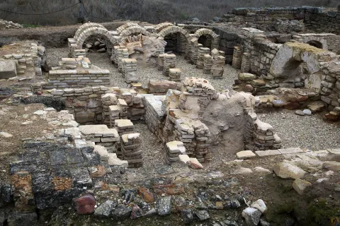
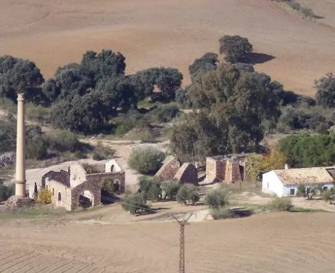
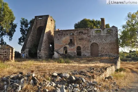
A lane connects right to the path. We follow on the right and about 100 meters away there are ruins, later leading a short and slight descent to the urbanization of San Roque in front of a slender fireplace on the Carretera de Guarroman. On the road and on the left you have to walk about 250 meters to a track between chalets that we take to turn left again. The path gently descends through an area of dehesa to reach the well of the Gypsy, not before opening and closing a wire that as a door prevents the free passage.

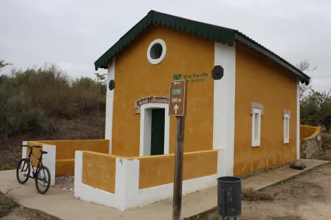
The well of the Gitana, ideal place of rest where we can be surprised by a spectacular rainbow effect produced in the mouth of the well. We arrive at the well of Las Animas, there at a table of interpretation the most interesting places in the area are recognized. The crossing is located with the mines of Adaro. Without deviating, during the descent to the left is the Pozo de San Isidro, below a vaguada the road ascends leaving at its pass and to the right the Pozo San Francisco 2nd, and culminates in the Solid Waste Plant, where it continues along the road, which is only to be left after passing the crossing with the Mina de Los Quinientos and taking a path that leaves to the left through the Via Verde next to a ruined shed linking with the Fundado de la Tortilla, PRA 265, which together use the Camino de Siles to reach Linares.

Breve descripción

This Path, in its journey, not only recovers the pecuary path of the Way of Mayecosas at its beginning, but also does so by returning to Linares on the old way of Siles, also called the Way of the Stones. This road has no loss and is marked by some other stone wall. We leave the pecuaria road turning left at the first crossing, a few meters from another crossing with the road of the well of San Adriano, which we can visit if we leave the route. Our tour continues to cross the Green Way and reach a crossing where we turn right on a road next to an electric tower that continues between olive trees.
Latitud
37.8202
Longitud
-3.4601
Distrito
Municipio
Ubicación en el mapa
POINT (-3.4601 37.8202)
imagen
Image
MINA_POZO_DE_LA_GITANA.jpg
Imagen principal
Activado
imagen
Image
20110702-0391.jpg
Imagen principal
Desactivado

Nature

icon-intereses-naturaleza

Friends

icon-intereses-amigos

Adventure

icon-intereses-aventura

Culture

icon-intereses-cultura

Sport

icon-intereses-deporte

Eco-friendly

icon-intereses-eco-friendly

For couples

icon-intereses-en-pareja

Family

icon-intereses-familia

Gastronomy

icon-intereses-gastronomia

Municipality

icon-intereses-municipio

Low-cost tourism

icon-intereses-turismo-low-cost

Solo travel

icon-intereses-viajar-solo
Sendero de La Gitana
On foot
All year round
Activado
Tramo de asfalto o cemento
 
Tramo de pista o camino forestal
 
Tramo de vía pecuaria
 
Tramo de senda
 

Route de los olivos centenarios

Submitted by brandcode_deweloper on
Id
1935699
Descripción larga

By oral tradition it is known that the olive trees located in theMotril plainhaveover 500 years. This enclave is located just over 1 km from the city centre, at the foot of the Martos road to Santiago de Calatrava. It occupies an extension of 84 ha, with 5,394 trees in total, some of them, true living sculptures. It is a fully productive olive tree, with an average production of 150 kg per tree.

Breve descripción

The olive treeMartosIt's traditional. More than 60% of plants are ageover 200 years. Among this olive forest, located in the world's first olive oil producing municipality, are the so-called Centennial Olives.
Latitud
37.722251
Longitud
-3.970322
Distrito
Municipio
Ubicación en el mapa
POINT (-3.970322 37.722251)
imagen
Image
shutterstock_113528608.jpg
Imagen principal
Activado
imagen
Image
Ruta%20de%20los%20olivos%20centenarios2.jpg
Imagen principal
Desactivado

Family

icon-intereses-familia

Friends

icon-intereses-amigos

Nature

icon-intereses-naturaleza

Adventure

icon-intereses-aventura

Solo travel

icon-intereses-viajar-solo

Culture

icon-intereses-cultura

Gastronomy

icon-intereses-gastronomia

Sport

icon-intereses-deporte

Municipality

icon-intereses-municipio

Low-cost tourism

icon-intereses-turismo-low-cost

Eco-friendly

icon-intereses-eco-friendly

For couples

icon-intereses-en-pareja
Ruta de los olivos centenarios
All year round
Desactivado
Coordenadas / Huso 30S
30S x = 414487 and = 4175442

Route de la "Tapa Nazarí"

Submitted by brandcode_deweloper on
Id
1477225
Descripción larga

The Route of the Tapa Nazarí is held every November in our town as an activity included within the Cultural November, organized by the Arjona City Council. It is certainly one of the most popular activities that has become a tourist attraction, with a level of tapas corresponding to the most demanding palates. All the cafeterias, Bars and restaurants of our town, participate in this gastronomic activity, make different dishes, which serve in individual portions as a cover. Among all the establishments compete to take the prize in the different forms of the contest: Tapa Nazarí, Tapa Autóctona, Tapa Diseño, next to the "typical cover of the house." The awards are awarded by a jury of culinary experts from our locality and members of the Municipal Corporation.

Arjona during these days becomes a gastronomic reference of our province, there are many visitors who come to our town these days, dedicating the morning to make guided visits to the monumental heritage and continuing at noon with the gastronomic tasting that these days offer

Latitud
37.936476
Longitud
-4.055304
Distrito
Municipio
Ubicación en el mapa
POINT (-4.055304 37.936476)
imagen
Image
tapas_recurso_jaen-28-640.jpg
Imagen principal
Activado
imagen
Image
tapa_nazar%C3%AD.jpg
Imagen principal
Desactivado

Family

icon-intereses-familia

Friends

icon-intereses-amigos

Nature

icon-intereses-naturaleza

Adventure

icon-intereses-aventura

Solo travel

icon-intereses-viajar-solo

Culture

icon-intereses-cultura

Gastronomy

icon-intereses-gastronomia

Sport

icon-intereses-deporte

Municipality

icon-intereses-municipio

Low-cost tourism

icon-intereses-turismo-low-cost

Eco-friendly

icon-intereses-eco-friendly

For couples

icon-intereses-en-pareja
Ruta de la "Tapa Nazarí"
All year round
Desactivado
Coordenadas / Huso 30S
30S x = 407266 and = 4199292

Route rincones literarios de Juan Eslava Galán

Submitted by brandcode_deweloper on
Id
1477015
Breve descripción

The route Rincones Literarios is born by the number of readers, arjonero and internationally renowned writer Juan Eslava Galán, who come to the town, to see physically and know the corners, stories and legends that appear on the pages of his books and which have the main motive of the town, Arjona. To this end, a guided tour has been designed to make known these literary scenarios that in Arjona have a physical presence. During the route and in front of the monuments, the guide proceeds to read fragments of these works, which describe in the fist and letter of Juan Eslava Galán the monument or place in question.

Latitud
37.936494
Longitud
-4.055315
Distrito
Municipio
Ubicación en el mapa
POINT (-4.055315 37.936494)
imagen
Image
juan-eslava.jpg
Imagen principal
Activado
imagen
Image
Ruta%20rincones%20literarios%20de%20Juan%20Eslava%20Gal%C3%A1n.jpg
Imagen principal
Desactivado

Culture

icon-intereses-cultura

Friends

icon-intereses-amigos

Adventure

icon-intereses-aventura

Sport

icon-intereses-deporte

Eco-friendly

icon-intereses-eco-friendly

For couples

icon-intereses-en-pareja

Family

icon-intereses-familia

Gastronomy

icon-intereses-gastronomia

Municipality

icon-intereses-municipio

Nature

icon-intereses-naturaleza

Low-cost tourism

icon-intereses-turismo-low-cost

Solo travel

icon-intereses-viajar-solo
Ruta rincones literarios de Juan Eslava Galán
All year round
Desactivado
Coordenadas / Huso 30S
30S x = 407265 and = 4199294

El callejón de las bruja

Submitted by brandcode_deweloper on
Id
1476912
Descripción larga

Departure from the Echo-Parque de Arjona, start of the route by the so-called "Allejón de las Brujas" from the Km 0 to the 3,4 Km, reaching the recreational site called "La bridge." Same itinerary back, ending the Eco- Park.

Information about the Itinerary:

The itinerary is fully marked. Access to the point of departure can be made by car - as well as to the site called "La Puente."
In the course of the walk you can see, both on the right and left margin, species of shrubs and Mediterranean mountains that persist, among which we can highlight, Granado (Punica granatum), Zarzamora (Rubus ulmifolius), Almendro Silvestre or bitter (Prunus amygdalus), Acebuche (European olea silvestris), Chaparro (Quercus ilex)...
At the end of the journey, the visitor comes to a municipal road or green area, called the "La Puente" road, where you can enjoy a recreational area, where we also find some tree species such as Catalpa, Falsa Pepia, Olmo and Alamos among others.

One of the Legends of the Place called "Witch Street"

A few years ago, a middle-aged man was walking on the so-called "Cuesta del Monte," coinciding with the fall of the afternoon. The martial passage he was carrying did not stop the night from coming, dinning in black the horizon, leaving it with no more light than the moon itself and no more reference than the stars, accompanied along his journey by a sound of slack, sound that became ever more intense and close until he found what caused that sound, was a small, disoriented lamb that claimed with his cry help. This good man hastened to take him and put him on the shoulder, perhaps with the intention of taking him home and taking care of him with the rest of his animals or perhaps to see if he could find the flock or the shepherd along the way looking for him. But the pretensions of this good man, soon they went to the stray, when by passing through the place called "alley of witches" he felt like a voice whispered to him in the ear, "You have teeth like me," the man looked back and discovered that it was the lamb who spoke to him, such was the fear that the man who released the animal and began to run to his destination.

Breve descripción

Eco-healthy route

Latitud
37.936476
Longitud
-4.055304
Distrito
Municipio
Ubicación en el mapa
POINT (-4.055304 37.936476)
imagen
Image
callejon-brujas.png
Imagen principal
Activado
imagen
Image
Callej%C3%B3n%20de%20las%20Brujas.png
Imagen principal
Desactivado

Nature

icon-intereses-naturaleza

Friends

icon-intereses-amigos

Adventure

icon-intereses-aventura

Culture

icon-intereses-cultura

Sport

icon-intereses-deporte

Eco-friendly

icon-intereses-eco-friendly

For couples

icon-intereses-en-pareja

Family

icon-intereses-familia

Gastronomy

icon-intereses-gastronomia

Municipality

icon-intereses-municipio

Low-cost tourism

icon-intereses-turismo-low-cost

Solo travel

icon-intereses-viajar-solo
El callejón de las bruja
Activado
Coordenadas / Huso 30S
30S x = 407266 and = 4199292
Tramo de asfalto o cemento
 
Tramo de pista o camino forestal
 
Tramo de vía pecuaria
 
Tramo de senda
 

CIRCUIT 9. EXPLORING THE SIERRA DE LAS VILLAS. CULTURA, PATRIMONIO Y GASTRONOMÍA

Submitted by brandcode_deweloper on
Id
13500143
Descripción larga

Day 1.

Arrived at the accommodation.

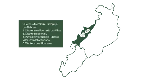
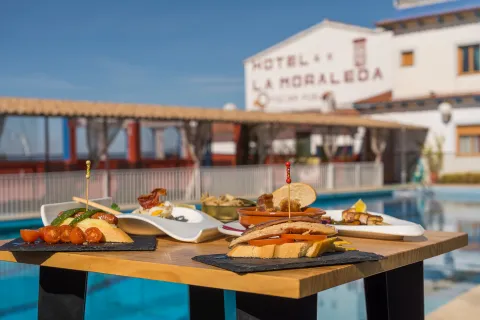
Enjoy your stay with a taste of typical saw tapas in Hotel La Moraleda- Las Delicias Complex.
Duration of experience: Minimum stay of 2 nights.

Price: from 195 €/ stay.

Day 2.

Experience 1.

Visit to the mill with breakfast of typical products in Oleoturismo Puerta de Las Villas.

Duration of experience: 1 and a half hours.

Price: 15 €/ person from 12 years. €8 / children aged 6-11. Free admission for children under 6 years of age.

Experience 2.

Tates the local products of Degusta Jaén in Oleoturism Notaliv Gourmet.

Duration of experience: 1 and a half hours.

Price: 115 €/ person.

Day 3

Experience 1.

Visit Villanueva del Archbishop from the eyes of his most famous characters with the Tourist Information Point of Villanueva del Archbishop.

Duration of experience: 2 and a half hours.

Price: free.

Experience 2.

The flavors of extra virgin olive oil with Oleoteca los Albacares.

Duration of experience: 1 and a half hours.

Price: €7,5 / adult and €5,50 / child

Day 4.

Discover Villanueva's identity through its architecture with the Tourist Information Point of Villanueva del Archbishop.

Duration of experience: 2 and a half hours.

Price: free.

(*) Prices may be subject to change.

GEOLOCALIZATION

Breve descripción

A circuit designed for those who want to immerse themselves in the natural and cultural beauty of the Sierra de Las Villas. Various experiences of oleoturism are offered, where travelers will discover the process of making extra virgin olive oil, a real local treasure. On many occasions you can combine it with the rich gastronomy of the area, which offers local and quality products, highlighting its authentic flavors.

If you prefer to enter the historical heritage of your municipalities you can do so with guided tours that make known your most emblematic traditions and monuments.

A circuit that combines culture, sport and the pleasure of gastronomy, allowing to discover the Sierra de Las Villas in a unique and sustainable way.


Latitud
38.3204
Longitud
-2.6801
Ubicación en el mapa
POINT (-2.6801 38.3204)
imagen
Image
mapas-lasvillas-4-png
Imagen principal
Activado
imagen
Image
dsc08437-1-jpg
Imagen principal
Desactivado
imagen
Image
dsc08042-1-jpg
Imagen principal
Desactivado
imagen
Image
_mg_5197-jpg
Imagen principal
Desactivado

Friends

icon-intereses-amigos

Nature

icon-intereses-naturaleza

Solo travel

icon-intereses-viajar-solo

Gastronomy

icon-intereses-gastronomia

For couples

icon-intereses-en-pareja

Family

icon-intereses-familia

Adventure

icon-intereses-aventura

Culture

icon-intereses-cultura

Sport

icon-intereses-deporte

Municipality

icon-intereses-municipio

Low-cost tourism

icon-intereses-turismo-low-cost

Eco-friendly

icon-intereses-eco-friendly
CIRCUITO 9. EXPLORANDO LA SIERRA DE LAS VILLAS. CULTURA, PATRIMONIO Y GASTRONOMÍA
Desactivado

CIRCUIT 10. EXPLORING THE SIERRA DE LAS VILLAS-NATURALEZA Y AVENTURA

Submitted by brandcode_deweloper on
Id
13413607
Descripción larga

Day 1.

Arrived at the accommodation.

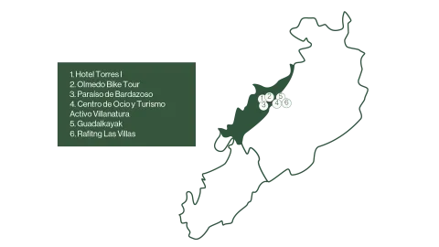
Defeat the liquid gold of Jaén from the hand of the Hotel Torres I.

Duration of experience: Minimum stay of 1 night.

Price: 125 €/ adult.

Day 2.

Discover the Sierra de Las Villas by bike or by taking a route.

Option A.

Explore the Natural Park of the saws of Cazorla, Segura and Las Villas by bicycle with Olmedo Bike Tour.

Duration of experience: 6 to 7 hours.

Price: 50 €/ group.

Option B.

Taste and adventure: Route and tasting gourmet in Paradise of Bardazoso.

Duration of experience: 5 hours.

Price: 50 €/ person.

Option C.

Change of accommodation.

Rural House and Active Tourism and Leisure Center Villanatura. Enjoy a day in a mountain olive grove.

Duration of experience: 5 hours.

Minimum stay of 1 night.

Price: 50 €/ person.

Day 3.

Adventure activities.

Option A.

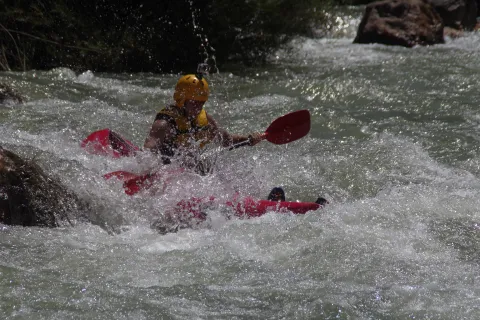
Rafting by the Guadalquivir River with Guadalkayak.

Duration of experience: 1 hour.

Price: adult 40 €/ person and children (under 14 years): 30 €/ person.

Option B.

Kayak waters by the Guadalquivir River with Guadalkayak.

Duration of experience: 3 hours.

Price: 50 €/ person.

Day 4

Initiation to the Via Ferrata El Rayo with Rafting Las Villas.

Duration of experience: 2 and a half hours.

Price: 35 €/ person.

(*) Prices may be subject to change.

GEOLOCALIZATION

Breve descripción

A circuit designed for those who want to immerse themselves in the natural and cultural beauty of the Sierra de Las Villas. Various experiences of oleoturism are offered, where travelers will discover the process of making extra virgin olive oil, a real local treasure. On many occasions you can combine it with the rich gastronomy of the area, which offers local and quality products, highlighting its authentic flavors.

For nature and sport lovers, you can make bike routes or explore the river by practicing kayak or rafting, ideal for enjoying the landscapes of the saw from different perspectives.

A circuit that combines culture, sport and the pleasure of gastronomy, allowing to discover the Sierra de Las Villas in a unique and sustainable way.


Latitud
38.3203
Longitud
-2.6801
Ubicación en el mapa
POINT (-2.6801 38.3203)
imagen
Image
mapas-las-villas-4-1-png
Imagen principal
Activado
imagen
Image
fotos-guadalkayak-1-jpg
Imagen principal
Desactivado
imagen
Image
dsc08567-1-jpg
Imagen principal
Desactivado
imagen
Image
_mg_6928-1-jpg
Imagen principal
Desactivado

Friends

icon-intereses-amigos

Nature

icon-intereses-naturaleza

Solo travel

icon-intereses-viajar-solo

Gastronomy

icon-intereses-gastronomia

For couples

icon-intereses-en-pareja

Family

icon-intereses-familia

Adventure

icon-intereses-aventura

Culture

icon-intereses-cultura

Sport

icon-intereses-deporte

Municipality

icon-intereses-municipio

Low-cost tourism

icon-intereses-turismo-low-cost

Eco-friendly

icon-intereses-eco-friendly
CIRCUITO 10. EXPLORANDO LA SIERRA DE LAS VILLAS-NATURALEZA Y AVENTURA
Desactivado

1. Viewpoints and forest landscapes of the Sierras de Cazorla, Segura and Las Villas Natural Park. A general tour of its forest legacy.

Submitted by brandcode_deweloper on
Id
13767729
Descripción larga

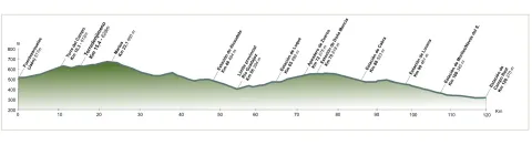
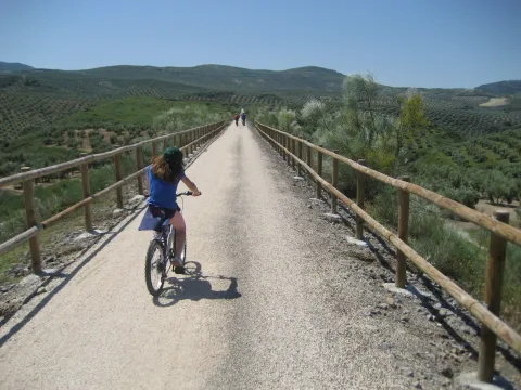
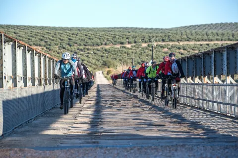
The tour begins at the edge of the city centre of Jaén, next to the municipal sports complex Las Fuentezuelas. The first 2 km, used by hiking and cycling, have several rest areas. From here on, we will cross, on a service road, the north-west circumvalation of Jaén to resume the trail to the town of Torredelcamp. After passing through a new alternative road that saves the A-316 motorway, we arrive at the Torredelcampo station (km. 11,100) located in this urban nucleus.

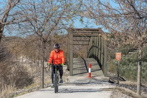
After two tunnels (the first lit 333 meters long), two viaducts and the rest area of the Quebradas, we will reach the nearby town of Torredonjimeno. From Torredonjimeno Station (Km. 1,600) we will continue in the direction of Martos, for which we will have to cross two long metal walkways that allow the crossing with the road A-316. La Via Verde crosses the city centre of Martos and offers the possibility to make interesting visits to the city.

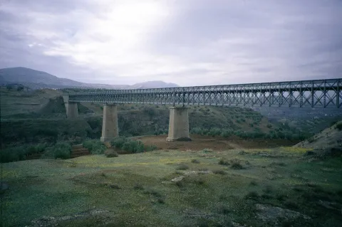
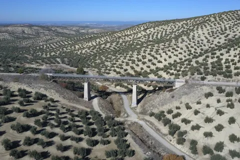
We left Martos, in a southwestern direction, towards the border with the province of Córdoba. New intersections with the national road are resolved by installing a lower step and a new gateway. In Km. 33, coinciding with the proximity of the Salado stream, the landscape changes and becomes more abrupt and serrano, already in the foothills of the Sierra Sur massif. The railway crosses rivers and streams in the middle of impressive ravines, through metal viaducts with lengths between 70 m and 224 m. These complex engineering works, which were designed by the French Alessandre and Delapierre, date back to the end of the 19th century, magnificent examples of oblonted architecture, and which constitute extraordinary views on the rural landscapes of the province of Jaén.

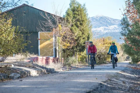
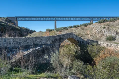
The rest area of the isolated station of Vado-Jaén is located at km 37. The old railway platform continues its course in the direction of the Alcaudete Station, passing the impressive viaduct on the Víboras River (224 m long and 80 m high), the remains of an abandoned balast quarry, called La Muela, and some sections of lush Mediterranean vegetation in which they stand out oak, retama and majajelos, as well as old almonds.

Leaving the Alcaudete station behind, at 48,400 km, we will reach a crossing with the A-316 road, saved by a high gateway.

After passing through the building for the railway houses, the Green Way of Oil connects with the Biking Routes of Sierra Sur de Jaén (signposted), which enter the cycloturist in the heart of the massif of the same name, and runs right next to the Laguna Honda Natural Reserve (Km. 50,500); at this point you can see the abundant and rich avifauna that dwells in this 65 Has. wetland of extension: evil, real anade, squid or small zampullin.

On the right bank of the Green Way, a road leads to another natural space protected from the environment: the Natural Reserve of Laguna del Chinche, of 6.5 Has. of extension and with an interesting perilagunar vegetation. The last miles pass through a very eroded site where deep ravines are frequent, in whose slopes the thyme and the spartum occupy a land, not suitable for the olive tree, which sometimes offer excellent panoramic views of the Vadomojón reservoir. The jiennese part of the Green Way of Oil concludes on the great iron bridge over the Guadaljoz River, right in the tail of the reservoir, 199 m long.

From this point the green track connects with that of the Cordobese Subbetic.

Latitud
38.2167
Longitud
-2.7228
Distrito
Municipio
Ubicación en el mapa
POINT (-2.7228 38.2167)
imagen
Image
foto-4_rncc_2540-jpg
Imagen principal
Activado
imagen
Image
perfil-aceite-fusion-1-jpg
Imagen principal
Activado
imagen
Image
vva-jpg
Imagen principal
Desactivado
imagen
Image
patricia-aybar-en-via-verde-jpg
Imagen principal
Desactivado
imagen
Image
vva-1-jpg
Imagen principal
Desactivado
imagen
Image
vva-2-jpg
Imagen principal
Desactivado
imagen
Image
vva-3-jpg
Imagen principal
Desactivado
imagen
Image
vva-4-jpg
Imagen principal
Desactivado
imagen
Image
vva-5-jpg
Imagen principal
Desactivado
imagen
Image
vva-6-jpg
Imagen principal
Desactivado
imagen
Image
74422248_140452477303677_4407740479924338688_o-jpg
Imagen principal
Desactivado
imagen
Image
vva-7-jpg
Imagen principal
Desactivado
imagen
Image
vva-8-jpg
Imagen principal
Desactivado
imagen
Image
aceite08-jpg
Imagen principal
Desactivado
imagen
Image
aceite10-jpg
Imagen principal
Desactivado
imagen
Image
aceite13-jpg
Imagen principal
Desactivado
imagen
Image
rcc_2082-1-jpg
Imagen principal
Desactivado
imagen
Image
cantera-de-la-muela-1-jpg-1
Imagen principal
Desactivado
7 h 30 min

Friends

icon-intereses-amigos

Nature

icon-intereses-naturaleza

Solo travel

icon-intereses-viajar-solo

Gastronomy

icon-intereses-gastronomia

For couples

icon-intereses-en-pareja

Family

icon-intereses-familia

Adventure

icon-intereses-aventura

Culture

icon-intereses-cultura

Sport

icon-intereses-deporte

Municipality

icon-intereses-municipio

Low-cost tourism

icon-intereses-turismo-low-cost

Eco-friendly

icon-intereses-eco-friendly
Baja
Document
Image
fc880c76-e19a-7c1e-4cfb-785b4441a694?t=1604415740731
1. Miradores y paisajes forestales del Parque Natural Sierras de Cazorla, Segura y las Villas. Un recorrido general por su legado forestal.
115 km
892m
All year round
Desactivado
Image
perfil-aceite-fusion-1-jpg

6, from Jaén (The Fuentezuelas' polysports complex) and from each of the five stations.

Users: cyclists, walkers and wheelchair people.

Regardless of the way you decide to travel this route, it is recommended to use comfortable clothes and footwear and adapted to the time of the year. Although it is not convenient to do so in the middle of summer due to the heat. You must not forget to wear enough water and, if you go on a bike, it is always recommended to wear a helmet.

For more information visit:http: / / www.viasverdes.com

Cultural heritage: Monumental set of Jaén. The medieval castle of Alcaudete. Medieval Bridge of the Vipers. Archaeological route of the Torreones. Urban assemblies of Luque, Zuheros, Doña Mencía, Cabra and Lucena. Cueva de los Murcielagos en Zuheros.
Ramal a Baena: Urban complex of Luque and Baena, archaeological park of Torreparedones, the Historical and Archaeological Museum of Baena, church of the ancient Convent of the Agustinos Descalzo in Luque.

The starting point is located in the village of Vadillo-Castril. The latter is followed by the A-319 road that links the towns of Peal de Becerro and Hornos de Segura. We must take the detour located at the kilometer 31.7 and continue for 5 km by the JF-7091 until the entrance detour to Vadillo-Castril and the Training and Forest Experiment Centre.

The route has been broken down in stages, assuming that it will be of interest to cycloturists, although it could be carried out by car as it travels on roads open to traffic.

  1. Km 115 - Sequero de Siles.

Coordinates 38.39197, -2,58255

Siles is a village of 2200 inhabitants located on the north end of the Natural Park. There is an old artificial pineapple sequero, which has been musealized and transformed into the current Centre for Interpretation and Reception of Visitors of the Sierra de Segura. It is located in the street Carretera de Hellín no. 21, and has several exhibition spaces that report on the natural values of the Sierra de Segura, the history of the human population in the territory, the serrano trades and, in an outstanding way, on the sequero itself, from which the original machinery is preserved.

Tramo de asfalto o cemento
97.39%
Tramo de pista o camino forestal
2.61%
Tramo de vía pecuaria
0
Tramo de senda
0

Route Viaje al Tiempo de los Íberos

Submitted by brandcode_deweloper on
Id
9356905
Breve descripción

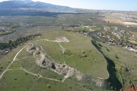
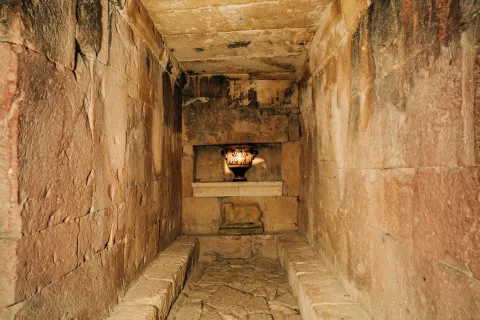
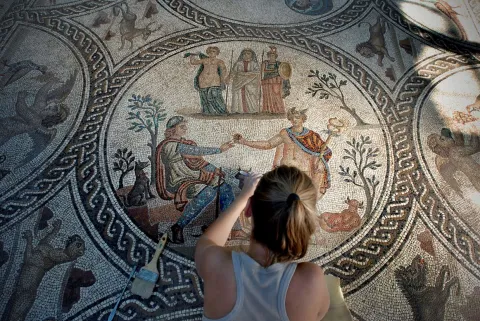
The archaeological heritage that left the culture of the Iberos in Jaén is unique in the world, both for its uniqueness and for its variety. The development of this culture between the 6th century BC and the 1st century BC, has left in the province more than 545 invented sites, among which are the most important
fortified cities of Catulo and Puente Tablas, funeral chambers such as Toya, and ethnic shrines such as the Cave of the Dolls or the Lobera.

The archaeological heritage that left the culture of the Iberos in Jaén is unique in the world, both for its uniqueness and for its variety.

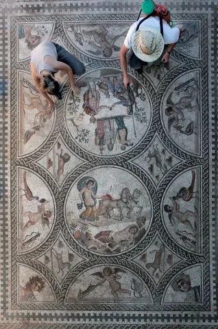
The great journey we propose to the time of the Iberos is a great project of the Diputación de Jaén coordinated with the various municipalities, and is currently in full development. The visitor can contemplate one of the largest sculptural assemblies of the Ibera Statuary in stone: that of Cerillo Blanco de Porcra and that of the Heroic Sanctuary of the Pajarillo of Huelma, exposed at the Provincial Museum of Jaén. In the Archaeological Museum of Linares we can visit the history of Catulo, one of the most important cities of ancient times, and in the Museum of Castellar an impressive collection of Iberian exvotes is presented. All this together with the new projects that are currently being implemented and have new
museum spaces and the value of archaeological sites such as the White Crow in Porcilla.

Journey to the time of the Iberians

Municipio
imagen
Image
Guerrero%20%C3%ADbero%20%281%29%20%281%29.jpg
Imagen principal
Activado
imagen
Image
puente%20tablas%20a%C3%A9rea%20%281%29.jpg
Imagen principal
Desactivado
imagen
Image
C%C3%A1mara%20de%20Toya.%20Peal%20de%20Becerro.%20Viaje%20al%20Tiempo%20de%20los%20%C3%8Dberos.jpg
Imagen principal
Desactivado
imagen
Image
Limpieza%20mosaico%20de%20los%20Amores%204%20%281%29.jpg
Imagen principal
Desactivado
imagen
Image
Limpieza%20mosaico%20de%20los%20Amores%205%20%281%29.jpg
Imagen principal
Desactivado
imagen
Image
c%C3%A1stulo.jpeg
Imagen principal
Desactivado
imagen
Image
IMG_2037%20giribaile%20%281%29.jpg
Imagen principal
Desactivado

Seniors

icon-intereses-senior

Friends

icon-intereses-amigos

Culture of the Bull

icon-intereses-cultura-del-toro

Nature

icon-intereses-naturaleza

Solo travel

icon-intereses-viajar-solo

Gastronomy

icon-intereses-gastronomia

For couples

icon-intereses-en-pareja

Business

icon-intereses-negocios

Family

icon-intereses-familia

Culture

icon-intereses-cultura

Adventure

icon-intereses-aventura

Sport

icon-intereses-deporte

Low-cost tourism

icon-intereses-turismo-low-cost

Eco-friendly

icon-intereses-eco-friendly
All year round
Desactivado

Route del río Cerezuelo

Submitted by brandcode_deweloper on
Id
9271092
Descripción larga

Shortly after the fifth bridge, it is recommended to continue to the left, where it is already incorporated into a wider road, right next to a rural house called "Nace el Río." If you go ahead, there are two ways to return, or on a road to the left that goes down to the same point of departure, or you can follow the right by a road called "Paseo del Solar," which when you reach the village allows you to go down to the Plaza de Santa María again.

The first option would be about an hour, the second option would be half an hour more, but it is worth the beautiful views we have from the viewpoints. Both routes are very simple so they are perfect for those trails who want to go for a walk or families with children. But they are also ideal to discover the most beautiful corners of the area without making an intense effort, being able to enjoy the road to the maximum.

Breve descripción

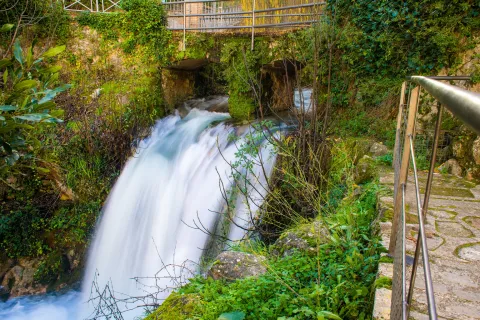
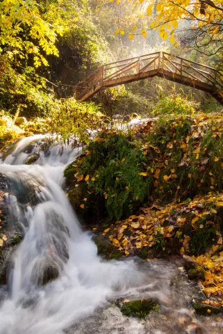
In the direction of the Castle of the Yedra we run into a small square where to the right it is moving towards the Castle, and to the left it is already marked the beginning of this circular route, which will enter into a space closed by large chopos that, in combination with the crystal waters of the river forming pozas, will make our journey an unparalleled environment to enjoy nature. Using the various wooden bridges, you can cross the river to continue this magnificent expedition.

Latitud
37.9143
Longitud
-3.0072
Municipio
Ubicación en el mapa
POINT (-3.0072 37.9143)
imagen
Image
Cascada%20r%C3%ADo%20Cerezuelo.jpg
Imagen principal
Activado
imagen
Image
Ruta%20r%C3%ADo%20Cerezuelo.jpg
Imagen principal
Desactivado
1 h

Nature

icon-intereses-naturaleza

Friends

icon-intereses-amigos

Adventure

icon-intereses-aventura

Sport

icon-intereses-deporte

Eco-friendly

icon-intereses-eco-friendly

For couples

icon-intereses-en-pareja

Family

icon-intereses-familia

Municipality

icon-intereses-municipio

Low-cost tourism

icon-intereses-turismo-low-cost

Solo travel

icon-intereses-viajar-solo
Baja
Ruta del río Cerezuelo
2,4 km
All year round
Desactivado

Wear adequate clothing and footwear.

About 200 m behind the ruins of Santa Maria.

Tramo de asfalto o cemento
 
Tramo de pista o camino forestal
 
Tramo de vía pecuaria
 
Tramo de senda