Route Félix Rodríguez de la Fuente



Description
We cannot talk about the Natural Park Sierras de Cazorla, Segura and Las Villas without the extraordinary figure of Professor Felix Rodríguez de la Fuente coming to our attention. Since 2001, the year when this tour was arranged under the advice of the well-known naturalist and writer Joaquín Araujo, the Félix Rodríguez de la Fuente Route has become a reference to reflect the best moments in the TV series "Man and Earth." In 2011, thirty years after the death of Professor Rodríguez de la Fuente in an unfortunate accident, the RFRF has been renewed with new interpretative panels and pointed elements to be visited, without losing detail, in total symbiosis with nature.
Is part of
Datos de la ruta
ROUTE NAME
Ruta Félix Rodríguez de la Fuente
TRAIL TYPE
--
DIFFICULTY
Baja
TOTAL DISTANCE (IN KILOMETERS) 18 km
-
Stretch of asphalt or concrete: --
-
Section of track, forest road, or dry watercourse: --
-
Trail section: --
-
Sections of livestock trails: --
HUSO 30S
ESTIMATED TRAVEL TIME
2 h en vehículo turismo
ROAD SURFACE TYPE
Forest track
--
--
DIFFICULTY. RATING ACCORDING TO THE MIDE METHOD
--
MEANS
Severity of the natural environment
--
ITINERARY
Route guidance
--
DISPLACEMENT
Difficulty moving about
--
EFFORT
Amount of effort required
ACCESSIBILITY TYPE
TIME OF YEAR
All year round
SIGNALING
No
MORE INFORMATION
TUNNELS
STEEL VIADUCTS
METAL WALKWAYS
WATER POINTS
PONTOONS
GUARD BOOTHS AND BARRIERS
SWITCHMAN'S CABINS
CYCLABILITY
RECREATIONAL OR SPORTS AREAS NEAR THE TRAIL
Source in the Cortijo de las Animas.
AID STATIONS
LINKS TO OTHER TRAILS
SHELTERS
RECOMMENDATIONS
It is advised to remain silent on the forest track to observe wild fauna in its natural habitat.
Forest track crossing restriction: from 18: 00 (winter) and 21: 00 (summer).
OTHER INFORMATION OF INTEREST (ARCHITECTURAL OR HISTORICAL-CULTURAL, GEOLOGICAL-ECOLOGICAL)
The RFRF has five perfectly-equipped viewpoints with interpretative panels of the territory, as well as a natural balcony, which allow a better understanding of the landscape and biological values of the Natural Park Sierras de Cazorla, Segura and Las Villas.
Félix Rodríguez de La Fuente
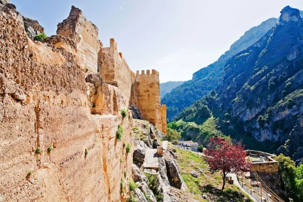
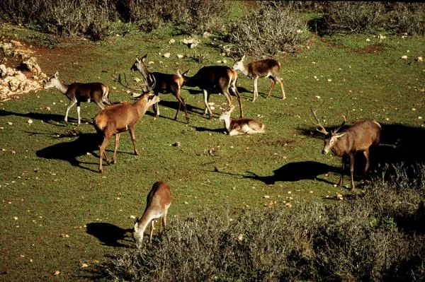
It is located at 60,500 km of the A-319 autonomous road and offers a beautiful panoramic part of the Sierra de las Banderillas and its 1,993-metre summit, the Tranco reservoir and the small island of Bujaraiza, with the remains of its castle of Muslim origin. At this point, the Man and Earth shooting team filmed the most enchanting scenes of the deer's berrhea in heat.
Mirador Castillo de Bujaraiza
It is located within the Park of Fauna Silvestre, almost two kilometres from the start of the route. It is one of a vestige of the past, when the waters of the reservoir did not flood the fertile vegas of Guadalquivir.
Mirador de las Animas
A few meters from the previous lookout is that of the Animas, which offers spectacular views of the slopes of Piedras Brunas with its characteristic fully vertical flashlights.
Mirabuene Viewer
From here there is a spectacular view of the Guadalquivir before arriving at the reservoir. In addition, we will be able to see, hopefully, the majestic flights of lethargy vultures and some other road eagle.
Natural balcony of Collado del Almond
On the banks of the Tranco reservoir, at the height of kilometer 13.8, we have a unique opportunity to get a panoramic view from the outside of Fauna Silvestre Park. A mile later, it is located in Cortijo de las Animas, where there is a spring water source.
Mirador de Cabeza de la Viña
The huge island ofHead of the vineyardwith its more than a thousand hectares of extension, it seems to be from the waters of the reservoir. This enclave, located at the end of the RFRF, is ideal for the observation of the park's aquatic fauna.
Technical Description
The itinerary, which runs along 18 km (every thousand metres) by means of identification. It begins at the Félix lookout, located at the foot of the road of the Tranco A-319, continuing for it towards Arroyo Frio until the intersection with the track leading to the campsiteLlanos de Aranceand that goes along, first, the right bank of the Guadalquivir River and then the tail of the Tranco reservoir. The first half of the route, along the asphalt road, passes through an interesting forest of coniferous: black pines and carrasco, complaints, oaks..., mixed with alffas, strawberries and willows of the river of Guadalquivir, and includes the required visit to the Park of Fauna SilvestreAlmond Necklace. Large mammals, such as deer, mountain goats, muflons and wos, live in semi-freedom this part of the Natural Park
From kilometer 8, past the bridge of the Golondrinas over the Guadalquivir, we travel through a forest track that crosses streams under the refreshing shade of chopos, strawberries and willows, with intrusions of Mediterranean forest, where it will be nothing difficult to meet with deer, boars, squirrels, etc.
We recommend