Saltar al contenido principal

Úbeda RV Parking Area

Submitted by brandcode_deweloper on
Id
11767010
Redes sociales
Facebook
https://www.facebook.com/ubeda.turismo
Descripción
Breve descripción

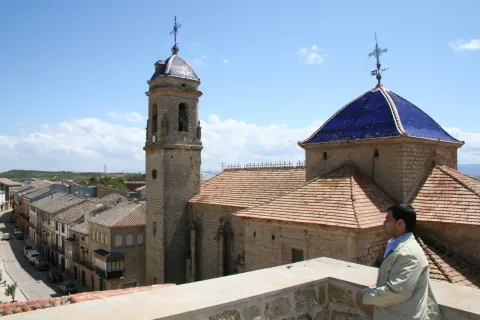
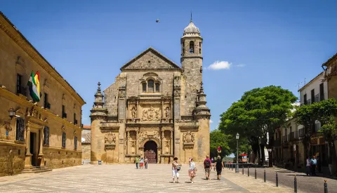
The city (World Heritage) has 48 notable monuments and over a hundred buildings of interest (Renaissance, Arab, Baroque and Gothic). Very important your Holy Week. A must visit to the Museum of the pottery and the Centre for the interpretation of the olive and oil.
Información de contacto
Teléfono
953 779 204
Sitio web
www.turismodeubeda.com
Correo electrónico
promocion@ubeda.es
Ubicación
Código Postal
23400
Latitud
38.006390
Longitud
-3.379440
Dirección
Travesía del Comendador Messía, s/n
Municipio
Ubicación en el mapa
POINT (-3.37944 38.00639)
Tipo de alojamiento
Imágenes
imagen
Image
visita-ubeda-baeza-individuales.jpg
Imagen principal
Activado
Horario
24 h
Qué ofrece

Ubeda has a beautiful monumental and cultural heritage that makes it a fundamental destination for those interested in the Renaissance architecture.

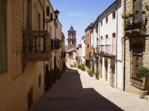
From its heritage we will highlight the excellent degree of conservation of many of its buildings, which still keep details of the time as can be the doors of claveted wood, the iron aldabas, the lanterns and the bars.

Loading map
Preparing points of interest and routes...
El Hotel

Free parking. Maximum stay, 48 hours. It is not allowed to remove chairs, tables, or other camping elements. All services and the historic centre are about 800 m away.

Number of places: 10 places.

Maximum permanence:Two nights.

Services included:

  • Empty of grey water

  • emptying of black water

  • Water filling
Vitores Apartments

Submitted by brandcode_deweloper on
Id
10614971
Redes sociales
Facebook
https://www.facebook.com/Vitores-Apartamentos-Turisticos-%C3%9Abeda-625390631190863/
Instagram
https://www.instagram.com/vitoresubeda/
Descripción
Breve descripción

The Vítores Apartments are located in the heart of the historic city heritage of the humanity of Ubeda. Just a few steps away from the main tourist points of interest of the Renaissance city, such as La Sacra Capilla del Salvador, Plaza Vázquez de Molina or the emblematic Church of San Pablo.

Información de contacto
Teléfono
633 428 961
Sitio web
https://www.vitoresapartamentos.com/
Correo electrónico
vitoresubeda@gmail.com
Ubicación
Código Postal
23400
Latitud
38.008466
Longitud
-3.367803
Dirección
C/ Juan Ruíz González, 22
Municipio
Ubicación en el mapa
POINT (-3.367803 38.008466)
Tipo de alojamiento
Imágenes
imagen
Image
vitores%206.jpg
Imagen principal
Activado
imagen
Image
vitores%207.jpg
Imagen principal
Desactivado
imagen
Image
vitores%208.jpg
Imagen principal
Desactivado
Idiomas
Las habitaciones

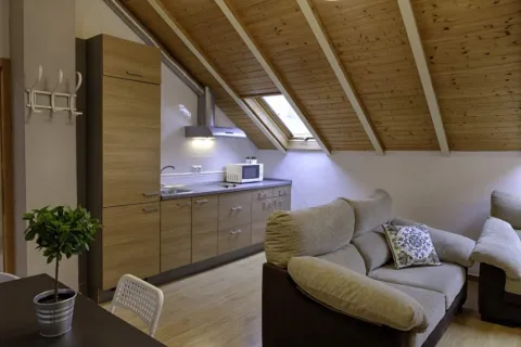
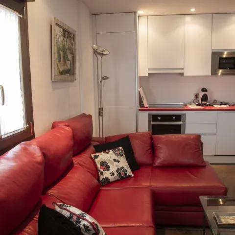
The accommodation has air conditioning, fully equipped kitchen with dining area, flat-screen TV and private bathroom with shower, hairdryer and free toiletries. There is also a microwave, fridge and stove, as well as coffee maker and kettle.
Loading map
Preparing points of interest and routes...
El Hotel

Our apartments are in a privileged area to visit the center of the Ubeda, without giving up a quiet rest. We are in the center of an oasis of Renaissance palaces, church stories with its time bells, between a sea of olive trees with infinite viewpoints,... Ubeda in love and her stay in our apartments will make your visit a unique moment full of sensations.

Palacio Sirvente de Mieres Apartments

Submitted by brandcode_deweloper on
Id
2638401
Descripción
Breve descripción

The Sirente Mieres Palace is a restored 18th-century building in the historic centre of Andújar. It is just 10 metres from the church of Santa María and offers 3 air-conditioned apartments.

Información de contacto
Teléfono
616 935 401
Sitio web
www.palaciosirventedemieres.com
Ubicación
Código Postal
23740
Latitud
38.037035
Longitud
-4.056028
Dirección
C/ Altozano Serrano Plato, 4
Distrito
Municipio
Ubicación en el mapa
POINT (-4.056028 38.037035)
Tipo de alojamiento
Imágenes
imagen
Image
Palacio_Sirvente_de_Mieres.jpg
Imagen principal
Activado
imagen
Image
4.jpg
Imagen principal
Desactivado
imagen
Image
3.jpg
Imagen principal
Desactivado
imagen
Image
5%20%281%29.jpg
Imagen principal
Desactivado
Las habitaciones

2 keys

Loading map
Preparing points of interest and routes...
El Hotel

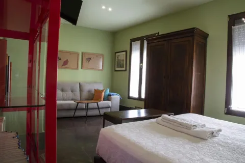
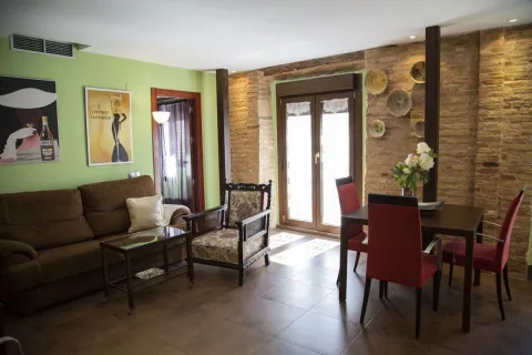
The apartments of the Sirente Mieres Palace have a colorful decoration and have a living area, dining area and open-floor kitchen. They are also equipped with washing machines, dryer and bathroom with shower.

The accommodation is a 5-minute drive from the Sierra de Andújar natural park, a 30-minute drive from the Virgin of the Cabeza shrine and a 1-hour drive from Córdoba airport.

Cortijo Peñardera Apartment

Submitted by brandcode_deweloper on
Id
10614116
Redes sociales
Facebook
https://es-la.facebook.com/Cortijopenardera/
Instagram
https://www.instagram.com/penardera/
Descripción
Breve descripción

It connects with the authenticity of nature, let yourself be hypnotized by the rumor of water and disconnect to reconnect. Cortijo Peñardera is an old Cortijo Jienense surrounded by olive trees converted into a Nature Accommodation composed of ten unique and fully updated apartments.

Peñardera will allow you to enjoy the privileged environment in which we are. In the heart of the natural park of Cazorla, Segura and the Villas you can escape from the noise and learn to value the silence without leaving any kind of luxury behind.

Información de contacto
Teléfono
686 959 863
Sitio web
www.cortijopenardera.com/
Teléfono de contacto
686 959 863
Correo electrónico
info@cortijopenardera.com
Ubicación
Código Postal
23380
Latitud
38.381781
Longitud
-2.592550
Dirección
Ctra. de Puente Honda
Distrito
Municipio
Cómo llegar (URL de Google Maps)
https://www.google.com/maps/embed?pb=!1m18!1m12!1m3!1d3127.596810250139!2d-2.5950652238265013!3d38.381447676982!2m3!1f0!2f0!3f0!3m2!1i1024!2i768!4f13.1!3m3!1m2!1s0xd6f5da8a57d98b7%3A0xb0838fae3e60edc9!2sApartamentos%20Cortijo%20Pe%C3%B1ardera%20-%20Tu%20refugio%20de%20Monta%C3%B1a!5e0!3m2!1ses!2ses!4v1742833766664!5m2!1ses!2ses" width="600" height="450" style="border:0;" allowfullscreen="" loading="lazy" referrerpolicy="no-referrer-when-downgrade"
Ubicación en el mapa
POINT (-2.59255 38.381781)
Tipo de alojamiento
Imágenes
imagen
Image
cortijo%20pe%C3%B1ardera.jpg
Imagen principal
Activado
imagen
Image
cortijo%20pe%C3%B1ardera%204.jpg
Imagen principal
Desactivado
Idiomas
Las habitaciones

The apartments have a large living room and a clear kitchen to enjoy long conversations while preparing a tasty dinner. They are distributed in two bedrooms and a private bathroom. It also has a comfortable Italian-type sofa bed where you will rest better than at home.

Loading map
Preparing points of interest and routes...
El Hotel

Cortijo Peñardera is born of our family's commitment to stay close to our roots. After a complete remodeling, we have succeeded in modernizing all our facilities, always trying to respect their own Essence. Cortijo Peñardera is for us a return to the origins.

We ourselves form the team of professionals who will try to bring you the luxury of simple rural life. By accompanying you during your stay, you will find a young, fresh, energy-filled team, conscious of the environment around you and committed to society. We love nature, that's why we live as close to her and take care of her as anyone takes care of her house. In addition, we love animals and that is why we openly declare ourselves a petfriendly and sustainable accommodation.

Albergue El Hornico Hostel

Submitted by brandcode_deweloper on
Id
2162143
Descripción
Breve descripción

The hostel El Hornico is located in the middle of the mountain within the Natural Park Sierras de Cazorla, Segura and Las Villas. They are located 10 Km from Pozo Alcón, in Jaén Province.

Antigua Casa Forestal rehabilitated and owned by the Consejeria de Medio Ambiente has facilities that are perfectly adapted to accommodate groups and develop Environmental Education Programs, as well as activities of Active Tourism for both its infrastructure and its location.

Información de contacto
Teléfono
667 227 275
Sitio web
www.aventurocio.com
Correo electrónico
info@aventurocio.com
Ubicación
Código Postal
23485
Latitud
37.774551
Longitud
-2.923538
Dirección
Pantano de la Bolera, s/n
Municipio
Ubicación en el mapa
POINT (-2.923538 37.774551)
Tipo de alojamiento
Imágenes
imagen
Image
el-hornico.png
Imagen principal
Activado
imagen
Image
habitaciones-hornico.jpeg
Imagen principal
Desactivado
imagen
Image
albergue%20%281%29.jpg
Imagen principal
Desactivado
imagen
Image
el-hornico.jpeg
Imagen principal
Desactivado
imagen
Image
turismo%20%281%29.png
Imagen principal
Desactivado
Aforo
48
Las habitaciones

2 rooms with 6 places with bunk beds, with 2 double for disabled. All with spring mattresses, protective and wardrobe for clothes and luggage. They also have sheets and blankets. All rooms have a bathroom with service, sink and shower.

Loading map
Preparing points of interest and routes...
El Hotel

It has two facilities: an old rehabilitated forest house located next to a Botanical Garden and a newly built Training Center located next to the Pantano de la Bolera, one of the most beautiful areas of Andalusia.

Santa Elena

Submitted by brandcode_deweloper on
Id
750455
Perfil de redes sociales
Facebook
https://www.facebook.com/AyuntSantaElena/
Twitter
https://twitter.com/santaelenajaen
Youtube
https://www.youtube.com/user/santaelenajaen
Descripción
Breve descripción

Nice town, located in the northernmost area of the Sierra Morena regionnext to the provincial border with Ciudad Real.

The northern part of its term is found within the Natural Park of Despeñapores and its geographical position makes it the greatest point of passage between Andalusia and the plateau so it receives the nickname "Puerta de Andalucía. "

It is one of the few municipalities with little agricultural interest, only 1% of its term is cultivated land.

Its economy is based mainly on the exploitation of the mountain, among which the forest, cynegetic, mushroom collection and livestock, usually cattle. The passage of the motorway of Andalusia has developed a relevant hotel offer.

It has two nests: Miranda del Rey and Venta Nueva.

From its historical heritage we highlight the St. Helena Parish Church, Iberian Shrine of the Collado de los Jardines, Urban Helmets and Rupestrian Paints in St. Helena.

Telecomunicaciones
Teléfono
953 664 010
Sitio web
www.santaelena.es
Fax
953 664 253
Correo electrónico
santaelenajaen@gmail.com
Ubicación
Nombre
Santa Elena
Latitud
38.340230
Longitud
-3.539800
Distrito
Municipio
Ubicación en el mapa
POINT (-3.5398 38.34023)
Imágenes
imagen
Image
56f3a98d-b73d-3f55-8527-4d32fc56ae8f?t=1621425534983
Imagen principal
Desactivado
imagen
Image
e0fb7c79-3e7f-346a-cc16-3c8006bb9462?t=1610986998582
Imagen principal
Desactivado
imagen
Image
3429e098-1c49-2cdf-4ef5-179be64fce14?t=1621425535119
Imagen principal
Desactivado
imagen
Image
4e91cd6e-bea0-d427-df82-939c7ce7f23c?t=1621425535162
Imagen principal
Desactivado
imagen
Image
10c50cba-ee4b-ebcf-0e3e-0d11e8e97728?t=1621425535219
Imagen principal
Desactivado
imagen
Image
0c44f832-9d15-336d-b8e7-72044fea6e76?t=1610986998629
Imagen principal
Desactivado
imagen
Image
b5682c3b-4bf3-f730-fe45-52d0391f170c?t=1621425535421
Imagen principal
Desactivado
imagen
Image
78ede978-44df-d8c2-c363-f10c79bea024?t=1621425535584
Imagen principal
Desactivado
Información adicional
Curiosidades

OFICINAS DE INFORMACIÓN Centro de Visitantes LLANO DE LAS AMÉRICAS

  • Autovía A4, salida 257. Ctra. Miranda del Rey, Km. 2   
  • (Abierto de jueves a domingo)
  • Tfno.: 610 282 531
  • Email: puertanatura@hotmail.com
Imágenes cabecera
imagen
Image
Santa Elena
Imagen principal
Desactivado
Datos de interés

Tourist area: Sierra Morena / Despeñacolos

Distance to the capital (km): 78

Altitude over sea level (m): 742

Extension (Km2): 144

Number of inhabitants: 1,003

Gentilicon: Santaeleneros

Postal code: 23213

Videos
Video file
Cultura
  • St. Helena Parish Church: It was erected in 1793 on an ancient medieval hermitage, which had been raised to commemorate the Christian victory in the battle of the Navas de Tolosa, which had these sites on stage and to guard the Cross to which the miracle was attributed. Built of redesigned and painted masonry, with a simple facade, of small dimensions. A staircase stands out the access door, composed of a half-point arch on imposts, flanked by Tuscan pillars that give way to an inlet finished with triangular fronton and two bones, one on each side. On the top of the first body, the pyramidal structure is raised to three levels, with pinacles at the ends and half-point holes for bells. Inside it is a single drawer ship, covered with a half-canyon vault and double lunetes on the sides. The presbyterium is opened with a spinal arch, covered with an arista vault and illuminated with two large bone-shaped windows. The header is presided over by the image of its patron saint, St. Helena, between dogrous columns that support an injunction and a curved fronton. It was remodeled in 2001.
  • Iberian Shrine of the Collado de los Jardines: It is located in the heart of Sierra Morena Oriental, on the most important traditional road of communication between Alta Andalucía and the Plateau. For the Iberian shrines they chose places, usually caves, located next to springs and forests, where it was thought that the divinity lived and where the faithful went to worship, pray and deliver offerings to their divinities. These offerings were what we know as "exvotes," small statues, between eight and twenty cm, made of bronze, stone or mud. In Iberian Shrine of the Collado de los Jardines There have been many exvotes, most of them bronze, representing men and women offering, priests, warriors and objects. It is part of the whole town that was excavated on the hill adjacent to the castle, where a wall, a sacred enclosure and a cast of metal exvotes have appeared. We meet before one of the three great Iberian shrines of the peninsula.
  • St. Helena's Urban Helmets:Given its geographical location, a forced passage between the plateau and Andalusia, has experienced many historical events. The Battle of the Navas de Tolosa in 1212 in which King Alfonso VIII of Castile defeated the Almohades. To commemorate this battle, a hermitage was erected in honor of the Empress St. Helena, who would later name this place and the new population, which King Charles III founded in 1767. In the colonizing urbanism of Sierra Morena, the most important element is the large rectangular square, from which they leave streets on each side and where are the important buildings, such as the Church, the City Hall and the posite of Diezmos and Labradores. The rest of the town is organized from the Plaza. The streets are dominated by axial perspectives, houses of the same height and proportions, reticular fabric and geometric structure. It only deviates from the neoclassical model on its perimeter, to adapt to the road. It has been declared Good for Cultural Interest.

  • Rupestrian Paints: The province of Jaén has more than forty points with rock paintings, declared World Heritage Sitewithin the whole Mediterranean arc. Some of them are found in St. Helena with exceptional testimonies of schematic and seminaturalist paintings, located in coats of the area, including those of the Cave of the Cows of the Retamoso in the area of the bodies, Cave of the Holy, the Cave of the Schools and some more.
  • Mining Heritage. The landscape of ancient mines and Mediterranean mountains of the former Minero District extends to eight municipalities: Linares, La Carolina, Bailén, Baños de la Encina, Vilches, Guarroman, Santa Elena and Carboneros. This mining activity has left in these municipalities an exceptional concentration of remains, unique vestiges in the world and representative of the industrial revolution in the 19th century.
Naturaleza

St. Helena is located in the northernmost sector of the northern region, next to the border with the province of Ciudad Real.

It is of the few municipalities of the province without agricultural vocation, only 1% of the total area. So its economy is based on development of the mountainincluding forest, cicnetic, mushroom collection and livestock (cattle).

The passage of the highway of Andalusia through the municipality has developed in the town a certain hotel offer of importance.

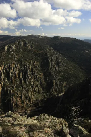
By its term the rivers run Caraway and Bell.The northern part of the municipality of St. Helena belongs to the Natural Park of Despeñacolos, of great landscape, faunistic and botanical interest.

The Park includes, among others:

  • Place of the bodies, declared a Natural Monument of Andalusia. A place where a set of huge rock columns that resemble the tubes of the organ of a cathedral. Increases the beauty of this place the chromatic contrast of the grey of the coas with the intense yellow and orange of the different species of lichens that survive in them. On these rocks, oaks, alcornoques and shrubs form a Mediterranean forest in which they inhabit ginets, chickpeas and numerous rapacious birds.
  • Embryo de los Organos: It is an affront place that was inhabited from very old, as shown by the rock paintings found. From here we can discover the pineapples of repopulation (carrascos, black, pineapples), sodas of alcornoques, complaints, oaks and madroños.
  • The Empedraillo: These are the interesting remains of a small section of the Roman road that unites Catulo (Linares) and the Galena mines of El Centenillo with Toledo.
  • Quejigal del Collado de los Jardines: Also located in the Natural Park of Despeñacolos, its biodiversity stands out. In the plant species we find complaints, alcornoques, maples and other species typical of the Mediterranean forest. With regard to the faunistic species that inhabit this place quote the wolf, lince, the otter, imperial eagle, royal eagle and azor.

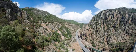
If anything characterizes Despeñacolos are their unique geological formations. The Despeñapoerno de Despeñaperes, with 4 km of extension is the product of the erosion of the stream of the same name on a natural failure of the Iberian Macizo and the main means of communication between Castilla La Mancha and the lower lands of the Guadalquivir valley.

Fiestas y Eventos
  • Sunday of Resurrection: From the Central European settlers who came in the 18th century, only the tradition of painting cooked eggs, which are eaten in the area of La Aliseda, is left. Before you have to meet the rite of making them roll by a earring of grass so they don't break. This has meant that, in St. Helena, the feast of this very well-known day is known as Rolaeggs.
  • Romeria de San Isidro: On May 15, the neighbors of St. Helena accompanied San Isidro, in gilded carrots for that party until the site of The Aliseda. In this place, of incomparable beauty, a mass is held in honor of the Holy and a whole day of field is spent.
  • Patron parties: In honor of their patron saint St. Helena, parties are held between 17 and 21 August. During all these days there are many and varied leisure and sports activities. On the 17th, with the traditional repeat of bells, the beginning of the parties is announced and the three rocket warnings indicate the beginning of the cobblestones in the streets of the town. In the afternoon, taurino show. We arrived at 18 August, big day. In the morning Mass in honor of the Holy and invitation to all attendees in one of the houses. At night, the most important event of the whole fair that is the procession of the Patronthat accompanied by a music band runs through the streets of the village. On the 20th and 21st days, the morning and evening cobwebs and taurino festival return. The fair ends with a powerful haze on the 21st of the morning.
Gastronomía

St. Helena for its location in Sierra Morena is a very suitable place to take mountain meat, either from major game (deer, boar or gamo) or from small game (perdiz, rabbit or hare).

  • Andrajos: Made with a mass of flour (andrajo) that is cooked in a broth of hare meat with a saffrito of peppers and tomatoes flavoured with mint.
  • Pipirrana: Salad made from roasted peppers, olives, cooked eggs, tuna and olive oil.
  • Sage in salsa: It is made with deer meat, onion, tomato, flour, water, thyme, rosemary, peppers, olive oil and almonds.
  • Niselos al ajillo: Niscalos, olive oil, ham, garlic, parsley white wine and salt.
  • Tortilla Alfonso XIII: Made of eggs, ham, lamb kidneys, mushrooms, salt, fried tomato and olive oil.

Warehouse:

  • Sweet Gachas: With toast, hot milk or boiler honey, flour, sugar, cinnamon powder olive oil. They are preparing for the feast of All Saints.
  • Pestiños: They are made with olive oil, wine, dry spirits, sugar, cinnamon and flour.
  • Lis flower: Eggs, flour, milk, sugar and olive oil, salt and cinnamon or melted honey for irrigation.
  • Risol: A drink made with sweet anis, coffee, mejana and water.
Historia

The area has been occupied from prehistoric periodAs shown by the rock paintings located in the area's coats, with more than five thousand years old and declared a World Heritage Site in 1998.

In time of the Iberiansin the term of St. Helena was one of the most important centres of worship: Shrine of the Collado de los Jardineswhere many Iberian exvotes and the remains of what could have been a village have been located, not only in Iberian times but also in Roman and medieval times. The sanctuary also known as Cave of the Dolls has been used by the Romans for religious worship.

In the Age of Mediathe most important event is the Battle of the Navas de Tolosain 1212. The town is very close to it, in the vicinity is the Museum of the Battle de las Navas de Tolosa. The Almohade army was defeated and King Alfonso VIII of Castilla, ordered to build in the place a hermitage to guard the Cross to which they attributed the miracle of victory and a window-castle, to commemorate the triumph over the Almohades and that currently It is part of the Route of the Castles and the Battle.

In this same place in the 18th century, one of the New populations of Sierra Morena, project driven by the King Charles III. One of these populations is St. Helena. With the settlers, farmers from Centroeuropa (French, German and Flemish), efforts were made to establish a population and generate wealth in the depopulated areas of Sierra Morena while ensuring the passage of Despeñacolos.

In 1793, the population was in a ruinous state and it was King Charles IV who ordered it to demolish and build a new colonial type..

Otra información

It has recently been built in the municipal term, the Museum of the Battle of the Navas de Tolosa. The museum is one of the most interesting points on the route of the Castles and the Battle and is the starting point for the seventeen municipalities that make up this tourist product. Very close is the Iberian Sanctuary of La Cueva de los Muñecos and The "Llano de las Américas" Interpretation Center.

Loading map
Preparing points of interest and routes...
Imagen principal
imagen
Image
Santa Elena
Imagen principal
Activado

Castellar

Submitted by brandcode_deweloper on
Id
727183
Perfil de redes sociales
Facebook
https://www.facebook.com/excmo.ayto.castellar
Twitter
https://twitter.com/aytocastellar
Instagram
https://www.instagram.com/ayto.castellar/
Descripción
Breve descripción

Castellar is a municipality in the north-eastern part of the province of Jaén. It is located in the central part of the district of El Condado, between the mountain ranges of La Loma and Sierra Morena.

The crops occupy more than half of their municipal term and are located to the south, where the olive grove predominates, although the Vega del Guadalquivir gives rise to horticultural, industrial and forage crops. The main activity is in agriculture and in particular in olive farming.

This municipality has witnessed the passage of millennial cultures that have left its mark. The rupestre sanctuary of the Cave of the Lobera where remains of the Iberian era have been found, and the 17th-century ex-collegiate Church of Santiago, which has been declared a Historical-artistic Monument in 1983, is noteworthy.

Telecomunicaciones
Teléfono
953 460 005
Sitio web
www.castellar.es
Fax
953 460 006
Correo electrónico
info@castellar.es
Ubicación
Nombre
Castellar
Latitud
38.251690
Longitud
-3.131480
Distrito
Municipio
Ubicación en el mapa
POINT (-3.13148 38.25169)
Imágenes
imagen
Image
62138201-faa9-3c39-b466-c842034c7b2d?t=1617623743189
Imagen principal
Desactivado
imagen
Image
45effd2a-8662-3921-c160-ec621270acc1?t=1594657620241
Imagen principal
Desactivado
imagen
Image
d7ca5134-6c43-1033-5bd4-fd66d29903f1?t=1617623743257
Imagen principal
Desactivado
imagen
Image
e4b3a80e-476d-092c-d0ec-2005f348ffa8?t=1617623743320
Imagen principal
Desactivado
imagen
Image
1303f3fd-29bd-5937-e9a9-722618a26dee?t=1617623743388
Imagen principal
Desactivado
imagen
Image
30b4529e-0e6c-ebd1-44f5-0c366ace828b?t=1617623743463
Imagen principal
Desactivado
imagen
Image
294387e5-91e3-def1-a9b4-48c35ec956b6?t=1617623743578
Imagen principal
Desactivado
imagen
Image
8fedaf5c-26e2-acbd-fc31-3fe132b1125f?t=1617623743638
Imagen principal
Desactivado
Imágenes cabecera
imagen
Image
castellar
Imagen principal
Desactivado
Datos de interés

Tourist area: Sierra Morena / Sierras de Andújar and Despeñacolos
Distance to the capital (km): 110
Altitude over sea level (m): 757
Extension (km ²): 157
Number of inhabitants: 3,654
Gentillo: Castellariegos, Castellarenses or Alcucillas
Postal code: 23260

Videos
Video file
Cultura
  • Former Collegiata de Santiago, declared an Artistic Historical Monument, is a sober construction of elegant proportions dating from the 17th century. In 1692 he was raised to the rank of a collegiate by Pope Inocencio XII.
  • The parish Church of Our Lady of the Incarnationsettled on an old Visigode castle rebuilt in the 10th century by the Arabs and whose torreon served as the base of the tower of the present temple. Its interior is protogotic (14th century), but its cover is neoclassical from the 17th century.
  • Palace of the House of Medinaceli, 16th century Renaissance palace, current city hall.
  • The Iberian Sanctuary of the Cave of the Loberalocated 1.5 km. de Castellar, on a rocky ledge that houses caves that were used as houses in past civilizations, is an emblematic settlement of Iberian archaeology. Place known as Altos de Sotillo, numerous bronze exvotes from Iberian times have been found, which can be visited at the Iberian Sanctuary Museum.
  • The Museum of Iberian Art, popularly known as the Museum of the Exvote, it is located within the 14th century tower of tribute, known as the Pallarés Castle. It presents one of the largest collections of exvotes exposed to the public.
  • The House of the Diez Family, is a living-16th century palace of which stands out its plateresque cover carved in stone and topped with an imposing shield.

Naturaleza

The municipal term of Castellar has a very irregular form, in the north-south direction it reaches 39 km, while in the east-west it does not reach 10 km. of a maximum width of less than 0,5 km near the Montizon River.

The northern part of the term, known as Sierra del Oro, is mountainous and belongs to Sierra Morena. It presents the typical Mediterranean forest, steep and pedestal areas.

The characteristic fauna is the same as that of Sierra Morena, in which the cynetic species abound: deer, boars, goos, foxes, rabbits, partridges...

The flora is made up of low mountain and native Mediterranean forest: oaks, juniors, madroños, acuches, complaints...

South of the municipal term, being part of the Guadalquivir basin, extends the valley area, more suitable for the cultivation of olive trees, pastures, forage plants and garden areas.

Fiestas y Eventos

Among the main festivities, we will mention the following:

  • Great Fair, is held in August, from 10 to 15, are its patron parties, in which the bull, with different taurino shows, is the protagonist of these parties.
  • San BenitoOn March 21, the Spanish people celebrate the feast of their patron. This day, the saint, is moved to his hermitage as a form of romance in the midst of different religious and playful activities.
  • Our Lady of Consolation, patron of the town and is held from 1 to 3 May. There is a rosemary with the later transfer of the patron to the town.

Gastronomía

The gastronomy of Castellar is rich and varied, its base being the olive oil.

Its inhabitants presuppose to produce the best triguero or campero asparagus in the province, and prepare them in many ways.

The most traditional dishes are not missing:

  • Calandrajoswith either hare or cod. In other places they are called rags, rags or wink.
  • The Galians, which makes us think this has been a land of transhuman shepherds.
  • "Ajoharina", it's a stew of vegetables, potatoes and flour with pepper.
  • "Ajopringue"and consists of the liver of pig seasoned with spices and "print"either pork butter or olive oil.
  • "Gachasmigas"It's a great breakfast for the men who were going to do a hard job in the field.
  • Other variants, where "garlic" means "crushed": "Burn." and "Hairdresser".

Within the traditional sweetness, stand out the entangled, stained olives, roses of spirit and olive oil, flowers, drunks, papajotes...

The work on olive wood is worth noting.

Historia

The archaeological vestiges located in its municipal term go back to the Neolithic, and one of the most interesting findings is that of the Cave of the Sima, with a collective burial set.

Castellar was an important place in the time of the Iberians, as it was in the territory of the Oretania, and here is located one of the great centres of worship of the Iberians, the Rock Shrine of the Cave of the Lobera, located in the Altos del Sotillo.

From the period of Roman domination there have also been found a multitude of vestiges and settlements characterized as the sites of Campillo and El Dorado.

It was one of the first localities conquered by King Fernando III by the Nazari Muslims in 1226. During the Middle and Modern Ages, Castellar was linked to the Casa de los Benavides. Under his patronage, the collegiate of Santiago Apostolo is built.

This dynasty of the Benavids, would become condes in 1473, and its county comprised three villages: Navas, Castellar and Santisteban. Conflicts between the three localities over disputes over common land membership were very frequent and would continue for a long time. They would be ended in 1978 with the "Scripture of Concord".

Otra información

It should be noted that in Castellar there is an important shellfish factory, even if it seems to be a contradiction for being this town of the earth inside. From this factory, high quality seafood are produced and distributed from the most distant coasts.

Loading map
Preparing points of interest and routes...
Imagen principal
imagen
Image
castellar
Imagen principal
Activado

Museum of Alfarería "Paco Tito"

Submitted by brandcode_deweloper on
Id
2279201
Descripción
Breve descripción

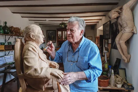
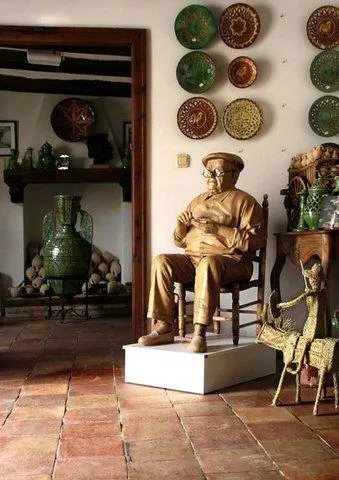
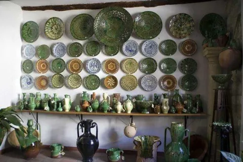
The museum houses reproductions of the traditional pieces of the ubetense pottery as well as pieces as curious as a baptismal pile, a parrot or even a bathtub; collected during the extensive career as potter of Paco Tito. You can visit the exhibition and at the same time have the opportunity to contemplate the potter working in the centenary worker.

Telecomunicaciones
Sitio web
https://pablotito.es/
Teléfono de contacto
953 751 496
Correo electrónico
museo@pacotito.com
Ubicación
Código Postal
23400
Latitud
38.012530
Longitud
-3.364120
Dirección
C/ de Valencia, 22
Municipio
Ubicación en el mapa
POINT (-3.36412 38.01253)
Tipos de punto de interés
Imágenes carrusel
imagen
Image
Ubeda%20alfar%20pablo%20tito.jpg
Imagen principal
Desactivado
imagen
Image
tito1.jpg
Imagen principal
Desactivado
imagen
Image
image_105805.jpeg
Imagen principal
Desactivado
imagen
Image
26456567085_2366ce5130_b.jpg
Imagen principal
Desactivado
imagen
Image
museo-de-alfareria-paco.jpg
Imagen principal
Desactivado
imagen
Image
image_105807.jpeg
Imagen principal
Desactivado
Imágenes cabecera
imagen
Image
Ubeda%20alfar%20pablo%20tito%202.jpg
Imagen principal
Activado
Horario
Monday to Saturday: 08: 30 - 14: 00 and 16: 00 - 20: 00. Saturdays: 08: 00 - 14: 00 and 17: 00 - 20: 00. Sundays and holidays: 10: 00 - 13: 30.
Microsite al que pertenece
Loading map
Preparing points of interest and routes...

Mines of the Centenillo

Submitted by brandcode_deweloper on
Id
2854769
Descripción
Descripción larga

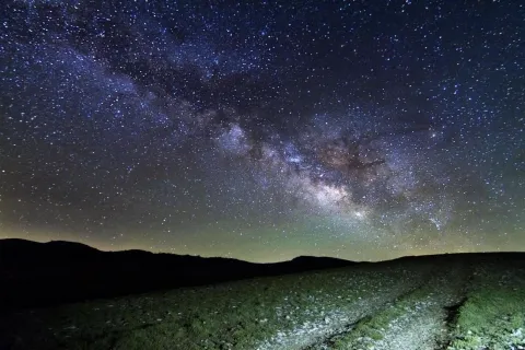
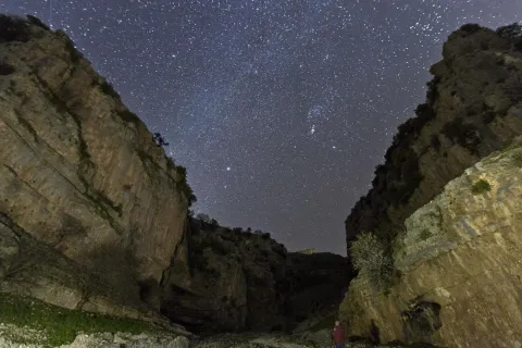
In spring it is possible to enjoy the elusive zodiacal light, while in summer it is an excellent place to observe the constellations that are being hidden in the West. Especially recommended to observe in group the different rains of stars that take place throughout the year due to their wide accessibility and the size of the explanade, where large groups can meet.

It is an excellent place to approach the family to enjoy the firmament on winter and spring nights. We recommend not to leave the explanade and not to go into the ruins under any circumstances for security matters.

Breve descripción

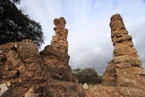
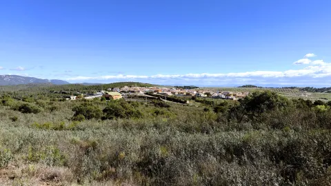
Few places are thought to be more appropriate for the observation of the firmament than the set of ancient mines abandoned from "El Centenillo," in Baños de la Encina, Jaén. Just 500 metres from this village in the west direction, we find a large explanade surrounded by old abandoned buildings. The horizon in the north, west and south direction is completely free of light pollution, with an impressive darkness in the cenit. This area is currently being restored.

Ubicación
Latitud
38.348123
Longitud
-3.732338
Dirección
Pedanía El Centenillo
Distrito
Ubicación en el mapa
POINT (-3.732338 38.348123)
Tipos de punto de interés
Imágenes carrusel
imagen
Image
_MG_9754%20%281%29.jpg
Imagen principal
Desactivado
Imágenes cabecera
imagen
Image
_MG_9754%20%281%29.jpg
Imagen principal
Activado
Microsite al que pertenece
Loading map
Preparing points of interest and routes...
Interés

Control Checkpoint of La Cabrera

Submitted by brandcode_deweloper on
Id
2854602
Descripción
Descripción larga

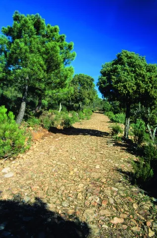
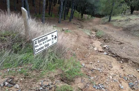
The access road runs through a relatively easy forest track; this track is taken from the same town of Marmolejo, after crossing the bridge over the Guadalquivir River at the height of the spa.

Right on the north bank of the river a right turn is taken towards the Aliseda, follow those signs and this way for 12.5 km until you reach the closed control door. There you can leave the vehicle and put things on the other side by entering the pedestrian door.

This point is especially suitable for those fans with telescopes and their own means in search of an outstanding sky and with light-taking to connect their equipment.

Breve descripción

Another privileged place is La Cabrera Control, in Marmolejo. The great advantage of this enclave is that it currently has an electric current that can be taken directly from an external plug that is located on the wall of the guard's surveillance shed.

Telecomunicaciones
Sitio web
www.andalucia.org/es/marmolejo-turismo-cultural-control-de-la-cabrera
Ubicación
Latitud
38.044893
Longitud
-4.170983
Distrito
Municipio
Ubicación en el mapa
POINT (-4.170983 38.044893)
Tipos de punto de interés
Imágenes carrusel
imagen
Image
Sendero%20Control%20de%20la%20Cabrera-Santuario%20Virgen%20de%20la%20Cabeza2.jpg
Imagen principal
Desactivado
Imágenes cabecera
imagen
Image
JJG_1117%20%281%29.jpg
Imagen principal
Activado
Microsite al que pertenece
Loading map
Preparing points of interest and routes...