Saltar al contenido principal
Image
calidad turistica

Interpretation Centre Olivar y Aceite

Submitted by brandcode_deweloper on
Id
777120
Descripción
Descripción larga

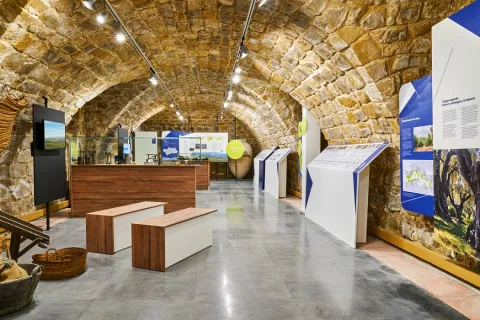
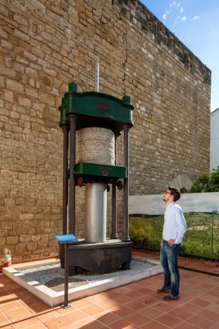
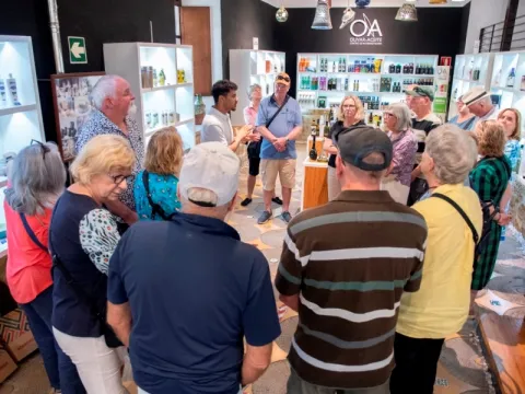
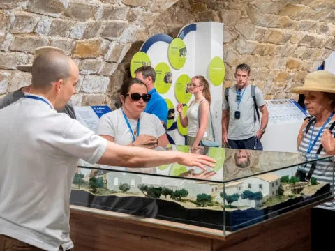
A multifunctional space, of outreach, learning and entertainment around the culture of extra Virgin Olive Oil, allowing the visitor to approach and deepen this millennial culture. All this in an exhibition area of more than 1,200 m ², through museum areas, interactive panels, exhibitions, time tunnel (a complete tour of the oil processing process, by models from the olive to the winery, in antiquity and today) and children's areas with our pet "Olivia."

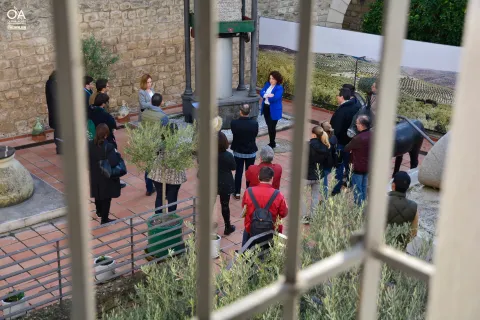
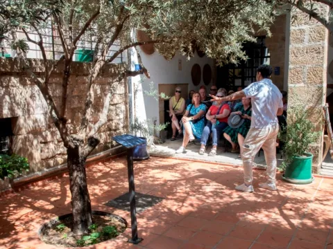
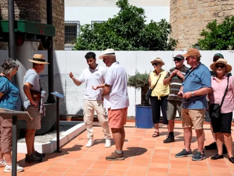
A number of educational activities are also carried out for visitors, such asOil tats, oil deustations,Training courses, gastronomic workshops,Days,Conferences, Oil workshopsandChildren's activities.

There is a specialized shop, where the visitor will find a selection of the best extra virgin olive oils, of different varieties of olives, with daily tastings, along with typical gastronomy, cosmetics and crafts that you can buy.

Breve descripción

Located in the historic city of Ubeda, declared in 2003, by UNESCO "Cultural Heritage of Humanity" and at the gates of the monumental area of this Jewel of the Andalusian Renaissance, is this beautiful Interpretation Centre, where you will enjoy a unique experience around the Extra Virgin Olive Oil and its olive grove. All this in a 17th century building of unique beauty, "La Casa de la Tercia," where they combine past and present, as well as tradition with new technologies.

Telecomunicaciones
Sitio web
www.centrodeolivaryaceite.com
Teléfono de contacto
953 755 889
Correo electrónico
info@centrodeolivaryaceite.com / gerencia@centrodeolivaryaceite.com / centrodeolivaryaceite@gmail.com
Ubicación
Código Postal
23400
Latitud
38.011410
Longitud
-3.369170
Dirección
C/ Corredera de San Fernando, 32
Municipio
Ubicación en el mapa
POINT (-3.36917 38.01141)
Tipos de punto de interés
Imágenes carrusel
imagen
Image
museo-1-1-jpg
Imagen principal
Desactivado
imagen
Image
oleoturismo-d1-0039.jpg
Imagen principal
Desactivado
imagen
Image
MUSEO%201.jpg
Imagen principal
Desactivado
imagen
Image
MUSEO%202.jpg
Imagen principal
Desactivado
imagen
Image
museo-2-1-jpg
Imagen principal
Desactivado
imagen
Image
museo-3-1-jpg
Imagen principal
Desactivado
imagen
Image
visita1-jpg
Imagen principal
Desactivado
imagen
Image
visita2-jpg
Imagen principal
Desactivado
imagen
Image
visita3-jpg
Imagen principal
Desactivado
imagen
Image
visita4-jpg
Imagen principal
Desactivado
Imágenes cabecera
imagen
Image
oleoturismo-d1-0035%20%281%29.jpg
Imagen principal
Activado
Horario
Winter (oct - may): Tuesday to Saturday 10: 00 - 14: 00 and 17: 00 - 19: 30, Sundays and holidays 10: 00 - 14: 00, Monday closed. Summer (jun - sept): Tuesday to Saturday 10: 00 - 14: 00 and 18: 00 - 20: 30, Sundays and holidays 10: 00 - 14: 00, Monday closed. Tasting workshops: 11: 00 (Spanish) and 12: 30 (English) Tuesday to Sunday.
Microsite al que pertenece
Loading map
Preparing points of interest and routes...
Marcas de calidad

Interpretation Centre Iliturgi "La Ciudad de los Tres Ríos"

Submitted by brandcode_deweloper on
Id
10338578
Descripción
Descripción larga

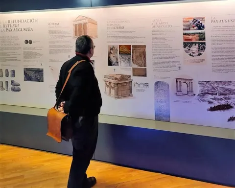
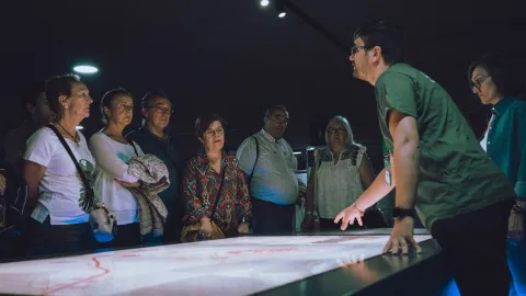
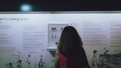
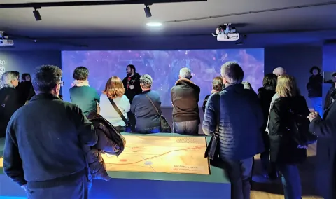
Through visual and interactive technologies in three dimensions (videomapping, holograms, etc.) it offers the visitor a tour, from the Iberorromana era, through the history of Mengibar related to its geographical location in the confluence of three great rivers: Guadalquivir, Guadalclón and Guadalimar. In this line, its content links with routes such as the time journey of the Iberians or the Phoenicians. Its assembly has received the advice and support of the professionals of the University Institute of Ibera Archaeology of the University of Jaén, headed by Juan Pedro Bellón Ruiz, current director.

Breve descripción

This newly opened Interpretation Centre is a space dedicated to the history of Mengibar, the result of collaboration between the City Council and the University of Jaén. It is located in the Casa Palacio existing in this town.

Telecomunicaciones
Sitio web
www.mengibarturismo.com/
Teléfono de contacto
677 222 285
Correo electrónico
turismo@aytomengibar.com
Ubicación
Código Postal
23620
Latitud
37.967994
Longitud
-3.808773
Dirección
Plaza de la Constitución, 1
Distrito
Municipio
Ubicación en el mapa
POINT (-3.808773 37.967994)
Tipos de punto de interés
Imágenes carrusel
imagen
Image
Meng%C3%ADbar%205.jpg
Imagen principal
Desactivado
imagen
Image
326893268_599341252019359_3732608081625461969_n.jpg
Imagen principal
Desactivado
imagen
Image
mosss-648-jpg
Imagen principal
Desactivado
imagen
Image
mosss-649-jpg
Imagen principal
Desactivado
imagen
Image
mosss-647-jpg
Imagen principal
Desactivado
Imágenes cabecera
imagen
Image
Meng%C3%ADbar%204.jpg
Imagen principal
Activado
Loading map
Preparing points of interest and routes...
Marcas de calidad

Interpretation Centre of the Orden Calatrava

Submitted by brandcode_deweloper on
Id
2343442
Descripción
Descripción larga

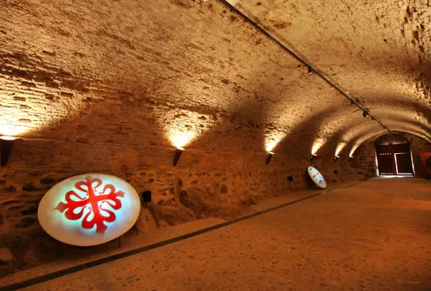
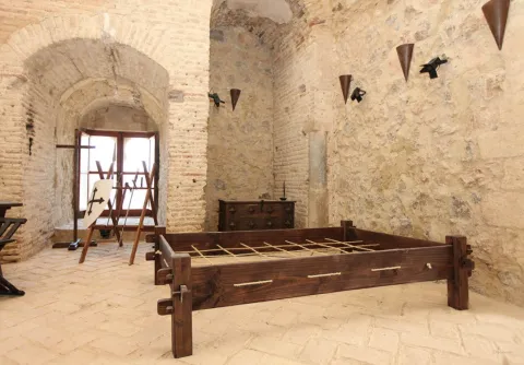
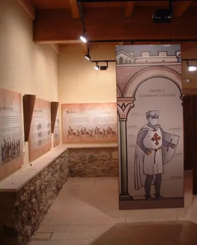
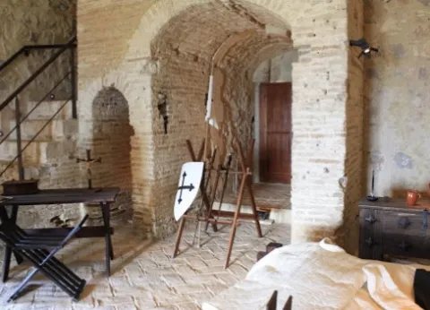
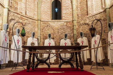
Its objective is to know first-hand, the origin and history of the Military Order of Calatrava, the function of a castle on the border with the Nazarí kingdom of Granada, the way of life and internal structure of the Order, and finally, the wenches of war used both for the assault and for the defense of a fortress, as well as the manual and personal weaponry, most used by the freires or Monjes- knights.

Breve descripción

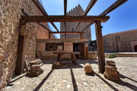
The restoration works that are putting in value the fortress have generated a center of interpretation, where the visitor can know the historical evolution of the building, from its origin as alcázar almohade, through the transformations developed by the Calatravos friars and the construction of a new castle, equipped with the necessary rooms to develop in it, a comfortable life; to conclude with the construction inside of the palace of the lords of the villa.

Telecomunicaciones
Sitio web
www.alcaudeteturismo.com
Teléfono de contacto
953 560 304 / 633 763 629
Correo electrónico
alcaudeteturismo@gmail.com
Ubicación
Código Postal
23660
Latitud
37.590790
Longitud
-4.087350
Dirección
Plaza de Santa María, s/n
Distrito
Municipio
Ubicación en el mapa
POINT (-4.08735 37.59079)
Tipos de punto de interés
Imágenes carrusel
imagen
Image
1.jpg
Imagen principal
Desactivado
imagen
Image
2%20%281%29.jpg
Imagen principal
Desactivado
imagen
Image
3.jpg
Imagen principal
Desactivado
imagen
Image
4.jpg
Imagen principal
Desactivado
Imágenes cabecera
imagen
Image
2.jpg
Imagen principal
Activado
Horario
Winter: Wednesday to Sunday 10: 00 - 14: 00 and 16: 00 - 19: 00. Summer: Wednesday to Sunday 09: 00 - 13: 00 and 18: 00 - 21: 00. Monday and Tuesday closed. Tuesday afternoon: free visits on request.
Loading map
Preparing points of interest and routes...
Marcas de calidad

Segura de la Sierra Castle Interpretation Center

Submitted by brandcode_deweloper on
Id
2343598
Descripción
Descripción larga
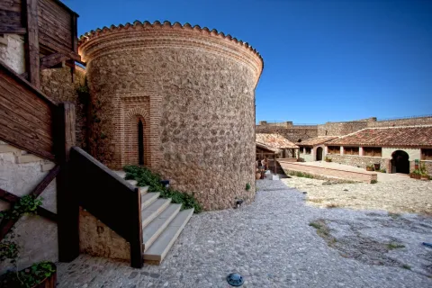
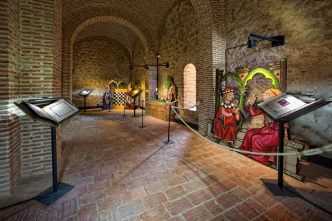
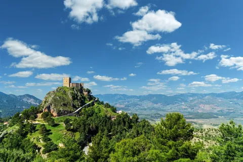
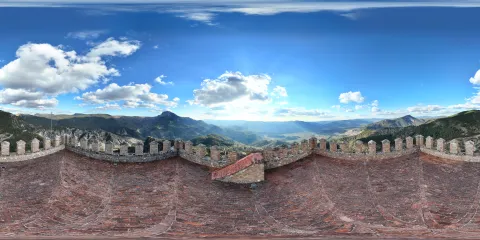
In the Islamic period the town was fortified and provided with a triple enclosure of walls. This fortification was accessed through four gates: Catena, which is the best preserved, Gontar, Mediodia or Orcera and the New Gate, which was rebuilt in the 16th century. It was declared a Picturesque Landscape and Historic-Artistic Site along with the town. Currently, it is home to an interpretation center called Segura de la Sierra. Border Territory in which you can delve into the Middle Ages, during which Segura de la Sierra was a relevant enclave. This interpretive space consists of several exhibition sets from the family environment of the warrior poet, ranging from sound elements that recreate the conversation that Jorge Manrique has with his father, Don Rodrigo, on the stage of the Coplas on the death of his father, as well as other interpretive speeches more linked to the author's poetic work. After visiting Jorge Manrique's interpretive space, it is possible to climb the battlements of the Torre del Homenaje and shudder with the spectacular views it offers: El Yelmo, with its more than 1,800 meters of altitude and symbol of the Sierra de Segura; Segura La Vieja (Iberian town), the Cerro de Góntar, the Peñalta viewpoint and so on countless landmarks that, together with a relaxed reading of Manriqueña poetry, will offer the visitor an emotion that will connect them forever with Segura de la Sierra.
Breve descripción
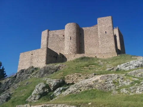
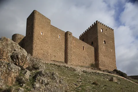
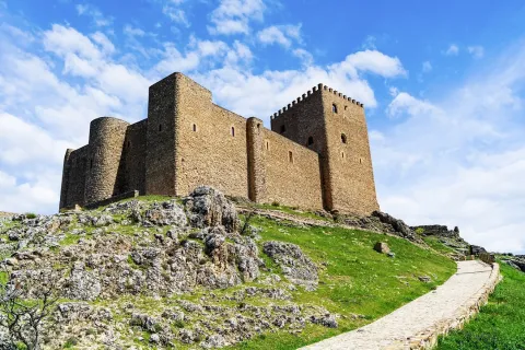
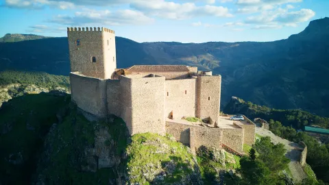
Of Muslim origin, its factory denotes an evident Christian remodeling, dating mostly to the second half of the 13th century. Inside we can find the Parade Ground, the Capilla de Santa Ana y la Torre del Homenaje with three floors. It was besieged during the French invasion and later restored.
Ubicación
Nombre
Castillo de Segura de la Sierra
Código Postal
23379
Latitud
38.299220
Longitud
-2.649790
Distrito
Ubicación en el mapa
POINT (-2.64979 38.29922)
Tipos de punto de interés
Imágenes carrusel
imagen
Image
IMG_4369.jpg
Imagen principal
Desactivado
imagen
Image
IMG_4372.jpg
Imagen principal
Desactivado
imagen
Image
IMG_4384.jpg
Imagen principal
Desactivado
imagen
Image
IMG_4387.jpg
Imagen principal
Desactivado
imagen
Image
IMG_4404.jpg
Imagen principal
Desactivado
imagen
Image
IMG_4420.jpg
Imagen principal
Desactivado
imagen
Image
IMG_4425.jpg
Imagen principal
Desactivado
Imágenes cabecera
imagen
Image
Segura%20de%20la%20Sierra18.jpg
Imagen principal
Activado
Horario
May 1 - Oct 31: Tuesday to Sunday 10:30 - 14:00 and 17:00 - 20:30. Nov 1 - Apr 30: Tuesday to Sunday 10:00 - 14:00 and 16:00 - 18:30.
Loading map
Preparing points of interest and routes...
Marcas de calidad

Interpretation Centre Castle of La Iruela

Submitted by brandcode_deweloper on
Id
2343586
Descripción
Breve descripción

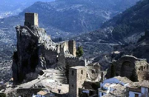
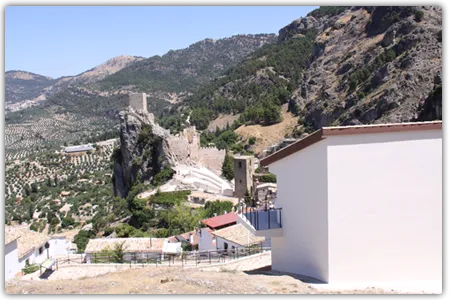
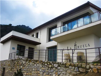
This centre is born of the need to have a space where the visitor can know and interpret the history of La Iruela, making a journey from its origins to the present and can enjoy in a didactic way and through technological means of the historical, heritage, cultural, natural and ethnic heritage of the place. It is located in the Historical Set composed of the Castle of La Iruela and the Church of Santo Domingo de Silos, monumental symbols of the town, declared an artistic Historical Set in 1985.

Telecomunicaciones
Teléfono de contacto
953 720 712 / 691 782 295
Ubicación
Código Postal
23476
Latitud
37.920900
Longitud
-2.990120
Dirección
Esperilla Alta, s/n
Municipio
Ubicación en el mapa
POINT (-2.99012 37.9209)
Tipos de punto de interés
Imágenes carrusel
imagen
Image
image_104333.jpeg
Imagen principal
Desactivado
imagen
Image
725_img.png
Imagen principal
Desactivado
Imágenes cabecera
imagen
Image
thb_g_1.jpg
Imagen principal
Activado
Horario
Wednesday to Sunday: 10: 30 - 13: 30 and 16: 00 - 18: 30 (October to April).
Loading map
Preparing points of interest and routes...
Marcas de calidad

Castle of Torredonjimeno

Submitted by brandcode_deweloper on
Id
321405
Descripción
Descripción larga

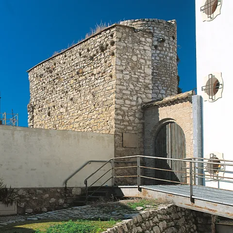
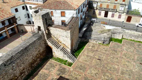
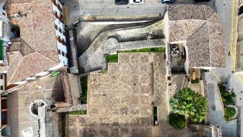
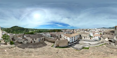
El castillo de Torredonjimeno se localiza en el interior del núcleo urbano, sobre una pequeña elevación en la margen septentrional del arroyo Salado. 
La fortificación estaba compuesta por un recinto de grandes dimensiones y planta cuadrangular con torres, circulares y cuadradas, defendiendo sus ángulos. En su interior se situaría el antiguo patio de armas y la torre del Homenaje, hoy desaparecida. A los torreones, que alcanzarían unos 11 m de altura, se accedería desde el interior del recinto, mientras que en su planta superior se abría una salida al adarve que recorría las murallas. La mayor parte del conjunto está construida en mampostería irregular.

Su flanco oriental se protegió en época cristiana mediante un antemuro ataludado y un foso, conformando una doble línea de muralla o barbacana con, al menos, un bastión semicircular que sobresale del lienzo. Recientes investigaciones arqueológicas también han documentado los restos de estructuras defensivas en el costado oeste, concretamente parte de un foso y un antemural que contribuían a incrementar sus defensas por este sector.

Tras la conquista de Granada, el Castillo pierde su valor estratégico y su función militar, convirtiéndose en un conjunto industrial y residencial, llegando a convertirse en la vivienda señorial del comendador de la Encomienda de la Peña de Martos. A partir del siglo XV, el interior del recinto se dividió en dos grandes sectores. El occidental estará ocupado por la casa palacio que construye en su interior el maestre de la Orden de Calatrava, Luis de Guzmán, de la que se han conservado artesonados de estilo mudéjar, con motivos geométricos, vegetales y heráldicos de la familia Guzmán, y una zona ajardinada que ocupaba el extremo oeste del recinto. 

Ya en el siglo XVIII, el Duque de Abrantes mandó edificar dos almazaras en el sector oriental del recinto, en uso hasta el siglo XX, que se superponen a la muralla ataludada, destruyéndola y empleando los mampuestos como material constructivo. 

Las investigaciones arqueológicas en la zona en que se asienta el castillo de Torredonjimeno han detectado material fechado en la primera mitad del III milenio a.n.e y de época iberorromana, pero la construcción de la fortificación parece haber arrasado las posibles estructuras de estos períodos.

El origen de las estructuras defensivas de la localidad podría corresponderse con la fortificación de un enclave agrícola islámico emplazado en el distrito de Martos, del que se han documentado dos fases de ocupación, una primera datada entre los siglos VIII -X, y otra segunda de mayor entidad, fechada entre los siglos XI-XIII. Quizá fue en este momento, época almohade, cuando como consecuencia de la inseguridad imperante en toda esta comarca y con el objetivo de proteger a sus habitantes, se llevó a cabo la construcción de un recinto amurallado que pudo cercar esta pequeña población o bien dotarla de una torre de alquería. Pero será tras la conquista cristiana, y la formación en el sector occidental de la actual provincia de Jaén del señorío de la Orden Militar de Calatrava, cuando se emprenden las obras más importantes, que darán como resultado la edificación del conjunto fortificado que podemos contemplar hoy. 

Tras la toma de Martos y su comarca en 1224, Fernando III concedió cuatro años más tarde la población de Martos a la Orden de Calatrava. Este primitivo señorío fue expandiéndose a medida que avanzaba la conquista castellana, de tal manera que en 1241 el Logar de Don Ximeno pasaría a engrosar sus dominios. La Orden acaparó un extenso territorio situado en el extremo suroeste de la actual provincia de Jaén, controlando amplias zonas de la Campiña y buena parte del piedemonte de la Sierra Sur. En todo ese espacio configuró así un extenso señorío desde el que ejercía un exhaustivo control de las principales vías de comunicación que unían Jaén con Córdoba y Granada, estructurando el territorio en encomiendas. 

La Orden, ante la inestabilidad de la zona por su carácter fronterizo, que la exponía a continuas incursiones musulmanas, llevaría a cabo una intensa labor de fortificación de todo su territorio, creando un estratégico sistema defensivo, con la edificación de una compleja red de castillos, edificios fortificados y torres, que frenara las continuas algaradas musulmanas por la Campiña giennense, entre la que destacaría la fortaleza de Torredonjimeno. Una fortaleza dotada de importantes elementos defensivos erigidos en mampostería irregular, con novedosas estructuras que la capacitaban para su defensa con piezas artilleras y armas de fuego. A partir de estos momentos surgirá un pequeño núcleo urbano en torno a la fortaleza, como consecuencia de las repoblaciones que la Orden de Calatrava desarrolló en sus territorios, dotándolo de la protección de un recinto amurallado, según las fuentes, del que solo han quedado vestigios en la toponimia del callejero de la localidad. Desde el punto de vista jurisdiccional y económico, esta población quedó adscrita a la encomienda de la Peña de Martos.

La fortaleza participaría, como baluarte fronterizo, en la expansión territorial emprendida por los ejércitos castellanos durante los siglos XIII y XIV. Posteriormente, en la segunda mitad del siglo XV, volvería a verse inmersa en conflictos bélicos, en el marco de las luchas nobiliarias que estallaron durante el reinado de Enrique IV, que enfrentó a los partidarios del monarca castellano contra los seguidores de una coalición nobiliaria encabezada por D. Pedro Pacheco, Marqués de Villena y D. Pedro Girón, Maestre de Calatrava.

En 1558 Torredonjimeno logró el privilegio de villazgo, segregándose de la jurisdicción de la ciudad de Martos. Durante el siglo XVI, Torredonjimeno experimentará un desarrollo urbano que se refleja en la construcción de notables edificios civiles y religiosos. Un apogeo que se vió frenado por la crisis económica, demográfica y social del siglo XVII, tras la cual, en la centuria siguiente, emprende un lento proceso de recuperación económica y demográfica. 

En el año 2005 Torredonjimeno es declarado por la Consejería de Cultura de la Junta de Andalucía, Bien de Interés Cultural en la categoría de Conjunto Histórico.

Breve descripción

The castle of Torredonjimeno has its origin in a small Islamic house that could be fortified in the Almohad era, which will evolve, following the Christian conquest and its integration into the lordship of the Order of Calatrava, building a solid castle in irregular masonry. It would finally go from military fortress to residential castle in the second half of the 15th century. It was initially composed of a large, quadrangular plant, which covered the old courtyard of arms and the tower of Homage, with towers protecting its angles, to which was added an anthemural and a pit. During the visit to the castle you can see an ancient oil mill from the 18th century, with the Torredonjimen Visigodo Treasury Interpretation Center or the permanent exhibition of "Witnesses of Life"; as well as the remains of a Master House, from the 15th century, among which are the Mudejar-style craftsmen of the 15th century and the Garden of the late 18th century.
The origin of the fortress appears to be around the second half of the 13th or early 14th century, as it was built in a sector of a small Islamic settlement that could have been fortified in the Almohad period by a perimeter of wall or by incorporating a simple tower of plateau. After the Spanish conquest of this region, the Order of Calatrava set up a vast lordship at the southwestern end of the current province of Jaén, which became part of the Logar of Don Ximeno in 1241. The proximity of this lordship to the Nazari kingdom of Granada, led the Order to create a strategic defensive system, building a complex castral network of castles and towers, which would stop the continuous rascades or Muslim algarades by the Giennense countryside, among which would be the strength of Torredonjimeno. His military role was also evident in the civil conflicts and struggles that erupted during the reign of Henry IV. In 1558 he reached the privilege of village, experiencing an urban development process. According to tradition, in this fortress was written in 1551, the first book on the art of bullfighting, currently guarded at the University of Salamanca.
The historical centre of Torredonjimeno is declared to be a Cultural Interest in the category of Historical Set since 2005.

Telecomunicaciones
Sitio web
www.tosiria.com/
Teléfono de contacto
953 572 202
Ubicación
Código Postal
23650
Latitud
37.765330
Longitud
-3.959480
Dirección
C/ Cantera, 1
Distrito
Municipio
Ubicación en el mapa
POINT (-3.95948 37.76533)
Tipos de punto de interés
Imágenes carrusel
imagen
Image
Castillos_ruta_torredonjimeno.jpg
Imagen principal
Desactivado
imagen
Image
castillo_torredonjimeno.jpg
Imagen principal
Desactivado
imagen
Image
Castillo de Torredonjimeno
Imagen principal
Desactivado
imagen
Image
Castillo de Torredonjimeno
Imagen principal
Desactivado
Imágenes cabecera
imagen
Image
CyB_Torredonjimeno_01
Imagen principal
Desactivado
imagen
Image
CyB_Torredonjimeno_02
Imagen principal
Desactivado
Horario
Consult by appointment.
Microsite al que pertenece
Experiencia 360
Image
CyB_Torredonjimeno_03_360
Image
CyB_Torredonjimeno_04_360
Loading map
Preparing points of interest and routes...
Marcas de calidad

Castle of Segura de la Sierra

Submitted by brandcode_deweloper on
Id
6250036
Descripción
Descripción larga

El recinto exterior abarca una gran superficie, en la que se distinguen muros que pertenecerían a construcciones características de un castillo y dos grande aljibes excavados en la roca, destinados a recoger y almacenar agua.

La barbacana, muy restaurada, está formada por un antemuro que protegía el lado oeste, más accesible, y una puerta con dos tramos de escalera en codo, lo que dificultaba la entrada a los posibles atacantes y que sería el acceso original.

El alcázar, de forma trapezoidal, tiene cuatro torres esquineras y dos más pequeñas en los lienzos sur y sureste, esta última semicircular. La entrada, también en codo, pero con una subida en rampa, se sitúa en la torre noroeste, mientras que la torre del Homenaje, situada en el sector este, con 18,43 m de altura, se estructuraba en tres plantas y terraza comunicadas por una escalera empotrada en el grueso de los muros. Las torres están comunicadas por un adarve que recorre todo el recinto.

En el interior del recinto se conserva una capilla erigida en el siglo XIII por la Orden de Santiago, de estilo mudéjar, con una nave rectangular y ábside semicircular. Frente a ella hay una gran sala o refectorio con arcos apuntados, en la que, probablemente, el techo original fuese más alto que el actual, pudiendo haber sido reutilizada como polvorín durante la Guerra de la Independencia (1808-1814). El aljibe existente en el centro del patio de armas se construyó para el aprovisionamiento de los defensores del castillo en caso de que los atacantes hubiesen conquistado el recinto exterior. Durante las excavaciones arqueológicas realizadas en 2001 salieron a la luz restos de otras construcciones de diversas cronologías: una vivienda del siglo X, lienzos de la muralla de tapial del siglo XII y de una torre almohade o un baño. El baño debió estar decorado con cierta suntuosidad, como muestran los restos de elementos decorativos recuperados, lo que correspondería a residencia de un importante señor.

Un segundo recinto de mampostería trabada con argamasa se extiende por la ladera oeste, de sur a nordeste. En él se distinguen restos de hasta siete torreones, mientras que en su interior son visibles restos de otras estructuras. 

Al nordeste, a la misma altitud de la villa, se conservan restos de un pequeño recinto con una gran torre de tapial, conocida como la “Torre de las Eras” de, al menos, cuatro niveles, horadada por numerosas saeteras de la que tan sólo quedan en pie dos de sus lados. Unos metros al este se observan los restos de una torre esquinera de menor tamaño, y de unas caballerizas y un silo excavados en la roca, situados entre ambas.

En la ladera sur del cerro sobre el que se asienta el castillo se encuentra la Torre del Agua, construcción almohade de planta rectangular y realizada en un tapial muy duro (tabiyya). Formada por tres muros, tiene como cierre trasero la roca natural. Originalmente carecía de entrada u otros vanos, pues su función parece haber sido la protección de un manantial al que se accedería desde la parte superior. 

La ocupación del cerro en el que se asienta Segura de la Sierra es anterior a la construcción de la fortaleza y de los grandes recintos de murallas hoy visibles en la población, erigidos probablemente como resultado de las transformaciones sociopolíticas que sufrió al-Andalus a partir del siglo XI. Los restos más antiguos documentados durante las investigaciones arqueológicas corresponden a una vivienda del siglo IX bajo el castillo.

La desmembración del Califato de Córdoba, a principios del siglo XI, causó un continuo cambio de manos de Segura, que, tras pertenecer a la taifa de Murcia, llegó a ser reino independiente entre 1043 y 1044, antes de caer bajo el control de la Taifa de Denia. La conquista de esta última por el rey de Zaragoza propició un nuevo período de independencia entre 1076 y 1079, pasando finalmente a formar parte del reino de Sevilla, hasta la ocupación de Segura por los almorávides en 1091.

Durante la crisis del movimiento almorávide Ibrahim ibn Hamusk se sublevó en Sócovos de Yeste, apoderándose de Segura en 1147, aliándose con el reino creado en Levante y Murcia por ibn Sai ibn Mardanis. Esta alianza propició que ibn Hamusk se apoderase de un gran territorio, tomando Jaén, Baeza y Úbeda. Estos territorios que formaron parte de un reino independiente pasaron a manos almohades en 1169, quedando ibn Hamusk como gobernador de sus territorios en Jaén. 

En ese momento Saqura se describe ya como una fortaleza (hisn) comparable a una ciudad (medina) por la importancia de su población. Entre los siglos XI y XIII se produjo una amplia fortificación en la Sierra de Segura.

Tras la conquista castellana de la comarca, entre 1226 y 1239, Fernando III reparte paulatinamente los territorios a la Orden de Santiago, concediéndole Segura el 21 de agosto de 1242, localidad a la que la Orden trasladará la Encomienda Mayor de Castilla desde Uclés. En 1243 tenía Concejo y recibió el fuero de Cuenca. 

El castillo de Segura sirvió como bastión durante las luchas nobiliarias de los siglos XIV y XV, bajo la autoridad de la familia Manrique, y como lugar desde el que partieron numerosos ataques al reino nazarí de Granada, teniendo como uno de sus principales protagonistas a Rodrigo Manrique, Maestre de la Orden de Santiago y padre del poeta Jorge Manrique.

Permaneció como sede de la Encomienda y cabeza del señorío santiaguista durante toda la Edad Moderna. 

En 1748 se constituye la Provincia Marítima de Segura de la Sierra, por el aprovisionamiento de madera para la política naval del reinado de Fernando VI, lo que produjo la degradación forestal de la comarca.

En 1810 fue nuevamente escenario de un conflicto bélico, con el enfrentamiento con las tropas napoleónicas, que arrasaron y quemaron tanto la villa como el castillo, que permaneció en ruinas hasta una serie de restauraciones llevadas a cabo en el castillo y las murallas de la localidad durante los años 60 y 70 del siglo XX. En 2001 la Universidad de Jaén acometió la primera intervención arqueológica en el castillo y en 2021 en parte de la muralla de la villa, en la zona de la puerta de Góntar.

La villa de Segura de la Sierra y su castillo están declarados Conjunto Histórico Artístico y Paisaje Pintoresco.

LEYENDAS
Leyenda del ajedrez del rey de Segura. Mudarra, sobrino del rey de Córdoba, ganó una partida de ajedrez al rey de Segura siendo huésped de su castillo. El monarca indignado le llamó “hijo de nadie”, ante lo que Mudarra le asesinó golpeándole iracundo con el tablero en la cabeza. Huyó a Córdoba donde su madre le relató la historia de su padre, Gonzalo Gustioz, a cuyos hijos, los 7 infantes de Salas, decapitaron por orden de su tío Ruy Velázquez, como venganza por una grave afrenta a la familia de su esposa durante las celebraciones de su boda. 

Mudarra partió a Castilla en busca de Ruy Velázquez, al que dio muerte cerca de Burgos, completando su venganza quemando viva a doña Lambra, esposa de su tío e instigadora del asesinato de los infantes.

 

Breve descripción

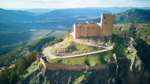
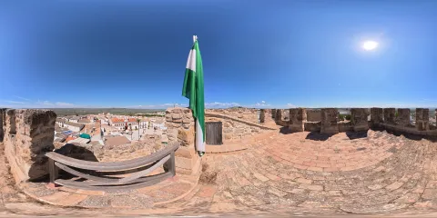
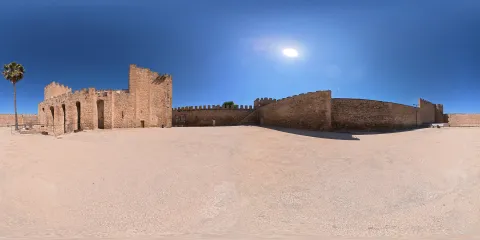
The castle of Segura de la Sierra is made up of an outer enclosure of tapial and an alcázar protected by a barbacana, made in masonry, a Christian work built between the 13th and 14th centuries, although taking advantage of the remains of the previous Muslim fortification. Many defensive elements extend along the hill side on which it sits, while inside the castle a chapel, a capitular room, a bathroom and other structures are preserved from different chronological moments. The walls embrace the villa, in which samples of typical serrana architecture and monumental buildings are alternated.
The dismemberment of the Califate of Cordoba, in the early 11th century, caused a continuous change of hands of Segura, becoming the center of the independent kingdom of ibn Hamusk in the 12th century. After the Spanish conquest of the region, in 1242 Fernando III granted Segura to the Order of Santiago, which would make it the major envoys of Castile. From it, numerous attacks took place on the Nazari kingdom of Granada and served as a bastion during the nobility struggles of the 14th and 15th centuries, under the authority of the Manrique family. In 1810 it was the scene of the confrontation with the Napoleonic troops, which destroyed and burned both the village and the castle.
After several restorations, the village of Segura de la Sierra and its castle are declared an Artistic Historical Set and Pintoresque Landscape.

Telecomunicaciones
Sitio web
www.claritasturismo.com/experiencias-segura-de-la-sierra/
Teléfono de contacto
682 834 293
Correo electrónico
info@castilloseguradelasierra.com
Ubicación
Código Postal
23379
Latitud
38.299210
Longitud
-2.649790
Dirección
C/ Castillo
Distrito
Ubicación en el mapa
POINT (-2.64979 38.29921)
Tipos de punto de interés
Imágenes carrusel
imagen
Image
img-20160526-184330-largejpg.jpg
Imagen principal
Desactivado
imagen
Image
_MG_0250%20%281%29.jpg
Imagen principal
Desactivado
imagen
Image
Segura de la Sierra
Imagen principal
Desactivado
imagen
Image
Segura de la Sierra
Imagen principal
Desactivado
Imágenes cabecera
imagen
Image
CYB_Segura_Sierra_01
Imagen principal
Desactivado
imagen
Image
CYB_Segura_Sierra_02
Imagen principal
Desactivado
Horario
1 may - 31 oct: tuesday to sunday 10: 30 - 14: 00 and 17: 00 - 20: 30. 1 nov - 30 abr: tuesday to sunday 10: 00 - 14: 00 and 16: 00 - 18: 30.
Experiencia 360
Image
cyb_segura_sierra_360_02
Image
cyb_segura_sierra_360_02
Loading map
Preparing points of interest and routes...
Marcas de calidad

Lopera Castle

Submitted by brandcode_deweloper on
Id
2292974
Descripción
Descripción larga
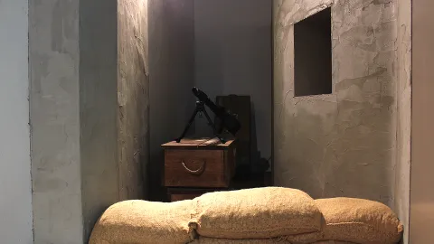
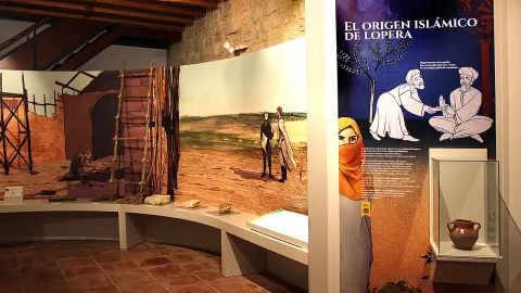
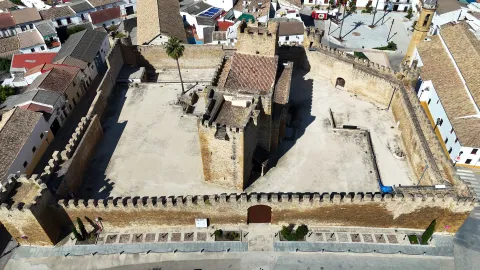
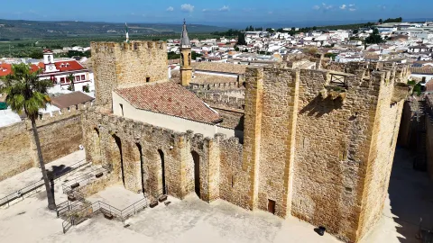
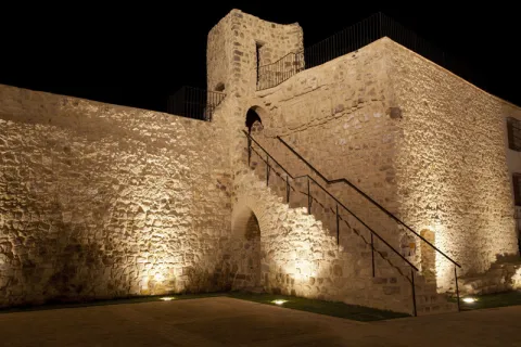
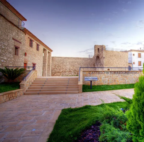
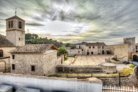
The original construction was a fortified rural church, built in masonry repointed with lime mortar, with an irregular basilica plan and a quadrangular head offset to the left, a characteristic that defines those known as “Crooked” head Churches. It was divided into three naves, the central one being the widest, by arches on pillars and columns, lacking a transept, whose capitals have late Romanesque decoration. On the outside, on its northern side, during the archaeological excavations, part of a “U”-shaped trench excavated in the geological base was located, with an approximate depth of 2 m, and a dry-joined masonry wall that rests directly on the pit, possibly an antemural that delimited a narrow list. The excavations also revealed the existence of numerous burials both inside and outside the temple, most of them in the head and in its surroundings. The bodies rested in trapezoidal or anthropomorphic graves excavated in the rock, some with marked heads, and covered by earthen mounds or, in some cases, stone slabs. A burial covered by part of a large ceramic container stood out. This first building was destroyed and burned by the Nasrid armies of Muhammad V, allies of King Pedro I, around 1368, during the conflicts between the Castilian king and his half-brother Enrique II of Trastámara. After its destruction, a new church was built that maintains its layout, although it incorporates modifications. Two towers are erected, that of San Miguel, at the foot of the church and that of Santa María, which will encompass the head, now with a semicircular shape inside. This new fortification corresponds to the external walled enclosure that is preserved today, with an irregular pentagonal layout and five solid corner towers, built in masonry. It was defended by a rampart or a barbican and a moat. In the parade ground, the new fortified church was rebuilt as a fortress: two large towers joined by two sections of walls that form a wide walkway with loopholes, supported by semicircular arches on buttresses. This building was functionally divided into two environments: the lower one for religious use and the upper one for military use. The worship space was divided into three naves, the central one being the widest. A large terrace was formed above the cult area, which would serve as a parade ground and give access to the defensive elements of the walls and tower of Santa María. At this time the burials will be concentrated in the exterior area, relegated to the head and surrounding areas, with the exception of two tombs that are located inside next to the large arch that gives access to the apse area, the most sacred space of this new church. Between the end of the 15th century and the first half of the 16th century, this fortified church was adapted into a castle-palace. The works consisted of the construction of two large bodies and a small porticoed patio with three carpanel arches with Renaissance capitals, which would serve as the articulating axis of the noble residence, around which various rooms are distributed. The apse area of ​​the church was transformed into an oratory by the Commander of Lopera D. Juan Pacheco in 1535, covered by a barrel vault decorated with Renaissance plasterwork and painted inscriptions, which was also accessed from the exterior patio through a new door made on the north façade, equipped with a portico on columns. On the outside of the building, archaeological excavations brought to light a garden space, with a large patio, with a fountain that was supplied with water extracted by a water wheel and an orchard area, which confirm its use as a residential home. In the 20th century the castle functioned as a residence and winery, a phase from which numerous buried wine cellars are preserved to the west of the San Miguel tower, which caused the destruction of the archaeological levels. In the area around Lopera, sites from the Bronze and Iron Age have been found; settlements of the Lower Roman Empire with continued occupation until the Visigothic period; as well as rural settlements from the Emiral period, which used the Cerro de San Cristóbal as a common place of refuge, including the Lopera farm itself, which we could identify with the population of Bayyara cited in Islamic sources. The archaeological investigations carried out to date in its historic center confirm the existence of this farm that exploited the agricultural resources of the area in the 12th and 13th centuries. After the conquest, Lopera was handed over, in 1240–1241, to the Military Order of Calatrava, creating the Commandery of Lopera, which would reinforce its primitive defenses between the 14th and 15th centuries. The Order managed to form an extensive lordship in the extreme southwest of the current province of Jaén, which included large areas of the Campiña and a good part of the foothills of the Sierras Sur, bordering the Kingdom of Granada, which led it to promote extensive fortification work in its possessions. This network of fortifications played an important border role in the territorial expansion undertaken by the Castilian armies during the 13th and 14th centuries, regaining prominence in the second half of the 15th century, within the framework of the noble struggles during the reign of Henry IV. In the confrontation between the supporters of the Castilian monarch against the followers of a noble coalition headed by D. Pedro Pacheco, Marquis of Villena and D. Pedro Girón, Master of Calatrava, the members of the Order actively participating in the contest. During the conflict, the Lopera fortress was attacked and looted in 1466 by the allies of the Constable of Castile, led by the Mayor of Andújar, Pedro de Escavias. It was declared an independent town by Philip II in 1595. In the 19th century, with the confiscation, the assets of the church were acquired for the most part by bourgeoisie, the ownership of the castle passing into the hands of Alonso de Valenzuela, deputy and mayor of Lopera, in 1856. During the Spanish Civil War, Lopera once again became a prominent scene of a war, since the dividing line between both national and republican sides, popularly known as the Andújar front, was located around the town. Numerous vestiges have remained of this conflict in the area around Lopera: machine gun nests, Republican trenches, an anti-tank fort, basements and caves used as anti-aircraft shelters in the same town. The most notable episode was the Battle of Lopera, fought between December 27 and 29, 1936, in which the rebellious armies conquered Lopera. Finally, in the 20th century the Calatrava fortress was used as a wine cellar, a new use that profoundly transformed the original structure of the defensive complex, conditioned as a temporary residence and wine cellar and introducing irreversible changes to the castle.
Breve descripción
The castillo de Lopera, which is currently made up of two enclosures, offers a configuration resulting from its complex historical evolution, starting from an original fortified church to becoming a castle-palace formed by two large towers joined by two sections of wall, located in the center of a walled enclosure with towers in the corners.  After the Castilian conquest, Lopera was handed over, in 1240–1241, to the Military Order of Calatrava, creating the Commandery of Lopera, which would reinforce its primitive defenses between the 14th and 15th centuries. It played an important role as a border fortress in the advance of the Castilian armies through the Giennese countryside during the 13th and 14th centuries, regaining prominence in the second half of the 15th century, within the framework of the noble struggles that were settled during the reign of Henry IV. It was attacked and looted in 1466 by the allies of the Constable of Castile, led by the Mayor of Andújar, Pedro de Escavias. Finally, in 1595 it was declared an independent town by the monarch Felipe II.
Ubicación
Código Postal
23780
Latitud
37.943710
Longitud
-4.213650
Dirección
C/ Castillo, s/n
Distrito
Municipio
Ubicación en el mapa
POINT (-4.21365 37.94371)
Tipos de punto de interés
Imágenes carrusel
imagen
Image
VISTA%20A%C3%89REA.jpg
Imagen principal
Desactivado
imagen
Image
patio%20de%20armas.JPG
Imagen principal
Desactivado
imagen
Image
castillo de lopera
Imagen principal
Desactivado
imagen
Image
castillo lopera
Imagen principal
Desactivado
imagen
Image
castillo lopera
Imagen principal
Desactivado
Imagen principal
Desactivado
Imágenes cabecera
imagen
Image
CyB_Lopera_01
Imagen principal
Activado
imagen
Image
CyB_Lopera_02
Imagen principal
Desactivado
Horario
Tuesday to Friday: showings at 10:00 and 12:00. Saturdays and Sundays: passes at 10:00, 12:00 and 17:00 (winter) or 9:00, 11:00 and 13:00 (summer).
Experiencia 360
Image
CyB_Lopera
Image
CyB_Lopera
Loading map
Preparing points of interest and routes...
Marcas de calidad

Arab Baths

Submitted by brandcode_deweloper on
Id
2275715
Descripción
Descripción larga
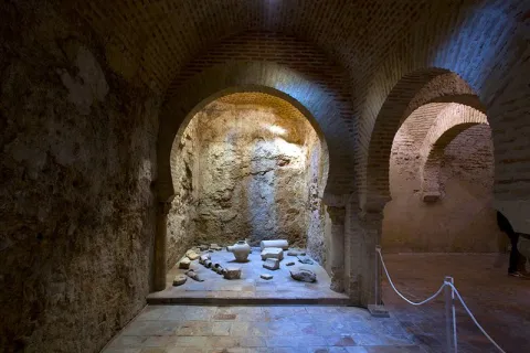
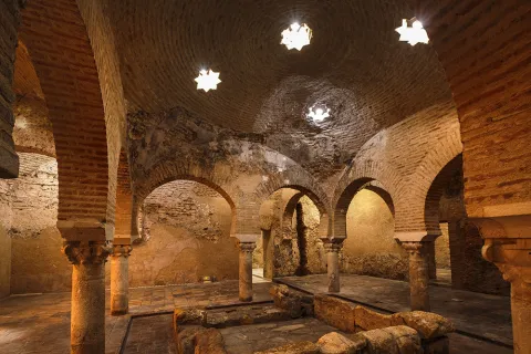
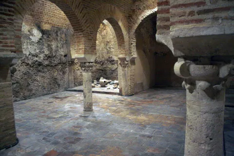
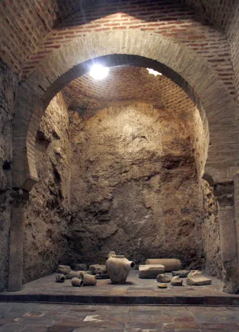
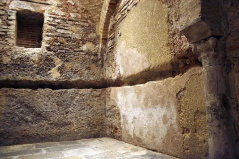
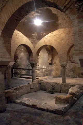
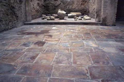
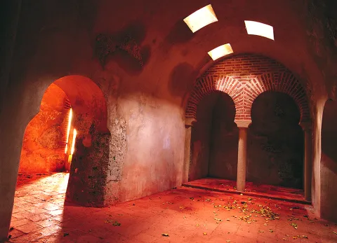
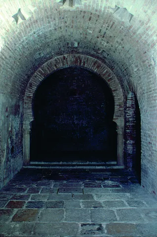
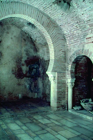
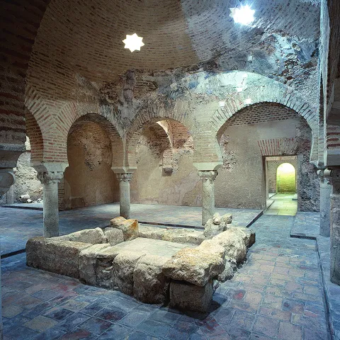
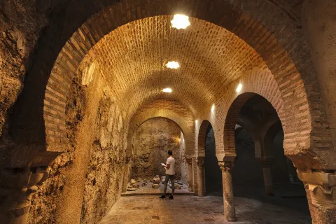
After the conquest of the city in 1246 by Ferdinand III the Saint, its use continued during the first years of Christian rule. It will be between the 14th and 15th centuries when its function as a bath disappears when the Christians establish tanneries in its rooms. Proof of this are the remains of its facilities that are still preserved in the Temperate and Hot Rooms. At the end of the 16th century, Don Fernando de Torres y Portugal, Count of Villardompardo and Viceroy of Peru, built his Palace on the Baths, leaving part of them hidden between the foundations and basements, remaining this way during the 18th and 19th centuries. At the beginning of the 20th century, the Palace became part of the real estate assets of the Provincial Council of Jaén, an institution that, between 1901 and 1903, freed up the space of several houses adjacent to the property in order to build a Chapel for the Women's Hospice. These works must have affected the remains that still remained of the bathrooms. In 1913, during the inspection of the Palacio de Villardompardo factory for the preparation of the Monumental Catalog of Jaén, a small part of the Baths was discovered by Don Enrique Romero de Torres. Just four years later, they were visited by the Professor of Archeology Mr. Manuel Gómez Moreno, who, once the appropriate data had been taken, proposed the property as a National Monument. This proposal was accepted and in 1931 the remains were declared a National Monument with the General Registry number 528. In 1936 the restoration works began under the direction of Mr. Leopoldo Torres Balbás and his partner, the architect from Jaén, Mr. Luis Berges Martínez. However, these works would be interrupted by the beginning of the Civil War. It would not be until 1970 when the General Directorate of Fine Arts commissioned the first restoration project of the Baths to the architect Luis Berges Roldán, son of the previous one. This initial project was followed by six more in successive years, the last two in 1980 and 1982, in agreement with the Provincial Council of Jaén. Thanks to the work, most of the Rooms that can be seen today were discovered. Once the works were completed in 1984, the Europa Nostra Association awarded the Medal of Honor that year to the restoration of the Arab Baths. The rooms that make up the Arab Baths are: Lobby (al-bayt al-maslaj) The entrance hall is a transverse room 14 meters long by 3.80 meters wide, with bedrooms at both ends separated from the rest of the room by horseshoe arches on half columns, a scheme that will be repeated in all the other rooms. On both sides of the entrance there are two blocks. The room is covered by a barrel vault and has 18 star lights. The floor was covered in white marble and the walls were plastered and painted with decoration of red arches on a white background. Cold Room (al-bayt al-barid) Adjacent and very similar to the previous one although smaller in size (11.4 m x 3.50 m.), this room is also covered by a half-barrel vault in which 12 windows are located. The bedroom located on the far right is covered with a dome with 5 lights. Temperate Room (al-bayt al-wastani) It consists of a large square hall measuring 11.30 m x 11.30 m which, in turn, encloses another central square, this one covered by a large dome with a hemispherical cap on pendentives. The dome does not rest on solid walls but on horseshoe arches supported by eight columns. In the four corners of the great hall there are four other smaller domes, and the remaining spaces are covered with four half-barrel vaults with 3 windows in each of them. This large room gives way, through two horseshoe arches, to another room of 11.30 m x 2.80 m that presides over the entire complex and is covered by a half-barrel vault; having two bedrooms at the ends covered with domes with windows. Hot Room (al-bayt al-sajum) With dimensions of 15.90 m long by 3.30 m wide, the hot room is very similar to the previous rooms. It is covered with a half-barrel vault with 15 windows and with two bedrooms at the ends with 5 windows each. This room is located next to the boilers where the water was heated. Its walls are covered by hidden chimneys through which hot air circulated. In the center of the room, a large flared arch separates it from the place where the boiler was. On both sides of this central arch, two small rooms contain: one, a square sitz bath and the other, two jars. Under its stone floor, the entire room is hollow: numerous small brick pillars support it, allowing hot air to circulate, which, due to its natural tendency, rises and adheres to the floor, warming it. Juan Eslava Galán makes continuous mention of both spaces in Los Templarios and Salomón's Table. (…) In the center of the Magdalena neighborhood, surrounded by the initiation places of the old matriarchal sanctuary, in front of the palace of the counts of Villardompardo, scions of the Torres family, in whose basements you can visit the Arab baths where the Moorish king died (…) The Templars and Solomon's Table. Chapter 27. In the same building that makes up the Villardompardo palace there is also the Museo Internacional de Arte Naïf “Manuel Moral”, the first and only one in Spain specialized in this art; and the Museo de Artes y Costumbres Populares de Jaén. In the square in front of the palace, there is also an element that Juan Eslava Galán is very interested in in his research on the Templars: the duck fountain. (…) in the Santa Luisa de Marillac square (…). In the center, emerging from the still water, an octagonal pillar (so common in Templar and Calatrava construction) supports a hemisphere (the stone of the Mother Goddess) on which stands a goose with its palmiped legs extended on the stone. (…). Let us remember that the goose is one of the main symbols of the matriarchal cults of the sanctuary (...) The Templars and Solomon's Table. Chapter 26.
Breve descripción
Built in the 11th century, the Arab Baths are located in the basements of the Palacio de Villardompardo. They have an area of ​​450 square meters, which probably makes them the largest of those that can be visited in Spain. Judging by the remains of Almohad decoration that are preserved in some of its rooms, they must have been restored towards the end of the 12th century.
Ubicación
Código Postal
23004
Latitud
37.771137
Longitud
-3.794066
Dirección
Plaza de Santa Luisa de Marillac
Distrito
Municipio
Ubicación en el mapa
POINT (-3.794066 37.771137)
Tipos de punto de interés
Imágenes carrusel
imagen
Image
image_217353%20%281%29.jpeg
Imagen principal
Desactivado
imagen
Image
baños árabes
Imagen principal
Desactivado
imagen
Image
baños árabes
Imagen principal
Desactivado
imagen
Image
baños árabes
Imagen principal
Desactivado
imagen
Image
baños árabes
Imagen principal
Desactivado
imagen
Image
baños árabes
Imagen principal
Desactivado
imagen
Image
baños árabes
Imagen principal
Desactivado
imagen
Image
baños árabes
Imagen principal
Desactivado
imagen
Image
baños árabes
Imagen principal
Desactivado
imagen
Image
baños árabes
Imagen principal
Desactivado
imagen
Image
baños árabes
Imagen principal
Desactivado
Imágenes cabecera
imagen
Image
Ja%E2%80%9An%20Ba%C2%A4os%20%C2%A0rabes%202.jpg
Imagen principal
Activado
Horario
Tuesday to Saturday and holidays: 09:00 - 21:00. Sundays: 09:00 - 15:00. Closed Mondays (except February 28, May 2, August 15 and December 26) and January 1 and 6 and December 24, 25 and 31. Access until 1 hour before closing.
Microsite al que pertenece
Loading map
Preparing points of interest and routes...
Marcas de calidad

Former Pósito - Ciudad y Museum of Raphael Interpretation Centre

Submitted by brandcode_deweloper on
Id
2343550
Descripción
Descripción larga

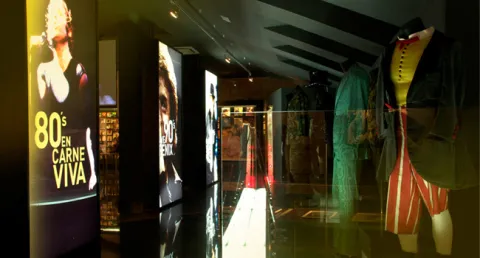
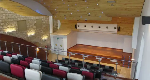
Today turned into a cultural and tourist space, this Interpretation Center of the city, welcomes in its interior the brightest pages of local history, the evolution of its urbanism and all its Art and Culture where the Toreo and the Flamenco in Linares have a prominent place. This building, in turn, houses the Museum of Raphael, a English universal singer, the Tourist Information Office, souvenir shop, a Linear Documentation Centre, temporary exhibition room and the Municipal Auditorium, able to host congresses and events of all kinds.

Based on a conceptual recreation of the Santa Margarita Thing, which was erected as one of the largest rings in the world in 1866, the visitor will be immersed in a 360-degree enveloping projection. Six exhibition spaces are offered that explain the importance of the city in the history of the party and its main representatives; such as Palomo Linares, Paco Bautista, Curro Díaz, José Fuentes, Curro Vázquez and so up to 20 great matadores.

In addition, taking advantage of Linares' world fame for being the city where the right-hand Cordobe Manuel Rodríguez Sánchez 'Manolete' lost his life in a tragic evening of bulls, the City Council promotes the tourist product "Linares, after the legend of Manolete," which allows groups to know wineries, museums, scenarios of special relevance, such as the Santa Margarita Coso and the Los Marqueses Hospital, or the Flemish peñas of the city.

Breve descripción

The building of the Old Posite, was built in the second half of the 18th century as a grain warehouse, by then the Villa de Linares, transformed years later into prison, in 1975 became a special education school.

Telecomunicaciones
Sitio web
www.elpositolinares.es
Teléfono de contacto
953 100 183
Correo electrónico
turismo@aytolinares.es
Ubicación
Código Postal
23700
Latitud
38.092871
Longitud
-3.634982
Dirección
Iglesia, 5
Distrito
Municipio
Ubicación en el mapa
POINT (-3.634982 38.092871)
Imágenes carrusel
imagen
Image
MuseoLinares.jpg
Imagen principal
Desactivado
imagen
Image
raphael27.jpg
Imagen principal
Desactivado
imagen
Image
espacios_expos.jpg
Imagen principal
Desactivado
imagen
Image
espacios_auditorio.jpg
Imagen principal
Desactivado
Imágenes cabecera
imagen
Image
0_3726_1.jpg
Imagen principal
Activado
Horario
Winter: Wednesday to Sunday 10: 00 - 14: 00 and 17: 00 - 19: 00. Summer: Wednesday to Sunday 10: 00 - 14: 00 and 18: 00 - 20: 00.
Loading map
Preparing points of interest and routes...
Marcas de calidad