Saltar al contenido principal

Source of the River San Juan

Submitted by brandcode_deweloper on
Id
8091631
Descripción
Descripción larga

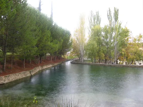
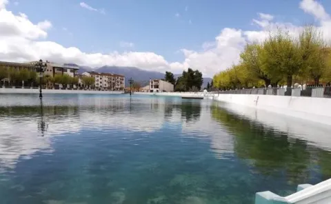
Natural area of great beauty of water and tiled wires that invite to relax, turned into a recreational area, magnificent enclave to spend a pleasant day of countryside surrounded by nature, enjoy the environment, rest under the dense tree grove or take some hiking route. The space has a magnificent road with banks, tables, stationery, a small bar, children's playground and a large parking lot. This area attracts thousands of visitors from many municipalities, some very far away.

From the same pozas of the Nacimiento, a channel known by the neighbors by "el Caz," that allows to water the orchards of the river along several kilometres, and that rejoins the river in the village, next to the Roman bridge of Triana, where the permits for the fishing stop "El Carrizal," whose upper section is the same Birth of the San Juan River, were issued. The nearest pool to the river was used for the release of trout and fishing for both people with reduced mobility and children, learning the values and techniques needed to manage themselves within this sport and get their own catches (there is a children's fishing school in the town in the summer, taking advantage of school holidays).

The fishing ground was about 4 km. where roads have been enabled, making many parts of the banks practicable and facilitating the formation of pokes, where fish can find better shelter and more water.

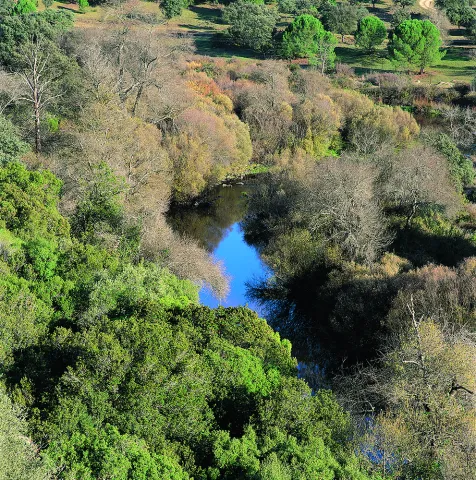
Fishing could also be practiced in the Valdepeñas Bridge, where one of the most remarkable pozas of the fishing ground is formed, both by the number of trout and by the quality of the trout. The environment of Nacimiento del Río San Juan is characterized by a typical Mediterranean landscape, with the oak and the coscoja as protagonists. Other plants present are the lentif, the white jara, the thyme and the rosemary, but, without a doubt, the white lamo is the most abundant species in the Birth and on the river bank. In this we can see fertile gardens that make up the "Vega castillera," which acquires its maximum splendor in spring with the flowering of the cherry trees, very abundant in the area, irrigated from the very pods of the birth by "the Caz" mentioned above.

This area, owned by the City Council, houses a multitude of outdoor physical activities.

Breve descripción

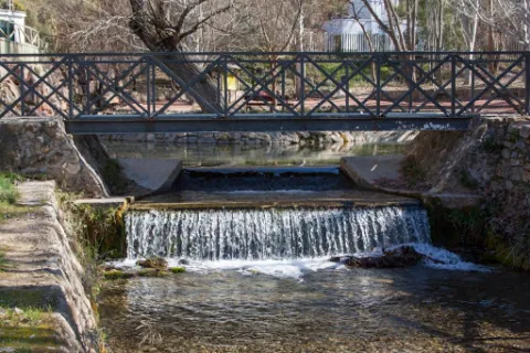
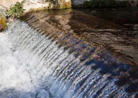
The Birth of the San Juan River is located in the municipal term of Castillo de Locubín in the depression between the hills of the Sierrezuela and the Nava. This idyllic landscape, surrounded by vegetation, has in the abundance water that springs from the interior of the mountain its main characteristic. It is a place of great beauty, where several pools of crystalline water have been naturally formed, from which the groundwater springs, forming beautiful and intermittent columns of bubbles to the surface. In addition, we can observe small waterfalls and channels. It is accessed by the road C-3221, which links Castillo with the nearby town of Valdepeñas de Jaén.
Telecomunicaciones
Sitio web
www.aytocastillodelocubin.org/?page_id=1283
Teléfono de contacto
953 591 364
Ubicación
Código Postal
23670
Latitud
37.540360
Longitud
-3.919260
Distrito
Ubicación en el mapa
POINT (-3.91926 37.54036)
Imágenes carrusel
imagen
Image
nacimiento%20del%20r%C3%ADo%20san%20juan.jpg
Imagen principal
Desactivado
imagen
Image
nacimiento%20del%20r%C3%ADo%20san%20juan3.jpg
Imagen principal
Desactivado
Imágenes cabecera
imagen
Image
nacimiento%20del%20r%C3%ADo%20san%20juan2.JPG
Imagen principal
Activado
Loading map
Preparing points of interest and routes...

Source of the River Arbuniel

Submitted by brandcode_deweloper on
Id
8091520
Descripción
Descripción larga

It is one of the most cuddly and important springs in Sierra Magina, being the pride of the shrubs. Although water sprouts through limestone rocks and liasic dolomies of an aquifer, it has a marked saline character because it arises in the breast of margas with triasic plaster.

The waters of the birth are collected in an artificial construction raft that stores them and leads by a system of waterfalls that runs throughout the village.

Next to the birth is one of the four power plants that used the waters of the river for the production of electricity.
This beautiful area is conditioned with a meringero area that allows visitors to enjoy a picnic in a unique natural environment.

The river course is channeled in a multitude of waterfalls that give wealth to the land of the municipality and irrigate many hectares of land. Previously it gave impetus to flour and oil mills, while it is currently used for the irrigation of the olive tree, true economic engine of the area.

The space has a magnificent road with barbecues, banks, tables, stationery, a small bar and children's playground, where you can spend a pleasant day surrounded by nature and where you can take advantage of the freshness of the place and the shadows of the trees.

In the birth of the Arbuniel you can see ducks and river crabs, which inhabit in its channel thanks to the great amount of lime of its waters, and abundant trout.

Breve descripción

The Birth of the Arbuniel River, also known as The Birth of Water, is located on the slopes of Mount Torre de Gallarín, in the vicinity of the urban town of Arbuniel (Cambil), within the region of Sierra Magina.

Telecomunicaciones
Sitio web
www.cambil-arbuniel.es/municipio/patrimonio-natural/nacimiento-de-arbuniel/
Ubicación
Código Postal
23193
Latitud
37.624420
Longitud
-3.540790
Dirección
Camino del Álamo, 3. Arbuniel
Distrito
Municipio
Ubicación en el mapa
POINT (-3.54079 37.62442)
Imágenes carrusel
imagen
Image
Nacimiento%20del%20r%C3%ADo%20Arbuniel2.JPG
Imagen principal
Desactivado
imagen
Image
Nacimiento%20de%20Arbuniel.jpg
Imagen principal
Desactivado
Imágenes cabecera
imagen
Image
Nacimiento%20del%20r%C3%ADo%20Arbuniel3.jpg
Imagen principal
Activado
Microsite al que pertenece
Loading map
Preparing points of interest and routes...

Lagoon of las Casillas y laguna de las Navas

Submitted by brandcode_deweloper on
Id
4885202
Descripción
Breve descripción

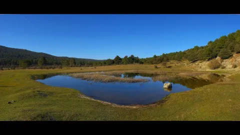
They are seasonal lagoons located in the western part of the municipality. Since 2007 they have been registered in the inventory of wetlands in Andalusia. These two lagoons are ideal for the observation of aquatic and amphibian birds at some times of the year.

Ubicación
Código Postal
23650
Latitud
37.761010
Longitud
-3.951102
Distrito
Municipio
Ubicación en el mapa
POINT (-3.951102 37.76101)
Imágenes carrusel
imagen
Image
lagunanavas.png
Imagen principal
Desactivado
Imágenes cabecera
imagen
Image
4%20%283%29.jpg
Imagen principal
Activado
Microsite al que pertenece
Loading map
Preparing points of interest and routes...

La Laguna

Submitted by brandcode_deweloper on
Id
5928867
Descripción
Breve descripción

The Laguna de Siles is approximately 150 m in diameter and 3 m in maximum depth depending on the station. To access La Laguna, from the municipality of Siles, an indicative lane is taken in the direction of El Puntal. At one of the crosses to the left, a lane goes straight to the place, and is very well identified with signs.

Ubicación
Latitud
38.377901
Longitud
-2.537913
Distrito
Municipio
Ubicación en el mapa
POINT (-2.537913 38.377901)
Imágenes carrusel
imagen
Image
4.jpg
Imagen principal
Desactivado
Imágenes cabecera
imagen
Image
pantanosiles.png
Imagen principal
Activado
Loading map
Preparing points of interest and routes...

The Pond

Submitted by brandcode_deweloper on
Id
4658699
Descripción
Descripción larga

This spring has never been enough to fertilize all the lands that extend on a decreasing level towards the Guadalbullion River. On the other hand, the years of drought have always been very numerous, in which the volume of this source was significantly reduced, because the piezometric surface of the aquifer located to the north of the population, which gives rise to the Charca spring, is linked to driving through galleries with siphoning phenomena.

Breve descripción

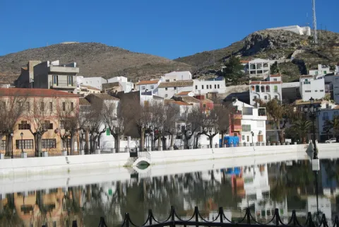
La Charca is a reservoir that collects the waters of the birth of the Fuente de la Reja from medieval times. In the beginning it was a simple dam with a containment stone wall and gates that regulated the water output through an intricate network of miles of waterfalls. These irrigated the orchard and olive lands located to the south of the urban core, distributed in banks. The higher caces served as a southern limit to the population, thus delimiting the urban growth of Pegalajar.

Ubicación
Código Postal
23110
Latitud
37.739660
Longitud
-3.644450
Distrito
Municipio
Ubicación en el mapa
POINT (-3.64445 37.73966)
Imágenes carrusel
imagen
Image
lacharca.jpg
Imagen principal
Desactivado
Imágenes cabecera
imagen
Image
charca-kM3F-U501644234364StF-624x385%40Ideal.jpg
Imagen principal
Activado
Microsite al que pertenece
Loading map
Preparing points of interest and routes...

Víboras Reservoir

Submitted by brandcode_deweloper on
Id
6115159
Descripción
Breve descripción

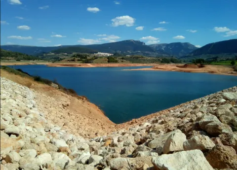
The Víboras, is one of the most requested swamps by the sports fishing clubs of the province, even by club of other provinces, reaching a few weekends up to four competitions on its shores, with seven areas enabled for the freshwater competitions, thanks to the collaboration of the municipal team of Las Casillas de Martos.

Ubicación
Código Postal
23614
Latitud
37.638034
Longitud
-3.999677
Distrito
Municipio
Ubicación en el mapa
POINT (-3.999677 37.638034)
Imágenes carrusel
imagen
Image
Embalse%20del%20V%C3%ADboras.jpg
Imagen principal
Desactivado
Imágenes cabecera
imagen
Image
DSCF6882.JPG
Imagen principal
Activado
Loading map
Preparing points of interest and routes...

Rumblar Reservoir

Submitted by brandcode_deweloper on
Id
6115043
Descripción
Breve descripción

The tent, barbo and Black Bass are present, although the big fish are very rare. The average size is small or at most medium, so it's a perfect place with polo and it can end with a lot.

Ubicación
Código Postal
23711
Latitud
38.191160
Longitud
-3.785430
Distrito
Ubicación en el mapa
POINT (-3.78543 38.19116)
Imágenes carrusel
imagen
Image
Playa-el-tamujoso-embalse-del-rumblar-e1435315737961.jpg
Imagen principal
Desactivado
imagen
Image
Natu159.jpg
Imagen principal
Desactivado
Imágenes cabecera
imagen
Image
Natu103.jpg
Imagen principal
Activado
Microsite al que pertenece
Loading map
Preparing points of interest and routes...

Tranco Reservoir

Submitted by brandcode_deweloper on
Id
912713
Descripción
Descripción larga

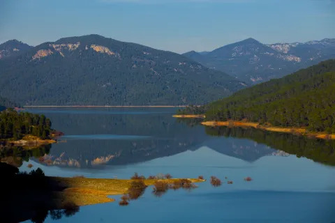
The reservoir is mainly nourished by the waters of the Guadalquivir, it has almost 500 cubic meters of capacity and 1500 hectares of surface. Much of it was previously occupied by the beautiful Vega de Hornos and the Guadalquivir valley.

We suggest...

The Tranco road is usually quite busy on dates of greater tourist influx, so, if you really want to enjoy the landscape, do not agree to look at it from the car and stop for a while at the dam or at some viewpoint, as usual. Our advice is: walk. On the right bank, you have several forest tracks, as well as the circular signposted path PR-A 149, which begins very close to the village of Fuente la Higuera. On the left, there are two signposted paths: the PR-A 193, which starts 1.1 km from the Tranco dam to the north, and a stretch of the GR-144, which is taken halfway between the Hornos de Segura and Cañada Morales, in a pronounced curve. In addition, in the environment of the reservoir you will not find many earrings.

Breve descripción

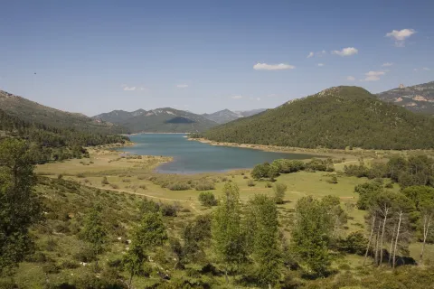
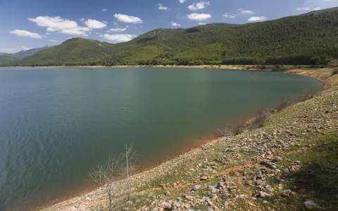
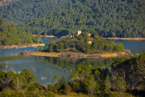
It is one of the largest reservoirs in Spain and is a first-class landscape resource in the Natural Park, so its entire environment is especially protected as the Bujaraiza Reserve Area. The left bank is on the A-319 road, and has various viewpoints, recreational areas, signposted trails and accommodation and restoration services, as well as water sports facilities. The right margin is mostly passed through forest tracks and roads. In its beginning (southern part) has several views of the Félix Rodríguez de la Fuente route.

Ubicación
Latitud
37.772886
Longitud
-3.788329
Distrito
Municipio
Ubicación en el mapa
POINT (-3.788329 37.772886)
Imágenes carrusel
imagen
Image
_mg_3284-jpg
Imagen principal
Desactivado
imagen
Image
_mg_0792-jpg
Imagen principal
Desactivado
imagen
Image
_mg_3280-jpg
Imagen principal
Desactivado
imagen
Image
img_0526-copia-jpg
Imagen principal
Desactivado
imagen
Image
img_0528-copia-jpg
Imagen principal
Desactivado
Imágenes cabecera
imagen
Image
_mg_0793-jpg
Imagen principal
Activado
Loading map
Preparing points of interest and routes...

Yeguas Reservoir

Submitted by brandcode_deweloper on
Id
6115426
Descripción
Breve descripción

An English stage, ideal for facing tents and barbs above the kilo.It therefore requires a reel and a certain distance to deceive its untrustworthy fish, which usually enter into fine, half-water, and with continuous barley of spice. A very sophisticated plug is also used, with elastic to the third, fourth or fifth tranche, or the bologna in case this technique is dominated.

Ubicación
Código Postal
23770
Latitud
38.079566
Longitud
-4.164839
Distrito
Municipio
Ubicación en el mapa
POINT (-4.164839 38.079566)
Imágenes carrusel
imagen
Image
embalse_yeguas.png
Imagen principal
Desactivado
Imágenes cabecera
imagen
Image
Yeguas_Ferro.jpg
Imagen principal
Activado
Microsite al que pertenece
Loading map
Preparing points of interest and routes...

Jándula Reservoir

Submitted by brandcode_deweloper on
Id
5861609
Descripción
Breve descripción

From this viewpoint you can see a beautiful landscape, in which rounded lomas occur with adhesitated extensions around the Jandula reservoir. The effect of the soil reflections on the packaged waters provides a beautiful picture. It is curious to see the clear line that borders the banks of the loins, which suggests how far the water level reaches in rainy times. The reservoir contains species such as black-bass, tent and barb. And next to them, a fish that is only found in these waters and tributaries of the Jandula, called Bogardilla. An ideal time to visit this viewpoint is the autumn, when deer will give us the sound show of the berrea. And with a little luck, we can contemplate the struggle of the males, horn against horn, on their arduous path to reproduction.

Telecomunicaciones
Teléfono de contacto
953 549 030
Ubicación
Código Postal
23740
Latitud
38.258730
Longitud
-3.934320
Distrito
Municipio
Ubicación en el mapa
POINT (-3.93432 38.25873)
Imágenes carrusel
imagen
Image
Natu054.jpg
Imagen principal
Desactivado
imagen
Image
rio-jandula.jpg
Imagen principal
Desactivado
imagen
Image
Natu073.jpg
Imagen principal
Desactivado
imagen
Image
Natu419.jpg
Imagen principal
Desactivado
imagen
Image
Natu425.jpg
Imagen principal
Desactivado
imagen
Image
Natu388.jpg
Imagen principal
Desactivado
imagen
Image
Natu384.jpg
Imagen principal
Desactivado
imagen
Image
Natu118%20%281%29.jpg
Imagen principal
Desactivado
imagen
Image
Natu185.jpg
Imagen principal
Desactivado
Imágenes cabecera
imagen
Image
Natu071.jpg
Imagen principal
Activado
Microsite al que pertenece
Loading map
Preparing points of interest and routes...