Saltar al contenido principal

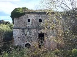
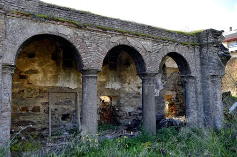
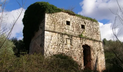
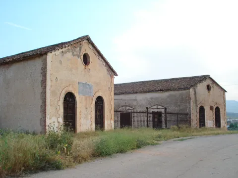
Mill of the Cubo

Submitted by brandcode_deweloper on
Id
4884561
Descripción
Breve descripción

It is a fortified flour mill that takes the name of the stream of the cube, is built by the Order of Calatrava in 1437. It is the largest and best preserved fortified mill built by the South Peninsular Military Orders. In this place, down to the river of the Cube, we find an area of high ecological and landscape value.

Telecomunicaciones
Sitio web
www.tosiria.com
Teléfono de contacto
622 626 159
Ubicación
Código Postal
23650
Latitud
37.743900
Longitud
-3.940700
Distrito
Municipio
Ubicación en el mapa
POINT (-3.9407 37.7439)
Tipos de punto de interés
Imágenes carrusel
imagen
Image
molino%20del%20cubo.jpg
Imagen principal
Desactivado
imagen
Image
molino%20del%20cubo%202.jpg
Imagen principal
Desactivado
Imágenes cabecera
imagen
Image
molino.jpg
Imagen principal
Activado
Loading map
Preparing points of interest and routes...
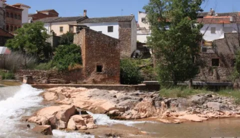
Lower Mill or Vicarage Mill

Submitted by brandcode_deweloper on
Id
4707246
Descripción
Descripción larga

It consists of one wheel and two milling stones, the first to mould wheat and the second for other grain types; the network of acequias and canals that fed it is kept in use but only for the irrigation of the annexed gardens.

Breve descripción

This flour mill is located on the right bank of the Guadalimar, upstream of the core of Puente de Génave, being the most interesting from the architectural and historical point of view. It appears to be mentioned in Philip II's Relations in which it is said that it is "a particular flour mill in which all the neighbors of Génave grind" and that they went here due to the absence of streams with sufficient flows for the construction of a mill in that locality; from this circumstance derives the name of "Génave mill" with which it is also known.

Telecomunicaciones
Sitio web
www.puentedegenave.es/el-municipio/patrimonio-historico.html
Correo electrónico
pgenave@puentedegenave.es
Ubicación
Código Postal
23350
Latitud
38.354562
Longitud
-2.803199
Distrito
Municipio
Ubicación en el mapa
POINT (-2.803199 38.354562)
Tipos de punto de interés
Imágenes carrusel
imagen
Image
111430.jpg
Imagen principal
Desactivado
Imágenes cabecera
imagen
Image
Almazara_de_la_Vicarxa.jpg
Imagen principal
Activado
Loading map
Preparing points of interest and routes...
Old Wash House

Submitted by brandcode_deweloper on
Id
4520112
Descripción
Breve descripción

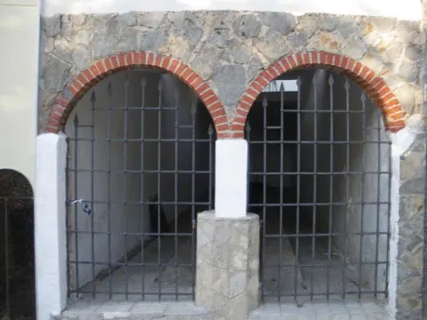
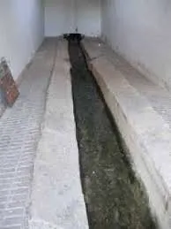
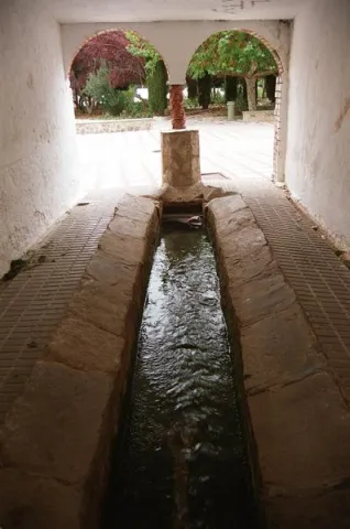
A few meters from the Fuente de la Negra is another public building related to water, the laundry, whose origin dates back to the 17th century, with architectural elements characteristic of the popular baroque such as the access panels arches or the small central salomonic column that is based on a pillar. Its use, markedly social, has been maintained until almost today. Incidentally, it is an elongated rectangular ship (10 x 2.5 meters), of argamase and lime, with a central channel, covered by a skylight, which constitutes the proper laundry.

Telecomunicaciones
Sitio web
www.fuensantademartos.es
Teléfono de contacto
953 565 000
Ubicación
Código Postal
23610
Latitud
37.647140
Longitud
-3.905260
Distrito
Ubicación en el mapa
POINT (-3.90526 37.64714)
Tipos de punto de interés
Imágenes carrusel
imagen
Image
lavadero%202.jpg
Imagen principal
Desactivado
imagen
Image
lavadero.jpg
Imagen principal
Desactivado
Imágenes cabecera
imagen
Image
Monumentos6Lavadero.jpg
Imagen principal
Activado
Loading map
Preparing points of interest and routes...
La Puente

Submitted by brandcode_deweloper on
Id
912688
Descripción
Descripción larga

Cobos not only had territorial jurisdiction over these populations, but also exercised strong control over all of them of their Councils and their inhabitants.

In Torres, apart from certain actions to preserve the medieval castle, the Council planned various works throughout the 16th century, such as the capitular houses, the posite, the reform of the parish temple and a bridge, absolutely necessary to unite the town with the site of the Fuenmayor, where the mills of the secretary Cobos were located, by which the neighbors were required to pass. In the population, the only one who had a privilege to build mills was Cobos and his wife, Maria de Mendoza. Their control assured them of a safe income, so it was absolutely necessary to keep the bridge in good condition.

Dead Cobos, Mrs. Maria de Mendoza, through his butler Bartolomé Ximénez, ordered the Council to make a new bridge, as the old man was destroyed by a heavy storm. The project was carried out by Andrés de Vandelvira, an architect at the service of the family of Cobos. According to María José Sánchez Lozano the works began in 1561, and the following year the Council agreed that all that was left to rise from it should be done according to the trace of Andrés de Vandelvira: "(...) I saw what is left to be made of the work of the bridge that is to be done in the river of the said villa for the passage of the mills of the bread of his lordship (...) command that everything that is left to be made of the bridge be done by the trace that has given Andrés de Vandelvira (...). The bridge, which is currently preserved, although removed, is made of stone and has a single half-point eye rather high, as the ravine on which it rises is very deep in this area.

Vandelvira draws a bridge without great pretensions, without decorative attachments, in which security and permanence in time must take precedence over other aspects. Vandelvira will be an experienced bridge builder, sometimes simple as this one of Torres, others of great architectural and engineering monumental, such as those raised on the channels of the Guadalmena, Guadalimar (Ariza) and Guadalquivir (Mazuecos) rivers.

Breve descripción

In 1539 the Secretary of Charles V, the ubetense Don Francisco de los Cobos, acquired the villas of Canena and Torres, which were alienated by the Crown to the Military Orders of Santiago and Calatrava. With this double purchase he rounded Cobos his heritage; years earlier, in 1537 he also made it with the villa of Sabiote, head of his large lordship, completed with the acquisition of Jimena and Recena by his wife Maria de Mendoza.

Telecomunicaciones
Sitio web
www.torresturismo.es
Teléfono de contacto
953 363 011
Correo electrónico
info@torresturismo.es
Ubicación
Código Postal
23540
Latitud
37.786140
Longitud
-3.509730
Distrito
Municipio
Ubicación en el mapa
POINT (-3.50973 37.78614)
Tipos de punto de interés
Imágenes carrusel
imagen
Image
La%20Puente%202.jpg
Imagen principal
Desactivado
imagen
Image
La%20Puente.jpg
Imagen principal
Desactivado
Imágenes cabecera
imagen
Image
800px-La_Puente%2C_Torres_24J_02.jpg
Imagen principal
Activado
Microsite al que pertenece
Loading map
Preparing points of interest and routes...
La Fuente del Vergao

Submitted by brandcode_deweloper on
Id
4742245
Descripción
Breve descripción

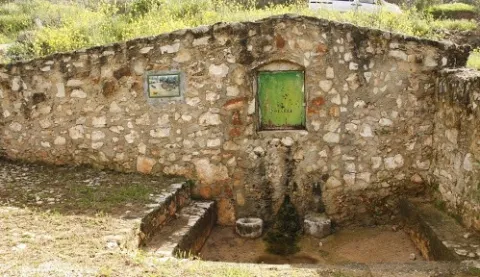
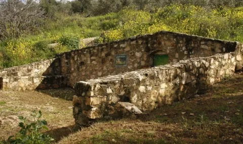
The source of El Vergao is a public source whose existence has been known at least since 1752. It is a source of alcoba that was in use until 1966, when the municipality was provided with the drinking water network. It is located next to the road of El Vergao.

Ubicación
Latitud
38.183511
Longitud
-3.313678
Distrito
Municipio
Ubicación en el mapa
POINT (-3.313678 38.183511)
Tipos de punto de interés
Imágenes carrusel
imagen
Image
unnamed.jpg
Imagen principal
Desactivado
imagen
Image
La%20Fuente%20del%20Vergao.jpg
Imagen principal
Desactivado
Imágenes cabecera
imagen
Image
7.jpg
Imagen principal
Activado
Loading map
Preparing points of interest and routes...
La Hermitage of Santa María Magdalena

Submitted by brandcode_deweloper on
Id
4619189
Descripción
Descripción larga

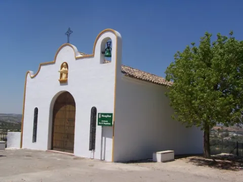
It features a simple half-point arch cover with two small side voids imitating saetas. On the top we find a hornadine with the image of Mary Magdalena and on a side a small body of swordsman.

Breve descripción

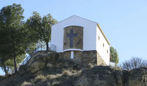
On July 14, 1990, the new hermitage of Santa María Magdalena was opened and blessed; it is located on the hill of Maquiz, where the old one was and which is quoted in the 16th century.

Telecomunicaciones
Sitio web
https://mengibarturismo.com/
Teléfono de contacto
677 222 285
Correo electrónico
turismo@aytomengibar.com
Ubicación
Código Postal
23620
Latitud
37.968050
Longitud
-3.808780
Dirección
Carretera A-6000 a Villargordo, desvío por el camino de Los Chorrillos
Distrito
Municipio
Ubicación en el mapa
POINT (-3.80878 37.96805)
Tipos de punto de interés
Imágenes carrusel
imagen
Image
La%20Ermita%20de%20Santa%20Mar%C3%ADa%20Magdalena.jpg
Imagen principal
Desactivado
Imágenes cabecera
imagen
Image
ermita-de-la-malena-mengibar.jpg
Imagen principal
Activado
Microsite al que pertenece
Loading map
Preparing points of interest and routes...
La Hermitage of Jesús

Submitted by brandcode_deweloper on
Id
4969981
Descripción
Breve descripción

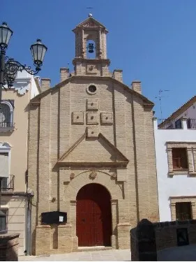
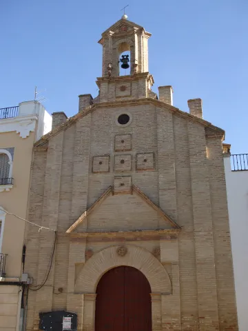
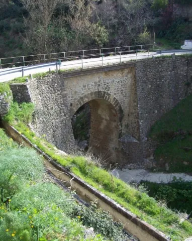
Built in the17th century, retains the cover of its only floor with canyon vault with lunetes. The 18th century facade stands out for its monocrous simplicity of the brick, the ascending verticality of lines and the articulation of spaces. From its interior to highlight theJesus' shrimpwith paintings of this century in the vault.

Telecomunicaciones
Sitio web
www.arjonilla.es/el-municipio/patrimonio-historico.html
Correo electrónico
alcaldia@ayuntamientodearjonilla.es
Ubicación
Código Postal
23750
Latitud
37.974440
Longitud
-4.107590
Dirección
Plaza de la Encarnación, s/n
Distrito
Municipio
Ubicación en el mapa
POINT (-4.10759 37.97444)
Tipos de punto de interés
Imágenes carrusel
imagen
Image
Ermita%20de%20Jes%C3%BAs%20en%20arjonilla.jpg
Imagen principal
Desactivado
Imágenes cabecera
imagen
Image
ermita%20%281%29.jpg
Imagen principal
Activado
Microsite al que pertenece
Loading map
Preparing points of interest and routes...
The Big House

Submitted by brandcode_deweloper on
Id
4571299
Descripción
Descripción larga

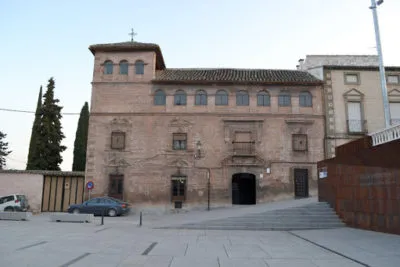
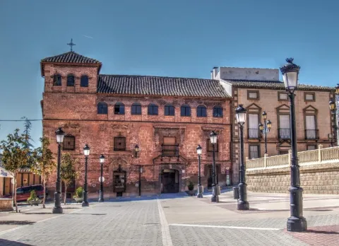
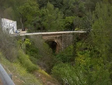
It is actually a wide rectangle, divided into three floors in height and with an airful turret-view on the east side - or left side. Very common typology in Granada, especially in the neighborhoods of San Jerónimo, San Matías and la Magdalena. Although, unlike here, it does not present a porticated and blasphemed courtyard in its centralizer, which leads us to think that it would not in its origin be a foundation of a family - more or less aristocratic - for its particular residence, so we suspect it would have another purpose.

The same similarity with the granadine is also given from a constructive point of view. Thus, if brick is used for the wall walls, for the structural elements, jambas, dintels and frontons, the quarry is used - in this case the asperon so abundant in the place - and the latter are the elements that define it from the stylistic point of view.

As a result, we are facing an interesting example of a typical house of the full baroque - the second half of the XVII-, where there is still a very strong presence of the elements of Mudejar tradition, the façade being very well resolved, because of its interior only highlights the dome on the pechines that originally topped the staircase.

On the first floor, whose cover of the apainelated arch does not appear by focusing the set, its beautiful intellized windows, crowned by beautiful curved and broken fronts, stand out. In the second, the most noble, the rhythms are changed, as they are small intellized windows with the same type of front, except that located on the door which is a large balcony framed by a beautiful alfice, also being in both bodies of a high quality the grate. Finally, a large, flying cornice separates them from the last with a proliferation of semicircular windows.

A number of hypotheses have been set aside on the promoters of its construction. At some times we thought it might be the great plateau that the first Marquis de la Rambla ordered to raise in the town, from which we even have several works payments. However, by some documents it seems to be deduced that it was built by the albaceas and employers of the foundation created by Mother Martha of Jesus - the so-called Almagro House - from the place - to also use it as a table to house travellers and carriages, which with their income would help to cover the expenses of the Hospital of Mercy.

Breve descripción

The so-called Casa Grande is located flanking the southern side of the Plaza de Bajo - a popular name -, wide public space, which works and performs functions that a larger square of any Spanish village.

Telecomunicaciones
Sitio web
www.cabradelsantocristo.org/monumentos/la-casa-grande/
Teléfono de contacto
953 397 002
Correo electrónico
info@aytocabradelsantocristo.com
Ubicación
Latitud
37.704510
Longitud
-3.285770
Distrito
Ubicación en el mapa
POINT (-3.28577 37.70451)
Tipos de punto de interés
Imágenes carrusel
imagen
Image
casa-grande-cabradelsantocristo-400x267.jpg
Imagen principal
Desactivado
Imágenes cabecera
imagen
Image
11.jpg
Imagen principal
Activado
Microsite al que pertenece
Loading map
Preparing points of interest and routes...
The Priest's House

Submitted by brandcode_deweloper on
Id
6547993
Descripción
Breve descripción

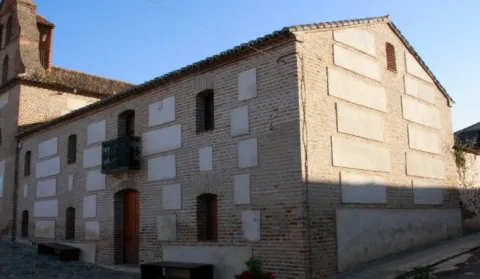
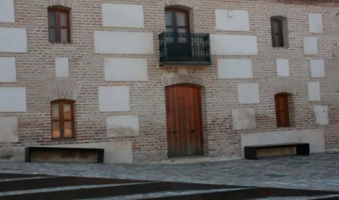
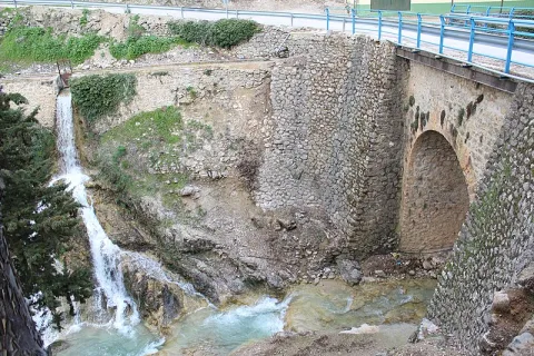
Located on the side of the church, the house of the priest is currently in the process of restoration after a time of abandonment.

Telecomunicaciones
Sitio web
www.aldeaquemada.com
Teléfono de contacto
680 104 199
Correo electrónico
turismo.aldeaquemada@gmail.com
Ubicación
Código Postal
23215
Latitud
38.412170
Longitud
-3.371710
Dirección
C/ Miguel Hernández, 4
Distrito
Municipio
Ubicación en el mapa
POINT (-3.37171 38.41217)
Tipos de punto de interés
Imágenes carrusel
imagen
Image
1.jpg
Imagen principal
Desactivado
Imágenes cabecera
imagen
Image
3.jpg
Imagen principal
Activado
Loading map
Preparing points of interest and routes...
The Civil Commander's House

Submitted by brandcode_deweloper on
Id
6549854
Descripción
Breve descripción

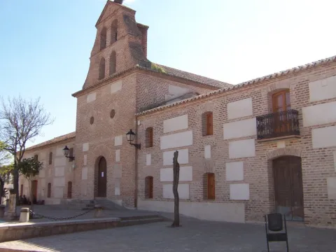
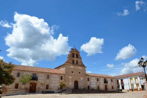
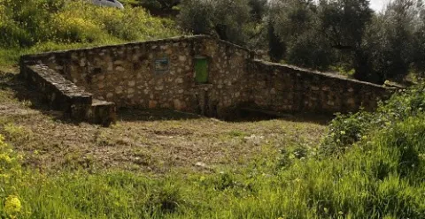
In the church, this house has had several functions, some of which are the City Council and currently the home of the retired. For many years it was used as a poultry of braves during the holidays.

Telecomunicaciones
Sitio web
www.aldeaquemada.com
Teléfono de contacto
680 104 199
Correo electrónico
turismo.aldeaquemada@gmail.com
Ubicación
Código Postal
23215
Latitud
38.411930
Longitud
-3.371660
Dirección
C/ Miguel Hernández, 4
Distrito
Municipio
Ubicación en el mapa
POINT (-3.37166 38.41193)
Tipos de punto de interés
Imágenes carrusel
imagen
Image
1001176.jpg
Imagen principal
Desactivado
Imágenes cabecera
imagen
Image
Aldeaquemada%20-%20Iglesia%20%281%29.jpg
Imagen principal
Activado
Loading map
Preparing points of interest and routes...