Saltar al contenido principal

Ascent to Pandera

Submitted by brandcode_deweloper on
Id
2649168
Descripción larga

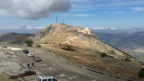
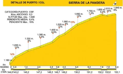
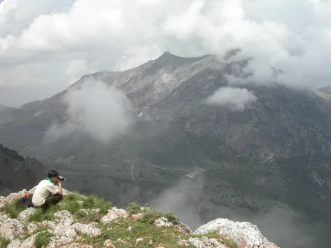
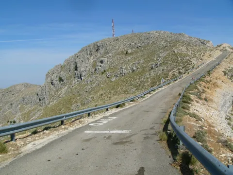
The road that leads to La Pandera, which is accessed from the road A-6.050 Jaén-Valdepeñas de Jaén-Castillo de Locubín, through a detour to the left located at the point of 24,500, is an asphalt and narrow itinerary built to access the military facilities at its top. In recent years it has become a forced quote from La Vuelta Ciclista to Spain, being considered as one of the mountain queen stages. For the first 3 km. We are accompanied by the typical landscape of the Mediterranean forest, with plenty of shrubs splashed by oak trees.

When you reach a quarry, the first important ramps appear, with slopes about 15% changing the vegetation as the altitude rises: lavender, thyme, aulagas, thorn, rosemary, cardo... The road, even in the dark, is becoming more and more difficult and offers the cycloturist the first landscape panorama. The environment is gradually becoming more arid, but the visual basin is greatly expanded and the views of Los Villares, Valdepeñas de Jaén or the capital itself, surrounded by olive fields, are impressive.

Breve descripción

The area has abundant snow wells, used until the 20th century, of which snow was extracted that would then be transformed into ice, to be used for medical purposes and as a water revival.

The Alto de La Pandera is a great lookout for the entire Jiennense province and other areas. Thus, in clear sky conditions, it is possible to see Sierra Nevada and the Sierra de Alhama (Granada), the Cordobese subbetic saw, the Ronda serrania and the Málaga Mountains, the Alpujarra almerienne and even Gibraltar.
Latitud
37.6203
Longitud
-3.7601
Distrito
Ubicación en el mapa
POINT (-3.7601 37.6203)
imagen
Image
Subida%20a%20la%20Pandera%202.jpg
Imagen principal
Activado
imagen
Image
P1030436.JPG
Imagen principal
Desactivado
imagen
Image
pandera2010.jpg
Imagen principal
Desactivado
7 h 8 min

Nature

icon-intereses-naturaleza

Friends

icon-intereses-amigos

Adventure

icon-intereses-aventura

Culture

icon-intereses-cultura

Sport

icon-intereses-deporte

Eco-friendly

icon-intereses-eco-friendly

For couples

icon-intereses-en-pareja

Family

icon-intereses-familia

Gastronomy

icon-intereses-gastronomia

Municipality

icon-intereses-municipio

Low-cost tourism

icon-intereses-turismo-low-cost

Solo travel

icon-intereses-viajar-solo
Alta
Image
69feca5b-9e6c-2510-25be-3fa0d3e57662?t=1607089019405
Subida a la Pandera
8,3 km
1217m
1217m
On foot
All year round
Desactivado
Image
11ac37f5-591c-1aaf-9b80-18a2e3be9cb9?t=1589225712911

The access road to Alto de La Pandera is closed to the traffic of vehicles so it is necessary to request the key of the cancel in the City of Valdepeñas de Jaén (Tel. 953 310 111) or Los Villares (Tel. 953 320 005).

The tour ends on the top of the Pandera, just in the place where the quartering is located, which, taking advantage of its strategic position, was the seat of a military detachment specialized in communications.
1.872 m.
Tramo de asfalto o cemento
 
Tramo de pista o camino forestal
 
Tramo de vía pecuaria
 
Tramo de senda
 

Route de la Sierra de los Ahillos

Submitted by brandcode_deweloper on
Id
2597124
Descripción larga

This alternative route connects the Alcaudete station (point 48,250 of the Green Way of Oil) to that of Vado Jaén (point 36,950 of the track). The tour begins at the old Alcaudete Station (km. 0). From here we're headed for Alcaudete. In the center of the city center we took the signposted detour to the location of the Amuña Fountain. At kilometer 6.4 we arrive at the crossing of Fuente Amuña, where we will continue in the direction of the Casillas de Martos. The road is raised by a curved route that for several kilometres offers good views of the countryside. At the kilometer 11.6 of tour we see a typical mountain cortijo located on a nava or depression inside the saw.

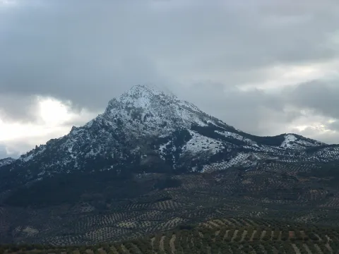
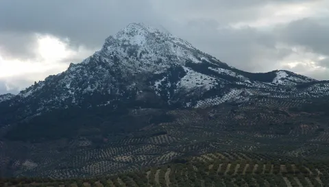
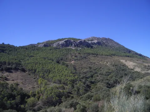
On the right side according to the direction of the march is the Pico Achillos (1.453 m.) that retains a lush slope of Mediterranean vegetation, and that gives name to this saw. Through paths you can ascend to this summit. At the kilometer 13.4 we reach the port, and the road begins the descent (at the crossing choose the right option). After five kilometres of quiet descent, you pass through a village that conserves a unitary school, witness to almost extinct rural ways of life. The kilometer 22 of route reaches the tail of the reservoir of the Víboras River (at this point there is a full rental rural house "La Morata").

After 2 kilometres, the wall of the dam serves as an entrance to the village of the Casillas de Martos. At the kilometer 25.4 we turned in the roundabout towards Martos and Alcaudete. This road leads us directly to the Green Way of Oil, and after 30.6 kilometers of pedal we arrived at the former Vado Jaén Station.

Breve descripción

The Sierra de Achillos is a small mountain formation integrated in the Sierra Sur de Jaén. This is an interesting example of an interior Mediterranean mountain, with a natural forest landscape and olive crops, splattered with cords and isolated villages.

Latitud
37.5953
Longitud
-4.0864
Distrito
Municipio
Ubicación en el mapa
POINT (-4.0864 37.5953)
imagen
Image
Sierra%20Ahillos%20nevada%20-%20copia.jpg
Imagen principal
Activado
imagen
Image
Sierra%20Ahillos%20bis.JPG
Imagen principal
Desactivado
imagen
Image
Sierra%20Ahillos%20nevada%20%281%29.jpg
Imagen principal
Desactivado
4 h 53 min

Nature

icon-intereses-naturaleza

Friends

icon-intereses-amigos
Medium
Ruta de la Sierra de los Ahillos
30,6 km
927m
927m
All year round
Desactivado

It is recommended to start the route at the Old Alcaudete Station, as in this sense the miles of ascent are less.

To access the starting point, in Alcaudete you take the road to Las Casillas, pedanía de Martos. Before coronating the neckline, and on a fence, the vehicle can be parked. At this point there is a drinking water source located in a ravine.